

Mori Atlas logo
Nature reserve新疆托木尔峰国家级自然保护区

Trace the vertical ecological zonation and complex valley glacier systems within this significant protected mountain corridor.

新疆托木尔峰国家级自然保护区: Mapping the High Alpine Glacial Landscapes of the Western Tian Shan

The Xinjiang Tomur Peak National Nature Reserve protects a vast high-altitude wilderness centered on the Tomur-Hantengri massif in the western Tian Shan. This reserve serves as a critical hydrological and ecological divide, preserving an unbroken sequence of mountain environments from arid foothill steppes to extensive nival zones. The geography includes thousands of square kilometers of active valley glaciers, rugged mountain peaks exceeding four thousand meters, and rare relict Schrenk's spruce forests on the southern slopes. This atlas entry provides geographic context for its role as the primary glacial center of the region.

glacial landscapemountain peaksalpine meadowssnow leopard habitatspruce forestvertical zonation
A minimalist vector illustration showing snow capped mountain peaks rising above a dense pine forest under a soft sunset colored sky.

新疆托木尔峰国家级自然保护区

Nature reserve

Park overview

Structured park overview, official facts, and landscape profile for Xinjiang Tomur Peak National Nature Reserve

Xinjiang Tomur Peak National Nature Reserve park facts, protected area profile, and essential visitor context

Review the core facts for Xinjiang Tomur Peak National Nature Reserve, including designation, size, terrain, visitor scale, habitats, and operating context in one park-focused overview.

About Xinjiang Tomur Peak National Nature Reserve

The Xinjiang Tomur Peak National Nature Reserve is the highest-elevation national nature reserve in the Tian Shan range, anchored on the massif of Tomur Peak, the highest summit of the eastern Tian Shan, and the neighboring Hantengri Peak. Located in Wen su County of Ak su Prefecture in the Xinjiang Uyghur Autonomous Region, the reserve straddles the western end of the Tian Shan geoclinal fold belt and faces the Tarim Basin to the south.

Its origins lie in the uplift of the Tian Shan during the Himalayan orogeny, which separated the temperate Junggar Basin from the warm-temperate Tarim Basin and produced an exceptionally steep and asymmetric mountain landscape. The reserve's south slope is dominated by deeply dissected valleys, glacial cirques, and a transition from desert to spruce forest that is rare in this part of central Asia.

The reserve conserves a complete vertical ecological sequence of seven belts: warm-temperate desert, temperate desert steppe, mountain steppe, subalpine meadow, alpine meadow, alpine cushion vegetation, and the nival snow and ice zone. Its valley glacier systems, including the Tomur-type valley glaciers first described by Chinese Academy of Sciences researchers, make it a signature site for the study of continental-type high mountain glaciology.

Ecologically, the reserve provides habitat for some of central Asia's most iconic high mountain species, including the snow leopard, whose conservation significance in the western Tian Shan has been documented since the 1980s, as well as Siberian ibex, argali, brown bear, golden eagle, and bearded vulture. Together with its inclusion in the UNESCO Xinjiang Tianshan World Heritage site, this combination of glacial, ecological, and wildlife values places the reserve among the most significant protected mountain landscapes in China.

Quick facts and research context for Xinjiang Tomur Peak National Nature Reserve

The Xinjiang Tomur Peak National Nature Reserve is a national-level protected area in Ak su Prefecture, Xinjiang, China, administered since 2003 under the jurisdiction of Wen su County. Covering roughly 3,800 square km, it spans the south slopes of the Tomur Peak massif, bordering Kyrgyzstan and Kazakhstan to the east and reaching into Zhaosu County of Ili Kazakh Autonomous Prefecture.

Its zonation includes a core area of about 2,160 square km, a buffer zone of roughly 860 square km, and an experimental zone around 770 square km. The reserve is part of the UNESCO Xinjiang Tianshan World Heritage site and is a key component of China's western Tian Shan glacial and ecological system.

Protection and recognition

Documented terrestrial protection scope, designation year, and official recognition metrics.

新疆托木尔峰国家级自然保护区 Protection Status and Designated Area History

新疆托木尔峰国家级自然保护区 maintains a documented terrestrial protection status established in 2003 with defined administrative parameters. Comprehensive records provide structured data regarding designation timelines, management scope, and conservation frameworks.

Protection details

Protection scope
Terrestrial
Designated year
2003
Transboundary protection
No
Core area
2,167 km²
Buffer area
865 km²
Park context

Deeper park guide and search-rich context for Xinjiang Tomur Peak National Nature Reserve

Xinjiang Tomur Peak National Nature Reserve history, landscape, wildlife, and travel context

Explore Xinjiang Tomur Peak National Nature Reserve through its history, landscape character, ecosystems, wildlife, conservation priorities, cultural context, and seasonal travel timing in a structured park guide built for atlas discovery and search intent.

Why Xinjiang Tomur Peak National Nature Reserve stands out

The reserve is renowned for the Tomur Hantengri mountain confluence, the largest glacier center in the Tian Shan range. It contains over 800 glaciers and approximately 500 active glaciers, including the Hantengri Glacier, one of the longest mountain valley glaciers in the region at nearly 61 km, and the uniquely classified Tomur-type valley glaciers. It is also recognized for the most complete altitudinal zonation on the south slope of the Tian Shan, ranging from warm temperate desert through subalpine conifer forest to nival and glacial zones, and for hosting rare alpine wildlife including the snow leopard, Siberian ibex, argali, and brown bear.

A dramatic, long-distance view of the snow-capped Tomur Peak rising above a secondary ridgeline of the Tianshan mountains under a dark, overcast sky.
Tomur Peak, the highest summit of the Tianshan mountain range, rising above the clouds.

Xinjiang Tomur Peak National Nature Reserve history and protected-area timeline

The reserve's history began on June 1, 1980, when the Xinjiang Uyghur Autonomous Regional Government approved the establishment of the Tomur Peak Nature Reserve covering 1,256 square km. At that time, the focus was on protecting the high mountain ecosystems on the south slope of the Tomur Peak massif.

In 2003, the State Council upgraded the reserve to a national-level nature reserve, expanding its area to 2,376 square km. A decade later, in June 2013, the 28th session of the UNESCO World Heritage Committee inscribed the Xinjiang Tianshan as a World Natural Heritage site, with Tomur Peak incorporated as a key component. In response, the reserve underwent a further expansion to over 3,800 square km in 2014, bringing the entire Tomur Hantengri massif and its glaciers fully into the protected area.

Conservation management has progressively strengthened since the 2003 upgrade. By the early 2020s, the reserve had established boundary markers, a wildlife rescue center, and ongoing monitoring programs funded by central government subsidies. Since 2017, mining and industrial facilities within and at the edge of the reserve have been progressively removed, and former grazing communities have been resettled to villages such as Tagelake and Pakelek in Wen su County, which now host tourism activities in lieu of former pastoral livelihoods.

Xinjiang Tomur Peak National Nature Reserve landscape and geographic character

The reserve occupies the western Tian Shan geoclinal fold belt and centers on the Tomur Hantengri mountain confluence, a region characterized by extremely rugged, asymmetric relief. The north slope is markedly steeper and more compact, while the south slope features broader valleys and gentler transitions into the Tarim Basin lowlands. Differential uplift, glacial scour, and water-based erosion have produced dramatic topographic relief with peaks rising above 4,000 m above deeply incised valleys.

Beyond Tomur Peak itself, the reserve encompasses Hantengri Peak, Aktash Peak, Tailan Peak, and Keqikal Peak, which together form an unbroken massif extending across the international border. The Tomur Hantengri region is the largest glacial center in the entire Tian Shan, hosting approximately 830 glaciers with a total surface area near 3,850 square km. Within the reserve, glaciers are predominantly valley-type, many of them dendritic in form, and were formally classified by Chinese Academy of Sciences researchers as Tomur-type valley glaciers.

The Hantengri Glacier, one of the longest such glaciers in Asia, stretches nearly 61 km and is distinguished by numerous supraglacial lakes and fissures reaching depths of up to 100 m. The lower elevation landscape is dominated by extensive alluvial fans and erosional valleys, while the upper zones are shaped by glacial moraines and frost-driven patterned ground. Touching both the Junggar and Tarim basin climatic regimes, the reserve's landscape is defined as much by its role as a continental hydrological divide as by its mountains.

Xinjiang Tomur Peak National Nature Reserve ecosystems, habitats, and plant life

The reserve contains one of the most complete altitudinal vegetation sequences on the south slope of the Tian Shan range. Seven clearly defined vertical belts span warm-temperate desert at the lowest elevations around 1,450 m to 1,900 m, through temperate desert steppe, mountain steppe with fescue and feather grass, subalpine meadow where coniferous forest dominates, alpine meadow, alpine cushion vegetation, and finally the nival snow and ice zone above roughly 4,250 m.

Forest cover is particularly significant in the subalpine belt. The reserve supports extensive mature stands of Schrenk's spruce on north-facing and shaded slopes, interspersed with associated understory species. The forest mosaic of the reserve forms a notable island of arboreal habitat surrounded by steppe and desert at lower elevations.

Botanical records document at least 62 families, 295 genera, and 634 species of seed plants, including 43 woody species and 210 herbaceous species. Bryophyte surveys have recorded 41 families, 79 genera, and 246 species of mosses. Lichen flora is also rich, with 8 orders and 151 species documented, playing an important role as pioneer species colonizing newly exposed glacial forelands and driving primary succession on exposed rock.

Xinjiang Tomur Peak National Nature Reserve wildlife and species highlights

The reserve's high diversity of habitats supports a significant community of terrestrial vertebrates and insects. Mammalian fauna includes 73 terrestrial vertebrate genera from 28 families in 13 orders, while bird surveys have documented 82 species across 10 orders, with summer visitors significantly outnumbering resident species. Insect surveys have recorded at least 277 genera in 73 families across 8 orders, with Diptera, Hymenoptera, and Coleoptera dominant.

The reserve is most noted for its high-mountain ungulates and carnivores. Siberian ibex and argali are characteristic residents of rocky alpine and cushion vegetation zones, while brown bear has been recorded in the reserve since 2021 via camera traps. Smaller mammals include long-eared pika, marmot, and various voles in alpine meadows.

Avian fauna is dominated by raptors suited to high-elevation conditions. Golden eagle, bearded vulture, Himalayan vulture, and steppe eagle occupy the higher altitudes, while species such as Saker falcon and common kestrel patrol the subalpine zone. Songbirds and steppe birds, including twite and red-billed chough, occupy the steppe belts. Snow leopard occurs in the highest elevation zones, primarily in the upper Tomur River and Qiongtailan River valleys.

Xinjiang Tomur Peak National Nature Reserve conservation status and protection priorities

The Xinjiang Tomur Peak National Nature Reserve was first gazetted in 1980 as a provincial-level reserve, upgraded to national status in 2003, and significantly expanded in 2014 to fully encompass the Tomur Hantengri mountain confluence. Since 2013 it has formed part of the UNESCO Xinjiang Tianshan World Natural Heritage site.

The reserve prioritizes conservation of alpine glacial ecosystems, subalpine forest, and high-mountain wildlife, in particular the snow leopard, whose populations within the reserve have been studied since the late 1980s. Early surveys in 1988 documented declining snow leopard presence, prompting anti-poaching efforts that have continued alongside habitat protection. Six species in the reserve are listed as nationally first-class protected wildlife in China, including snow leopard, Siberian ibex, golden eagle, Pallas's fish eagle, and bearded vulture, with 21 additional species listed as second-class protected.

Xinjiang Tomur Peak National Nature Reserve cultural meaning and human context

The reserve lies in a region historically inhabited by Kazakh, Uyghur, and other minority pastoralist communities who traditionally used its mountain meadows as summer grazing land. Following the reserve's 2003 national designation and subsequent expansion, grazing rights have been progressively retired, and since 2014 herders have been relocated to resettlement villages such as Tagelake and Pakelek in Wen su County. These villages have pivoted toward rural tourism, with scenic areas and visitor services replacing traditional pastoral livelihoods.

Top sights and standout views in Xinjiang Tomur Peak National Nature Reserve

The Xinjiang Tomur Peak National Nature Reserve's foremost highlights are its extensive glacial landscapes and complete vertical ecological zonation, making it a flagship site for Tian Shan glaciology and mountain ecology. The reserve contains the largest concentration of valley glaciers in the Tian Shan, including the Hantengri Glacier, and hosts rare relict Schrenk's spruce forests on the south slope of the range.

Best time to visit Xinjiang Tomur Peak National Nature Reserve

The reserve's most favorable visitation period generally corresponds to the warmer months between late spring and early autumn, when mountain roads and trails are more reliably accessible. The south slope experiences warm-temperate semi-arid to arid conditions at lower elevations and humid mountain conditions at higher elevations, while the north slope experiences sub-zero mean winter temperatures in the alpine zone, making winter access difficult. Climate observations indicate a sustained warming trend in the reserve, with seasonal precipitation concentrated in summer and autumn, so late summer visits may coincide with peak glacial melt runoff and lush subalpine meadows.

Monthly climate preview

Long-term representative coordinate measurements of monthly temperature and precipitation patterns

新疆托木尔峰国家级自然保护区 Climate Normals and Annual Temperature Rhythm

Representative coordinates record measured multi-year temperature variations alongside long-term monthly precipitation averages across the protected landscape. Examining the complete twelve-month climatology profile reveals detailed thermal ranges and seasonal moisture distribution for the high-altitude terrain.
Annual mean-3 °C
-15 °C8 °C
Jan-15°
Feb-13°
Mar-8°
Apr-2°
May
Jun
Jul
Aug
Sep
Oct-2°
Nov-8°
Dec-13°
Warmest month
July

8.3 °C

Coolest month
January

-15.4 °C

Wettest month
June

0.9 mm/day

Driest month
December

0.1 mm/day

Park location guide

Geography guide, regional context, and park location map for Xinjiang Tomur Peak National Nature Reserve

Xinjiang Tomur Peak National Nature Reserve park geography, regions, and map view in China

Understand where Xinjiang Tomur Peak National Nature Reserve sits in China through a broader geographic reading of the surrounding landscape, nearby location context, and its mapped position within the national park landscape.

How Xinjiang Tomur Peak National Nature Reserve fits into China

China is a unitary communist state in East Asia, governed by the Chinese Communist Party. The country's capital is Beijing, while Shanghai is the largest city by urban population. China has 33 province-level divisions including provinces, autonomous regions, municipalities, and special administrative regions. The nation has a long history spanning thousands of years, with achievements including the invention of gunpowder, paper, printing, and the compass.

Wider geography shaping Xinjiang Tomur Peak National Nature Reserve in China

China is located in East Asia, bordering fourteen countries: Russia, North Korea, Vietnam, Laos, Myanmar, India, Bhutan, Nepal, Pakistan, Afghanistan, Tajikistan, Kyrgyzstan, Kazakhstan, and Mongolia. The country spans diverse terrain including deserts, mountains, plateaus, and river valleys. Major river systems include the Yellow River and Yangtze River. The coastline stretches along the East China Sea, South China Sea, and Yellow Sea.

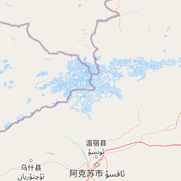
Map view of Xinjiang Tomur Peak National Nature Reserve

Use this park location map to pinpoint Xinjiang Tomur Peak National Nature Reserve in China, understand its exact geographic position, and read its mapped placement within the surrounding landscape more clearly.

Pigeon | © OpenStreetMap contributors

Location context for Xinjiang Tomur Peak National Nature Reserve

Aksu PrefectureWensu CountyXinjiang

Explore photographic records of rugged mountain terrain, valley glacier systems, and vertical ecological zones.

新疆托木尔峰国家级自然保护区 Photos and Landscapes: Visualizing Tian Shan Glaciers and Alpine Ecosystems

Visual documentation captures the dramatic topography, expansive valley glaciers, and varied ecological zones of 新疆托木尔峰国家级自然保护区. Photographic evidence reveals remote mountain habitats, high alpine massifs, and protected wilderness characteristics across the western Tian Shan.

A dramatic, long-distance view of the snow-capped Tomur Peak rising above a secondary ridgeline of the Tianshan mountains under a dark, overcast sky.

Park atlas

Compare regional protected landscapes, neighboring mountain ranges, and adjacent high-altitude reserves.

Explore Other Parks Near 新疆托木尔峰国家级自然保护区 and Surrounding Mountain Protected Areas

Visitors exploring Xinjiang Tomur Peak National Nature Reserve can browse adjacent high-altitude protected areas and compare regional mountain ecosystems. Examining surrounding protected landscapes reveals broader geographic patterns across the Tian Shan mountain range and neighboring alpine terrain.
State or regional parkKyrgyzstan
About 45 km away#1 closest

West

Khan-Tengri State Nature Park: Kyrgyzstan State or Regional Park Atlas Exploration

Explore protected landscapes and geographic context.

Khan-Tengri State Nature Park is a designated protected area in Kyrgyzstan, offering unique insights into the region's mountainous geography. This page serves as a detailed atlas entry, highlighting the park's protected landscape characteristics, its mapped boundaries, and its place within the broader natural terrain of Central Asia. Understand the geographic identity of this state or regional park and its contribution to conservation landscapes.

Area
2,758 km²
Established
2016
Relief
Mountain
Access
Remote access
National parkKyrgyzstan
About 164 km away#2 closest

West

Karakol State Nature Park: Kyrgyzstan National Park Atlas and Mapped Protected Landscape

Explore the geographic context and mapped boundaries of this Kyrgyz national park.

Delve into Karakol State Nature Park, a designated national park contributing to Kyrgyzstan's rich protected lands catalog. This entry provides essential details for understanding its protected landscape identity, its geographic setting within the Central Asian mountains, and its mapped presence within a broader atlas of natural areas. Discover the park's unique role as a mapped conservation zone and its contribution to regional geographic context.

Area
380.95 km²
Established
1997
Relief
Mountain
Scope
Terrestrial
Watercolor painting of a river landscape with green mountains, grasses, and a stream
National parkAlmaty Region
About 176 km away#3 closest

Northwest

Charyn National Park: Protected Landscape Atlas and Mapped Terrain in Almaty Region

Explore its dramatic canyons and ancient Sogdian ash groves.

Charyn National Park offers a compelling exploration of Central Asia's dramatic natural heritage, centered around its spectacular canyon system. This protected area, situated in Kazakhstan's Almaty Region, features towering red rock walls and unique geological formations carved by the Charyn River. The park is also notable for preserving one of the world's northernmost stands of ancient Sogdian ash trees, a vital link to prehistoric ecosystems. Users can discover the park's mapped boundaries, diverse terrain, and distinct landscape features, making it a key destination for geographic and atlas-based discovery.

Area
1,250 km²
Established
2004
IUCN
II
Relief
Mountain
Watercolor illustration of a mountain lake with forests, distant mountains, and calm water reflecting the scenery
National parkAlmaty Region
About 185 km away#4 closest

Northwest

Kolsay Lakes National Park: Discover Protected Alpine Lakes in Almaty Region

Mapped Tian Shan mountain geography and glacial lake context.

Kolsay Lakes National Park is a significant protected area within the Almaty Region, celebrated for its breathtaking chain of three alpine lakes, often referred to as the 'Pearls of Tien Shan.' This national park showcases the rugged beauty of the Tian Shan mountains, with dramatic valleys, dense spruce forests, and pristine glacial waters. Understanding its geographic setting and mapped boundaries reveals the unique ecological and landscape value of this protected natural area.

Area
1,619 km²
Established
2007
IUCN
II
Relief
Mountain
A horizontal watercolor illustration showing soft green grassy foregrounds, a midground of low vegetation, and distant purple and green mountain silhouettes on a white background.
Natural monumentAlmaty Region
About 197 km away#5 closest

Northwest

Charyn Ash Grove Natural Monument and Riparian Forest Landscape in Almaty Region

Protected botanical relic in the Kazakhstan steppe

Charyn Ash Grove preserves a rare population of river-loving Sogdian ash trees within the arid landscape of southeastern Kazakhstan. This protected natural monument traces the moisture-rich corridors of the Charyn and Temirlik rivers, creating a vivid riparian ribbon surrounded by rugged semi-desert terrain and ancient archaeological features that define the regional geography.

Area
48.55 km²
Established
1964
IUCN
III
Relief
Lowland
Nature reserveXinjiang
About 219 km away#6 closest

Northeast

新疆伊犁小叶白蜡国家级自然保护区: Regional Protected Landscape and Tianshan Mountain Geography

Conservation focus on rare riparian ash forest ecosystems in Xinjiang

Spanning the alluvial floodplains of the Kashi and Ili Rivers, this nature reserve is a scientific stronghold for the narrow-leaved ash. The protected area showcases multi-generational forest structures and diverse ancient plant lineages, shaped by a sheltered Tianshan valley microclimate that remains unusually humid for the arid landscapes of inland Xinjiang.

Area
91.03 km²
Established
1983
Relief
Mixed relief
Climate
Temperate
Watercolor illustration showing rolling hills, distant mountains, and sparse vegetation
National parkAlmaty Region
About 226 km away#7 closest

Northwest

Altyn-Emel National Park: A Protected Landscape of Singing Dunes and Lunar Mountains

Explore unique geological wonders and ancient Saka history.

Discover Altyn-Emel National Park, a prominent national park located in Kazakhstan's Almaty Region. This protected area showcases an extraordinary diversity of landscapes, from the echoing Singing Dunes to the otherworldly Aktau mountains, often referred to as the 'lunar mountains' due to their vivid mineral hues. As a vital conservation zone, it safeguards Central Asian steppe ecosystems and significant Iron Age archaeological sites, offering a rich tapestry of natural beauty and historical depth for atlas exploration.

Area
4,600 km²
Established
1996
IUCN
II
Relief
Mixed relief
Nature reserveGongliu County
About 245 km away#8 closest

Northeast

Xinjiang West Tianshan National Nature Reserve: Protected Landscape and Mountain Terrain Map

A high-altitude forest and mountain nature reserve in Gongliu County.

This nature reserve encompasses a vast altitudinal range and complex river drainage systems in the western Tianshan. It is defined by its deep river gorges, glaciated peaks, and ancient spruce stands, functioning as a moist island for diverse Central Asian flora and fauna within an otherwise arid regional geography.

Area
312.17 km²
Established
1983
Relief
Mountain
Climate
Temperate

Common questions about visiting, size, designation, and location context for Xinjiang Tomur Peak National Nature Reserve

Xinjiang Tomur Peak National Nature Reserve FAQs for park facts, access, geography, and protected area context

Find quick answers about Xinjiang Tomur Peak National Nature Reserve, including protected-area facts, park geography, trail and visitor context, and how the park fits into its surrounding country and regional landscape.
MoriAtlas Explorer

Continue Your Protected Areas Search Across the Global Atlas

Deepen your exploration by continuing the structured search for national parks and protected areas worldwide. Utilize the comprehensive filtering capabilities to compare different conservation landscapes and refine your understanding of global park geography. Discover more about the distribution and characteristics of protected natural areas.

Global natural geography