
Streams
Park geography
Technical overview of regional location, terrain elevation, and landscape distribution
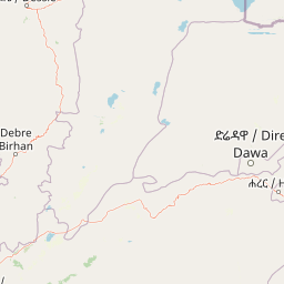
Geographic Profile and Mapped Boundaries of Yangudi Rassa National Park in Ethiopia
Yangudi Rassa National Park occupies a significant expanse within the Afar Region of Ethiopia, covering a recorded area of 4731 square kilometers. The terrain is characterized by a mix of mountain ranges, grasslands, and wetland systems, with elevations spanning from 400 meters to 1459 meters. Geographic data includes detailed perimeter measurements and primary water features such as the Awash River.
Related tags
National ParkSemi-DesertGrasslandRiverine ForestAfar Region
Ethiopia's Afar Region wilderness protecting semi-desert plains and endemic wildlife
Yangudi Rassa National Park
Yangudi Rassa National Park is a vast protected area spanning 4,731 square kilometers in the Afar Region of northeastern Ethiopia. The park encompasses Mount Yangudi rising to 1,383 meters above sea level along its southern boundary, together with the expansive Rassa Plains that stretch across the lowland terrain. Elevations within the park range from 400 meters in the lower areas to 1,459 meters at the highest points, creating a diverse landscape of semi-desert terrain, grassy plains, and riverine ecosystems. The Awash River flows through the park from south to north, providing critical water resources for both wildlife and the local Afar pastoralist communities. Established in 1969, this national park was created to protect some of Ethiopia's most distinctive dryland ecosystems and the remarkable wildlife adapted to these challenging conditions, including populations of Somali wild ass, Grevy's zebra, and diverse bird species. The park adjoins several other protected areas forming a larger conservation complex in the Afar landscape.
- Location
- Ethiopia
- Park type
- National park
- Established
- 1969
- Area
- 4,731 km²
- Highest point
- 1,383 m
Location overview
Mapped regional placement within Ethiopia's Afar Region
Geographic Location of Yangudi Rassa National Park in Ethiopia
Yangudi Rassa National Park is situated in the Afar Region of Ethiopia. Administrative records confirm the park remains a landlocked, national protected area without coastal or transboundary territory.
- Countries
- Ethiopia
- Regions
- Afar Region
- Primary location
- Afar Region
- Geographic setting
- Inland
Boundary and coordinates
Yangudi Rassa National Park’s mapped outline spans 4,731 km²
Yangudi Rassa National Park mapped boundary and 4,731 km² area
Yangudi Rassa National Park has stored boundary geometry conveying its expansive 4,731 km² extent. The record contains one overall area, without a land–marine breakdown and without a perimeter measurement.
- Boundary area
- 3,046.2 km²
- Boundary perimeter
- 220 km
- Northernmost point
- 11.2381° N
- Southernmost point
- 10.6788° N
- Easternmost point
- 41.0626° E
- Westernmost point
- 40.4569° E
- Geographic centre
- 10.9565° N, 40.7683° E
- North–south span
- 61.9 km
- East–west span
- 66.2 km
Elevation and terrain
Vertical relief metrics and recorded water features within the protected landscape
Yangudi Rassa National Park Terrain and Elevation Range
Recorded elevation metrics outline the mixed terrain profile across Yangudi Rassa National Park. Associated feature cards detail waterways and river systems positioned within the protected boundary.
- Minimum elevation
- 400 m
- Maximum elevation
- 1,459 m
- Highest point
- 1,383 m
Selected named natural features
Rivers
Awash River
Rivers
አዋሽ ወንዝ
Environmental setting
Arid climate zones, mixed relief, and partial forest cover characteristics
Yangudi Rassa National Park Environmental Classifications and Physical Setting
Stored landscape features and habitat types provide complementary ways to read the physical setting across the terrain. Recorded categories connect directly to relevant atlas destinations where available.
- Relief
- Mixed relief
- Climate
- Arid
- Water
- Minor water
- Forest cover
- Partial forest
Landscape features
Mountains · Grassland · Rivers · Wetland
Habitat types
Temperate broadleaf forest · Grassland · Wetland · Riverine habitat
Park atlas
Trace the geographic spread of protected areas surrounding Yangudi Rassa National Park, comparing diverse dryland ecosystems.
Explore Related National Parks and Protected Areas Near Yangudi Rassa National Park in Ethiopia
Extend your park discovery from Yangudi Rassa National Park to browse other national parks and protected areas within Ethiopia's Afar Region, tracing their mapped geography. Understand the conservation landscapes of Eastern Ethiopia by comparing diverse terrains, riverine ecosystems, and semi-desert environments found across this crucial wildlife corridor.
National parkDjibouti
About 119 km away#1 closest
East

Yoboki National Park: Djibouti National Park Geographic Atlas Explorer
Discover its mapped boundaries and regional terrain.
Yoboki National Park is a key protected area within Djibouti, offering a distinct focus for geographic exploration. This entry provides structured information to understand the park's mapped landscape and its position within the Horn of Africa's regional geography. Delve into the park's protected land identity and terrain context, essential for atlas-based discovery and appreciating its natural features.
- IUCN
- II
- Relief
- Mixed relief
- Climate
- Arid
- Scope
- Terrestrial
National parkEthiopia
About 182 km away#2 closest
Southwest

Awash National Park: Mapped Protected Boundaries and Ethiopian Regional Geography
Discover the protected landscape of this Ethiopian National Park.
Awash National Park represents a significant protected area within Ethiopia, offering a rich focus for geographic discovery. This page illuminates the park's specific mapped boundaries and its positioning within the surrounding regional geography. It serves as a detailed entry point for understanding the park's landscape character and its role as a national park in East Africa.
- Area
- 850 km²
- Established
- 1966
- IUCN
- II
- Relief
- Mixed relief
National parkTadjourah Region
About 189 km away#3 closest
Northeast
Day Forest National Park: Ancient Juniper Woodland and Protected Landscape in Djibouti
Discover a rare East African forest refuge with unique endemic species.
Day Forest National Park represents a critical ecological island within Djibouti's predominantly semi-desert geography. As the nation's oldest national park, it protects the largest remaining East African juniper forest, a vital sanctuary for species found nowhere else on Earth. Located in the Goda Mountains of the Tadjourah Region, its existence relies on rare localized rainfall, creating a distinctive mountainous forest environment that offers profound insights into protected landscape dynamics and regional biodiversity.
- Area
- 15 km²
- Established
- 1939
- IUCN
- II
- Relief
- Mountain
National parkAmhara Region
324 km away#4 closest
Northwest
Simien Mountains National Park: National Park Protected Landscape and Regional Geography
Explore Amhara Region's distinct mountain terrain and park boundaries.
Simien Mountains National Park serves as a key protected landscape within the Amhara Region of Ethiopia. This national park offers a distinct geographic identity, characterized by its unique terrain and mapped natural boundaries. Understanding this park provides valuable context for regional geography and the broader atlas of protected areas in northern Ethiopia.
- Area
- 412 km²
- Established
- 1969
- IUCN
- II
- Visitors
- 26K annual
National parkArsi Zone
About 339 km away#5 closest
Southwest
Arsi Mountains National Park: Protected Ethiopian Highlands Landscape & Geography
Mapped protected terrain and endemic species habitat within the Arsi Zone.
Arsi Mountains National Park is a vast protected area celebrated for its significant biodiversity and distinctive Afro-alpine ecosystems. Situated in the Arsi Zone, this national park encompasses a dramatic mountain landscape central to the Ethiopian Highlands. It serves as a crucial refuge for endangered endemic species, including the mountain nyala and Ethiopian wolf, within its varied ecological zones and protected park boundaries, offering rich context for geographic exploration.
- Area
- 10,876 km²
- Established
- 2011
- IUCN
- II
- Relief
- Mountain
National parkBale Zone
401 km away#6 closest
South
Bale Mountains National Park National Park: Explore Protected Landscape and Regional Geography
Mapped boundaries and natural terrain context for this Ethiopian park.
Delve into Bale Mountains National Park, a designated national park in Ethiopia's Bale Zone, focusing on its role as a vital protected landscape. This page offers detailed insights into the park's mapped boundaries and its contribution to the regional geography, providing a foundation for structured atlas exploration of protected areas and natural terrain. Understand the geographic significance and landscape identity of this key conservation entity within the broader context of Ethiopia's natural heritage.
- Area
- 2,220 km²
- Established
- 1970
- IUCN
- II
- Relief
- Mountain
National parkEthiopia
About 417 km away#7 closest
Southwest
Abidjatta-Shalla National Park: Ethiopian National Park and Rift Valley Bird Habitat
Mapped terrain and protected wetland ecology in the Ethiopian Rift Valley.
Explore Abidjatta-Shalla National Park, a significant protected area in Ethiopia renowned for its stunning avian spectacles, particularly the vast flamingo colonies on Lake Abijatta. This national park's landscape is defined by the distinct volcanic geology of the Rift Valley, featuring both shallow alkaline waters and deeper lakes that create diverse wetland ecosystems. Understand its geographic placement within Ethiopia and its importance as a major birdwatching destination, offering insights into unique protected natural landscapes.
- IUCN
- II
National parkOromia Region
About 417 km away#8 closest
Southwest
Abijatta-Shalla National Park: Protected National Park within Oromia Region
Mapped landscape and regional geographic context.
Delve into the protected landscape identity of Abijatta-Shalla National Park, a designated national park situated within the Oromia Region. This dedicated detail page offers an atlas-driven perspective, focusing on the park's geographic scope, mapped terrain, and its significance as a protected natural area. Understand its role in the broader context of Ethiopian protected lands and regional geography.
- Area
- 887 km²
- Established
- 1974
- IUCN
- II
- Relief
- Mountain
MoriAtlas Explorer
Continue Exploring Yangudi Rassa National Park's Geographic Context
Delve deeper into the protected landscape of Yangudi Rassa National Park, a significant national park in the Afar Region. Understand its position within the broader Ethiopian geography, its characteristic terrain, and the mapped boundaries that define this vital conservation area. This exploration reveals the park's unique dryland ecosystems and their ecological importance for regional wildlife.
Browse next
Global natural geography
Explore related park routes
Explore MoriAtlas Global ParksBrowse All MoriAtlas ParksGlobal Park Map DiscoveryMoriAtlas: Browse All CountriesBrowse All MoriAtlas ContinentsNational Park Environment AtlasGrand Canyon National Park AtlasYellowstone National Park AtlasYosemite National Park Atlas and GeographySerengeti National Park AtlasGalápagos National Park Protected LandscapeBanff National Park Geography and AtlasKruger National Park Atlas EntryUluṟu-Kata Tjuṯa National Park AtlasExplore Uluru-Kata Tjuta National Park GeographyPlitvice Lakes National Park AtlasFiordland National Park Protected LandscapeGreat Smoky Mountains National Park AtlasAfghanistan National Parks and Protected AreasAlbania National Parks and Protected AreasAlgeria National Parks and Protected AreasAmerican Samoa National Parks and Protected AreasAndorra National Parks and Protected AreasAngola National Parks and Protected AreasAntarctica National Parks and Protected AreasAntigua and Barbuda Park List