

Mori Atlas logo
National parkAbaco National Park

Discover the geographic identity and mapped landscape of this Bahamian national park.

Abaco National Park: Mapped Protected Area and Regional Geography in South Abaco

Abaco National Park represents a significant protected area within the Bahamian archipelago, specifically situated in South Abaco. This page offers an atlas-style exploration of its mapped boundaries and geographic context, providing a foundation for understanding its unique landscape and place within regional conservation efforts. Dive into the structured geographic data to grasp the essence of this protected national park entity.

Caribbean pine forestEndemic bird speciesBahama parrotProtected areaBirdwatchingIsland conservation

Abaco National Park

National park

Park overview

Structured park overview, official facts, and landscape profile for Abaco National Park

Abaco National Park park facts, protected area profile, and essential visitor context
Review the core facts for Abaco National Park, including designation, size, terrain, visitor scale, habitats, and operating context in one park-focused overview.

About Abaco National Park

Abaco National Park occupies a significant portion of South Abaco in the northern Bahamas, protecting a landscape characterized by rolling pine forests, coastal wetlands, and interior scrubland. The park was established in 1994 through the efforts of the Bahamas National Trust, the non-governmental organization responsible for managing the nation's protected areas. The park's establishment reflected growing recognition of the ecological importance of Abaco's pine forest habitats, which had faced increasing pressure from development and logging throughout the 20th century. Today, the park serves as the primary protected area for one of the Bahamas' most ecologically significant forest ecosystems. The geography of South Abaco places the park in a transition zone between the Caribbean pine forests of the island's interior and the marine environments of the surrounding coastline. This positioning creates a mosaic of habitats that support both forest-dwelling species and species associated with more coastal environments. The park's management under the Bahamas National Trust ensures ongoing protection of these habitats while supporting research and conservation programs focused on the park's endemic species.

Quick facts and research context for Abaco National Park

Abaco National Park covers 20,500 acres (83 square kilometers) in South Abaco, established on May 9, 1994. The park features approximately 5,000 acres of Caribbean pine forest, representing one of the most extensive pine habitats in the Bahamas. It is managed by the Bahamas National Trust, the country's primary conservation authority. The park is particularly significant for protecting endemic bird species, including the Bahama parrot, which is found only in the Bahamas.

Park context

Deeper park guide and search-rich context for Abaco National Park

Abaco National Park history, landscape, wildlife, and travel context
Explore Abaco National Park through its history, landscape character, ecosystems, wildlife, conservation priorities, cultural context, and seasonal travel timing in a structured park guide built for atlas discovery and search intent.

Why Abaco National Park stands out

Abaco National Park is best known for its extensive Caribbean pine forests and its role as a critical habitat for the Bahama parrot, an endemic species found only in the Bahamas. The park supports exceptional bird diversity, protecting species such as the Bahama swallow, Bahama yellowthroat, Bahama mockingbird, loggerhead kingbird, olive-capped warbler, West Indian woodpecker, and white-crowned pigeon. The pine forest ecosystem within the park represents one of the most intact and significant in the Caribbean region, providing crucial refuge for species that depend on this increasingly rare habitat type.

Abaco National Park history and protected-area timeline

Abaco National Park was established on May 9, 1994, representing a milestone in the Bahamas' conservation history. The creation of the park came in response to growing concerns about the protection of the Caribbean pine forests that once covered much of Great Abaco Island. These forests had experienced significant reduction due to timber extraction and agricultural expansion in preceding decades. The Bahamas National Trust, founded in 1969 as the nation's primary conservation body, worked with government partners to secure protection for the remaining pine forest areas. The establishment of the park also reflected the recognition that Abaco harbored unique biodiversity, particularly among bird species, that required dedicated protection. Since its creation, the park has served as a living laboratory for studying Caribbean pine forest ecology and the conservation needs of endemic bird populations.

Abaco National Park landscape and geographic character

The landscape of Abaco National Park is dominated by Caribbean pine forest, with the Caribbean pine (Pinus caribaea) forming the primary tree species across much of the protected area. The terrain consists of gently rolling hills and flatland that characterize South Abaco's interior, with elevation generally remaining modest throughout the park. The pine forest gives way in places to more open scrubland and wetland areas, particularly in lower-lying sections where water collects during wet periods. The park's location on the eastern side of Great Abaco places it relatively close to the Atlantic coastline, though the primary forest habitat occupies the interior elevations. The combination of pine forest, open woodland, and transitional areas creates a varied landscape that supports diverse ecological communities.

Abaco National Park ecosystems, habitats, and plant life

The nature of Abaco National Park centers on its Caribbean pine forest ecosystem, which represents one of the most important forest types in the Bahamas. The approximately 5,000 acres of pine forest within the park provide critical habitat for species adapted to this relatively dry forest environment. The ecosystem supports a distinctive community of plants and animals that have evolved in isolation on the Bahamas archipelago. Beyond the pine forests, the park includes areas of scrubland and seasonal wetlands that add ecological diversity to the protected area. The forest ecosystem exists in a Caribbean context where pine forests are relatively rare, making the protected area in Abaco particularly significant for regional biodiversity conservation. The park's location within the Bahamas also places it within a broader island chain that supports significant numbers of migratory bird species passing between North and South America.

Abaco National Park wildlife and species highlights

The wildlife of Abaco National Park is highlighted by its exceptional bird fauna, with several species found nowhere else in the world. The Bahama parrot, a subspecies of the Cuban parrot, makes its home in the park's pine forests and represents one of the most recognizable endemic birds in the Bahamas. Additional endemic or near-endemic species include the Bahama swallow, Bahama yellowthroat, and Bahama mockingbird, all of which rely on the park's forest habitats. Other notable bird species found in the park include the loggerhead kingbird, olive-capped warbler, West Indian woodpecker, and white-crowned pigeon. The pine forest environment supports a bird community that differs substantially from the more commonly encountered birdlife of tropical Caribbean lowland forests, reflecting the unique ecological character of the Bahamas' pine habitats. While the Wikipedia source focuses primarily on avian wildlife, the park's forest and wetland habitats also support various reptile, mammal, and invertebrate species typical of the Bahamas.

Abaco National Park conservation status and protection priorities

Abaco National Park plays a vital role in conserving Caribbean pine forest ecosystems that have been significantly reduced across their historical range in the Bahamas. The park protects one of the largest remaining intact areas of this forest type, safeguarding habitat for species that depend on it. The protection of the Bahama parrot population is particularly significant, as this species faces ongoing threats from habitat loss and fragmentation throughout its limited range. The park's management by the Bahamas National Trust provides ongoing conservation oversight and supports monitoring programs for key species. The establishment of the protected area also reflects the broader conservation framework of the Bahamas, which recognizes the importance of protecting endemic biodiversity on the island archipelago. As climate change and development pressures continue to affect Caribbean islands, protected areas like Abaco National Park become increasingly important for maintaining ecological resilience.

Abaco National Park cultural meaning and human context

Abaco National Park exists within the context of the Abaco Islands, which have a long human history intertwined with the marine environments of the Bahamas. The island of Abaco has been inhabited since the time of the Lucayan people, the indigenous inhabitants of the Bahamas before European contact. More recently, Abaco developed as a center of boat building and maritime activity, with communities like Marsh Harbour serving as important ports. The establishment of the national park reflected a growing awareness among Bahamians of the importance of preserving natural heritage alongside the cultural and economic traditions of the islands. The park's pine forests have also been part of the historical landscape used by local communities, though protection status now limits extractive uses within the park boundaries.

Top sights and standout views in Abaco National Park

The highlights of Abaco National Park include its extensive Caribbean pine forest, which is one of the most significant remaining examples of this ecosystem in the Bahamas. The park provides critical habitat for the Bahama parrot, one of only two parrot species native to the Bahamas. The diversity of endemic and near-endemic bird species, including the Bahama swallow, Bahama mockingbird, and West Indian woodpecker, makes the park a significant destination for bird conservation and observation. The protected area serves as a living example of successful conservation in the Caribbean, demonstrating how dedicated protection can preserve unique ecosystems and the species that depend on them.

Best time to visit Abaco National Park

The best time to visit Abaco National Park aligns with the cooler, drier months typically experienced in the Bahamas from November through April. During this period, temperatures are more comfortable for outdoor exploration and wildlife activity is generally higher as migratory birds are present. The dry season reduces issues with mosquitoes and other insects that can be more prevalent during the summer months. Late winter and early spring often represent optimal conditions for bird watching, as both resident species are active and migratory species may be passing through. The summer months bring warmer temperatures and increased rainfall, which can make outdoor activities more challenging but may offer different ecological experiences.
Park location guide

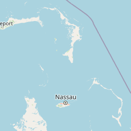
Geography guide, regional context, and park location map for Abaco National Park

Abaco National Park park geography, regions, and map view in Bahamas
Understand where Abaco National Park sits in Bahamas through a broader geographic reading of the surrounding landscape, nearby location context, and its mapped position within the national park landscape.

How Abaco National Park fits into Bahamas

The Bahamas is an island nation in the Atlantic Ocean, forming part of the Lucayan Archipelago. It consists of more than 3,000 islands, cays and islets located north of Cuba, northwest of Hispaniola, and southeast of Florida. The country gained independence from Britain in 1973 and operates as a constitutional monarchy under King Charles III, with Nassau as its capital and largest city.

Wider geography shaping Abaco National Park in Bahamas

The Bahamas occupies the Lucayan Archipelago in the Atlantic Ocean. The island chain is positioned north of Cuba, northwest of Hispaniola (shared by the Dominican Republic and Haiti), southeast of the US state of Florida, and east of the Florida Keys. The territory spans over 3,000 islands, cays and islets, with the total land area being 13,943 km². The Royal Bahamas Defence Force claims approximately 470,000 km² of surrounding ocean space.

Map view of Abaco National Park

Use this park location map to pinpoint Abaco National Park in Bahamas, understand its exact geographic position, and read its mapped placement within the surrounding landscape more clearly.

Pigeon | © OpenStreetMap contributors

Location context for Abaco National Park

South Abaco
Park atlas

Browse the protected landscapes and park geography surrounding Abaco National Park for regional context.

Explore National Parks and Protected Areas Near Abaco National Park, Bahamas
Trace the protected landscapes and national parks across the Bahamas, building on your exploration of Abaco National Park's unique Caribbean pine forests and critical Bahama parrot habitat. Compare regional park geography, conservation priorities, and diverse ecosystems to understand the broader spread of protected areas within the Bahamian archipelago.
National parkBahamas

Pelican Cays Land and Sea Park: Protected Marine Landscape in the Bahamas

Explore coral reefs, undersea caves, and vital sea turtle habitats.

Pelican Cays Land and Sea Park, a protected national park in the Bahamas, offers a rich marine atlas experience. Its landscape is defined by extensive coral reef formations and unique undersea cave systems, supporting remarkable biodiversity. This park highlights the importance of protected waters for species like sea turtles and provides exceptional opportunities for exploring submerged geography and vibrant coral ecosystems.

Area
8 km²
Established
1972
IUCN
II
Relief
Lowland
Nature reserveHope Town

Tilloo Cay National Reserve Nature Reserve: Coastal Habitat for White-Tailed Tropicbirds

Mapped protected area within the Hope Town region of the Abacos.

Tilloo Cay National Reserve, a protected nature reserve situated near Hope Town, represents a significant habitat for the white-tailed tropicbird, a species reliant on such island nesting sites. This 11-acre reserve showcases a characteristic Bahamian small island ecosystem, featuring coastal terrain and scrub vegetation. Its protected status under the Bahamas National Trust ensures the security of critical breeding grounds, making it a key focus for conservation within the Abaco Islands. The reserve offers a distinct example of targeted habitat preservation, contributing to the broader atlas of protected natural landscapes in the Caribbean.

Area
0.04 km²
Established
1990
IUCN
II
Relief
Lowland
National parkBahamas

Fowl Cays National Park: Bahamas Marine Protected Area and Coral Reef Atlas

Discover the mapped geography and marine ecosystems of this Bahamian national park.

Fowl Cays National Park in the Bahamas is a protected marine environment known for its significant coral reef formations and supporting seagrass meadows. This atlas-focused entry details the park's geographic setting within the Abaco Islands, highlighting its importance as a marine conservation landscape. Users can explore the protected boundaries and the ecological richness of this vital Caribbean ecosystem.

Area
9 km²
Established
2009
IUCN
II
Climate
Subtropical
National parkNorth Abaco

Black Sound Cay National Reserve National Park: Protected Landscape in North Abaco

Explore its mapped boundaries and regional geographic context.

Black Sound Cay National Reserve is a key protected area situated in North Abaco, within the Bahamas. This national park offers a unique lens into the island's natural geography and conservation landscapes. Users can delve into the park's mapped outlines and understand its specific role within the broader Abaco Islands archipelago, providing critical geographic context for any atlas-based discovery.

Area
0.008 km²
Established
1988
IUCN
Ia
Relief
Lowland
National parkBahamas

Bonefish Pond National Park: Essential Bahamas Coastal Wetland & Marine Nursery

Mapped protected area, mangrove ecosystem, and habitat for key marine species.

Bonefish Pond National Park, a protected national park on New Providence island in The Bahamas, is essential for its role as a thriving marine nursery. The park's landscape features extensive red mangrove forests, tidal channels, and shallow lagoons crucial for juvenile bonefish, crawfish, and conch. This area highlights effective wetland restoration and conservation, offering valuable insights into Caribbean coastal protected landscapes and their geographic importance.

Area
5 km²
Established
2002
IUCN
II
Relief
Lowland
National parkBahamas

Primeval Forest National Park: A Protected Landscape within the Bahamas Archipelago

Explore mapped boundaries and regional geography in the Lucayan Archipelago.

Primeval Forest National Park serves as a key protected area within the Bahamas, offering a focused view of island geography and conservation landscapes. This national park is a critical element for understanding the archipelago's natural terrain and mapped protected lands. Its presence provides valuable geographic context, allowing for detailed exploration of its boundaries and its place within the broader Bahamian atlas.

Established
2002
Relief
Mixed relief
Climate
Tropical
Access
Easy access
National parkGrand Bahama

Lucayan National Park: National Park Geography and Mapped Landscape Exploration

Discover protected area boundaries on Grand Bahama.

Lucayan National Park stands as a distinct national park entity within the geography of Grand Bahama. This page provides a focused atlas-style exploration of the park's protected landscape, detailing its mapped area and contributing to a structured understanding of its regional context. Delve into the geographic specifics that define Lucayan National Park as a key element of the Bahamas' protected lands, suitable for detailed map-based discovery and analysis.

Area
7.84 km²
Established
1982
IUCN
II
Climate
Tropical
National parkBahamas

North and South Marine Parks National Park: Geographic Atlas and Protected Landscape in the Bahamas

Mapping Bahamian protected marine geography and its national park boundaries.

Delve into the atlas-view of North and South Marine Parks, a key national park in the Bahamas. This page details the park's specific geographic features and its protected landscape identity within the island nation. Understand its placement and significance as a protected marine area contributing to the regional geography.

Area
20 km²
Established
2002
IUCN
II
Climate
Tropical

Common questions about visiting, size, designation, and location context for Abaco National Park

Abaco National Park FAQs for park facts, access, geography, and protected area context
Find quick answers about Abaco National Park, including protected-area facts, park geography, trail and visitor context, and how the park fits into its surrounding country and regional landscape.
MoriAtlas Explorer

Continue Your Protected Areas Search Across the Global Atlas

Deepen your exploration by continuing the structured search for national parks and protected areas worldwide. Utilize the comprehensive filtering capabilities to compare different conservation landscapes and refine your understanding of global park geography. Discover more about the distribution and characteristics of protected natural areas.

Global natural geography