
Mori Atlas logo
Nature reserveAgioi Theodoroi

A vital wildlife sanctuary and historical landmark featuring rugged Mediterranean islets off the coast of Chania

Agioi Theodoroi Nature Reserve: Protected Island Geography and Coastal Terrain in Crete

Agioi Theodoroi consists of two uninhabited islets near the coast of Crete that function as a critical nature reserve within the Natura 2000 network. The islands serve as a protected haven for the endemic kri-kri wild goat and support important breeding populations of Eleonora's falcons. Beyond their ecological value, the rocky slopes preserve historical Venetian fortifications that offer a glimpse into the defensive past of the Aegean coastline.

isletsCreteCretan IslandsAegeannature reserveNatura 2000
A stylized graphic illustration of a coastal cliff landscape featuring rocky bluffs, a sea cave, calm water, and soft-colored foliage at sunset.

Agioi Theodoroi

Nature reserve

Park overview

Structured park overview, official facts, and landscape profile for Agioi Theodoroi

Agioi Theodoroi park facts, protected area profile, and essential visitor context

Review the core facts for Agioi Theodoroi, including designation, size, terrain, visitor scale, habitats, and operating context in one park-focused overview.

About Agioi Theodoroi

Agioi Theodoroi is a small but ecologically significant island group located a short distance offshore from the northwestern coast of Crete, immediately north of the coastal settlement of Agia Marina and within view of the wider Chania region. The group consists of two islets, the larger Agios Theodoros and the much smaller Mikros Agios Theodoros, separated by only a few metres of sea. Together they form a tightly defined protected area that has been managed for wildlife conservation for nearly a century.

The identity of the islands is inseparably linked to the kri-kri, the endemic wild goat of Crete. In 1935, a small founding group of kri-kri was captured in the Samaria Gorge and released on Thodorou to establish a pure-breeding population free from contact with domestic goats. Because the original group was too small to avoid inbreeding, additional animals were introduced, and over the following decades the resulting population became one of the best-known insurance populations of the species worldwide. Many European and international zoos have received their founding kri-kri from this very island, giving Agioi Theodoroi an outsize role in ex situ conservation.

Beyond the kri-kri, the islets host a breeding colony of Eleonora's falcons, which has earned the site recognition as an Important Bird Area by BirdLife International. The cliffs and undisturbed substrate of the islands provide the conditions these falcons need during their long breeding season, which extends late into the Cretan summer.

The protected area is integrated into the Natura 2000 network under the European Habitats and Birds Directives and is one of a chain of small island reserves that, together with the larger Samaria Gorge and White Mountains complex inland, anchors nature protection in western Crete. The combination of strict access rules, dedicated wardening, decades of continuity, and the genetic value of the kri-kri herd has made Agioi Theodoroi a reference example of small-island reserve management in the Mediterranean.

Quick facts and research context for Agioi Theodoroi

Agioi Theodoroi is a pair of small, uninhabited islets off the northwest coast of Crete in the Aegean, administratively within the municipality of Chania. The two islands, Agios Theodoros (Thodorou) and Mikros Agios Theodoros (Thodoropoula), together cover a very small land area and rise to about 165 metres at their highest point. They were first protected in 1930 as a nature reserve and are today part of the European Natura 2000 network under the site code GR4340018. The islets are recognised by BirdLife International as an Important Bird Area because of their breeding population of Eleonora's falcons.

Protection and recognition

Documented management scope and international recognition records

Agioi Theodoroi Protection Status and Designation History

Agioi Theodoroi maintains a mixed protection scope established through historical designation records dating back to 1930. Structured administrative details outline the documented conservation status and formal recognition parameters associated with this protected landscape.

Protection details

Protection scope
Mixed
Designated year
1930
Transboundary protection
No
Park context

Deeper park guide and search-rich context for Agioi Theodoroi

Agioi Theodoroi history, landscape, wildlife, and travel context

Explore Agioi Theodoroi through its history, landscape character, ecosystems, wildlife, conservation priorities, cultural context, and seasonal travel timing in a structured park guide built for atlas discovery and search intent.

Why Agioi Theodoroi stands out

Agioi Theodoroi is best known as the long-established home of a self-sustaining population of the kri-kri, the wild Cretan goat, as well as for its breeding colony of Eleonora's falcons. The islets have been used repeatedly since the 1930s as a source population from which surplus kri-kri have been sent to zoos around the world, cementing their international conservation reputation. The combination of a strict nature reserve status, a tiny but well-documented breeding falcon colony, and a visible Venetian military history makes the islands a compact but unusually rich site within the Cretan archipelago.
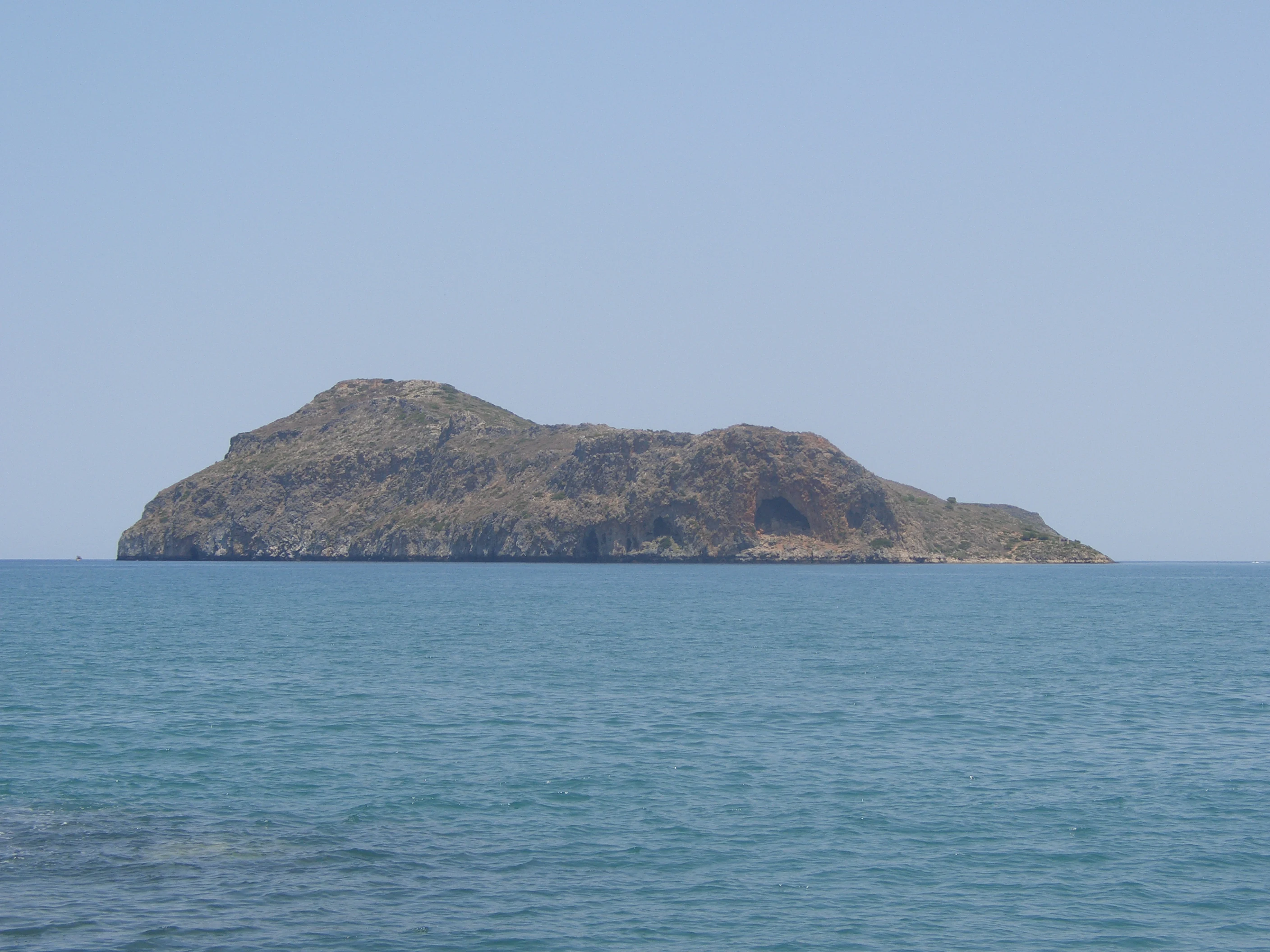
A wide, eye level shot of a small, barren, rocky island rising out of a calm blue sea under a clear sky.
A view of the rocky islet of Theodorou, a protected nature reserve off the coast of Crete.

Agioi Theodoroi history and protected-area timeline

The islets have a documented history that reaches back into antiquity. The Stadiasmus Maris Magni, a Greek navigational text from the second half of the third century BCE, mentions the islands and notes that they possessed potable water, indicating that they were already known as usable anchor points along the Cretan coast. In classical references they are mentioned under the names Coete, Koite, and Akytos, with the latter name traditionally interpreted as referring to something not inhabited.

During the Venetian period of Cretan rule, the islands took on a military role. In 1583, the Venetians constructed two small fortresses on Agios Theodoros, designed both to deny the islands to maritime raiders and to defend the nearby coastline. One fortress was sited on lower ground and became known as the fortress of San Francesco; the other, on higher ground, was called the fortress of San Thodoro, or Tourlourou.

These fortifications met a dramatic end in 1645, when the island was attacked during the Ottoman conquest of western Crete. Rather than surrender, the small Venetian garrison of about seventy defenders set fire to the powder magazine, destroying the fortress along with themselves and the Ottoman troops who had landed. The fortifications were never rebuilt and have survived only as ruins.

A new chapter began in 1930, when the municipality of Agia Marina, working with the hunting association of Chania, designated the islets as a nature reserve. This made Agioi Theodoroi one of the earliest formally protected small-island sites in modern Greece and set the stage for the introduction of the kri-kri herd five years later.

Agioi Theodoroi landscape and geographic character

The landscape of Agioi Theodoroi is defined by small-scale, exposed Mediterranean island terrain rather than by dramatic relief. The larger islet, Agios Theodoros or Thodorou, rises to about 165 metres above the sea, creating a rocky, sloping landform that falls directly into the surrounding waters of the Aegean. Its surface is a mix of bare rock, low Mediterranean scrub, and patches of vegetation shaped by wind, salt spray, and the grazing pressure of the resident kri-kri herd.

A notable physical feature is a large, arched cave on the southern side of the main island, which is visible from nearby coastal viewpoints and adds a distinctive element to the otherwise simple coastline. The smaller companion islet, Mikros Agios Theodoros or Thodoropoula, lies only a short distance to the north and shares the same compact, rocky character on a far smaller scale.

From the islands themselves, the view extends across the northwestern Cretan coast toward the resort strip around Platanias and Agia Marina, and, on clear days, inland to the White Mountains, whose higher peaks frame the wider horizon. This juxtaposition of a tiny offshore landmass against the backdrop of the Lefka Ori range gives the islands a clear sense of place within the geography of western Crete.

On the higher ground of Agios Theodoros, the ruined Venetian fortifications are the most visible reminders of human shaping of the landscape, while the partly ruined church of the Saints Theodore gives the islands the name that has stuck for centuries.

Agioi Theodoroi ecosystems, habitats, and plant life

Ecologically, Agioi Theodoroi functions as a tightly bounded offshore extension of the Cretan natural environment. Its flora reflects typical Aegean island vegetation, with low, hardy phrygana-type scrub, scattered shrubs, and herb communities adapted to thin soils, strong sun, and limited freshwater. The presence of the kri-kri herd acts as a continuous ecological force, shaping which plants establish and persist.

The islands sit at the interface between the marine environment of the northwestern Cretan coast and the terrestrial habitats of the island itself, and this transition zone is of particular conservation interest. The cliffs and rocky outcrops provide nesting habitat for raptors, while the surrounding waters support the marine food web on which those birds depend. Because the islands are uninhabited and access is restricted for most of the year, the terrestrial habitats remain largely undisturbed by human activity, allowing natural processes to dominate.

The site's integration into the Natura 2000 network reflects this combined ecological value, protecting both the island ecosystems themselves and the birdlife they support.

Agioi Theodoroi wildlife and species highlights

Agioi Theodoroi's wildlife profile is unusually concentrated for such a small area. The dominant species, in both ecological and cultural terms, is the kri-kri, the wild Cretan goat, recognisable by its curved horns and reddish-brown coat. The population on Thodorou has functioned as a closed breeding stock since the 1930s, and over the decades surplus animals from this herd have been sent to zoos across Europe and beyond, making the island an internationally important reservoir of the subspecies.

The avian fauna is also significant. BirdLife International has recognised the islets as an Important Bird Area specifically because they support a breeding colony of between roughly fifty and sixty-five pairs of Eleonora's falcons. Eleonora's falcon is a late-season breeder in the Mediterranean, timing its nesting to coincide with the autumn passage of migratory passerines, and undisturbed islands such as Agioi Theodoroi provide the cliff nesting conditions it requires.

Beyond these headline species, the islands contribute to the broader ornithological richness of the Cretan coast during migration periods, when various seabirds and landbirds move along this part of the Aegean.

Agioi Theodoroi conservation status and protection priorities

Agioi Theodoroi is one of the earliest examples of small-island nature protection in Greece and one of the more unusual cases internationally, because an entire islet group has been dedicated to conserving a single, ecologically distinctive subspecies. The protection regime dates back to 1930, when the municipality of Agia Marina and the Chania hunting association jointly designated the islands as a nature reserve; the 1935 introduction of kri-kri then turned the site into a living conservation archive for the Cretan wild goat.

The reserve is now part of the Natura 2000 network under site code GR4340018, recognised under both the European Habitats Directive for its terrestrial habitats and the Birds Directive for its Eleonora's falcon colony. Access to the islands is generally prohibited, with the islands continuously wardened, and visitors are allowed only on the feast day of the church of the Saints Theodore in June, when a service draws local people to the site. This tight access regime is a core part of what makes the protection effective.

The conservation significance of the site extends well beyond Crete. Because the kri-kri herd has long been used as a source population for international zoo programmes, Agioi Theodoroi effectively serves as a global genetic anchor for ex situ conservation of the subspecies. The combination of strict in situ protection, decades of population management, and international zoo contributions gives the islands an outsized footprint in Mediterranean wildlife conservation.

Agioi Theodoroi cultural meaning and human context

The cultural identity of Agioi Theodoroi rests on three intertwined strands: Orthodox religious tradition, Venetian military heritage, and modern nature protection. The name of the islands comes from a now partly ruined church dedicated to the Saints Theodore, and a religious celebration held on the islands each June remains one of the few occasions when people are permitted to land.

The Venetian fortresses on Agios Theodoros are a more dramatic, if less well-known, element of local heritage. Although the dramatic destruction of the garrison in 1645 is less famous than it deserves to be beyond Crete, the fortress ruins remain visible on the island and form part of a broader pattern of Venetian coastal defence works along the Chania shoreline. Local mythology, preserved in oral tradition, weaves the islands into stories involving Saint George, Saint Marina, and the transformation of threatening creatures into stone, reflecting the strong place these rocks hold in the imagination of nearby coastal communities.

Top sights and standout views in Agioi Theodoroi

Two uninhabited islets off northwestern Crete form one of the oldest small-island nature reserves in Greece, integrated into the Natura 2000 network. A self-contained herd of kri-kri, the endemic Cretan wild goat, has lived on Thodorou since 1935 and has supplied founder animals to zoos around the world. The islands are recognised by BirdLife International as an Important Bird Area for the breeding population of Eleonora's falcons. Ruins of two Venetian fortresses, famously destroyed in 1645, sit on the larger islet alongside the partly ruined church that gives the group its name.

Best time to visit Agioi Theodoroi

Because access to the islands themselves is restricted and the wildlife values are protected year-round, the timing of any visit is shaped more by the biological calendar than by tourist seasons. The clearest months for viewing Eleonora's falcons at the colony are those of the late summer and early autumn, when these falcons nest and raise their young along the Cretan cliffs. The kri-kri can be observed through the warmer months, though they remain secretive and are best appreciated from a distance.

The principal human occasion to approach the islands is the religious festival of the Saints Theodore in June, the one exception when landings are traditionally allowed. Outside this period, the islands are best appreciated from the coastal viewpoints near Agia Marina and Platanias, with the clearest atmospheric conditions typically found during the calmer late spring and early autumn months.

Monthly climate preview

Long-term representative records tracking monthly temperature and precipitation cycles

Agioi Theodoroi Climate Normals: Annual Temperature and Precipitation Rhythm

Representative coordinates record measured multi-year temperature variations alongside shifting monthly precipitation values across the protected landscape. Examining the complete twelve-month record provides deeper clarity into long-term climate normals and seasonal thermal patterns.
Annual mean18 °C
11 °C26 °C
Jan11°
Feb11°
Mar13°
Apr15°
May19°
Jun23°
Jul26°
Aug26°
Sep23°
Oct20°
Nov16°
Dec13°
Warmest month
August

25.9 °C

Coolest month
February

11.3 °C

Wettest month
December

3.7 mm/day

Driest month
July

0.1 mm/day

Park location guide

Geography guide, regional context, and park location map for Agioi Theodoroi

Agioi Theodoroi park geography, regions, and map view in Greece

Understand where Agioi Theodoroi sits in Greece through a broader geographic reading of the surrounding landscape, nearby location context, and its mapped position within the national park landscape.

How Agioi Theodoroi fits into Greece

Greece, officially the Hellenic Republic, is a country in Southeast Europe occupying the southern Balkans. It borders Albania, North Macedonia, Bulgaria, and Turkey, with coastlines on the Aegean, Ionian, and Mediterranean seas. The country has over 10 million people and is renowned for its ancient Greek heritage, philosophy, democracy, and the Olympic Games.

Wider geography shaping Agioi Theodoroi in Greece

Greece occupies the southern tip of the Balkan peninsula in Southeast Europe. It shares land borders with Albania to the northwest, North Macedonia and Bulgaria to the north, and Turkey to the east. The Aegean Sea lies to the east of the mainland, the Ionian Sea to the west, and the Sea of Crete and Mediterranean Sea to the south. The country spans thousands of islands across nine traditional geographic regions and has the longest coastline in the Mediterranean basin.

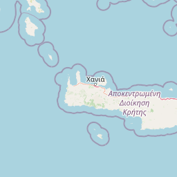
Map view of Agioi Theodoroi

Use this park location map to pinpoint Agioi Theodoroi in Greece, understand its exact geographic position, and read its mapped placement within the surrounding landscape more clearly.

Pigeon | © OpenStreetMap contributors

Location context for Agioi Theodoroi

Crete

Explore photographic records of rocky terrain, coastal habitats, and protected island scenery.

Agioi Theodoroi Photos and Landscapes: Visual Guide to the Cretan Wildlife Reserve

Visual documentation reveals the rugged topography, native scrub vegetation, and exposed marine environment defining the Agioi Theodoroi islets. Studying these protected landscapes provides clear insight into the remote sanctuary supporting endemic fauna and coastal bird colonies off the Cretan shore.

A wide, eye level shot of a small, barren, rocky island rising out of a calm blue sea under a clear sky.

Park atlas

Compare adjacent island refuges and regional conservation zones across western Crete

Exploring Parks Near Agioi Theodoroi and Surrounding Cretan Protected Areas

Visitors exploring Agioi Theodoroi can continue browsing other protected areas to compare coastal wildlife habitats and island nature reserves across the region. Reviewing related parks provides broader geographic context for the Mediterranean ecosystems and island landforms found throughout western Crete.
A watercolor painting showing a panoramic landscape with green hills, distant mountains, and water, set against a plain white background.
National parkGreece
About 30 km away#1 closest

South

Samaria National Park: Geological Landscape and Protected Area Atlas in Crete, Greece

Mapping the dramatic White Mountain canyon and coastal descent

Samaria National Park stands as a major protected landmark in Greece, defined by a tectonic gorge that bisects the White Mountains. This atlas entry covers the park boundary, the distinct vertical limestone cliffs of the Iron Gates, and the transition from mountain plateau to the Mediterranean coastline.

Area
4.848 km²
Established
1962
Relief
Mountain
Climate
Mediterranean
Watercolor painting of a coastal landscape featuring green rolling hills, distant landmasses, and stylized shrubs and trees in the foreground against a white background.
Nature reserveCrete
About 47 km away#2 closest

Southwest

Elafonisi Nature Reserve: Geography and Protected Landscape Analysis in Crete

Coastal dunes and limestone formations in southwestern Crete.

Elafonisi is a protected nature reserve situated in the southwestern reaches of Crete. This site encompasses a complex landscape of sand dunes, juniper-covered scrub, and rugged limestone terrain. By providing a clear look at the area, this atlas entry helps users understand the geographic setting, the ecological significance of the island, and the natural boundaries of this noteworthy Mediterranean conservation area.

Area
1.5 km²
Relief
Lowland
Climate
Mediterranean
Access
Easy access
A horizontal watercolor painting showing soft, rolling mountains and sparse desert-like shrubbery in shades of light green, pale pink, and yellow.
Biosphere reserveCrete
About 91 km away#3 closest

East

Psiloritis Natural Park: Protected Karstic Mountains and Cultural Landscapes in Crete

Geological exploration and regional mountain geography

Psiloritis Natural Park encompasses the central massif of Crete, featuring the famous Mount Ida range. Its protected territory serves as an essential site for understanding karstic geology, from deep underground cave systems to high-altitude steppes. The region perfectly highlights the intersection between large-scale tectonic history and the long-standing human traditions that shape the mountainous interior of the island.

Area
1,159 km²
Established
2001
Relief
Mountain
Climate
Mediterranean
A horizontal watercolor painting depicting a pale blue coastal landscape with low green vegetation in the foreground and soft mountainous ridges in the distance.
Protected areaLasithi
About 178 km away#4 closest

Southeast

Chrysi Protected Area: Mapping the Juniper Forests and Beaches of Lasithi, Greece

A coastal island sanctuary in the Libyan Sea

Chrysi presents a distinct landscape characterized by a mature juniper forest and golden-sand beaches. Situated within the Lasithi regional unit, this island remains a primary example of a protected Mediterranean woodland environment, preserving a unique set of coastal terrain, shallow sea ecosystems, and archaeological history on a small geographic footprint.

Area
4.743 km²
Relief
Lowland
Climate
Mediterranean
Access
Easy access
A horizontal watercolor illustration showing soft, stylized green and pink layers representing rolling hills and distant land over a light foreground of scrubby vegetation.
Protected areaLasithi
About 205 km away#5 closest

East

Dionysades Protected Area: An Atlas Guide to the Islands of Northeastern Crete

Geography and protected island landscapes in Lasithi

The Dionysades archipelago comprises four rocky islets isolated in the shallow waters of the northeastern Cretan shelf. This protected area functions as a key seabird stronghold in the Aegean, characterized by its dramatic maritime silhouette, deep-water surroundings, and significant cultural history reaching back to classical antiquity.

Area
5.25 km²
Relief
Upland
Climate
Mediterranean
Access
Remote access
A watercolor painting of a rolling mountainous landscape in Crete, featuring soft green hills, wildflowers, and pale mountain outlines against a light sky.
Biosphere reserveCrete
About 209 km away#6 closest

East

Sitia Nature Park: Geographic Atlas of Crete's Eastern Protected Mountain Landscapes

Mapping gorges, karst caves, and the eastern Cretan coastline.

Sitia Nature Park represents a vast protected territory across eastern Crete, characterized by its complex mountain spine and profound geological formations. This atlas entry provides geographic insights into the park's canyon systems, including the Valley of the Dead, and the karst caves that define its UNESCO Global Geopark status and regional natural terrain.

Established
2015
Relief
Mountain
Climate
Mediterranean
Access
Moderate access
National parkCrete
About 214 km away#7 closest

East

Vai Aesthetic Forest National Park: Geographic and Protected Landscape Overview

Coastal palm woodland and regional Cretan geography

Investigate the landscape composition of Vai Aesthetic Forest, a protected national park in northeastern Crete. This site preserves a rare Mediterranean wetland ecosystem and a significant population of endemic date palms, offering deep insights into the region's geological and ecological heritage within the Sitia UNESCO Global Geopark framework.

Area
0.2 km²
Established
1985
Relief
Lowland
Climate
Mediterranean
National parkGreece
About 235 km away#8 closest

North

Sounio National Park: Protected Coastal Geography and Mediterranean Terrain in Greece

A rugged maritime landscape on the Attica headland

Sounio National Park occupies the dramatic southernmost tip of the Attica peninsula in Greece. The protected area features vertical limestone cliffs, scrub-covered coastal hills, and a strategic headland overlooking the Aegean. This atlas entry provides a detailed look at the park boundaries, surrounding maritime geography, and the unique integration of classical heritage sites within an exposed Mediterranean conservation zone.

Area
0.75 km²
Established
1974
Relief
Upland
Climate
Mediterranean

Common questions about visiting, size, designation, and location context for Agioi Theodoroi

Agioi Theodoroi FAQs for park facts, access, geography, and protected area context

Find quick answers about Agioi Theodoroi, including protected-area facts, park geography, trail and visitor context, and how the park fits into its surrounding country and regional landscape.
MoriAtlas Explorer

Continue Your Protected Areas Search Across the Global Atlas

Deepen your exploration by continuing the structured search for national parks and protected areas worldwide. Utilize the comprehensive filtering capabilities to compare different conservation landscapes and refine your understanding of global park geography. Discover more about the distribution and characteristics of protected natural areas.

Global natural geography