Mori Atlas logo
Nature reserveAin Al-Auja Nature Reserve

Tracing the desert oasis, freshwater spring networks, and verdant riparian channels

Ain Al-Auja Nature Reserve: Geographic Mapping and Protected Landscape Identity in Palestine

(Ein Al-Auja Nature Reserve)

Located in the Jericho Governorate, Ain Al-Auja Nature Reserve stands as a critical wetland oasis within the arid eastern slopes of the West Bank. This protected area centers on the natural spring and its radiating water channels, which sustain extensive vegetation across a 22,000 dunam landscape. The geography creates a sharp contrast between rugged highland terrain and the fertile valley floor, serving as a significant ecological corridor extending toward the Jordan River.

nature reserveoasisspringfreshwater habitatdesert oasismedicinal plants

Ain Al-Auja Nature Reserve

Nature reserve

Park overview

Structured park overview, official facts, and landscape profile for Ain Al-Auja Nature Reserve

Ain Al-Auja Nature Reserve park facts, protected area profile, and essential visitor context

Review the core facts for Ain Al-Auja Nature Reserve, including designation, size, terrain, visitor scale, habitats, and operating context in one park-focused overview.

About Ain Al-Auja Nature Reserve

Ain Al-Auja Nature Reserve is one of the most ecologically distinct protected areas in the Palestinian landscape. Located in the Jericho Governorate in the eastern West Bank, it occupies a position between the dry central highlands and the Jordan Rift Valley, where permanent freshwater springs support vegetation and habitats that would otherwise be impossible in such an arid environment.

The reserve is anchored by the Ain al-Auja spring, which emerges from the eastern slopes of the Ramallah and al-Bireh Governorate near the Ein Samiya area. From there, its waters travel through long natural and historical channels, historically counted among the most important tributaries flowing into the Jordan River. This consistent flow has allowed a corridor of trees, shrubs, grasses, and medicinal plants to flourish in a region that otherwise receives very little rainfall.

The protected area covers around 22,000 dunams and extends across a mosaic of oasis vegetation, open terrain, and waterways. The geographic setting, immediately west of the Jordan River and north of the ancient city of Jericho, places the reserve within a landscape historically prized for its springs and agricultural potential. As a result, Ain Al-Auja is valued both as a refuge of biodiversity and as a living link to the long human relationship with water and cultivation in the lower Jordan Valley.

Quick facts and research context for Ain Al-Auja Nature Reserve

Ain Al-Auja Nature Reserve is located in the Jericho Governorate of the West Bank, Palestine, approximately 11 kilometers northeast of Jericho. The reserve extends over roughly 22,000 dunams and is built around the Ain al-Auja spring, whose waters flow eastward in channels historically regarded as a major tributary of the Jordan River.

It sits at the eastern edge of the central highlands, bordered by the village of Fasayil to the north, the lands of Kafr Malik and Deir Jarir to the west, An-Nuway'imah to the south, and the Jordan River to the east, giving the reserve a transitional location between the hill country and the rift valley.

Protection and recognition

Terrestrial conservation metrics and documented regional designations

Ain Al-Auja Nature Reserve Protection Status and Governance Data

Ain Al-Auja Nature Reserve maintains a terrestrial protection scope within its documented conservation framework. Official records compile administrative boundaries and management metrics to clarify governance status.

Protection details

Protection scope
Terrestrial
Transboundary protection
No
Park context

Deeper park guide and search-rich context for Ain Al-Auja Nature Reserve

Ain Al-Auja Nature Reserve history, landscape, wildlife, and travel context

Explore Ain Al-Auja Nature Reserve through its history, landscape character, ecosystems, wildlife, conservation priorities, cultural context, and seasonal travel timing in a structured park guide built for atlas discovery and search intent.

Why Ain Al-Auja Nature Reserve stands out

Ain Al-Auja is best known for being a natural desert oasis sustained by the Ain al-Auja spring, one of the most significant freshwater outflows along the eastern slopes of the West Bank. The reserve's combination of springs, long water channels, native trees, and medicinal plants creates a distinctive green pocket within the broader arid landscape of the Jordan Valley. Its historic role as a tributary system feeding toward the Jordan River has also made the reserve a focal point for both ecological and cultural recognition within the Palestinian protected-area network.

Ain Al-Auja Nature Reserve history and protected-area timeline

The site of Ain Al-Auja has deep roots in the ancient hydrology and agricultural history of the Jericho region, where springs emerging from the eastern slopes have supported settlement and farming for millennia. The springs of the Ain al-Auja system were once counted among the largest tributaries of the Jordan River, suggesting that the area's water resources played a major role in shaping early land use in the valley.

In more recent times, the area was formally recognized as a nature reserve, and the name Yitav Reserve has been used for the same site by Israeli settlers, reflecting the overlapping cultural and political narratives associated with the location. The reserve is bounded by Palestinian villages including Fasayil, Kafr Malik, Deir Jarir, and An-Nuway'imah, indicating its continued importance as a shared regional landscape, not only as an ecological site.

Ain Al-Auja Nature Reserve landscape and geographic character

The landscape of Ain Al-Auja is dominated by the contrast between the dry hills of the central West Bank and the low-lying rift of the Jordan Valley. The spring emerges from the eastern slopes of the highlands and descends toward the river, cutting through terrain that quickly transitions from rocky uplands to fertile, water-rich ground.

Within the reserve, the defining landscape features are the spring itself, the long flowing channels that radiate from it, and the surrounding mass of trees, shrubs, and herbaceous plants that thrive along the waterlines. The oasis effect of the springs produces a dramatic green interruption in the otherwise arid eastern foothills, while the eastern boundary of the reserve meets the Jordan River, one of the most significant geographical features of the region.

Ain Al-Auja Nature Reserve ecosystems, habitats, and plant life

The reserve's ecological identity is built around freshwater availability in an arid setting. The continuous flow from the Ain al-Auja spring and its associated channels supports a localized ecosystem of trees, medicinal plants, and water-associated vegetation that would not survive in the dry surroundings.

This creates a sharp ecological contrast within a relatively small geographic footprint: dense, water-loving vegetation clings to the springs and streams, while the margins fade into the drier, more open habitats typical of the eastern slopes. The reserve therefore functions as a refuge for moisture-dependent flora and for the fauna that rely on this green corridor near the Jordan River.

Ain Al-Auja Nature Reserve wildlife and species highlights

While the Wikipedia source material does not enumerate the specific fauna of the reserve, the ecological setting implies a meaningful presence of birdlife, small mammals, and invertebrates drawn to the perennial water, shaded vegetation, and shelter provided by the oasis environment. The proximity of the reserve to the Jordan River further enhances its value as a habitat and movement corridor for wildlife in the rift valley.

Ain Al-Auja Nature Reserve conservation status and protection priorities

Ain Al-Auja is ecologically significant because it preserves a rare combination in the eastern West Bank: a documented freshwater spring, established water channels, and a surrounding mosaic of native trees and medicinal plants. Protecting this system safeguards both the water resource itself and the biodiversity it supports in an otherwise water-scarce region.

The reserve's location near the Jordan River gives it additional conservation relevance, as the eastern slopes feeding the rift are increasingly recognized as critical areas for habitat connectivity, watershed protection, and the survival of oasis-type ecosystems under arid conditions.

Ain Al-Auja Nature Reserve cultural meaning and human context

The reserve lies within a landscape of profound historical importance, just northeast of Jericho, one of the oldest continuously inhabited cities in the world. The springs of the eastern foothills have long been central to agriculture, settlement, and daily life in the Jordan Valley, and the Ain al-Auja system has historically ranked among the major water sources of the region.

In the modern era, the site carries additional cultural and political significance. The reserve is shared by surrounding Palestinian communities such as Fasayil, Kafr Malik, Deir Jarir, and An-Nuway'imah, and is known by Israeli settlers as the Yitav Reserve, reflecting the layered cultural landscape of the area.

Top sights and standout views in Ain Al-Auja Nature Reserve

The reserve's standout qualities include the Ain al-Auja spring itself, the long heritage channels that once ranked among the largest Jordan River tributaries, the 22,000-dunam oasis of vegetation sustained by those waters, and the dramatic contrast between the dry eastern highlands and the lush green corridor along the water.

Equally distinctive is the reserve's position just northeast of Jericho, placing it at the meeting point of ancient settlement history and modern Palestinian conservation, with surrounding villages directly overlooking the protected landscape.

Best time to visit Ain Al-Auja Nature Reserve

Spring is generally the most rewarding season to experience Ain Al-Auja, when the combination of mild temperatures, active water flow, and flourishing vegetation brings the oasis character of the reserve into full expression. Autumn can also be appealing, offering cooler weather and a quieter atmosphere along the springs and channels.

Summer in the Jericho area is significantly hotter and drier, which reduces the visible contrast between the reserve and its surroundings, while winter visits can be pleasant in temperature but may limit the impression of the oasis landscape that defines the site.

Monthly climate preview

Long-term monthly temperature and precipitation data recorded across the reserve

Ain Al-Auja Nature Reserve Climate Normals and Temperature Patterns

Representative coordinates record measured annual temperature swings from cooler winter averages to higher summer maximums alongside varying monthly precipitation rates. Detailed long-term climate normals track these monthly shifts across the protected landscape for comprehensive geographic comparison.
Annual mean21 °C
11 °C29 °C
Jan11°
Feb12°
Mar15°
Apr19°
May24°
Jun28°
Jul29°
Aug29°
Sep27°
Oct24°
Nov18°
Dec13°
Warmest month
August

29.5 °C

Coolest month
January

11.2 °C

Wettest month
January

2.1 mm/day

Driest month
July

0 mm/day

Park location guide

Geography guide, regional context, and park location map for Ain Al-Auja Nature Reserve

Ain Al-Auja Nature Reserve park geography, regions, and map view in Palestine

Understand where Ain Al-Auja Nature Reserve sits in Palestine through a broader geographic reading of the surrounding landscape, nearby location context, and its mapped position within the national park landscape.

How Ain Al-Auja Nature Reserve fits into Palestine

The State of Palestine is a country in West Asia formed from the West Bank and Gaza Strip, both under Israeli occupation. Declared independent in 1988, it is recognized by 157 UN member states and serves as the national entity for the Palestinian people. Ramallah serves as the de facto administrative center while Jerusalem's status remains contested.

Wider geography shaping Ain Al-Auja Nature Reserve in Palestine

Palestine is located in the Levant region of West Asia. The West Bank borders Jordan to the east and Israel to the west and south, while the Gaza Strip borders Egypt to the southwest and Israel to the east. The terrain varies from plains along the coast to hills and mountains in the interior.

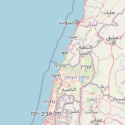
Map view of Ain Al-Auja Nature Reserve

Use this park location map to pinpoint Ain Al-Auja Nature Reserve in Palestine, understand its exact geographic position, and read its mapped placement within the surrounding landscape more clearly.

Pigeon | © OpenStreetMap contributors

Location context for Ain Al-Auja Nature Reserve

Jericho Governorate
Park atlas

Compare regional protected landscapes and surrounding valley geography.

Explore Protected Areas and Parks Near Ain Al-Auja Nature Reserve

Browse other parks and protected areas near Ain Al-Auja Nature Reserve to examine similar arid and oasis ecosystems across the region. Continuing into surrounding reserve geography reveals broader patterns in regional conservation and terrain transitions.
National parkIsrael
About 17 km away#1 closest

Southeast

Qasr el Yahud National Park: Exploring Protected Landscape and Geographic Identity in Israel

Mapped boundaries and regional natural landscape context.

Qasr el Yahud National Park is a designated protected area in Israel, serving as a crucial site for understanding regional geography and landscape context. This page facilitates detailed exploration of its protected land identity, mapped geographic boundaries, and its place within the natural terrain of the area, offering users a clear view of its atlas significance.

Watercolor painting of a landscape with mountains, water, and vegetation
National parkIsrael
About 25 km away#2 closest

South

Qumran National Park: National Park Atlas Exploration and Geographic Context in Israel

Mapped terrain and protected landscape identity in Israel.

Delve into Qumran National Park, a significant national park situated in Israel. This detailed exploration focuses on its protected landscape identity, mapped boundaries, and its place within the country's diverse geography. Understand the unique natural context and regional significance of Qumran National Park through an atlas-driven perspective.

Relief
Lowland
Climate
Arid
Access
Moderate access
Scope
Terrestrial
National parkIsrael
About 33 km away#3 closest

Southwest

Castel National Park: A National Park for Geographic Discovery in Israel

Investigate the mapped protected landscape and regional terrain.

Castel National Park represents a key protected area within Israel, focusing on the discovery of its mapped terrain and geographic identity. As a national park, it serves as a crucial entity for understanding regional conservation landscapes and the distribution of protected areas across Israel. This detailed view allows for focused exploration of the park's boundaries and its contribution to the country's natural heritage, offering valuable context for atlas-based geographical inquiry.

Relief
Mountain
Climate
Mediterranean
Scope
Terrestrial
Water
No major water
National parkIsrael
About 34 km away#4 closest

Southwest

Ein Hemed National Park: Mapped Protected Landscape in Israel's Geography

Discover the natural terrain and park boundaries.

Ein Hemed National Park is a designated national park in Israel, providing valuable insight into its protected natural landscapes and regional geography. This entry focuses on understanding the park's physical setting and its mapped boundaries, essential for atlas-based exploration. Examine the terrain and discover the geographic significance of this protected area within the Israeli context.

Access
Access unknown
Scope
Terrestrial
National parkIsrael
About 38 km away#5 closest

Southwest

Herodion National Park: A Key National Park within Israel's Protected Landscape Atlas

Explore its mapped boundaries and geographic terrain.

Herodion National Park stands as a significant protected area within Israel, contributing vital context to the nation's atlas of natural landscapes. This national park designation highlights its role in conservation and offers a unique opportunity to study its specific geography, terrain, and mapped boundaries. By focusing on the park's protected landscape identity, users can gain structured insights into Israel's conservation efforts and regional geographic features, enhancing any atlas exploration.

Scope
Terrestrial
National parkPalestine
About 41 km away#6 closest

Northwest

Shomron National Park: Protected Landscape and Geographic Identity

Explore the terrain and mapped boundaries of this national park.

Shomron National Park preserves the natural landscape and archaeological remnants of the historic Samarian region. This protected area offers a glimpse into the characteristic terrain of the West Bank highlands, featuring rolling hills and rocky outcrops. Understand the geographic placement and protected land context of Shomron National Park within its regional setting.

IUCN
V
Relief
Mountain
Scope
Terrestrial
Watercolor illustration showing a river flowing through a valley with green hills in the background and grassy areas with pink flowers
Nature reserveJordan
About 47 km away#7 closest

Northeast

Dibeen Forest Reserve Nature Reserve: Jordan's Ancient Pine-Oak Forest Atlas

Discover mapped terrain and protected landscape boundaries.

Dibeen Forest Reserve is a critical nature reserve in Jordan, safeguarding one of the few remaining naturally grown Aleppo pine and oak forest ecosystems in the Middle East. The reserve's landscape features rolling hills and steep limestone slopes, rising from 500 to 1000 metres, dissected by seasonal wadis. Its protected status highlights the importance of understanding mapped natural areas for preserving unique regional geography and biodiversity.

Area
8.5 km²
Established
2004
IUCN
IV
Relief
Highland
National parkIsrael
About 50 km away#8 closest

West

Yarkon-Tel Afek National Park: Explore Its Protected Landscape and Israeli Geography

Mapped protected area and natural terrain context.

Gain a structured understanding of Yarkon-Tel Afek National Park, a designated national park within Israel. This detail entry focuses on its geographic identity and role as a protected landscape, providing essential context for atlas exploration. Understand the park's mapped boundaries and its contribution to the natural geography of the region without extraneous visitor details.

Scope
Terrestrial
Water
Minor water

Common questions about visiting, size, designation, and location context for Ain Al-Auja Nature Reserve

Ain Al-Auja Nature Reserve FAQs for park facts, access, geography, and protected area context

Find quick answers about Ain Al-Auja Nature Reserve, including protected-area facts, park geography, trail and visitor context, and how the park fits into its surrounding country and regional landscape.
MoriAtlas Explorer

Continue Your Protected Areas Search Across the Global Atlas

Deepen your exploration by continuing the structured search for national parks and protected areas worldwide. Utilize the comprehensive filtering capabilities to compare different conservation landscapes and refine your understanding of global park geography. Discover more about the distribution and characteristics of protected natural areas.

Global natural geography