Mori Atlas logo
Protected areaAl Jaghbub Oasis

Mapping the sub sea level depressions and Miocene fossil formations of the Libyan Desert

Al Jaghbub Oasis Protected Area: Geological Basin and Saharan Landscape Atlas

Al Jaghbub Oasis represents a distinct protected natural area situated in a deep basin ten metres below sea level on the northern margin of the Libyan Desert. This geological outlier is defined by escarpments exposing thick Middle Miocene sediment sequences rich in marine fossils. Beyond its structural significance, the protected zone maintains a brackish water ecosystem that serves as a vital refuge for migratory waterfowl within the vast surrounding Saharan terrain.

desert oasisSaharadepression below sea levelMiocene geologymigratory birdsprotected area

Al Jaghbub Oasis

Protected area

Park overview

Structured park overview, official facts, and landscape profile for Al Jaghbub Oasis

Al Jaghbub Oasis park facts, protected area profile, and essential visitor context

Review the core facts for Al Jaghbub Oasis, including designation, size, terrain, visitor scale, habitats, and operating context in one park-focused overview.

About Al Jaghbub Oasis

The Al Jaghbub Oasis is a compact yet layered protected area on the Libyan-Egyptian frontier, where geology, ecology, and regional history intersect in an unusually concentrated way. Set in a depression around 10 metres below sea level on the northern rim of the Libyan Desert, the oasis provides a striking contrast to the arid plateaus and escarpments that surround it. The protected designation reflects both the value of the oasis as a refuge for native desert wildlife and its role in preserving a fragile wetland-style habitat within an otherwise hyper-arid zone.

Beyond its environmental value, Al Jaghbub carries substantial historical weight. The settlement grew around an ancient caravan stop used by trans-Saharan traders and by pilgrims bound for Siwa, Cairo, and Mecca, and it gained renewed prominence in 1856 when Muhammad ibn Ali as-Senussi moved the Senussi movement's headquarters there. The town developed into a fortified religious and intellectual centre anchored by an Islamic university that ranked among the most respected in North Africa at the time.

As a protected area today, Al Jaghbub remains a relatively understated destination, shaped more by its ecological function and its layered Saharan context than by mass tourism. Its identity combines three strong threads: a distinctive geological setting defined by fossil-rich Middle Miocene rocks, a long human history tied to desert travel and the Senussi order, and a quiet but ecologically meaningful oasis ecosystem that supports migratory birds and unusual aquatic life.

Quick facts and research context for Al Jaghbub Oasis

Al Jaghbub Oasis is a protected area in northeastern Libya, close to the Egyptian border, and adjoins the Berber village of Jaghbub. The oasis occupies a depression roughly 10 metres below sea level on the northern fringe of the Libyan Desert and is bordered to the north by escarpments exposing Middle Miocene dolomitic and limestone formations. It has historical importance as a Senussi stronghold and a waypoint for trans-Saharan travel, and was designated a protected area under Libya's wildlife conservation framework administered since 1990.

Protection and recognition

Examine the documented protection status and territorial management framework.

Al Jaghbub Oasis Protection Status and Terrestrial Conservation Scope

Al Jaghbub Oasis encompasses a defined terrestrial protection scope with structured administrative records detailing conservation management. Documented designation metrics outline the administrative boundaries and official recognition parameters established for the area.

Protection details

Protection scope
Terrestrial
Transboundary protection
No
Park context

Deeper park guide and search-rich context for Al Jaghbub Oasis

Al Jaghbub Oasis history, landscape, wildlife, and travel context

Explore Al Jaghbub Oasis through its history, landscape character, ecosystems, wildlife, conservation priorities, cultural context, and seasonal travel timing in a structured park guide built for atlas discovery and search intent.

Why Al Jaghbub Oasis stands out

Al Jaghbub is best known for the combination of its sub-sea-level desert setting, its Miocene fossil-bearing escarpments, and its role as the 19th-century Senussi headquarters. The protected area is also distinguished by its appeal to migratory waterfowl and by the unusual presence of a brackish-water cockle subspecies, Cardium edule rectidens, which gives the oasis a distinctive biological character within the surrounding Sahara.

Al Jaghbub Oasis history and protected-area timeline

The Al Jaghbub Oasis has long served as a waypoint in the Saharan travel network. Before its modern period of significance, it functioned as a staging post where trans-Saharan traders paused and where pilgrims gathered en route to the spiritual centres of Siwa, Cairo, and eventually Mecca. This role placed the oasis within a continuous chain of desert settlements that linked North Africa to the wider Islamic world.

The oasis's modern reputation rests largely on its 19th-century history. In 1856, Muhammad ibn Ali as-Senussi relocated the headquarters of the Senussi movement from Bayda to Al Jaghbub, transforming the settlement into a key centre of the order. The town acquired a fortified character and became host to an important Islamic university that, at its height, was regarded as second only in prestige to Al-Azhar University in Cairo. This religious and scholarly draw gave Al Jaghbub a regional significance that extended well beyond its modest population.

In more recent decades, the oasis's identity has shifted toward landscape and ecological protection. Libya established the Technical Committee of Wildlife and National Parks in 1990, and the Al Jaghbub Oasis was designated a protected area under that framework, formalising its role as a refuge for native desert species and a stopover for migratory birds within the country's broader conservation system.

Al Jaghbub Oasis landscape and geographic character

The landscape of Al Jaghbub is defined by its unusual vertical position within the desert. The oasis occupies a depression sunk roughly 10 metres below sea level on the northern margin of the Libyan Desert, giving it a low-lying basin character surrounded by higher ground. To the north, escarpments rise above the oasis and expose layered geological formations that record the area's ancient marine past.

Those escarpments reveal the Al Jaghbub Formation, a Middle Miocene sequence dominated by dolomite and reaching about 120 metres in thickness at this location. The same formation stretches westward as the thicker Marmarica Formation and thins eastward toward the Moghra Oasis, where it becomes only a few metres thick and increasingly sandy. At Al Jaghbub, the rocks consist of white to yellow limestone, clay, marl, and sandstone, and contain fossils of echinoderms, bivalve molluscs, gastropods, and bryozoans, marking the area as a geologically rich outlier within an otherwise sand-dominated landscape.

The surrounding region shares its character with other Saharan depressions; the Siwa Oasis in nearby Egypt sits in a similar basin roughly 100 kilometres to the southeast. This broader pattern of isolated low-lying oases scattered across high desert terrain gives Al Jaghbub its distinctive visual rhythm of greenery and water punching through a sea of rock and sand.

Al Jaghbub Oasis ecosystems, habitats, and plant life

Ecologically, Al Jaghbub stands apart from much of the surrounding Libyan Desert because of its persistent moisture and shelter. The combination of a below-sea-level basin and accessible shallow groundwater has produced a habitat mosaic that supports native desert plants and animals not easily sustained in the open Sahara. The protected status reinforces this function, framing the oasis as a managed refuge rather than just a traditional settlement site.

A defining element of the oasis's nature is its seasonal turnover of birdlife. Migratory waterfowl use Al Jaghbub as a stop along broader Saharan flyways, taking advantage of the open water and shoreline vegetation that the depression supports. This seasonal movement adds a dynamic dimension to what is otherwise a deeply arid regional ecosystem.

The oasis also has a less obvious aquatic component, with brackish or saline water features that support unusual biological communities. This subtle blend of desert oasis ecology, migratory bird habitat, and specialised aquatic life gives Al Jaghbub a layered natural character more nuanced than its remote location might suggest.

Al Jaghbub Oasis wildlife and species highlights

The wildlife significance of the Al Jaghbub Oasis lies in the way it functions as a refuge within an extremely arid zone. The protected area was established specifically to provide conditions under which the native wild animals and plants of the region could flourish, away from the harsher pressures of the open desert. This makes Al Jaghbub a key node in the local ecological network rather than simply a decorative landscape feature.

Birds are the most visible wildlife presence. The oasis attracts migrating waterfowl during their annual journeys, with seasonal stopovers that bring flocks to the water and shoreline vegetation. These migrations offer one of the clearest ecological events in the area and contribute to the oasis's broader conservation value.

Below the surface, the waters of the oasis sustain a less conspicuous but scientifically interesting fauna. A subspecies of the marine bivalve cockle, Cardium edule rectidens, occurs here, marking the oasis as an unexpected home for a normally coastal mollusc. The presence of this subspecies emphasises how Al Jaghbub blends classic desert oasis ecology with unusual aquatic elements that set it apart from neighbouring depressions.

Al Jaghbub Oasis conservation status and protection priorities

The Al Jaghbub Oasis was designated as a protected area with the explicit goal of preserving a functioning habitat in which the region's native wild animals and plants could thrive. In the broader Saharan context, where vast tracts of land offer little reliable refuge, the combination of permanent water, vegetation cover, and sheltered topography makes the oasis a high-value site for conservation planning.

Governance of the protected area falls under Libya's Technical Committee of Wildlife and National Parks, an institutional body established in 1990 to coordinate wildlife protection across the country. The creation of this committee marked a more formal national approach to protected-area management, and the inclusion of Al Jaghbub within its scope reflects recognition of the oasis as a site of genuine ecological rather than purely symbolic importance.

Ecologically, the protected status reinforces the oasis's role as a refuge for migratory waterfowl and as a host for specialised aquatic life, including the local cockle subspecies. By anchoring these habitats within a managed area, the conservation framework helps secure one of the few reliable wildlife sites along this stretch of the Libyan-Egyptian border.

Al Jaghbub Oasis cultural meaning and human context

The cultural identity of Al Jaghbub is closely tied to the oasis's long-standing role as a desert gathering place. The Berber village of Jaghbub, with a population of around 400 residents, represents a living continuity of Saharan oasis community life, with traditional knowledge adapted to an environment of scarce water and harsh climate. The oasis itself acted as a meeting point for travellers, traders, and pilgrims, helping to shape local customs around hospitality, water management, and caravan logistics.

The 19th century added a powerful religious and intellectual layer to this cultural profile. After Muhammad ibn Ali as-Senussi moved the Senussi movement's headquarters to Al Jaghbub in 1856, the town acquired a fortified character and became home to an Islamic university that, for a time, was considered second only to Cairo's Al-Azhar in prestige. This scholarly and religious heritage remains a defining feature of the oasis's cultural memory.

Together, these threads of Berber village life, trans-Saharan travel tradition, and Senussi religious heritage give Al Jaghbub a cultural depth that extends well beyond its status as a protected natural area, situating it within a wider North African narrative of desert communities and reform movements.

Top sights and standout views in Al Jaghbub Oasis

Al Jaghbub is defined by the tension between desert vastness and enclosed oasis life. Its below-sea-level setting, escarpment-fringed basin, and Middle Miocene fossil exposures mark it as a distinctive geological corner of the Libyan Desert. At the same time, the oasis's function as a refuge for migratory waterfowl and as a habitat for the unusual local cockle subspecies gives it clear ecological significance within Libya's national protected-area network.

Best time to visit Al Jaghbub Oasis

The character of a visit to Al Jaghbub shifts with the seasons in ways typical of Saharan oases. Cooler months, generally associated with autumn, winter, and early spring, bring milder daytime temperatures and can offer a more comfortable setting for exploring the village, escarpments, and oasis margins. These cooler periods also coincide with broader migratory seasons, when waterfowl are more likely to be present at the oasis and bird activity around the water is at its peak.

Summer in this part of the Libyan Desert is extremely hot, with temperatures that make extended outdoor exploration difficult and generally less conducive to appreciating the oasis's finer landscape details. Travellers interested in both the scenery and the birdlife will find the cooler half of the year the most rewarding, when the contrast between the surrounding arid plateaus and the sheltered, vegetated oasis is felt most strongly. Soft light and lower heat also make the exposures of the Middle Miocene formations easier to observe on the northern escarpments.

Monthly climate preview

Long-term monthly temperature and precipitation data for Al Jaghbub Oasis in Libya

Al Jaghbub Oasis Climate Normals and Measured Annual Temperature Patterns

Representative coordinates record long-term monthly temperature and precipitation normals, showing recorded means from 10.96 degrees Celsius to nearly 29.78 degrees Celsius alongside minimal daily rainfall values. Full twelve-month tables and detailed monthly profiles provide deeper context for studying the complete climate rhythm.
Annual mean21 °C
11 °C30 °C
Jan11°
Feb12°
Mar16°
Apr20°
May25°
Jun29°
Jul30°
Aug30°
Sep28°
Oct23°
Nov17°
Dec13°
Warmest month
August

29.8 °C

Coolest month
January

11 °C

Wettest month
December

0.3 mm/day

Driest month
June

0 mm/day

Park location guide

Geography guide, regional context, and park location map for Al Jaghbub Oasis

Al Jaghbub Oasis park geography, regions, and map view in Libya

Understand where Al Jaghbub Oasis sits in Libya through a broader geographic reading of the surrounding landscape, nearby location context, and its mapped position within the national park landscape.

How Al Jaghbub Oasis fits into Libya

Libya is a country in North Africa along the Mediterranean coast. Formerly ruled by Italy, it gained independence in 1951 as the Kingdom of Libya and later became famous for Muammar Gaddafi's rule from 1969 to 2011. The country has experienced significant instability since the 2011 civil war. It is known for its vast desert landscapes, oil resources, and strategic geopolitical position in the Sahara.

Wider geography shaping Al Jaghbub Oasis in Libya

Libya occupies a large territory in North Africa along the Mediterranean Sea. It borders Egypt, Sudan, Chad, Niger, Algeria, and Tunisia. The terrain is predominantly desert with the Sahara covering much of the country. The coastal region in the north is more fertile.

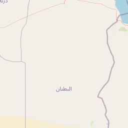
Map view of Al Jaghbub Oasis

Use this park location map to pinpoint Al Jaghbub Oasis in Libya, understand its exact geographic position, and read its mapped placement within the surrounding landscape more clearly.

Pigeon | © OpenStreetMap contributors
Park atlas

Compare regional desert depressions and connected protected areas

Parks Near Al Jaghbub Oasis and Surrounding Protected Landscapes

Browse other parks near Al Jaghbub Oasis to compare similar Saharan depressions, fossil-bearing escarpments, and arid basin ecosystems across the surrounding region. Extending the geographic review beyond a single protected area reveals the wider regional distribution of desert oases and low-lying terrain.
Wildlife reserveLibya
About 451 km away#1 closest

Northwest

Ain Elshakika Wetland: Protected Coastal Sabkha and Wildlife Habitat in Northern Libya

Coastal Mediterranean wetland and bird sanctuary

Ain Elshakika Wetland represents a distinctive coastal landscape in Libya, defined by its hypersaline salt flats and seasonal tidal connections. The reserve serves as a critical refuge for migratory waterbirds and features a rare ecological transition between saline mudflats and freshwater-fed vegetation zones, all integrated within the broader protected geography of the coastal Mediterranean.

Area
0.33 km²
Established
2000
Relief
Lowland
Climate
Mediterranean
National parkNew Valley Governorate
About 452 km away#2 closest

Southeast

White Desert National Park: Egypt's Surreal Chalk Rock Protected Landscape Atlas

Explore mapped terrain and unique desert formations.

White Desert National Park, situated in the New Valley Governorate of Egypt, offers a visually stunning protected landscape defined by its iconic white chalk formations. These geological wonders, sculpted by wind and sand into fantastical shapes, create an almost lunar environment. As a national park, it serves as a vital protected area, showcasing the dramatic geography where chalk spires meet Sahara dunes and supporting unique desert ecosystems within its mapped boundaries.

Area
300 km²
Established
2002
IUCN
II
Relief
Lowland
National parkLibya
About 458 km away#3 closest

Northwest

El-Kouf National Park: Protected Landscape Discovery within Libya's Geography

Explore the mapped natural terrain of this Libyan national park.

El-Kouf National Park serves as a significant protected area, offering a detailed look at its geographic identity within Libya and the wider North African region. This park detail page provides essential atlas-style context, highlighting its status as a national park and its contribution to the mapped protected landscapes. Users can explore its regional geographic placement and understand its unique natural terrain characteristics, serving as a vital point of discovery.

Area
350 km²
Established
1975
IUCN
II
Visitors
300K annual
A horizontal watercolor painting depicting a pale blue coastal landscape with low green vegetation in the foreground and soft mountainous ridges in the distance.
Protected areaLasithi
About 579 km away#4 closest

North

Chrysi Protected Area: Mapping the Juniper Forests and Beaches of Lasithi, Greece

A coastal island sanctuary in the Libyan Sea

Chrysi presents a distinct landscape characterized by a mature juniper forest and golden-sand beaches. Situated within the Lasithi regional unit, this island remains a primary example of a protected Mediterranean woodland environment, preserving a unique set of coastal terrain, shallow sea ecosystems, and archaeological history on a small geographic footprint.

Area
4.743 km²
Relief
Lowland
Climate
Mediterranean
Access
Easy access
A horizontal watercolor painting showing soft, rolling mountains and sparse desert-like shrubbery in shades of light green, pale pink, and yellow.
Biosphere reserveCrete
About 609 km away#5 closest

North

Psiloritis Natural Park: Protected Karstic Mountains and Cultural Landscapes in Crete

Geological exploration and regional mountain geography

Psiloritis Natural Park encompasses the central massif of Crete, featuring the famous Mount Ida range. Its protected territory serves as an essential site for understanding karstic geology, from deep underground cave systems to high-altitude steppes. The region perfectly highlights the intersection between large-scale tectonic history and the long-standing human traditions that shape the mountainous interior of the island.

Area
1,159 km²
Established
2001
Relief
Mountain
Climate
Mediterranean
A watercolor painting showing a panoramic landscape with green hills, distant mountains, and water, set against a plain white background.
National parkGreece
About 615 km away#6 closest

North

Samaria National Park: Geological Landscape and Protected Area Atlas in Crete, Greece

Mapping the dramatic White Mountain canyon and coastal descent

Samaria National Park stands as a major protected landmark in Greece, defined by a tectonic gorge that bisects the White Mountains. This atlas entry covers the park boundary, the distinct vertical limestone cliffs of the Iron Gates, and the transition from mountain plateau to the Mediterranean coastline.

Area
4.848 km²
Established
1962
Relief
Mountain
Climate
Mediterranean
A watercolor painting of a rolling mountainous landscape in Crete, featuring soft green hills, wildflowers, and pale mountain outlines against a light sky.
Biosphere reserveCrete
About 617 km away#7 closest

North

Sitia Nature Park: Geographic Atlas of Crete's Eastern Protected Mountain Landscapes

Mapping gorges, karst caves, and the eastern Cretan coastline.

Sitia Nature Park represents a vast protected territory across eastern Crete, characterized by its complex mountain spine and profound geological formations. This atlas entry provides geographic insights into the park's canyon systems, including the Valley of the Dead, and the karst caves that define its UNESCO Global Geopark status and regional natural terrain.

Established
2015
Relief
Mountain
Climate
Mediterranean
Access
Moderate access
Watercolor painting of a coastal landscape featuring green rolling hills, distant landmasses, and stylized shrubs and trees in the foreground against a white background.
Nature reserveCrete
About 619 km away#8 closest

North

Elafonisi Nature Reserve: Geography and Protected Landscape Analysis in Crete

Coastal dunes and limestone formations in southwestern Crete.

Elafonisi is a protected nature reserve situated in the southwestern reaches of Crete. This site encompasses a complex landscape of sand dunes, juniper-covered scrub, and rugged limestone terrain. By providing a clear look at the area, this atlas entry helps users understand the geographic setting, the ecological significance of the island, and the natural boundaries of this noteworthy Mediterranean conservation area.

Area
1.5 km²
Relief
Lowland
Climate
Mediterranean
Access
Easy access

Common questions about visiting, size, designation, and location context for Al Jaghbub Oasis

Al Jaghbub Oasis FAQs for park facts, access, geography, and protected area context

Find quick answers about Al Jaghbub Oasis, including protected-area facts, park geography, trail and visitor context, and how the park fits into its surrounding country and regional landscape.
MoriAtlas Explorer

Continue Your Protected Areas Search Across the Global Atlas

Deepen your exploration by continuing the structured search for national parks and protected areas worldwide. Utilize the comprehensive filtering capabilities to compare different conservation landscapes and refine your understanding of global park geography. Discover more about the distribution and characteristics of protected natural areas.

Global natural geography