
Mori Atlas logo
Marine protected areaAllonby Bay

Tracing protected marine boundaries, dune systems, and Roman frontier history along the Irish Sea.

Allonby Bay Marine Protected Area and Solway Coast Geography in Cumbria, England

Allonby Bay stands as a significant coastal landscape on the north western edge of Cumbria, where protected marine habitats meet a dense historical record. This stretch of the Solway Firth contains complex honeycomb worm reefs, diverse saltmarshes, and rare dune systems that form part of a highly protected marine environment. Beyond the tide, the area preserves archaeological layers including a series of Roman milefortlets that extend the legacy of Hadrian's Wall across the coastal terrain.

solway coastcumbriacoastal baysaltmarshdune systemsmarine conservation
A minimalist flat illustration of a coastal landscape at sunset featuring a curved beach, calm water, a simple house, and a prominent cliff face under a pastel sky.

Allonby Bay

Marine protected area

Park overview

Structured park overview, official facts, and landscape profile for Allonby Bay

Allonby Bay park facts, protected area profile, and essential visitor context

Review the core facts for Allonby Bay, including designation, size, terrain, visitor scale, habitats, and operating context in one park-focused overview.

About Allonby Bay

Allonby Bay is a gently curved coastal inlet on the Solway Firth, in the far north-west of England. Framed by the low-lying farmland, saltmarshes, and dune systems of Cumbria's Solway coast, the bay opens westward into the Irish Sea and forms part of one of the most distinctive transitional landscapes in the region: a place where tidal waters, sandflats, dunes, and human settlement have interacted for thousands of years. The bay is roughly 5.5 miles across and is followed closely by the B5300 coast road, which threads between the small coastal villages of Silloth, Mawbray, Allonby, and Maryport.

The natural value of Allonby Bay is recognised at multiple levels. Its shoreline sits within the Solway Coast Area of Outstanding Natural Beauty, and the bay itself was designated a Marine Conservation Zone in 2016, before becoming one of the first Highly Protected Marine Areas in England in 2023. These protections reflect the importance of subtidal sediments that serve as spawning and nursery habitat for commercially and ecologically significant fish species, as well as rare reefs constructed by honeycomb worms. Together with adjacent habitats such as the saltwater wetlands of Salta Moss, the bay supports a striking mix of coastal, estuarine, and marine biodiversity within a relatively compact area.

Allonby Bay also carries a deep archaeological and cultural layer. The Solway shoreline preserves traces of Neolithic activity, Bronze Age metalwork, and, most visibly, a string of Roman milefortlets that once extended the defensive reach of Hadrian's Wall along the coast. The unusually well-preserved Milefortlet 21, near Crosscanonby, offers a tangible link to Roman frontier life, while later episodes, including Scottish raids and the medieval 'seawake' coastal watch system, attest to the long history of human vulnerability and adaptation along this stretch of coast. The result is a coastal landscape where dunes, saltmarshes, marine wildlife, and ancient ruins form a single, integrated environment.

For visitors and residents alike, Allonby Bay remains a working coastal landscape, with tourism, fishing, and small-scale agriculture shaped by the rhythms of the tides and the seasons. Beach activities, birdwatching along the Solway, and visits to nearby attractions such as the Lake District Coast Aquarium in Maryport all sit alongside the bay's quieter identity as a place of ecological protection, archaeological discovery, and protected seascape.

Quick facts and research context for Allonby Bay

Allonby Bay is a roughly 5.5-mile-wide crescent-shaped inlet of the Solway Firth, opening into the Irish Sea along the north-western shore of Cumbria, England. It sits within the Solway Coast Area of Outstanding Natural Beauty and forms the southern section of that protected landscape, running from near Beckfoot in the north to Crosscanonby in the south. The bay also holds overlapping marine designations, including a Marine Conservation Zone created in 2016 and Highly Protected Marine Area status granted in 2023, reflecting the ecological value of its subtidal sands, honeycomb worm reefs, and nursery grounds for plaice, skate, and thornback rays. Onshore, features such as the Salta Moss Site of Special Scientific Interest, rare plant communities, and adders, Britain's only native venomous snake, add to the bay's ecological importance.

A string of small coastal communities, including Allonby, Mawbray, Salta, and Crosscanonby, line the curving shore, while the B5300 coast road threads along the entire bay. The area combines a working coastal landscape of saltmarshes and dunes with deep archaeological layers, including Neolithic evidence, Bronze Age metalwork finds, and a chain of well-preserved Roman milefortlets that once guarded the western flank of Hadrian's Wall.

Protection and recognition

Documented protection history, marine scope, and official designation timeline for Allonby Bay.

Allonby Bay Protection Status and Marine Conservation Designation Record

Allonby Bay establishes its documented marine protection scope through an official designation recorded in 2023. Structured records outline the baseline conservation framework without additional international recognition sources or transboundary status.

Protection details

Protection scope
Marine
Designated year
2023
Transboundary protection
No
Park context

Deeper park guide and search-rich context for Allonby Bay

Allonby Bay history, landscape, wildlife, and travel context

Explore Allonby Bay through its history, landscape character, ecosystems, wildlife, conservation priorities, cultural context, and seasonal travel timing in a structured park guide built for atlas discovery and search intent.

Why Allonby Bay stands out

Allonby Bay is best known for the unusual overlap of seascape, protected habitats, and ancient archaeology found along a single stretch of Cumbrian coast. Its subtidal sediments are recognised spawning and nursery grounds for plaice, skate, and thornback rays, while reefs built by honeycomb worms at the northern edge of the species' range have become one of the defining marine features of the bay. Onshore, the bay is distinguished by sweeping dune systems, saltmarshes, and the saline wetland complex of Salta Moss, where rare plants and Britain's only native venomous snake, the adder, coexist. Equally defining is the bay's archaeological footprint. A near-complete chain of Roman milefortlets, including the unusually well-preserved Milefortlet 21, runs along the shoreline, extending the defensive vision of Hadrian's Wall west into the Solway. Combined with its placement inside the Solway Coast Area of Outstanding Natural Beauty and its Highly Protected Marine Area status, this layering of marine, terrestrial, and historical protection makes Allonby Bay stand out among the protected coastal landscapes of north-west England.
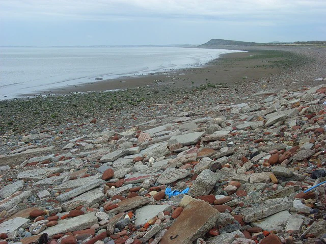
A wide angle view of a stony and debris-filled shoreline meeting the calm waters of the Solway Firth under a cloudy sky.
A coastal view of the stony beach at Allonby Bay during a low tide.

Allonby Bay history and protected-area timeline

The human story of Allonby Bay stretches back well beyond the Roman era. Archaeological investigations along the small communities fringing the bay have uncovered evidence of activity dating to the Neolithic period, suggesting that the coastal zone has long attracted settlement. A more tangible early find came on Salta Moss, near the northern end of the bay, where a Bronze Age rapier was unearthed in the 1980s and later entered the collections of the Tullie House museum in Carlisle. Together, these finds point to a long continuity of human presence along the Solway shore.

The most visually dramatic historical layer belongs to the Roman period. Allonby Bay was a key stretch of coastline beyond the western end of Hadrian's Wall, guarded by a series of small fortifications known as milefortlets. Milefortlets 17 through 22 ran along the bay's shoreline, forming part of a wider frontier defence against incursions from across the Solway. Among them, Milefortlet 21, near Crosscanonby, is the best preserved and remains a striking archaeological landmark visible from the surrounding coast road.

Long after Roman rule ended in Britain, the vulnerability of this coastline did not disappear. Scottish raids continued to trouble communities along the Solway for centuries, and by the 1550s incidents such as the abduction of William Osmotherly of Dubmill Point, near Salta, for ransom were still being recorded. In response, a coastal watch system known as the 'seawake' was established, organising a nightly guard along the shore. The persistence of such defensive arrangements illustrates how the bay's identity as a working, inhabited coastline has remained inseparable from its wider history as a frontier zone between England and Scotland.

Allonby Bay landscape and geographic character

Allonby Bay presents a soft, curving coastal landscape typical of the Solway shore, where the boundary between land and sea is marked by long beaches, dune ridges, and broad saltmarshes rather than by cliffs or rocky headlands. The bay sweeps in a wide crescent, roughly 5.5 miles across, with its northern horn at Dubmill Point and its southern end tapering toward Crosscanonby and Maryport. Inland, the coastal strip gives way to low farmland and gently rising terrain that forms the backdrop to the shoreline. Streams and becks, often fed by traditional irrigation channels, drain into the bay and help shape the patchwork of wetland, dune slack, and saltmarsh habitats along its edge.

The dune systems themselves are a defining feature of the bay, providing both scenic interest and ecological structure. Behind these dunes lie more sheltered habitats such as Salta Moss, a saline wetland complex where specialised plant communities thrive in nutrient-poor, salt-influenced soils. The combination of open beach, dune ridges, saltmarsh, and inland bog-like depressions creates a varied coastal topography within a relatively narrow band of land. The whole of this southern stretch of the Solway coast, including the bay's shoreline, sits within the Solway Coast Area of Outstanding Natural Beauty, recognising the visual and ecological coherence of the landscape.

Allonby Bay ecosystems, habitats, and plant life

The ecological character of Allonby Bay is shaped by the meeting of marine, estuarine, and terrestrial systems within a small coastal area. The bay's subtidal sediments and sands form important spawning and nursery grounds for fish such as plaice, skate, and thornback rays, while reefs built by honeycomb worms along the northern part of the bay add a distinctive biogenic habitat at the edge of the species' range. These reefs, in turn, host a community of other marine organisms, making them one of the most ecologically significant features of the local inshore environment.

Above the tideline, the bay's nature takes on a more transitional character. The dune systems are interspersed with dune slacks and coastal grasslands, while the saline wetlands around Salta Moss support rare plant assemblages, including the bog bean, Menyanthes trifoliata. The mosaic of beach, dune, saltmarsh, and coastal freshwater seepage gives the bay a layered habitat structure that supports a wide range of invertebrates, breeding and wintering birds, and small mammals. The Solway coast as a whole is widely recognised for its bird populations, and Allonby Bay sits within some of the most important areas for waders and wildfowl on England's north-western seaboard.

Because the bay spans freshwater, brackish, and marine influences, it also functions as a transitional zone in ecological terms: a place where species typical of upland, lowland, coastal, and marine environments can be found in close proximity. This blending of habitats is one of the reasons the bay is recognised through both terrestrial designations, such as the Solway Coast AONB and the Salta Moss SSSI, and marine protections, including its Marine Conservation Zone and Highly Protected Marine Area.

Allonby Bay wildlife and species highlights

Although Allonby Bay is perhaps better known for its scenery and archaeology than for charismatic megafauna, it supports a varied and ecologically meaningful wildlife community. The bay's interior and offshore waters are important for fish life, particularly as spawning and nursery habitat for plaice, skate, and thornback rays. The honeycomb worm reefs along the northern edge of the bay add a distinctive structural habitat that, despite their small size, host a specialised community of associated marine invertebrates and other fauna.

On land, the saline wetland of Salta Moss stands out for its botanical and faunal interest. Rare plant communities grow alongside animal life that includes the adder, Britain's only native venomous snake, which is found in this part of the Solway coast. Insects, especially those tied to dune and mossland habitats, contribute to the ecological richness of the area, while the wider Solway shore is well known for its bird populations, including waders and waterfowl that use the tidal flats and saltmarshes. Together, these features give Allonby Bay a wildlife profile defined more by habitat diversity and ecological function than by single flagship species, but one that is nonetheless recognised through a stack of formal conservation designations.

Allonby Bay conservation status and protection priorities

Allonby Bay stands out as a coastal landscape protected at multiple, overlapping levels, reflecting an unusual concentration of ecological value. The shoreline forms a major part of the southern section of the Solway Coast Area of Outstanding Natural Beauty, a designation that recognises the scenic, geological, and ecological qualities of the coast. Onshore, parts of the bay are anchored by sites such as the Salta Moss Site of Special Scientific Interest, where rare plant species and sensitive wetland habitats are formally protected.

In the marine environment, the bay's conservation profile has grown significantly in recent years. In 2016, Allonby Bay was designated as a Marine Conservation Zone, with the stated aim of maintaining important subtidal sediments and sands used as spawning and nursery grounds for species such as plaice, skate, and thornback rays, alongside the locally distinctive honeycomb worm reefs. By July 2023, after a period in which the bay was proposed by Defra as one of five Highly Protected Marine Areas, Allonby Bay received that stronger form of protection, placing it among the first HPMAs in English waters. The progression from MCZ to HPMA illustrates an escalating recognition of the bay's marine ecological importance, even as earlier concerns, including the temporary risk of losing beach quality recognition in 2012, illustrated how vulnerable the area's identity as a clean, attractive coast can be to pressure on water quality and management planning.

Allonby Bay cultural meaning and human context

Although Allonby Bay is framed first and foremost as a natural coastal landscape, it carries a rich human and cultural memory that is unusually legible along the shore. The underlying farmland and small villages, including Allonby itself, Mawbray, Salta, and Crosscanonby, are part of a wider Solway coastal community whose history has long been shaped by proximity to the Scottish border and the rhythms of the Irish Sea. Tourism, fishing, and small-scale agriculture remain important threads of this local economy.

The bay's archaeological landmarks, particularly the string of Roman milefortlets and the well-preserved Milefortlet 21, anchor the coast to a deeper frontier history. These ruins are not isolated monuments but a clear extension of Hadrian's Wall into the Solway landscape, marking the bay as a working frontier zone in the Roman period. Later episodes, such as the 16th-century Scottish raid at Dubmill Point and the medieval 'seawake' coastal watch tradition, reflect how the shoreline continued to be a contested and watched-over edge long after Rome's influence faded. The presence of the Lake District Coast Aquarium in nearby Maryport adds a more contemporary cultural layer, interpreting the bay's marine life for visitors and reinforcing the area's identity as a coastal educational and tourism destination.

Top sights and standout views in Allonby Bay

Allonby Bay's strongest highlights lie in the way a single stretch of coast compresses marine protection, dune and saltmarsh habitats, and Roman frontier archaeology into one accessible landscape. Few coastal sites in north-west England combine the conservation weight of an Area of Outstanding Natural Beauty, a Marine Conservation Zone, and a Highly Protected Marine Area with such a visible archaeological trail. The honeycombed worm reefs at the northern edge of the bay and the chain of milefortlets from Milefortlet 17 to Milefortlet 22 make the shoreline read almost like an open-air archive of the Solway.

Equally striking is the bay's identity as a transitional landscape: a place where the tidal flats, dune ridges, saline mires of Salta Moss, and rolling inland farmland meet within a few hundred metres of each other. Whether approached as a place for beachgoing, birdwatching, marine and ecological interest, or Roman archaeology, the bay offers a layered experience that rewards both casual visits and more focused exploration.

Best time to visit Allonby Bay

The character of Allonby Bay shifts meaningfully with the seasons, although it remains a place of interest throughout the year. Late spring and summer tend to bring the warmest beach conditions and the busiest atmosphere, with longer daylight hours and more stable weather drawing visitors to the shoreline, the dunes, and the villages of Allonby, Mawbray, and Crosscanonby. These months are typically the most comfortable time for activities along the open beach and for exploring the dune and saltmarsh habitats on foot.

Autumn and winter, by contrast, often bring richer conditions for those interested in birdlife and atmospheric scenery. The Solway coast is well known for its wintering and migratory waders and waterfowl, and the bay's saltmarshes, mudflats, and saline wetlands tend to be at their most dynamic when colder weather brings movement of birds inland and along the coast. Stormier winter weather also accentuates the curvature of the bay and the long views across the Irish Sea, while the quieter tourist season gives the village of Allonby and its surrounding archaeological sites a more tranquil feel. For visitors whose primary interest is birdwatching, marine life, or photography of dramatic skies, the colder months can be especially rewarding.
Monthly climate preview

Measured monthly averages and precipitation patterns for Cumbria

Allonby Bay Climate Normals and Long Term Temperature Records

Representative coordinates record annual temperature rhythms alongside consistent monthly precipitation values across the sampled elevation. Full twelve month climate profiles provide deeper analytical context for long term regional weather trends.
Annual mean8 °C
4 °C14 °C
Jan
Feb
Mar
Apr
May10°
Jun13°
Jul14°
Aug14°
Sep12°
Oct
Nov
Dec
Warmest month
July

14.3 °C

Coolest month
January

3.5 °C

Wettest month
October

4.3 mm/day

Driest month
May

2.6 mm/day

Park location guide

Geography guide, regional context, and park location map for Allonby Bay

Allonby Bay park geography, regions, and map view in United Kingdom

Understand where Allonby Bay sits in United Kingdom through a broader geographic reading of the surrounding landscape, nearby location context, and its mapped position within the national park landscape.

How Allonby Bay fits into United Kingdom

The United Kingdom is a parliamentary constitutional monarchy located in northwestern Europe, consisting of four constituent countries: England, Scotland, Wales, and Northern Ireland. As a major global power with over 69 million residents, it maintains significant international influence in politics, economics, and culture.

Wider geography shaping Allonby Bay in United Kingdom

The United Kingdom is an island nation located in northwestern Europe, surrounded by the Atlantic Ocean, North Sea, English Channel, Celtic Sea, and Irish Sea. It shares a land border with the Republic of Ireland to the west. The territory includes the island of Great Britain, the northeastern portion of Ireland, and most of the smaller British Isles islands.

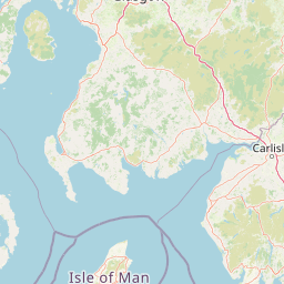
Map view of Allonby Bay

Use this park location map to pinpoint Allonby Bay in United Kingdom, understand its exact geographic position, and read its mapped placement within the surrounding landscape more clearly.

Pigeon | © OpenStreetMap contributors

Location context for Allonby Bay

Cumbria

Visualizing the dunes, saltmarshes, and marine habitats of the Solway Firth

Allonby Bay Photos and Protected Coastal Landscapes

Visual records reveal the diverse terrain of Allonby Bay, spanning from dynamic tidal flats and dune ridges to sheltered saline wetlands. Examining these protected coastal environments provides clear insight into the ecological and physical character of the Cumbrian shore.

A wide angle view of a stony and debris-filled shoreline meeting the calm waters of the Solway Firth under a cloudy sky.

A wide shot of a gravel beach meeting the calm waters of the Solway Firth, with buildings visible on the shoreline to the right and distant blue hills across the bay.

Park atlas

Compare regional protected areas and coastal geography across the Solway Firth

Explore Other Parks Near Allonby Bay and Connected Protected Landscapes

Browsing other parks near Allonby Bay reveals wider protected landscapes and interconnected coastal reserves throughout the Solway region. Comparing these adjacent areas provides deeper geographic context for the marine habitats and dune ecosystems found along the Cumbrian shore.
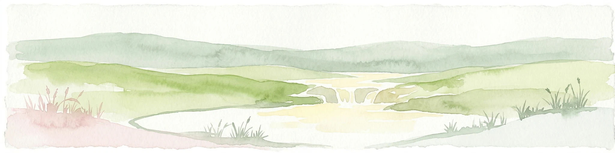
Watercolor painting showing a lake, green hills, and sky
National parkCumbria
About 10 km away#1 closest

Southeast

Lake District National Park: Protected Landscape Atlas and Geographic Exploration

Mapped mountain terrain and glacial valleys in Cumbria

Delve into the geography of Lake District National Park, a protected area renowned for its dramatic mountainous terrain, U-shaped glacial valleys, and stunning natural lakes. This atlas perspective highlights the park's unique landscape features, mapped boundaries, and its significance within Cumbria, offering a comprehensive view for geographic discovery.

Area
2,292 km²
Established
1951
IUCN
V
Relief
Mountain
Watercolor painting of green hills, a stream, and grassy areas
National parkNorth Yorkshire
About 59 km away#2 closest

Southeast

Yorkshire Dales National Park: A Protected Landscape in North Yorkshire

Explore mapped boundaries and distinctive limestone terrain.

Yorkshire Dales National Park offers a rich tapestry of mapped natural landscapes, characterized by its iconic limestone valleys, U-shaped glacial formations, and rolling heather-clad moorlands. Situated within North Yorkshire, this protected area showcases a unique karst geology, evident in features like Malham Cove and extensive cave systems. The park's traditional dry-stone walls and working farms contribute to a living cultural landscape, making it a prime destination for atlas-driven geographic discovery and understanding regional terrain.

Area
2,178 km²
Established
1954
IUCN
V
Relief
Mountain
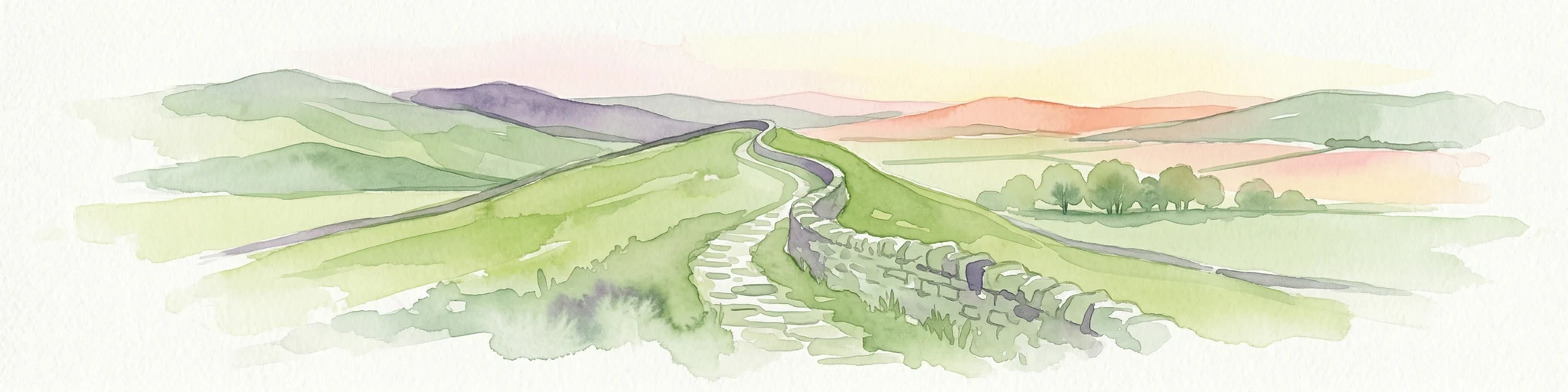
Watercolor illustration of Hadrian's Wall stretching across rolling green hills with distant mountains and trees under a sunset sky
National parkNorthumberland
About 62 km away#3 closest

Northeast

Northumberland National Park: England's Northernmost Protected Landscape and Dark Sky Wilderness

Explore its mapped boundaries, Roman heritage, and remote moorland terrain.

Northumberland National Park protects over 1,050 square kilometers of remote and stunning natural beauty in northern England, bordering Scotland. This page provides a structured overview of its protected landscape, focusing on its geographic context within the county of Northumberland, its designation as a National Park, and its renowned status as Europe's largest Dark Sky Park. Users can discover the park's characteristic moorland terrain, the archaeological significance of Hadrian's Wall, and the vast expanses of Kielder Forest, offering an atlas-level understanding of this unique frontier landscape.

Area
1,050 km²
Established
1956
IUCN
V
Relief
Highland
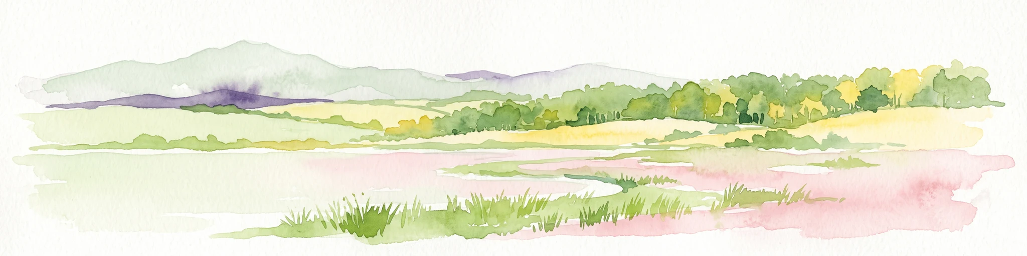
A horizontal watercolor painting showing a wetland in the foreground with grasses, rolling hills, and distant mountains under a pale sky.
Wildlife reserveLancashire
About 79 km away#4 closest

Southeast

Leighton Moss RSPB Reserve: Geographic Atlas and Protected Wetland Boundary Analysis

Lancashire coastal wetland and reedbed ecosystems

Leighton Moss RSPB Reserve stands as the largest reedbed complex in north west England. This protected wildlife reserve offers a distinct landscape contrast between enclosed freshwater wetlands and the open saltmarsh of Morecambe Bay, providing essential habitat data for regional environmental study and birdlife geography.

Established
1964
Relief
Lowland
Access
Easy access
Scope
Terrestrial
Marine protected areaEngland
About 81 km away#5 closest

South

West of Walney Marine Protected Area: Irish Sea Geographic and Seabed Analysis

Mapped protected landscape in northwest England

West of Walney is a major marine protected area off the Cumbrian coast, notable for its 388 square kilometre coverage of subtidal mud and sand habitats. This site is uniquely shaped by its overlap with offshore wind energy infrastructure, providing a distinct study in regional conservation and seabed management within the Irish Sea.

Area
388 km²
Established
2016
Relief
Lowland
Climate
Temperate
Protected landscapeScottish Borders
About 95 km away#6 closest

North

Upper Tweeddale National Scenic Area: Geography and Protected Landscape Atlas Map

Regional landscape profile in the Scottish Borders

Upper Tweeddale National Scenic Area encompasses 12,770 hectares of refined southern Scottish countryside. This atlas entry provides an overview of the area landscape, defined by its narrow river valley, tributary glens, and the significant upland plateau of the Tweedsmuir Hills. Examine the geographic intersection of protected habitats, historic estates, and the winding course of the River Tweed.

Area
128 km²
Established
1981
Relief
Upland
Climate
Temperate
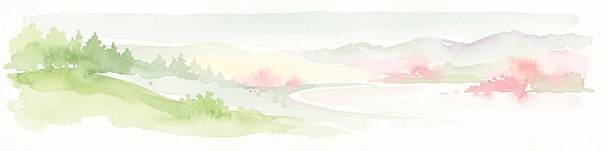
A soft watercolor illustration featuring green rolling hills; pink foliage; and a calm bay under a pale sky.
Marine protected areaScotland
About 137 km away#7 closest

Northwest

Lamlash Marine Protected Area: Coastal Geography and Protected Waters in Scotland

Maritime terrain and conservation landscapes of the Firth of Clyde

Located along the eastern coast of the Isle of Arran, the Lamlash Marine Protected Area serves as a landmark for community-led conservation in Scotland. The site protects a vital marine ecosystem including maerl beds within a sheltered natural harbour, providing a distinct study of coastal boundaries and marine terrain facing Holy Isle across the Firth of Clyde.

Established
2008
Visitors
1.1K annual
Relief
Lowland
Climate
Temperate
Nature reserveWest Yorkshire
About 146 km away#8 closest

Southeast

Bradford Pennine Gateway: Protected Pennine Fringe Geography in West Yorkshire

A sprawling network of moorland, wetlands, and gritstone valleys.

Spanning over a thousand hectares, this protected nature reserve integrates varied terrain across the Bradford district. From the ancient post-glacial sediments of Bingley North Bog to the sweeping gritstone plateaus, the reserve provides essential habitat for upland bird species and rare reptiles. It stands as a vital corridor of wilderness within the northern landscape, illustrating the geological character of the South Pennines.

Area
12.74 km²
Established
2025
Water
Minor water
Season
Year-round

Common questions about visiting, size, designation, and location context for Allonby Bay

Allonby Bay FAQs for park facts, access, geography, and protected area context

Find quick answers about Allonby Bay, including protected-area facts, park geography, trail and visitor context, and how the park fits into its surrounding country and regional landscape.
MoriAtlas Explorer

Continue Your Protected Areas Search Across the Global Atlas

Deepen your exploration by continuing the structured search for national parks and protected areas worldwide. Utilize the comprehensive filtering capabilities to compare different conservation landscapes and refine your understanding of global park geography. Discover more about the distribution and characteristics of protected natural areas.

Global natural geography