

Mori Atlas logo
Nature reserveAnkarana Special Reserve

A detailed look at the tsingy ridges, cave systems, and rugged plateau of the Diana Region.

Ankarana Special Reserve: Mapping the Karst Landscape and Jurassic Limestone of Northern Madagascar

(Réserve Spéciale d'Ankarana)

Ankarana Special Reserve protects a dramatic middle Jurassic limestone plateau defined by its sharp tsingy pinnacles and deep central gorges. This expansive nature reserve in the Diana Region holds the longest mapped cave systems in Madagascar, creating a complex underground and surface landscape that supports endemic lemurs and diverse bird communities.

karst landscapetsingylimestone plateaucave systemssubterranean riversspeleology
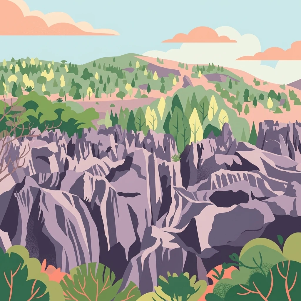
A digital illustration of a rugged limestone plateau with sharp, jagged grey rock formations, surrounded by patches of forest and rolling hills under a soft pastel sky.

Ankarana Special Reserve

Nature reserve

Park overview

Structured park overview, official facts, and landscape profile for Ankarana Special Reserve

Ankarana Special Reserve park facts, protected area profile, and essential visitor context

Review the core facts for Ankarana Special Reserve, including designation, size, terrain, visitor scale, habitats, and operating context in one park-focused overview.

About Ankarana Special Reserve

Ankarana Special Reserve protects a compact but ecologically and geologically significant slice of northern Madagascar, centred on a limestone plateau that rises abruptly out of the surrounding lowlands. Its defining character is the contrast between a hard, dissected plateau surface and the softer vegetated corridors that wind through it, with the western edge guarding the massif behind the sheer Wall of Ankarana and the southern margin dissolving into isolated spires of tower karst.

Wet conditions, with annual rainfall in the neighbourhood of 2,000 millimetres, drive the chemistry of erosion that has defined the landscape. Water has eaten through the Jurassic limestone to form tsingy ridges, sharp pinnacles, ribbons of flowstone, deep gorges, and complex underground rivers, leaving behind a terrain that is simultaneously beautiful, scientifically fascinating, and physically unforgiving. The same inaccessibility has been Ankarana’s greatest ally in conservation: the rugged relief and the dense, tangled vegetation have made industrial-scale exploitation impractical and have helped the plateau retain much of its natural character.

Wildlife value is unusually high for an area of this size. The reserve is a major refuge for crowned lemurs and Sanford’s brown lemurs, with several other lemur species also recorded, including the northern sportive lemur, brown mouse lemur, fat-tailed dwarf lemur, fork-marked lemur, eastern woolly lemur, Perrier’s sifaka, aye-aye, and the western lesser bamboo lemur. Bird surveys in the 1980s documented dozens of breeding species, and mixed-species foraging flocks in the canopy illustrate the area’s ecological complexity. The reserve is also notable for sub-fossil discoveries of large extinct lemurs preserved in its caves and sinkholes, including species sometimes referred to as sloth lemurs and baboon lemurs, giving Ankarana an unusually direct window into Madagascar’s vanished evolutionary past.

For visitors and researchers alike, Ankarana combines three layers of appeal. On the surface, the tsingy and the Wall of Ankarana create an unforgettable visual identity. Below ground, Africa’s longest mapped cave systems invite exploration of underground rivers and passages such as La Grotte d’Andrafiabe. In the canopy, lemurs and a rich endemic bird fauna present one of Madagascar’s most rewarding wildlife experiences, all within a reserve that has been formally protected since 1956 and continues to be governed as a habitat and species management area by Madagascar National Parks.

Quick facts and research context for Ankarana Special Reserve

Ankarana Special Reserve lies in the Diana Region of northern Madagascar, with its southern entrance reached from the town of Mahamasina on Route nationale 6, between Antsiranana to the north-east and Ambilobe to the south-west. It is managed by Madagascar National Parks and classified as an IUCN Category IV protected area, focused on habitat and species management.

The reserve covers roughly 182 square kilometres of Jurassic limestone plateau, edged on its western side by the towering Wall of Ankarana and broken to the south into isolated tower karst spires. Rainfall of around 2,000 millimetres a year has carved the rock into tsingy formations, deep gorges, and around 100 kilometres of mapped cave passages, including the long horizontal cave known as La Grotte d'Andrafiabe.

Protection and recognition

Documented terrestrial protection scope and management parameters for Ankarana Special Reserve

Ankarana Special Reserve Protection Status and International Recognition

Ankarana Special Reserve holds a documented terrestrial protection scope detailing its formal conservation boundaries and administrative framework. Structured records outline the official protected area designation and management status without international recognition sources.

Protection details

Protection scope
Terrestrial
Transboundary protection
No
Park context

Deeper park guide and search-rich context for Ankarana Special Reserve

Ankarana Special Reserve history, landscape, wildlife, and travel context

Explore Ankarana Special Reserve through its history, landscape character, ecosystems, wildlife, conservation priorities, cultural context, and seasonal travel timing in a structured park guide built for atlas discovery and search intent.

Why Ankarana Special Reserve stands out

Ankarana is renowned above all for its tsingy, the jagged blades and needles of Jurassic limestone that earn their name from the Malagasy warning that one cannot walk barefoot across them. These sharp ridges, the towering western cliff known as the Wall of Ankarana, and the deep central gorges together create one of Africa’s most visually distinctive limestone landscapes. The reserve is equally celebrated for its underground world. The Ankarana Massif contains the longest cave systems in Madagascar, with roughly 100 kilometres of mapped passages that include horizontal caves accessible to visitors, subterranean rivers, and hidden shafts. Above ground, the same dense, rugged vegetation that made the plateau hard to exploit has preserved important populations of crowned lemurs, Sanford’s brown lemurs, and a rich array of endemic birds, making Ankarana a landmark destination for both geological and wildlife exploration in the Indian Ocean.
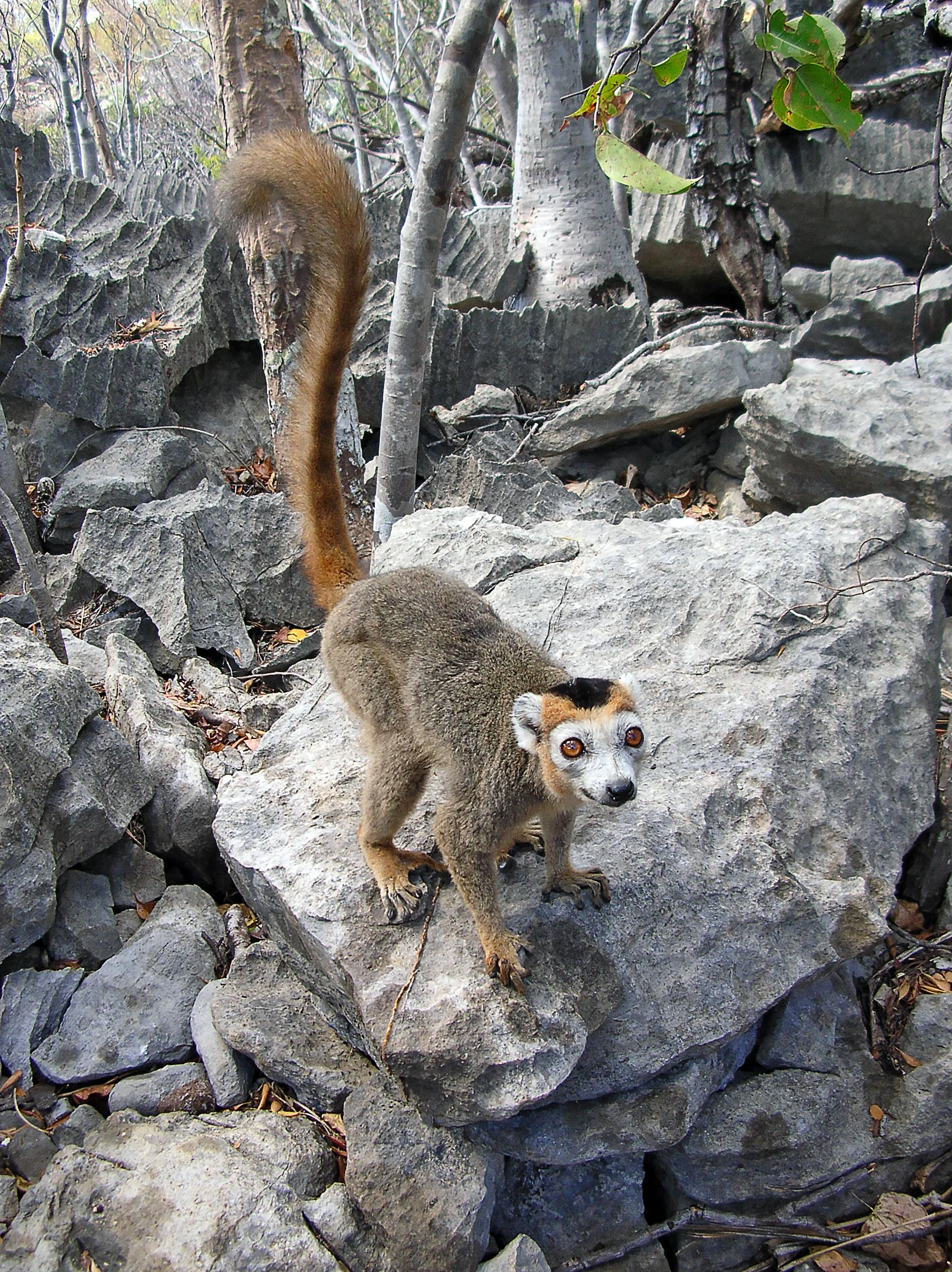
A crowned lemur stands on a large gray limestone rock in a forest setting, with its tail raised vertically.
A crowned lemur perched on the rugged limestone terrain of Ankarana Special Reserve.

Ankarana Special Reserve history and protected-area timeline

Ankarana was formally established as a protected area on 20 February 1956, giving it one of the longer continuous conservation histories in northern Madagascar. Its rugged terrain meant that legal protection reinforced, rather than created, the plateau’s isolation from large-scale exploitation, and the reserve has remained under the care of Madagascar National Parks as an IUCN Category IV habitat and species management area.

Modern scientific and speleological interest in the massif expanded in the 1960s, when Jean Duflos, later known as Jean Radofilao, began an extensive programme of cave exploration across the plateau, much of it alone or in collaboration with visiting speleologists. By the time his work was more broadly published, around 100 kilometres of cave passages had been mapped within the Ankarana Massif, revealing what are recognised as the longest cave systems in Madagascar, and likely in Africa as a whole.

A second important chapter opened in the 1980s, when a series of scientific expeditions began systematically documenting the reserve’s animals and plants. Researchers published bird lists, descriptions of mixed-species foraging behaviour, and an array of new or previously unrecorded invertebrate species from the caves. These expeditions also uncovered sub-fossil remains of large extinct lemurs, including Babakotia radofilai, species of Mesopropithecus and Palaeopropithecus, Megaladapis, Archaeolemur, and the indri, transforming Ankarana into a key site for understanding Madagascar’s vanished megafauna. The explorer-scientist tradition that began with Duflos and continued through these expeditions is the foundation on which Ankarana’s modern identity as a destination for both adventure travel and serious field research rests.

Ankarana Special Reserve landscape and geographic character

The defining feature of Ankarana is its plateau of middle Jurassic limestone, around 150 million years old, which has been shaped over time into a dense, sharply etched karst landscape. The plateau slopes gently to the east, but to the west it ends in the dramatic Wall of Ankarana, a sheer cliff that runs roughly 25 kilometres north to south and rises up to about 280 metres, separating the massif from the surrounding lowlands.

Towards the south, the continuous cliff face breaks up into a scatter of isolated limestone spires known as tower karst, while the interior of the plateau is crossed by seismic activity and long-continued rainfall into a network of deep gorges and ribbons of flowstone. In areas where the softer upper layers of limestone have been stripped away, the harder base rock has been etched into channels and ridges known locally as tsingy, a Malagasy word meaning ‘where one cannot walk barefoot’. Scattered basalt boulders and old basalt flows through the canyons add a darker, volcanic accent to what is otherwise a pale limestone world.

Below the surface, the same carbonate geology has produced an exceptional underground landscape of caves, chambers, and subterranean rivers. Roughly 100 kilometres of cave passages have been mapped, including long horizontal systems such as La Grotte d'Andrafiabe, which alone contains more than eight kilometres of mapped horizontal galleries, making the massif an internationally significant site for karst and speleological study.

Ankarana Special Reserve ecosystems, habitats, and plant life

Ankarana sits within the humid tropical climate of northern Madagascar, with rainfall close to 2,000 millimetres per year, and its vegetation reflects this combination of heat, moisture, and thin, sharply drained soils. The plateau is only partially vegetated, with dense patches of forest clinging to deeper soils and moister areas, while the bare tsingy ridges, cliff faces, and exposed rock surfaces remain largely unvegetated. Where soil accumulates in sheltered pockets, plant cover can become dense enough to make movement difficult, and it is partly this density, together with the rugged relief, that has protected the massif from outside pressure.

The ecological pattern of the reserve is shaped by the underlying geology. Drainage dissolves into karst systems rather than running off in surface rivers, the microclimate varies sharply between exposed rock and shaded gorges, and habitat for ground-dwelling species differs strongly from that of the canopy. These contrasts support a wide range of niches within a relatively small area and help explain the unusually high species density for certain groups, particularly lemurs and forest-interior birds.

In addition to its living vegetation, Ankarana preserves an extraordinary natural archive in its caves and sinkholes, where sub-fossil deposits have preserved the remains of extinct lemurs that were considerably larger than any surviving Malagasy primates. These deposits have made the reserve a key reference point for understanding how Madagascar’s unique primate fauna has changed over time, blending living biodiversity with a deep palaeontological record in a single landscape.

Ankarana Special Reserve wildlife and species highlights

Ankarana is most famous for its lemurs, which include crowned lemurs and Sanford’s brown lemurs as two of the reserve’s signature species. Field records also document the northern sportive lemur, brown mouse lemur, fat-tailed dwarf lemur, fork-marked lemur, eastern woolly lemur, Perrier’s sifaka, aye-aye, and the western lesser bamboo lemur, giving the plateau an unusually complete cross-section of Madagascar’s nocturnal and diurnal primate guilds within a relatively compact area.

Birds are another highlight. Surveys undertaken as part of the 1986 expedition recorded 65 species from 32 families, representing almost a third of Madagascar’s breeding bird species. Many of these small insect-eating songbirds, including paradise flycatchers, common jery, greenbuls, the Malagasy bulbul, sunbirds, and several vangas, forage together in mixed flocks in which each species concentrates on a different part of the tree, from trunk to branches to slender boughs and undersides of leaves. This division of foraging roles, which improves both feeding efficiency and predator detection, is a striking behavioural feature of the Ankarana bird community.

The reserve’s wildlife significance extends beyond living species into its caves and sinkholes, which have yielded sub-fossil remains of the greater bamboo lemur, indri, sloth lemur (Babakotia radofilai, named after the explorer Jean Radofilao), Mesopropithecus, Palaeopropithecus, Megaladapis, and Archaeolemur. These finds have transformed Ankarana into a key site for understanding the lost megafauna of Madagascar and have given the reserve a presence in both modern conservation and the broader study of primate evolution.

Ankarana Special Reserve conservation status and protection priorities

Ankarana’s conservation importance rests on the unusual combination of geological inaccessibility and biological richness concentrated in a relatively small area. The tsingy ridges, the Wall of Ankarana, and the dense plateau vegetation have together created a physical barrier to large-scale logging, agriculture, and other forms of exploitation, allowing the reserve to retain much of its original character more than half a century after it was first protected.

Formally designated in 1956 and managed today by Madagascar National Parks as an IUCN Category IV habitat and species management area, Ankarana plays an important role for several threatened and endemic species. It supports significant populations of crowned lemurs and Sanford’s brown lemurs, along with a wider lemur community that includes species of conservation concern such as the aye-aye, Perrier’s sifaka, and the northern sportive lemur. Its bird and invertebrate fauna also include species first characterised through expeditions to the massif.

Beyond its living biodiversity, the reserve’s cave systems have preserved sub-fossil deposits of extinct lemurs, giving Ankarana scientific and conservation value as a natural archive of Madagascar’s evolutionary past. Protecting these deposits, together with the fragile surface ecosystems above, is a continuing challenge for park management, particularly given the pressures affecting protected areas across Madagascar, but the reserve’s physical setting and long history of formal protection make it one of the more resilient strongholds for the country’s distinctive wildlife.

Ankarana Special Reserve cultural meaning and human context

Ankarana sits in the Diana Region of northern Madagascar, and the surrounding landscape is shaped by the same plateau that defines the reserve. The Malagasy name tsingy, used for the jagged limestone formations on the plateau, is itself a piece of local culture, a short, practical warning that captures the difficulty of walking across the sharp rock in a single word and reflects generations of local knowledge about the terrain.

The reserve is also linked to the broader story of scientific exploration in Madagascar. The French explorer Jean Duflos, who later took the Malagasy name Jean Radofilao, spent much of the 1960s and later years mapping its caves and underground rivers, and one of the extinct lemurs later found in the reserve, Babakotia radofilai, was named in his honour. The intersection of local place names, Malagasy identity, and international scientific work gives Ankarana a layered cultural and historical presence that complements its natural significance.

Top sights and standout views in Ankarana Special Reserve

Among Ankarana’s most distinctive features are the tsingy limestone ridges and the Wall of Ankarana, a 25-kilometre-long cliff rising up to about 280 metres that forms the western edge of the massif. Together these define the reserve’s visual identity and make its landscape instantly recognisable within Madagascar.

Equally important are the underground systems: around 100 kilometres of mapped cave passages, including the horizontal galleries of La Grotte d'Andrafiabe, rank Ankarana as the holder of Madagascar’s, and arguably Africa’s, longest cave network. Above ground, the reserve supports strong populations of crowned lemurs and Sanford’s brown lemurs, a remarkable 65-species bird community, and a unique set of sub-fossil sites that have preserved extinct giant lemurs, giving Ankarana a rare blend of landscape, wildlife, and palaeontological significance.

Best time to visit Ankarana Special Reserve

Ankarana lies in the wet tropical north of Madagascar, where the year is shaped more by the alternation between wetter and drier periods than by sharply contrasting seasons. Visitors tend to find conditions most rewarding during the drier months, when the tsingy ridges and cave entrances are more accessible, forest paths are firmer underfoot, and bird and lemur activity around fruiting trees is easier to observe.

In the wetter part of the year, the same rainfall that creates the karst landscape also makes underground rivers swell and can make some tracks slippery or difficult, though the vegetation is at its lushest. Travellers interested in the caves should generally expect that water levels underground will be higher during the rains and lower during the dry season, while those focused on seeing lemurs and birds will find that fruiting peaks shape seasonal visibility more than any single calendar window.
Monthly climate preview

Long-term temperature and precipitation records measured across representative park coordinates

Ankarana Special Reserve Climate Normals and Annual Weather Patterns

Ankarana Special Reserve records sustained monthly temperatures alongside distinct precipitation shifts across the representative coordinate. Reviewing the complete twelve-month climate normals provides deeper context for long-term temperature ranges and rainfall variations.
Annual mean27 °C
25 °C28 °C
Jan28°
Feb27°
Mar28°
Apr28°
May27°
Jun26°
Jul25°
Aug25°
Sep26°
Oct27°
Nov28°
Dec28°
Warmest month
December

27.9 °C

Coolest month
August

24.9 °C

Wettest month
February

7.5 mm/day

Driest month
September

0.1 mm/day

Park location guide

Geography guide, regional context, and park location map for Ankarana Special Reserve

Ankarana Special Reserve park geography, regions, and map view in Madagascar

Understand where Ankarana Special Reserve sits in Madagascar through a broader geographic reading of the surrounding landscape, nearby location context, and its mapped position within the national park landscape.

How Ankarana Special Reserve fits into Madagascar

Madagascar is an island nation in the Indian Ocean, positioned off the southeastern coast of Africa. As the world's fourth-largest island and second-largest island country, it stands out for its exceptional biodiversity, over 90% of its wildlife is endemic, making it one of 17 megadiverse countries. The population is approximately 32 million, with Antananarivo as both the capital and largest city.

Wider geography shaping Ankarana Special Reserve in Madagascar

Madagascar lies in the Indian Ocean off the southeastern coast of Africa, separated from the mainland by the Mozambique Channel. The island is situated approximately 400 km from the African continent. As the world's fourth-largest island, it also includes numerous smaller peripheral islands.

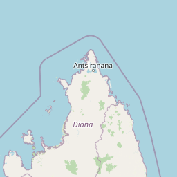
Map view of Ankarana Special Reserve

Use this park location map to pinpoint Ankarana Special Reserve in Madagascar, understand its exact geographic position, and read its mapped placement within the surrounding landscape more clearly.

Pigeon | © OpenStreetMap contributors

Location context for Ankarana Special Reserve

Diana Region

Explore photographic records of sharp limestone pinnacles, deep gorges, and rugged protected habitats.

Ankarana Special Reserve Photos and Scenery: Visualizing Limestone Terrain

Visual documentation reveals the sharp tsingy limestone pinnacles, sheer cliffs, and intricate cave networks defining the protected landscape. Examining national park photography provides clear structural insight into the remote terrain, geological formations, and isolated habitats.

A crowned lemur stands on a large gray limestone rock in a forest setting, with its tail raised vertically.

A wide view of sharp, vertically eroded grey limestone tsingy rock formations under a bright blue sky with a vegetated hill in the background.

Park atlas

Compare regional park geography and connected conservation landscapes in northern Madagascar

Explore Parks Near Ankarana Special Reserve and Surrounding Protected Areas

Continue browsing other national parks and protected areas situated close to Ankarana Special Reserve. Comparing adjacent limestone massifs and regional reserves reveals broader geological patterns across the surrounding territory.
Wildlife reserveDiana
9.3 km away#1 closest

Northeast

Réserve spéciale d'Analamerana: Mapped Geography and Protected Karst Ecosystems

Northern Madagascar wilderness and dry forest topography

Navigate the rugged limestone corridors and canyon networks of Réserve spéciale d'Analamerana. This protected area showcases a distinctive dry forest landscape shaped by seasonal tropical climates and serves as a critical habitat for rare endemic species within the Diana region.

Area
347 km²
Established
1956
IUCN
IV
Relief
Upland
National parkMadagascar
About 25 km away#2 closest

Northeast

Montagne d'Ambre National Park: Mapped Volcanic Massif and Rainforest Boundaries in Madagascar

Protected montane landscape in the Diana Region of northern Madagascar

Centered around the prominent Mount Ambohitra, this national park showcases a distinct volcanic basaltic massif that creates a dramatic contrast with the nearby semi-desert terrain. Explore the geographic footprint of this biodiversity hotspot, featuring dense montane rainforests, numerous crater lakes, and cascading mountain waterfalls within the northern territory of Madagascar.

A watercolor painting showing a panoramic view of a calm lake surrounded by lush green hills and forests in Madagascar.
National parkDiana Region
About 25 km away#3 closest

Northeast

Montagne d'Ambre National Park: Volcanic Landscapes and Rainforest Geography in Diana Region

Isolated montane ecosystems and volcanic mountain terrain

Montagne d'Ambre National Park forms a distinct volcanic massif in northern Madagascar, sheltering an isolated montane rainforest within the drier Diana Region. The protected area features a network of crater lakes and waterfalls, providing a crucial water catchment for the regional capital. Its unique terrain and dense humid forests act as a natural island for endemic species, creating a sharp contrast with the surrounding semi-arid landscape.

Area
182 km²
Established
1958
IUCN
II
Relief
Mountain
National parkDiana Region
About 66 km away#4 closest

North

Nosy Hara National Park: Mapped Protected Landscape and Regional Geographic Context

Atlas exploration of national park boundaries and natural terrain.

Nosy Hara National Park is a designated national park situated within the Diana Region of Madagascar. This entry provides detailed geographic information, focusing on the park's mapped boundaries and its role as a protected landscape. Explore the unique regional geography and understand how this protected area contributes to the broader atlas of natural landscapes.

Area
2.7 km²
Relief
Lowland
Climate
Tropical
Access
Access unknown
National parkMadagascar
About 85 km away#5 closest

Southwest

Lokobe National Park: Madagascar's Protected Natural Landscape and Geographic Context

Explore mapped boundaries and regional park geography.

Lokobe National Park is a protected national park situated within Madagascar, an island country recognized globally for its exceptional biodiversity and unique ecosystems. This page offers a detailed, atlas-oriented perspective on Lokobe National Park, focusing on its designation as a protected area, its specific geographic location, and the natural landscape features that define its territory. Users can explore the park's mapped boundaries and understand its contribution to Madagascar's remarkable natural heritage.

Area
15.23 km²
Established
1927
IUCN
II
Climate
Tropical
National parkMadagascar
About 98 km away#6 closest

Southwest

Nosy Tanikely National Park: Madagascar National Park & Protected Landscape Identity

Mapped geography and regional park context in Madagascar.

Nosy Tanikely National Park is a designated national park in Madagascar, offering a focused entry point for understanding protected land geography. As a key entity within the island's conservation landscape, it provides valuable context for exploring mapped park boundaries and regional geographic features. Discover how this protected area contributes to the broader atlas of Madagascar's natural heritage.

Area
3.41 km²
Established
2011
Relief
Lowland
Climate
Tropical
Nature reserveDiana
About 106 km away#7 closest

South

Réserve naturelle intégrale de Tsaratanana: Highland Massif and Protected Mountain Terrain

High-altitude geography in the Diana region of northern Madagascar

Spanning tens of thousands of hectares, the Réserve naturelle intégrale de Tsaratanana protects the highest mountain terrain in Madagascar. The landscape is defined by the crystalline Vohibory massif, creating a complex topography of deep valleys and dramatic elevation gradients that support endemic primate habitats and montane forest ecosystems.

Area
486.22 km²
Established
1927
IUCN
Ia
Wildlife reserveDiana
About 131 km away#8 closest

Southwest

Manongarivo Special Reserve: Protected Wildlife and River Landscapes in Northern Madagascar

Examining the humid forest terrain and geographic boundaries of the Diana region

Located in the Diana region, Manongarivo Special Reserve serves as a critical protected area within the northern humid rainforest system of Madagascar. The territory is defined by steep forested hills, narrow river valleys, and diverse ecological niches. By analyzing its specific topographic markers and river systems, this entry details the natural landscape and protected status of this significant biodiversity reserve.

Area
327.35 km²
Established
1956
IUCN
IV
Climate
Tropical

Common questions about visiting, size, designation, and location context for Ankarana Special Reserve

Ankarana Special Reserve FAQs for park facts, access, geography, and protected area context

Find quick answers about Ankarana Special Reserve, including protected-area facts, park geography, trail and visitor context, and how the park fits into its surrounding country and regional landscape.
MoriAtlas Explorer

Continue Your Protected Areas Search Across the Global Atlas

Deepen your exploration by continuing the structured search for national parks and protected areas worldwide. Utilize the comprehensive filtering capabilities to compare different conservation landscapes and refine your understanding of global park geography. Discover more about the distribution and characteristics of protected natural areas.

Global natural geography