

Mori Atlas logo
Nature reserveAnkeniheny-Zahamena Corridor

Mapping the ecological boundaries and terrain of this expansive eastern highland forest reserve

Ankeniheny-Zahamena Corridor: A Vital Protected Rainforest Landscape in Eastern Madagascar

The Ankeniheny-Zahamena Corridor serves as one of the most significant rainforest tracts in eastern Madagascar, functioning as a continuous biological bridge across the central-eastern highlands. This nature reserve protects a vast, humid forest ecosystem characterized by deeply dissected terrain and high levels of floral and faunal endemism. Through its expansive protected boundaries, the area maintains hydrological stability and provides habitat for threatened primate species like the indri and diademed sifaka.

rainforestcorridorbiodiversity hotspotendemic specieslemursprimate conservation

Ankeniheny-Zahamena Corridor

Nature reserve

Park overview

Structured park overview, official facts, and landscape profile for Ankeniheny-Zahamena Corridor

Ankeniheny-Zahamena Corridor park facts, protected area profile, and essential visitor context

Review the core facts for Ankeniheny-Zahamena Corridor, including designation, size, terrain, visitor scale, habitats, and operating context in one park-focused overview.

About Ankeniheny-Zahamena Corridor

The Ankeniheny-Zahamena Corridor is a large, ecologically vital stretch of eastern Madagascar rainforest that functions as both a reserve and a connecting habitat between distinct protected areas in the central-eastern part of the island. Stretching roughly across the Alaotra-Mangoro region, it forms a bridge between forest blocks that once formed a more continuous eastern rainforest belt, allowing wildlife populations to move, forage, and maintain genetic exchange across a landscape that would otherwise be heavily fragmented.

The corridor lies within the eastern rainforest biome of Madagascar, one of the world's most distinctive bioregions and a global hotspot for endemic species. Its humid forests support extraordinary plant diversity: more than two thousand plant species have been catalogued there, with roughly eighty-five percent of those known only from this broader region of Madagascar. This level of endemism reflects the long evolutionary isolation of the island and the variety of microhabitats found along the corridor's elevational and moisture gradients.

Beyond its forests, the corridor plays a critical hydrological role. Its catchments feed rivers and streams that supply water across both the eastern lowlands and the central highlands, making it an important source of freshwater for communities well beyond its own boundaries. Designated in 2007 and later reinforced with natural resource reserve status in 2015, the corridor is managed to maintain these forests while supporting the traditional and sustainable resource needs of local populations.

Conservation organizations, including Conservation International Madagascar, have been involved in providing technical and management support for the reserve, working alongside Malagasy authorities. This combination of ecological richness, landscape connectivity, hydrological importance, and formal protected status makes the Ankeniheny-Zahamena Corridor a cornerstone of eastern Madagascar's broader strategy to maintain rainforest ecosystems in the face of widespread deforestation.

Quick facts and research context for Ankeniheny-Zahamena Corridor

The Ankeniheny-Zahamena Corridor is a protected forest landscape covering roughly 3,810 square kilometers in eastern Madagascar, near the regional town of Moramanga in the Alaotra-Mangoro region. It falls under IUCN Category VI, recognizing it as a protected area where sustainable use of natural resources is permitted alongside conservation objectives, and it was formally established in 2007 under Madagascar's Ministry of Environment and Forests. In 2015 it received the additional designation of natural resource reserve, strengthening long-term protection of its forests.

Ecologically, the corridor is among the most botanically diverse places on the island, with over 2,000 plant species recorded and an exceptionally high proportion of endemics. It also supports fifteen lemur species, dozens of other mammals, nearly 130 amphibians, and almost ninety bird species, several of which are globally threatened.

Protection and recognition

Examine the documented terrestrial protection scope and historical designation milestones.

Ankeniheny-Zahamena Corridor Protection Status and Official Designation History

Ankeniheny-Zahamena Corridor maintains a documented terrestrial protection status established in 2015. Official designation records outline the management scope and historical framework for this protected landscape.

Protection details

Protection scope
Terrestrial
Designated year
2015
Transboundary protection
No
Park context

Deeper park guide and search-rich context for Ankeniheny-Zahamena Corridor

Ankeniheny-Zahamena Corridor history, landscape, wildlife, and travel context

Explore Ankeniheny-Zahamena Corridor through its history, landscape character, ecosystems, wildlife, conservation priorities, cultural context, and seasonal travel timing in a structured park guide built for atlas discovery and search intent.

Why Ankeniheny-Zahamena Corridor stands out

The Ankeniheny-Zahamena Corridor is best known as a continental-scale rainforest connector in Madagascar, linking otherwise isolated forest fragments in the central-eastern part of the island into a single, much larger functioning landscape. Its exceptional botanical richness, with the great majority of recorded plant species being endemic, has made it a focal point for Madagascar's conservation science community. The corridor is also a stronghold for several of the country's most threatened lemurs, including the indri, the black-and-white ruffed lemur, and the diademed sifaka. These three iconic primates, all classified as threatened with extinction, are central to the corridor's global conservation significance and have driven much of the international attention it receives.

Ankeniheny-Zahamena Corridor history and protected-area timeline

The Ankeniheny-Zahamena Corridor was formally established in 2007 as a recognized protected forest landscape in eastern Madagascar, consolidating a network of forest blocks that had previously been managed in a more fragmented manner. Its creation reflected growing recognition that Madagascar's remaining eastern rainforests needed to be managed not just as isolated reserves, but as connected landscapes capable of sustaining wildlife populations over the long term.

In 2015, the area received the additional status of a natural resource reserve, a designation that reinforced its long-term protection while still allowing regulated, sustainable use of forest resources by local communities. This dual framework was seen as central to the corridor's effectiveness, recognizing that biodiversity conservation in the eastern forests depends heavily on the involvement and support of the people who live around them.

Over the years, international conservation organizations, including Conservation International Madagascar, have contributed to the corridor's development by providing technical support for protected-area management and assisting with secretariat functions for the technical committee overseeing the reserve. This institutional backing, alongside national governance under the Ministry of Environment and Forests, has shaped the corridor into one of the more prominent examples of Madagascar's efforts to integrate ecological protection with sustainable regional development.

Ankeniheny-Zahamena Corridor landscape and geographic character

The Ankeniheny-Zahamena Corridor occupies a substantial swath of eastern Madagascar's central rainforest belt, characterized by dense humid forest, deeply dissected terrain, and a network of forested hills and ridges. The corridor follows the tropical wet climate of the eastern escarpment, where year-round moisture supports tall, closed-canopy rainforest.

The terrain transitions from lower-elevation humid forests into the foothills of the central highlands, producing a varied topography of narrow valleys, wooded slopes, and elevated ridges. Streams and small rivers thread through the forest, feeding into larger catchments that ultimately supply water to communities both within the corridor and in surrounding regions. This combination of relief, persistent rainfall, and intact forest cover is what gives the corridor its distinctive humid and densely vegetated character.

Outside the forested core, the surrounding landscape transitions into the mosaic of agricultural land, secondary vegetation, and eroded slopes typical of eastern Madagascar, highlighting the corridor's role as a critical remaining block of primary forest within a heavily transformed regional setting.

Ankeniheny-Zahamena Corridor ecosystems, habitats, and plant life

Ecologically, the Ankeniheny-Zahamena Corridor represents one of the most important surviving examples of Madagascar's eastern humid forest biome, a vegetation type that once blanketed the island's eastern escarpment but now survives only in fragments. The corridor's forests support an exceptional diversity of plants, with more than two thousand recorded species and a strikingly high proportion of regional endemics, reflecting the long isolation of Madagascar's flora and the microhabitat complexity created by the area's varied topography and moisture conditions.

The vegetation is structured into multiple layers, from a tall emergent canopy down through mid-story trees, shrubs, ferns, and a rich ground layer of leaf litter and herbaceous plants. This structural complexity supports a correspondingly diverse animal community, with amphibians, reptiles, and forest-bound birds all finding habitat within the corridor's intact forest blocks.

As a functional connector between otherwise separate forest areas, the corridor also helps sustain ecological processes like seed dispersal and animal migration across a broader landscape. Its long-term ecological significance is less about any single stand of trees and more about the maintenance of a wide, unbroken forest matrix in a region where such continuity is increasingly rare.

Ankeniheny-Zahamena Corridor wildlife and species highlights

The Ankeniheny-Zahamena Corridor hosts a remarkable concentration of Madagascar's endemic wildlife, anchored by its primate fauna. Fifteen lemur species have been recorded within its bounds, including the indri, the black-and-white ruffed lemur, and the diademed sifaka, all three of which are classified as threatened. The indri is particularly emblematic of the corridor's identity, as one of the few remaining strongholds for this largest of Madagascar's living lemurs.

Beyond lemurs, the corridor supports around thirty other mammal species and an exceptionally rich amphibian fauna, with 129 amphibian species recorded, a figure that underscores the area's importance for the island's globally distinctive frog diversity. Reptiles are also well represented, reflecting the productivity of the humid forest understory.

Nearly ninety bird species have been documented in the corridor, including forest-dependent species that rely on the continuity and maturity of the canopy. Combined with the primate and amphibian records, this bird diversity contributes to the corridor's reputation as one of the most ecologically complete remaining forest landscapes in eastern Madagascar.

Ankeniheny-Zahamena Corridor conservation status and protection priorities

From a conservation standpoint, the Ankeniheny-Zahamena Corridor is one of the most strategically important protected area complexes in Madagascar. Its 2007 establishment and 2015 designation as a natural resource reserve reflect a sustained national effort to safeguard a significant percentage of the country's remaining eastern rainforest in a single integrated management framework.

The corridor's IUCN Category VI status reflects a deliberate balance between strict biodiversity protection and sustainable resource use, recognizing that effective conservation of rainforest ecosystems in Madagascar depends on engaging local communities in the management of the forests on which they rely. This approach is paired with international collaboration: Conservation International Madagascar has played a key role in providing technical support to protected-area management and to the technical committee coordinating conservation efforts within the reserve.

The conservation value of the corridor extends beyond its own boundaries as well. By maintaining forest cover across a huge area, the corridor helps protect watershed functions, reduce erosion, and preserve habitat connectivity for species that require large, unbroken forest blocks to survive. These combined ecological, hydrological, and landscape-level benefits have placed the corridor at the center of Madagascar's wider strategy for conserving its eastern forests in the face of ongoing national and regional pressures on forest cover.

Ankeniheny-Zahamena Corridor cultural meaning and human context

The lands surrounding the Ankeniheny-Zahamena Corridor have long been home to rural communities whose livelihoods are closely tied to the surrounding forests, including through small-scale agriculture, gathering of forest products, and other traditional land uses. The corridor's management framework reflects this relationship by integrating local communities into its conservation model through the natural resource reserve designation, which formally allows regulated, sustainable use alongside biodiversity protection.

While the corridor is fundamentally an ecological designation rather than a cultural one, its successful operation depends heavily on the cooperation, knowledge, and stewardship of these communities, whose presence and practices have shaped the eastern Malagasy landscape for generations. That human dimension is an integral part of how the reserve functions and is sustained over time.

Top sights and standout views in Ankeniheny-Zahamena Corridor

The corridor's most distinctive feature is its sheer scale: at roughly 3,810 square kilometers, it ranks among the largest tracts of eastern rainforest still standing in Madagascar, and one of the few areas large enough to function as a true landscape-level reserve rather than a fragmented patch.

Its botanical richness, with over two thousand recorded plant species and an extraordinarily high rate of regional endemism, places the corridor among the most significant sites globally for the study and protection of Madagascar's uniquely evolved flora. The presence of three threatened lemur species, including the indri, the black-and-white ruffed lemur, and the diademed sifaka, makes the corridor a flagship site for primate conservation on the island. Its hydrological significance, supplying water across both eastern and western Madagascar, adds another layer of importance that extends well beyond its borders.

Best time to visit Ankeniheny-Zahamena Corridor

The climate of eastern Madagascar around the Ankeniheny-Zahamena Corridor is humid and tropical, with rain possible throughout much of the year. Conditions tend to be drier during the cooler months, when access roads and forest trails are typically in their best condition and the canopy remains active with wildlife, including lemurs that are easier to observe when the vegetation is less saturated.

Visiting earlier in the temperate dry season generally offers the most comfortable combination of manageable rainfall, cooler temperatures, and high wildlife visibility. The warmer, wetter period brings heavier rains and more difficult travel conditions, though it is also a time of intense biological activity in the forests. For visitors focused on bird and amphibian observation, the wet season can be rewarding despite the logistical challenges.

Monthly climate preview

Long-term temperature ranges and monthly precipitation averages for regional terrain

Ankeniheny-Zahamena Corridor Climate Normals and Annual Weather Patterns

Representative coordinates indicate measured monthly temperature variations and shifting precipitation rates across the landscape. Examining the full twelve-month profile provides complete historical averages for detailed climate comparison.
Annual mean19 °C
16 °C22 °C
Jan22°
Feb22°
Mar22°
Apr20°
May19°
Jun17°
Jul16°
Aug16°
Sep17°
Oct19°
Nov21°
Dec22°
Warmest month
January

22.1 °C

Coolest month
July

15.8 °C

Wettest month
February

12 mm/day

Driest month
September

1.5 mm/day

Park location guide

Geography guide, regional context, and park location map for Ankeniheny-Zahamena Corridor

Ankeniheny-Zahamena Corridor park geography, regions, and map view in Madagascar

Understand where Ankeniheny-Zahamena Corridor sits in Madagascar through a broader geographic reading of the surrounding landscape, nearby location context, and its mapped position within the national park landscape.

How Ankeniheny-Zahamena Corridor fits into Madagascar

Madagascar is an island nation in the Indian Ocean, positioned off the southeastern coast of Africa. As the world's fourth-largest island and second-largest island country, it stands out for its exceptional biodiversity, over 90% of its wildlife is endemic, making it one of 17 megadiverse countries. The population is approximately 32 million, with Antananarivo as both the capital and largest city.

Wider geography shaping Ankeniheny-Zahamena Corridor in Madagascar

Madagascar lies in the Indian Ocean off the southeastern coast of Africa, separated from the mainland by the Mozambique Channel. The island is situated approximately 400 km from the African continent. As the world's fourth-largest island, it also includes numerous smaller peripheral islands.

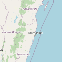
Map view of Ankeniheny-Zahamena Corridor

Use this park location map to pinpoint Ankeniheny-Zahamena Corridor in Madagascar, understand its exact geographic position, and read its mapped placement within the surrounding landscape more clearly.

Pigeon | © OpenStreetMap contributors

Location context for Ankeniheny-Zahamena Corridor

Alaotra-Mangoro
Park atlas

Compare adjacent rainforest reserves, biological corridors, and regional conservation areas in Madagascar

Explore Other Parks Near Ankeniheny-Zahamena Corridor and Connected Protected Landscapes

Browsing protected areas near Ankeniheny-Zahamena Corridor reveals broader ecological continuity across the eastern highlands. Regional park comparison maps the full extent of Madagascar tropical rainforest belts.
National parkMadagascar
About 8.8 km away#1 closest

South

Zahamena National Park: Madagascar National Park Exploration and Geographic Context

Mapping the protected boundaries and landscape of Zahamena National Park.

Delve into Zahamena National Park, a vital protected territory situated in Madagascar. This national park offers a unique perspective on the island's natural geography and its status as a significant protected landscape. Understand its position within Madagascar's broader context, focusing on the mapped aspects of its protected area identity and its contribution to the country's renowned biodiversity hotspot status.

Area
423 km²
Established
1997
IUCN
II
Relief
Mountain
Protected landscapeAlaotra-Mangoro
About 35 km away#2 closest

Northwest

Lake Alaotra Protected Landscape: Atlas and Geographic Wetland Profile

Mapping the primary wetland basin of Madagascar's Alaotra-Mangoro region.

Lake Alaotra serves as a central protected landscape within the Alaotra-Mangoro region, featuring an extensive system of marshes, reedbeds, and freshwater zones. This profile offers a structured look at the lake's geography, its role as a critical wetland habitat, and the surrounding terrain that shapes this important Madagascar catchment area.

Area
7,223 km²
Relief
Lowland
Scope
Terrestrial
Water
Water-dominated
Nature reserveAnalanjirofo
About 55 km away#3 closest

Southeast

Réserve naturelle intégrale de Betampona: Atlas and Geographic Protected Area Profile

A vital lowland humid forest enclave in Analanjirofo

Delve into the mapped terrain of Réserve naturelle intégrale de Betampona, an integral nature reserve established in 1927 that protects a critical lowland humid evergreen forest fragment. The landscape is defined by its steep ridges and rapid stream networks, providing essential refuge for endemic lemurs and diverse plant life. This profile offers a clear view of the reserve's geographic setting and its status as a key conservation anchor for the eastern coastal ecosystems of Madagascar.

Area
29.18 km²
Established
1927
IUCN
Ia
Relief
Mountain
Wildlife reserveAtsinanana
About 58 km away#4 closest

South

Réserve spéciale de Mangerivola: Geographic Overview of an Atsinanana Wildlife Reserve

Rainforest topography and protected corridor mapping

Réserve spéciale de Mangerivola serves as a cornerstone of the eastern Malagasy rainforest corridor. This overview provides insight into the reserve's challenging, roadless terrain and its layered ecological composition, ranging from dense humid forests to rocky, high-altitude outcrops that sustain rare bird species and seven distinct lemur populations.

Area
130.05 km²
Established
1958
IUCN
IV
Relief
Upland
Watercolor illustration of a landscape featuring mountains, a lake, trees, and pink flowers in the foreground
National parkAlaotra-Mangoro
About 141 km away#5 closest

South

Analamazaotra National Park: Protected Rainforest Ecosystem and Mapped Landscape in Alaotra-Mangoro

Explore Madagascar's Eastern Highlands protected area geography.

Analamazaotra National Park, situated in Madagascar's Alaotra-Mangoro region, represents a critical segment of the island's protected eastern rainforests. This national park is mapped as a vital conservation area, offering insights into its unique ecosystems and natural terrain. Understanding Analamazaotra National Park's geographic placement and protected boundaries provides essential context for regional landscape exploration and atlas-based geographic discovery within Madagascar.

Area
26.53 km²
Established
2015
IUCN
II
Relief
Highland
National parkAlaotra-Mangoro
About 141 km away#6 closest

South

Andasibe-Mantadia National Park: National Park and Protected Landscape Identity

Explore its mapped boundaries and geographic context.

Andasibe-Mantadia National Park is a distinct protected territory within the Alaotra-Mangoro region, serving as a crucial focal point for understanding Madagascar's regional geography and protected land distribution. This detail page provides essential atlas-style information on the park's mapped area and its natural landscape characteristics. Engage with structured data that highlights the park's protected status and its position within the broader geographic framework of eastern Madagascar, supporting focused discovery for researchers and explorers.

Area
155 km²
Established
1989
IUCN
II
Visitors
26.1K annual
National parkMadagascar
About 141 km away#7 closest

South

Mantadia National Park: Madagascar National Park and Protected Landscape Atlas

Mapped boundaries and regional geographic context of Mantadia.

Mantadia National Park represents a crucial protected landscape within Madagascar, detailed here for comprehensive geographic and atlas exploration. This entry focuses on its identity as a national park, providing insights into its mapped boundaries and its contribution to the understanding of Madagascar's diverse natural terrain. The information facilitates a structured discovery of the park's environmental and geographical significance, essential for anyone mapping protected areas.

Wildlife reserveAlaotra-Mangoro
About 142 km away#8 closest

South

Analamazaotra Forest Station: Protected Rainforest Landscapes in Alaotra-Mangoro, Madagascar

Community-managed wildlife reserve and humid forest habitat

Analamazaotra Forest Station represents a core protected area within the humid eastern rain forests of Madagascar. Managed through local partnership, the reserve functions as a hub for habitat restoration and biodiversity conservation. This site is integral to the regional landscape, preserving a continuous block of essential forest habitat along the eastern escarpment that supports a wide range of endemic species.

Area
7.1 km²
Relief
Upland
Climate
Tropical
Access
Access unknown

Common questions about visiting, size, designation, and location context for Ankeniheny-Zahamena Corridor

Ankeniheny-Zahamena Corridor FAQs for park facts, access, geography, and protected area context

Find quick answers about Ankeniheny-Zahamena Corridor, including protected-area facts, park geography, trail and visitor context, and how the park fits into its surrounding country and regional landscape.
MoriAtlas Explorer

Continue Your Protected Areas Search Across the Global Atlas

Deepen your exploration by continuing the structured search for national parks and protected areas worldwide. Utilize the comprehensive filtering capabilities to compare different conservation landscapes and refine your understanding of global park geography. Discover more about the distribution and characteristics of protected natural areas.

Global natural geography