

Mori Atlas logo
Protected landscapeApostle Islands National Lakeshore

Mapping the sandstone sea caves, boreal forests, and historic lighthouse clusters of the Wisconsin archipelago.

Apostle Islands National Lakeshore: Geographic Atlas of a Lake Superior Protected Landscape

Apostle Islands National Lakeshore encompasses twenty-one islands and a dense stretch of Lake Superior shoreline in northern Wisconsin. This protected landscape preserves significant geological features, including wave-eroded sandstone sea caves, sandspits, and tombolos shaped by centuries of glacial activity and lake currents. Beyond its unique terrain, the area hosts an extensive concentration of historic lighthouses set within regenerating northern hardwood and boreal forests protected as wilderness.

Lake SuperiorislandsGreat Lakessandstone sea caveslighthousesnational lakeshore
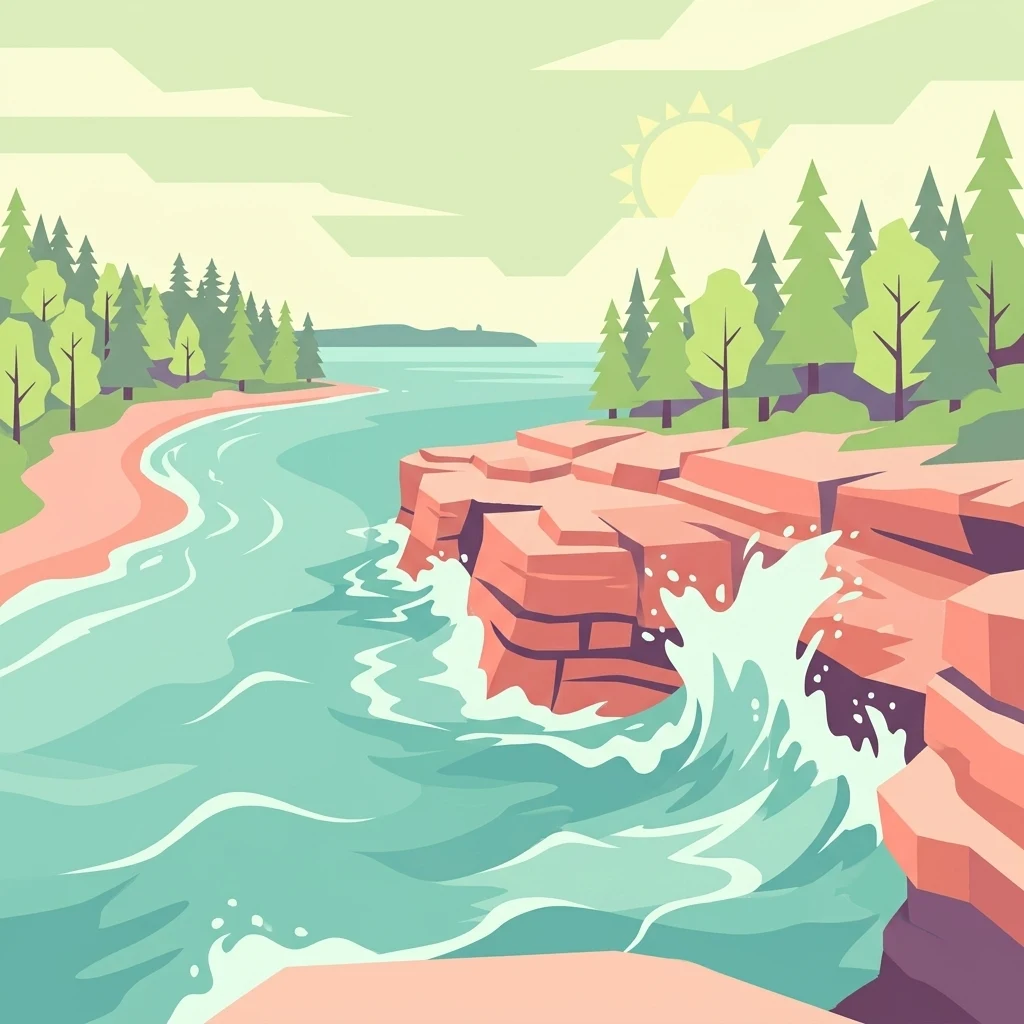
A stylized vector illustration showing red layered rock cliffs meeting turquoise water, with green pine trees on the shoreline and a pale sun in the sky.

Apostle Islands National Lakeshore

Protected landscape

Park overview

Structured park overview, official facts, and landscape profile for Apostle Islands National Lakeshore

Apostle Islands National Lakeshore park facts, protected area profile, and essential visitor context

Review the core facts for Apostle Islands National Lakeshore, including designation, size, terrain, visitor scale, habitats, and operating context in one park-focused overview.

About Apostle Islands National Lakeshore

Apostle Islands National Lakeshore occupies the northwestern corner of Wisconsin, where Lake Superior meets the Bayfield Peninsula. Twenty-one of the Apostle Islands are administered by the National Park Service, along with a strip of mainland shoreline and the surrounding Lake Superior waters out to a quarter-mile from land. The result is a landscape that fuses a working freshwater coast with a wild, largely roadless island archipelago.

Geologically, the islands and the mainland shoreline share a common ancestry in red sandstone laid down in the distant past and later reworked by the glaciers that covered the region. As the continental ice retreated and Lake Superior filled the basin, wave action began eroding the soft sandstone, opening the sea caves and arches that are among the lakeshore's most photographed features. The eroded sand was deposited in sheltered bays, building the long barrier beaches, sandspits, and tombolos that connect features such as Stockton Island's Presque Isle to the main body of the island. The same geology underlies the area's human story: nineteenth-century fishermen and quarrymen cut the reddish stone for use in regional buildings, including the park's present headquarters, the Old Bayfield County Courthouse in Bayfield.

The ecological identity of the lakeshore is shaped by its position at the boundary of forest regions. Northern hardwood forest dominates, with oaks, hickories, hemlock, birch, and maples together defining much of the canopy, but the islands also host boreal elements typical of Ontario, reflecting the cool, lake-moderated climate. Selective old-growth remnants survive alongside extensive secondary forest that has reclaimed former farm clearings, logging camps, and quarry sites. Sea stacks, caves, and cliffs host nesting seabirds, while the more sheltered interiors support forest songbirds, waterfowl, and mammals such as black bear, white-tailed deer, red fox, coyote, beaver, otter, and snowshoe hare.

In addition to its natural significance, the lakeshore carries a strong maritime-historical identity. Eight historic lighthouse towers on six islands, including Sand Island Light, Devils Island Light, Outer Island Light, Raspberry Island Light, the paired Michigan Island lights, and the newer Chequamegon Point Light, guided vessels through Lake Superior's often treacherous approaches. Shipwrecks and shoreline ruins, such as those of the schooner Lucerne, add to the lakeshore's layered cultural landscape. Together, the islands' geology, ecosystems, lighthouses, and wilderness character define Apostle Islands National Lakeshore as one of the most distinctive protected areas on the Great Lakes.

Quick facts and research context for Apostle Islands National Lakeshore

Apostle Islands National Lakeshore protects 21 islands and mainland Lake Superior shoreline in Ashland and Bayfield counties, Wisconsin. The unit covers roughly 69,540 acres in total, split between about 42,308 acres of land and 27,232 acres of lake water within one-quarter mile of the shoreline.

It was authorized in 1970 and is managed by the National Park Service, headquartered in the historic Old Bayfield County Courthouse in Bayfield. In 2004, Congress designated about 80 percent of the park's land area as the Gaylord Nelson Wilderness, the largest wilderness unit in Wisconsin. The lakeshore includes eight historic lighthouse towers spread across six islands, more lighthouses than any other National Park Service site.

Protection and recognition

Examine the documented conservation framework, mixed protection scope, and official recognition metrics.

Apostle Islands National Lakeshore Protection Status and Designated Area Record

Apostle Islands National Lakeshore holds a documented mixed protection scope within its regional conservation framework. Official records compile administrative boundaries, protected area status, and management metrics for detailed geographic analysis.

Protection details

Protection scope
Mixed
Transboundary protection
No
Park context

Deeper park guide and search-rich context for Apostle Islands National Lakeshore

Apostle Islands National Lakeshore history, landscape, wildlife, and travel context

Explore Apostle Islands National Lakeshore through its history, landscape character, ecosystems, wildlife, conservation priorities, cultural context, and seasonal travel timing in a structured park guide built for atlas discovery and search intent.

Why Apostle Islands National Lakeshore stands out

The Apostle Islands are best known for the striking red sandstone sea caves carved into the islands' cliffs by the waves of Lake Superior, visible by kayak or boat during calm conditions. The lakeshore is also famous for its historic lighthouse collection: eight lighthouse towers on six islands, including the Sand Island, Devils Island, Outer Island, Raspberry Island, Michigan Island, and Chequamegon Point lights. Equally central to its identity is the wilderness character of the islands, where forests of birch, maple, oak, hemlock, and boreal species regrow over the remains of earlier logging, farming, and quarrying activity. The combination of a Great Lakes archipelago, sea caves, lighthouses, and a designated wilderness has made the lakeshore a signature destination on Lake Superior.
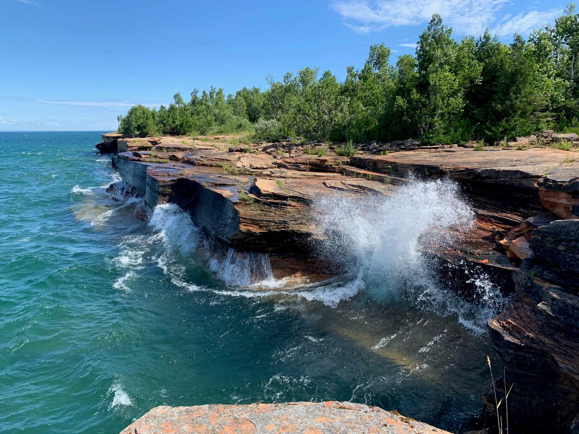
Large white waves crashing against layered red sandstone rock formations along a shoreline, with green trees in the background under a blue sky.
Large waves crashing against layered sandstone ledges on the Devils Island shoreline with a forest backdrop under a blue sky.

Apostle Islands National Lakeshore history and protected-area timeline

The physical foundation of the Apostle Islands was laid during the last ice age. Glaciers that once covered much of North America retreated and left behind a rift or fault along what is now the Bayfield Peninsula; the waters of Lake Superior filled this depression, and wave action subsequently eroded the soft red sandstone, separating individual islands from the mainland and gouging out the sea caves that now define the shoreline.

Humans have been drawn to the islands for centuries. Native Americans likely visited the archipelago long before European contact, and in the seventeenth century the French explorer Étienne Brûlé reached the islands as part of French Canadian efforts to find a western passage to the East Indies. The Jesuits, who frequently assigned holy names to newly encountered places, are widely credited with calling the group the Apostle Islands. Fur traders later established the first semi-permanent settlements, building from the wealth generated by the regional fur trade.

During the late nineteenth and early twentieth centuries, the islands supported a working economy of logging, small-scale farming, commercial fishing, and sandstone quarrying. Trout Point Logging Camp and the old quarry sites on Stockton and Hermit Islands preserve evidence of this period, though much of the landscape has since returned to forest. Lighthouses were built to guide ships past the islands' hazards, including Sand Island Light, one of the first lights on the Great Lakes to be automated, in 1922, and later the paired towers on Michigan Island and the lights at Devils, Raspberry, and Outer Islands.

Modern protection began when U.S. Senator Gaylord Nelson, a Wisconsin native and the principal sponsor of Earth Day and the Wilderness Act, championed federal legislation for the area. Public Law 91-424, signed by President Richard Nixon on September 26, 1970, established the Apostle Islands National Lakeshore, initially including twenty islands, a roughly twelve-mile strip of mainland, and Lake Superior waters out to a quarter-mile from land. In 1986, Public Law 99-497 added Long Island to the unit and transferred all the light stations from the U.S. Coast Guard to the National Park Service. Following a 2004 wilderness study and broad public support, Congress designated about 80 percent of the park's land area, roughly 35,000 acres across eighteen of the Apostle Islands, as the Gaylord Nelson Wilderness, the largest wilderness area in Wisconsin. In 2024, legislation was introduced to redesignate the lakeshore as a national park, with Sand Island set aside as a related national preserve.

Apostle Islands National Lakeshore landscape and geographic character

The landscape of Apostle Islands National Lakeshore is defined by red sandstone, the westernmost reach of Lake Superior, and the ancient erosive power of the lake itself. The islands are largely composed of Precambrian-age sandstone that, over thousands of years, has been undercut by waves to create deep sea caves, arches, and sea stacks along the windward shores. Devils Island and Sand Island are particularly known for these sculptured cliff faces, which become especially dramatic during storms on Lake Superior.

On the lee sides of the islands, the same eroded sand has been redeposited into elongated sandspits, cuspate forelands, tombolos, and barrier beaches. Presque Isle on Stockton Island is a classic example where a sandy isthmus nearly encloses a shallow bay. Elsewhere, gravel beaches and cobble strands mark the meeting of sandstone bedrock and the lake, while low interior terrain supports forest and bog communities.

Above the cliffs and beaches, the islands rise into forested uplands shaped by glacial deposits and centuries of regrowth. Inland Lake Superior moderates temperatures, leading to long, snowy winters and cool, fog-tinged summers. The mainland portion of the lakeshore includes sea cliffs, river mouths, and pocket beaches, while the surrounding waters stretch more than 150 miles of shoreline, creating a landscape that is as much about water and weather as it is about stone and trees.
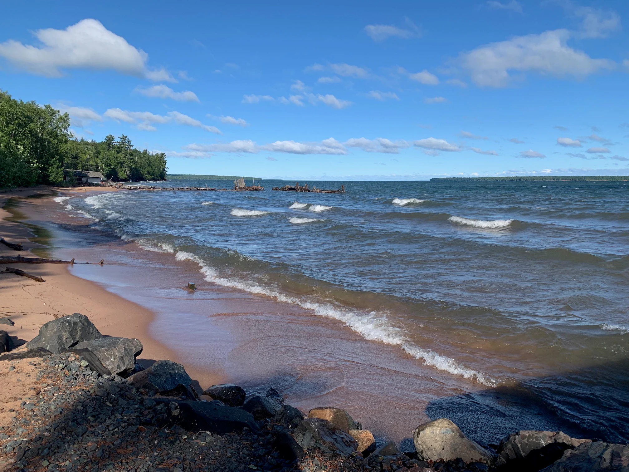
A sandy beach with small waves rolling in, bordered by a forest on the left and rocks in the foreground, under a blue sky with scattered clouds.
Waves rolling onto a sandy beach near a forest edge at the Little Sand Bay kayak launch on Lake Superior.

Apostle Islands National Lakeshore ecosystems, habitats, and plant life

Ecologically, the Apostle Islands sit at a fascinating crossroads between eastern hardwood forests and the boreal forests typical of central Canada. The dominant vegetation is a northern hardwood forest community featuring red oak, white oak, hickory, hemlock, sugar maple, yellow birch, and paper birch, intermixed with boreal elements such as white spruce, balsam fir, and white cedar in cooler pockets. Some old-growth remnants persist, but most of the forest cover is secondary growth that has reclaimed land once cleared for logging, farming, fishing camps, or quarrying. Bogs, cliffs, sand dunes, and rocky shorelines add habitat diversity along the edges of the lakeshore.

More than 800 plant species have been documented across the islands and mainland shoreline, including a notable mix of ferns, mosses, lichens, orchids, and coastal and wetland plants that thrive in the cool, foggy climate. This botanical richness, layered on a relatively small land area, gives the lakeshore unusually high ecological value per acre, and the wilderness designation now preserves much of this habitat from motorized disturbance.

The waters surrounding the islands are themselves part of the protected ecosystem. Lake Superior is one of the world's largest freshwater bodies and supports cold-water fisheries including lake trout and various salmonid species. The lake's cold, clear waters shape both the wildlife of the islands and the way visitors experience them, by constraining boating seasons and amplifying the impact of storms on the sandstone cliffs.
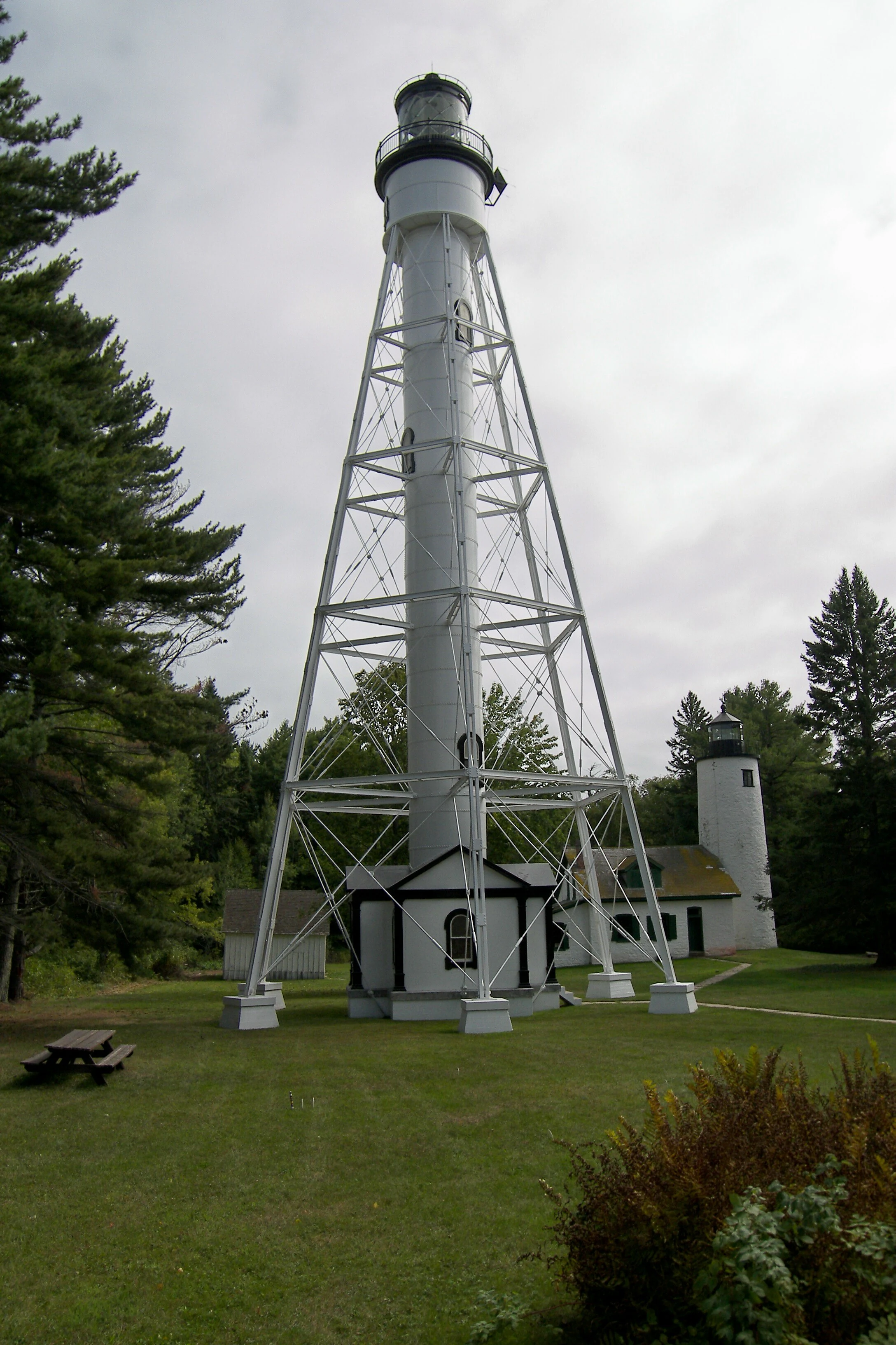
A tall white skeletal steel lighthouse tower stands on a grassy lawn with a shorter solid white lighthouse tower and small buildings in the background, surrounded by pine trees under an overcast sky.
Two white lighthouse towers situated on a grass lawn surrounded by coniferous trees on Michigan Island.

Apostle Islands National Lakeshore wildlife and species highlights

The islands and mainland of the lakeshore host a typical upper Great Lakes fauna shaped by isolation, lake-moderated climate, and extensive forest cover. White-tailed deer are abundant on the larger islands and are a focus of managed hunting, while black bears are present in lower numbers and hunted on a limited basis. Mammalian predators include red fox and coyote, and smaller mammals such as squirrels, beaver, river otter, snowshoe hare, and various voles occupy the forests, wetlands, and shoreline edges.

Birdlife is a particular strength of the lakeshore. The cliffs, sea stacks, and small rocky islets provide limited but important nesting habitat for colonial waterbirds and seabirds, while the interior forests support ruffed grouse, woodcock, and a wide variety of songbirds. Waterfowl are common around the islands' sheltered bays and along the mainland lakeshore, especially during spring and fall migration, when Lake Superior acts as a major flyway. Together, these bird communities add to the sense of the Apostle Islands as a transition zone between northern boreal and eastern temperate avifaunas.

Cold-water fish such as lake trout and salmon inhabit Lake Superior around the islands, while nearshore shallows and rocky reefs hold additional resident fish that have historically supported local fisheries. The combination of terrestrial mammals, breeding and migratory birds, and a cold-water fishery gives the lakeshore a rich, year-round wildlife presence despite its rugged and seasonal character.
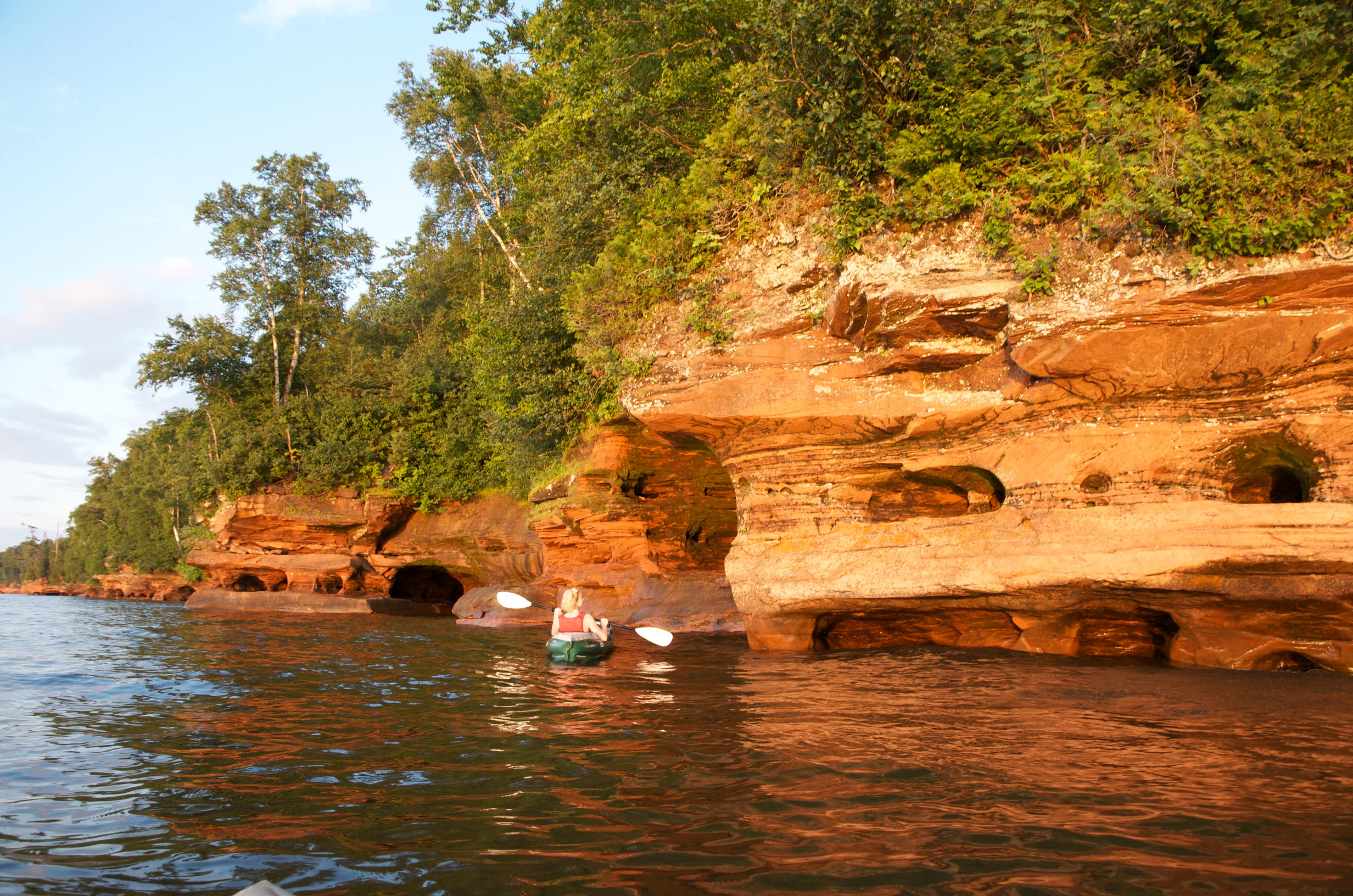
Two sea kayakers paddling on calm water near large red sandstone cliffs with sea caves and green trees on top.
Sea kayakers paddling near red sandstone sea caves along the shoreline of Apostle Islands National Lakeshore.

Apostle Islands National Lakeshore conservation status and protection priorities

Apostle Islands National Lakeshore protects 21 islands and a long stretch of Lake Superior shoreline that together safeguard significant examples of northern Lake Superior geology, coastal vegetation, and forest communities. The islands contain some of the few remaining old-growth stands in the region and a high concentration of rare and uncommon plant species for their latitude, supported by a cool maritime climate that contrasts with the surrounding mainland.

The most important single conservation milestone came in December 2004, when Congress designated approximately 80 percent of the park's land area, some 35,000 acres across eighteen of the Apostle Islands, as the Gaylord Nelson Wilderness. This designation, the largest in Wisconsin, prohibits motorized travel on the wilderness islands and helps ensure that the recovering forests, sea-cliff habitats, and interior wetlands continue to mature without further human alteration. Together with national lakeshore status, the wilderness designation protects both the ecological integrity of the islands and the broader visual and scenic character of Lake Superior's western shore.

Beyond ecological preservation, the lakeshore conserves cultural and historical resources tied to its maritime and industrial past. Nineteenth- and early twentieth-century quarry sites, logging camps, and lighthouses are managed as part of the protected landscape, maintaining an unusually complete picture of how the islands were used before they became a national lakeshore. The 2024 legislative proposal to redesignate the area as a national park, with a related national preserve for Sand Island, reflects ongoing recognition of the lakeshore's national significance.

Apostle Islands National Lakeshore cultural meaning and human context

The cultural context of the Apostle Islands is shaped by layers of Indigenous, French, and American maritime history. Native Americans likely visited the archipelago for centuries before European contact, and the islands' naming is traditionally attributed to Jesuit missionaries who gave the group its apostolic identity in keeping with practices of assigning sacred names to new lands. In the seventeenth century, the French explorer Étienne Brûlé passed through the islands as part of broader French Canadian ventures into the western Great Lakes, linking the archipelago to the wider story of French exploration and the fur trade.

Lighthouse keeping, commercial fishing, small-scale farming, logging, and sandstone quarrying defined the islands in the late nineteenth and early twentieth centuries. Quarrymen cut the distinctive red sandstone used in regional buildings, including the Old Bayfield County Courthouse that now serves as the park's headquarters. Lightkeepers and their families staffed remote stations such as Sand Island, Raspberry Island, and Michigan Island through some of the most punishing weather on the Great Lakes, contributing to a maritime heritage that the National Park Service has worked to preserve since the lights were transferred to it in 1986.

On the nearby mainland, the Red Cliff community, a federally recognized Ojibwe (Chippewa) band, anchors a living cultural and economic relationship with the lake and islands. Today, Bayfield functions as the gateway to the lakeshore, and seasonal community life, festivals, and tour-boat services connect the islands to broader regional identity in northern Wisconsin and along the Lake Superior shoreline.

Top sights and standout views in Apostle Islands National Lakeshore

The single most distinctive feature of Apostle Islands National Lakeshore is its density of natural and cultural landmarks in a relatively compact Great Lakes archipelago. Within a few square miles of inland Lake Superior waters, visitors can paddle past sculpted sandstone sea caves on Devils and Sand Islands, climb historic lighthouse towers on Sand, Raspberry, Devils, Outer, and Michigan Islands, and hike through regenerating northern hardwood and boreal forests on quiet wilderness islands.

The lakeshore is also notable for the breadth of protection it provides. It is simultaneously a national lakeshore, a wilderness area, and a major lighthouse collection, with eight lighthouse towers on six islands under one National Park Service umbrella. This layering of designations makes it an unusually rich site for understanding how the United States has approached the conservation of Lake Superior's complex cultural and natural systems.

Best time to visit Apostle Islands National Lakeshore

Summer is the most forgiving season for visiting Apostle Islands National Lakeshore, when Lake Superior is calmer, ferry and tour-boat services to islands like Sand, Devils, and Raspberry are running, and mainland daily highs in nearby Bayfield reach the mid-seventies Fahrenheit. The same season is when the sea caves are most safely viewed by kayak or boat and when the islands' trails and historic lighthouses are most accessible.

Autumn brings cooler weather, smaller crowds, and vivid fall color across the hardwood and boreal forests, though ferry schedules taper off as the season advances. Winter is a defining season in its own right: the islands receive substantial snowfall, the lake freezes around the shore in some years, and the mainland shapes dramatic ice formations on the sandstone cliffs, but access becomes far more limited and visitors should expect a quieter, weather-driven experience. Spring is variable and reflects the slow warming of Lake Superior, with cool temperatures, fog, and the gradual return of migrating waterfowl before summer services fully resume.

Monthly climate preview

Long-term temperature ranges and monthly precipitation averages for Wisconsin

Apostle Islands National Lakeshore Climate Normals and Annual Weather Patterns

Historical climate data from 1991 to 200 of a representative coordinate details the measured annual temperature rhythm and monthly precipitation distribution across Apostle Islands National Lakeshore. Examining the complete twelve-month record provides a comprehensive breakdown of average minimum and maximum temperatures alongside precipitation shifts.
Annual mean5 °C
-6 °C18 °C
Jan-6°
Feb-6°
Mar-2°
Apr
May
Jun11°
Jul16°
Aug18°
Sep15°
Oct
Nov
Dec-3°
Warmest month
August

18.2 °C

Coolest month
January

-6.2 °C

Wettest month
June

3.4 mm/day

Driest month
January

1.1 mm/day

Park location guide

Geography guide, regional context, and park location map for Apostle Islands National Lakeshore

Apostle Islands National Lakeshore park geography, regions, and map view in United States of America

Understand where Apostle Islands National Lakeshore sits in United States of America through a broader geographic reading of the surrounding landscape, nearby location context, and its mapped position within the national park landscape.

How Apostle Islands National Lakeshore fits into United States of America

The United States of America is a federal presidential republic and one of the world's largest countries by area and population. It consists of 50 states across a vast territory spanning multiple time zones, with its capital in Washington, D.C. and largest city in New York City. The nation has a diverse economy, influential political system, and significant cultural and military presence globally.

Wider geography shaping Apostle Islands National Lakeshore in United States of America

The United States occupies a vast territory in North America, bordered by Canada to the north and Mexico to the south. The 48 contiguous states stretch from the Atlantic to the Pacific Ocean, while Alaska occupies the northwestern region and Hawaii is an archipelago in the Pacific. The country encompasses diverse terrain including the Rocky Mountains, Appalachian Mountains, Great Plains, and extensive river systems.

Map view of Apostle Islands National Lakeshore

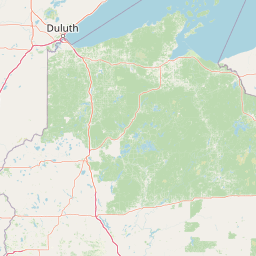
Use this park location map to pinpoint Apostle Islands National Lakeshore in United States of America, understand its exact geographic position, and read its mapped placement within the surrounding landscape more clearly.

Pigeon | © OpenStreetMap contributors

Location context for Apostle Islands National Lakeshore

Wisconsin
Natural feature types

Browse All Natural Features Within Apostle Islands National Lakeshore

Examine the rich physical geography of Apostle Islands National Lakeshore by exploring our comprehensive database of island landmarks and coastal formations. This index facilitates deep investigation into the specific geological and ecological elements that define this protected landscape through MoriAtlas.

Visual exploration of Lake Superior sea caves and protected island landscapes.

Apostle Islands National Lakeshore Photos and Scenery

Visual records capture the rugged red sandstone cliffs, sculpted sea caves, and forested archipelagos defining Apostle Islands National Lakeshore. Photographic documentation reveals the protected Lake Superior terrain, historic maritime structures, and diverse northern habitats.

Large white waves crashing against layered red sandstone rock formations along a shoreline, with green trees in the background under a blue sky.

A dirt hiking trail with a short wooden boardwalk section leads through a dense forest of tall coniferous and deciduous trees.

A sandy beach with small waves rolling in, bordered by a forest on the left and rocks in the foreground, under a blue sky with scattered clouds.

A tall white skeletal steel lighthouse tower stands on a grassy lawn with a shorter solid white lighthouse tower and small buildings in the background, surrounded by pine trees under an overcast sky.

Two sea kayakers paddling on calm water near large red sandstone cliffs with sea caves and green trees on top.

Wide landscape view of dense green forest covering rolling hills on an island, with a building visible on the left side and a body of water at the horizon under a clear blue sky.

Park atlas

Compare surrounding Great Lakes landscapes and related conservation lands

Parks Near Apostle Islands National Lakeshore And Regional Protected Areas

Continue exploring regional park geography by comparing protected areas adjacent to Apostle Islands National Lakeshore. Broadening the geographic scope reveals connected wilderness terrain and complementary shoreline habitats across the wider Upper Great Lakes.
Wildlife reserveBayfield County
48 km away#1 closest

Southwest

Rainbow Lake Wilderness: Protected Forest and Lake Mosaic in Bayfield County

Exploration of a designated wildlife reserve in northern Wisconsin

Rainbow Lake Wilderness presents a deeply forested landscape in northern Wisconsin, marked by a high density of sixteen named lakes and numerous ponds. Managed to maintain its natural character, this protected area in Bayfield County provides an essential look at the intersection of glacial geography, old-growth hardwood stands, and quiet aquatic habitats within a larger federal forest context.

Area
28.9 km²
Established
1975
IUCN
Ib
Relief
Upland
Wildlife reserveBayfield County
51 km away#2 closest

Southwest

Porcupine Lake Wilderness: Mapping the Protected Forest and Glacial Basins of Bayfield County

A federally designated wildlife reserve and forest landscape

Examine the geographic composition of Porcupine Lake Wilderness. This protected area features a dense network of glacial lakes, including the namesake Porcupine Lake and Eighteen Mile Spring Pond, surrounded by a rolling landscape of northern hardwoods and white pine. The mapped boundaries highlight a roadless wilderness that serves as a core forest habitat in northern Wisconsin.

Area
17.99 km²
Established
1984
IUCN
Ib
Relief
Upland
Nature reserveWisconsin
About 89 km away#3 closest

West

Lake Superior National Estuarine Research Reserve: Protected Landscape and Map Context

Freshwater estuarine geography in northwestern Wisconsin

Spanning the confluence of the St. Louis River and Lake Superior, this nature reserve preserves expansive coastal marshland, forested bluffs, and rare sand dune ecosystems. The area serves as a critical freshwater research site within the Great Lakes region, showcasing unique transitions between forest types and complex hydrologic structures shaped by wind driven seiche events.

Area
67.57 km²
Established
2010
Relief
Lowland
Scope
Mixed
National parkKeweenaw County
119 km away#4 closest

Northeast

Isle Royale National Park: Protected Landscape Atlas and Geographic Context

Explore mapped boundaries and natural terrain of this national park.

Isle Royale National Park offers a distinct opportunity for understanding protected landscapes through detailed map exploration. As a national park within Keweenaw County, its geographic identity and mapped boundaries provide valuable context for regional geography and atlas-based discovery. Investigate the natural terrain and protected land features that define this unique area, contributing to a richer comprehension of the surrounding protected areas.

Area
2,314 km²
Established
1940
IUCN
Ib
Visitors
29K annual
A pale, minimalist watercolor painting of a landscape with soft green hills, distant faded mountains, and a small, calm pool of water in the foreground.
Protected landscapeMichigan
About 137 km away#5 closest

Southeast

Ottawa National Forest: Mapped Geography and Protected Landscape Context in Michigan

Glacial watersheds and waterfall corridors of the Upper Peninsula

Ottawa National Forest represents a primary protected landscape within the western Upper Peninsula of Michigan. This atlas entry covers its hydrological significance, ranging from Lake Superior tributaries to regional drainage divides, alongside its role in preserving old-growth white and red pine stands within a broader boreal forest mosaic.

Area
4,020 km²
Established
1931
IUCN
VI
Relief
Upland
Wildlife reserveMichigan
182 km away#6 closest

East

McCormick Wilderness: Protected Forest and Hydrology in Michigan's Upper Peninsula

A federally protected wildlife reserve and river headwaters landscape

Centrally located within the western Upper Peninsula of Michigan, McCormick Wilderness preserves 17,000 acres of dense, regrown northern forest. The area is defined by its unusual density of river headwaters, providing significant ecological value as a quiet, roadless tract within the Ottawa National Forest network.

Area
69 km²
Established
1987
IUCN
Ib
Relief
Upland
National parkMinnesota
184 km away#7 closest

Northwest

Voyageurs National Park: Minnesota's Mapped Protected Landscape and Geography

Explore the atlas context and mapped park boundaries of Voyageurs National Park.

Voyageurs National Park in Minnesota is a key protected area offering rich geographic discovery. As a designated National Park, it provides a unique lens through which to study regional landscapes and mapped natural terrain. Users can delve into its protected boundaries and understand its specific identity within the broader Minnesota geography, making it a vital point for atlas-focused exploration.

Area
883 km²
Established
1975
IUCN
II
Visitors
239.7K annual
A watercolor painting of a rolling, soft-toned landscape with a foreground of green forest and layers of hills receding into the distance.
Protected landscapeUpper Peninsula of Michigan
254 km away#8 closest

East

Hiawatha National Forest: Geographic Overview and Protected Area Map of the Upper Peninsula

Coastal forest landscape and wilderness river corridors.

Hiawatha National Forest spans significant portions of the Upper Peninsula of Michigan, bridging the gap between northern hardwood forests and the boreal environments of the Great Lakes. This protected landscape encompasses extensive shorelines along Lake Superior, Lake Michigan, and Lake Huron, alongside six wilderness areas and five designated wild and scenic rivers.

Area
3,621.27 km²
Established
1931
IUCN
VI
Relief
Lowland

Common questions about visiting, size, designation, and location context for Apostle Islands National Lakeshore

Apostle Islands National Lakeshore FAQs for park facts, access, geography, and protected area context

Find quick answers about Apostle Islands National Lakeshore, including protected-area facts, park geography, trail and visitor context, and how the park fits into its surrounding country and regional landscape.
MoriAtlas Explorer

Continue Your Protected Areas Search Across the Global Atlas

Deepen your exploration by continuing the structured search for national parks and protected areas worldwide. Utilize the comprehensive filtering capabilities to compare different conservation landscapes and refine your understanding of global park geography. Discover more about the distribution and characteristics of protected natural areas.

Global natural geography
