Mori Atlas logo
National parkArabuko Sokoke National Park

Understand the mapped boundaries and regional geographic context of this key protected area.

Arabuko Sokoke National Park: A Protected National Park in Kenya's Coast Province

Arabuko Sokoke National Park stands as a significant protected natural area within the historic Coast Province of Kenya. This page provides detailed atlas-style information on its protected landscape identity and geographic setting. Explore the mapped boundaries and regional context of Arabuko Sokoke National Park, offering a focused view for geographic discovery and understanding its place within the mapped terrain of the former province.

coastal forestendemic speciesbirdwatchingEast AfricaKenyawetlands

Arabuko Sokoke National Park

National park

Park overview

Structured park overview, official facts, and landscape profile for Arabuko Sokoke National Park

Arabuko Sokoke National Park park facts, protected area profile, and essential visitor context
Review the core facts for Arabuko Sokoke National Park, including designation, size, terrain, visitor scale, habitats, and operating context in one park-focused overview.

About Arabuko Sokoke National Park

Arabuko Sokoke National Park represents the northernmost portion of a critical coastal forest ecosystem that stands as the largest remaining fragment of its kind in East Africa. Though the national park itself covers only about six square kilometres, it sits within the broader Arabuko Sokoke Forest Reserve, which spans approximately 420 square kilometres and represents what remains of extensive coastal forests that once stretched along the East African seaboard. The park's protection status was formalized in the late 1980s, though interestingly about half of its designated area lies outside the formal forest reserve boundary and falls within community-managed land where an electric elephant fence was installed in 2006-2007. The forest contains three distinct habitat types, each supporting unique assemblages of flora and fauna: mixed forest, Brachystegia woodland, and Cynometra forest. This habitat diversity contributes to the area's exceptional biodiversity value, making it one of the most important conservation sites in Kenya and the broader East African region.

Quick facts and research context for Arabuko Sokoke National Park

Arabuko Sokoke National Park occupies a narrow strip at the north-western boundary of the Arabuko Sokoke Forest Reserve along Kenya's Coast Province. The park covers approximately six square kilometres within a much larger 420-square-kilometre coastal forest ecosystem. Established in 1990, the park is administered by the Kenya Wildlife Service though it shares management responsibility with the Kenya Forest Service and other conservation partners for the broader reserve. The forest itself has a longer protection history, first designated as a Crown Forest in 1943 and formally gazetted in the 1960s. The area is renowned for its exceptional endemism, supporting species found nowhere else including Clarke's weaver, the Sokoke scops owl, and the golden-rumped elephant shrew.

Park context

Deeper park guide and search-rich context for Arabuko Sokoke National Park

Arabuko Sokoke National Park history, landscape, wildlife, and travel context
Explore Arabuko Sokoke National Park through its history, landscape character, ecosystems, wildlife, conservation priorities, cultural context, and seasonal travel timing in a structured park guide built for atlas discovery and search intent.

Why Arabuko Sokoke National Park stands out

Arabuko Sokoke is globally significant for its extraordinary concentration of endemic species. The forest supports multiple bird species that exist nowhere else on Earth, most notably Clarke's weaver, which is completely endemic to this ecosystem, as well as the Sokoke scops owl, Sokoke pipit, Amani sunbird, and spotted ground thrush, all of which are found only here and in a disconnected forest fragment in Tanzania. The park also protects notable endemic mammals including the golden-rumped elephant shrew, one of the most recognizable small mammals in the area, the elusive Sokoke bushy-tailed mongoose, and Aders's duiker, which occurs only here and on Zanzibar. The adjacent Mida Creek mangrove system adds marine and avian diversity, serving as an important wintering ground for shorebirds such as the Terek sandpiper and crab plover.

Arabuko Sokoke National Park history and protected-area timeline

The Arabuko Sokoke area has a long history of formal protection, with the forest first receiving Crown Forest status in 1943 during Kenya's colonial period. The forest was formally gazetted as a reserve during the 1960s following independence, establishing the foundational legal framework for its ongoing conservation. The national park designation came considerably later, with formal gazettment occurring in the late 1980s and the area officially established in 1990 under the administration of the Kenya Wildlife Service. This relatively recent national park status reflects the evolution of Kenya's protected area network and growing recognition of the forest's exceptional biodiversity value. The collaborative management arrangement that exists today, involving multiple government agencies, research institutions, community forest associations, and non-governmental conservation partners, developed over subsequent decades as the importance of coordinated stewardship for this coastal forest ecosystem became increasingly apparent.

Arabuko Sokoke National Park landscape and geographic character

The Arabuko Sokoke landscape is defined by a sequence of three forest types that create a complex and ecologically diverse environment. The mixed forest zone supports the greatest variety of tree species and provides habitat for most of the forest's endemic bird species. The Brachystegia woodland, characterized by the distinctive Brachystegia tree species, forms a more open canopy environment supporting different wildlife communities. The Cynometra forest type occupies lower-lying areas and represents a distinct ecological zone with its own characteristic species assemblages. The park lies near the coast at relatively low elevation, with the landscape transitioning to mangrove habitats at nearby Mida Creek where tidal influence creates a different environmental character. The forest reserve as a whole represents a remnant of the extensive coastal forest ecosystem that once covered much of the East African coast, now reduced to this significant but fragmented remnant.

Arabuko Sokoke National Park ecosystems, habitats, and plant life

The ecological character of Arabuko Sokoke is defined by its position as the largest remaining coastal forest in East Africa and its remarkable biodiversity. The three forest types present within the reserve each support distinct plant and animal communities, creating a mosaic of habitats within a relatively compact area. The forest supports exceptional levels of endemism across multiple taxonomic groups, with species that have evolved in isolation and occur nowhere else on the planet. The proximity to Mida Creek, a extensive mangrove system, extends the ecological diversity beyond the forest itself, creating an interface between terrestrial and marine environments that supports additional species groups. The area is also recognized as an outstanding centre of amphibian diversity, adding another dimension to its ecological significance. This combination of forest types, endemic species, and adjacent marine habitats makes the ecosystem exceptionally valuable from a conservation perspective.

Arabuko Sokoke National Park wildlife and species highlights

Arabuko Sokoke harbours an extraordinary assembly of endemic and near-endemic wildlife that distinguishes it as one of Africa's most important biodiversity sites. The bird fauna is particularly remarkable, with Clarke's weaver being completely endemic to the forest while other species including the Sokoke scops owl, Sokoke pipit, Amani sunbird, and spotted ground thrush are found only here and in a disconnected Tanzanian forest fragment. The mammalian fauna includes several highly sought-after endemic species, most famously the golden-rumped elephant shrew, a distinctive small mammal that has become somewhat of a flagship species for the reserve. The Sokoke bushy-tailed mongoose and Aders's duiker represent more elusive residents, with the latter also occurring on Zanzibar. Larger mammals present include savannah elephants, African civets, baboons, and vervet monkeys. The surrounding mangrove at Mida Creek supports significant shorebird populations during the northern hemisphere's winter months, with species such as the Terek sandpiper and crab plover utilizing this important coastal habitat.

Arabuko Sokoke National Park conservation status and protection priorities

Arabuko Sokoke represents a conservation priority of international significance due to its irreplaceable biodiversity and the extremely restricted distribution of many endemic species. The forest's status as the largest remaining coastal forest fragment in East Africa gives it added importance, as it serves as a refuge for species that have lost habitat elsewhere across the region. Multiple conservation organizations work alongside the Kenya Wildlife Service and Kenya Forest Service to address the ongoing pressures the forest faces, particularly from land conversion pressure by local communities. The collaborative management arrangement involving government agencies, research institutions, community forest associations, and Friends of Arabuko Sokoke represents a model for integrated conservation. The gazettment of the national park in the late 1980s added formal protection though the broader forest reserve had been protected since the mid-twentieth century, and the 2006-2007 installation of an electric elephant fence reflects ongoing efforts to mitigate human-wildlife conflict at the forest boundaries.

Arabuko Sokoke National Park cultural meaning and human context

The Arabuko Sokoke area exists within a landscape where human communities and forest ecosystems have interacted for generations. The forest reserve and national park occupy territory that has historically supported local communities, and the contemporary conservation context must balance protection objectives with the livelihood needs of surrounding populations. The fact that roughly half of the national park lies outside the formal forest reserve boundary and within community-managed land demonstrates this ongoing human presence in the landscape. Community Forest Associations participate in the collaborative management framework for the reserve, reflecting recognition that successful conservation in this context requires engaging with local stakeholders. The surrounding coastal region near Malindi has a rich history as part of Kenya's maritime zone and the broader Swahili Coast cultural zone.

Top sights and standout views in Arabuko Sokoke National Park

Arabuko Sokoke National Park offers exceptional opportunities to encounter endemic species found nowhere else on Earth in a compact coastal forest setting. The forest's three distinct habitat types support different wildlife communities, creating a remarkably diverse experience within a relatively small area. Birdwatchers particularly value the chance to observe Clarke's weaver, the Sokoke scops owl, and the Sokoke pipit in their natural habitat. The golden-rumped elephant shrew represents one of Africa's more unusual small mammals and draws significant scientific and wildlife tourism interest. The proximity to Mida Creek mangrove adds coastal and marine diversity, with shorebird viewing complementing the forest-based wildlife experiences. The park serves as a critical conservation refuge for species with extremely restricted ranges, making every encounter with endemic wildlife meaningful.

Best time to visit Arabuko Sokoke National Park

The optimal period for visiting Arabuko Sokoke falls during Kenya's dry seasons, typically from December through March and again from June through October, when wildlife viewing conditions are most favorable and forest trails are more accessible. The long rains from April into early June can make some trails muddy and less suitable for exploration, while the short rains from November into December may also affect visibility but generally present fewer obstacles than the heavier seasonal rainfall. The dry seasons offer more comfortable conditions for walking safaris and birdwatching activities within the forest, though the park's compact size means it can be explored effectively year-round for those with specific interests such as amphibian observation during the wetter periods. Early morning visits maximize wildlife viewing opportunities, particularly for bird species that are most active during the cooler hours.
Park location guide

Geography guide, regional context, and park location map for Arabuko Sokoke National Park

Arabuko Sokoke National Park park geography, regions, and map view in Kenya
Understand where Arabuko Sokoke National Park sits in Kenya through a broader geographic reading of the surrounding landscape, nearby location context, and its mapped position within the national park landscape.

How Arabuko Sokoke National Park fits into Kenya

Kenya is a presidential republic in East Africa and the seventh-most populous country on the continent. Its capital is Nairobi, and it borders five countries and the Indian Ocean. The country features significant geographic diversity including Mount Kenya, the Rift Valley, and coastal regions.

Wider geography shaping Arabuko Sokoke National Park in Kenya

Kenya is located in East Africa, bordering South Sudan to the northwest, Ethiopia to the north, Somalia to the east, Tanzania to the southwest, and Uganda and Lake Victoria to the west. The southeastern border meets the Indian Ocean. The geography includes the Rift Valley highlands with Mount Kenya, coastal plains, and northern arid regions.

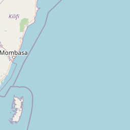
Map view of Arabuko Sokoke National Park

Use this park location map to pinpoint Arabuko Sokoke National Park in Kenya, understand its exact geographic position, and read its mapped placement within the surrounding landscape more clearly.

Pigeon | © OpenStreetMap contributors

Location context for Arabuko Sokoke National Park

Coast Province
Park atlas

Explore adjacent protected landscapes, compare other parks within Kenya's coastal forest region, and trace East African conservation efforts.

Discover More Protected Areas Near Arabuko Sokoke National Park and Kenya's Coastal Region
Continue your exploration beyond Arabuko Sokoke National Park by browsing other national parks and protected areas within Kenya's unique coastal forest region. Compare mapped geography, conservation landscapes, and ecological diversity to deepen your understanding of the protected areas surrounding this globally significant coastal forest.
Marine protected areaKenya

Watamu Marine National Park: Coastal Protected Marine Landscape in Kenya

Explore mapped boundaries and regional geography.

Watamu Marine National Park represents a crucial marine protected area situated on Kenya's coastline, contributing significantly to the country's conservation landscape. This designation underscores its role in preserving coastal and underwater geography, making it a key entity for atlas exploration of protected marine environments. Understanding its specific geographic scope and mapped protected boundaries is essential for comprehending Kenya's broader environmental atlas.

Established
1968
Relief
Lowland
Climate
Tropical
Access
Moderate access
Watercolor painting showing a landscape with mountains in the background, green hills in the midground, and water or wetland in the foreground
National parkKenya

Malindi Marine National Park: Kenya's National Park Atlas of Coastal Protected Lands

Explore mapped marine geography and protected landscape context.

Malindi Marine National Park is a protected national park situated along Kenya's coast, contributing to the nation's atlas of conservation landscapes. This entry details the park's specific geographic identity, its mapped boundaries, and its role as a protected marine environment. Engage with its regional context and understand how its protected status shapes its unique landscape for a deeper geographic appreciation.

Relief
Lowland
Climate
Tropical
Access
Access unknown
Scope
Marine
National parkKenya

Tsavo East National Park: Kenya's Protected Natural Landscape for Geographic Exploration

Explore mapped boundaries and regional park geography.

Tsavo East National Park in Kenya offers a rich entry point for understanding protected landscapes and regional geography. As a designated national park, its mapped boundaries and natural terrain provide essential context for geographic exploration within East Africa. This page serves as a focused discovery point for the park's specific environmental attributes and its role in the broader atlas of protected areas.

Area
13,747 km²
Established
1948
IUCN
II
Relief
Lowland
Watercolor illustration of a hilly landscape with green and pink hues, showing trees, distant hills, and a light sky
National parkKenya

Kisite-Mpunguti Marine National Park: Kenya's Coastal Protected Marine Landscape

Mapped coral reefs and diverse marine ecosystems.

As Kenya's foremost marine national park, Kisite-Mpunguti Marine National Park presents an unparalleled opportunity to explore a thriving underwater world. Its protected boundaries encompass remarkable coral formations and a rich tapestry of marine species, including diverse fish populations, sea turtles, and dolphins. This park is a cornerstone of coastal conservation, offering valuable insights into marine geography and ecosystem health for those seeking detailed landscape context.

Area
39 km²
Established
1973
IUCN
II
Relief
Lowland
National parkTanzania

Mkomazi National Park: Tanzania's Vast Protected Savanna Landscape and Wildlife Geography

Explore its mapped terrain and conservation significance within East Africa.

Mkomazi National Park is a critical protected landscape in Tanzania, spanning over 3,200 square kilometers of classic East African semi-arid savanna woodland. This national park offers a unique atlas-style view into conservation success, particularly for its black rhinoceros sanctuary and African wild dog programs. Its landscape is characterized by rolling terrain and Acacia-Commiphora vegetation, forming a vital transboundary conservation area with Kenya that supports significant wildlife migration corridors and provides a distinct geographic context within the broader regional atlas.

Area
3,234 km²
Established
2006
IUCN
II
Visitors
1.6K annual
National parkTaita-Taveta County

Tsavo West National Park: Kenya's Protected National Park and Regional Geography

Explore mapped boundaries and natural landscapes in Taita-Taveta County.

Tsavo West National Park offers a focused exploration of protected landscape and regional geography within Kenya. Discover the mapped extent of this national park, understanding its role as a conservation area in Taita-Taveta County. This entry provides key geographic context and atlas-style information, highlighting the natural terrain and protected boundaries for detailed discovery.

Area
9,065 km²
Established
1948
IUCN
II
Relief
Mixed relief
National parkKilimanjaro Region

Kilimanjaro National Park: Protected Landscape Geography and Atlas Exploration

Explore its mapped boundaries and regional context.

Delve into Kilimanjaro National Park, a protected national park situated in the Kilimanjaro Region. This detail page offers an atlas-driven view of the park's geographic scope, focusing on its mapped boundaries and the surrounding natural landscape. Understand the unique terrain and regional context that make this protected area a significant feature within Tanzania's geography.

Area
1,688 km²
Established
1973
IUCN
II
Visitors
52K annual
National parkLower Juba

Lag Badana National Park National Park: Mapped Geography and Protected Landscape Context

Explore the distinct geographic identity of this protected national park.

Lag Badana National Park is a designated national park within the Lower Juba region, offering a focused look at protected landscapes and regional geography. This entry provides an atlas-oriented perspective on the park's mapped boundaries and its significance as a conservation area. Understand its place within the broader geographic context of Somalia through its defined park lands.

Area
3,340 km²
IUCN
II
Climate
Tropical
Scope
Mixed

Common questions about visiting, size, designation, and location context for Arabuko Sokoke National Park

Arabuko Sokoke National Park FAQs for park facts, access, geography, and protected area context
Find quick answers about Arabuko Sokoke National Park, including protected-area facts, park geography, trail and visitor context, and how the park fits into its surrounding country and regional landscape.
MoriAtlas Explorer

Continue Your Protected Areas Search Across the Global Atlas

Deepen your exploration by continuing the structured search for national parks and protected areas worldwide. Utilize the comprehensive filtering capabilities to compare different conservation landscapes and refine your understanding of global park geography. Discover more about the distribution and characteristics of protected natural areas.

Global natural geography