
Mori Atlas logo
National parkAshkelon National Park

Discover the mapped boundaries and distinct geography of an ancient coastal city preserved as a national park.

Ashkelon National Park: A Millennia-Strata Protected Landscape on Israel's Mediterranean Coast

Ashkelon National Park preserves the profound archaeological depth of one of the world's oldest continuously inhabited cities, set along the Mediterranean coast of Israel. This protected area reveals a remarkable stratification of civilizations, from the Bronze Age gate with the earliest known arch to imposing Fatimid walls and Roman-era structures. Its coastal location and the distinct natural terrain shape the context for exploring these extensive historical remains, offering a unique window into millennia of human habitation and landscape evolution.

Archaeological siteAncient ruinsMediterranean coastPhilistine historyRoman archaeologyHistoric walls
Stylized illustration showing mountains, waterfall, river, and pine trees under a sky with clouds

Ashkelon National Park

National park

Park overview

Structured park overview, official facts, and landscape profile for Ashkelon National Park

Ashkelon National Park park facts, protected area profile, and essential visitor context

Review the core facts for Ashkelon National Park, including designation, size, terrain, visitor scale, habitats, and operating context in one park-focused overview.

About Ashkelon National Park

Ashkelon National Park serves as a window into the ancient world, preserving the physical remains of a city that played pivotal roles in biblical history, classical antiquity, and medieval crusader politics. The site lies along the Mediterranean shoreline, where the coastal plain meets the historic trade routes that connected Egypt, Mesopotamia, and the broader Mediterranean basin. The park's boundaries encompass the heart of ancient Ascalon, a city mentioned in Egyptian texts, the Hebrew Bible, and classical Greek and Roman sources. The multi-layered archaeology reflects the city's strategic importance as a port and its resilience through numerous conquests and reconstructions. Visitors walk among the foundations, columns, and walls of civilizations that built upon each other's work, creating a palimpsest of human settlement spanning nearly four millennia. The Fatimid walls, though reduced from their original height of 15 meters, still define the park's perimeter and create a tangible connection to the medieval period when Ascalon served as a fortified outpost of the Islamic caliphate.

Quick facts and research context for Ashkelon National Park

Ashkelon National Park protects the ruins of ancient Ascalon, located on the Mediterranean coast in southern Israel. The site contains the world's earliest known arch, dating to approximately 1850 BCE, at a Middle Bronze Age gate. The Fatimid-era walls from the 12th century are among the best-preserved elements, originally measuring 2,200 meters in length. Archaeological work has been conducted at the site since 1815, with major excavations by Lady Hester Stanhope, the British School of Archaeology in Jerusalem, Harvard University, and the Israel Antiquities Authority. The park also incorporates land formerly belonging to the Palestinian village of Al-Jura.

Protection and recognition

Geographic conservation framework, terrestrial scope, and global designation index

Ashkelon National Park Protection Status and Protected Area Designation

Terrestrial conservation parameters define the official management scope and protection status of Ashkelon National Park. Documented records outline the designation history and track whether any international conservation frameworks or global designations apply to the coastal territory.

Protection details

Protection scope
Terrestrial
Transboundary protection
No
Park context

Deeper park guide and search-rich context for Ashkelon National Park

Ashkelon National Park history, landscape, wildlife, and travel context

Explore Ashkelon National Park through its history, landscape character, ecosystems, wildlife, conservation priorities, cultural context, and seasonal travel timing in a structured park guide built for atlas discovery and search intent.

Why Ashkelon National Park stands out

Ashkelon National Park is best known for its extraordinary archaeological depth, preserving remains from multiple millennia of continuous habitation. The Middle Bronze Age gate with the world's oldest known arch represents a landmark in architectural history. The Roman ruins, including a basilica complex with imported marble columns and capitals from Asia Minor, showcase the city's importance during the Herodian period. The discovery of the largest known dog cemetery from the ancient world adds a unique dimension to the site's significance. The Fatimid-era fortifications, though partially ruined, remain visually commanding and provide a clear sense of the city's medieval scale.
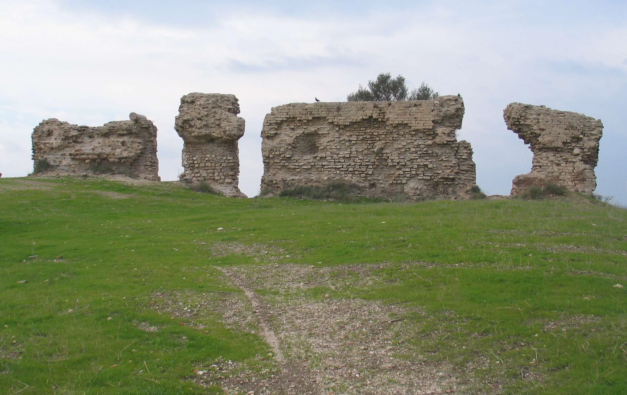
Stone ruins on a grassy hill with a dirt path leading up to them under a partly cloudy sky.
Ancient stone ruins on a grassy hillside in Ashkelon National Park.

Ashkelon National Park history and protected-area timeline

The history of Ashkelon as a protected area begins with the recognition of its extraordinary archaeological value in the modern era. The first modern archaeological excavation occurred in 1815, when Lady Hester Stanhope conducted pioneering work at the site, becoming one of the first women to lead such an expedition in the region. Her work focused on the mosque area and revealed the site's multi-phase history, including its transformation from a pagan temple to a church and then a mosque. The British School of Archaeology in Jerusalem conducted excavations in 1921, focusing on the Roman-era columns and identifying what they determined to be a municipal council hall dating to Herod the Great's reign. The park's establishment as a national park incorporated not only the ancient city but also the land of the Palestinian village Al-Jura, which was depopulated during the 1948 war and subsequently absorbed into the preserve. Harvard University's archaeological program, led by Lawrence Stager beginning in 1985, has conducted the most sustained excavation work, with particular focus since 2007 on the Early Iron Age and Late Bronze Age periods. The Israel Antiquities Authority continues active excavation work, with significant recent discoveries including a Roman basilica complex dating to Herod's reign announced in 2021.

Ashkelon National Park landscape and geographic character

The park occupies a coastal position along the Mediterranean Sea, where the ancient city benefited from both maritime trade access and defensive advantages. The landscape is characterized by the relatively flat terrain of the coastal plain, though centuries of accumulated archaeological material have created an undulating terrain of foundations, walls, and eroded structures. The Fatimid wall, constructed of local limestone, follows a roughly rectangular perimeter, with more substantial remains surviving in the eastern and southern sections. The Mediterranean shoreline provides a western boundary, and the proximity to the sea influenced Ascalon's development as a major port city throughout antiquity. The modern park includes areas of exposed archaeological remains interspersed with sections where excavation has not yet occurred, creating a landscape that alternates between defined ruins and areas of archaeological potential.
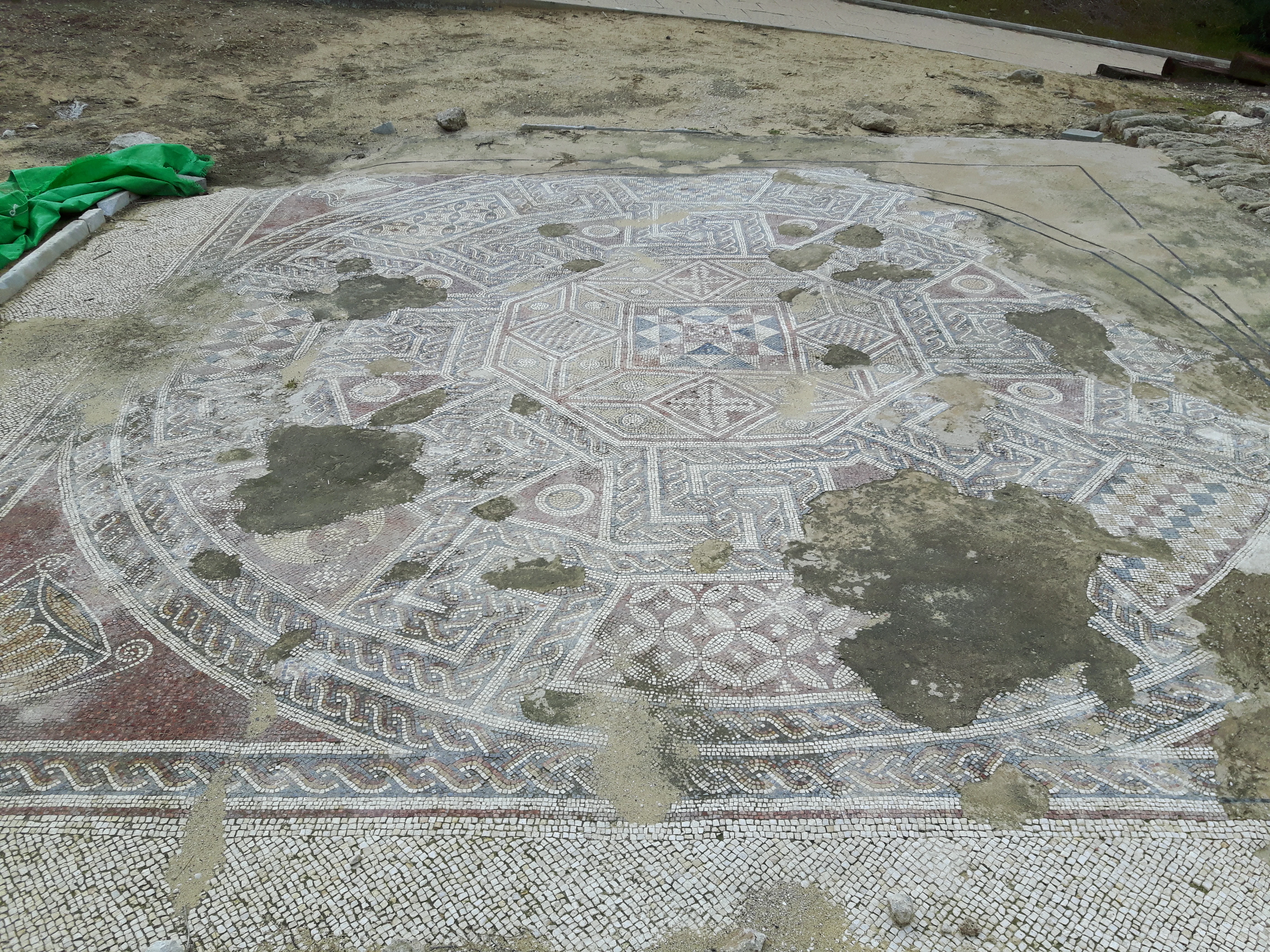
A large circular mosaic floor with geometric patterns and areas of missing tiles, situated in an archaeological site
Mosaic floor remains at Ashkelon National Park

Ashkelon National Park ecosystems, habitats, and plant life

As an archaeological preserve rather than a nature reserve, Ashkelon National Park's ecological character is secondary to its historical significance. The coastal Mediterranean setting supports typical vegetation of the Israeli coastal plain, though the heavily disturbed nature of the site due to millennia of construction and excavation has limited natural habitat development. The archaeological importance takes precedence, and management focuses on preservation and interpretation of the structural remains rather than ecological conservation. The park does provide some habitat for coastal bird species and small fauna typical of the region, but this is not a primary feature of the preserve.

Ashkelon National Park wildlife and species highlights

Wildlife at Ashkelon National Park is limited by the site's intensive archaeological character and high visitor traffic. The coastal location attracts some bird species associated with Mediterranean shoreline habitats, particularly during migration seasons. Small mammals and reptiles typical of the Israeli coastal plain may inhabit the less-disturbed areas of the park periphery. The most famous animal-related discovery at the site is not wildlife in the living sense but rather the archaeological remains of the largest known dog cemetery from the ancient world, dating to the Roman period. This unusual burial practice, with hundreds of dogs interred, reflects specific cultural practices of the city's inhabitants rather than contemporary wildlife.

Ashkelon National Park conservation status and protection priorities

Ashkelon National Park represents an important conservation priority as a repository of archaeological heritage spanning multiple millennia. The site's significance has been recognized through its designation as a national park and through sustained archaeological excavation programs. Conservation challenges include the preservation of exposed structures, particularly the Roman and Byzantine remains that are vulnerable to weathering and coastal salt exposure. The Fatimid walls require ongoing stabilization work to prevent further deterioration. The Israel Antiquities Authority's continued excavation work, combined with conservation measures, aims to balance public access with preservation of the fragile remains. The site is also protected under Israeli heritage preservation laws.

Ashkelon National Park cultural meaning and human context

Ashkelon occupies a profound place in the cultural and religious history of the eastern Mediterranean. The city appears in ancient Egyptian texts as early as the 19th century BCE and is mentioned numerous times in the Hebrew Bible as a major Philistine city. The biblical narrative associates Ashkelon with Samson and other key figures, embedding the site deeply in Jewish cultural memory. In classical antiquity, Ascalon functioned as a significant Hellenistic and Roman city, with the discovered basilica and imported marble columns demonstrating its prosperity during the Roman period. The medieval period saw the city become a contested stronghold between Muslim powers and crusader forces. The park's incorporation of Al-Jura adds a more recent layer to the site's cultural complexity, reflecting the modern history of the region.

Top sights and standout views in Ashkelon National Park

The Middle Bronze Age gate with the world's earliest known arch stands as the park's most architecturally significant feature, representing a milestone in the development of vaulted construction. The Fatimid walls from the 12th century provide the most visually imposing structural remains, with their substantial scale still evident despite centuries of deterioration. The Roman basilica complex, with its imported marble columns and capitals, offers insight into the city's Roman-period grandeur. The archaeological excavation areas, particularly Grid 38 where continuous occupation from the Early Bronze Age through the Islamic period has been documented, provide a unique educational resource for understanding urban development patterns. The dog cemetery, while macabre by modern standards, represents a unique archaeological phenomenon with no known parallel in the ancient world.

Best time to visit Ashkelon National Park

The optimal time to visit Ashkelon National Park is during the cooler months from October through April, when temperatures are more comfortable for walking the extensive site. Summer months can bring intense heat along the Mediterranean coast, making prolonged exploration uncomfortable. The winter season may see occasional rain, but this is generally not severe enough to significantly impact visits. Morning visits are recommended to avoid the strongest afternoon sun, particularly in the warmer months. The park can be enjoyed in any season, but the cooler periods allow for more extended exploration of the outdoor archaeological remains.

Monthly climate preview

Analyze long term temperature averages and seasonal precipitation cycles along the Mediterranean coast.

Ashkelon National Park Average Temperature and Weather by Month Patterns

Decades of climate data from the representative park coordinate at thirty-eight meters of elevation show a distinct warm, dry summer profile transitioning to mild, wetter winter intervals. Accessing the complete monthly climate dataset for Ashkelon National Park reveals precise average maximums, minimums, and daily precipitation rates to map the regional seasonal cycle.
Annual mean21 °C
15 °C27 °C
Jan15°
Feb15°
Mar16°
Apr19°
May22°
Jun25°
Jul27°
Aug27°
Sep26°
Oct24°
Nov21°
Dec17°
Warmest month
August

27.4 °C

Coolest month
January

14.5 °C

Wettest month
January

1.8 mm/day

Driest month
June

0 mm/day

Park location guide

Geography guide, regional context, and park location map for Ashkelon National Park

Ashkelon National Park park geography, regions, and map view in Israel

Understand where Ashkelon National Park sits in Israel through a broader geographic reading of the surrounding landscape, nearby location context, and its mapped position within the national park landscape.

How Ashkelon National Park fits into Israel

Israel is a parliamentary republic in the Southern Levant, established in 1948 as a Jewish homeland. It borders Lebanon, Syria, Jordan, and Egypt, with Mediterranean coastline and access to the Red Sea. Jerusalem is the capital, though its status is contested, while Tel Aviv is the largest urban area. The country has a high-income economy with strong technology and innovation sectors.

Wider geography shaping Ashkelon National Park in Israel

Israel occupies the Southern Levant region of West Asia. It is bordered by Lebanon to the north, Syria to the northeast, Jordan to the east, and Egypt to the southwest. The western coast lies on the Mediterranean Sea, while the southern tip reaches the Red Sea. The eastern border includes the Dead Sea, Earth's lowest point. The country occupies the West Bank, Gaza Strip, and Golan Heights.

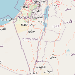
Map view of Ashkelon National Park

Use this park location map to pinpoint Ashkelon National Park in Israel, understand its exact geographic position, and read its mapped placement within the surrounding landscape more clearly.

Pigeon | © OpenStreetMap contributors

A visual reference for understanding Ashkelon National Park's historic walls, archaeological layers, and Mediterranean coastal protected-area environment.

Ashkelon National Park Images: Explore Ancient Ruins, Coastal Landscapes, and Protected-Area Scenery

Browse a curated collection of Ashkelon National Park photos to visually grasp its distinct archaeological landscape, extensive ancient ruins, and captivating Mediterranean coastal scenery. These images illuminate the park's historical stratification, from the commanding Fatimid walls to the subtle undulations of millennia-old foundations, offering deeper insight into its protected-area character.

Stone ruins on a grassy hill with a dirt path leading up to them under a partly cloudy sky.

Stone columns and ancient stone ruins with scattered stones and vegetation in a coastal area

A large circular mosaic floor with geometric patterns and areas of missing tiles, situated in an archaeological site

Park atlas

Trace the regional protected landscapes surrounding Ashkelon National Park, mapping archaeological and natural reserves.

Explore Surrounding Protected Areas and National Parks Near Ashkelon National Park

Continue exploring beyond Ashkelon National Park by browsing other national parks and protected areas within the wider regional geography. Compare diverse protected landscapes, such as archaeological sites, coastal reserves, and natural areas, to understand broader conservation patterns.
Nature reserveGaza Strip
About 27 km away#1 closest

Southwest

Wadi Gaza Nature Reserve: Geographic Overview and Protected Coastal Wetland Mapping

Essential protected land data for the Gaza Strip coastal wetland

Wadi Gaza Nature Reserve forms a vital ecological seam within the Gaza Strip, encompassing the active riverbed, floodplain, and vegetated margins of the wadi as it meets the Mediterranean Sea. This protected area supports rare wetland habitats and serves as a major migration flyway for waterbirds, standing as a significant conservation feature within the coastal landscape.

Established
2000
Relief
Lowland
Climate
Mediterranean
Access
Access unknown
National parkIsrael
About 34 km away#2 closest

East

Beit Guvrin-Maresha National Park: A Mapped Exploration of Israel's Ancient Subterranean Heritage

Discover unique bell caves and archaeological landscape in the Judean lowlands.

Beit Guvrin-Maresha National Park in Israel presents a unique atlas-style discovery of a landscape defined by ancient human excavation. Explore the vast networks of bell caves, Phoenician necropolises, and Byzantine underground churches carved into the soft limestone hillsides. This protected area offers a compelling journey through millennia of history, revealing the geography and terrain shaped by continuous habitation and burial practices, making it a vital site for understanding regional archaeology and ancient cave systems.

IUCN
V
Water
No major water
Watercolor illustration showing a winding river through green hills with distant trees under a light sky
National parkIsrael
About 40 km away#3 closest

South

Eshkol National Park: Desert Wetland Oasis with Archaeological Significance in Southern Israel

Mapped protected area featuring Ein HaBesor spring and Besor valley landscapes.

Eshkol National Park showcases a rare desert wetland environment sustained by the significant Ein HaBesor spring in Israel's Northern Negev. This protected natural area offers a distinctive landscape where water nourishes lush vegetation against the backdrop of arid terrain. Beyond its ecological value, the park encompasses archaeological remnants, including the mound of Khirbet Shalala, providing a rich geographical and historical discovery context within the Besor Stream basin.

Area
3.54 km²
Relief
Lowland
Climate
Arid
Access
Easy access
National parkIsrael
About 54 km away#4 closest

Southeast

Tel Be'er Sheva National Park: Mapped Boundaries and Protected Landscape Identity

Discover its geographic context within Israel's natural terrain.

This MoriAtlas detail page for Tel Be'er Sheva National Park provides focused insights into its identity as a protected landscape. Users can explore its specific geographic setting within Israel, understand its mapped boundaries, and gain a clearer appreciation for its natural terrain. The content is designed to support detailed atlas-based discovery, offering a comprehensive view of the park's protected area characteristics and regional geographic significance.

National parkIsrael
About 57 km away#5 closest

East

Ein Hemed National Park: Mapped Protected Landscape in Israel's Geography

Discover the natural terrain and park boundaries.

Ein Hemed National Park is a designated national park in Israel, providing valuable insight into its protected natural landscapes and regional geography. This entry focuses on understanding the park's physical setting and its mapped boundaries, essential for atlas-based exploration. Examine the terrain and discover the geographic significance of this protected area within the Israeli context.

Access
Access unknown
Scope
Terrestrial
National parkIsrael
About 59 km away#6 closest

East

Castel National Park: A National Park for Geographic Discovery in Israel

Investigate the mapped protected landscape and regional terrain.

Castel National Park represents a key protected area within Israel, focusing on the discovery of its mapped terrain and geographic identity. As a national park, it serves as a crucial entity for understanding regional conservation landscapes and the distribution of protected areas across Israel. This detailed view allows for focused exploration of the park's boundaries and its contribution to the country's natural heritage, offering valuable context for atlas-based geographical inquiry.

Relief
Mountain
Climate
Mediterranean
Scope
Terrestrial
Water
No major water
National parkIsrael
About 61 km away#7 closest

Northeast

Yarkon-Tel Afek National Park: Explore Its Protected Landscape and Israeli Geography

Mapped protected area and natural terrain context.

Gain a structured understanding of Yarkon-Tel Afek National Park, a designated national park within Israel. This detail entry focuses on its geographic identity and role as a protected landscape, providing essential context for atlas exploration. Understand the park's mapped boundaries and its contribution to the natural geography of the region without extraneous visitor details.

Scope
Terrestrial
Water
Minor water
National parkIsrael
About 66 km away#8 closest

East

Herodion National Park: A Key National Park within Israel's Protected Landscape Atlas

Explore its mapped boundaries and geographic terrain.

Herodion National Park stands as a significant protected area within Israel, contributing vital context to the nation's atlas of natural landscapes. This national park designation highlights its role in conservation and offers a unique opportunity to study its specific geography, terrain, and mapped boundaries. By focusing on the park's protected landscape identity, users can gain structured insights into Israel's conservation efforts and regional geographic features, enhancing any atlas exploration.

Scope
Terrestrial

Common questions about visiting, size, designation, and location context for Ashkelon National Park

Ashkelon National Park FAQs for park facts, access, geography, and protected area context

Find quick answers about Ashkelon National Park, including protected-area facts, park geography, trail and visitor context, and how the park fits into its surrounding country and regional landscape.
MoriAtlas Explorer

Continue Your Protected Areas Search Across the Global Atlas

Deepen your exploration by continuing the structured search for national parks and protected areas worldwide. Utilize the comprehensive filtering capabilities to compare different conservation landscapes and refine your understanding of global park geography. Discover more about the distribution and characteristics of protected natural areas.

Global natural geography