Mori Atlas logo
National parkEshkol National Park

Discover the mapped protected boundaries and unique ecology of this vital spring in the arid Northern Negev.

Eshkol National Park: A Desert Wetland Oasis and Archaeological Landscape in Southern Israel

Eshkol National Park represents a unique protected landscape within Israel's arid Northern Negev region, centered around Ein HaBesor, the largest spring in the Besor Stream basin. This vital desert wetland oasis is sustained by a near-surface aquifer, creating a lush environment contrasting sharply with the surrounding semi-arid terrain. The park offers a glimpse into a landscape where natural springs meet significant archaeological sites, providing a rich context for exploration and understanding the geography of southern Israel.

Desert WetlandsSprings and AquifersArchaeological SitesNorthern NegevRiparian HabitatsByzantine History
Illustration of palm trees, yellow flowers, and green fields with mountains in the background under a pink sky

Eshkol National Park

National park

Park overview

Structured park overview, official facts, and landscape profile for Eshkol National Park

Eshkol National Park park facts, protected area profile, and essential visitor context
Review the core facts for Eshkol National Park, including designation, size, terrain, visitor scale, habitats, and operating context in one park-focused overview.

About Eshkol National Park

Eshkol National Park occupies a distinctive position in Israel's protected area network as a desert wetland sanctuary in the Northern Negev. The park's defining feature is Ein HaBesor, a substantial spring system that emerges from the local aquifer and forms the hydrological heart of the Besor basin. This water source creates a verdant landscape that contrasts sharply with the surrounding semi-arid terrain, supporting vegetation communities uncommon in this region. The park provides accessible recreational facilities including maintained lawns and shaded picnic areas, making it popular for family outings and nature appreciation. Beyond its natural value, the park serves as a gateway to understanding the long human history of this part of the Negev, with archaeological evidence of continuous occupation spanning millennia.

Quick facts and research context for Eshkol National Park

Eshkol National Park spans 875 acres in Israel's Southern District, situated in the Northern Negev desert region near Gaza. The park's centerpiece is Ein HaBesor, the largest spring in the Besor basin, which taps a near-surface aquifer fed by winter rainfall. Archaeological sites within and near the park include the Byzantine-era Khirbet Shalala with remnants of a church mosaic, and the significant biblical site of Tell el-Far'ah (South), where Flinders Petrie conducted excavations. A historic Roman-era road from Beer Sheva to Rafah passes by the park's boundaries.

Park context

Deeper park guide and search-rich context for Eshkol National Park

Eshkol National Park history, landscape, wildlife, and travel context
Explore Eshkol National Park through its history, landscape character, ecosystems, wildlife, conservation priorities, cultural context, and seasonal travel timing in a structured park guide built for atlas discovery and search intent.

Why Eshkol National Park stands out

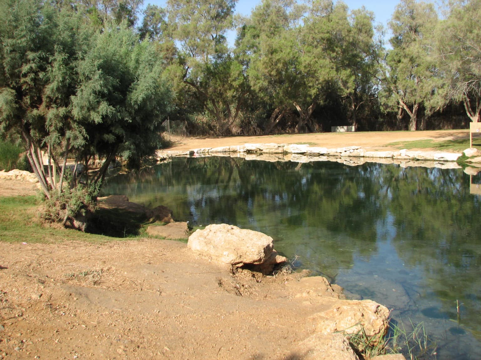
Eshkol National Park is best known for Ein HaBesor, the largest spring in the Besor Stream basin, which creates a rare desert wetland environment in the heart of the arid Negev. The park's combination of natural springs, archaeological significance, and cultural history makes it distinctive among Israeli protected areas. The Byzantine church mosaic discovered at Khirbet Shalala by ANZAC troops during the First World War, now displayed in the Australian War Memorial in Canberra, represents a particularly unique historical connection to this landscape.

Natural spring surrounded by trees and rocks with calm water reflecting sky and foliage
Open spring at Ein Habsor with surrounding trees and rocky shore

Eshkol National Park history and protected-area timeline

The Eshkol area has been inhabited since ancient times, with the nearby Tell el-Far'ah (South) mound showing continuous human presence from the Early Bronze Age through the Roman Empire, a period of approximately two thousand years. At this site, Flinders Petrie conducted important archaeological excavations that contributed significantly to understanding of the region. During the First World War, ANZAC troops stationed in the area discovered an elaborate Byzantine church mosaic at Khirbet Shalala depicting various animals. This mosaic, part of the ruins of a Byzantine church, was subsequently removed and now resides in the Australian War Memorial in Canberra. The Romans constructed supporting walls along the Besor Stream to prevent erosion of the archaeological mound, and a historic road from Beer Sheva to Rafah passed through the area, linking the inland desert city with the coastal approach to Egypt.

Eshkol National Park landscape and geographic character

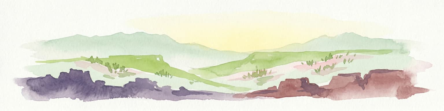
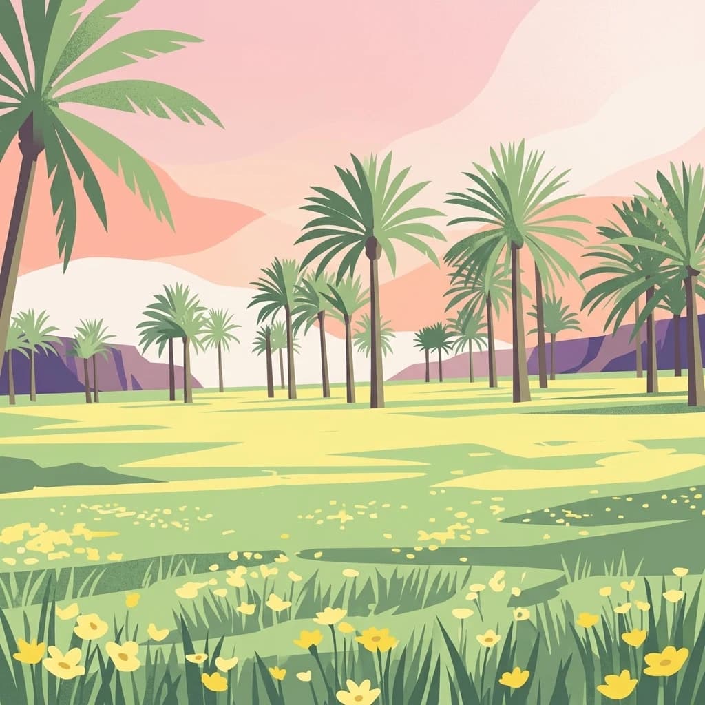
The park sits within the Besor valley, a broad drainage system in the Northern Negev that carries seasonal runoff from winter rains eastward toward the Mediterranean coast. The landscape is characterized by flat desert terrain punctuated by the lush vegetation surrounding the spring-fed wetlands. The mound of Khirbet Shalala rises east of the springs, dominating the local topography and providing views across the Besor valley. The aquifer system here lies near the surface, allowing natural springs to emerge and create areas of permanent vegetation including date palms and riparian plants. The contrast between the green wetland areas and the tan desert plains defines the park's visual character.

Eshkol National Park ecosystems, habitats, and plant life

The ecosystem at Eshkol represents a rare desert wetland type found in few other locations in Israel. The permanent water flow from Ein HaBesor supports riparian vegetation including date palms, reeds, and grasses that form an oasis within the semi-arid Negev. The aquifer is recharged by winter rainfall and provides the hydrological foundation for this ecological phenomenon. Birdlife is attracted to the water sources, particularly during migration seasons, and the wetland habitat supports species adapted to both desert and aquatic environments. This juxtaposition of desert and wetland makes the park ecologically significant beyond its relatively modest size.

Eshkol National Park wildlife and species highlights

The park's wetland habitat attracts birdlife uncommon in the surrounding desert, including various waterfowl and migratory species that stop at the springs during their seasonal movements. The date palm groves and riparian vegetation provide nesting and foraging habitat for desert birds. Small mammals and reptiles inhabit the transition zone between the wetland areas and the drier desert beyond. The ecological significance lies not in any single flagship species but in the habitat itself, which represents a biodiversity hotspot within the arid Negev environment.

Eshkol National Park conservation status and protection priorities

Eshkol National Park protects one of the few remaining desert wetland systems in the Northern Negev, making it important for preserving ecological diversity in Israel's southern region. The park's protection ensures the continuation of the aquifer-fed spring system and the unique habitat it supports. This protected area also preserves access to significant archaeological resources and maintains the cultural landscape where ancient settlement, agricultural use, and natural processes have interacted over millennia. The Israel Nature and Parks Authority manages the site to balance public recreation with natural and cultural preservation.

Eshkol National Park cultural meaning and human context

The Eshkol area represents a crossroads of history where desert nomadic culture, biblical settlements, Byzantine Christianity, and modern Israeli development have all left traces. The nearby Tell el-Far'ah (South) archaeological site reflects Egyptian-influenced anthropoid coffin traditions and was an important settlement during multiple historical periods. The discovery of the Byzantine mosaic by ANZAC troops during the 1917 Second Battle of Gaza created a historical connection between this landscape and Australian military history. The historic road from Beer Sheva to Rafah passed through this area, linking the desert interior with the coastal corridor to Egypt.

Top sights and standout views in Eshkol National Park

The park's main highlight is the large spring at Ein HaBesor, which creates a year-round green oasis in the desert and supports the wetland ecosystem. Visitors can explore the archaeological mound of Khirbet Shalala with its Byzantine church foundations and enjoy the contrast between the water-fed vegetation and the surrounding semi-arid landscape. The proximity to Tell el-Far'ah (South) offers opportunities to understand the deeper archaeological significance of the Besor valley. Picnic areas and maintained grounds make the park accessible for families while the natural and cultural features provide interest for those seeking more than basic recreation.

Best time to visit Eshkol National Park

The optimal time to visit Eshkol National Park is during the Israeli spring months of March through May, when temperatures are comfortable and the desert landscape often displays blooming wildflowers. Winter months from December through February can also be pleasant, though temperatures may be cooler, while the aquifer continues to provide reliable water flow year-round. Summer months bring high temperatures that make extended outdoor activity uncomfortable. The spring maintains consistent flow throughout the year regardless of season, so the park's main natural feature is always accessible.

Park location guide

Geography guide, regional context, and park location map for Eshkol National Park

Eshkol National Park park geography, regions, and map view in Israel
Understand where Eshkol National Park sits in Israel through a broader geographic reading of the surrounding landscape, nearby location context, and its mapped position within the national park landscape.

How Eshkol National Park fits into Israel

Israel is a parliamentary republic in the Southern Levant, established in 1948 as a Jewish homeland. It borders Lebanon, Syria, Jordan, and Egypt, with Mediterranean coastline and access to the Red Sea. Jerusalem is the capital, though its status is contested, while Tel Aviv is the largest urban area. The country has a high-income economy with strong technology and innovation sectors.

Wider geography shaping Eshkol National Park in Israel

Israel occupies the Southern Levant region of West Asia. It is bordered by Lebanon to the north, Syria to the northeast, Jordan to the east, and Egypt to the southwest. The western coast lies on the Mediterranean Sea, while the southern tip reaches the Red Sea. The eastern border includes the Dead Sea, Earth's lowest point. The country occupies the West Bank, Gaza Strip, and Golan Heights.

Map view of Eshkol National Park

Use this park location map to pinpoint Eshkol National Park in Israel, understand its exact geographic position, and read its mapped placement within the surrounding landscape more clearly.

Pigeon | © OpenStreetMap contributors

Explore the distinctive blend of lush spring-fed habitats, arid desert terrain, and cultural sites within this unique protected area.

Eshkol National Park Photos: Visualizing the Northern Negev's Desert Wetland Landscapes
Visually explore Eshkol National Park through a dedicated image gallery, illustrating its unique desert wetland environment and surrounding arid landscapes. Gain a deeper understanding of the park's diverse habitats, the prominent Ein HaBesor spring, and the archaeological features that define this protected area in the Northern Negev.

Natural spring surrounded by trees and rocks with calm water reflecting sky and foliage

Grassy field with yellow wildflowers and scattered palm trees under an overcast sky

Park atlas

Trace the regional protected landscapes surrounding Eshkol National Park, comparing desert wetlands and archaeological sites.

Explore Nearby National Parks and Protected Areas Around Eshkol National Park
From Eshkol National Park, browse other national parks and protected areas across the Northern Negev region of Israel, tracing diverse landscapes and conservation efforts. Compare different conservation landscapes, regional park geography, and the varied terrain around Ein HaBesor, gaining a deeper understanding of Israel's natural and historical protected sites.
Watercolor painting of rolling hills with pink, green, and purple hues
National parkIsrael

Ashkelon National Park: Ancient Coastal Protected Landscape and Archaeological Atlas

Explore mapped ruins, Fatimid walls, and Mediterranean coastal geography.

Ashkelon National Park in Israel offers a unique dive into ancient urban development, preserving layers of history from multiple civilizations along the Mediterranean coast. This protected area features landmark archaeological discoveries, including the Middle Bronze Age gate and extensive Roman ruins, all situated within a distinct coastal landscape. Understanding its mapped boundaries and the progression of its terrain provides critical context for appreciating this significant heritage site's geographic and historical importance.

IUCN
V
Relief
Lowland
Climate
Mediterranean
Access
Access unknown
Watercolor illustration of a canyon with winding river, mountains, and rolling hills
National parkIsrael

Ein Avdat National Park: A Spectular Desert Oasis and Protected Landscape in Israel

Explore its unique springs, waterfalls, and ancient Nabatean and Byzantine history.

Ein Avdat National Park showcases a rare desert oasis environment, a starkly beautiful protected landscape where natural springs emerge from the Negev's arid terrain. This park is celebrated for its dramatic waterfalls, deep pools, and the preserved remnants of ancient human habitation, including a remarkable Byzantine cave monastery carved directly into the canyon walls. Its geography, shaped by the Nahal Zin wadi, provides a vivid study in desert ecosystems and their capacity for supporting life and history over millennia, making it a key site for understanding landscape context in Israel.

Area
4.8 km²
IUCN
V
Relief
Mixed relief
Climate
Arid
National parkIsrael

Castel National Park: A National Park for Geographic Discovery in Israel

Investigate the mapped protected landscape and regional terrain.

Castel National Park represents a key protected area within Israel, focusing on the discovery of its mapped terrain and geographic identity. As a national park, it serves as a crucial entity for understanding regional conservation landscapes and the distribution of protected areas across Israel. This detailed view allows for focused exploration of the park's boundaries and its contribution to the country's natural heritage, offering valuable context for atlas-based geographical inquiry.

Relief
Mountain
Climate
Mediterranean
Scope
Terrestrial
Water
No major water
National park

Makhtesh Ramon National Park: Israel's Premier Erosion Cirque & Geological Wonder

Discover dramatic desert terrain and ancient, colorful rock formations.

Makhtesh Ramon National Park in Israel's Negev Desert is the world's largest erosion cirque, a vast 40-kilometer depression revealing millions of years of geological history. Its striking landscape features colorful clay hills, ancient volcanic remnants, fossil beds, and unique sandstone formations, making it an unparalleled destination for understanding Earth's past through its protected natural terrain. Explore the mapped boundaries and regional context of this extraordinary desert formation.

Relief
Mountain
Climate
Arid
Access
Moderate access
Scope
Terrestrial
National parkIsrael

Yarkon-Tel Afek National Park: Explore Its Protected Landscape and Israeli Geography

Mapped protected area and natural terrain context.

Gain a structured understanding of Yarkon-Tel Afek National Park, a designated national park within Israel. This detail entry focuses on its geographic identity and role as a protected landscape, providing essential context for atlas exploration. Understand the park's mapped boundaries and its contribution to the natural geography of the region without extraneous visitor details.

Scope
Terrestrial
Water
Minor water
Nature reserveJordan

Wadi Mujib Nature Reserve: Explore Jordan's Dramatic Canyon Protected Landscape

Discover mapped boundaries and arid biodiversity within this unique rift valley gorge.

Wadi Mujib Nature Reserve represents a significant protected landscape in Jordan, celebrated for its deep desert canyon and dramatic slot canyon terrain. Situated in the Dead Sea region, this reserve protects a remarkable range of geography, from its lowest points near the Dead Sea to surrounding mountain terrain. Its status as a UNESCO biosphere reserve highlights its importance for arid biodiversity and its role as a migratory bird flyway, offering a distinct atlas-level discovery of Jordan's natural heritage.

Area
212 km²
Established
1987
IUCN
IV
Relief
Mountain
Watercolor illustration of a mountainous landscape with multiple colored terrain layers
Biosphere reserveJordan

Dana Biosphere Reserve: Mapped Biosphere Reserve in Jordan's Geography

Explore protected landscape boundaries and regional context.

Dana Biosphere Reserve is a critical protected landscape in Jordan, recognized for its significant geographic features and ecological value. This page offers detailed insights into its mapped boundaries and its place within the broader regional geography of the Middle East. It serves as an essential resource for understanding the park's protected-area identity and its contribution to Jordan's natural heritage, facilitating a deeper atlas-driven exploration of its terrain and conservation significance.

Area
308 km²
Established
1989
Relief
Mixed relief
Scope
Terrestrial
National parkIsrael

Mount Carmel National Park: Explore Israel's Protected Landscape and Geographic Atlas

Discover the mapped boundaries and natural terrain.

Mount Carmel National Park serves as a critical point for understanding protected areas and regional geography within Israel. This national park offers a detailed view of its specific landscape, mapped terrain, and protected boundaries, making it an essential component of any geographic exploration focused on the Levant. Investigate the park's unique features to enhance your understanding of conservation landscapes and their mapping within the Middle East.

Area
100 km²
Established
1960
Relief
Mountain
Climate
Mediterranean

Common questions about visiting, size, designation, and location context for Eshkol National Park

Eshkol National Park FAQs for park facts, access, geography, and protected area context
Find quick answers about Eshkol National Park, including protected-area facts, park geography, trail and visitor context, and how the park fits into its surrounding country and regional landscape.
MoriAtlas Explorer

Continue Your Protected Areas Search Across the Global Atlas

Deepen your exploration by continuing the structured search for national parks and protected areas worldwide. Utilize the comprehensive filtering capabilities to compare different conservation landscapes and refine your understanding of global park geography. Discover more about the distribution and characteristics of protected natural areas.

Global natural geography