
Mori Atlas logo
Wildlife reserveBaie de Bouéni

Explore the largest mangrove belt in the Comoros and the volcanic terrain of Grande Terre.

Baie de Bouéni Wildlife Reserve: Mapping the Coastal Ecosystems of Mayotte, France

Baie de Bouéni serves as a primary protected landscape on the south western coast of Grande Terre in Mayotte. This expansive wildlife reserve connects dense mangrove forests and intertidal mudflats with a dramatic backdrop of volcanic peaks, including Mont Bénara and Mont Choungui. The protected bay provides critical habitat and represents a core site for understanding the layered coastal geography of the western Indian Ocean.

baymangrovescoastal habitatimportant bird areaisland territoryvolcanic landscape
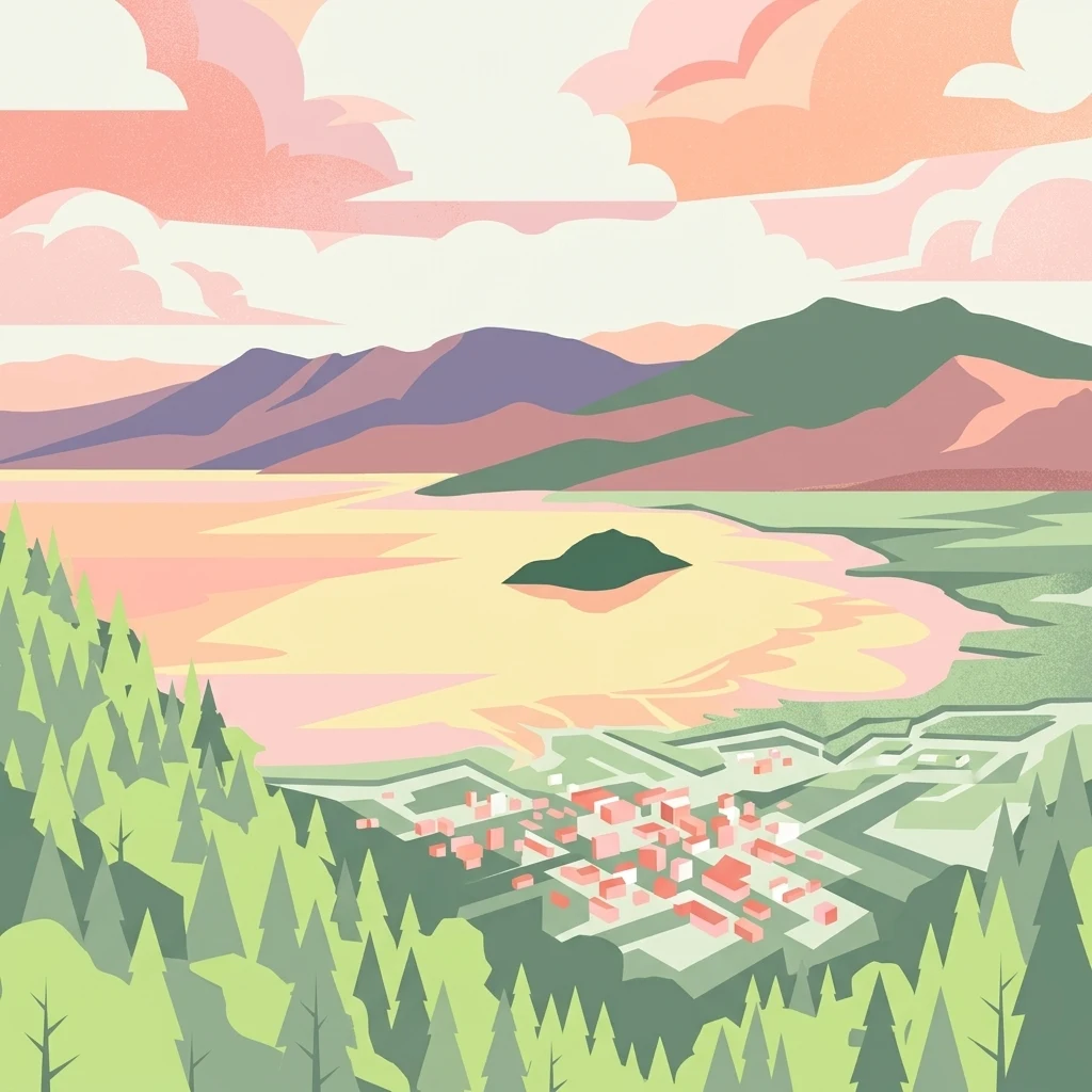
An illustrative graphic showing a bay with mountains in the background, a small island in the center, and a small town nestled near the coast, all under a pastel sunset sky.

Baie de Bouéni

Wildlife reserve

Park overview

Structured park overview, official facts, and landscape profile for Baie de Bouéni

Baie de Bouéni park facts, protected area profile, and essential visitor context

Review the core facts for Baie de Bouéni, including designation, size, terrain, visitor scale, habitats, and operating context in one park-focused overview.

About Baie de Bouéni

Baie de Bouéni is one of the defining natural landmarks of south-west Mayotte, a broad and shallow bay carved into the volcanic terrain of Grande-Terre. The bay lies where the Indian Ocean narrows into the Mozambique Channel, between the East African coast and Madagascar, placing it within one of the most biologically interesting marine regions of the western Indian Ocean.

Geographically, the bay is bookended by two of Mayotte's most prominent volcanic peaks. Mont Bénara rises to the north of the inlet while Mont Choungui dominates the southern side of the bay, and from the summit of Choungui the full sweep of the bay, its mangrove fringe, and the small islet of Chissioua Karoni can be viewed in a single panorama. This setting, a deep curving coastline set between shield volcanoes, gives the site a strong sense of place and makes it one of the most photogenic coastal landscapes on the island.

The bay's deeper significance, however, lies in its coastal ecosystems. The mangrove belt along the bay's eastern shore is the most extensive surviving mangrove stand in the Comoros, forming a continuous narrow strip along the shoreline and providing nursery habitat for fish, crustaceans, and many other marine organisms. Behind the mangroves lie intertidal mudflats that are exposed at low tide and that draw wading and waterbird species in significant numbers. Together, these habitats support a community of birds and reptiles that justifies the bay's international conservation recognition.

Administratively and ecologically, Baie de Bouéni forms part of a broader protected natural heritage on Mayotte. It was formally placed under protection in 2007 through the French Conservatoire du Littoral, the national coastal and lakeside conservancy that acquires and manages sensitive shoreline sites across France and its overseas territories. The designation reflects both the ecological value of the mangroves and the cultural and landscape significance of the bay itself.

Quick facts and research context for Baie de Bouéni

Baie de Bouéni lies on the south-west coast of Grande-Terre, Mayotte, opening onto the northern reaches of the Mozambique Channel. It measures roughly 5 to 6 kilometres across at its mouth and extends inland for around 10 kilometres, framed between the volcanic massifs of Mont Bénara and Mont Choungui. A small islet, Chissioua Karoni, sits near the middle of the bay.

The bay's coastal fringe contains the largest mangrove belt in the Comoro Islands, supporting intertidal mudflats and at least seven mangrove species recorded for Mayotte. Its protected status dates from 2007, when the site was acquired by the Conservatoire du Littoral. BirdLife International has designated the bay an Important Bird Area, and the area also provides habitat for the endangered, endemic Robert Mertens's day gecko.

Protection and recognition

Marine conservation framework and international recognition data for Baie de Bouéni

Baie de Bouéni Protection Status and Marine Protected Area Designation

Marine protected area records for Baie de Bouéni outline the documented conservation scope and regulatory framework governing the coastal environment. Verified designation details and administrative boundaries provide clear reference points for researchers analyzing marine resource protection.

Protection details

Protection scope
Marine
Transboundary protection
No
Park context

Deeper park guide and search-rich context for Baie de Bouéni

Baie de Bouéni history, landscape, wildlife, and travel context

Explore Baie de Bouéni through its history, landscape character, ecosystems, wildlife, conservation priorities, cultural context, and seasonal travel timing in a structured park guide built for atlas discovery and search intent.

Why Baie de Bouéni stands out

Baie de Bouéni is best known for hosting the largest mangrove system in the Comoros, an unusually extensive coastal ecosystem for an archipelago that has lost mangrove cover elsewhere. The mangrove strip and its associated mudflats form the backbone of the site's ecological identity. The bay is equally noted as an Important Bird Area for the Mayotte region, supporting breeding populations of regionally and globally significant species such as the Malagasy pond heron and the Mayotte drongo. Its combination of mangrove forest, sandy southern shoreline, and volcanic highland backdrop makes it a textbook example of the layered coastal ecosystems found around Mayotte.
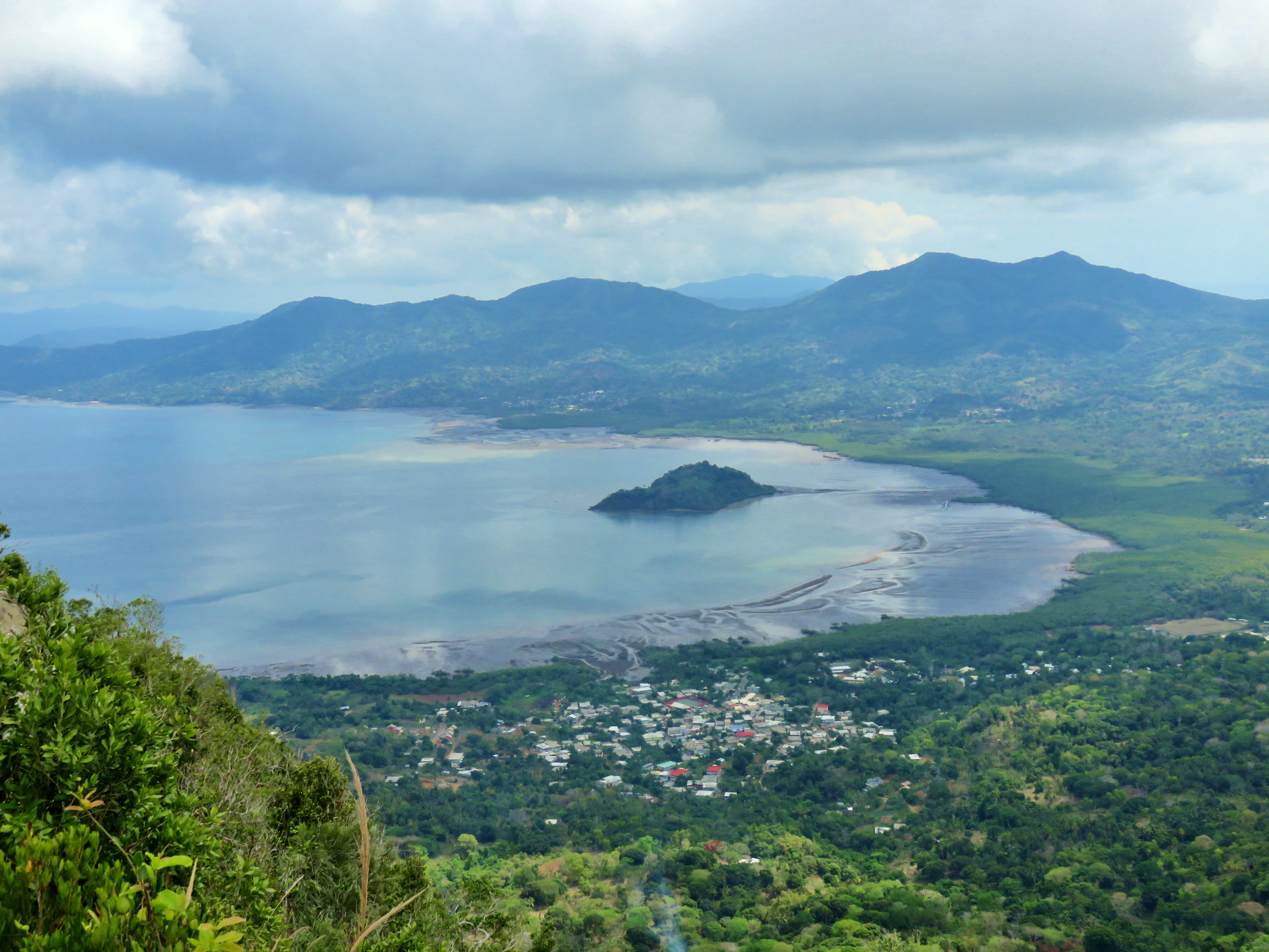
A high-angle, wide-angle view overlooking a broad, calm bay with a small, forested islet in the center and a small town nestled in the lush coastal landscape below.
A panoramic view of the Baie de Bouéni featuring the islet of Chissioua Karoni, seen from the heights of Mount Choungui.

Baie de Bouéni history and protected-area timeline

Although Baie de Bouéni has long been part of the coastal landscape inhabited by communities in the Chirongui and Bouéni communes of south-west Mayotte, its formal recognition as a protected natural area came relatively recently. In 2007 the bay and its surrounding coastal strip were acquired by the Conservatoire du Littoral, the French national agency responsible for safeguarding outstanding shoreline and lakeside sites.

Following this acquisition, the bay gained a clear institutional identity as a conservation site. Recognition by BirdLife International as an Important Bird Area confirmed the international significance of the habitats already known locally, particularly the mangrove fringe and the intertidal mudflats that support regionally important bird populations.

The designation placed Baie de Bouéni within the evolving network of protected coastal sites across Mayotte and strengthened the territory's profile as a stronghold for mangrove and island biodiversity in the western Indian Ocean. It also marked a turning point in formal scientific attention to the Comoros' remaining mangrove stands, of which this bay holds the largest example.

Baie de Bouéni landscape and geographic character

The landscape of Baie de Bouéni is shaped by the meeting of sea and volcanic island. The bay itself is wide and open at its mouth, gradually narrowing and curving inland between two contrasting shorelines. Along its eastern side, a continuous belt of mangrove forest presses close to the water, giving way inland to low coastal flats. To the south, the shore takes on a different character, opening into broader sandy beaches backed by gentle terrain.

The bay's vertical scale is provided by the two volcanic massifs that frame it: Mont Bénara on one side and Mont Choungui on the other. These peaks shape the watershed that drains toward the bay and lend it a striking visual backdrop. From the slopes of Choungui, particularly its summit, the entire bay unfolds with its small offshore islet, Chissioua Karoni, sitting quietly within the broader expanse of water.

The interplay of mangrove shoreline, sandy southern coast, small islet, and surrounding volcanic relief creates a layered coastal landscape that is characteristic of Mayotte yet unusually well-preserved here. The combination of accessibility and biodiversity makes the bay a focal point for understanding how terrestrial and marine ecosystems meet on the island.
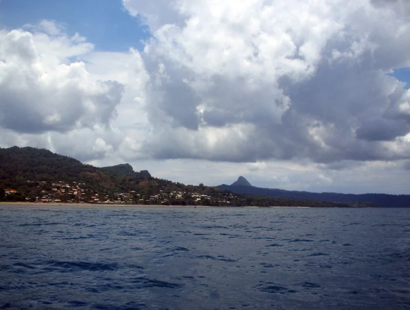
A wide shot looking across the water toward the hilly, green coastline of Baie de Bouéni in Mayotte, with a prominent peak in the distance under a partly cloudy sky.
A view of the Baie de Bouéni coastline in Mayotte, characterized by its hills and tropical waters.

Baie de Bouéni ecosystems, habitats, and plant life

The natural character of Baie de Bouéni is dominated by its mangrove ecosystem, the largest of its kind in the Comoro archipelago. The mangrove strip runs for several kilometres along the bay's eastern shore and reaches several hundred metres inland in places, forming a near-continuous green fringe between the water and the land. At least seven species of mangrove tree have been recorded for Mayotte within this habitat, contributing to an unusually diverse mangal for a small island group.

Behind the mangroves lie extensive intertidal mudflats that emerge at low tide and provide rich feeding grounds for coastal birds, crustaceans, and other invertebrates. This combination of mangrove cover and tidal flats creates a transitional zone where marine and terrestrial influences overlap almost continuously along the shoreline. The small islet of Chissioua Karoni adds a further dimension, providing hard substrate habitat distinct from the muddy coastal fringe.

Beyond the shore itself, the bay's catchment reaches into the surrounding volcanic uplands. Drainage from the slopes of Mont Bénara and Mont Choungui feeds the coastal system with freshwater and nutrients, reinforcing the productivity of the mangroves and mudflats. Altogether, the bay stands as a compact but ecologically rich mosaic of coastal habitats within the broader island ecosystem of Mayotte.

Baie de Bouéni wildlife and species highlights

The wildlife profile of Baie de Bouéni is closely tied to its mangrove and intertidal habitats. The bay has been identified by BirdLife International as an Important Bird Area precisely because these habitats support bird populations of regional and global conservation concern.

Among the species associated with the bay are the Malagasy pond heron, a heron of regional significance whose populations depend on wetland and mangrove-rich coastlines; the Mayotte drongo, an island-associated forest bird; the Mayotte white-eye and the Mayotte sunbird, two of the bird species characteristic of Mayotte's woodland and coastal habitats; and the red-headed fody, a small passerine whose range includes the western Indian Ocean islands. Together these species point to the bay's role as both a mangrove specialist site and a stronghold for island-endemic birds.

The bay also supports a colony of crabier blanc, a white heron species, within its mangroves, highlighting the site's relevance for waterbirds as well as forest-associated species. Beyond birds, the area is home to the endangered and endemic Robert Mertens's day gecko, a reptile found only in limited parts of Mayotte and dependent on intact coastal habitat. This combination of endemic birdlife, waterbirds, and an endemic reptile gives the bay a distinctive place in the regional wildlife network of the Comoros.

Baie de Bouéni conservation status and protection priorities

Baie de Bouéni holds a clear conservation profile that extends well beyond its local shoreline. It contains the largest remaining mangrove belt in the Comoros, an ecosystem that has declined sharply on many islands worldwide, and therefore serves as a regional refuge for mangrove biodiversity in the western Indian Ocean.

The bay's formal protection began in 2007, when the site was acquired and brought under the management of the Conservatoire du Littoral, the French national agency dedicated to safeguarding outstanding coastline and lakeshore areas across France and its overseas territories. This designation ensured that the mangrove fringe, intertidal flats, and surrounding coastal lands would be managed with conservation as a primary objective.

Recognition as an Important Bird Area by BirdLife International gave the bay an international conservation identity and underlined its role in supporting threatened and endemic bird populations, as well as the endangered Robert Mertens's day gecko. In practical terms, the bay functions as a reference site for mangrove and coastal bird conservation in the Comoros, anchoring efforts to monitor, protect, and potentially restore mangrove habitat across the archipelago.

Baie de Bouéni cultural meaning and human context

The bay lies within a region of Mayotte with a long-standing coastal human presence. The communes of Chirongui, on the south-eastern side of the bay, and Bouéni, to the east, both border the inlet and give the bay its name. These communities are part of Mayotte's broader Mahoran cultural landscape, in which fishing, small-scale agriculture, and coastal settlement have shaped the relationship between people and the sea for generations.

From Mont Choungui and other vantage points around the bay, villages such as Tsimkoura and Chirongui are visible along the shoreline, illustrating how closely the inhabited landscape and the mangrove-lined coast are interwoven. The bay itself, together with the small islet of Chissioua Karoni, forms part of the local geographic identity and is a familiar feature in the everyday surroundings of nearby communities.

Top sights and standout views in Baie de Bouéni

The single most defining feature of Baie de Bouéni is its mangrove belt, the largest in the Comoros, which forms a continuous coastal strip along the bay and supports a rich mosaic of associated habitats. The bay's intertidal mudflats add a second layer of ecological value, exposing rich feeding grounds for waterbirds at low tide.

Equally striking is the visual setting, in which the curving bay sits between two of Mayotte's most prominent volcanoes, Mont Bénara and Mont Choungui, with the small islet of Chissioua Karoni lying near its centre. The combination of formal protection since 2007 under the Conservatoire du Littoral, international recognition as an Important Bird Area, and the presence of an endemic gecko species gives the site a tightly defined and internationally significant conservation identity.

Best time to visit Baie de Bouéni

As a coastal and mangrove-dominated site, Baie de Bouéni is best appreciated when conditions allow clear views across the bay and active bird presence along the shoreline. The dry season months, broadly aligned with the cooler and less humid period in the southern hemisphere winter, generally offer calmer seas, better visibility from the surrounding volcanic viewpoints such as Mont Choungui, and easier walking on exposed mudflats and beaches.

The wetter and warmer months bring heavier seas and reduced visibility but can also be a time of greater waterbird activity around the mangroves. Birdwatchers and naturalists may find the transitional shoulder periods particularly rewarding, when bird populations are active and weather is not yet at its most extreme. The bay is an outdoor site, and conditions can shift quickly, so visitors typically prefer clear, dry days for both panoramic views from the surrounding peaks and shoreline exploration.
Monthly climate preview

Track representative monthly temperatures and precipitation rhythms for Mayotte

Baie de Bouéni Climate Normals and Long Term Weather Patterns

Historical averages for Baie de Bouéni reveal consistent annual temperature variations alongside distinct monthly precipitation shifts measured across thirty years. Examining the full twelve month record provides deeper insight into long term climate normals at a representative elevation point.
Annual mean27 °C
25 °C28 °C
Jan28°
Feb28°
Mar28°
Apr28°
May27°
Jun26°
Jul25°
Aug25°
Sep25°
Oct26°
Nov27°
Dec28°
Warmest month
April

28.2 °C

Coolest month
August

24.9 °C

Wettest month
January

8.2 mm/day

Driest month
August

0.4 mm/day

Park location guide

Geography guide, regional context, and park location map for Baie de Bouéni

Baie de Bouéni park geography, regions, and map view in France

Understand where Baie de Bouéni sits in France through a broader geographic reading of the surrounding landscape, nearby location context, and its mapped position within the national park landscape.

How Baie de Bouéni fits into France

France is a unitary semi-presidential republic and one of the world's largest economies. It borders Belgium, Luxembourg, Germany, Switzerland, Italy, Monaco, Andorra, and Spain, with a maritime border to the United Kingdom. The country is known for its cultural influence, art, cuisine, and political history spanning centuries.

Wider geography shaping Baie de Bouéni in France

France is located in Western Europe. Metropolitan France extends from the Rhine to the Atlantic Ocean and from the Mediterranean Sea to the English Channel and North Sea. The country borders Belgium, Luxembourg, Germany, Switzerland, Italy, Monaco, Andorra, Spain, and has a maritime border with the United Kingdom.

Map view of Baie de Bouéni

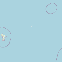
Use this park location map to pinpoint Baie de Bouéni in France, understand its exact geographic position, and read its mapped placement within the surrounding landscape more clearly.

Pigeon | © OpenStreetMap contributors

Location context for Baie de Bouéni

Mayotte

Explore photographic records of mangroves, volcanic backdrops, and intertidal ecosystems.

Baie de Bouéni Photos and Landscape Scenery: Visualizing Coastal Habitats

Visual documentation captures the extensive mangrove forests, mudflats, and volcanic relief defining the protected coastal geography of Baie de Bouéni. Photographic records reveal the intricate terrain, shoreline habitats, and ecological character of this Indian Ocean bay.

A high-angle, wide-angle view overlooking a broad, calm bay with a small, forested islet in the center and a small town nestled in the lush coastal landscape below.

High angle scenic view overlooking a bay with a small, isolated islet, surrounded by lush green hills and coastal settlements in Mayotte.

A wide shot looking across the water toward the hilly, green coastline of Baie de Bouéni in Mayotte, with a prominent peak in the distance under a partly cloudy sky.

Park atlas

Compare surrounding coastal landscapes and regional protected natural areas

Explore Protected Areas and Parks Near Baie de Bouéni for Regional Comparison

Browsing other parks near Baie de Bouéni reveals wider coastal ecosystems and volcanic terrain across the regional network. Protected areas in the surrounding territory provide valuable context for comparing mangrove habitats and island topography.
Protected areaMayotte
About 9.2 km away#1 closest

Southeast

Pointes et plages de Saziley et Charifou Protected Area Geography and Map Context

Coastal ridgelines, mangrove habitats, and Mayotte island terrain

Delve into the physical geography and protected area configuration of Pointes et plages de Saziley et Charifou. This site presents a striking contrast between steep, dry inland ridges and low-lying coastal mangrove systems, offering an essential look at the complex environmental layering found across the southeastern coast of Mayotte.

Area
6.65 km²
Established
1997
IUCN
IV
Relief
Upland
Nature reserveMayotte
About 20 km away#2 closest

Northeast

Vasière des Badamiers: Mapping the Protected Coastal Wetlands of Petite-Terre

Nature reserve geography and intertidal ecosystem character

Vasière des Badamiers is an essential protected coastal wetland in Mayotte, characterized by its tidal mudflats and mangrove fringes. This site acts as a key migratory refuge for waterbirds while functioning as a natural filter for the surrounding lagoon. Use this data to analyze the unique brackish basin and the ecological boundaries that define this Ramsar-recognized environment.

Area
1.25 km²
Established
2002
IUCN
IV
Watercolor illustration of a mountainous landscape with a lake and grassy fields.
National parkAnjouan
About 107 km away#3 closest

Northwest

Mount Ntringui National Park: Protected Volcanic Landscape and Highland Geography on Anjouan

Explore its dramatic peaks, crater lake, and remnant montane forests.

Mount Ntringui National Park is a significant protected area situated in the rugged volcanic highlands of Anjouan. This national park preserves the island's highest peaks, Mount Ntringui and Mount Trindrini, alongside the unique Dzialandzé crater lake and the crucial Moya Forest. It stands as a vital refuge for endemic species and represents the last substantial tract of montane forest on Anjouan, offering deep insights into the region's unique ecology and mapped natural terrain.

Area
79.14 km²
Established
2010
IUCN
II
Relief
Mountain
National parkAnjouan
About 128 km away#4 closest

Northwest

Shisiwani National Park: Anjouan's Protected Marine and Island Landscape Atlas

Coastal and terrestrial protected area mapping in Comoros.

Delve into the protected landscape of Shisiwani National Park, a critical national park situated on Anjouan's Sima Peninsula in Comoros. This atlas entry details the park's combined marine and terrestrial boundaries, highlighting its vital coral reefs, mangrove forests, and unique island geography. Understand the park's role in conservation through its mapped extent and diverse natural environments, offering a clear geographic context for protected area exploration.

Area
64.97 km²
Established
2016
IUCN
II
Climate
Tropical
National parkComoros
About 168 km away#5 closest

Northwest

Mohéli National Park: Comoros National Park and Protected Landscape Exploration

Mapped geography and protected area identity.

Mohéli National Park is a dedicated national park within the Comoros, providing a specific focus for exploring protected lands and their geographic distribution. This entry details the park's mapped boundaries and its significance as a conservation landscape. Understanding Mohéli National Park offers valuable insight into the regional geography of the Comoros archipelago and its unique natural context.

Area
643.62 km²
Established
2010
Relief
Mixed relief
Climate
Tropical
National parkComoros
About 230 km away#6 closest

Northwest

Karthala National Park: Comoros' Active Volcano and Endemic Protected Landscape

Explore mapped volcanic terrain and unique island biodiversity.

Karthala National Park, situated on Grande Comore, is defined by its active shield volcano, Mount Karthala, the highest peak in the Comoros. This protected area is celebrated for its extraordinary endemism, housing unique bird species and plant life evolved in isolation. The park's dramatic caldera system and sloping volcanic mass present a fascinating geological and ecological landscape, offering critical context for understanding island ecosystems and protected areas in the Indian Ocean.

Area
262.14 km²
Established
2010
Relief
Mountain
Climate
Tropical
National parkGrande Comore
About 234 km away#7 closest

Northwest

Coelacanth National Park: Marine Protected Landscape and Geographic Setting off Grande Comore

Explore the unique marine geography and conservation value.

Coelacanth National Park is a significant marine protected area dedicated to preserving a unique underwater ecosystem surrounding Grande Comore. Its designation as a national park highlights its importance for safeguarding the habitat of the coelacanth, a rare prehistoric fish species. The park's landscape comprises vibrant coral reefs and deep offshore waters, integral to the broader Indian Ocean geography, offering insights into marine conservation and protected areas.

Area
92.76 km²
Established
2010
IUCN
II
Scope
Marine
Watercolor painting of a coastal landscape with green trees, rolling hills, and light water reflections.
Protected areaSofia
About 247 km away#8 closest

South

Anjajavy Forest Protected Area: Landscape Geography and Regional Mapping

Tsingy karst, dry forest, and mangrove ecosystems in Sofia, Madagascar

The Anjajavy Forest protects a unique peninsula defined by the meeting of dry deciduous forest and jagged marine tsingy limestone. Spanning fifty square kilometres, this area is bordered by the Majajamba and Narinda Bays, showcasing an accessible convergence of complex karst topography and coastal mangrove corridors essential for endemic species.

Area
50 km²
Relief
Mixed relief
Climate
Tropical
Scope
Mixed

Common questions about visiting, size, designation, and location context for Baie de Bouéni

Baie de Bouéni FAQs for park facts, access, geography, and protected area context

Find quick answers about Baie de Bouéni, including protected-area facts, park geography, trail and visitor context, and how the park fits into its surrounding country and regional landscape.
MoriAtlas Explorer

Continue Your Protected Areas Search Across the Global Atlas

Deepen your exploration by continuing the structured search for national parks and protected areas worldwide. Utilize the comprehensive filtering capabilities to compare different conservation landscapes and refine your understanding of global park geography. Discover more about the distribution and characteristics of protected natural areas.

Global natural geography