Mori Atlas logo
National parkBasaseachic Falls National Park

Discover the mapped boundaries and regional context of this Mexican national park.

Basaseachic Falls National Park: Protected Landscape and Geographic Atlas

(Parque Nacional Cascada de Basaseachic)

Basaseachic Falls National Park represents a significant protected natural area within Ocampo Municipality, Mexico. This page offers an atlas-focused exploration of its protected landscape, detailing its geographic scope and mapped boundaries. Understand the park's place within the regional geography and discover its unique natural terrain through detailed atlas-style context, providing a factual foundation for exploring Mexico's protected areas.

WaterfallCanyonPine-Oak ForestMountain LandscapeProtected AreaSierra Madre Occidental

Basaseachic Falls National Park

National park

Park overview

Structured park overview, official facts, and landscape profile for Basaseachic Falls National Park

Basaseachic Falls National Park park facts, protected area profile, and essential visitor context

Review the core facts for Basaseachic Falls National Park, including designation, size, terrain, visitor scale, habitats, and operating context in one park-focused overview.

About Basaseachic Falls National Park

Basaseachic Falls National Park occupies a remarkable position in the Sierra Madre Occidental, protecting a landscape of exceptional geological and ecological significance. The park's defining feature, Basaseachic Falls, cascades 246 meters into Candameña Canyon, creating one of Mexico's most iconic natural spectacles. The canyon itself, carved over millions of years by the Basaseachic River, reaches depths that rank among the greatest in the Sierra Tarahumara region. The terrain exhibits dramatic vertical relief, with cliff walls rising to 1,640 meters above the canyon floor, a testament to the powerful tectonic forces that shaped this landscape through deep fractures and rising rifts. The park's ecological character is defined by its pine-oak forests, which vary with elevation and benefit from the numerous microclimates created by the complex topography. This ecological diversity supports both significant plant and animal life, making the park an important conservation area within northern Mexico's mountain systems.

Quick facts and research context for Basaseachic Falls National Park

Located in Ocampo Municipality, Chihuahua, in the Sierra Madre Occidental mountain range. The park protects Basaseachic Falls, Mexico's second-highest waterfall at 246 meters, which empties into Candameña Canyon. Established February 2, 1981 under President José López Portillo. The park features dramatic canyon walls up to 1,640 meters high, two major rivers (Basaseachic and Duraznos), and a remarkable diversity of flora supported by multiple microclimates. The area was historically inhabited by the Tarahumara people prior to European discovery in the 18th century.

Protection and recognition

Tracing official terrestrial conservation status and global boundary database records

Basaseachic Falls National Park Protection Status and Area Designation

Geographic discovery of Basaseachic Falls National Park requires verifying official terrestrial protection status and documented conservation boundaries. Mapping verified regional records helps researchers and travelers understand how local mountain terrains fit into the wider network of protected global landscapes.

Protection details

Protection scope
Terrestrial
Transboundary protection
No
Park context

Deeper park guide and search-rich context for Basaseachic Falls National Park

Basaseachic Falls National Park history, landscape, wildlife, and travel context

Explore Basaseachic Falls National Park through its history, landscape character, ecosystems, wildlife, conservation priorities, cultural context, and seasonal travel timing in a structured park guide built for atlas discovery and search intent.

Why Basaseachic Falls National Park stands out

Basaseachic Falls National Park is best known for housing Mexico's second-tallest waterfall, which drops 246 meters into the dramatic Candameña Canyon. The park's dramatic alpine scenery, with towering 1,640-meter cliffs and deep canyon formations, represents some of the most spectacular terrain in the Sierra Madre Occidental. The protected pine-oak forest ecosystem supports remarkable biodiversity, including the endangered mountain trogon, known locally as the Mexican flag bird for its red, white, and green coloring. The park also preserves the cultural heritage of the Tarahumara people, who have inhabited this region for centuries.

Basaseachic Falls National Park history and protected-area timeline

The area now protected as Basaseachic Falls National Park has a rich human history predating European contact. The region was inhabited for centuries by the Tarahumara people, known in their own language as the Rarámuri, whose presence is reflected in the park's name, which derives from their language meaning place of the wolves. European discovery of Basaseachic Falls occurred sometime in the 18th century, and the falls quickly became one of the most popular tourist attractions in Chihuahua. The first known European settlement in the area was Misión de Tomochi, located near the town of Cajurichi and under the legal jurisdiction of the mission. Following the 18th century, the area attracted settlers due to the discovery of abundant natural resources, including minerals and high-quality timber. Basaseachic Falls National Park was formally established by the Mexican federal government on February 2, 1981, under President José López Portillo, encompassing 5,803 hectares to protect the falls and the surrounding Candameña Canyon environment within the Sierra Madre Occidental.

Basaseachic Falls National Park landscape and geographic character

The landscape of Basaseachic Falls National Park is characterized by extraordinary vertical relief and dramatic topography shaped by geological forces over millions of years. The Sierra Madre Occidental, one of Mexico's major mountain ranges, created the foundational terrain through tectonic plate movements that produced large fractures and rising rifts. The violence of these earth movements resulted in the deep canyons and high mountains that define the park today. Candameña Canyon, carved by the Basaseachic River, represents one of the deepest canyons in the Sierra Tarahumara, with walls reaching heights of 1,640 meters. The park encompasses two primary river systems, the Basaseachic River and the Duraznos River, both of which feed into Basaseachic Falls before ultimately flowing into the Candameña River. Wind erosion and ongoing river action have further sculpted the terrain over thousands of years, creating the complex array of ridges, cliffs, and valleys that characterize this mountainous protected area.

Basaseachic Falls National Park ecosystems, habitats, and plant life

The ecological diversity of Basaseachic Falls National Park is remarkable, owing largely to the dramatic elevation changes and resulting microclimates found throughout the park. The Sierra Madre Occidental's vegetation varies significantly with altitude, and at elevations above 2,000 meters, the characteristic pine-oak forest dominates. The park contains 92 species of conifers and 76 species of oaks, representing an extraordinary botanical wealth. These forests provide habitat for diverse plant genera including Pinus, Quercus, Ficus, Vachellia, Ipomoea, Acacia, Lysiloma, Bursera, Vitex, Tabebuia, Sideroxylon, Cordia, Fouquieria, and Pithecellobium. The presence of multiple microclimates, resulting from the complex terrain and varying elevations, enables this exceptional plant diversity to thrive within a relatively compact protected area.

Basaseachic Falls National Park wildlife and species highlights

Basaseachic Falls National Park supports a rich variety of wildlife, with notable populations of mammals, reptiles, and birds inhabiting its diverse habitats. Mammals found in the park include Mexican fox squirrel, antelope jackrabbit, raccoon, hooded skunk, wild boar, collared peccary, white-tailed deer, and cougar. The reptile community is represented by three primary species: Texas horned lizard, rock rattlesnake, and black-tail rattlesnake. The birdlife is particularly significant, featuring species such as Mexican jay, Steller's jay, acorn woodpecker, canyon towhee, mourning dove, broad-billed hummingbird, Montezuma quail, turkey vulture, and the endangered mountain trogon. The mountain trogon holds special significance in Mexican culture, known as the Mexican flag bird because its red, white, and green coloring resembles the Mexican flag.

Basaseachic Falls National Park conservation status and protection priorities

Basaseachic Falls National Park serves as an important conservation unit within Mexico's protected area system, designated under IUCN Category II as a national park. The protected area preserves critical habitat within the Sierra Madre Occidental, one of Mexico's most significant mountain ecosystems. The park's protection extends to the watershed systems of both the Basaseachic and Duraznos Rivers, ensuring the ecological integrity of the waterfall and canyon system. The protection of the pine-oak forest ecosystem safeguards 92 conifer species and 76 oak species, representing significant botanical heritage. The presence of the endangered mountain trogon underscores the park's importance for species conservation, while the overall habitat preservation supports populations of large mammals including cougars and diverse reptile species.

Basaseachic Falls National Park cultural meaning and human context

The cultural landscape of Basaseachic Falls National Park is deeply intertwined with the heritage of the Tarahumara people, known in their own language as the Rarámuri. This indigenous group inhabited the Sierra Tarahumara region long before European contact, and their presence in the area predates the 18th-century discovery of the falls by European explorers. The etymology of the park's name, Basaseachic, originates from the Rarámuri language, with basachí being the term used to call coyotes, and the full name translating to place of the wolves. Following Spanish colonial contact, the area around what is now the park fell under the jurisdiction of Mission Tomochi near Cajurichi. The region subsequently attracted settlers in the post-18th century period due to abundant natural resources including minerals and timber, changing the human landscape while preserving the deep cultural connections to the land.

Top sights and standout views in Basaseachic Falls National Park

The park's most prominent highlight is Basaseachic Falls, Mexico's second-tallest waterfall at 246 meters, which plunges dramatically into Candameña Canyon. The canyon itself, with walls reaching 1,640 meters, ranks among the deepest in the Sierra Tarahumara and provides spectacular scenic views. The protected pine-oak forest supports exceptional botanical diversity with 92 conifer species and 76 oak species. Wildlife highlights include the endangered mountain trogon, known as the Mexican flag bird, plus cougars, white-tailed deer, and diverse bird species. The Tarahumara cultural heritage adds historical depth to the natural landscape.

Best time to visit Basaseachic Falls National Park

The best time to visit Basaseachic Falls National Park depends on the experience sought, as the park's high elevation and varied terrain create distinct seasonal characteristics. Winter brings snowfall to the higher elevations of the Sierra Madre Occidental, creating dramatic winter scenery with snow-dusted pines and oak trees. Spring and summer offer warmer conditions and fuller water flow at the falls, though summer thunderstorms are possible. The park's many microclimates mean that weather conditions can vary significantly between the canyon floor and the higher elevations. Visitors seeking to experience the full power of Basaseachic Falls should consider the wetter seasons when water flow is strongest, while those preferring clearer skies and comfortable hiking temperatures may find spring and fall optimal.
Park guides

Targeted questions and answers for navigating canyon terrain and seasonal timing

Basaseachic Falls National Park Focused Guides and Protected Area Insights

Targeted readings provide structured answers regarding protected mountain geography and canyon conservation zones. Travelers can examine specific insights covering optimal timing and seasonal variations for visiting the waterfall.
Monthly climate preview

Comparing long-term temperature ranges and monthly precipitation at high elevation

Climate Normals and Weather by Month for Basaseachic Falls National Park

Long-term climate data for Basaseachic Falls National Park reveals wide temperature swings at high elevation, featuring winter minimums below freezing and a mid-year concentration of rainfall. Comparing the full twelve-month profile displays average daily maximums and precipitation shifts to clarify the park's complete annual climate cycle.
Annual mean14 °C
7 °C21 °C
Jan
Feb
Mar10°
Apr13°
May17°
Jun21°
Jul20°
Aug19°
Sep18°
Oct15°
Nov10°
Dec
Warmest month
June

21.1 °C

Coolest month
January

6.8 °C

Wettest month
July

6.8 mm/day

Driest month
April

0.3 mm/day

Park location guide

Geography guide, regional context, and park location map for Basaseachic Falls National Park

Basaseachic Falls National Park park geography, regions, and map view in Mexico

Understand where Basaseachic Falls National Park sits in Mexico through a broader geographic reading of the surrounding landscape, nearby location context, and its mapped position within the national park landscape.

How Basaseachic Falls National Park fits into Mexico

Mexico, officially the United Mexican States, is a country in North America spanning the Sierra Madre mountain ranges, coastal plains, and tropical regions. It borders the United States to the north, Guatemala and Belize to the southeast, and has coastlines along the Pacific Ocean, Gulf of Mexico, and Caribbean Sea. With a population exceeding 130 million, Mexico is home to one of the world's most significant concentrations of Indigenous languages alongside Spanish.

Wider geography shaping Basaseachic Falls National Park in Mexico

Mexico occupies a land area of 1,972,550 km2, making it the thirteenth-largest country in the world. The terrain is highly diverse, featuring the Sierra Madre Occidental and Sierra Madre Oriental mountain ranges, the Mexican Plateau, coastal lowlands along the Pacific and Gulf/Caribbean margins, and the Yucatan Peninsula. The country spans multiple climate zones from desert in the north to tropical rainforest in the south.

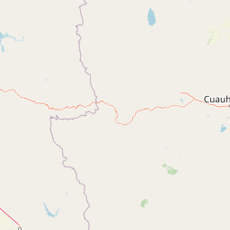
Map view of Basaseachic Falls National Park

Use this park location map to pinpoint Basaseachic Falls National Park in Mexico, understand its exact geographic position, and read its mapped placement within the surrounding landscape more clearly.

Pigeon | © OpenStreetMap contributors

Location context for Basaseachic Falls National Park

ChihuahuaOcampo Municipality
Park atlas

Explore the Sierra Madre Occidental's diverse protected landscapes, mapped canyon geography, and regional park comparisons.

Discover Other National Parks and Protected Areas Near Basaseachic Falls National Park

Browse a curated list of national parks and protected areas geographically connected to Basaseachic Falls National Park, encompassing the rugged Sierra Madre Occidental mountain range. Compare similar canyon landscapes, dramatic waterfall features, and diverse pine-oak forest ecosystems across northern Mexico, enriching your understanding of regional park geography.
Wildlife reserveChihuahua
About 39 km away#1 closest

North

Tutuaca Flora and Fauna Protection Area: Sierra Madre Occidental Mountain Conservation Reserve

Expansive pine-oak forest habitat in Chihuahua, Mexico

Covering over 4,000 square kilometers, the Tutuaca Flora and Fauna Protection Area acts as a critical link in the Sierra Madre Occidental mountain spine. This wildlife reserve preserves dense pine-oak woodlands, rugged canyons, and high-elevation watersheds that characterize the biodiversity of northwestern Mexico. The area plays a vital role in sustainable resource management and habitat connectivity between Chihuahua and neighboring regions.

Area
4,369.86 km²
Established
2001
IUCN
VI
Relief
Mountain
Wildlife reserveChihuahua
About 50 km away#2 closest

East

Papigochic Flora and Fauna Protection Area: Sierra Madre Occidental Forest Geography

An expansive mountain wildlife reserve in Chihuahua, Mexico.

Spanning over 2,200 square kilometers, this reserve preserves vital pine and oak forest ecosystems in the Sierra Tarahumara. The area is defined by its deep canyons, high-elevation forested ridgelines, and important role in safeguarding temperate montane habitats within northwestern Mexico.

Area
2,227.64 km²
Established
2003
IUCN
VI
Relief
Mountain
Protected areaSonora
About 127 km away#3 closest

South

Área de protección de flora y fauna Sierra de Álamos-Río Cuchujaqui: Geography and Park Boundaries

Detailed atlas view of the Sonora biodiversity enclave and canyon systems.

Spanning over 92,000 hectares in Sonora, this protected area is defined by its dramatic transition from coastal plains to the Sierra Madre range. The geography centers on the deep, moisture-trapping barrancas of the Cuchujaqui River, which sustain a rare mixture of Neotropical and temperate species. Examine the structural complexity of these forested slopes and river-carved valleys that function as a essential habitat for large predators and diverse flora alike.

Area
928.9 km²
Established
1996
Nature reserveSonora
About 173 km away#4 closest

Northwest

Northern Jaguar Reserve: Geography and Protected Landscape Atlas of Sonora

Foothill bushland between the Aros and Bavispe River valleys

Northern Jaguar Reserve represents a key protected block of dry tropical bushland in the Sierra Madre foothills of Sonora. This map-focused profile examines the topography, drainage systems, and structural habitat corridors that support one of the northernmost wild jaguar populations within a transition zone of mountain slopes and river-fed canyons.

Area
222 km²
Relief
Mountain
Climate
Subtropical
Access
Remote access
National parkChihuahua
About 188 km away#5 closest

Northeast

Cumbres de Majalca National Park: National Park Discovery and Geographic Context in Chihuahua

Mapped protected landscape exploration in Chihuahua.

Delve into the protected landscape of Cumbres de Majalca National Park, a national park situated in the Chihuahua region of Mexico. This entry provides essential geographic context and details on its mapped boundaries, serving as a key point for atlas-based exploration of Mexico's protected areas. Understand its specific contribution to the regional geography and conservation landscape.

Area
47.72 km²
Established
1939
IUCN
II
Relief
Mountain
Wildlife reserveChihuahua
About 201 km away#6 closest

North

Campo Verde Flora and Fauna Protection Area: Atlas and Landscape Discovery in Chihuahua

A significant wildlife reserve in the Sierra Madre Occidental

Spanning the transition from high montane forests to semi arid desert, Campo Verde Flora and Fauna Protection Area represents a core component of Mexico's northern conservation network. Documented for its endemic flora and fauna, this wildlife reserve provides a rare look at the ecological mosaic of the Sierra Madre Occidental region.

Area
1,080.67 km²
Established
1938
IUCN
VI
Relief
Mountain
Protected areaChihuahua
About 269 km away#7 closest

Southeast

Cerro Mohinora: Protected Volcanic Summit and Alpine Geography in Chihuahua

An analysis of volcanic terrain and high-elevation protected ecosystems.

Cerro Mohinora dominates the skyline as a prominent volcanic landmark within the Sierra Madre Occidental. This record details the protected area's geographic reach, examining its complex igneous history and the dramatic vertical transition from pine-covered slopes to its snowy summit, offering a clear map-oriented view of this significant Chihuahua natural landmark.

Established
2012
Relief
Mountain
Water
Minor water
Season
Seasonal
Wildlife reserveSonora
About 307 km away#8 closest

Northwest

Bavispe Flora and Fauna Protection Area: Sierra Madre Occidental Mountain Geography

Mapped protected forest tracts across Sonora ranges

Spanning five distinct mountain tracts in Sonora, this wildlife reserve preserves rare pine-oak forest communities within the Sierra Madre Occidental. Learn how these ridges and basins act as a vital hydrological anchor for the Yaqui River and provide critical corridors for wildlife through the diverse, transition-heavy terrain of northern Mexico.

Area
2,009 km²
Established
1936
IUCN
VI
Relief
Mountain

Common questions about visiting, size, designation, and location context for Basaseachic Falls National Park

Basaseachic Falls National Park FAQs for park facts, access, geography, and protected area context

Find quick answers about Basaseachic Falls National Park, including protected-area facts, park geography, trail and visitor context, and how the park fits into its surrounding country and regional landscape.
MoriAtlas Explorer

Continue Your Protected Areas Search Across the Global Atlas

Deepen your exploration by continuing the structured search for national parks and protected areas worldwide. Utilize the comprehensive filtering capabilities to compare different conservation landscapes and refine your understanding of global park geography. Discover more about the distribution and characteristics of protected natural areas.

Global natural geography