Mori Atlas logo
Wildlife reserveBavispe Flora and Fauna Protection Area

Mapping the pine-oak forest watersheds and ecological corridors of the Sierra Madre Occidental

Bavispe Flora and Fauna Protection Area: Protected Mountain Ranges of Sonora, Mexico

(Área de Protección de Flora y Fauna Bavispe)

Bavispe Flora and Fauna Protection Area serves as a critical conservation landscape across the Sierra Los Ajos, Sierra Buenos Aires, and Sierra La Púrica ranges. By bridging the temperate forests of the Sierra Madre Occidental with the arid Sonoran uplands, this wildlife reserve safeguards the headwaters of the Yaqui River basin. Its fragmented tracts form a complex mosaic of ridges and valleys that provide essential habitat connectivity for diverse mountain species.

pine-oak forestSierra Madre OccidentalSonoramountain rangesYaqui River basinflora and fauna protection area

Bavispe Flora and Fauna Protection Area

Wildlife reserve

Park overview

Structured park overview, official facts, and landscape profile for Bavispe Flora and Fauna Protection Area

Bavispe Flora and Fauna Protection Area park facts, protected area profile, and essential visitor context

Review the core facts for Bavispe Flora and Fauna Protection Area, including designation, size, terrain, visitor scale, habitats, and operating context in one park-focused overview.

About Bavispe Flora and Fauna Protection Area

Bavispe Flora and Fauna Protection Area is one of the larger and more ecologically significant protected areas in northern Mexico. Situated in the northeastern portion of Sonora, it spans a network of mountain ranges that rise above the surrounding arid lands, creating a temperate forest environment within a predominantly dry region. The protected area covers portions of Sierra Los Ajos, Sierra Buenos Aires, and Sierra La Púrica, all of which form the northern reach of the Sierra Madre Occidental.

The reserve lies in the upper basin of the Yaqui River, a watershed that supports both natural ecosystems and rural communities downstream. The combination of cool, forested mountains and the Yaqui watershed gives Bavispe a defining dual role: a refuge for pine-oak biodiversity and a critical source of forest-driven hydrology in northwestern Mexico.

Ecologically, Bavispe is a meeting point between the temperate forests of the Sierra Madre and the dryland habitats of the Sonoran region. This transitional character sustains a diverse mix of species typically associated with coniferous forests alongside those more typical of arid North America. With more than 1,040 documented species, including around 50 at-risk taxa, the protected area is widely recognized as a biodiversity stronghold of regional importance.

Administered by CONANP and classified as IUCN Category VI, the reserve is managed to balance ecosystem conservation with sustainable use of natural resources. Its design as a flora and fauna protection area reflects an emphasis on safeguarding entire ecological assemblages rather than a single species or monument.

Quick facts and research context for Bavispe Flora and Fauna Protection Area

The Bavispe Flora and Fauna Protection Area lies in northeastern Sonora, near the town of Nacozari de García, and is administered by Mexico's National Commission of Natural Protected Areas. It is classified under IUCN Category VI, recognizing a protected area with sustainable use of natural resources.

The reserve covers five separate land areas totaling roughly 200,900 hectares across three mountain ranges that form part of the northern Sierra Madre Occidental. More than 1,040 plant and animal species have been documented in the area by CONABIO, including about 50 species considered at risk. The landscape is dominated by pine-oak forest and serves as a key watershed for the upper Yaqui River basin.

Protection and recognition

Documented terrestrial protection scope, designation year, and international recognition records

Bavispe Flora and Fauna Protection Area Protection Status and Designation History

Bavispe Flora and Fauna Protection Area maintains a documented terrestrial protection status established in 2017. Structured protection records detail the official designation history and management scope associated with the protected area.

Protection details

Protection scope
Terrestrial
Designated year
2017
Transboundary protection
No
Park context

Deeper park guide and search-rich context for Bavispe Flora and Fauna Protection Area

Bavispe Flora and Fauna Protection Area history, landscape, wildlife, and travel context

Explore Bavispe Flora and Fauna Protection Area through its history, landscape character, ecosystems, wildlife, conservation priorities, cultural context, and seasonal travel timing in a structured park guide built for atlas discovery and search intent.

Why Bavispe Flora and Fauna Protection Area stands out

Bavispe is best known for sheltering pine-oak forest communities within the otherwise arid Sierra Madre landscape of northeastern Sonora, an unusual setting for such temperate forest ecosystems in northwestern Mexico. The reserve is recognized as one of the few protected areas in the region that harbors top predators such as jaguar and puma alongside iconic highland species like the thick-billed parrot and Mexican jay. Its position across three interconnected mountain ranges makes it especially significant for watershed conservation, protecting the headwaters of the Yaqui River system. The combination of coniferous forest, oak woodland, and transition habitats supports an exceptionally diverse mammal and bird fauna for a reserve of its geographic position.

Bavispe Flora and Fauna Protection Area history and protected-area timeline

The Bavispe region has been formally protected for nearly a century, making it one of the older conservation designations in northwestern Mexico. In 1936, President Lázaro Cárdenas first decreed the area as a reserve, establishing its protected status in the years following the Mexican Revolution as part of an early wave of national conservation efforts. The decree was amended in 1939 to reflect the area's current extent, solidifying its boundaries within the Sierra Los Ajos, Sierra Buenos Aires, and Sierra La Púrica ranges.

For decades, the area operated under the designation of national forest reserve and wildlife refuge, known as the Ajos-Bavispe National Forest Reserve and Wildlife Refuge. The forest reserve framework emphasized both forest protection and the safeguarding of wildlife habitat, and helped maintain the predominant pine-oak forests that were historically threatened by logging, grazing, and land conversion.

In 2017, the Mexican government reclassified the reserve under the country's flora and fauna protection area category, renaming it Bavispe Flora and Fauna Protection Area. This re-designation modernized the legal framework under which the area is protected and brought it into alignment with the broader system of Mexican Flora and Fauna Protection Areas managed by CONANP. The change reflects a more comprehensive conservation approach that views the park as an integrated ecosystem rather than primarily as a forest reserve.

Bavispe Flora and Fauna Protection Area landscape and geographic character

The landscape of Bavispe is shaped by the northern foothills and ranges of the Sierra Madre Occidental, a major mountain chain that extends down the spine of northwestern Mexico. Within the protected area, three distinct ranges define its physical character: Sierra Los Ajos, Sierra Buenos Aires, and Sierra La Púrica. These ranges create a patchwork of ridges, valleys, and highland basins, and the protected area is composed of five separate tracts distributed across them.

The terrain varies from rocky slopes and forested ridges to slightly lower transition zones where temperate forest gradually gives way to drier vegetation types typical of Sonora. Elevations support pine-oak forest communities that are characteristic of higher elevations in the Sierra Madre, while lower elevations often support vegetation more typical of the surrounding Sonoran region.

The Yaqui River basin is the broader context for Bavispe's landscape. The headwaters of the Yaqui originate in and near these mountains, giving the ranges outsized hydrological importance for northwestern Mexico. River valleys and drainages connecting the ranges shape access routes and ecological corridors, and the watershed setting defines much of the area's conservation significance.

Bavispe Flora and Fauna Protection Area ecosystems, habitats, and plant life

Bavispe lies in a transitional ecological zone where the temperate forests of the Sierra Madre Occidental meet the drier vegetation types of northwestern Sonora. Its dominant plant community is pine-oak forest, characterized by a mix of conifers and oaks that have adapted to the cooler and moister conditions of higher elevations in the Sierra Madre.

Among the characteristic trees are oaks such as Quercus viminea and Quercus mcvaughii, along with conifers like Pinus strobiformis and Abies concolor. Beneath the canopy, notable plants include maguey de colibrí (Agave polianthiflora) and Amoreuxia palmatifida, adding to the botanical richness of the protected area's understory.

The mosaic of forest types, elevation gradients, and transition zones creates habitat diversity unusual for the region. This ecological complexity underpins the high species counts documented for the area and supports the presence of both forest-dependent species and those more typical of arid lands, reinforcing the role of the reserve as a transitional refuge at the interface of two major regions of Mexico's natural heritage.

Bavispe Flora and Fauna Protection Area wildlife and species highlights

The wildlife of Bavispe reflects its position at the intersection of temperate forest and arid Northern Mexican habitats. Large carnivores found here include jaguar, puma, and ocelot, as well as American black bear, an unusually prominent presence for a northern Sonora protected area. Coyote, gray fox, and a range of smaller mammals such as North American porcupine, black-tailed prairie dog, and silver-haired bat also occur within the reserve.

The area supports notable ungulates such as pronghorn, white-tailed deer, and desert mule deer, along with collared peccary. The presence of these species within a forested mountain reserve highlights the varied habitats available across the protected area's elevation and moisture gradients.

Birdlife is a particular strength of Bavispe. Among the species documented here are golden eagle, aplomado falcon, elegant trogon, acorn woodpecker, Montezuma quail, Mexican jay, and military macaw. The reserve also harbors the thick-billed parrot, a high-profile species of conservation importance in Mexico's northern forests. Reptiles and amphibians such as the desert box turtle, boa constrictor, Western diamondback rattlesnake, mountain spiny lizard, western narrow-mouthed toad, and Tarahumara salamander further add to the faunal richness of the area. Native freshwater fauna include the Yaqui catfish, a species closely tied to the area's river systems.

Bavispe Flora and Fauna Protection Area conservation status and protection priorities

Bavispe Flora and Fauna Protection Area holds substantial conservation significance for northwestern Mexico. As one of the larger reserves in Sonora, it safeguards pine-oak forest and associated mountain ecosystems in a region where such habitats are geographically limited and increasingly important for climate and watershed integrity. The protected area's five-component structure across three mountain ranges provides redundancy and connectivity that is critical for species that require extensive ranges.

The area's role in protecting the upper Yaqui River basin gives it hydrological importance beyond its forest habitats. Headwaters and forest cover in the Sierra Los Ajos, Sierra Buenos Aires, and Sierra La Púrica ranges contribute to downstream water supply, sediment regulation, and erosion control, all of which affect both ecosystems and human communities in Sonora.

According to CONABIO, the area contains more than 1,040 plant and animal species, with around 50 species considered at risk. The presence of imperiled species such as jaguar, thick-billed parrot, and Yaqui catfish underscores the reserve's status as a regional stronghold for biodiversity. Its designation as IUCN Category VI reflects a management approach that balances protection with sustainable use of natural resources, recognizing the long-standing relationship between local communities and these forested landscapes.

Top sights and standout views in Bavispe Flora and Fauna Protection Area

Bavispe Flora and Fauna Protection Area stands out as a rare pine-oak forest refuge in the dry lands of northeastern Sonora, an ecological anomaly that combines temperate Sierra Madre forest with the watersheds of the Yaqui River system.

Its three mountain ranges: Sierra Los Ajos, Sierra Buenos Aires, and Sierra La Púrica, give the reserve a notable scale and structural diversity rarely matched within a single Mexican protected area of this region, and its long protection history, dating to 1936, makes it one of the older continuously protected landscapes in northern Mexico.

Best time to visit Bavispe Flora and Fauna Protection Area

Bavispe's mountain forests experience a distinct seasonal rhythm. Cooler months, which in Sonora typically run from late autumn through early spring, tend to bring crisper temperatures and clearer conditions, making this a common period for visiting higher-elevation pine-oak forests and viewing raptors and other temperate forest birdlife. Spring and early summer bring warmer temperatures and active growth, which can be appealing for those interested in flowering plants and the activity of wildlife such as deer, peccary, and macaws.

The rainy season in northern Mexico, generally in summer, can make higher elevations lusher but may also bring difficult road conditions. Visitors interested in spotting migratory or breeding birds often favor spring and early summer, while those seeking cool, dry hiking conditions frequently favor the autumn and winter months. Because the area is composed of multiple tracts, conditions vary across the different ranges.

Monthly climate preview

Long-term representative monthly temperature and precipitation patterns across the protected terrain

Bavispe Flora and Fauna Protection Area Climate Normals and Annual Temperature Rhythm

Bavispe Flora and Fauna Protection Area exhibits a recorded baseline of monthly temperature and precipitation swings from representative coordinate sampling between 1991 and 2020. Examining the complete twelve-month climatology dataset reveals granular variations in average minimum and maximum thermal ranges.
Annual mean18 °C
9 °C27 °C
Jan
Feb11°
Mar14°
Apr17°
May22°
Jun27°
Jul27°
Aug26°
Sep24°
Oct19°
Nov14°
Dec
Warmest month
June

27.5 °C

Coolest month
December

9.1 °C

Wettest month
July

3.5 mm/day

Driest month
May

0.1 mm/day

Park location guide

Geography guide, regional context, and park location map for Bavispe Flora and Fauna Protection Area

Bavispe Flora and Fauna Protection Area park geography, regions, and map view in Mexico

Understand where Bavispe Flora and Fauna Protection Area sits in Mexico through a broader geographic reading of the surrounding landscape, nearby location context, and its mapped position within the national park landscape.

How Bavispe Flora and Fauna Protection Area fits into Mexico

Mexico, officially the United Mexican States, is a country in North America spanning the Sierra Madre mountain ranges, coastal plains, and tropical regions. It borders the United States to the north, Guatemala and Belize to the southeast, and has coastlines along the Pacific Ocean, Gulf of Mexico, and Caribbean Sea. With a population exceeding 130 million, Mexico is home to one of the world's most significant concentrations of Indigenous languages alongside Spanish.

Wider geography shaping Bavispe Flora and Fauna Protection Area in Mexico

Mexico occupies a land area of 1,972,550 km2, making it the thirteenth-largest country in the world. The terrain is highly diverse, featuring the Sierra Madre Occidental and Sierra Madre Oriental mountain ranges, the Mexican Plateau, coastal lowlands along the Pacific and Gulf/Caribbean margins, and the Yucatan Peninsula. The country spans multiple climate zones from desert in the north to tropical rainforest in the south.

Map view of Bavispe Flora and Fauna Protection Area

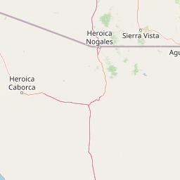
Use this park location map to pinpoint Bavispe Flora and Fauna Protection Area in Mexico, understand its exact geographic position, and read its mapped placement within the surrounding landscape more clearly.

Pigeon | © OpenStreetMap contributors

Location context for Bavispe Flora and Fauna Protection Area

Sonora
Park atlas

Compare regional protected landscapes and mountain reserves across northwestern Mexico.

Other Parks Near Bavispe Flora and Fauna Protection Area

Browse protected areas and connected mountain habitats located near Bavispe Flora and Fauna Protection Area. Comparing adjacent reserves helps reveal broader ecological patterns across the Sierra Madre ranges and regional watersheds.
Nature reserveSonora
About 135 km away#1 closest

Southeast

Northern Jaguar Reserve: Geography and Protected Landscape Atlas of Sonora

Foothill bushland between the Aros and Bavispe River valleys

Northern Jaguar Reserve represents a key protected block of dry tropical bushland in the Sierra Madre foothills of Sonora. This map-focused profile examines the topography, drainage systems, and structural habitat corridors that support one of the northernmost wild jaguar populations within a transition zone of mountain slopes and river-fed canyons.

Area
222 km²
Relief
Mountain
Climate
Subtropical
Access
Remote access
Wildlife reserveChihuahua
About 137 km away#2 closest

Southeast

Campo Verde Flora and Fauna Protection Area: Atlas and Landscape Discovery in Chihuahua

A significant wildlife reserve in the Sierra Madre Occidental

Spanning the transition from high montane forests to semi arid desert, Campo Verde Flora and Fauna Protection Area represents a core component of Mexico's northern conservation network. Documented for its endemic flora and fauna, this wildlife reserve provides a rare look at the ecological mosaic of the Sierra Madre Occidental region.

Area
1,080.67 km²
Established
1938
IUCN
VI
Relief
Mountain
National parkPima County
About 185 km away#3 closest

Northwest

Saguaro National Park: Discover Its Protected Landscape Geography and Mapped Boundaries

Explore the natural terrain and regional context of this national park.

Saguaro National Park offers a focused exploration of a specific protected landscape, highlighting its unique geographic features and mapped boundaries within Pima County. This detail page provides an atlas perspective, allowing for a deep dive into the park's natural terrain and its regional significance. Understand the protected area's identity and its place within the wider geographical context.

Area
371.16 km²
Established
1994
IUCN
II
Visitors
946.4K annual
A horizontal watercolor painting depicting a desert landscape with mountains in the distance, soft green and yellow foreground vegetation, and several yucca plants.
Protected landscapeUnited States of America
About 192 km away#4 closest

North

Rincon Mountain Wilderness: Geographic Atlas and Protected Landscape Overview

Sky island ecosystems and mountainous desert terrain in Arizona

This protected landscape encompasses the core of the Rincon Mountains, defining a classic triangular range oriented southwest to northeast. The wilderness serves as a vital ecological bridge, rising from arid Sonoran lowlands to cool, high-elevation montane forests. Its boundaries protect an intricate system of ridges and canyons that support isolated relict plant communities, offering a distinct study in regional desert mountain geography.

Relief
Mountain
Access
Moderate access
Scope
Terrestrial
Water
Minor water
A soft watercolor painting of a wide, rolling mountain landscape with muted greens, yellows, and purples.
Wildlife reserveArizona
About 213 km away#5 closest

North

Galiuro Wilderness: A Protected Mountain Landscape in Southeastern Arizona

Mapped geography and terrain of the Galiuro range

Trace the uplifted slabs and eroded canyons that define Galiuro Wilderness. This protected area rises from the Arizona plains to reveal a complex geography of brushy slopes, spring-fed riparian zones, and sky-high summit vistas.

Area
309 km²
Established
1932
IUCN
Ib
Relief
Mountain
A watercolor illustration of a wide desert landscape with soft, pastel-colored mountains, arid terrain, and sparse desert vegetation against a bright sky.
Wildlife reserveUnited States of America
About 223 km away#6 closest

Northwest

Pusch Ridge Wilderness: Wildlife Reserve and Sky Island Geography in Arizona

Protecting diverse habitats from Sonoran desert lowlands to high mountain forests.

Located in the Santa Catalina Mountains, Pusch Ridge Wilderness preserves a significant vertical gradient of ecosystems. This wildlife reserve features steep canyons and granite uplifts, providing an essential habitat for Desert Bighorn Sheep while illustrating the distinct Sky Island geography found across the southern Arizona region.

Area
228.36 km²
Established
1978
Relief
Mountain
Climate
Arid
A horizontal watercolor painting showing distant mountains in shades of purple, soft green rolling hills, a central winding river or stream, and grassy foreground elements on a white background.
Protected landscapeNew Mexico
About 235 km away#7 closest

North

Gila National Forest: A Geographic Overview of New Mexico's Protected Wilderness Core

Mapped terrain, forest boundaries, and regional wilderness character

Gila National Forest stands as a critical protected landscape in New Mexico, encompassing immense mountain ranges, narrow river gorges, and extensive backcountry basins. This atlas entry details the forest's topographic transition from high-altitude ponderosa stands to desert lowlands, highlighting its status as the foundational site for the global wilderness movement and a stronghold for regional ecological diversity.

Area
10,969.7 km²
Established
1905
Relief
Mountain
Climate
Temperate
Wildlife reserveChihuahua
About 274 km away#8 closest

Southeast

Tutuaca Flora and Fauna Protection Area: Sierra Madre Occidental Mountain Conservation Reserve

Expansive pine-oak forest habitat in Chihuahua, Mexico

Covering over 4,000 square kilometers, the Tutuaca Flora and Fauna Protection Area acts as a critical link in the Sierra Madre Occidental mountain spine. This wildlife reserve preserves dense pine-oak woodlands, rugged canyons, and high-elevation watersheds that characterize the biodiversity of northwestern Mexico. The area plays a vital role in sustainable resource management and habitat connectivity between Chihuahua and neighboring regions.

Area
4,369.86 km²
Established
2001
IUCN
VI
Relief
Mountain

Common questions about visiting, size, designation, and location context for Bavispe Flora and Fauna Protection Area

Bavispe Flora and Fauna Protection Area FAQs for park facts, access, geography, and protected area context

Find quick answers about Bavispe Flora and Fauna Protection Area, including protected-area facts, park geography, trail and visitor context, and how the park fits into its surrounding country and regional landscape.
MoriAtlas Explorer

Continue Your Protected Areas Search Across the Global Atlas

Deepen your exploration by continuing the structured search for national parks and protected areas worldwide. Utilize the comprehensive filtering capabilities to compare different conservation landscapes and refine your understanding of global park geography. Discover more about the distribution and characteristics of protected natural areas.

Global natural geography