
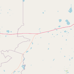
Lakes
Park geography
Examining terrain elevation, protected boundaries, and diverse natural landscape features.
Comprehensive Geographic and Environmental Profile of Bayanaul National Park in Kazakhstan
This geographic profile details the physical characteristics of Bayanaul National Park, encompassing 684.53 square kilometers within Pavlodar Province. The terrain spans an elevation range from 400 to 1027 meters, featuring significant mountain peaks, lakes, and distinct geological formations such as karst caves and gorges. The data provides a structured look at the environmental landscape, including forest and steppe habitats.
Related tags
National ParkKazakhstanMountain RangeLakesGranite Landscape
Kazakhstan's first national park protecting a granite mountain range with four scenic lakes and bizarre rock formations
Bayanaul National Park
Bayanaul National Park is Kazakhstan's first national park, established in 1985 to protect the distinctive Bayanaul Range in the northeastern Pavlodar Province. The park encompasses 68,453 hectares of granite mountains, valleys, and four significant freshwater lakes set within the Kazakh Uplands. The landscape is characterized by ancient Paleozoic mountains that have eroded into relatively low but dramatic formations, with elevations ranging from 400 to 1,027 meters. The highest peak, Akbet Mountain, reaches 1,027 meters and is associated with a local legend about a girl who jumped from its summit to escape an arranged marriage. Despite its location in a semi-desert steppe region, the park supports remarkably diverse vegetation including pine forests, birch woodlands, and approximately 460 plant species. The area holds significant ecological value as a mountainous island of biodiversity within the surrounding steppe ecosystem.
- Location
- Kazakhstan
- Park type
- National park
- Established
- 1985
- Area
- 684.5 km²
- Highest point
- 1,027 m
Location overview
Administrative boundaries and regional alignment in Kazakhstan
Geographic Profile and Location of Bayanaul National Park
Bayanaul National Park is situated within the Pavlodar Province of Kazakhstan. Official mapping confirms its status as an entirely domestic interior reserve with no marine or coastal boundaries.
- Countries
- Kazakhstan
- Regions
- Pavlodar Province
- Primary location
- Kazakhstan
- Geographic setting
- Inland
Boundary and coordinates
Tracing the mapped perimeter and spatial extent across 684.53 square kilometers
Bayanaul National Park Boundary Mapping and Spatial Limits
Interactive geometric outlines define the exact spatial shape and geographic layout of Bayanaul National Park. Regional datasets detail the 684.53 square kilometers of land along with calculated geographic coordinates and spans.
- Boundary area
- 418.3 km²
- Boundary perimeter
- 130.1 km
- Northernmost point
- 50.8734° N
- Southernmost point
- 50.7063° N
- Easternmost point
- 75.8147° E
- Westernmost point
- 75.245° E
- Geographic centre
- 50.794° N, 75.5601° E
- North–south span
- 18.6 km
- East–west span
- 40.2 km
Elevation and terrain
Mountain relief range spanning recorded peaks and lakes
Bayanaul National Park Terrain and Elevation Profile
Explore the recorded elevation summary detailing the vertical range and terrain structure across the park. Linked feature cards provide names, types, and spatial relationships for recorded natural formations.
- Minimum elevation
- 400 m
- Maximum elevation
- 1,027 m
- Highest point
- 1,027 m
Selected named natural features
Rock formations
Кемпиртас
Viewpoints
Висячий камень
Peaks
Батылдар шыңы
Peaks
Саймантас
Lakes
Торайғыр көлі
Environmental setting
Temperate climate, mountain relief, and regional habitat types
Bayanaul National Park Environmental Settings and Mapped Physical Classifications
Recorded landscape features, forest cover, and water presence provide complementary ways to read the physical setting of Bayanaul National Park. Selected categories link directly to relevant atlas destinations across connected protected areas.
- Relief
- Mountain
- Climate
- Temperate
- Water
- Major water bodies
- Forest cover
- Partial forest
- Seasonality
- Seasonal
Landscape features
Mountains · Cliffs · Forest · Woodland · Grassland · Steppe · Wetland · Lakes · Beach · Islands · Cave
Habitat types
Temperate broadleaf forest · Temperate coniferous forest · Steppe · Grassland · Wetland · Lacustrine habitat · Karst habitat
Park atlas
Map the regional spread of protected areas, comparing national parks and unique landscapes across Kazakhstan.
Explore Nearby National Parks and Protected Areas Around Bayanaul National Park, Kazakhstan
Browse other national parks and protected areas in Kazakhstan, extending your exploration beyond Bayanaul National Park's granite formations and forest oases. Compare mapped geography and regional park context to understand how diverse terrain and ecological zones are protected throughout the wider Central Asian steppe.
National parkKazakhstan
135 km away#1 closest
South

Karkaraly State National Nature Park: Kazakhstan's Mountain-Forest Protected Area
Discover unique geology, archaeology, and regional landscape context.
Delve into the distinctive protected landscape of Karkaraly State National Nature Park, situated in Kazakhstan's Karaganda Region. This park preserves a rare mountain-forest ecosystem with dramatic granite formations, ancient archaeological sites, and lakes, presenting a rich geographic contrast to the surrounding Kazakh Steppe. MoriAtlas provides structured insights into Karkaraly State National Nature Park's unique terrain, its conservation value, and its position within the broader regional geography of Central Asia.
- Area
- 1,121.2 km²
- Established
- 1998
- IUCN
- II
- Relief
- Mountain
National parkAkmola Region
About 146 km away#2 closest
West
Buiratau State National Nature Park: Kazakhstan National Park within Akmola Region
Explore unique steppe-forest transition ecosystems and geography.
Buiratau State National Nature Park in Kazakhstan's Akmola Region protects a significant transitional zone between dry steppe and semi-arid forest. This national park showcases a diverse landscape of low ridges, plains, and salt lakes, contributing to its rich biodiversity. Discover the mapped boundaries and the unique ecological character of this protected area within the context of the Kazakh Uplands atlas and its regional geography.
- Area
- 890 km²
- Established
- 2011
- IUCN
- II
- Relief
- Upland
Natural monumentPavlodar Region
About 177 km away#3 closest
Northeast
Gusiny Perelet Natural Monument: Geological Geography and Fossil Site Mapping in Pavlodar Region
An iconic Irtysh River protected area and Neogene research locality
Situated along the Irtysh River bank, Gusiny Perelet functions as a vital reference point for Neogene mammal evolution in Central Asia. The protected site showcases an exposed geological face, providing scientific insight into ancient ecosystems once dominated by Hipparion fauna. Its preserved fossil assemblage and riverside location offer a tangible connection to the region's deep natural history.
- Established
- 1971
- Relief
- Lowland
- Climate
- Temperate
- Access
- Easy access
Nature reservePavlodar Region
About 237 km away#4 closest
Northeast
Ertis Ormany Nature Reserve: A Geographical Overview of Kazakhstan's Pine Belts
Protected forested corridors within the Kulunda Plain steppe.
Covering over 278,000 hectares, Ertis Ormany is a premier protected area in Kazakhstan's Pavlodar Region. The reserve manages unique ribbons of pine forest growing on sandy soils, forming an essential forest-steppe ecosystem that supports biodiversity and provides a natural barrier against desertification in the southwestern Kulunda Plain.
- Area
- 2,779.61 km²
- Established
- 2003
- IUCN
- VI
- Relief
- Lowland

Wildlife reserveKaraganda Region
About 252 km away#5 closest
Southwest
Bugyly Sanctuary Wildlife Reserve and Protected Mountain Terrain in Karaganda Region
A protected zoological landscape in the heart of central Kazakhstan
Bugyly Sanctuary is a specialized wildlife reserve defined by its low mountain topography, rocky outcrops, and narrow stream-side groves. Situated in the Karaganda Region, the protected area functions as a vital refuge for argali sheep, roe deer, and various ground-nesting birds, standing as a testament to the diverse interior uplands of the Sarysu River basin.
- Area
- 85 km²
- Relief
- Lowland
- Water
- Minor water
Nature reserveAbai Region
About 293 km away#6 closest
East
Semey Ormany Nature Reserve: Protected Ribbon Pine Forests in Abai Region
Mapped forest corridors and steppe ecological boundaries.
Semey Ormany protects extensive ribbon pine forests that stretch through the sandy plains of the Abai Region. This reserve serves as a vital ecological buffer, bridging the gap between desert-like semi-steppes and dense woodland strips, home to diverse wildlife and rare plant communities across the Irtysh river basin.
- Area
- 6,541.8 km²
- Established
- 2003
- IUCN
- VI
- Relief
- Mixed relief
Nature reserveKaraganda Region
About 372 km away#7 closest
Southwest
Karaagash Nature Reserve: Granite Ridge Landscapes in Central Kazakhstan
Protected forest-steppe habitat in the Karaganda region
Karaagash Nature Reserve stands as a sentinel of central Kazakhstan's geography, protecting a rugged area where granite uplands meet ridge-and-valley plains. This reserve supports a diverse array of flora and fauna, offering a representative look at the forest-steppe transition zone and its role in regional conservation.
- Area
- 68 km²
- Established
- 1986
- IUCN
- IV
- Relief
- Mountain
National parkAqmola Region
388 km away#8 closest
Northwest
Burabay State National Nature Park: Mapped Granite Hills and Forested Terrain Atlas
Explore protected landscapes in Kazakhstan's Aqmola Region.
Burabay State National Nature Park presents a unique protected landscape within the Kokshetau Massif of Kazakhstan's Aqmola Region. This atlas-focused entry details the park's distinctive terrain, featuring ancient granite outcrops and rolling hills draped in pine and birch forests. Understand the mapped boundaries and geographic setting of this national park, renowned for its scenic lakes and significant geological formations, offering rich context for protected-area discovery.
- Area
- 1,299.35 km²
- Established
- 2000
- IUCN
- II
- Relief
- Mixed relief
MoriAtlas Explorer
Continue Exploring Bayanaul National Park's Mapped Terrain and Regional Geography
Deepen your understanding of Bayanaul National Park by navigating its specific geographic context within Kazakhstan. Examine the mapped boundaries of this protected landscape, its distinctive geological formations, and the surrounding terrain that contributes to its unique ecological identity. MoriAtlas provides structured data to support your exploration of this significant Central Asian natural area.
Browse next
Global natural geography
Explore related park routes
Explore MoriAtlas Global ParksBrowse All MoriAtlas ParksGlobal Park Map DiscoveryMoriAtlas: Browse All CountriesBrowse All MoriAtlas ContinentsNational Park Environment AtlasGrand Canyon National Park AtlasYellowstone National Park AtlasYosemite National Park Atlas and GeographySerengeti National Park AtlasGalápagos National Park Protected LandscapeBanff National Park Geography and AtlasKruger National Park Atlas EntryUluṟu-Kata Tjuṯa National Park AtlasExplore Uluru-Kata Tjuta National Park GeographyPlitvice Lakes National Park AtlasFiordland National Park Protected LandscapeGreat Smoky Mountains National Park AtlasAfghanistan National Parks and Protected AreasAlbania National Parks and Protected AreasAlgeria National Parks and Protected AreasAmerican Samoa National Parks and Protected AreasAndorra National Parks and Protected AreasAngola National Parks and Protected AreasAntarctica National Parks and Protected AreasAntigua and Barbuda Park List