
Mori Atlas logo
Nature reserveBeerenbusch

A detailed look at the forest boundaries, terrain features, and regional geography near Fürstenwalde

Beerenbusch Nature Reserve: Mapping the Protected Oak and Alder Forest Landscapes of Brandenburg

(Naturschutzgebiet Beerenbusch)

Beerenbusch Nature Reserve represents a critical protected woodland fragment within the state of Brandenburg, Germany. This dedicated forest atlas profile examines the near-natural oak-hornbeam and alder swamp forest mosaic that thrives east of Fürstenwalde. By mapping these rare deciduous habitats and documenting their place within the broader lowland forest belt, we provide a clear geographic perspective on this significant conservation area.

nature reserveBrandenburgoak-hornbeam forestalder swamp forestdeciduous woodlandstag beetle habitat
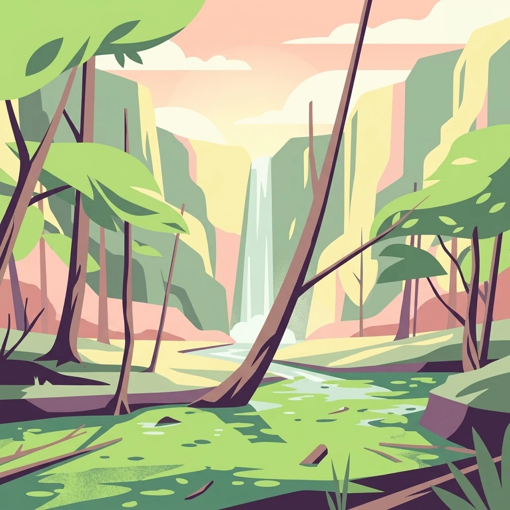
A digital illustration depicting a forest landscape with a waterfall in the distance, a stream in the foreground, and stylized trees.

Beerenbusch

Nature reserve

Park overview

Structured park overview, official facts, and landscape profile for Beerenbusch Nature Reserve

Beerenbusch Nature Reserve park facts, protected area profile, and essential visitor context

Review the core facts for Beerenbusch Nature Reserve, including designation, size, terrain, visitor scale, habitats, and operating context in one park-focused overview.

About Beerenbusch Nature Reserve

Beerenbusch is a protected woodland fragment in eastern Brandenburg, forming a small but ecologically meaningful island of near-natural forest within the wider agricultural and forested landscape of the Oder-Spree region. Although compact at about 70 hectares, it carries a protected-area status that reflects the high value local conservationists place on its remaining natural forest character.

Administratively, Beerenbusch belongs to the Fürstenwalde city forest (Stadtforst Fürstenwalde), making it both a conservation site and a managed forest unit of the town. Its location east of Fürstenwalde places it within the lowland forested belt that once stretched broadly across the area, much of which has since been converted to other land uses; the reserve therefore functions as a surviving example of older, more structurally diverse woodland.

Ecologically, Beerenbusch is characterized by two overlapping habitat types. Stieleichen-Hainbuchenwald, or pedunculate oak-hornbeam forest, is a classic Central European woodland association that thrives on moderately moist soils and is typically rich in structure and species. Erlenbruchwald, alder swamp forest, occupies wetter ground, often along low-lying depressions, and supports a very different suite of moisture-loving plants. Together, these two formations give the reserve a layered character that is unusual in such a small area.

Beyond its habitat diversity, the reserve is valued as a refuge for plant species that have become rare elsewhere in Brandenburg. It also documents forest-fauna interactions that have largely vanished from more intensively worked forests nearby. The presence of a managed forest experience trail indicates its function not only as a strict conservation zone but also as a local site for environmental education and low-key nature tourism.

Quick facts and research context for Beerenbusch Nature Reserve

Beerenbusch is a designated nature reserve (Naturschutzgebiet) in Brandenburg, in the Oder-Spree district, located east of Fürstenwalde/Spree and integrated into the Fürstenwalde city forest. The protected area covers approximately 70 hectares and was formally designated in 1967.

Its character is defined by mixed deciduous woodland, especially near-natural oak-hornbeam stands and alder swamp forests. The reserve is recognized locally as a refuge for rare native plants and, among fauna, the stag beetle is a notable inhabitant. A forest experience trail with educational stations crosses the area.

Protection and recognition

Terrestrial protection scope and verified management records

Beerenbusch Protection Status and Documented Conservation Framework

Terrestrial protection status records outline the administrative framework and management parameters established for Beerenbusch. Verified conservation data details the official protection scope and designation history maintained within the protected area database.

Protection details

Protection scope
Terrestrial
Transboundary protection
No
WDPA ID
162357
Park context

Deeper park guide and search-rich context for Beerenbusch Nature Reserve

Beerenbusch Nature Reserve history, landscape, wildlife, and travel context

Explore Beerenbusch Nature Reserve through its history, landscape character, ecosystems, wildlife, conservation priorities, cultural context, and seasonal travel timing in a structured park guide built for atlas discovery and search intent.

Why Beerenbusch Nature Reserve stands out

Beerenbusch is best known as a refuge for near-natural deciduous forest in an otherwise heavily altered region of Brandenburg. Its core ecological value lies in the surviving stands of oak-hornbeam woodland and alder swamp forest, two habitat types that have become increasingly fragmented around Berlin and the Spree lowlands. The reserve is also noted among visitors for the Königskiefer, a celebrated old pine tree with a direct connection to Prussian royal hunting history, and for its role as an accessible forest education site near Fürstenwalde.
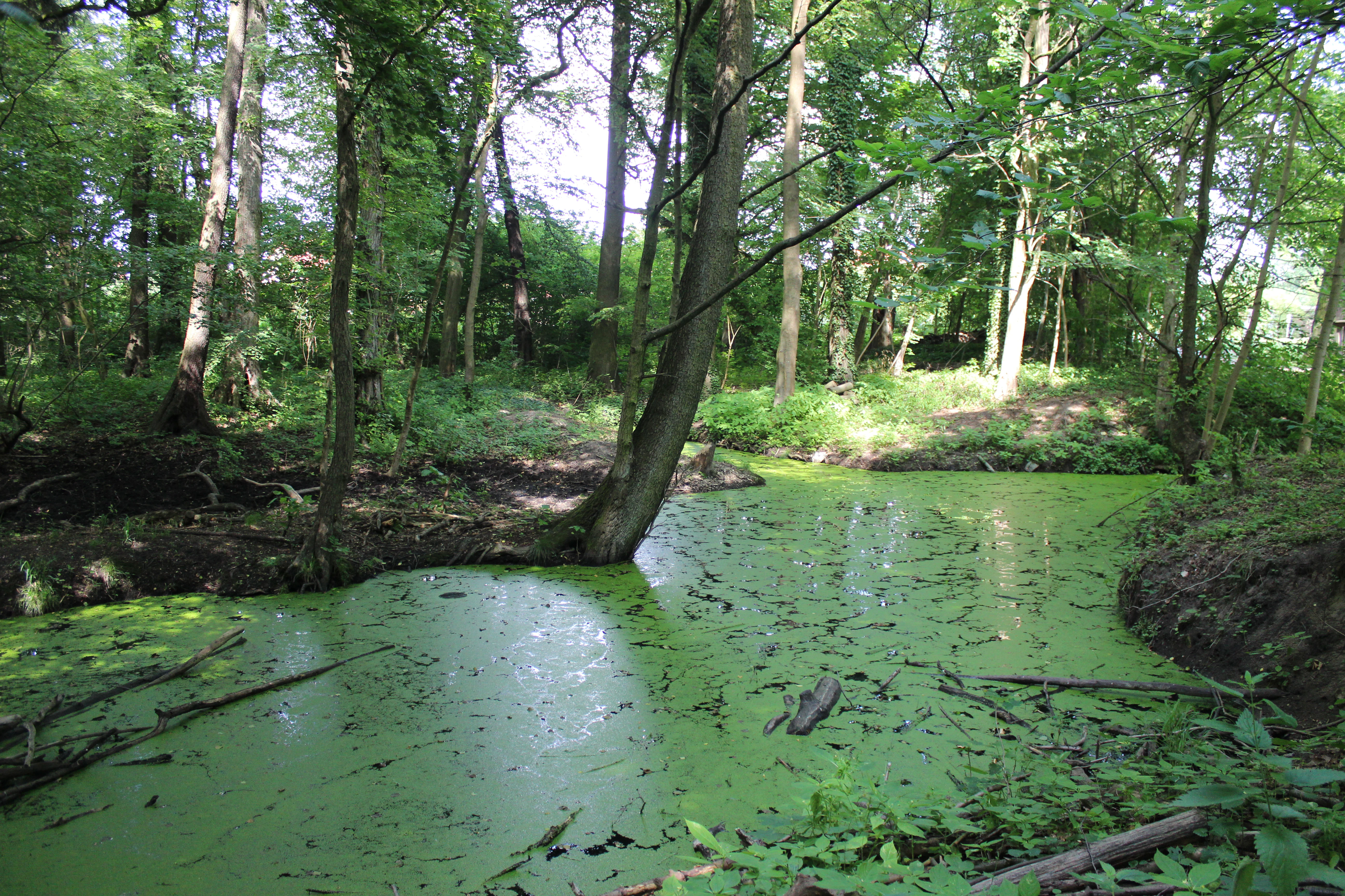
A small, murky pond covered in green algae and duckweed surrounded by deciduous trees in a dense forest setting.
A shaded, stagnant pool covered in duckweed within the Beerenbusch nature reserve.

Beerenbusch Nature Reserve history and protected-area timeline

Beerenbusch was formally designated as a nature reserve (Naturschutzgebiet) in 1967, recognizing the area's exceptional forest character at a time when Brandenburg's natural woodlands were under significant pressure from agricultural expansion and forestry intensification.

The reserve had already acquired a cultural significance before its formal protection. The so-called Königskiefer, a striking pine tree within the forest, served as a stand during a driven hunt (Treibjagd) attended by the later Kaiser Wilhelm I, who reportedly admired the tree so much that he wished to have it transplanted to his Babelsberg Park in Potsdam. Whether fully transplanted or not, the historical reference ties the forest to nineteenth-century Prussian royal hunting traditions that shaped many woodland areas around Berlin and Brandenburg.

Integration into the Fürstenwalde city forest (Stadtforst Fürstenwalde) has given the reserve a dual identity over time, functioning both as a strictly protected ecological area and as a working municipal forest. The later addition of a forest experience trail (Walderlebnispfad) with interpretive stations reflects a more recent emphasis on public environmental education, allowing visitors to engage directly with the forest's ecological themes.

Beerenbusch Nature Reserve landscape and geographic character

The landscape of Beerenbusch is shaped almost entirely by woodland. As part of the Stadtforst Fürstenwalde and the broader lowland forest belt east of Fürstenwalde/Spree, the terrain is gentle, typically consisting of low-relief glacial lowland rather than dramatic topography. The forest sits within a region that transitions between the Spree lowlands and the more open landscapes toward the Oder.

Two contrasting woodland environments define the reserve. The oak-hornbeam stands occupy the more typical, moderately moist forest soils and produce a dense, multi-layered canopy with understory shrubs and a rich herb layer. The alder swamp forests occur in the wetter pockets and along low-lying, periodically saturated ground, creating darker, more humid woodland with a distinct character and ground flora.

Among the reserve's most recognized individual landscape features is the Königskiefer, a tall pine of cultural and visual prominence. The presence of an educational forest trail marked by interpretive stations adds a human-scale layer to the landscape, allowing visitors to traverse and read the forest as a structured environment rather than a uniform block of trees.

Beerenbusch Nature Reserve ecosystems, habitats, and plant life

The ecological profile of Beerenbusch is anchored in two structurally rich and increasingly rare lowland forest types. The pedunculate oak-hornbeam woodland (Stieleichen-Hainbuchenwald) is the dominant formation on better-drained ground, while the alder swamp woodland (Erlenbruchwald) occupies the wetter zones, producing a mosaic of dry-mesic and moist forest within a relatively small total area.

This juxtaposition of habitats is ecologically significant. Oak-hornbeam forests support a diverse community of broadleaf trees and an understory of shade-tolerant herbs, while alder swamp forests are home to moisture-loving species and serve as important hydrological buffers. The combination of the two within one reserve makes Beerenbusch disproportionately valuable for conservation compared to its modest size.

For plants, the reserve functions as a refuge for rare native species, with documented occurrences such as the so-called Bleitblättriger Sitter and the Weiße Waldhyazinthe, two plants of conservation interest in Brandenburg. Such species occurrences reflect the continuing presence of near-natural forest conditions and emphasize the reserve's role in safeguarding botanical diversity on the edge of the Berlin-Brandenburg metropolitan region.

Beerenbusch Nature Reserve wildlife and species highlights

Wildlife in Beerenbusch reflects the reserve's woodland and swamp forest character. The most prominently mentioned species is the stag beetle (Hirschkäfer), a charismatic insect strongly associated with mature deciduous forests containing old oak trees and dead wood, both of which the reserve provides.

The mixture of dry-mesic oak-hornbeam and wet alder forest supports a variety of woodland invertebrates, amphibians adapted to damp forest pools and swampy ground, and typical lowland forest birds. Although the reserve is small, its structural diversity offers habitat niches that have largely disappeared from more uniformly managed forests nearby.

The presence of the stag beetle in particular highlights Beerenbusch's conservation relevance at a landscape scale, since this species requires long continuity of old trees and undisturbed decaying wood, conditions that the reserve continues to maintain.

Beerenbusch Nature Reserve conservation status and protection priorities

Beerenbusch carries formal nature reserve status (Naturschutzgebiet) under Brandenburg law and is classified internationally as an IUCN Category IV protected area, corresponding to a Habitat/Species Management Area. Its designation in 1967 marked a long-term recognition of the site's forest values at a time of substantial land-use change in the surrounding region.

The reserve's conservation value centers on the protection of near-natural Stieleichen-Hainbuchen and Erlenbruchwälder, habitat types that have become highly fragmented across Brandenburg and eastern Germany more broadly. By safeguarding such woodland within its borders, Beerenbusch contributes to the persistence of plant species of conservation concern, including the Bleitblättriger Sitter and the Weiße Waldhyazinthe, and supports wildlife such as the stag beetle that depends on old-growth forest features.

Its location within the larger Stadtforst Fürstenwalde means the reserve also plays a role in broader landscape-level forest management planning, providing a benchmark against which surrounding, more intensively used forest areas can be measured. The integrated designation approach, combining strict ecological protection with public education through the Walderlebnispfad, illustrates a typical Brandenburg model of managing small but ecologically rich forest reserves for both biodiversity and outreach.

Beerenbusch Nature Reserve cultural meaning and human context

Although Beerenbusch is primarily an ecological site, it carries a notable cultural heritage element in the Königskiefer. This old pine tree is associated with Kaiser Wilhelm I, who used the tree as a stand during a Treibjagd and reportedly admired it so much that he wished to have it moved to his Babelsberg Park in Potsdam. The story links the forest directly to nineteenth-century Prussian royal hunting culture that shaped much of the woodland landscape around Berlin and Potsdam.

The presence of a forester's house, Forsthaus Beerenbusch, at the eastern edge of the reserve also reflects the long-standing role of the area as a working municipal forest. The Walderlebnispfad running through the woodland represents a more contemporary layer of cultural engagement, framing the reserve as a site for environmental learning rather than only as a strict conservation zone.

The reserve is also part of the broader cultural geography of Brandenburg, where small forest reserves around towns like Fürstenwalde have shaped local identities tied to woodland traditions, hunting heritage, and the rural-forest character of the eastern Brandenburg countryside.

Top sights and standout views in Beerenbusch Nature Reserve

Among the most distinctive features of Beerenbusch is the survival of a near-natural oak-hornbeam and alder swamp forest mosaic, a habitat combination rare in such a compact area. The reserve's role as a refuge for rare plant species, including the Weiße Waldhyazinthe and the Bleitblättriger Sitter, underscores its botanical importance.

The Königskiefer gives the reserve a tangible cultural anchor, connecting Brandenburg lowland forest to Prussian royal hunting history. The presence of stag beetles and other old-forest wildlife adds a further layer of ecological significance, while the integrated Walderlebnispfad makes the reserve accessible and educational for visitors exploring the forests east of Fürstenwalde.

Best time to visit Beerenbusch Nature Reserve

Beerenbusch is a lowland Brandenburg forest, so seasonal character matters. Spring and early summer are typically the most rewarding periods for visitors interested in the woodland flora, when the understory plants and rare species such as the Weiße Waldhyazinthe emerge and the forest feels visually alive. Bird activity is also strong in this period.

Autumn brings a different kind of appeal, with broadleaf forest displays and a quieter atmosphere after the main tourist season, while walks along the Walderlebnispfad are pleasant year-round outside of prolonged wet or icy conditions. Because the reserve is a protected forest rather than a developed visitor attraction, seasonal conditions primarily affect scenery and flora rather than accessibility.

Monthly climate preview

Long term temperature and precipitation records for Brandenburg

Beerenbusch Climate Normals and Measured Monthly Weather Patterns

Historical measurements from a representative coordinate trace the multi-year temperature and precipitation averages across the park landscape. Examining the full twelve-month profile reveals detailed monthly fluctuations in thermal ranges and daily precipitation amounts.
Annual mean9 °C
-1 °C20 °C
Jan-1°
Feb
Mar
Apr
May14°
Jun18°
Jul20°
Aug20°
Sep15°
Oct
Nov
Dec
Warmest month
July

20.3 °C

Coolest month
January

-1.1 °C

Wettest month
July

2.5 mm/day

Driest month
April

1.1 mm/day

Park location guide

Geography guide, regional context, and park location map for Beerenbusch Nature Reserve

Beerenbusch Nature Reserve park geography, regions, and map view in Germany

Understand where Beerenbusch Nature Reserve sits in Germany through a broader geographic reading of the surrounding landscape, nearby location context, and its mapped position within the national park landscape.

How Beerenbusch Nature Reserve fits into Germany

Germany is a federal republic in Western and Central Europe with a population of over 83 million across sixteen constituent states. It is Europe's largest economy by nominal GDP and a major global exporter and importer. The capital is Berlin, and the country borders Denmark, Poland, Czech Republic, Austria, Switzerland, France, Luxembourg, Belgium, and the Netherlands.

Wider geography shaping Beerenbusch Nature Reserve in Germany

Germany is located in Western and Central Europe, spanning 357,022 km². It borders Denmark to the north, Poland and the Czech Republic to the east, Austria and Switzerland to the south, and France, Luxembourg, Belgium, and the Netherlands to the west. The country has coastlines on the Baltic Sea and North Sea to the north, with the Alps located in the southern region.

Map view of Beerenbusch Nature Reserve

Use this park location map to pinpoint Beerenbusch Nature Reserve in Germany, understand its exact geographic position, and read its mapped placement within the surrounding landscape more clearly.

Pigeon | © OpenStreetMap contributors

Location context for Beerenbusch Nature Reserve

Brandenburg

Protected area scenery, woodland habitats, and forest terrain

Beerenbusch Photos and Visual Landscape Exploration

Visual records capture the rare oak-hornbeam forest and alder swamp woodland that define the reserve. Examining these protected habitats reveals the natural character and glacial lowland terrain of the Brandenburg region.

A small, murky pond covered in green algae and duckweed surrounded by deciduous trees in a dense forest setting.

A green informational sign stands on a wooden post in a grassy, forested area next to a wooden fence that follows a path.

Park atlas

Compare adjacent woodland reserves and connected conservation areas across the Brandenburg lowlands

Exploring Parks Near Beerenbusch And Surrounding Regional Protected Landscapes

Browsing other parks near Beerenbusch reveals a broader mosaic of protected lowland forests and regional woodland habitats. Comparing these surrounding natural areas provides valuable geographic context for understanding Brandenburg conservation corridors.
A watercolor illustration of an open dune landscape with soft yellow sand, green grass, and scattered trees under a light sky.
Nature reserveBrandenburg
About 16 km away#1 closest

Southwest

Binnendüne Waltersberge: Nature Reserve and Glacial Landscape in Brandenburg

Exploring inland sand dune geography and protected habitat boundaries.

Binnendüne Waltersberge is a significant nature reserve representing the glacial history of Brandenburg. Its terrain features a wave-like sand ridge that contrasts bare, sun-exposed surfaces with lichen-rich pine forests. This site serves as an essential example of psammophilic ecosystem restoration and regional geomorphology within the Oder-Spree landscape.

Area
0.14 km²
Established
1990
Relief
Upland
Climate
Temperate
Nature reserveBrandenburg
About 18 km away#2 closest

West

Swatzke- und Skabyberge Nature Reserve and Protected Inland Dune Geography in Brandenburg

Mapping the sand heaths and forest ecosystems of northeastern Germany

Swatzke- und Skabyberge is a designated nature reserve in Brandenburg that preserves a rare inland dune complex. Originally shaped by long term military usage, this protected land now functions as a vital habitat for dry acid grasslands, lichen-rich pine forests, and wetland woodland fringes. It provides a unique study in how sand, fire, and moisture processes maintain biodiversity within the lowland German landscape.

Area
5.2 km²
Established
1999
IUCN
IV
Nature reserveBrandenburg
About 19 km away#3 closest

Southwest

Groß Schauener Seenkette Nature Reserve: Mapped Wetlands and Brandenburg Lake Geography

An undisturbed chain of shallow lakes and protected fen landscapes

This protected nature reserve in Brandenburg preserves a vital chain of six interconnected lakes. The geography is defined by extensive reedbeds, sedge stands, and rare inland saline meadows, providing a crucial habitat mosaic. Learn how these wetlands connect to the surrounding Dahme-Heideseen region through a network of terrain-focused conservation areas and historic trails.

Area
21.249 km²
Established
2000
Relief
Lowland
Climate
Temperate
A horizontal watercolor painting showing layers of soft-toned hills in green and purple, with tall blades of grass in the foreground.
Nature reserveBrandenburg
About 19 km away#4 closest

North

Klobichsee Nature Reserve: Protected Landscape and Glacial Lake Geography in Brandenburg

Mapping aquatic ecosystems and protected boundaries in eastern Germany

Klobichsee Nature Reserve covers roughly 5.59 square kilometers, centering on the Großer Klobichsee and Kleiner Klobichsee glacial lakes. This protected area in Brandenburg preserves essential forest and wetland habitats, maintaining the ecological character of the region situated between Buckow and Münchehofe.

Area
5.59 km²
Established
1990
IUCN
IV
Climate
Temperate
Nature reserveBrandenburg
About 22 km away#5 closest

North

Stobbertal Nature Reserve: Geography, Mapped Boundaries, and Protected Landscape Context

A detailed geographic study of the Stöbber river valley in Brandenburg, Germany

Stobbertal represents a compact yet ecologically dense protected area in Brandenburg. This study provides access to information regarding its diverse forest and wetland habitats, ranging from ancient oak-hornbeam woodlands to rare floodplain remnants. Gain insight into the regional importance of the river corridor, its hydrologic features, and the protected species that inhabit this distinct northeastern German landscape.

Area
8.84 km²
Established
1990
IUCN
IV
A soft watercolor painting of a pastoral landscape featuring green rolling hills, distant trees, and a foreground with grassy vegetation and pinkish marsh-like reflections.
Protected landscapeBrandenburg
About 23 km away#6 closest

North

Naturpark Märkische Schweiz: A Protected Landscape Discovery in Brandenburg

Glacial terrain, kettle lakes, and river basin geography.

Situated near Berlin, this protected landscape features a textbook glacial relief shaped by retreating ice sheets. The area encompasses the Schermützelsee, deep kettle ponds known as Sölle, and the narrow valleys of the Stobber river. Learn about the park's layered conservation framework, which combines European habitat protection with rich fieldstone architecture and cultural history.

Area
205 km²
Established
1990
Relief
Upland
Climate
Temperate
A soft watercolor painting of a wetland featuring grassy foregrounds, a winding stream, distant rolling hills, and a pale sky.
Protected areaBrandenburg
About 23 km away#7 closest

South

Reichardtsluch Protected Area: A Wetland Geography Overview in Brandenburg, Germany

Glacial moraine terrain and seasonal amphibian habitats

Reichardtsluch acts as a vital, two-hectare wetland refuge within the Beeskower Platte region of Brandenburg. This protected landscape is defined by its dramatic seasonal hydrology, alternating between full inundation and dry spells. The site remains a core component of the broader Natura 2000 network, offering insight into postglacial drainage patterns and forest-fringed amphibian breeding ecology in eastern Germany.

Area
0.29 km²
Established
2003
Relief
Lowland
Climate
Temperate
A watercolor painting showing a quiet wetland with calm water, scattered dark tree stumps, reeds in the foreground, and rolling green hills in the distance under a pale sky.
Nature reserveBrandenburg
About 24 km away#8 closest

East

Booßener Teichgebiet Nature Reserve: Regional Geography and Protected Landscape Analysis

Glacial meltwater valleys and pond ecosystems in eastern Brandenburg

Discover the geographic footprint of Booßener Teichgebiet, a 104-hectare nature reserve in Brandenburg. This protected area features a unique combination of managed stream corridors, impoundment ponds, and xerothermic biotopes nestled within a glacial meltwater valley near the German-Polish border.

Area
1.04 km²
Established
2008
IUCN
IV
Relief
Lowland

Common questions about visiting, size, designation, and location context for Beerenbusch Nature Reserve

Beerenbusch Nature Reserve FAQs for park facts, access, geography, and protected area context

Find quick answers about Beerenbusch Nature Reserve, including protected-area facts, park geography, trail and visitor context, and how the park fits into its surrounding country and regional landscape.
MoriAtlas Explorer

Continue Your Protected Areas Search Across the Global Atlas

Deepen your exploration by continuing the structured search for national parks and protected areas worldwide. Utilize the comprehensive filtering capabilities to compare different conservation landscapes and refine your understanding of global park geography. Discover more about the distribution and characteristics of protected natural areas.

Global natural geography