

Mori Atlas logo
Wildlife reserveBeza Mahafaly Special Reserve

Mapping the unique riparian woodland landscapes and dry spiny bush environments of Atsimo-Andrefana

Beza Mahafaly Special Reserve: A Protected Gallery Forest Landmark in Southwestern Madagascar

(Réserve spéciale de Beza Mahafaly)

Beza Mahafaly Special Reserve represents a critical protected landscape in the semi-arid southwest of Madagascar. This site is defined by its rare gallery forest, a lush ribbon of vegetation tracing a watercourse through the broader dry spiny bush terrain. The reserve serves as a significant research center, providing essential insights into the ecology of lemur species and bird assemblages within this distinct regional geography.

gallery forestriparian forestdry spiny bushsouthwestern MadagascarMadagascar National Parkslemur research

Beza Mahafaly Special Reserve

Wildlife reserve

Park overview

Structured park overview, official facts, and landscape profile for Beza Mahafaly Special Reserve

Beza Mahafaly Special Reserve park facts, protected area profile, and essential visitor context

Review the core facts for Beza Mahafaly Special Reserve, including designation, size, terrain, visitor scale, habitats, and operating context in one park-focused overview.

About Beza Mahafaly Special Reserve

Beza Mahafaly Special Reserve is a small but disproportionately important protected area in the arid southwest of Madagascar. Located in the Atsimo-Andrefana region and reachable from the town of Betioky in the country's deep south, the reserve represents a focused effort to conserve an unusual forest type within a landscape otherwise dominated by dry spiny bush and open grasslands.

The reserve consists of two parcels totaling 600 hectares and separated by roughly ten kilometers of intervening terrain. Despite its compact footprint, Beza Mahafaly holds exceptional conservation value because it includes the only protected gallery forest in Madagascar. A gallery forest is a narrow, linear forest formation that develops along a river or permanent watercourse, where soil moisture and microclimate allow trees and other dense vegetation to thrive in a region that is otherwise too dry to support closed-canopy woodland. Within Beza Mahafaly, this gallery forest creates a sharp ecological contrast with its surroundings and provides habitat for species that would not otherwise survive in the region's arid matrix.

Managed by Madagascar National Parks with additional financial support from the Fondation pour les aires protégées et la biodiversité de Madagascar, the reserve combines habitat protection with active scientific research. It is well known in primatology circles for its long-running studies of sifakas and other lemurs, and it has become a benchmark site for understanding how lemur populations respond to environmental pressures, habitat fragmentation, and the presence of human communities along reserve boundaries.

For visitors and naturalists, Beza Mahafaly offers an intimate and easily explored slice of southwestern Madagascar's biodiversity, with strong chances of observing iconic lemur species and a wide cross-section of dryland birds.

Quick facts and research context for Beza Mahafaly Special Reserve

Beza Mahafaly Special Reserve is a 600-hectare protected area in Madagascar's Atsimo-Andrefana region, situated about 35 kilometers northeast of Betioky. Established in 1986, it is classified as a Special Reserve under Madagascar's protected-area system and is administered by Madagascar National Parks with support from the Fondation pour les aires protégées et la biodiversité de Madagascar.

The reserve is composed of two separate parcels roughly ten kilometers apart and is best known for protecting the only protected gallery forest in Madagascar, a forest formation that follows the course of a river through surrounding dry spiny-bush habitat.

Protection and recognition

Examine official protected area designation records and conservation history

Beza Mahafaly Special Reserve Protection Status and Recognition Data

Beza Mahafaly Special Reserve features documented protection metrics and official database identifiers for conservation analysis. Designated records outline management scope and international recognition status across the protected landscape.

Protection details

WDPA ID
10634
Park context

Deeper park guide and search-rich context for Beza Mahafaly Special Reserve

Beza Mahafaly Special Reserve history, landscape, wildlife, and travel context

Explore Beza Mahafaly Special Reserve through its history, landscape character, ecosystems, wildlife, conservation priorities, cultural context, and seasonal travel timing in a structured park guide built for atlas discovery and search intent.

Why Beza Mahafaly Special Reserve stands out

Beza Mahafaly is best known as one of Madagascar's most important sites for the study and conservation of lemurs, including Verreaux's sifaka and ring-tailed lemur, and as the protector of the country's only legally designated gallery forest. The reserve has served as a long-term research base for primatologists and conservation biologists, making it scientifically significant far beyond its modest size.
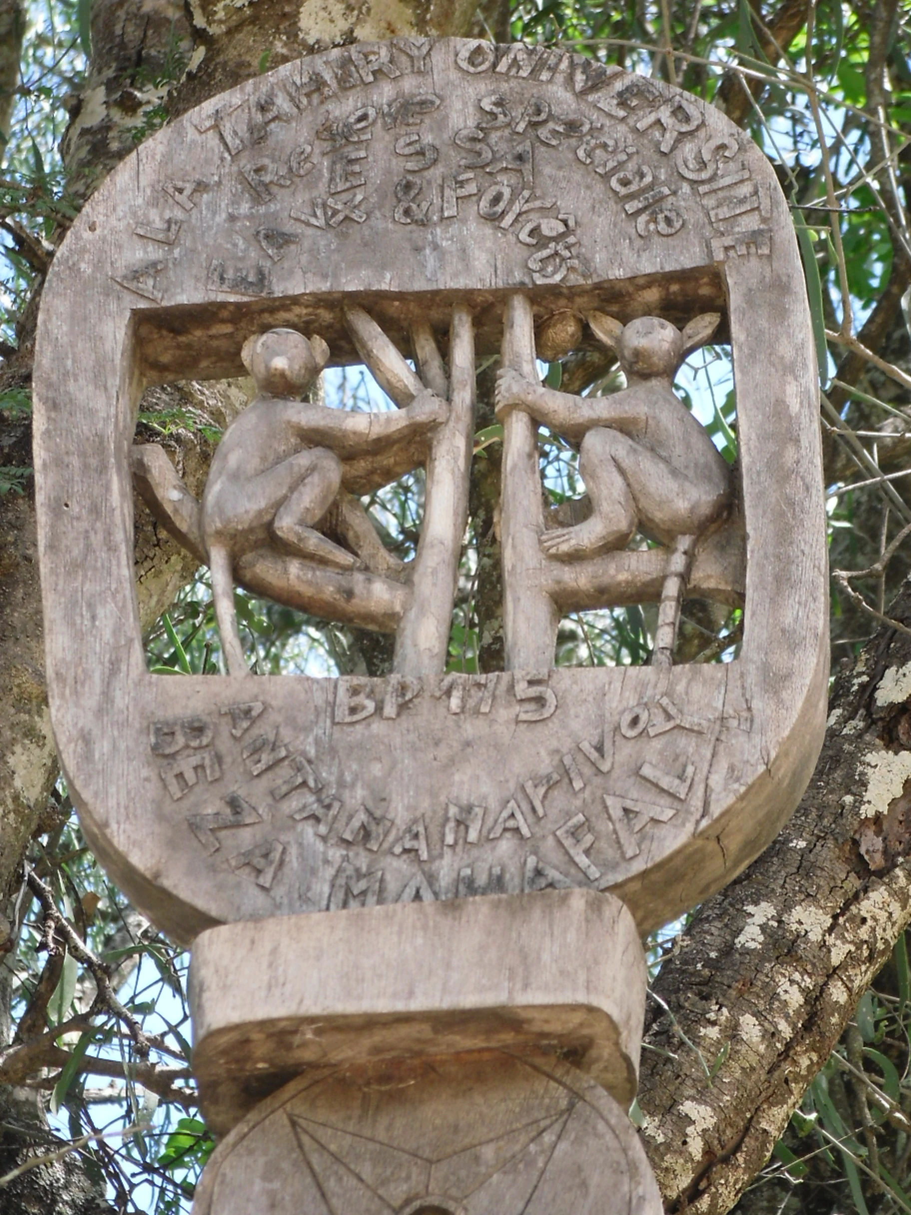
A close-up, eye-level photograph of a weathered wooden sign carved with the figures of two lemurs climbing trees, with text engraved above and below the figures, attached to a tree trunk.
Hand-carved wooden sign featuring two lemurs at the Beza Mahafaly Special Reserve in Madagascar.

Beza Mahafaly Special Reserve history and protected-area timeline

Beza Mahafaly Special Reserve was formally established in 1986 as part of Madagascar's developing network of protected areas, which expanded rapidly during the late twentieth century as the country formalized conservation of its exceptionally diverse but threatened natural heritage.

From its creation, the reserve was placed under the management of Madagascar National Parks, the national agency responsible for administering protected landscapes across the country. Over time it has also received material and financial support from the Fondation pour les aires protégées et la biodiversité de Madagascar, a foundation dedicated to financing conservation in Madagascar.

The reserve's identity is closely tied to its long-standing role as a scientific research site. Beza Mahafaly has hosted multigenerational studies of lemur behavior, demography, and ecology, and is one of the best-documented gallery-forest sites in Madagascar from a biological standpoint.

Beza Mahafaly Special Reserve landscape and geographic character

The landscape of Beza Mahafaly lies within the semi-arid southwest of Madagascar, a region characterized by low rainfall, thorny vegetation, and stretches of bare, reddish or pale soil between patches of woody cover. The terrain is generally flat to gently undulating, shaped more by seasonal rivers and long-term erosion patterns than by dramatic topography.

The reserve's defining landscape feature is its river and the gallery forest that lines its banks. Within the surrounding matrix of spiny bush, where plants such as didierea and euphorbias typically dominate, the gallery forest appears as a narrow green ribbon of denser, taller trees and understory vegetation tracing the watercourse. This contrast between linear riparian woodland and the open, dry scrub landscape is the visual hallmark of Beza Mahafaly and shapes how both wildlife and people move through the reserve.

Beza Mahafaly Special Reserve ecosystems, habitats, and plant life

Ecologically, Beza Mahafaly centers on the gallery-forest ecosystem that gives the reserve its special status. This riparian woodland supports a richer and structurally more complex plant community than the surrounding dry spiny-bush formations, including taller canopy trees, denser understory growth, and a more humid microclimate that retains moisture near the watercourse even during the long dry season.

Beyond the gallery forest itself, the reserve includes tracts of spiny bush typical of southwestern Madagascar, a vegetation type dominated by thorny, succulent, and drought-adapted plants. The combination of these two ecosystem types in a single protected unit gives Beza Mahafaly an unusually high habitat diversity for its size, supporting both gallery-forest specialists and dryland species.

Beza Mahafaly Special Reserve wildlife and species highlights

Beza Mahafaly is best known internationally for its lemur populations. The reserve is home to Verreaux's sifaka, one of Madagascar's most recognizable lemurs and a flagship species of the country's south, as well as the ring-tailed lemur, famous for its long striped tail and highly social troops. Smaller nocturnal lemurs also occur here, including the white-footed sportive lemur and the gray-brown mouse lemur.

The reserve's birdlife is similarly rich for its size, with species typical of southwestern Madagascar's drylands. Wading birds recorded around the reserve's water features include the black-crowned night heron, squacco heron, cattle egret, slaty egret, dimorphic egret, and hamerkop, along with the knob-billed duck. Raptors and other dryland species documented here include the Madagascar baza, black kite, Madagascar harrier-hawk, Madagascar sparrowhawk, Frances's sparrowhawk, Madagascar buzzard, Newton's falcon, and several other falcons.

Ground-dwelling birds and other characteristic southwest-Madagascar taxa are also present, including the helmeted guinea fowl, Madagascar buttonquail, and several coua species such as the giant coua, running coua, red-capped coua, and crested coua, all of which are emblematic of the region's avifauna.

Beza Mahafaly Special Reserve conservation status and protection priorities

Beza Mahafaly plays a meaningful role in Madagascar's conservation landscape, despite its small total area. By protecting what is described as the only legally designated gallery forest in the country, it preserves a habitat type that would otherwise disappear under the combined pressure of slash-and-burn agriculture, livestock grazing, and fuelwood collection that characterize much of the surrounding region.

The reserve is also a hub for long-term ecological and primatological research, giving it an outsized scientific importance relative to its size. Studies conducted at Beza Mahafaly have helped shape understanding of lemur demography, the effects of habitat fragmentation, human-wildlife interactions, and the role of gallery forests as refugia within otherwise dry landscapes. Support from the Fondation pour les aires protégées et la biodiversité de Madagascar has helped sustain both monitoring work and on-the-ground protection efforts.

Beza Mahafaly Special Reserve cultural meaning and human context

The area around Beza Mahafaly lies within a region of longstanding rural settlement, where communities have long interacted with the dryland environment through small-scale agriculture, livestock keeping, and selective use of forest products. The gallery forest corridor has historically been an important local resource for water, shade, and subsistence use, and local communities continue to live in proximity to the reserve.

Conservation work at Beza Mahafaly has often emphasized the relationship between human communities and the protected area, including the ways in which local land use, grazing pressure, and natural-resource harvesting shape both the boundary of the reserve and the wildlife populations inside it.

Top sights and standout views in Beza Mahafaly Special Reserve

The reserve's single most distinctive feature is its gallery forest: a narrow, riverine woodland that forms a sharp green contrast against the surrounding spiny bush and represents the only protected gallery forest in Madagascar.

Equally notable is Beza Mahafaly's role as a long-term research and monitoring site for lemurs, especially Verreaux's sifaka and ring-tailed lemur, and its unusually rich bird list for such a compact area.

Best time to visit Beza Mahafaly Special Reserve

The southwest of Madagascar has a strongly seasonal climate, with a hot, wet season roughly from November to April and a cooler, dry season from May to October. For visitors interested in terrestrial wildlife, including lemurs and ground-dwelling birds, the dry season generally offers easier access along unpaved roads, more comfortable daytime temperatures, and clearer viewing conditions in the open spiny-bush landscape.

The wet season brings greener vegetation, more active birdlife around the watercourse, and the possibility of seeing the gallery forest at its lushest, though access may be more difficult and the heat more intense. Either season can offer a rewarding visit for those interested in southwestern Madagascar's ecology.
Monthly climate preview

Long-term representative monthly averages for temperature and precipitation rhythms

Beza Mahafaly Special Reserve Climate Normals and Annual Temperature Patterns

Representative coordinates record sustained high temperatures and pronounced precipitation variations across the annual cycle for Beza Mahafaly Special Reserve. Examining the full twelve-month climate profile reveals complete statistical breakdowns for monthly averages and precipitation normals.
Annual mean25 °C
20 °C28 °C
Jan27°
Feb27°
Mar26°
Apr25°
May22°
Jun20°
Jul20°
Aug22°
Sep24°
Oct27°
Nov28°
Dec28°
Warmest month
December

27.9 °C

Coolest month
July

19.7 °C

Wettest month
January

6.8 mm/day

Driest month
August

0.3 mm/day

Park location guide

Geography guide, regional context, and park location map for Beza Mahafaly Special Reserve

Beza Mahafaly Special Reserve park geography, regions, and map view in Madagascar

Understand where Beza Mahafaly Special Reserve sits in Madagascar through a broader geographic reading of the surrounding landscape, nearby location context, and its mapped position within the national park landscape.

How Beza Mahafaly Special Reserve fits into Madagascar

Madagascar is an island nation in the Indian Ocean, positioned off the southeastern coast of Africa. As the world's fourth-largest island and second-largest island country, it stands out for its exceptional biodiversity, over 90% of its wildlife is endemic, making it one of 17 megadiverse countries. The population is approximately 32 million, with Antananarivo as both the capital and largest city.

Wider geography shaping Beza Mahafaly Special Reserve in Madagascar

Madagascar lies in the Indian Ocean off the southeastern coast of Africa, separated from the mainland by the Mozambique Channel. The island is situated approximately 400 km from the African continent. As the world's fourth-largest island, it also includes numerous smaller peripheral islands.

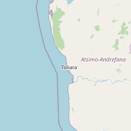
Map view of Beza Mahafaly Special Reserve

Use this park location map to pinpoint Beza Mahafaly Special Reserve in Madagascar, understand its exact geographic position, and read its mapped placement within the surrounding landscape more clearly.

Pigeon | © OpenStreetMap contributors

Location context for Beza Mahafaly Special Reserve

Atsimo-Andrefana

Visual reference of the gallery forest and dry spiny bush terrain

Beza Mahafaly Special Reserve Photos and Protected Landscape Scenery

Examine detailed park photography showcasing the striking contrast between the riverine gallery forest and the surrounding arid scrubland. Visualizing the terrain and natural habitats provides a deeper understanding of this protected wildlife refuge in southwestern Madagascar.

A close-up, eye-level photograph of a weathered wooden sign carved with the figures of two lemurs climbing trees, with text engraved above and below the figures, attached to a tree trunk.

A Verreaux's sifaka lemur with white fur and a dark face clinging vertically to a thin tree trunk inside a forest.

Park atlas

Compare regional wildlife habitats and dry forest reserves across southwestern Madagascar

Explore Parks Near Beza Mahafaly Special Reserve and Surrounding Protected Areas

Visitors exploring Beza Mahafaly Special Reserve can continue comparing adjacent protected landscapes and regional wildlife reserves across the dry Atsimo Andrefana terrain. Expanding the search helps reveal connected conservation areas and diverse natural habitats throughout southwestern Madagascar.
National parkMadagascar
About 74 km away#1 closest

Southwest

Tsimanampetsotsa National Park: National Park Protected Landscape and Geographic Features

Mapping the protected area boundaries and landscape context.

Delve into the protected landscape identity of Tsimanampetsotsa National Park, a designated national park. This profile focuses on its geographic significance, providing a clear view of its mapped boundaries and the surrounding natural terrain. Understand its role as a protected area within the larger atlas for comprehensive geographic exploration.

Area
432 km²
Established
1927
Relief
Mixed relief
Climate
Arid
National parkAtsimo-Andrefana
About 85 km away#2 closest

Southwest

Tsimanampetsotsa National Park: A Geographic Overview of the Mahafaly Plateau and Spiny Forest

Protected landscapes and wetland geography in Southwestern Madagascar.

Located in the Atsimo-Andrefana region, Tsimanampetsotsa National Park protects a rare convergence of limestone sinkholes, salt-tolerant lake ecosystems, and ancient spiny forest thickets. This atlas record details the park's structural boundaries and its critical role as a site for plant endemism and prehistoric subfossil preservation within the broader Madagascar geographic context.

Area
432 km²
Established
1927
IUCN
II
Relief
Upland
National parkAtsimo-Andrefana
About 91 km away#3 closest

North

Zombitse-Vohibasia National Park: Protected Landscape and Regional Geographic Context

Mapped protected areas and natural terrain discovery.

Investigate Zombitse-Vohibasia National Park, a designated national park within the Atsimo-Andrefana region. This dedicated entry provides detailed geographic information, focusing on the park's mapped terrain and its contribution to the regional protected landscape. Gain insight into the park's atlas-relevant features and its specific place within Madagascar's conservation geography.

Area
363.08 km²
Established
2002
IUCN
II
Relief
Upland
Natural monumentAtsimo-Andrefana
About 108 km away#4 closest

Northwest

Analavelona Natural Monument: An Isolated Montane Forest Refuge in Southwestern Madagascar

Mapping a sacred and biodiverse massif in the Atsimo-Andrefana region

Analavelona Natural Monument represents a striking geographic contrast, standing as an elevated montane forest massif surrounded by arid plains. This protected landscape contains a complex ecological mosaic, ranging from humid evergreen forests to rocky sclerophyllous slopes. Recognized for its sacred status and high level of narrow-range endemism, the massif serves as an essential ecological island within the broader topography of southwestern Madagascar.

Area
44.87 km²
Established
2015
Relief
Mountain
Climate
Tropical
National parkIhorombe Region
About 126 km away#5 closest

Northeast

Isalo National Park: Explore Madagascar's Sandstone Canyons and Protected Landscape Geography

Discover unique geology, tapia woodlands, and regional park context.

Isalo National Park is a prominent protected area in Madagascar's Ihorombe Region, celebrated for its spectacular sandstone landscape. This national park features deep canyons, eroded rock domes, and striking runiform mountains, formed from ancient sedimentary deposits. The park preserves significant tapia woodlands and remarkable plant endemism, offering a rich context for understanding protected land distribution and Madagascar's unique geography. Its mapped terrain provides a visual atlas of natural wonders.

Area
815.4 km²
Established
1962
IUCN
II
Visitors
32.7K annual
Wildlife reserveMadagascar
About 196 km away#6 closest

East

Kalambatritra Special Reserve: Exploring the Geography of Southern Madagascar Protected Lands

Mapping a unique humid highland forest refuge

The Kalambatritra Special Reserve comprises a significant forested block in southern Madagascar, defined by ridges and valleys that maintain a humid microclimate. This protected area serves as a critical habitat for endemic wildlife, bridging the gap between eastern forest ecosystems and the drier terrain of the southern plateau, providing an essential study in island geography and conservation.

Area
282.55 km²
Established
1959
IUCN
IV
Scope
Terrestrial
Wildlife reserveAndroy
About 223 km away#7 closest

South

Réserve spéciale du Cap Sainte-Marie: Wildlife Reserve and Protected Coastal Landscape in Androy

An essential arid-zone habitat at the southernmost edge of Madagascar

Réserve spéciale du Cap Sainte-Marie protects a fragile ecosystem of spiny thicket and coastal terrain. As a focal point for tortoise conservation in the Androy region, this reserve offers a window into the specialized reptile habitats and harsh environmental conditions that define the southern extremity of the Madagascar landscape.

Area
17.5 km²
Established
1962
IUCN
IV
Scope
Terrestrial
Marine protected areaMadagascar
About 223 km away#8 closest

Northwest

Velondriake Marine Protected Area: Coastal Geography and Conservation Landscape in Madagascar

A large-scale community marine reserve in southwestern Madagascar.

Velondriake protects 64,000 hectares of marine and terrestrial environment, spanning coral reefs, extensive mangroves, and inland baobab-rich spiny forests. As a focal point for regional marine management, the area showcases the intersection of coastal ecology and community governance in the western Indian Ocean. Explore the geographic boundaries and habitat features that define this significant marine protected territory along the coast of Madagascar.

Area
640 km²
Established
2006
Relief
Lowland
Climate
Tropical

Common questions about visiting, size, designation, and location context for Beza Mahafaly Special Reserve

Beza Mahafaly Special Reserve FAQs for park facts, access, geography, and protected area context

Find quick answers about Beza Mahafaly Special Reserve, including protected-area facts, park geography, trail and visitor context, and how the park fits into its surrounding country and regional landscape.
MoriAtlas Explorer

Continue Your Protected Areas Search Across the Global Atlas

Deepen your exploration by continuing the structured search for national parks and protected areas worldwide. Utilize the comprehensive filtering capabilities to compare different conservation landscapes and refine your understanding of global park geography. Discover more about the distribution and characteristics of protected natural areas.

Global natural geography