
Rivers
Park geography
Analyzing the physical terrain, spatial dimensions, and natural features in Far North Queensland.
Blackbraes National Park Geographic Profile and Mapped Protected Area Boundaries
Examine the technical geography and spatial landscape of Blackbraes National Park in Queensland, Australia. This profile details the park boundary, covering 520 square kilometers of woodland and mountain terrain, while identifying key natural features such as the Gilbert and Copperfield Rivers.
Related tags
ironbark woodlandselevated terrainGregory RangeFar North QueenslandAustralian national parks
Elevated ironbark wilderness in Far North Queensland
Blackbraes National Park
Blackbraes National Park is a protected wilderness area in Far North Queensland, Australia, covering approximately 520 square kilometres of elevated terrain in the Etheridge Shire region. The park occupies a majority of the southern portion of the locality Lyndhurst, along with parts of Porcupine and Basalt, situated roughly 1,265 kilometres northwest of Brisbane. This national park protects a distinctive landscape where the Einasleigh Uplands and Gulf Plains bioregions converge, creating a unique ecological transition zone that differs markedly from the surrounding lowland countryside. The park's defining characteristic is its elevation of approximately 900 metres above sea level, which results in a noticeably cooler and wetter climate compared to the surrounding tropical savanna regions. This climatic variation supports ironbark woodland ecosystems that provide crucial habitat for gray kangaroos and an impressive diversity of birdlife. The highest point of the Gregory Range is found within the park's boundaries, and the Gilbert-Einasleigh River system originates in these uplands, making the area an important hydrological catchment for the wider region.
- Location
- Australia
- Park type
- National park
- Area
- 520 km²
Location overview
Regional context and territorial classification within Australia
Blackbraes National Park Geographic Location and Regional Setting
Blackbraes National Park is located within Far North Queensland, Australia. Regional records confirm its inland status as a terrestrial protected landscape governed within Queensland's state borders.
- Countries
- Australia
- Regions
- Far North Queensland, Queensland
- Primary location
- Queensland
- Geographic setting
- Inland
Boundary and coordinates
Spatial limits and area dimensions spanning 520 square kilometers
Mapping the Geographic Boundaries of Blackbraes National Park
The mapped outline of Blackbraes National Park provides critical spatial context for the protected terrain. Structured measurements detail the 520 square kilometers of area alongside calculated center coordinates and geographic spans.
- Boundary area
- 512.9 km²
- Boundary perimeter
- 309.5 km
- Northernmost point
- 19.3747° S
- Southernmost point
- 19.5978° S
- Easternmost point
- 144.3201° E
- Westernmost point
- 143.9414° E
- Geographic centre
- 19.5075° S, 144.1213° E
- North–south span
- 24.7 km
- East–west span
- 39.8 km
Terrain and natural features
Mixed relief classifications and mapped hydrological features within boundaries
Blackbraes National Park Terrain and Recorded Natural Features
Recorded terrain classifications indicate mixed relief profiles across the protected landscape. Associated hydrological cards detail river and stream features located within boundaries alongside spatial data.
Selected named natural features
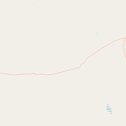
Rivers
Gilbert River
Streams
Gilbert River
Environmental setting
Temperate broadleaf forests, mixed relief, and seasonal woodland profiles
Blackbraes National Park Environmental Settings and Mapped Classification Data
Recorded environmental categories frame the physical setting through mixed relief, partial forest cover, and seasonal woodland features. Stored classifications connect recorded environmental traits to relevant atlas destinations for regional comparison.
- Relief
- Mixed relief
- Water
- Minor water
- Forest cover
- Partial forest
- Seasonality
- Seasonal
Landscape features
Mountains · Woodland
Habitat types
Temperate broadleaf forest · Grassland
Park atlas
Trace the varied protected landscapes and unique geographical features across Far North Queensland's inland regions.
Explore Nearby Protected Areas, National Parks, and Regional Geography Around Blackbraes National Park
Explore other national parks and protected areas geographically relevant to Blackbraes National Park, encompassing the unique elevated terrains, ironbark woodlands, and significant river catchments of Far North Queensland. Compare their distinct landscapes and conservation priorities to gain a broader understanding of Australia's diverse protected natural areas and regional park geography.
National parkQueensland
About 92 km away#1 closest
South

Porcupine Gorge National Park: Protected Area Geography and Landscape Context in Queensland
Explore mapped boundaries of this Australian national park.
Porcupine Gorge National Park serves as a focal point for understanding protected landscapes within Queensland. This entry provides detailed geographic context, focusing on the park's mapped boundaries and its natural terrain. Discover its identity as a national park and its contribution to the regional geography of northeastern Australia, essential for any atlas-focused exploration.
- Area
- 54.1 km²
- Established
- 1970
- IUCN
- II
- Relief
- Mountain
National parkQueensland
95 km away#2 closest
East
Great Basalt Wall National Park: Queensland National Park Protected Area and Geography Explorer
Mapped boundaries and regional landscape context.
Delve into the detailed protected landscape of Great Basalt Wall National Park, a designated national park situated in Queensland, Australia. This page provides insights into its specific geographic features and mapped boundaries, offering a foundational understanding for regional park discovery. Explore how this protected area fits into the broader natural landscape and atlas of Queensland.
- Area
- 352 km²
- Established
- 1987
- IUCN
- II
- Relief
- Upland
National parkQueensland
About 96 km away#3 closest
Southeast
White Mountains National Park: Queensland National Park Geographic Overview and Protected Boundaries
Mapped protected area context within northeastern Australia.
Discover White Mountains National Park, a significant protected area designated as a national park within Queensland, Australia. This entry offers a focused exploration of its geographic features, mapped boundaries, and its role within the regional landscape. Users interested in the atlas representation of conservation lands and the specific geography of Australian national parks will find detailed information here, emphasizing mapped protected areas and their national park status.
- Area
- 1,122 km²
- Established
- 1990
- IUCN
- II
- Relief
- Mountain
National parkQueensland
About 133 km away#4 closest
Northeast
Kirrama National Park: Protected National Park in Queensland's Natural Landscape
Explore mapped boundaries and regional geography.
Kirrama National Park is a protected national park located in Queensland, Australia. This page details its specific geographic footprint and role as a preserved natural landscape. Users can explore its mapped boundaries and understand its contribution to the regional geography of northeastern Australia, providing context for atlas-based discovery of protected lands. Understand Kirrama National Park as a distinct protected area within the Australian conservation landscape.
- Area
- 75.8 km²
- Established
- 2006
- IUCN
- II
- Relief
- Mountain
National parkAustralia
About 134 km away#5 closest
Northeast
Kinrara National Park: A Protected National Park Landscape in Australia
Explore mapped geography and protected area context.
Kinrara National Park represents a significant protected landscape within Australia, offering detailed insight into its mapped boundaries and natural terrain. As a national park, it provides a crucial point for understanding regional geography and the distribution of protected areas across the Australian continent. This page facilitates a focused discovery of Kinrara National Park's specific geographic characteristics and its contribution to the national atlas.
National parkQueensland
About 139 km away#6 closest
North
Undara Volcanic National Park: Mapped Volcanic Terrain and Protected Landscape in Queensland
Explore Queensland's unique volcanic geography and national park boundaries.
Undara Volcanic National Park stands as a significant protected landscape within Queensland, Australia. This entry provides detailed geographic context, focusing on the park's notable volcanic terrain and its officially mapped boundaries. It is designed to aid users in understanding the park's unique geological features and its role within the regional atlas, highlighting the importance of protected areas for geographic discovery and landscape study.
- Area
- 615 km²
- Established
- 2009
- IUCN
- II
- Relief
- Mixed relief
National parkQueensland
153 km away#7 closest
Northeast
Girringun National Park: Queensland Protected Area Atlas and Geographic Exploration
Discover mapped terrain and natural landscapes within northeastern Australia.
Girringun National Park stands as a significant protected landscape within Queensland, Australia, contributing to the nation's network of conservation areas. This park offers a focused lens through which to examine the geography of northeastern Australia, providing insights into its mapped boundaries and natural terrain. Users can leverage this park detail page to understand its role within the broader regional atlas and explore its distinct protected-area identity.
- Area
- 1,538 km²
- Established
- 1994
- Relief
- Mountain
- Climate
- Tropical
National parkQueensland
153 km away#8 closest
Northeast
Forty Mile Scrub National Park: Queensland National Park Atlas Exploration
Discover protected terrain shaped by ancient volcanic streams.
Forty Mile Scrub National Park is a national park in Queensland, Australia, recognized for its unique protected landscape defined by ancient volcanic stream systems and a rare semi-evergreen vine thicket. This isolated pocket of relict vegetation, sustained by permanent spring-fed waterways, stands as a significant ecological refuge within the Mulga Lands bioregion. Exploring this park offers a deep dive into regional geography and the mapped context of one of Australia's important conservation areas, highlighting its evolutionary significance and distinct natural terrain.
- Area
- 63.3 km²
- Established
- 1970
- IUCN
- II
- Relief
- Lowland
MoriAtlas Explorer
Continue Exploring Blackbraes National Park's Mapped Landscape and Regional Geography
Dive deeper into the atlas-driven discovery of Blackbraes National Park by examining its specific geographic context and protected land boundaries. Understanding this national park's unique position within Queensland enhances your appreciation of Australia's diverse natural landscapes and their regional distribution. Continue your exploration to uncover more about the mapped terrain and conservation areas detailed within MoriAtlas.
Browse next
Global natural geography
Explore related park routes
Explore MoriAtlas Global ParksBrowse All MoriAtlas ParksGlobal Park Map DiscoveryMoriAtlas: Browse All CountriesBrowse All MoriAtlas ContinentsNational Park Environment AtlasGrand Canyon National Park AtlasYellowstone National Park AtlasYosemite National Park Atlas and GeographySerengeti National Park AtlasGalápagos National Park Protected LandscapeBanff National Park Geography and AtlasKruger National Park Atlas EntryUluṟu-Kata Tjuṯa National Park AtlasExplore Uluru-Kata Tjuta National Park GeographyPlitvice Lakes National Park AtlasFiordland National Park Protected LandscapeGreat Smoky Mountains National Park AtlasAfghanistan National Parks and Protected AreasAlbania National Parks and Protected AreasAlgeria National Parks and Protected AreasAmerican Samoa National Parks and Protected AreasAndorra National Parks and Protected AreasAngola National Parks and Protected AreasAntarctica National Parks and Protected AreasAntigua and Barbuda Park List