
Mori Atlas logo
Biosphere reserveBogd Khan Uul Biosphere Reserve

Tracing the dramatic altitudinal transition from forest steppe to alpine tundra near Ulaanbaatar.

Bogd Khan Uul Biosphere Reserve: Geography, Map Context, and Protected Mountain Landscapes

Bogd Khan Uul Biosphere Reserve defines the southern horizon of Ulaanbaatar, serving as a rare example of a complex mountain protected area adjacent to a major urban center. This landscape encompasses a striking vertical gradient that shifts from dense coniferous taiga on northern slopes to exposed rock and open alpine tundra on southern ridges. The reserve preserves one of the longest continuous traditions of ecological protection, offering a significant window into the unique mountain ecosystems of the Khentii region.

biosphere reserveforest steppetaiga forestlarch forestSiberian pinealpine tundra
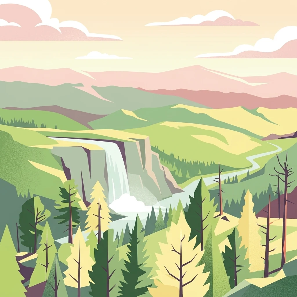
A stylized vector illustration of a forested mountain valley with a waterfall cascading down a cliff into a river.

Bogd Khan Uul Biosphere Reserve

Biosphere reserve

Park overview

Structured park overview, official facts, and landscape profile for Bogd Khan Uul Biosphere Reserve

Bogd Khan Uul Biosphere Reserve park facts, protected area profile, and essential visitor context

Review the core facts for Bogd Khan Uul Biosphere Reserve, including designation, size, terrain, visitor scale, habitats, and operating context in one park-focused overview.

About Bogd Khan Uul Biosphere Reserve

Bogd Khan Uul Biosphere Reserve occupies the heights directly south of Ulaanbaatar, where the city meets the rising ridges of the Khentii Mountains. The protected area centers on Bogd Khan Mountain, a landmark peak that has shaped both the city's setting and the surrounding ecosystem. Its location is unusual among biosphere reserves: rather than being a remote wilderness site, it borders the capital of Mongolia and forms a visible natural backdrop to urban life.

The reserve covers a substantial area, with its core zone making up the majority of the protected footprint and surrounded by buffer and transition areas that allow carefully managed uses. Within this footprint, the landscape rises from elevations around 1,300 meters to over 2,200 meters, producing a clear vertical gradient of vegetation and habitat. Lower slopes carry larch, birch, Siberian pine, and poplar, mid-elevations support denser taiga communities, and the upper elevations give way to alpine tundra before ending on exposed rock.

As a UNESCO Biosphere Reserve, Bogd Khan Uul belongs to an international network of sites recognized for combining biodiversity conservation with sustainable development and research. The Mongolian site contributes to that network by demonstrating how a culturally significant mountain can be formally integrated into global conservation frameworks while still serving as a living landscape for a neighboring urban population. Its profile is shaped as much by ecological criteria as by its role as a long-protected cultural-natural landmark.

The reserve also stands out for being embedded in a working capital region. Ulaanbaatar's southern districts abut the protected slopes, and access routes from the city make the mountain a frequent destination for hiking, recreation, and nature observation. This setting creates both opportunities and pressures, and the biosphere designation is meant, in part, to manage these interactions in a way that preserves ecological integrity while maintaining a productive relationship between the city and the mountain.

Quick facts and research context for Bogd Khan Uul Biosphere Reserve

Bogd Khan Uul Biosphere Reserve lies in the southern outskirts of Ulaanbaatar and is part of the Khentii Mountains system of northern Mongolia. It was formally recognized as a UNESCO Biosphere Reserve in 1996, with a structure that includes a strictly protected core area, a surrounding buffer zone, and transition areas where sustainable uses are permitted. The reserve's environment bridges the Mongolian forest steppe and higher mountain habitats, and its elevation range includes both forested slopes and exposed alpine terrain above the tree line.

Protection and recognition

Examine the terrestrial protection scope and documented designation year for this protected area.

Bogd Khan Uul Biosphere Reserve Protection Status and Designation History

Bogd Khan Uul Biosphere Reserve maintains a documented terrestrial protection scope established in 1996. Review the structured designation history and management context for this protected natural area.

Protection details

Protection scope
Terrestrial
Designated year
1996
Transboundary protection
No
Core area
416.51 km²
Park context

Deeper park guide and search-rich context for Bogd Khan Uul Biosphere Reserve

Bogd Khan Uul Biosphere Reserve history, landscape, wildlife, and travel context

Explore Bogd Khan Uul Biosphere Reserve through its history, landscape character, ecosystems, wildlife, conservation priorities, cultural context, and seasonal travel timing in a structured park guide built for atlas discovery and search intent.

Why Bogd Khan Uul Biosphere Reserve stands out

Bogd Khan Uul is best known for combining dense Siberian-style coniferous forest on its northern slopes with bare rocky terrain on its southern slopes, all within view of Mongolia's capital city. It is also recognized for its unusually long history of environmental protection: the mountain has been respected as sacred territory since at least the thirteenth century, well before the modern biosphere designation. The reserve's layered habitat structure, including taiga, mixed forest, alpine tundra, and bare rock, makes it a compact showcase of the forest-steppe to alpine transition typical of the Khentii region.
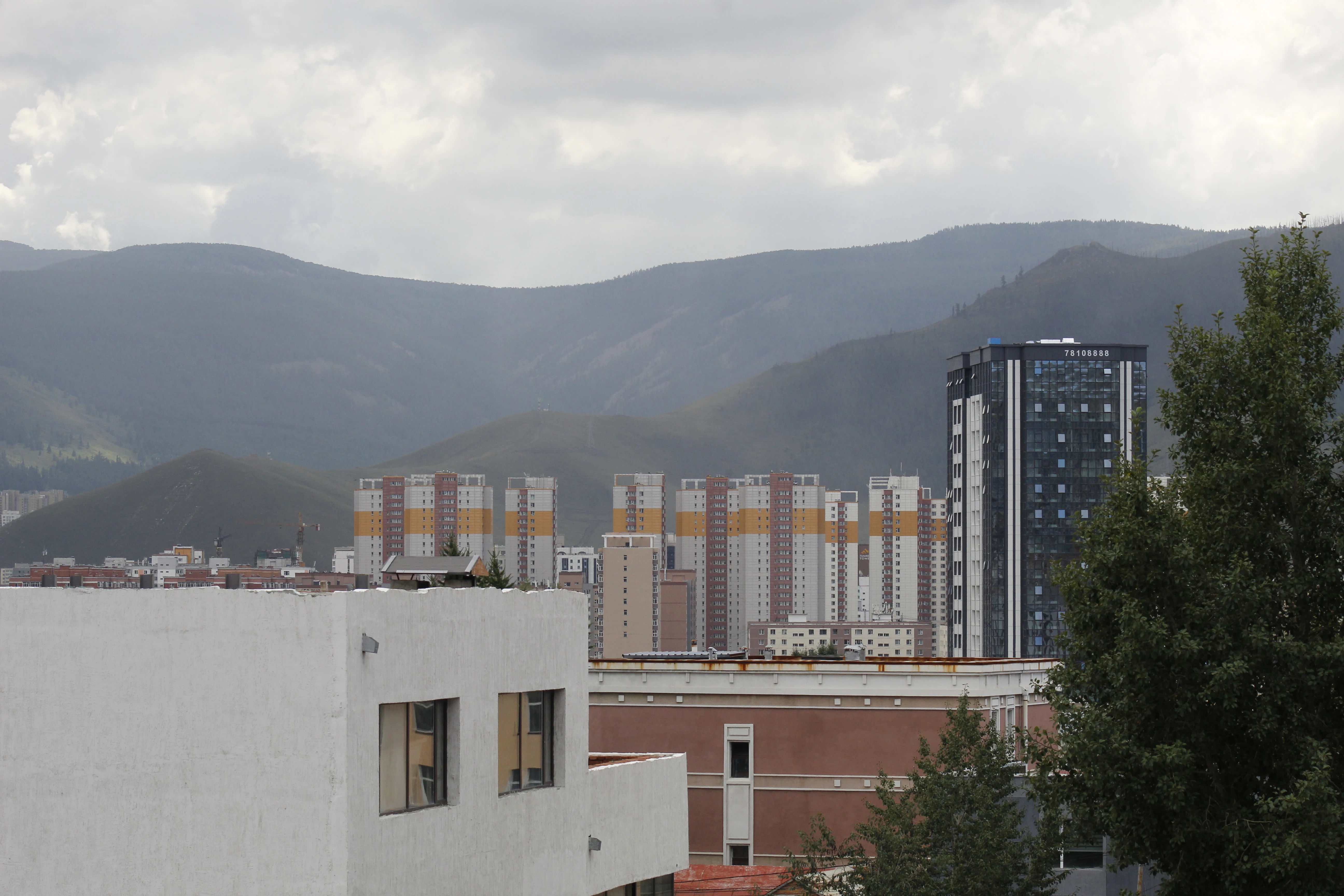
A view of the rolling slopes of Bogd Khan Uul rising behind the high rise apartment buildings and urban structures of Ulaanbaatar under a cloudy sky.
Bogd Khan Uul viewed from the urban landscape of Ulaanbaatar.

Bogd Khan Uul Biosphere Reserve history and protected-area timeline

Environmental protection on Bogd Khan Mountain is unusually ancient. Records indicate that during the thirteenth century, Tooril Khan, a ruler of the Keraite people, prohibited logging and hunting on the mountain, treating it as a sacred site unfit for ordinary exploitation. From that point forward, local populations broadly observed the mountain as venerated ground, avoiding both timber harvesting and hunting on its slopes.

The mountain's sacred status continued into later centuries. In 1778, the Mongolian governor of what is now Ulaanbaatar petitioned the Qianlong Emperor of the Qing dynasty for permission to hold ceremonies twice a year in honor of Mount Bogd Khan. Approval arrived just eight days later, and the Qing-era local government formally sanctioned the ceremonies in 1783, further entrenching the mountain's role as a focal point of regional ritual and respect.

Modern protection arrived in 1996, when Bogd Khan Uul was designated a UNESCO Biosphere Reserve. The biosphere framework formalized a layered management approach: a strictly protected core area, a buffer zone for activities compatible with sound ecological practice, and a transition zone where sustainable activities are permitted. This modern designation is often understood as the institutional continuation of a much older local ethic of restraint toward the mountain.

Bogd Khan Uul Biosphere Reserve landscape and geographic character

Bogd Khan Uul rises from the southern edge of Ulaanbaatar, where the rolling terrain of the Mongolian forest steppe gives way to the steeper ridges of the Khentii Mountains. The reserve's elevation spans roughly 1,300 to 2,270 meters, producing a notable vertical gradient over a relatively compact area. The slopes are sharply asymmetric: the northern faces are heavily forested and comparatively moist, while the southern faces are exposed and dominated by bare rock.

This north-south contrast shapes the visual identity of the mountain. From Ulaanbaatar, the dense green wall of the northern slopes stands in striking contrast to the city below, while the southern side reads as a rugged, lighter-toned massif. Ridges, gullies, and rocky outcrops define the upper landscape, with smoother forest-steppe terrain grading into the reserve at lower elevations.

Taken together, the landscape of Bogd Khan Uul captures a compressed slice of Mongolia's mid-latitude mountain environments. It moves quickly from cultivated and steppe fringes near the city into dense coniferous forest, up through subalpine stands, and finally across open alpine terrain to exposed rock and crests. This rapid ecological layering is part of what makes the reserve visually and ecologically distinctive.
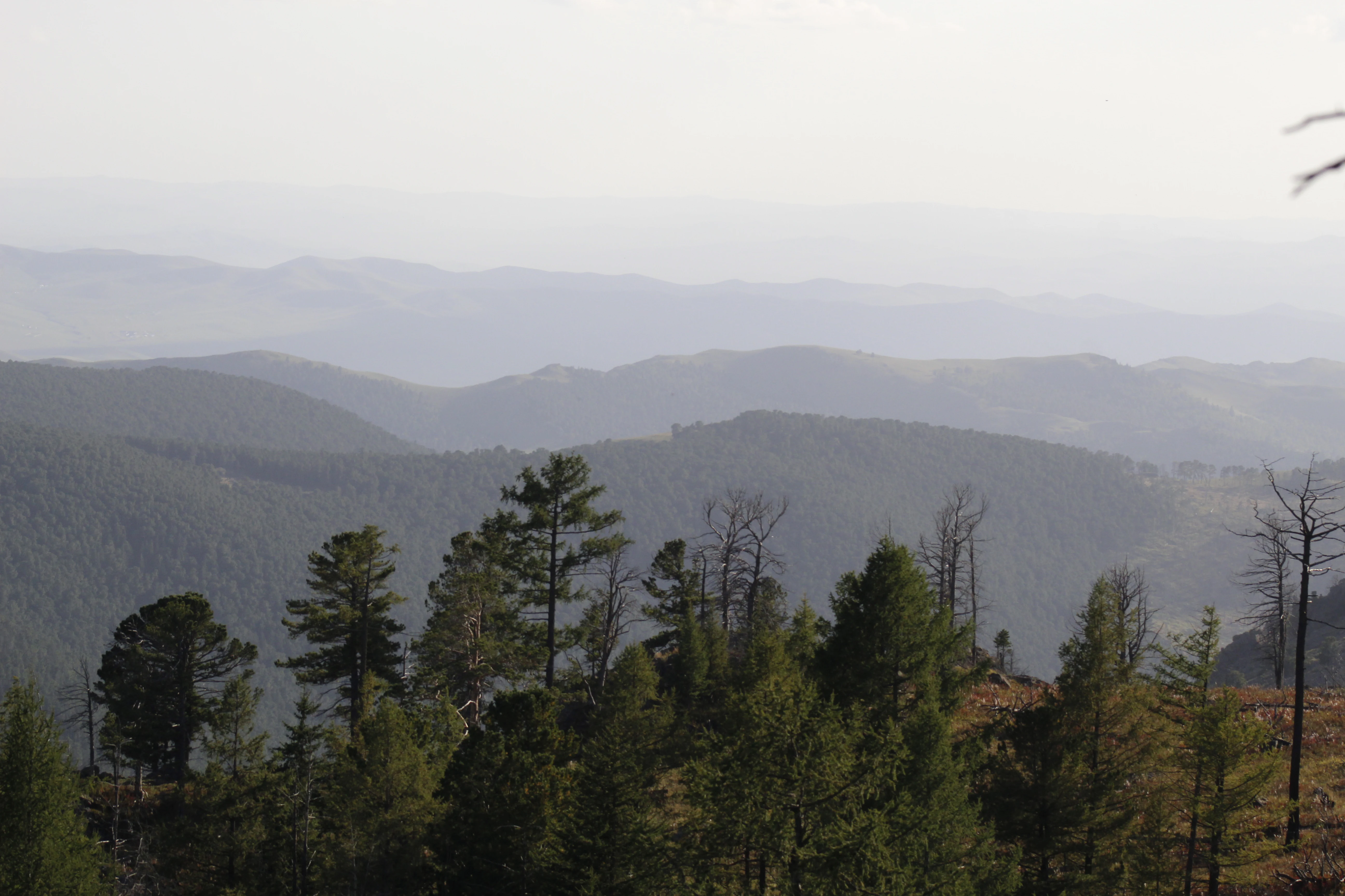
A wide view of rolling mountain ridges covered in coniferous forests, with layers of hills fading into the distance under a pale sky.
The forested slopes of Bogd Khan Uul.

Bogd Khan Uul Biosphere Reserve ecosystems, habitats, and plant life

The reserve sits within the forest steppe zone of Mongolia and includes some of the most complete representations of that ecological transition in the region. Within its boundaries are four major habitat types: grassland, taiga vegetation, Alpine tundra, and bare rock. Each habitat occupies a distinct position in the elevation gradient, producing a layered ecological profile across the mountain.

Mixed and coniferous forests are a defining feature, particularly on the cooler, moister northern slopes. Larch, including Siberian larch, forms a major component of these stands, accompanied by birch, Siberian pine (often locally referred to as cedar), other pines, and poplar in suitable sites. Above the tree line, vegetation thins into alpine tundra communities adapted to short growing seasons and exposed conditions, while the steepest and most exposed faces terminate in bare rock and scree.

This combination of habitats supports a wide ecological range within a small area. Grasslands at lower elevations blend into closed-canopy taiga higher up, and the transition from forest to alpine tundra to bare rock gives the reserve characteristics of both the Mongolian steppe biome and the broader Siberian forest ecosystem. The result is a reserve that expresses the ecological complexity of the Khentii region in compact form.

Bogd Khan Uul Biosphere Reserve wildlife and species highlights

The wildlife of Bogd Khan Uul reflects the same habitat range that defines its vegetation, supporting both steppe-influenced and taiga-oriented species. Because the reserve combines forest, alpine, and rocky terrain, it hosts mammals typical of the Mongolian-Siberian interface.

Several of the reserve's animal species are considered threatened or vulnerable. The Siberian musk deer inhabits the forested slopes and is one of the most sensitive ungulates present. Roe deer are also found in the reserve, alongside the sable, a forest-dwelling mustelid associated with mature taiga stands across northern Asia. The Arctic hare, more typically associated with northern Eurasia, also occurs here, underscoring the cold-adapted character of the reserve's fauna.

Beyond these notable mammals, the mix of forest, open ground, and rocky terrain provides habitat for a broader community of species, including smaller mammals and the birds typical of forest-steppe and taiga environments. The presence of vulnerable ungulates and fur-bearing predators gives the reserve particular conservation significance, as it offers relatively secure habitat close to a large city.

Bogd Khan Uul Biosphere Reserve conservation status and protection priorities

Bogd Khan Uul's conservation significance rests on both its ecological character and the longevity of its protection. The reserve includes a strictly protected core area, where natural processes are allowed to dominate, surrounded by a buffer zone that accommodates activities compatible with sound ecological practice. A wider transition zone allows carefully managed human activities to continue, recognizing that the reserve sits immediately adjacent to a major urban area.

Ecologically, the reserve protects a rare compact example of the forest steppe to alpine transition in the Khentii Mountains, including larch and Siberian pine forests that have been respected as off-limits for timber harvesting for centuries. The persistence of these forests, combined with the presence of threatened species such as musk deer, sable, and roe deer, gives the site enduring biodiversity value.

The biosphere designation, granted in 1996, also places Bogd Khan Uul within UNESCO's Man and the Biosphere Programme. This framework emphasizes the integration of conservation with research, education, and sustainable development, encouraging engagement with local communities and stakeholders. For a mountain that has been culturally protected since the thirteenth century, this modern framework continues a long tradition of restraint while giving it global institutional recognition.

Bogd Khan Uul Biosphere Reserve cultural meaning and human context

Bogd Khan Mountain has been considered sacred for centuries, and that belief has shaped land use on the mountain for far longer than modern conservation frameworks. Thirteenth-century Keraite traditions already discouraged logging and hunting on the slopes, and the mountain continued to function as a site of veneration through later periods of Mongolian history.

In 1778, local officials under Qing administration sought imperial permission to hold biannual ceremonies at the mountain, an indication that Bogd Khan Uul was already embedded in regional ritual practice. The Qianlong Emperor's prompt approval, formalized by the local Qing government in 1783, integrated the mountain more firmly into official ceremonial life and reinforced its protected status.

In the present day, the mountain remains both a working recreational landscape for Ulaanbaatar and a culturally significant landmark. The biosphere reserve framework is designed to acknowledge this dual identity, maintaining space for local engagement and visitation while preserving the ecological and cultural values for which the mountain has long been respected.

Top sights and standout views in Bogd Khan Uul Biosphere Reserve

Bogd Khan Uul stands out for offering, in a relatively compact protected footprint, a complete gradient of habitats from forest steppe through taiga to alpine tundra and bare rock. Its northern slopes preserve dense stands of larch and Siberian pine, while its southern face offers the visual contrast of exposed rock above a capital city. The mountain carries one of the oldest continuous traditions of environmental protection in the region, with formal sacred-status prohibitions dating back to the thirteenth century and reinforced through Qing-era ceremonial sanctioning. Today, the UNESCO Biosphere Reserve designation extends that tradition into a global conservation framework, while keeping the mountain accessible and meaningful for the residents of Ulaanbaatar.

Best time to visit Bogd Khan Uul Biosphere Reserve

The character of Bogd Khan Uul shifts notably with the seasons, and visitors will find a different mountain depending on when they come. Late spring and early summer bring green slopes and active wildlife in the forest zones, with the alpine meadows and tundra beginning to come alive. Summer offers the warmest conditions and the most accessible trails, though weather can still be variable in the higher elevations.

Autumn highlights the region's larch forests, which can take on golden tones characteristic of Siberian taiga landscapes, and the cooler air often brings clearer views across the reserve and the city below. Winter brings snow to the slopes, transforming the mountain into a strikingly white backdrop to Ulaanbaatar, though conditions in the higher terrain become colder and more demanding. The transitional shoulder seasons tend to combine atmospheric scenery with fewer crowds, while summer remains the period with the most active outdoor use of the reserve.
Monthly climate preview

Long-term representative temperature and monthly precipitation averages for Bogd Khan Uul Biosphere Reserve

Bogd Khan Uul Biosphere Reserve Climate Normals and Annual Weather Rhythm

Bogd Khan Uul Biosphere Reserve records long-term monthly temperature averages ranging from deep winter lows to warm summer peaks alongside measured precipitation patterns. Examining the complete twelve-month climatology profile reveals comprehensive variations across the representative elevation point.
Annual mean-1 °C
-21 °C17 °C
Jan-21°
Feb-17°
Mar-9°
Apr
May
Jun14°
Jul17°
Aug15°
Sep
Oct-2°
Nov-12°
Dec-19°
Warmest month
July

17.1 °C

Coolest month
January

-21 °C

Wettest month
July

2.3 mm/day

Driest month
January

0.1 mm/day

Park location guide

Geography guide, regional context, and park location map for Bogd Khan Uul Biosphere Reserve

Bogd Khan Uul Biosphere Reserve park geography, regions, and map view in Mongolia

Understand where Bogd Khan Uul Biosphere Reserve sits in Mongolia through a broader geographic reading of the surrounding landscape, nearby location context, and its mapped position within the national park landscape.

How Bogd Khan Uul Biosphere Reserve fits into Mongolia

Mongolia is a landlocked sovereign state in East Asia, known for its vast steppe landscapes, nomadic culture, and historical significance as the heartland of the Mongol Empire founded by Genghis Khan in 1206. The country has a population of approximately 3.5 million people and is the world's most sparsely populated sovereign state. Ulaanbaatar is the capital and largest city, home to roughly half the population.

Wider geography shaping Bogd Khan Uul Biosphere Reserve in Mongolia

Mongolia is located in East Asia, landlocked between Russia to the north and China to the south. The country occupies the Mongolian Plateau and features diverse terrain including grassy steppe, mountains in the north and west, and the Gobi Desert in the south. It covers 1,564,116 km2, making it the second largest landlocked country in the world.

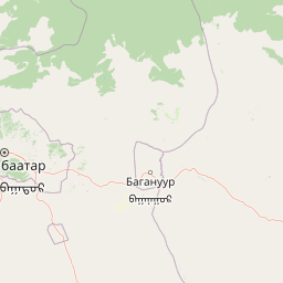
Map view of Bogd Khan Uul Biosphere Reserve

Use this park location map to pinpoint Bogd Khan Uul Biosphere Reserve in Mongolia, understand its exact geographic position, and read its mapped placement within the surrounding landscape more clearly.

Pigeon | © OpenStreetMap contributors

Location context for Bogd Khan Uul Biosphere Reserve

Ulaanbaatar

Visualizing forested northern slopes, rocky southern peaks, and protected taiga habitats.

Bogd Khan Uul Biosphere Reserve Photos, Landscapes, and Scenery

Bogd Khan Uul Biosphere Reserve photos reveal the striking contrast between dense Siberian coniferous forests and exposed southern rock faces. Examining protected area imagery helps researchers and visitors understand the vertical gradient from forest steppe to alpine tundra.

A view of the rolling slopes of Bogd Khan Uul rising behind the high rise apartment buildings and urban structures of Ulaanbaatar under a cloudy sky.

A small dark-furred red squirrel with a bushy tail running across a green grassy area in a forest setting.

A wide view of rolling mountain ridges covered in coniferous forests, with layers of hills fading into the distance under a pale sky.

Park atlas

Compare adjacent forest steppe reserves and high altitude mountain ecosystems across the Mongolian region.

Explore Protected Areas Near Bogd Khan Uul Biosphere Reserve and Surrounding Khentii Mountain Landscapes

Browse other parks near Bogd Khan Uul Biosphere Reserve to examine connected protected landscapes and regional terrain variations. Continuing into adjacent reserves provides valuable geographic context for understanding mid latitude mountain ecosystems.
National parkTöv Province
About 58 km away#1 closest

Northeast

Gorkhi-Terelj National Park: Mapped Protected Landscape in Töv Province

Explore the geographic context and park boundaries.

Gorkhi-Terelj National Park is a designated national park offering rich opportunities for geographic exploration and protected landscape discovery. This entity page provides detailed insights into its mapped boundaries and its position within the regional geography of Töv Province. Understand the specific landform and terrain characteristics that define this protected natural area, central to understanding Mongolia's conservation landscapes.

Area
2,920 km²
Established
1993
IUCN
II
Relief
Mountain
National parkTöv Province
About 64 km away#2 closest

West

Hustai National Park: Geographic and Protected Landscape Profile in Töv Province

Steppe, mountain, and riverine ecosystem mapping

Hustai National Park serves as a landmark conservation site in Töv Province, protecting a distinct gradient between the Khustai mountain ridges and the surrounding Mongolian plains. The area is defined by its role in steppe ecology, featuring varied slopes, riverine woodlands, and expansive grasslands that support a unique assembly of wildlife within the broader central Mongolian region.

Area
506 km²
Established
2003
IUCN
II
Relief
Mountain
National parkMongolia
About 83 km away#3 closest

West

Khustain Nuruu National Park: Mongolia's Steppe Wilderness & Przewalski's Horse Conservation Area

Explore its mapped protected landscape and regional geography.

Khustain Nuruu National Park is a protected area in Mongolia celebrated for its pivotal role in the conservation and reintroduction of the Przewalski's horse, the last truly wild horse species. This national park preserves the unique steppe terrain and rolling hills characteristic of the Mongolian Plateau, serving as a crucial habitat for native wildlife. Understanding Khustain Nuruu National Park provides a focused look into successful wildlife recovery efforts and the geographic context of Central Asian protected lands.

Established
1993
IUCN
II
Relief
Mountain
Scope
Terrestrial
Wildlife reserveKhentii Province
About 172 km away#4 closest

Northeast

Khan Khentii Strictly Protected Area: Geographic Overview and Protected Landscape Mapping

Eastern Mongolia wilderness and Khentii mountain terrain

Explore the expansive reaches of Khan Khentii Strictly Protected Area, a cornerstone of Mongolian conservation. This reserve shields intact taiga forests, river valley habitats, and the historic Burkhan Khaldun mountain from industrial activity, preserving one of the most significant mountain wilderness regions in the province of Khentii.

Area
12,270 km²
Established
1992
IUCN
Ib
Relief
Mountain
National parkMongolia
About 254 km away#5 closest

West

Khogno Khan National Park: A National Park with Distinct Mongolian Landscape Identity

Explore its mapped terrain and regional geographic context.

Khogno Khan National Park is a designated national park offering a specific focus for protected landscape discovery. Users can explore its geographic placement within Mongolia and understand its role as a mapped natural area. The park's identity as a protected territory provides critical context for those interested in the atlas of East Asian landscapes and regional geography, highlighting a distinct area for geographic study.

Area
841 km²
Established
2003
IUCN
II
Relief
Mountain
Nature reserveDornogovi Province
About 279 km away#6 closest

Southeast

Ikh Nartiin Chuluu Nature Reserve: Mapping Granite Outcrops and Steppe in Dornogovi Province

A vital protected sanctuary within the Mongolian Gobi desert landscape

Ikh Nartiin Chuluu Nature Reserve occupies a unique position in the Dornogovi Province of Mongolia, where granite skeletons meet arid plains. The protected area serves as a significant biological stronghold, offering a detailed study of how rocky crevices and sheltered valleys support diverse steppe life. Use this atlas resource to understand the park boundaries, terrain features, and regional landscape context that make this reserve a reference site for desert conservation.

Area
660 km²
Established
1996
Relief
Upland
Climate
Arid
A horizontal watercolor illustration depicting a soft, green landscape with distant rolling hills, foreground meadows, and flowering bushes under a pale sky.
Protected areaArkhangai Province
About 316 km away#7 closest

West

Ögii Lake Protected Area: A Comprehensive Geographic Overview of the Mongolian Steppe

Freshwater basin and wetland geography in Arkhangai Province

Ögii Lake represents a pivotal protected landscape in central Mongolia, defined by its 25 square kilometer surface area and gentle, shallow underwater topography. This site functions as an ecological nexus for migratory waterbirds and is essential for understanding the transition between open grassland and the mountainous terrain of the Khangai region.

Area
25.7 km²
Established
2006
Relief
Lowland
Access
Access unknown
Watercolor painting of a river winding through hills with trees and vegetation
National parkZabaykalsky Krai
About 327 km away#8 closest

Northeast

Chikoy National Park: Protected National Park with Highland Landscape and River Basin Geography

Explore its protected boundaries and unique taiga-steppe transition in Zabaykalsky Krai.

Chikoy National Park, a protected area in Russia's Zabaykalsky Krai, showcases the rugged geography of the Khentei-Daur Highlands. As a national park, it preserves the upper Chikoy River basin and represents a significant ecological borderland, marking the transition from Siberian taiga to Mongolian steppe. This page facilitates a structured understanding of the park's mapped landscape, its prominent natural monument Bystrinsky Golets, and its role within the broader atlas of protected natural areas.

Area
6,665 km²
Established
2014
IUCN
II
Relief
Mountain

Common questions about visiting, size, designation, and location context for Bogd Khan Uul Biosphere Reserve

Bogd Khan Uul Biosphere Reserve FAQs for park facts, access, geography, and protected area context

Find quick answers about Bogd Khan Uul Biosphere Reserve, including protected-area facts, park geography, trail and visitor context, and how the park fits into its surrounding country and regional landscape.
MoriAtlas Explorer

Continue Your Protected Areas Search Across the Global Atlas

Deepen your exploration by continuing the structured search for national parks and protected areas worldwide. Utilize the comprehensive filtering capabilities to compare different conservation landscapes and refine your understanding of global park geography. Discover more about the distribution and characteristics of protected natural areas.

Global natural geography