

Mori Atlas logo
Nature reserveBoin Tano Forest Reserve

Examining the equatorial mosaic of tropical forest, grassland, and shrubland habitats.

Boin Tano Forest Reserve: A Protected Tropical Nature Reserve in Ghana's Western North Region

Boin Tano Forest Reserve covers approximately 129 square kilometres of protected land within Ghana's Western North Region. This nature reserve is defined by a distinct tropical mosaic where closed-canopy forest, open grassland, and shrubland transition zones are interwoven. Situated roughly 50 kilometres from the Gulf of Guinea coast, the terrain offers a warm and humid equatorial climate that sustains a significant variety of mammal, amphibian, and bird species.

tropical forestgrasslandshrublandimportant bird areabiodiversity hotspotprimate habitat

Boin Tano Forest Reserve

Nature reserve

Park overview

Structured park overview, official facts, and landscape profile for Boin Tano Forest Reserve

Boin Tano Forest Reserve park facts, protected area profile, and essential visitor context

Review the core facts for Boin Tano Forest Reserve, including designation, size, terrain, visitor scale, habitats, and operating context in one park-focused overview.

About Boin Tano Forest Reserve

Boin Tano Forest Reserve is a national-scale protected landscape in the Aowin Municipal district of the Western North Region of Ghana, formally gazetted in 1968. Covering roughly 129 square kilometres, it sits in the heart of West Africa's Upper Guinean forest zone, where the equatorial climate, heavy rainfall, and proximity to the Gulf of Guinea coast create conditions for dense tropical vegetation and a wide spectrum of animal life. The reserve is administered as an IUCN Category V protected landscape, a designation that emphasizes the integration of biodiversity conservation with the surrounding land and cultural setting rather than a strictly closed-off wilderness approach.

The reserve's setting near five degrees north latitude places it firmly within the equatorial belt, and its position only about 50 kilometres inland from the Gulf of Guinea shapes a warm and humid environment. Within this climatic context, the landscape is not a uniform block of forest but a mosaic of tropical forest patches interspersed with grasslands and shrublands, creating transitional habitats that often support even more species than either closed forest or open savanna alone.

Ecologically, Boin Tano is one of the more diverse forest reserves in Ghana. It has been recognized by BirdLife International as an Important Bird Area, indicating that it supports regionally significant populations of particular bird species. The reserve is also home to an extensive mammal and amphibian fauna, including threatened great apes and monkeys, forest antelopes, large carnivores, pangolins, and many bat species. This combination of recognized bird importance, large mammal presence, and habitat diversity makes Boin Tano a meaningful component of conservation efforts in western Ghana and in the broader Upper Guinean forest landscape.

Quick facts and research context for Boin Tano Forest Reserve

Boin Tano Forest Reserve lies in the Aowin Municipal district of Ghana's Western North Region, with the regional coastal city of Sekondi-Takoradi being the nearest major urban centre. The protected area covers approximately 129 square kilometres and was formally established in 1968. It is classified as an IUCN Category V protected landscape and has been designated an Important Bird Area by BirdLife International for its significant bird populations. The reserve sits just five degrees north of the Equator and roughly 50 kilometres from the Gulf of Guinea, supporting a warm, humid climate across a habitat mosaic of grassland, shrubland, and tropical forest.

Protection and recognition

Examine documented terrestrial protection scope and conservation status data.

Boin Tano Forest Reserve Protection Status and International Recognition

Boin Tano Forest Reserve maintains a documented terrestrial protection scope within regional conservation frameworks. Official designation records detail management classifications without relying on external international recognitions.

Protection details

Protection scope
Terrestrial
Transboundary protection
No
Park context

Deeper park guide and search-rich context for Boin Tano Forest Reserve

Boin Tano Forest Reserve history, landscape, wildlife, and travel context

Explore Boin Tano Forest Reserve through its history, landscape character, ecosystems, wildlife, conservation priorities, cultural context, and seasonal travel timing in a structured park guide built for atlas discovery and search intent.

Why Boin Tano Forest Reserve stands out

Boin Tano is best known for its exceptional biodiversity within a relatively compact West African reserve. It is recognized as an Important Bird Area, and it hosts populations of threatened primates such as the chimpanzee and the Diana monkey, alongside rare forest antelopes like the bongo and a remarkable diversity of bats, rodents, and amphibians. The combination of mixed grassland, shrubland, and tropical forest habitats within close reach of the Gulf of Guinea coast gives the reserve a distinctive ecological richness for Ghana's protected-area network.

Boin Tano Forest Reserve history and protected-area timeline

Boin Tano Forest Reserve was formally established in 1968 as part of Ghana's broader effort to set aside representative tracts of its remaining tropical forest under state protection. Its 1968 designation placed the area within the early wave of formal forest reserves in the Western Region, then a unified administrative region that has since been reorganized into the current Western North Region arrangement. Since its establishment, the reserve has been maintained as a Category V protected landscape under the IUCN classification framework, reflecting its role as a protected area within a working landscape rather than a strict wilderness reserve.

Over the decades following its gazetting, Boin Tano has gained additional recognition beyond its status as a forest reserve. BirdLife International, through its Important Bird Area programme, has identified the reserve as an IBA, formal acknowledgement that the site's bird populations meet criteria of regional or global significance. This recognition has helped anchor the reserve's profile in national and international biodiversity conservation discussions, alongside its role in protecting populations of threatened mammals such as chimpanzees and other primates.

Boin Tano Forest Reserve landscape and geographic character

The landscape of Boin Tano Forest Reserve is defined by a tropical mosaic in which closed-canopy forest, open grassland, and shrubby transition zones are interwoven across the roughly 129 square kilometre protected area. Its location only about five degrees north of the Equator, and roughly 50 kilometres inland from the Gulf of Guinea coast, gives the terrain a strongly equatorial character, with warm temperatures, high humidity, and consistent moisture that sustain dense vegetation across much of the reserve.

Rather than presenting a uniform forest block, the reserve includes extensive grassland and shrubland patches that break up the tree cover and create varied microhabitats. These open areas are typically embedded within and around the forested zones, producing a patchwork that shifts gradually between savanna-like grasses, low shrubs, and taller woody growth. This kind of mixed habitat pattern is characteristic of the transition between true Upper Guinean forest and more open West African landscapes, and it gives Boin Tano a distinctive physical structure compared with reserves dominated entirely by closed forest.

The topography of the reserve is shaped by its position within the Western North Region of Ghana, in an area where elevations are generally moderate and relief is subtle. Streams and small watercourses drain through the forest and grassland mosaic, providing wet microhabitats along their banks and creating amphibian-rich zones within the broader landscape. The overall impression is of a relatively flat to gently rolling equatorial mosaic, with forest patches, grassy clearings, and shrub thickets creating a varied, biologically rich terrain.

Boin Tano Forest Reserve ecosystems, habitats, and plant life

The ecological identity of Boin Tano is rooted in its Upper Guinean forest character, augmented by the unusual extent of grassland and shrubland interspersed with woody vegetation. This habitat mosaic is at the core of the reserve's biodiversity value, because the edges between forest and open habitats in West Africa frequently support higher species richness than either habitat alone. The result is a landscape that harbours both forest-dependent species and those that require more open conditions, a pattern reinforced by Boin Tano's humid equatorial climate.

Wet microhabitats along the reserve's streams and low-lying areas add another ecological layer, supporting amphibian populations that depend on consistently moist conditions and seasonal pools for breeding. The matrix of forest, grassland, and shrubland also creates varied fruiting and flowering cycles throughout the year, helping to sustain the wide variety of fruit bats, rodents, and primates recorded in the reserve. Together, these features give Boin Tano an ecological profile rooted in transition rather than uniformity.

Boin Tano Forest Reserve wildlife and species highlights

Boin Tano Forest Reserve is recognized for an unusually broad mammal and amphibian fauna within its 129 square kilometre footprint. Primate diversity is one of its strongest features, with records of the chimpanzee, Diana monkey, Campbell's mona monkey, lesser spot-nosed monkey, olive colobus, western red colobus, Roloway monkey, white-thighed colobus, and the potto, alongside bushbabies such as Demidoff's dwarf galago and Thomas's dwarf galago. Several of these primates are classified by the IUCN as Endangered or Vulnerable, giving the reserve meaningful conservation significance for West Africa's great apes and colobines.

The reserve also supports a notable assemblage of forest ungulates, including forest duikers such as the bay duiker, black duiker, Maxwell's duiker, Ogilby's duiker, and yellow-backed duiker, the larger bongo antelope, the water chevrotain, the red river hog, the African buffalo, and the giant forest hog. Large carnivores and other charismatic mammals on the reserve's recorded list include the leopard, African golden cat, African civet, African palm civet, honey badger, marsh mongoose, and several other small carnivores, while both pangolin species of the region, the tree pangolin and giant pangolin, are also documented.

Bats make up one of the most species-rich groups recorded from Boin Tano, with many species of fruit bats, horseshoe bats, roundleaf bats, slit-faced bats, free-tailed bats, and vesper bats documented. The reserve's rodent diversity is similarly extensive, including African giant squirrels, flying squirrels, brush-tailed porcupines, crested porcupines, cane rats, and numerous forest mice and rats. Amphibians are likewise diverse, with many species of reed frogs, river frogs, tree frogs, toads, and clawed frogs, including a number of West African endemics and range-restricted species. The reserve's bird fauna has been singled out as significant enough that BirdLife International has designated the area an Important Bird Area.

Boin Tano Forest Reserve conservation status and protection priorities

Boin Tano's conservation significance lies in its role as a mixed-habitat refuge within Ghana's Upper Guinean forest zone. The reserve protects not just forest but also grassland and shrubland patches, an unusual combination in West African national-level conservation that supports a broader range of ecological niches than many strictly forested reserves. Its IUCN Category V status frames it as a protected landscape where biodiversity, ecosystem services, and the surrounding human context are managed together, emphasizing long-term landscape conservation rather than strict exclusion.

The site's recognition as an Important Bird Area by BirdLife International adds an important international layer to its conservation profile, drawing attention to the bird populations that meet the criteria for regional or global significance. At the same time, the reserve is one of the remaining strongholds for several threatened mammals, including the Endangered chimpanzee and Endangered western red colobus, and Vulnerable species such as the Diana monkey, white-thighed colobus, leopard, and African bush elephant. These recorded populations give Boin Tano direct relevance to broader primate and large mammal conservation planning in West Africa.

The reserve also harbours a range of species that, while not globally threatened, are part of the intact Upper Guinean forest fauna and would be difficult to conserve outside protected areas of this scale. Maintaining the integrity of the forest-grassland-shrubland mosaic and the reserve's connection to similar habitat in the wider landscape is central to its long-term conservation value, particularly as surrounding land uses intensify across the Western North Region.

Boin Tano Forest Reserve cultural meaning and human context

Boin Tano Forest Reserve lies within the Aowin Municipal district, an area of western Ghana associated with communities whose livelihoods and cultural history are closely tied to the surrounding forested landscape. While the reserve is primarily recognized for its ecological values, its setting within the Aowin area places it in a region with a long-standing relationship between local populations and forest resources, including traditional uses of forest products and small-scale agriculture in surrounding lands. The Category V protected landscape designation reflects, in part, this continuing interaction between people and the reserve landscape.

Top sights and standout views in Boin Tano Forest Reserve

Among Boin Tano's standout qualities are its designation as a BirdLife International Important Bird Area, its unusually diverse primate community that includes Endangered chimpanzees and Endangered western red colobus alongside Vulnerable Diana monkeys and other colobines, and its mixed habitat pattern of tropical forest, grassland, and shrubland rather than a uniform closed canopy. The reserve also stands out for the sheer breadth of its mammal and amphibian records, encompassing multiple forest antelope species, both African pangolins, a wide spectrum of bats and forest rodents, and many range-restricted frogs.
Monthly climate preview

Track monthly precipitation shifts and long term temperature records across the reserve.

Boin Tano Forest Reserve Climate Normals and Annual Temperature Rhythm

Representative coordinate records show sustained monthly temperature variations alongside shifting precipitation rates throughout the annual cycle. Detailed monthly climate profiles provide deeper context for studying long term meteorological patterns across the protected terrain.
Annual mean26 °C
24 °C28 °C
Jan27°
Feb28°
Mar27°
Apr27°
May26°
Jun25°
Jul24°
Aug24°
Sep25°
Oct25°
Nov26°
Dec27°
Warmest month
February

27.9 °C

Coolest month
July

24 °C

Wettest month
June

8.9 mm/day

Driest month
January

1 mm/day

Park location guide

Geography guide, regional context, and park location map for Boin Tano Forest Reserve

Boin Tano Forest Reserve park geography, regions, and map view in Ghana

Understand where Boin Tano Forest Reserve sits in Ghana through a broader geographic reading of the surrounding landscape, nearby location context, and its mapped position within the national park landscape.

How Boin Tano Forest Reserve fits into Ghana

Ghana, officially the Republic of Ghana, is a West African nation spanning approximately 240,000 km² along the Gulf of Guinea. It achieved independence from Britain in 1957, becoming the first Sub-Saharan colony to do so, and transitioned to a republic in 1960. The country has a population of over 35 million, with Accra as its capital and largest city. Ghana features diverse ecosystems from coastal savannas to tropical rainforests and is linguistically and ethnically rich, with English as the official language.

Wider geography shaping Boin Tano Forest Reserve in Ghana

Ghana is located in West Africa along the Gulf of Guinea and Atlantic Ocean to its south. It borders Côte d'Ivoire to the west, Burkina Faso to the north, and Togo to the east. The country spans diverse ecologies including coastal savannas and tropical rainforests.

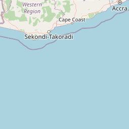
Map view of Boin Tano Forest Reserve

Use this park location map to pinpoint Boin Tano Forest Reserve in Ghana, understand its exact geographic position, and read its mapped placement within the surrounding landscape more clearly.

Pigeon | © OpenStreetMap contributors

Location context for Boin Tano Forest Reserve

Western North Region
Park atlas

Discover other protected landscapes and wildlife habitats in the surrounding region

Parks Near Boin Tano Forest Reserve and Regional Protected Area Comparisons

Browse nearby national parks and protected areas to compare regional tropical forest mosaics and wildlife habitats. Continuing beyond Boin Tano Forest Reserve reveals broader ecological patterns across the West African landscape.
National parkGhana
About 28 km away#1 closest

South

Nini-Suhien National Park: Protected Coastal Forest Geography and Mapping in Ghana

Regional forest landscapes and conservation boundaries

Nini-Suhien National Park serves as a vital anchor for coastal forest conservation in southwestern Ghana. This profile provides an atlas-level understanding of the park's location, its physical landscape features, and its role within the larger Ankasa Conservation Area for researchers and geography enthusiasts.

Area
160 km²
Established
1976
IUCN
II
Relief
Lowland
National parkGhana
About 28 km away#2 closest

South

Nini-Suhien National Park: Geographic Atlas and Protected Area Boundary Mapping

Regional landscape context and protected terrain in Ghana.

Nini-Suhien National Park serves as a crucial protected area within the geography of Ghana. This entry provides structured information regarding the park boundaries and regional landscape characteristics, facilitating a deeper understanding of its place in the broader West African natural landscape and mapping framework.

IUCN
II
Protected landscapeWestern Region
About 34 km away#3 closest

Northeast

Mamiri Forest Reserve: Mapped Geography and Protected Landscape Identity in Western Ghana

Ecological transition zone of the Upper Guinea forest block

Spanning roughly 45 square kilometers, Mamiri Forest Reserve is defined by its unusual, elongated geometry and dissected hill-and-valley topography. This protected landscape serves as a vital transition zone between wet and moist evergreen forest types, supporting a complex array of seasonal wetland patches and upland forest ridges. Recognized for its significance as an Important Bird Area, it remains a critical remnant of the original high forest system found in this part of Ghana.

Area
45 km²
Established
1949
IUCN
V
Relief
Upland
Watercolor illustration of a tropical lagoon scene with palm trees on the banks, calm water, and a distant, hazy shoreline.
National parkComoé District
About 75 km away#4 closest

Southwest

Parc national des îles Ehotilé: Geography and Protected Landscapes of the Aby Lagoon Archipelago

Coastal national park featuring unique estuarine terrain and mangrove ecosystems.

Parc national des îles Ehotilé preserves a rare six-island archipelago within the Aby lagoon. The area showcases diverse aquatic environments, including salt-tolerant mangrove forests and dense woodland habitats that support large fruit bat colonies and West African manatee populations. This protected landscape represents a critical estuarine intersection in southeastern Cote d'Ivoire, offering deep insight into the region's complex hydrological and botanical geography.

Area
105 km²
Established
1974
IUCN
II
National parkIvory Coast
About 75 km away#5 closest

Southwest

Îles Ehotilé National Park: A Protected Island Ecosystem within Ivory Coast's National Park Network

Explore its island terrain and mapped coastal geography.

Îles Ehotilé National Park stands as a protected island ecosystem within the national park system of Ivory Coast. This area is distinguished by its island landscapes, coastal zones, and the surrounding marine environments characteristic of the Gulf of Guinea. As a designated national park, it plays a crucial role in preserving unique West African island biodiversity and providing a mapped protected area for ecological study and appreciation. The park's conservation focus highlights the importance of safeguarding coastal habitats within the region.

Area
105 km²
Established
1974
IUCN
II
Relief
Lowland
National parkWestern North Region
About 82 km away#6 closest

Northwest

Bia National Park: Ghana's Vital Protected Forest Landscape with West Africa's Tallest Trees

Explore the unique mapped geography and biodiversity of this key conservation area.

Bia National Park serves as a crucial protected landscape in Ghana's Western North Region, celebrated for harboring some of West Africa's tallest trees and a rich diversity of wildlife. This detailed entry provides context on its mapped boundaries and ecological significance as one of the last relatively untouched forest remnants in the region. Understand the park's place within Ghana's geography and its value for conservation research, showcasing its unique transitional forest ecosystem and the documented species it protects.

Area
563 km²
Established
1974
IUCN
II
Climate
Tropical
National parkGhana
About 119 km away#7 closest

East

Kakum National Park: Ghana's Landmark Protected Rainforest and Canopy Walkway

Mapped tropical forest landscape and unique elevated park exploration.

Kakum National Park represents a significant protected area within Ghana, characterized by its 375 square kilometers of moist evergreen tropical rainforest. The park's identity is strongly linked to its iconic canopy walkway, an engineering feat offering elevated views into the forest structure. As a national park, Kakum provides crucial mapped context for understanding West African biodiversity and regional geography, including notable primate populations and the densest concentration of forest elephants in Ghana. Its community-driven establishment also marks it as a key site for participatory conservation examples.

Area
375 km²
Established
1992
IUCN
II
Visitors
135.9K annual
National parkAbidjan
About 154 km away#8 closest

West

Banco National Park National Park: Primary Forest Landscape and Abidjan Geography

Explore mapped boundaries and urban conservation.

Banco National Park is a globally significant protected area, uniquely preserving dense primary tropical forest within the urban sprawl of Abidjan, Ivory Coast. This national park offers critical insights into urban conservation, featuring rare tree species and providing essential ecosystem services like water supply and carbon sequestration for the surrounding region. Its landscape, characterized by the Gbangbo River and rare mahogany and avodire trees, forms a vital geographic element within the metropolitan atlas.

Area
30 km²
Established
1953
IUCN
II
Relief
Lowland

Common questions about visiting, size, designation, and location context for Boin Tano Forest Reserve

Boin Tano Forest Reserve FAQs for park facts, access, geography, and protected area context

Find quick answers about Boin Tano Forest Reserve, including protected-area facts, park geography, trail and visitor context, and how the park fits into its surrounding country and regional landscape.
MoriAtlas Explorer

Continue Your Protected Areas Search Across the Global Atlas

Deepen your exploration by continuing the structured search for national parks and protected areas worldwide. Utilize the comprehensive filtering capabilities to compare different conservation landscapes and refine your understanding of global park geography. Discover more about the distribution and characteristics of protected natural areas.

Global natural geography
