
Viewpoints
Park geography
Detailed analysis of park dimensions, regional landscape context, and river terrain
Comprehensive Geographic Profile and Mapped Boundaries of Bontebok National Park, South Africa
Discover the physical scope and mapped characteristics of Bontebok National Park within the Western Cape region of South Africa. This profile provides structured insights into the protected area boundary, encompassing approximately 27.86 square kilometers of grassland and river terrain integrated with regional mountain landscapes.
Related tags
South AfricaCape Floristic RegionFynbosRenosterveldEndemic Species
South Africa's smallest national park dedicated to preserving the endemic bontebok antelope in fynbos wilderness
Bontebok National Park
Bontebok National Park is a species-specific protected area in South Africa's Western Cape province, established in 1931 to safeguard the survival of the bontebok, a distinctive antelope species endemic to the Cape Floristic Region. Located approximately 6 kilometers south of the town of Swellendam, the park sits in the foothills of the Langeberg Mountains and is bordered to the south by the Breede River. At just 27.86 square kilometers, it is the smallest of South Africa's 19 national parks managed by SANParks. The park forms part of the Cape Floristic Region, a UNESCO World Heritage Site recognized as one of the world's six floral kingdoms and the smallest, featuring extraordinary plant diversity despite its compact size. The park's creation represents a remarkable conservation success story, as the bontebok was driven to near extinction by European settlement and hunting in the early 19th century before a relict population was protected on private farmland and ultimately translocated to establish the park.
- Location
- South Africa
- Park type
- National park
- Established
- 1931
- Area
- 27.9 km²
Location overview
National and regional placement within the Western Cape of South Africa
Geographic Location and Regional Setting of Bontebok National Park
Bontebok National Park is situated entirely within the Western Cape province of South Africa. Regional records confirm its inland status as a terrestrial, non-transboundary protected area.
- Countries
- South Africa
- Regions
- Western Cape
- Primary location
- Western Cape
- Geographic setting
- Inland
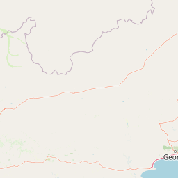
Boundary and coordinates
Spatial extent and coordinates for the 27.86 square kilometer reserve
Mapping the Geographic Boundaries of Bontebok National Park
Geographic boundary mapping offers clear spatial context for the protected wilderness. Detailed metrics outline the estimated 27.86 square kilometer area, coordinate limits, and central geographic coordinates.
- Boundary area
- 34.5 km²
- Boundary perimeter
- 33.1 km
- Northernmost point
- 34.041° S
- Southernmost point
- 34.0948° S
- Easternmost point
- 20.5179° E
- Westernmost point
- 20.4131° E
- Geographic centre
- 34.0665° S, 20.4669° E
- North–south span
- 6 km
- East–west span
- 9.7 km
Terrain and natural features
Mixed relief classifications and mapped water features
Bontebok National Park Terrain and Named Natural Features
Bontebok National Park contains mixed relief classifications and mountain park terrain attributes across its regional extent. Recorded natural features located within the protected area include the Breede River and a dedicated viewing point.
Selected named natural features
Rivers
Breede River
Environmental setting
Stored mediterranean climate types, mixed relief, and grassland habitats
Bontebok National Park Environmental Classifications and Physical Setting
Recorded physical classifications provide complementary ways to read the terrain of Bontebok National Park across its mountains, rivers, and grasslands. Associated environmental categories link directly to relevant atlas destinations sharing similar recorded conditions.
- Relief
- Mixed relief
- Climate
- Mediterranean
- Water
- Minor water
- Forest cover
- No forest cover
- Seasonality
- Year-round
Landscape features
Mountains · Rivers
Habitat types
Grassland
Park atlas
Expand your atlas view to compare surrounding protected areas and regional conservation landscapes.
Continue Your Discovery: Explore Nearby Protected Areas Around Bontebok National Park
After exploring Bontebok National Park, delve into a broader selection of national parks and protected areas located across South Africa's Western Cape province. Compare different conservation landscapes, trace regional protected area spread, and expand your geographic understanding of the Cape Floristic Region's unique ecology.
Nature reserveWestern Cape
About 29 km away#1 closest
East

Grootvadersbosch Nature Reserve: Protected Forest Landscapes and Langeberg Geography
Indigenous forest terrain in the Western Cape foothills.
Grootvadersbosch Nature Reserve offers a deep look into the largest surviving indigenous forest patch within the Langeberg range. This protected area integrates diverse valley geography with historic colonial farm infrastructure, providing a unique site for studying the natural terrain and river catchments of the South African Overberg region.
- Area
- 2.5 km²
- Relief
- Mountain
- Climate
- Mediterranean
- Access
- Access unknown
Protected areaWestern Cape Province
About 36 km away#2 closest
Northeast
Boosmansbos Wilderness Area: Geographic Atlas and Protected Landscape Overview
Rugged Langeberg mountain terrain and endemic floral corridors
Boosmansbos Wilderness Area stands as a major protected block in the eastern Langeberg range. This profile maps the diverse topography, ranging from rocky mountain ridges to moist valley forests. Learn about the geographic significance of this wilderness, which encompasses rare botanical species and serves as a vital transition zone between fynbos and indigenous forest habitats within the Western Cape.
- Area
- 142 km²
- Relief
- Mountain
- Climate
- Mediterranean
- Access
- Moderate access
Nature reserveWestern Cape
About 60 km away#3 closest
North
Anysberg Nature Reserve: Geographic Overview and Protected Landscape Mapping
A diverse mountain sanctuary in the Western Cape Karoo.
Anysberg Nature Reserve offers a deep look into the semi-arid mountain geography of South Africa's Western Cape. Spanning a rugged stretch of the Cape Fold Belt, the reserve highlights transitions between fynbos mountain slopes and succulent valley floors. This protected area serves as an essential case study for understanding how topography, ancient river courses, and varied soil conditions influence the distribution of endemic plant life and animal habitats across the Little Karoo region.
- Area
- 796.29 km²
- Established
- 1984
- Relief
- Mountain
- Climate
- Mediterranean
National parkWestern Cape
80 km away#4 closest
Southwest
Agulhas National Park: National Park Protected Landscape and Geographic Atlas
Mapped boundaries and regional geography in Western Cape.
Agulhas National Park is a protected national park in South Africa's Western Cape, vital for understanding regional geography and mapped landscape features. This entry focuses on its identity as a conservation area, detailing its protected landscape context and geographic setting within the broader atlas of Southern Africa. Explore the specific park boundaries and the unique terrain that defines this significant natural area.
- Area
- 209.59 km²
- Established
- 1998
- IUCN
- II
- Relief
- Lowland
Nature reserveWestern Cape
About 81 km away#5 closest
Southwest
Salmonsdam Nature Reserve: Atlas of Protected Landscapes in the Western Cape Overberg
Mountain fynbos, river gorges, and forest catchment geography.
Salmonsdam Nature Reserve is a compact protected expanse in the Overberg mountains of the Western Cape. The reserve encompasses the full Paardensberg River catchment, featuring complex terrain that ranges from high rocky ridges to the wet valley floor of Die Weivlakte. Its geography supports a high concentration of Afromontane forest patches and mountain fynbos habitats within a small, accessible area.
- Area
- 8.34 km²
- Established
- 1962
- Relief
- Mountain
- Climate
- Mediterranean
Biosphere reserveWestern Cape
About 109 km away#6 closest
East
Gouritz Cluster Biosphere Reserve: Geographic Overview and Protected Area Boundaries
A diverse protected landscape spanning the Western Cape coastline to high mountain ridges.
Spanning from the southern African coast into the interior mountain ranges, this biosphere reserve captures an unmatched variety of landforms including estuaries, rocky headlands, and arid Karoo basins. It serves as a vital protected system for threatened species and endemic flora, representing one of the most ecologically significant landscapes within the Cape Floristic Region.
- Area
- 31,878.9 km²
- Established
- 2015
- Relief
- Mixed relief
- Climate
- Mediterranean
Nature reserveWestern Cape
112 km away#7 closest
Southwest
Dyer Island Nature Reserve Complex: Protected Marine Islands and Coastal Ecosystems
A critical conservation node in the Western Cape
The Dyer Island Nature Reserve Complex encompasses a series of low lying, wind-swept rocky islets that function as a cornerstone for South African marine research. By preserving the crucial breeding grounds of African penguins and providing a hub for the Cape fur seal population, this reserve defines a unique stretch of the Western Cape marine geography where high concentrations of predators and prey interact.
- Established
- 1988
- IUCN
- Ia
- Water
- Water-dominated
Wildlife reserveWestern Cape
About 129 km away#8 closest
East
Gondwana Game Reserve: Geographic Overview of a Southern Cape Rewilding Landscape
Protected mountain and coastal savanna terrain in the Western Cape
Gondwana Game Reserve represents a deliberate conservation effort to restore large mammal populations to the southern coast of South Africa. Situated near the Garden Route, the reserve encompasses a complex mosaic of open plains, rolling hills, and mountain vistas, providing essential habitat connectivity for diverse wildlife species within a protected and managed ecosystem.
- Area
- 110 km²
- Relief
- Mountain
- Climate
- Mediterranean
- Access
- Access unknown
MoriAtlas Explorer
Continue Exploring Bontebok National Park's Geographic and Landscape Context
Deepen your understanding of Bontebok National Park by delving into its specific geographic setting and the mapped contours of its protected landscape. Discover the ecological significance of this unique national park and its role within the broader Western Cape region. Further exploration reveals how its protected status supports the survival of endemic species and contributes to the atlas of global natural heritage sites.
Browse next
Global natural geography
Explore related park routes
Explore MoriAtlas Global ParksBrowse All MoriAtlas ParksGlobal Park Map DiscoveryMoriAtlas: Browse All CountriesBrowse All MoriAtlas ContinentsNational Park Environment AtlasGrand Canyon National Park AtlasYellowstone National Park AtlasYosemite National Park Atlas and GeographySerengeti National Park AtlasGalápagos National Park Protected LandscapeBanff National Park Geography and AtlasKruger National Park Atlas EntryUluṟu-Kata Tjuṯa National Park AtlasExplore Uluru-Kata Tjuta National Park GeographyPlitvice Lakes National Park AtlasFiordland National Park Protected LandscapeGreat Smoky Mountains National Park AtlasAfghanistan National Parks and Protected AreasAlbania National Parks and Protected AreasAlgeria National Parks and Protected AreasAmerican Samoa National Parks and Protected AreasAndorra National Parks and Protected AreasAngola National Parks and Protected AreasAntarctica National Parks and Protected AreasAntigua and Barbuda Park List