
Mori Atlas logo
Nature reserveBoondelbah Island

An isolated island sanctuary providing a critical breeding habitat for threatened seabird populations within the Port Stephens marine corridor.

Boondelbah Island Nature Reserve: Mapped Geography and Protected Coastal Landscapes of New South Wales

(Boondelbah Nature Reserve)

Boondelbah Island serves as a strictly managed nature reserve off the coast of New South Wales, characterized by its rugged cliffs and flat plateau landscape. This vital protected area functions as a key seabird sanctuary within the regional Port Stephens Important Bird Area, offering a specialized habitat for threatened species. The island illustrates the intersection of coastal geological formations and intensive conservation management in an exposed marine environment.

island reserveseabird breeding siteGould's petrelstrict nature reservecoastal New South WalesPort Stephens
A stylized digital illustration of rugged coastal cliffs rising from a blue ocean with waves crashing against the rocks, framed by coastal vegetation in the foreground.

Boondelbah Island

Nature reserve

Park overview

Structured park overview, official facts, and landscape profile for Boondelbah Island

Boondelbah Island park facts, protected area profile, and essential visitor context

Review the core facts for Boondelbah Island, including designation, size, terrain, visitor scale, habitats, and operating context in one park-focused overview.

About Boondelbah Island

Boondelbah Island is a compact, uninhabited island reserve positioned in the warm-temperate coastal waters off northern New South Wales. Its location just outside the entrance to Port Stephens places it within a productive marine environment where coastal currents and sheltered bays support rich populations of fish and other marine life, which in turn sustain breeding seabirds. The island is small enough to be defined by its cliff edges rather than its interior, and its profile reflects its position at the meeting point between forested shoreline headlands and open ocean.

The reserve's identity is closely tied to seabird conservation. Boondelbah was recognised in the mid-1990s as a secondary breeding site for the nominate subspecies of Gould's petrel, and from 1999 onwards an active translocation programme moved chicks from the larger Cabbage Tree Island colony to artificial nest boxes on Boondelbah. The success of this work has made Boondelbah a textbook example of establishing an insurance colony for a threatened seabird, and the island now functions as a working component of Australia's seabird conservation strategy.

Although Boondelbah is much smaller and ecologically simpler than its better-known neighbour, Cabbage Tree Island, the two reserves are managed as a complementary pair. Together they have been classified by BirdLife International as an Important Bird Area, underlining the role Boondelbah plays not just in the survival of Gould's petrel, but in the broader picture of seabird protection along the New South Wales coast. Access to Boondelbah is strictly controlled, allowing the island to function as a relatively undisturbed refuge for breeding and roosting birds.

Quick facts and research context for Boondelbah Island

Boondelbah Island is a gazetted nature reserve under the National Parks and Wildlife Act 1974 of New South Wales, managed by the NSW National Parks and Wildlife Service. The island sits roughly 2 kilometres off the mouth of Port Stephens and is classified as a strict nature reserve (IUCN Category Ia), meaning access is limited to scientific and conservation work.

The reserve is dominated by seabird habitat rather than forest, with low coastal shrubland covering most of its surface. Its global conservation importance stems from its role as a second breeding colony for Gould's petrel, established through an active translocation programme that began in the late 1990s.

Protection and recognition

Examine terrestrial protection details, management scope, and recognition data for Boondelbah Island.

Boondelbah Island Protection Status and Formal Area Designation Records

Terrestrial protection status and formal designation records outline the documented conservation scope assigned to Boondelbah Island. Structured facts assemble available management frameworks and recognition sources into a clear overview for natural area research.

Protection details

Protection scope
Terrestrial
Transboundary protection
No
Park context

Deeper park guide and search-rich context for Boondelbah Island

Boondelbah Island history, landscape, wildlife, and travel context

Explore Boondelbah Island through its history, landscape character, ecosystems, wildlife, conservation priorities, cultural context, and seasonal travel timing in a structured park guide built for atlas discovery and search intent.

Why Boondelbah Island stands out

Boondelbah Island is best known as one of the two breeding grounds of Gould's petrel, an Australian seabird listed as threatened. Discovered as a breeding site only in the 1990s, the island has been deliberately developed as a second colony to reduce the risk faced by the species' main population on neighbouring Cabbage Tree Island. The island is also recognised for its role within the Port Stephens Important Bird Area, giving it international significance under BirdLife International's criteria for congregations of seabirds.
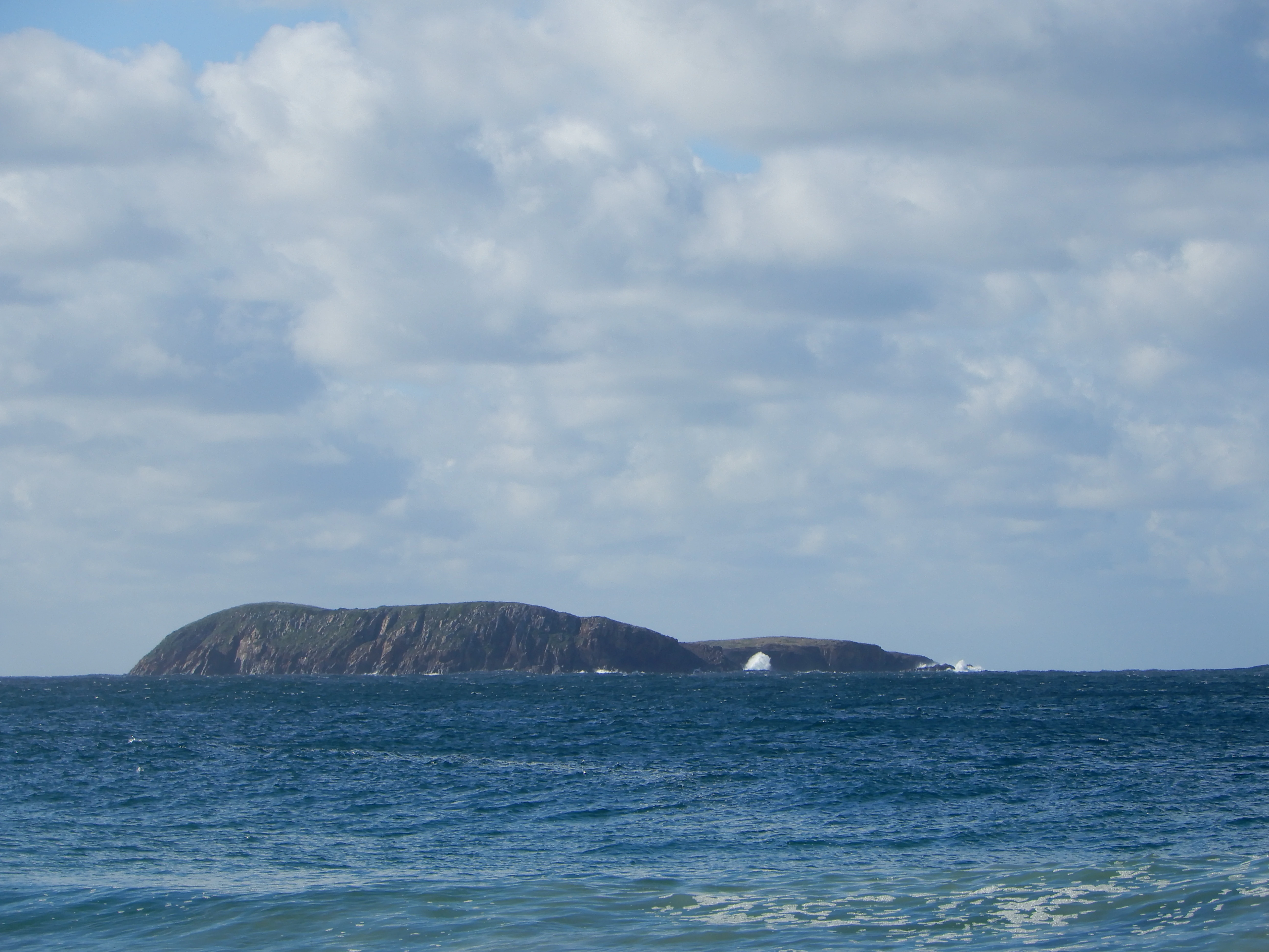
A low, rocky island sits on the horizon in the middle of a calm ocean under a partly cloudy sky.
A distant view of Boondelbah Island, a protected nature reserve off the coast of New South Wales.

Boondelbah Island history and protected-area timeline

Boondelbah Island's conservation history is relatively recent. Although the nearby Cabbage Tree Island had long been recognised as an important seabird breeding site, Boondelbah was not identified as a breeding location for Gould's petrel until 1995, when a small number of nesting birds were discovered on the island.

In response to the precarious concentration of the species' entire breeding population on a single island, New South Wales conservation authorities launched a translocation programme in February 1999. Around one hundred Gould's petrel chicks were moved from Cabbage Tree Island to Boondelbah and placed in artificial nest boxes. A further translocation of approximately one hundred chicks followed in March 2000. The vast majority of translocated chicks successfully fledged, establishing the foundations of a second breeding colony.

Both Boondelbah and Cabbage Tree Islands had already been gazetted as nature reserves under the National Parks and Wildlife Act 1974 of New South Wales, providing a formal protection framework that supported the translocation work. As the Boondelbah colony matured, the island's importance was recognised internationally through its inclusion, alongside Cabbage Tree Island, in the Port Stephens Important Bird Area designated by BirdLife International.

Boondelbah Island landscape and geographic character

Boondelbah Island is a small, flat-topped, roughly V-shaped landform that rises abruptly from the sea. It measures approximately 600 metres by 400 metres and reaches a maximum elevation of around 40 metres. The island's defining physical feature is the ring of cliffs that surrounds it, giving the reserve a compact and notably rugged profile for its size.

The flat-topped plateau and cliff-tops are covered in low coastal shrubland rather than forest, creating an open, windswept landscape that contrasts sharply with the rainforest-clad slopes of neighbouring Cabbage Tree Island. Prickly pear has colonised much of the cliff-top area, while the ground layer vegetation forms a distinctive mat of rushes and low shrubs. The result is a landscape shaped as much by exposure to salt-laden winds as by its geological structure, producing a terrain that is both visually distinctive and ecologically specialised.

Boondelbah Island ecosystems, habitats, and plant life

The vegetation of Boondelbah Island reflects the harsh coastal conditions of its cliff-top environment. The reserve is virtually treeless, lacking the rainforest cover that characterises Cabbage Tree Island. Instead, the dominant plant communities are low, hardy coastal species adapted to wind exposure, salt spray, and thin soils.

Mat rush and coastal rosemary form the principal cover, with scattered tussocks of paroo lily and knobby club rush contributing to the structural diversity of the vegetation. Prickly pear has spread across much of the cliff-top area, forming an additional layer of dense, spiny vegetation. This unusual mix of native coastal shrubs and opportunistic succulents gives Boondelbah an ecological character distinctly different from typical forested Australian island reserves, and reinforces its role primarily as seabird habitat rather than terrestrial forest habitat.

Boondelbah Island wildlife and species highlights

Boondelbah Island's wildlife profile is dominated by breeding and roosting seabirds, reflecting the island's strict protection and its concentration on marine-dependent fauna. Little penguins breed on the island, and shearwaters are known to roost there, making Boondelbah an important component of the region's seabird community.

The single most significant species linked to the reserve is the nominate subspecies of Gould's petrel. Following the discovery of a small breeding population in 1995, the island was deliberately developed as a second colony through chick translocations from Cabbage Tree Island in 1999 and 2000. Today, Boondelbah supports one of only two known breeding sites for this threatened seabird, playing a critical role in buffering the species against localised threats such as storms, predator incursions, or habitat loss on its original breeding island.

Boondelbah Island conservation status and protection priorities

Boondelbah Island is managed as a strict nature reserve under the National Parks and Wildlife Act 1974 of New South Wales, administered by the NSW National Parks and Wildlife Service. The reserve's strict protection status, with access restricted to scientific and conservation purposes, is central to its conservation value: it provides a relatively undisturbed refuge where breeding seabirds are buffered from the disturbance that often affects more accessible coastal islands.

The reserve's primary conservation significance lies in its role within the Gould's petrel recovery programme. By establishing an insurance breeding colony on Boondelbah through chick translocation, conservation managers have reduced the risk that the nominate subspecies could be lost to a single catastrophic event on Cabbage Tree Island. Jointly with Cabbage Tree Island, Boondelbah has been recognised by BirdLife International as an Important Bird Area, reflecting the global importance of the two islands for seabird conservation. The reserve's combination of legal protection, active species management, and international recognition makes it a small but high-profile example of targeted island reserve conservation in Australia.

Boondelbah Island cultural meaning and human context

Boondelbah Island does not have a developed human cultural narrative attached to it in available sources. The reserve is uninhabited, has no documented history of permanent settlement or traditional cultural infrastructure, and is administered strictly for natural conservation outcomes. Its cultural relevance is therefore primarily defined by its role within modern Australian conservation practice rather than by long-standing human associations with the land.

Top sights and standout views in Boondelbah Island

Boondelbah Island's most distinctive feature is its function as one of only two breeding sites for the threatened Gould's petrel, established through a deliberate translocation programme beginning in 1999. The island is small, rugged, and visually defined by its surrounding cliffs rather than its interior, offering a striking contrast to the rainforest-clad Cabbage Tree Island nearby.

Together with Cabbage Tree Island, Boondelbah forms part of a BirdLife International Important Bird Area, underlining the reserve's importance for seabird conservation well beyond its modest physical size. The strict access restrictions also mean that, although few visitors will ever set foot on the island, Boondelbah functions as a working conservation laboratory where threatened seabird populations are actively managed for long-term survival.

Best time to visit Boondelbah Island

Boondelbah Island is not open to general public visitation; access is permitted only for scientific and conservation purposes. As a result, traditional seasonal visitor guidance is not applicable. For those interested in the island's wildlife, the most ecologically significant periods align with the seabird breeding season, when Gould's petrels, little penguins, and shearwaters are most active on and around the cliffs. Anyone with an interest in the reserve would normally encounter it through authorised research, conservation work, or offshore viewing from boats operating in the Port Stephens area.
Monthly climate preview

Long-term monthly temperature ranges and precipitation patterns across representative coordinates

Boondelbah Island Climate Normals, Annual Temperature and Precipitation Rhythms

Boondelbah Island records measured monthly mean temperatures ranging from 14.73 degrees Celsius to 23.73 degrees Celsius alongside recorded daily precipitation values. Examining the complete twelve-month climate profile provides detailed long-term averages for average minimum and maximum temperatures.
Annual mean19 °C
15 °C24 °C
Jan24°
Feb24°
Mar23°
Apr21°
May18°
Jun16°
Jul15°
Aug15°
Sep17°
Oct19°
Nov21°
Dec22°
Warmest month
January

23.7 °C

Coolest month
July

14.7 °C

Wettest month
February

4.7 mm/day

Driest month
August

1.8 mm/day

Park location guide

Geography guide, regional context, and park location map for Boondelbah Island

Boondelbah Island park geography, regions, and map view in Australia

Understand where Boondelbah Island sits in Australia through a broader geographic reading of the surrounding landscape, nearby location context, and its mapped position within the national park landscape.

How Boondelbah Island fits into Australia

Australia is a constitutional monarchy and federal parliamentary democracy comprising six states and ten territories. With a population of nearly 28 million, it is one of the world's most urbanised countries, with most people concentrated on the eastern seaboard. The country has a high Human Development Index and is known for its cultural diversity, ancient Aboriginal heritage, and unique wildlife.

Wider geography shaping Boondelbah Island in Australia

Australia occupies the entire Australian continent, the island of Tasmania, and numerous smaller islands. It is the world's flattest and driest inhabited continent, featuring vast deserts in the interior (the Outback), tropical rainforests along the eastern coast, and a coastline bordering the Indian and Pacific Oceans.

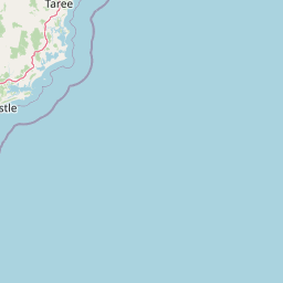
Map view of Boondelbah Island

Use this park location map to pinpoint Boondelbah Island in Australia, understand its exact geographic position, and read its mapped placement within the surrounding landscape more clearly.

Pigeon | © OpenStreetMap contributors

Location context for Boondelbah Island

New South Wales

Visualizing the rugged cliffs and protected coastal shrubland of New South Wales

Boondelbah Island Photos and Landscape Scenery

Examine detailed park imagery to understand the rugged terrain and coastal shrubland of Boondelbah Island. Visual documentation reveals the distinct geomorphology and protected seabird habitats found across this island reserve.

A low, rocky island sits on the horizon in the middle of a calm ocean under a partly cloudy sky.

Park atlas

Discover related coastal reserves and regional habitats across New South Wales.

Explore Protected Areas and Parks Near Boondelbah Island

Continue exploring regional protected landscapes and coastal habitats connected to Boondelbah Island. Comparing nearby island reserves and coastal environments provides broader context for eastern Australian conservation areas.
National parkNew South Wales
About 3.1 km away#1 closest

North

Myall Lakes National Park National Park: Mapped Boundaries and Protected Landscape Exploration

Discover its regional geography and natural terrain context.

Delve into the specific protected landscape and geographic features of Myall Lakes National Park. As a national park located in New South Wales, it provides critical atlas context for understanding protected areas and their distribution. Explore its mapped terrain and boundaries to gain a deeper appreciation for this significant natural area within Australia's geography.

Area
448 km²
Established
1972
IUCN
II
Relief
Lowland
A watercolor painting showing a green forested island shoreline with palm trees and rocky outcrops bordered by blue water against a white background.
Nature reserveNew South Wales
About 3.7 km away#2 closest

North

Cabbage Tree Island (John Gould Nature Reserve) Protected Area and Coastal Island Geography

Rugged island terrain and coastal conservation landscapes in New South Wales.

Cabbage Tree Island (John Gould Nature Reserve) represents a significant coastal nature reserve located off the New South Wales mainland. The island is defined by its steep 123-metre ridge, rocky scree fields, and specialized cabbage tree palm vegetation. As a dedicated protected area, the island provides a crucial sanctuary for rare seabird populations, showcasing the intersection of isolated island geography and active habitat management.

Area
0.3 km²
IUCN
IV
Relief
Upland
Access
Highly restricted
National parkNew South Wales
About 4.2 km away#3 closest

Southwest

Tomaree National Park: New South Wales National Park with Defined Protected Boundaries

Explore its mapped geography and regional landscape context.

Tomaree National Park represents a significant protected landscape within New South Wales, Australia. This national park entry focuses on its distinct geographic features and mapped boundaries, offering a clear point of reference for atlas-based exploration. Understand its place in the regional geography of New South Wales and its identity as a conserved natural area. The detailed mapping and contextual data provide a solid foundation for appreciating this protected landscape.

Area
23.18 km²
Established
1984
IUCN
II
Relief
Lowland
National parkNew South Wales
About 43 km away#4 closest

North

Wallingat National Park: Explore Protected Landscape and Regional Geography in New South Wales

Discover mapped park boundaries and terrain context.

Wallingat National Park in New South Wales is a protected landscape crucial for understanding Australia's natural geography. This canonical page detail provides essential information for atlas exploration, focusing on the park's protected status, mapped contours, and its place within the regional context. Discover the unique geographic features that distinguish this national park from others in the atlas.

Area
65.57 km²
Established
1999
IUCN
II
Relief
Lowland
National parkNew South Wales
About 45 km away#5 closest

North

Ghin-Doo-Ee National Park: National Park Protected Area Exploration in New South Wales

Mapped landscape and regional geography for Ghin-Doo-Ee National Park.

Ghin-Doo-Ee National Park represents a key component of Australia's protected lands, situated within the diverse geography of New South Wales. This park offers a structured point of entry for understanding its specific mapped boundaries, terrain characteristics, and its role as a national park. Users can delve into its unique landscape features and regional geographic context, contributing to a broader appreciation of conservation areas and natural atlas exploration.

Area
47.936 km²
Established
1999
IUCN
II
Relief
Upland
National parkNew South Wales
About 51 km away#6 closest

Northeast

Booti Booti National Park: New South Wales National Park Protected Landscape Atlas

Mapped boundaries and regional geography for this Australian national park.

Delve into the specifics of Booti Booti National Park, a designated national park within New South Wales, Australia. This resource facilitates a detailed understanding of its protected area status, landscape characteristics, and precise geographic placement. Explore its mapped features and regional context to enrich your atlas-based discovery of Australia's protected lands.

Area
15.67 km²
Established
1992
IUCN
II
Relief
Highland
Watercolor painting of rolling green hills, grassy foreground, and soft, hazy mountains in the background, set against a plain white background.
State or regional parkNew South Wales
About 52 km away#7 closest

Southwest

Glenrock State Conservation Area: Coastal Reserve and Geological Atlas Exploration

Protected coastal landscapes and rare remnant vegetation near Newcastle

Glenrock State Conservation Area encompasses 534 hectares of protected coastline, ranging from steep cliffs and exposed headlands to sheltered forested gullies and lagoon systems. This reserve functions as a critical ecological refuge, housing nationally significant plant communities and unique Permian-aged soil substrates. Its terrain documents both deep geological history and the cultural heritage of the Awabakal people, balanced with early industrial relics that reflect the colonial history of the lower Hunter region.

Area
5.34 km²
Established
1974
Relief
Upland
Climate
Temperate
Nature reserveNew South Wales
About 56 km away#8 closest

Southwest

Blackbutt Reserve: Protected Eucalyptus Woodland and Urban Nature Reserve in Newcastle

Geography and landscape mapping of a New South Wales nature reserve

Blackbutt Reserve stands as a notable 182-hectare nature reserve within Newcastle, New South Wales, protecting a diverse stretch of undulating eucalyptus forest. This protected area serves as an essential green space, offering a unique look at local topography and regenerating woodland ecosystems preserved through decades of community effort.

Area
1.82 km²
Established
1938
Relief
Upland
Climate
Temperate

Common questions about visiting, size, designation, and location context for Boondelbah Island

Boondelbah Island FAQs for park facts, access, geography, and protected area context

Find quick answers about Boondelbah Island, including protected-area facts, park geography, trail and visitor context, and how the park fits into its surrounding country and regional landscape.
MoriAtlas Explorer

Continue Your Protected Areas Search Across the Global Atlas

Deepen your exploration by continuing the structured search for national parks and protected areas worldwide. Utilize the comprehensive filtering capabilities to compare different conservation landscapes and refine your understanding of global park geography. Discover more about the distribution and characteristics of protected natural areas.

Global natural geography