

Mori Atlas logo
Nature reserveBoondina Conservation Park

Understanding the landscape context and ecological role of this remote mallee woodland territory.

Boondina Conservation Park: A Protected Nature Reserve in Far Western South Australia

Boondina Conservation Park sits as a distinct nature reserve in the far west of South Australia, serving as a critical component of the vast Yellabinna Reserves system. This protected area covers roughly 125 square kilometres of semi-arid mallee woodland, contributing to a massive, continuous block of natural habitat north-east of Fowlers Bay. The park demonstrates a unique governance model through its co-management arrangement with the Far West Coast Aboriginal Corporation, reflecting enduring cultural connections to local water sources and the surrounding arid terrain.

mallee woodlandsemi-arid landscapeconservation parkaboriginal co-managementSouth AustraliaYellabinna Reserves

Boondina Conservation Park

Nature reserve

Park overview

Structured park overview, official facts, and landscape profile for Boondina Conservation Park

Boondina Conservation Park park facts, protected area profile, and essential visitor context

Review the core facts for Boondina Conservation Park, including designation, size, terrain, visitor scale, habitats, and operating context in one park-focused overview.

About Boondina Conservation Park

Boondina Conservation Park lies in the remote far west of South Australia, within the gazetted locality of Yellabinna and roughly 38 kilometres north-east of the small town of Fowlers Bay. The park is part of a vast semi-arid landscape dominated by mallee woodland, one of the largest such woodland systems remaining in southern Australia. Its position places it within a broader network of reserves that collectively cover an enormous extent of South Australian outback country.

The park first received protection in 1993, when the land was dedicated as part of the Yumbarra Conservation Reserve under the Crown Lands Act 1929. In 2006 that broader reserve was resumed, and a portion of that crown land was formally constituted as Boondina Conservation Park. The park therefore represents a deliberate reshaping of the protected-area framework in this region, with the new entity focused on the area around Boondina and its associated water sources.

Boondina is now managed by South Australia's Department for Environment and Water and is administered as part of the Yellabinna Reserves, a grouping that also includes Pureba Conservation Park, Yumbarra Conservation Park, the Yellabinna Regional Reserve, and the Yellabinna Wilderness Protection Area. The stated management approach for the Yellabinna Reserves emphasises integrated and collaborative conservation across the wider landscape rather than treating each reserve as a discrete unit. This reflects the understanding that the ecological values of the mallee woodland extend across reserve boundaries.

The park has no visitor facilities of its own and does not permit public vehicular access. It is classified as an IUCN Category VI protected area, meaning it is intended for the sustainable use of natural resources as well as conservation. Within this framework, mineral exploration and mining are permitted activities. At the same time, Aboriginal people are permitted to hunt for and gather food within the park, and advice on its management is provided through a co-management agreement signed in 2013 between the Far West Coast Aboriginal Corporation and the Government of South Australia. The agreement originally related to Yumbarra Conservation Park but also extends its advisory role to Boondina and surrounding reserves in the west of the state.

Quick facts and research context for Boondina Conservation Park

Boondina Conservation Park is a conservation park in the far west of South Australia, located in the gazetted locality of Yellabinna and roughly 38 kilometres north-east of Fowlers Bay. The park covers about 125.55 square kilometres and is classified as an IUCN Category VI protected area, a designation that allows sustainable use of natural resources within its boundaries.

The park was first placed under formal protection in 1993 as part of the Yumbarra Conservation Reserve and was reconstituted as Boondina Conservation Park in 2006. It is now managed by the South Australian Department for Environment and Water as one component of the Yellabinna Reserves, which together protect more than three million hectares of mallee woodland. The park shares its management framework with Pureba Conservation Park, Yumbarra Conservation Park, the Yellabinna Regional Reserve, and the Yellabinna Wilderness Protection Area.

Protection and recognition

Examine the terrestrial protection scope and documented designation history.

Boondina Conservation Park Protection Status and Designation Records

Boondina Conservation Park maintains a defined terrestrial protection scope within the regional conservation network. Documented status records outline the official framework governing this protected area without external recognition sources.

Protection details

Protection scope
Terrestrial
Transboundary protection
No
Park context

Deeper park guide and search-rich context for Boondina Conservation Park

Boondina Conservation Park history, landscape, wildlife, and travel context

Explore Boondina Conservation Park through its history, landscape character, ecosystems, wildlife, conservation priorities, cultural context, and seasonal travel timing in a structured park guide built for atlas discovery and search intent.

Why Boondina Conservation Park stands out

Boondina Conservation Park is best known as one of the constituent protected areas of the Yellabinna Reserves, a vast system that safeguards more than three million hectares of mallee woodland in the far west of South Australia. Its name itself is drawn from an Aboriginal term connected to local water sources, emphasising the importance of water within this dry, semi-arid environment. The park is also recognised for its distinctive governance model, in which it sits within an integrated management framework linking several conservation parks, a regional reserve, and a wilderness protection area, and is subject to a co-management agreement between the South Australian Government and the Far West Coast Aboriginal Corporation. Its IUCN Category VI status, which explicitly permits mineral exploration and mining alongside conservation, reflects the broader landscape-scale land use arrangements in this part of South Australia.

Boondina Conservation Park history and protected-area timeline

Boondina Conservation Park emerged through a two-stage process of land protection and reserve restructuring in South Australia's far west. The land first received formal conservation status on 11 November 1993, when it was included in the Yumbarra Conservation Reserve. That reserve was dedicated under the Crown Lands Act 1929 and formed part of the suite of conservation reserves that the South Australian Government established to manage large tracts of semi-arid mallee country.

In 2006, the Yumbarra Conservation Reserve was resumed by the Crown. As part of the process, a portion of the resumed crown land was constituted as a new protected area called Boondina Conservation Park. The choice of name is significant: it comes from a native Aboriginal word associated with the area and linked to local water sources. The naming reflects the broader practice in South Australian reserves of acknowledging Aboriginal place-based knowledge, particularly the importance of water in arid environments.

By 2013, Boondina had been integrated into the Yellabinna Reserves, a cluster of protected areas that includes Pureba Conservation Park, Yumbarra Conservation Park, the Yellabinna Regional Reserve, and the Yellabinna Wilderness Protection Area. That same year, the Government of South Australia signed a co-management agreement with the Far West Coast Aboriginal Corporation covering Yumbarra Conservation Park and, more broadly, reserves in the west of the state including Boondina. Under this arrangement, the corporation provides advice on management, and Aboriginal people are permitted to hunt and gather food within the park.

Boondina Conservation Park landscape and geographic character

The landscape of Boondina Conservation Park is shaped by the semi-arid conditions of far western South Australia and the ecological character of its extensive mallee woodland vegetation. Mallee vegetation is dominated by multi-stemmed eucalypts adapted to dry conditions, creating a shrubby, often dense canopy that characterises large parts of the region north-east of Fowlers Bay.

The park sits within a flat to gently undulating country where surface water is limited and Aboriginal place names commonly refer to scattered water sources. The name Boondina itself is associated with local water sources in the area, highlighting the role of springs, soakages, or other natural water points in an otherwise dry landscape. To the south and east, the broader Yellabinna region extends across dune systems, salt lakes, and chenopod plains typical of the Eyre Peninsula and the western fringes of the Great Victoria Desert.

The land covered by Boondina forms part of an exceptionally large, continuous block of natural habitat. The grouping of reserves around it, including the Yellabinna Regional Reserve and Yellabinna Wilderness Protection Area, buffers the park and supports landscape-scale ecological processes such as fire regimes, animal movements, and vegetation patterning across much of the surrounding country.

Boondina Conservation Park ecosystems, habitats, and plant life

The ecological identity of Boondina Conservation Park is defined by its mallee woodland habitat, a vegetation type that dominates the broader Yellabinna Reserves system. Mallee communities in this part of South Australia typically include a diversity of multi-stemmed eucalypt species, an understorey of shrubs, and ground cover adapted to low rainfall and periodic fire. The park contributes to the conservation of more than three million hectares of this woodland type when considered together with the surrounding reserves.

Pockets of other habitats typical of the far west of South Australia also fall within the area, including chenopod shrublands, dune swales, and other arid-zone vegetation communities that make up part of the regional mosaic. The park's role within the Yellabinna Reserves is to help maintain the integrity of this mosaic and the ecological processes that sustain it, rather than to protect a single habitat type in isolation.

Because the park has no public vehicular access and no built facilities, the landscape retains a predominantly unmodified character. This absence of intensive infrastructure supports the continuation of natural patterns of vegetation regeneration, animal movement, and disturbance regimes across the area covered by Boondina and the wider reserve network.

Boondina Conservation Park wildlife and species highlights

The park sits within the broader Yellabinna Reserves system, which is recognised as an important refuge for wildlife across the semi-arid zone of western South Australia. While the park itself is one piece of a much larger habitat network, its contribution to the conservation of mallee woodland fauna is significant at a regional scale.

Mallee woodlands of this kind support species groups typical of arid and semi-arid southern Australia, including a range of reptiles, small to medium-sized mammals, and aerial insectivores that depend on the dense shrub structure for shelter and foraging. The vegetation mosaic surrounding the park, which includes chenopod shrublands and dune systems, further expands the range of habitat niches available to wildlife in the area.

The Yellabinna Reserves, of which Boondina is a part, are also recognised as an important area for birdlife, particularly for species associated with mallee and arid woodland communities. The absence of public vehicular access within Boondina helps maintain low levels of direct human disturbance for wildlife in this part of the reserve network.

Boondina Conservation Park conservation status and protection priorities

Boondina Conservation Park plays a strategic role in the conservation of mallee woodland in far western South Australia. Although the park itself is relatively modest in size compared to the surrounding reserves, it forms one link in the much larger Yellabinna Reserves system, which collectively protects more than three million hectares of this vegetation type. The park's inclusion in this system reflects an emphasis on landscape-scale conservation rather than the protection of isolated patches.

The park is classified as an IUCN Category VI protected area, a designation intended for the conservation of ecosystems together with the sustainable use of natural resources. This status allows activities such as mineral exploration and mining to continue within the park, balanced against the broader conservation objective. It also allows traditional Aboriginal hunting and gathering, reflecting the recognition of continuing Aboriginal connection to country.

The co-management agreement between the Government of South Australia and the Far West Coast Aboriginal Corporation, signed in 2013, gives Aboriginal people a formal advisory role in the management of the park and related reserves. This adds a layer of cultural governance to the conservation framework, integrating Aboriginal knowledge and interests into the day-to-day management of the area. Combined with the park's role within the integrated Yellabinna Reserves, Boondina contributes to an approach that values long-term ecological function and Aboriginal cultural connection across a very large region of South Australia.

Boondina Conservation Park cultural meaning and human context

The cultural significance of Boondina Conservation Park is closely tied to the Aboriginal heritage of the region. The park's name is derived from a word used by local Aboriginal people to refer to an area associated with water sources, and this naming reflects the deep connection between Aboriginal people and the water resources of the semi-arid country in the far west of South Australia.

The park falls within the area traditionally associated with Aboriginal groups represented by the Far West Coast Aboriginal Corporation. Through the 2013 co-management agreement between the corporation and the Government of South Australia, Aboriginal people have a continuing role in advising on how the park and surrounding reserves are managed. The agreement formalises the relationship between Aboriginal custodianship and the state's conservation framework.

Aboriginal people are also permitted to hunt for and gather food within the park, which reflects the recognition of continuing customary use of the land. This blend of conservation, sustainable resource use, and Aboriginal cultural practice gives Boondina a distinctive cultural profile compared with more strictly protected parks elsewhere in South Australia.

Top sights and standout views in Boondina Conservation Park

Boondina Conservation Park stands out as a small but meaningful component of one of the largest protected-area networks in southern Australia. Its highlights include its place within the Yellabinna Reserves, its mallee woodland environment, and the formal recognition of Aboriginal connection through both its name and its co-management arrangements.

Visitors to the area will not find built facilities or vehicular access at Boondina itself, but the park contributes directly to the integrity of a much larger landscape that supports characteristic wildlife, arid-zone vegetation, and continuing Aboriginal cultural practice. Its IUCN Category VI status, allowing sustainable resource use including mineral exploration, alongside its conservation role, gives it a distinctive position in South Australia's protected-area system.

Best time to visit Boondina Conservation Park

Boondina Conservation Park does not provide visitor facilities or public vehicular access, so the experience of the park is essentially one of travelling through the surrounding country rather than visiting the park as a destination in its own right. For those exploring the broader Yellabinna region around Fowlers Bay and surrounding reserves, cooler months between late autumn and early spring generally offer milder conditions for travel across the semi-arid landscape, while summer in this part of South Australia can be extremely hot and dry.

The character of the mallee woodland changes with the seasons. Spring can bring wildflower displays typical of arid South Australia, while cooler months offer more comfortable conditions for landscape appreciation and wildlife observation. Visitors planning to explore the broader region should treat the park itself as a non-accessible conservation area accessed only through surrounding reserves and roads, and plan around the climatic extremes of the far west of the state.
Monthly climate preview

Long term temperature and monthly precipitation averages for South Australia

Boondina Conservation Park Climate Normals and Annual Temperature Patterns

Boondina Conservation Park records measured monthly mean temperatures spanning from twelve to twenty four degrees Celsius alongside stable precipitation distributions across the coordinate point. Reviewing the complete twelve month climatology profile provides deeper insight into long term weather by month trends for this protected area.
Annual mean19 °C
12 °C24 °C
Jan24°
Feb24°
Mar22°
Apr19°
May16°
Jun13°
Jul12°
Aug13°
Sep16°
Oct19°
Nov21°
Dec23°
Warmest month
January

24.5 °C

Coolest month
July

12.1 °C

Wettest month
July

1.2 mm/day

Driest month
January

0.4 mm/day

Park location guide

Geography guide, regional context, and park location map for Boondina Conservation Park

Boondina Conservation Park park geography, regions, and map view in Australia

Understand where Boondina Conservation Park sits in Australia through a broader geographic reading of the surrounding landscape, nearby location context, and its mapped position within the national park landscape.

How Boondina Conservation Park fits into Australia

Australia is a constitutional monarchy and federal parliamentary democracy comprising six states and ten territories. With a population of nearly 28 million, it is one of the world's most urbanised countries, with most people concentrated on the eastern seaboard. The country has a high Human Development Index and is known for its cultural diversity, ancient Aboriginal heritage, and unique wildlife.

Wider geography shaping Boondina Conservation Park in Australia

Australia occupies the entire Australian continent, the island of Tasmania, and numerous smaller islands. It is the world's flattest and driest inhabited continent, featuring vast deserts in the interior (the Outback), tropical rainforests along the eastern coast, and a coastline bordering the Indian and Pacific Oceans.

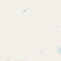
Map view of Boondina Conservation Park

Use this park location map to pinpoint Boondina Conservation Park in Australia, understand its exact geographic position, and read its mapped placement within the surrounding landscape more clearly.

Pigeon | © OpenStreetMap contributors

Location context for Boondina Conservation Park

South Australia
Park atlas

Discover related reserves and contiguous mallee woodland across far western South Australia

Exploring Parks Near Boondina Conservation Park and Surrounding Protected Landscapes

Continue geographic discovery by comparing Boondina Conservation Park with adjacent protected areas across the vast Yellabinna mallee system. Examining neighboring reserves provides a clearer understanding of arid zone vegetation, regional conservation networks, and landscape scale habitats.
Nature reserveSouth Australia
About 28 km away#1 closest

Southwest

Fowlers Bay Conservation Park: Coastal Protected Area and Regional Geography

A remote conservation landscape on the Great Australian Bight

Fowlers Bay Conservation Park stands as a vital protected area in South Australia, where vertical limestone cliffs meet horizontal chenopod plains. The park provides an essential look at the interaction between Southern Ocean maritime forces and the arid western Eyre Peninsula, offering a rare window into the transition zones of the Great Australian Bight coast.

Area
87.27 km²
Established
1993
IUCN
VI
Relief
Lowland
Nature reserveSouth Australia
About 28 km away#2 closest

Southeast

Chadinga Conservation Park: Coastal Dunes and Salt Lake Geography in South Australia

Remote protected dune systems and arid saline landscapes

Chadinga Conservation Park protects a significant stretch of coastal dune country west of Lake MacDonnell. This arid landscape, defined by salt lakes and mallee scrub, serves as a crucial habitat for rare species, offering a raw and undisturbed look at the coastal geography of the South Australian coastline.

Area
118.54 km²
Established
1993
IUCN
VI
Relief
Lowland
Marine protected areaSouth Australia
About 60 km away#3 closest

West

Great Australian Bight Marine National Park: Marine Protected Area Atlas and Geographic Context

Mapping the protected marine landscape of South Australia.

Delve into the geography and mapped boundaries of Great Australian Bight Marine National Park, a critical marine protected area located off the coast of South Australia. This resource provides an atlas-style view of the park, highlighting its geographic setting and significance as a protected marine environment. Understand the scope of this marine protected area and its place within the Australian geography, offering rich context for discovery and map exploration.

Area
1,233.22 km²
Established
1996
IUCN
II
Access
Access unknown
Marine protected areaSouth Australia
About 93 km away#4 closest

South

Murat Marine Park: Geography and Protected Marine Landscape of South Australia

Marine protected area atlas and bathymetric overview

Murat Marine Park represents an offshore sanctuary within the Great Australian Bight. This marine protected area features a blend of sediment-dominated shelf habitats and the submerged Yatala Reef, providing essential feeding grounds for diverse marine life. Explore the mapped territory and understand its placement within the wider South-west Marine Parks Network through a geographic and atlas-focused lens.

Area
937.77 km²
Established
2012
IUCN
II
Relief
Lowland
Nature reserveSouth Australia
About 193 km away#5 closest

Southeast

Eba Island Conservation Park: Coastal Landforms and Nature Reserve Geography in South Australia

A protected offshore sanctuary within Streaky Bay's coastal landscape.

Eba Island Conservation Park represents a key protected area within the coastal geography of South Australia. Composed primarily of calcarenite and limestone, the reserve features a diverse range of coastal landforms, including rugged jagged ridges, active blowholes, and sheltered coves, providing an essential habitat for seabird colonies.

Area
1.34 km²
Established
1966
IUCN
Ia
Relief
Lowland
National parkSouth Australia
About 202 km away#6 closest

East

Lake Gairdner National Park: National Park with Unique South Australian Geography and Mapped Boundaries

South Australian protected area with distinct landscape characteristics.

Lake Gairdner National Park serves as a key protected area within the geographic expanse of South Australia. This national park offers a unique focus for atlas exploration, highlighting its specific landscape features and mapped boundaries. Users can delve into the park's protected status and its contribution to the regional geography, providing valuable context for understanding Australia's diverse natural protected lands and their cartographic representation.

Area
5,531.77 km²
Established
1991
IUCN
VI
Relief
Lowland
Protected areaSouth Australia
About 209 km away#7 closest

Southeast

Cape Blanche Conservation Park: Eyre Peninsula Coastal Protected Landscape Map

Regional geography and conservation coastal terrain

Located on the remote western coast of the Eyre Peninsula, Cape Blanche Conservation Park serves as a dedicated sanctuary for coastal raptors and migratory birds. This protected area features a rugged intersection of limestone cliffs, sandy bays, and native coastal flora, providing an essential ecological corridor within the South Australian reserve system.

Area
810 km²
Established
2012
IUCN
III
Scope
Terrestrial
Nature reserveSouth Australia
About 221 km away#8 closest

Southeast

Calpatanna Waterhole Conservation Park: Protected Geography and Coastal Reserve Mapping

Nature reserve landscape within the South Australian Eyre Peninsula

Calpatanna Waterhole Conservation Park represents a specialized protected environment within South Australia. Centred on its namesake waterhole, the area preserves a distinctive mosaic of seasonal saline lagoons and hardy mallee eucalyptus scrub. This reserve highlights the ecological and geographic character of the Eyre Peninsula, where low undulating terrain supports unique, salt-adapted vegetation communities.

Area
36.44 km²
Established
1974
IUCN
Ia
Relief
Lowland

Common questions about visiting, size, designation, and location context for Boondina Conservation Park

Boondina Conservation Park FAQs for park facts, access, geography, and protected area context

Find quick answers about Boondina Conservation Park, including protected-area facts, park geography, trail and visitor context, and how the park fits into its surrounding country and regional landscape.
MoriAtlas Explorer

Continue Your Protected Areas Search Across the Global Atlas

Deepen your exploration by continuing the structured search for national parks and protected areas worldwide. Utilize the comprehensive filtering capabilities to compare different conservation landscapes and refine your understanding of global park geography. Discover more about the distribution and characteristics of protected natural areas.

Global natural geography