
Mori Atlas logo
Protected areaBoosmansbos Wilderness Area

A comprehensive geographic examination of fynbos ridges, deep river gorges, and protected afrotemperate forests.

Boosmansbos Wilderness Area: Mapping the Rugged Langeberg Mountain Landscapes and Forested Valleys

Boosmansbos Wilderness Area represents a critical protected landscape within South Africa's Western Cape Province, anchored by the dramatic 1,637-meter Grootberg peak. This geographic profile details the transition from high-altitude fynbos plateaus to the deeply incised gorges of the Duiwenhoks River system. As part of the Cape Floral Region, the area showcases a striking contrast between endemic mountain vegetation and the sheltered afrotemperate forests found within the Grootvadersbosch basin.

Cape fynbosafrotemperate forestLangebergWestern CapeUNESCO World Heritage Sitemountain wilderness
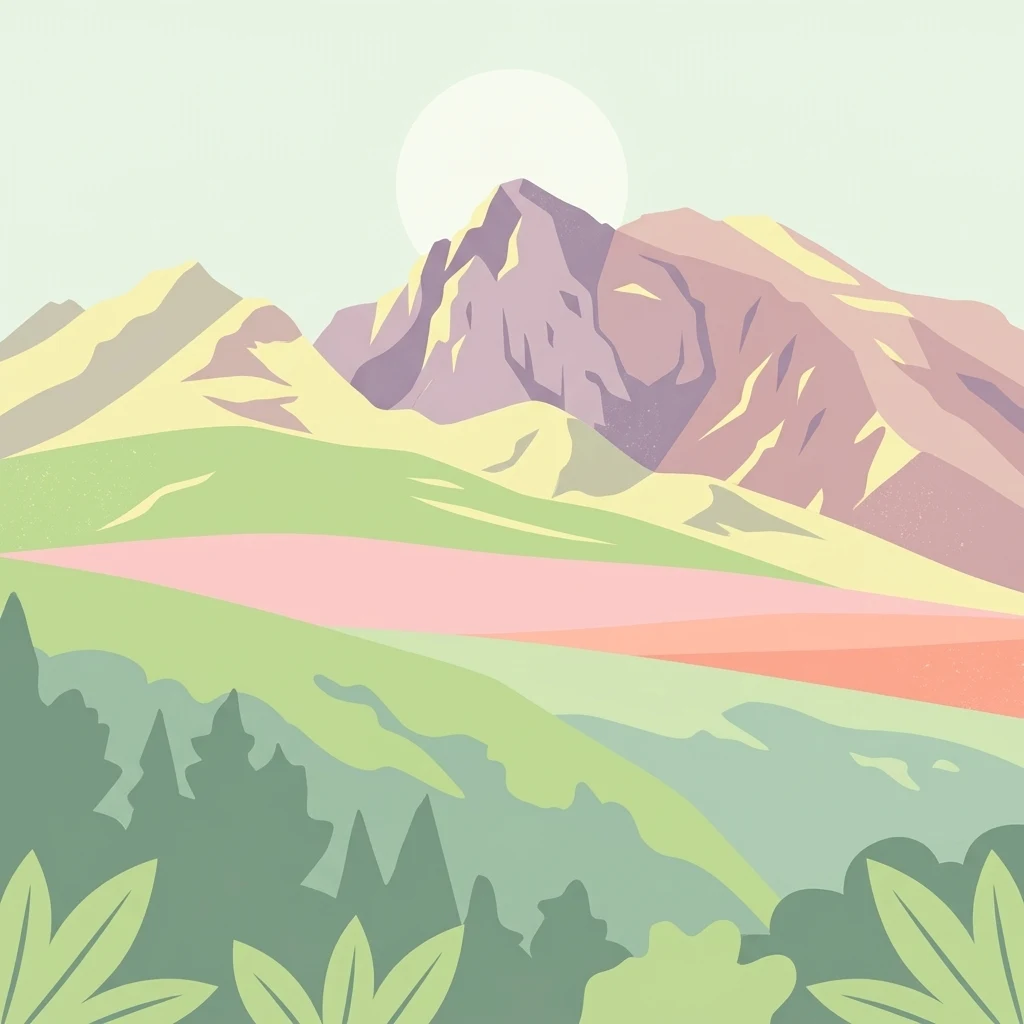
A minimalist, flat-style illustration showing green foreground vegetation, a grassy midground, and purple-tinted mountains against a pale sky with a faint sun.

Boosmansbos Wilderness Area

Protected area

Park overview

Structured park overview, official facts, and landscape profile for Boosmansbos Wilderness Area

Boosmansbos Wilderness Area park facts, protected area profile, and essential visitor context

Review the core facts for Boosmansbos Wilderness Area, including designation, size, terrain, visitor scale, habitats, and operating context in one park-focused overview.

About Boosmansbos Wilderness Area

Boosmansbos Wilderness Area is one of the quieter but ecologically significant protected landscapes of the Western Cape, anchoring the remote eastern end of the Langeberg mountains. Covering around 142 square kilometers of rugged terrain north of Heidelberg, it was established to safeguard both the mountain fynbos on its higher slopes and the moist indigenous forests that line its sheltered valleys. The result is a single protected area where two very different but interlocking plant communities of the Cape region meet and survive side by side.

The wilderness surrounds its own high point, Grootberg, which at over 1,600 meters gives the area much of its character. From this central ridge the land drops away in different directions: to the south, steep gorges channel tributaries of the Duiwenhoks River downward toward the lowlands; to the southwest, the terrain softens slightly to enclose the small Grootvadersbosch Nature Reserve, whose 250 hectares of valley forest represent the westernmost natural forest in South Africa. The juxtaposition of bare, rock-strewn fynbos slopes above and dense, evergreen forest below is one of the area's defining visual themes.

Boosmansbos is part of a wider conservation story that links it to broader Cape Floral Region Protected Areas, a UNESCO World Heritage Site recognising the extraordinary botanical importance of the fynbos biome. By protecting both fynbos and forest in a contiguous mountain setting, Boosmansbos contributes to safeguarding the plant diversity, watershed function, and landscape integrity of the Langeberg, while offering visitors a relatively undisturbed space for walking and exploring through an extensive trail network.

Quick facts and research context for Boosmansbos Wilderness Area

Boosmansbos Wilderness Area covers about 142 square kilometers in the eastern Langeberg mountains of the Western Cape, South Africa, with Grootberg as its central summit at 1,637 meters. It includes the 250 hectare Grootvadersbosch Nature Reserve in its southwestern corner, the most westerly natural forest in South Africa. The area forms part of the Cape Floral Region Protected Areas UNESCO World Heritage Site, inscribed in 2004 and extended in 2015, and conserves both mountain fynbos and indigenous valley forest.

Protection and recognition

Terrestrial conservation framework and official designation timeline for 2004

Boosmansbos Wilderness Area Protection Status and Designation History

Boosmansbos Wilderness Area maintains a documented terrestrial protection status established in the designated year of 2004. Structured records present the official management scope and available international recognition details for this protected landscape.

Protection details

Protection scope
Terrestrial
Designated year
2004
Transboundary protection
No
Park context

Deeper park guide and search-rich context for Boosmansbos Wilderness Area

Boosmansbos Wilderness Area history, landscape, wildlife, and travel context

Explore Boosmansbos Wilderness Area through its history, landscape character, ecosystems, wildlife, conservation priorities, cultural context, and seasonal travel timing in a structured park guide built for atlas discovery and search intent.

Why Boosmansbos Wilderness Area stands out

Boosmansbos is best known for its combination of high-altitude Cape fynbos and rare valley forest in a single contiguous wilderness, including the Langeberg rambling aloe and a sequence of protected forest trees. It is also notable for enclosing Grootvadersbosch, the most westerly natural forest in South Africa, and for its inclusion in the Cape Floral Region World Heritage Site. Beyond botany, the area stands out for its rugged Langeberg scenery, with Grootberg rising above deep gorges that drain into the Duiwenhoks River system. The mix of mountain ridges, forested valleys, and endemic fynbos creates a compact landscape that captures many of the defining features of the Western Cape's mountain ecosystems in one protected block.
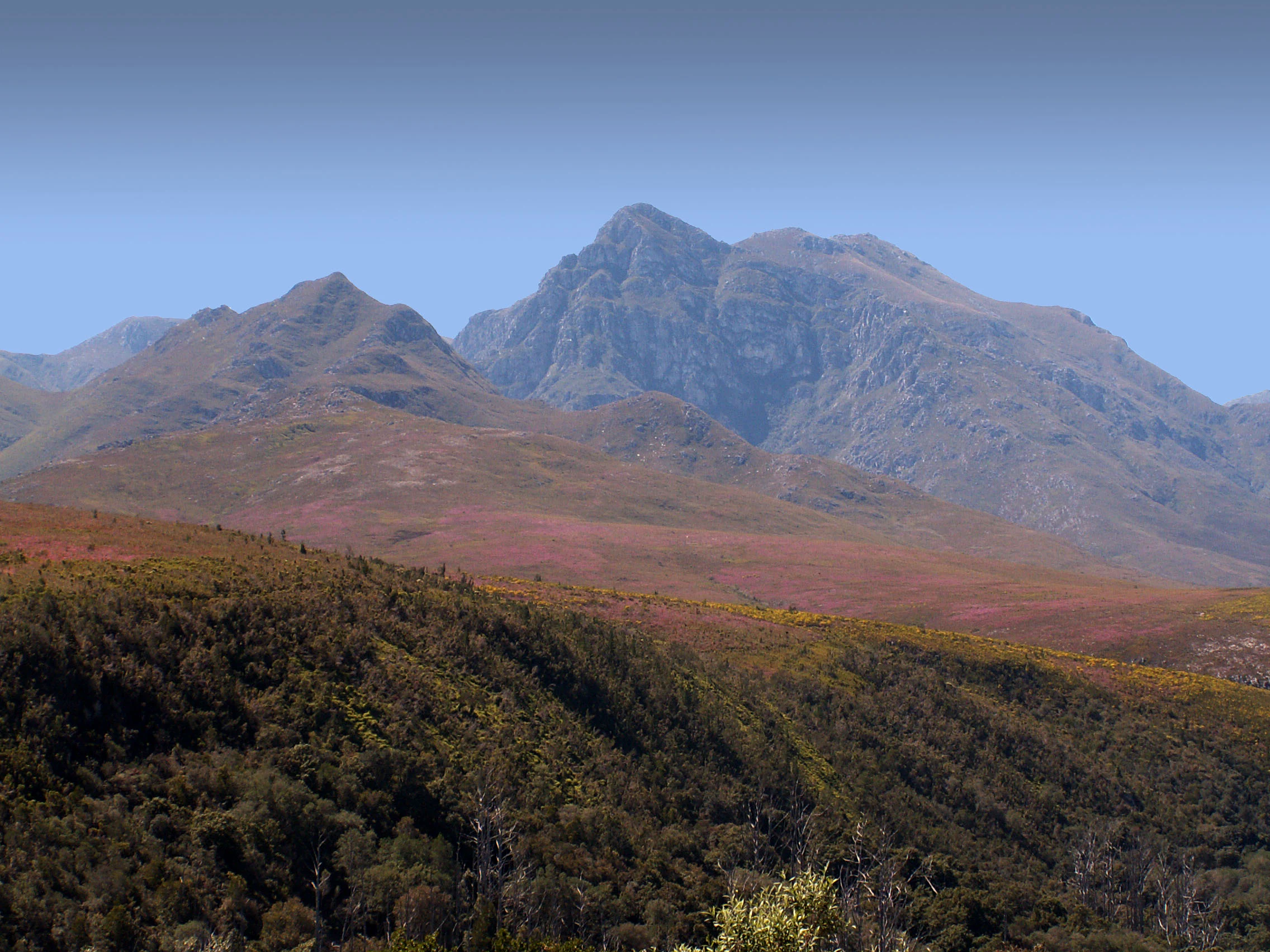
A wide-angle mountain landscape under a clear blue sky, featuring rocky peaks rising above slopes covered in fynbos vegetation.
The rugged peaks of the Langeberg range as seen within the Boosmansbos Wilderness Area.

Boosmansbos Wilderness Area history and protected-area timeline

The name Boosmansbos, meaning 'angry man's forest', comes from an early 19th century hermit who lived in the area and was known for frightening local youngsters who came near his apiaries. The surrounding landscape was gradually recognised for both its forest and fynbos values, leading to the establishment of the wilderness area and the inclusion of the smaller Grootvadersbosch Nature Reserve within its boundaries.

The wider regional context became formally significant in 2004 when the Cape Floral Region Protected Areas were inscribed on the UNESCO World Heritage List. Boosmansbos forms part of this World Heritage property, which was extended in 2015, recognising the area's contribution to one of the most botanically diverse temperate regions on Earth.

Boosmansbos Wilderness Area landscape and geographic character

Boosmansbos is a mountain wilderness defined by the eastern Langeberg range. Its central feature is Grootberg, a peak rising to 1,637 meters that anchors the high ground of the reserve. From this crest, the terrain fans outward as a series of ridges, slopes, and valleys, with rocky fynbos-covered upper slopes giving way to forested kloofs and river gorges lower down.

The southern edge of the wilderness is shaped by the tributaries of the Duiwenhoks River, which descend precipitously through steep gorges, falling roughly 200 meters toward the lowlands around the southern perimeter. To the southwest, the topography becomes slightly less extreme, enclosing the moist valley basin of Grootvadersbosch, whose indigenous forest stands in striking contrast to the open mountain slopes elsewhere in the area. The overall impression is of a compact, mountainous landscape where elevation, slope, and moisture create rapid variation over short distances.

Boosmansbos Wilderness Area ecosystems, habitats, and plant life

The ecological identity of Boosmansbos rests on the meeting of two distinct vegetation types. Above, mountain fynbos covers the higher ridges and slopes, a characteristically Cape floral community rich in ericas, everlasting daisies, and other specialised shrubs, including the rare Langeberg rambling aloe.

Lower in the valleys, where soils are deeper and moisture more reliable, the vegetation shifts to indigenous afrotemperate forest. These forests shelter important tree species such as sickle-leaved yellowwood, stinkwood, and red alder, forming dense, shaded canopies that contrast strongly with the open fynbos above. The transition between fynbos and forest, often occurring over very short distances on the same mountain, gives the area much of its botanical significance and forms the basis of its conservation value within the Cape Floral Region.

Boosmansbos Wilderness Area wildlife and species highlights

Although Boosmansbos is primarily valued as a botanical reserve, its forests and fynbos slopes support typical small fauna associated with the Langeberg. The dense valley forests provide refuge for forest-dependent birds and small mammals, while the fynbos slopes carry the invertebrate and reptile life typical of the Cape mountain environment. The richness of vegetation types within a small area makes the wilderness attractive for birdwatching and for encounters with the broader small-scale fauna of the Western Cape mountains, though detailed species information is limited in the source material.

Boosmansbos Wilderness Area conservation status and protection priorities

Boosmansbos Wilderness Area is recognised as part of the Cape Floral Region Protected Areas UNESCO World Heritage Site, inscribed in 2004 under natural criteria relating to ecological processes and biodiversity, and extended in 2015. This international designation reflects the area's role in protecting two complementary ecosystems within a single mountain block: mountain fynbos on the upper slopes and indigenous afrotemperate forest in the valleys.

The inclusion of Grootvadersbosch Nature Reserve within the wilderness adds further conservation weight, as this small forest represents the westernmost natural forest in South Africa and protects species such as yellowwood, stinkwood, and red alder. Together, these features make Boosmansbos an important contributor to the long-term survival of both fynbos and forest communities in the Langeberg, and a key piece of the broader Cape Floral Region conservation network.

Top sights and standout views in Boosmansbos Wilderness Area

Boosmansbos combines rugged Langeberg mountain scenery with two of the Western Cape's most distinctive vegetation types in a single protected area. Its central peak, Grootberg, anchors a varied topography of high fynbos ridges, deeply incised gorges, and sheltered forested valleys. The presence of Grootvadersbosch, the most westerly natural forest in South Africa, makes the area unusual within the national conservation estate and adds depth to a visit beyond open mountain landscapes.

For visitors seeking a quieter wilderness experience, the area offers an extensive footpath network of about 64 kilometers, allowing multi-day exploration of fynbos plateaus, forest kloofs, and river headwaters without leaving the protected landscape.

Best time to visit Boosmansbos Wilderness Area

Boosmansbos receives rainfall in any month of the year, but mid-summer and mid-winter tend to be the drier periods. During these drier months, hot bergwind conditions can occur, bringing dry, warm winds off the interior that may affect comfort on exposed slopes and increase fire risk in the fynbos. The shoulder seasons of spring and early autumn often combine more moderate temperatures with active wildflower displays in the fynbos, making them particularly rewarding for botanical interest.

Because weather can shift quickly in the Langeberg, visitors should expect the possibility of rain at any time of year, and plan hiking timings accordingly rather than aligning visits to a single fixed season.
Monthly climate preview

Long-term monthly temperature and precipitation rhythm for Boosmansbos Wilderness Area

Boosmansbos Wilderness Area Climate Normals and Temperature Patterns

Boosmansbos Wilderness Area displays a recorded annual temperature rhythm ranging from warmer summer peaks to cooler winter minimums alongside steady daily precipitation rates. Examining the full twelve-month climate profile reveals comprehensive long-term averages for sustained regional geography analysis.
Annual mean17 °C
11 °C22 °C
Jan22°
Feb22°
Mar21°
Apr18°
May15°
Jun12°
Jul11°
Aug12°
Sep14°
Oct17°
Nov19°
Dec21°
Warmest month
February

22.4 °C

Coolest month
July

11.4 °C

Wettest month
November

1.6 mm/day

Driest month
September

0.9 mm/day

Park location guide

Geography guide, regional context, and park location map for Boosmansbos Wilderness Area

Boosmansbos Wilderness Area park geography, regions, and map view in South Africa

Understand where Boosmansbos Wilderness Area sits in South Africa through a broader geographic reading of the surrounding landscape, nearby location context, and its mapped position within the national park landscape.

How Boosmansbos Wilderness Area fits into South Africa

South Africa is the southernmost country in Africa, spanning 1.22 million km² with a population of over 63 million. The country operates with three capital cities, Pretoria (executive), Cape Town (legislative), and Bloemfontein (judicial), and is renowned for its biodiversity, national parks, and multicultural society.

Wider geography shaping Boosmansbos Wilderness Area in South Africa

South Africa occupies the southernmost region of Africa, with coastline along both the Atlantic Ocean to the west and the Indian Ocean to the east. The interior features elevated plateaus including the Highveld, with the Drakensberg escarpment marking the eastern highlands. The country shares borders with Namibia, Botswana, Zimbabwe, Mozambique, Eswatini, and Lesotho.

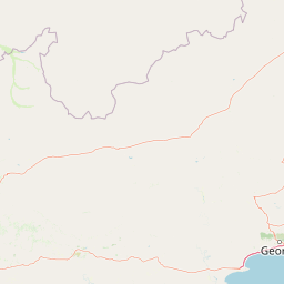
Map view of Boosmansbos Wilderness Area

Use this park location map to pinpoint Boosmansbos Wilderness Area in South Africa, understand its exact geographic position, and read its mapped placement within the surrounding landscape more clearly.

Pigeon | © OpenStreetMap contributors

Location context for Boosmansbos Wilderness Area

Western Cape Province

Visual reference for mountain fynbos ridges, river gorges, and sheltered valley forests

Boosmansbos Wilderness Area Photos and Mapped Landscape Scenery

Visual records capture the rugged topography of the eastern Langeberg range, detailing high fynbos slopes and deep river gorges. Examining these protected habitats reveals the striking contrast between exposed mountain ridges and moist valley forests across the reserve.

A wide-angle mountain landscape under a clear blue sky, featuring rocky peaks rising above slopes covered in fynbos vegetation.

Park atlas

Compare regional mountain terrain, fynbos reserves, and adjacent protected areas in the Western Cape.

Other Parks Near Boosmansbos Wilderness Area and Surrounding Protected Landscapes

Visitors exploring Boosmansbos Wilderness Area can browse neighboring mountain reserves and protected landscapes across the Western Cape. Comparing adjacent terrain reveals broader regional patterns in fynbos vegetation, river gorges, and afrotemperate forests.
A horizontal watercolor painting showing rolling green hills and distant mountain ridgelines with clusters of trees in the foreground.
Nature reserveWestern Cape
About 8.6 km away#1 closest

Southwest

Grootvadersbosch Nature Reserve: Protected Forest Landscapes and Langeberg Geography

Indigenous forest terrain in the Western Cape foothills.

Grootvadersbosch Nature Reserve offers a deep look into the largest surviving indigenous forest patch within the Langeberg range. This protected area integrates diverse valley geography with historic colonial farm infrastructure, providing a unique site for studying the natural terrain and river catchments of the South African Overberg region.

Area
2.5 km²
Relief
Mountain
Climate
Mediterranean
Access
Access unknown
National parkWestern Cape
About 36 km away#2 closest

Southwest

Bontebok National Park: A Unique Protected Landscape in South Africa's Western Cape

Mapping the endemic bontebok's habitat and diverse fynbos.

Bontebok National Park represents a singular achievement in conservation, dedicated to protecting the rare bontebok antelope and showcasing the extraordinary biodiversity of the Cape Floristic Region. Located in the Western Cape, this smallest of South Africa's national parks features a landscape of fynbos-covered foothills beneath the Langeberg Mountains, with the Breede River defining its southern edge. Explore its mapped boundaries and unique ecosystems, offering a concentrated natural discovery experience within a UNESCO World Heritage Site.

Area
27.86 km²
Established
1931
IUCN
II
Relief
Mixed relief
A minimalist watercolor painting depicting rolling hills and gentle valleys in muted green, yellow, and soft red tones on a white background.
Nature reserveWestern Cape
About 50 km away#3 closest

Northwest

Anysberg Nature Reserve: Geographic Overview and Protected Landscape Mapping

A diverse mountain sanctuary in the Western Cape Karoo.

Anysberg Nature Reserve offers a deep look into the semi-arid mountain geography of South Africa's Western Cape. Spanning a rugged stretch of the Cape Fold Belt, the reserve highlights transitions between fynbos mountain slopes and succulent valley floors. This protected area serves as an essential case study for understanding how topography, ancient river courses, and varied soil conditions influence the distribution of endemic plant life and animal habitats across the Little Karoo region.

Area
796.29 km²
Established
1984
Relief
Mountain
Climate
Mediterranean
Biosphere reserveWestern Cape
About 75 km away#4 closest

East

Gouritz Cluster Biosphere Reserve: Geographic Overview and Protected Area Boundaries

A diverse protected landscape spanning the Western Cape coastline to high mountain ridges.

Spanning from the southern African coast into the interior mountain ranges, this biosphere reserve captures an unmatched variety of landforms including estuaries, rocky headlands, and arid Karoo basins. It serves as a vital protected system for threatened species and endemic flora, representing one of the most ecologically significant landscapes within the Cape Floristic Region.

Area
31,878.9 km²
Established
2015
Relief
Mixed relief
Climate
Mediterranean
Wildlife reserveWestern Cape
About 98 km away#5 closest

East

Gondwana Game Reserve: Geographic Overview of a Southern Cape Rewilding Landscape

Protected mountain and coastal savanna terrain in the Western Cape

Gondwana Game Reserve represents a deliberate conservation effort to restore large mammal populations to the southern coast of South Africa. Situated near the Garden Route, the reserve encompasses a complex mosaic of open plains, rolling hills, and mountain vistas, providing essential habitat connectivity for diverse wildlife species within a protected and managed ecosystem.

Area
110 km²
Relief
Mountain
Climate
Mediterranean
Access
Access unknown
A soft watercolor painting of a rolling mountain landscape with light green and muted earth tones, featuring tufts of vegetation in the foreground.
Nature reserveWestern Cape
About 99 km away#6 closest

East

Gamkaberg Nature Reserve: An Atlas Overview of Mountain Geography and Protected Biomes

A vital conservation landscape within the Western Cape of South Africa.

Gamkaberg Nature Reserve stands as a focal point for ecological research and conservation in the Little Karoo. Defined by a rugged mountain range and deep gorges, the reserve protects the critical habitat of the Cape mountain zebra. Its landscape reveals an unusual overlap of four Cape biomes, offering a deep look into the regional geography and biological history of the South African interior.

Area
94 km²
Established
1974
Relief
Mountain
Climate
Mediterranean
National parkWestern Cape
About 120 km away#7 closest

Southwest

Agulhas National Park: National Park Protected Landscape and Geographic Atlas

Mapped boundaries and regional geography in Western Cape.

Agulhas National Park is a protected national park in South Africa's Western Cape, vital for understanding regional geography and mapped landscape features. This entry focuses on its identity as a conservation area, detailing its protected landscape context and geographic setting within the broader atlas of Southern Africa. Explore the specific park boundaries and the unique terrain that defines this significant natural area.

Area
209.59 km²
Established
1998
IUCN
II
Relief
Lowland
Nature reserveWestern Cape
About 127 km away#8 closest

Southwest

Salmonsdam Nature Reserve: Atlas of Protected Landscapes in the Western Cape Overberg

Mountain fynbos, river gorges, and forest catchment geography.

Salmonsdam Nature Reserve is a compact protected expanse in the Overberg mountains of the Western Cape. The reserve encompasses the full Paardensberg River catchment, featuring complex terrain that ranges from high rocky ridges to the wet valley floor of Die Weivlakte. Its geography supports a high concentration of Afromontane forest patches and mountain fynbos habitats within a small, accessible area.

Area
8.34 km²
Established
1962
Relief
Mountain
Climate
Mediterranean

Common questions about visiting, size, designation, and location context for Boosmansbos Wilderness Area

Boosmansbos Wilderness Area FAQs for park facts, access, geography, and protected area context

Find quick answers about Boosmansbos Wilderness Area, including protected-area facts, park geography, trail and visitor context, and how the park fits into its surrounding country and regional landscape.
MoriAtlas Explorer

Continue Your Protected Areas Search Across the Global Atlas

Deepen your exploration by continuing the structured search for national parks and protected areas worldwide. Utilize the comprehensive filtering capabilities to compare different conservation landscapes and refine your understanding of global park geography. Discover more about the distribution and characteristics of protected natural areas.

Global natural geography