

Mori Atlas logo
Wildlife reserveBornadi Wildlife Sanctuary

Examining the ecological corridors and riverine landscapes defining this Assam border sanctuary.

Bornadi Wildlife Sanctuary: Protected Himalayan Foothill Geography and Mapped Natural Reserves

Bornadi Wildlife Sanctuary encompasses a distinct transitional landscape along the Indo-Bhutan border, where the eastern Himalayan foothills descend into the Brahmaputra valley. This protected reserve serves as a vital refuge for specialized grassland and forest wildlife within the northern districts of Assam. By mapping these rugged terrains and riverine corridors, users gain insight into the conservation geography that sustains rare species and diverse forest habitats across this regional boundary.

wildlife sanctuaryfoothill habitatHimalayan foothillsgrasslandriverine habitatAssam

Bornadi Wildlife Sanctuary

Wildlife reserve

Park overview

Structured park overview, official facts, and landscape profile for Bornadi Wildlife Sanctuary

Bornadi Wildlife Sanctuary park facts, protected area profile, and essential visitor context

Review the core facts for Bornadi Wildlife Sanctuary, including designation, size, terrain, visitor scale, habitats, and operating context in one park-focused overview.

About Bornadi Wildlife Sanctuary

Bornadi Wildlife Sanctuary covers an area of approximately 26 square kilometers on the foothills of the Himalayas, straddling the border region between Udalguri and Baksa districts in the Indian state of Assam. The sanctuary sits at the southern edge of the eastern Himalayan landscape, where the mountainous terrain of Bhutan descends into the rolling foothills and plains of the Brahmaputra valley. The Bornadi River runs along its western boundary and gives the protected area its name.

The sanctuary was established in 1980 with a clear conservation mandate focused on protecting the hispid hare and the pygmy hog, two species whose survival in the wild was already precarious at the time. Hispid hares depend on tall, dense grassland habitats that were rapidly disappearing across the region, while pygmy hogs had been pushed to near extinction by habitat loss and hunting. By formally designating this foothill landscape as a protected area, conservation authorities sought to safeguard a refuge where both species could persist alongside the broader community of native wildlife.

Over the decades, Bornadi has come to represent more than just a recovery site for a couple of rare species. Its forests and grasslands support a wide range of mammals including the golden langur, hoolock gibbon, and clouded leopard, together with various deer species. Birdlife is particularly rich and includes peafowl, hornbills, swamp partridges, Bengal floricans, kingfishers, woodpeckers, cormorants, herons, and the globally significant white-winged wood duck. Local and migratory waterbirds also find suitable habitat in the sanctuary's wetlands and watercourses.

The refuge is administered by the Department of Environment and Forests of the Government of Assam. Its governance framework, dedicated staff presence, and research-based conservation efforts have helped it play a role in regional wildlife management. For travelers exploring the cultural and natural heritage of northern Assam, Bornadi offers a compact yet rewarding destination that showcases the transition zone between the Himalayan foothills and the Brahmaputra floodplain.

Quick facts and research context for Bornadi Wildlife Sanctuary

Bornadi Wildlife Sanctuary is a small protected area of roughly 26 square kilometers in Udalguri and Baksa districts of Assam, India, situated at the Himalayan foothills along the Bhutan border. Established in 1980 and managed by the Department of Environment and Forests, Assam, the sanctuary was originally created to protect the hispid hare and pygmy hog.

The reserve takes its name from the Bornadi River, which flows along its western boundary. The nearest town is Tangla, approximately 30 kilometers away, while the major regional city of Guwahati lies roughly 130 kilometers from the sanctuary. The landscape and climate of the area reflect a warm foothill environment with mixed forest, grassland, and riverine influences typical of northern Assam.

Protection and recognition

Documented terrestrial protection metrics and recognized conservation frameworks

Bornadi Wildlife Sanctuary Protection Status and Formal Conservation Designations

Bornadi Wildlife Sanctuary maintains an active terrestrial protection scope within its registered regional boundary. Structured conservation metrics outline the documented administrative status and formal recognition records associated with the protected landscape.

Protection details

Protection scope
Terrestrial
Park context

Deeper park guide and search-rich context for Bornadi Wildlife Sanctuary

Bornadi Wildlife Sanctuary history, landscape, wildlife, and travel context

Explore Bornadi Wildlife Sanctuary through its history, landscape character, ecosystems, wildlife, conservation priorities, cultural context, and seasonal travel timing in a structured park guide built for atlas discovery and search intent.

Why Bornadi Wildlife Sanctuary stands out

Bornadi is best known as a targeted refuge for two of South Asia's most threatened small mammals: the hispid hare, a rare rabbit-like species native to the tall grassland habitats of the Brahmaputra floodplain, and the pygmy hog, once considered the world's smallest wild pig. Together, these two species defined the sanctuary's founding purpose in 1980 and continue to shape its conservation identity. Beyond its flagship species, the sanctuary is also recognized for its hill forests and foothill ecosystems along the Indo-Bhutan border. Its combination of rare small mammals, forest cover, and rich birdlife has earned it a quiet but important place within the broader network of protected habitats in northern Assam.

Bornadi Wildlife Sanctuary history and protected-area timeline

Bornadi Wildlife Sanctuary was formally established in 1980, making it one of the older specialized wildlife sanctuaries in the Indian state of Assam. Its creation responded directly to growing concerns about the survival of the hispid hare and the pygmy hog, two small mammalian species that had already lost much of their natural habitat to agricultural expansion, floodplain conversion, and hunting pressure.

The selection of the foothills along the Indo-Bhutan border reflected a deliberate effort to protect an area where remaining grassland, forest, and riverine habitats could continue to support these and associated species. Since its establishment, the sanctuary has been administered by the Department of Environment and Forests, Assam, which oversees habitat management, anti-poaching efforts, and species recovery programs.

Over time, conservation efforts at Bornadi have contributed to broader regional knowledge about the ecology of rare mammals in the eastern Himalayan foothills. While the sanctuary remains relatively small in geographic terms, its consistent protection record has helped secure a long-term foothold for several threatened species in northern Assam.

Bornadi Wildlife Sanctuary landscape and geographic character

Bornadi lies within the transitional belt where the eastern Himalayas give way to the wide alluvial plains of the Brahmaputra valley. The terrain is shaped by rolling foothills, forested ridges, valleys, and stretches of grassland that together form a patchwork mosaic typical of this Himalayan fringe environment. Elevations are moderate, but the topography creates a varied and visually engaging landscape of wooded slopes and open clearings.

The Bornadi River defines much of the sanctuary's western boundary, lending the area a strong riverine character. Seasonal streams and smaller watercourses thread through the interior, shaping vegetation patterns and providing water sources for wildlife. In the lower and flatter parts of the sanctuary, tall grasslands and scrubby patches dominate, while the higher elevations transition into denser mixed forest with elements of Himalayan and sub-Himalinan flora.

The overall impression of the landscape is one of quiet, relatively undisturbed hillside forest meeting river-edge habitats. This combination of forest, grassland, and water features contributes directly to the sanctuary's value for both resident wildlife and seasonal migrants, particularly waterbirds.

Bornadi Wildlife Sanctuary ecosystems, habitats, and plant life

The ecosystems of Bornadi reflect the overlapping influences of Himalayan forests and the grasslands of the Brahmaputra floodplain. The sanctuary's forests are predominantly mixed deciduous and evergreen types, with tree species typical of the Himalayan foothills giving way to more open woodland and scrub as elevation decreases. Dense patches of tall grass, especially along the Bornadi River corridor, provide the specialized habitat structure needed by species like the hispid hare.

Wetland and riverine features play an important ecological role. Pools, streams, and shallow water bodies along the river create habitat for amphibians, fish, and a variety of waterbirds. The mosaic of forest, grassland, and aquatic environments supports a layered ecological network in which species can move, feed, and shelter across relatively small distances.

The overall ecological character of Bornadi can be described as foothill transitional habitat, where species associated with Himalayan forests overlap with those more typical of the lower floodplains. This interface zone gives the sanctuary a biodiversity profile that is distinctive within Assam, even though its overall area is modest.

Bornadi Wildlife Sanctuary wildlife and species highlights

The wildlife profile of Bornadi is shaped by the sanctuary's conservation mission and the habitats that surround its protected core. The two flagship species, the hispid hare and the pygmy hog, remain central to the sanctuary's identity. Hispid hares depend on dense, tall grasslands for cover and forage, while pygmy hogs favor similar habitat with sufficient cover and water. Their continued presence is the strongest indicator of effective habitat protection in the area.

Larger and more charismatic mammals are also reported from the sanctuary. The clouded leopard is one of the most notable feline residents, reflecting the presence of adequate forest cover and prey base. Primates include the golden langur, an important primate species of the northeastern India-Bhutan region, and the hoolock gibbon, India's only ape species. Deer, including species typical of Assam's foothill forests, are also part of the mammal community.

Avifauna is particularly diverse. Resident and migratory birds include the white-capped redstart, blue magpie, peafowl, hornbills, swamp partridges, Bengal floricans, kingfishers, woodpeckers, great and little cormorants, little green herons, and night herons. The white-winged wood duck, a globally threatened species associated with swamp forests of northeastern India, has also been recorded. This combination of mammals, primates, and birds makes Bornadi a meaningful destination for those interested in the wildlife of northern Assam.

Bornadi Wildlife Sanctuary conservation status and protection priorities

Bornadi's conservation significance lies in its explicit role as a protected refuge for two of South Asia's most endangered small mammals. The 1980 establishment of the sanctuary was a deliberate intervention to counter habitat loss and hunting pressure on the hispid hare and the pygmy hog, both of which had seen dramatic declines across the Brahmaputra floodplain in earlier decades.

Beyond its flagship species, the sanctuary contributes to the conservation of broader foothill ecosystems that connect Himalayan forest habitats to the grasslands and wetlands of the Brahmaputra valley. This connective role supports gene flow, seasonal movement, and refuge functions for species that depend on multiple habitat types throughout the year.

The protected area is governed by the Department of Environment and Forests, Assam, which oversees habitat management, monitoring, and enforcement activities. Continued protection at Bornadi complements conservation initiatives elsewhere in northeastern India that target pygmy hog recovery, grassland habitat restoration, and the survival of threatened wetland species.

Bornadi Wildlife Sanctuary cultural meaning and human context

Bornadi Wildlife Sanctuary lies within a region of northern Assam that is closely tied to the cultural mosaic of the Indo-Bhutan borderlands. The districts of Udalguri and Baksa, through which the sanctuary extends, host a diverse mix of communities, including indigenous Bodo people and other ethnic groups whose traditional livelihoods, festivals, and agricultural practices are deeply connected to the surrounding hills, forests, and river systems.

The presence of the border with Bhutan adds a further cultural dimension, with movement of people, languages, and traditions historically shaping life in the foothills. Local communities have long interacted with these landscapes through shifting cultivation, forest harvests, fishing, and small-scale livestock keeping, all of which have influenced the ecological character of the area.

For visitors, this cultural backdrop provides context for understanding the broader relationship between people and protected landscapes in northeastern India. Conservation at Bornadi takes place within a living cultural landscape, where indigenous knowledge, traditional land use, and modern wildlife management intersect.

Top sights and standout views in Bornadi Wildlife Sanctuary

The sanctuary's most distinctive features are its rare grassland-dependent mammals, including the hispid hare and pygmy hog, that originally motivated its protection.

Its foothill position on the Indo-Bhutan border gives Bornadi a transitional ecological character where Himalayan forests meet Brahmaputra valley grasslands. The Bornadi River corridor and associated wetlands add further ecological richness, while the diversity of birds, primates, and forest carnivores makes the sanctuary a rewarding destination for naturalists working in northern Assam.

Best time to visit Bornadi Wildlife Sanctuary

The warm climatic conditions of the region suggest that cooler, drier months are generally preferable for exploring foothill habitats like Bornadi, when dense undergrowth is less intrusive and visibility for wildlife observation tends to be better. Winter months often bring migratory waterbirds and many resident species to forest edges and waterbodies, enhancing birdwatching opportunities.

The warmer and wetter months, while lush and green, can make trails more challenging and increase the presence of insects and dense vegetation. Travelers interested primarily in mammals may prefer the cooler season, while those drawn to lush forest landscapes may appreciate the monsoon period's rich greenery. Regardless of season, visiting with awareness of the sanctuary's protected status and respecting local access norms enhances the experience.

Monthly climate preview

Long-term temperature and precipitation records measured across twelve representative months

Bornadi Wildlife Sanctuary Climate Normals and Annual Weather Patterns

Bornadi Wildlife Sanctuary exhibits a measured annual rhythm ranging from cooler winter minimums to higher summer temperatures alongside distinct monthly precipitation variations. Reviewing the complete twelve-month profile provides detailed meteorological data derived from long-term coordinate sampling.
Annual mean17 °C
10 °C22 °C
Jan10°
Feb12°
Mar15°
Apr18°
May20°
Jun22°
Jul22°
Aug22°
Sep21°
Oct18°
Nov15°
Dec12°
Warmest month
July

22 °C

Coolest month
January

10.3 °C

Wettest month
June

10.5 mm/day

Driest month
December

0.2 mm/day

Park location guide

Geography guide, regional context, and park location map for Bornadi Wildlife Sanctuary

Bornadi Wildlife Sanctuary park geography, regions, and map view in India

Understand where Bornadi Wildlife Sanctuary sits in India through a broader geographic reading of the surrounding landscape, nearby location context, and its mapped position within the national park landscape.

How Bornadi Wildlife Sanctuary fits into India

India is a South Asian country bordered by the Indian Ocean, Arabian Sea, and Bay of Bengal. It shares land borders with Pakistan, China, Nepal, Bhutan, Bangladesh, and Myanmar. The country has a population of over 1.4 billion people and operates as a federal parliamentary republic with its capital in New Delhi.

Wider geography shaping Bornadi Wildlife Sanctuary in India

India occupies the Indian subcontinent in South Asia, bordered by the Arabian Sea to the southwest, the Bay of Bengal to the southeast, and the Indian Ocean to the south. It shares land borders with Pakistan to the west, China, Nepal, and Bhutan to the north, and Bangladesh and Myanmar to the east. The territory also includes the Andaman and Nicobar Islands in the Indian Ocean.

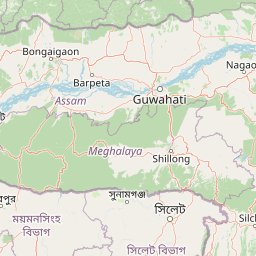
Map view of Bornadi Wildlife Sanctuary

Use this park location map to pinpoint Bornadi Wildlife Sanctuary in India, understand its exact geographic position, and read its mapped placement within the surrounding landscape more clearly.

Pigeon | © OpenStreetMap contributors

Location context for Bornadi Wildlife Sanctuary

Assam
Park atlas

Compare surrounding foothill habitats and regional conservation landscapes

Other Parks and Protected Areas Near Bornadi Wildlife Sanctuary

Continue exploring protected natural areas near Bornadi Wildlife Sanctuary by examining adjacent foothill reserves and riverine ecosystems across northern Assam. Comparing these regional conservation landscapes reveals broader patterns of biodiversity along the Himalayan border.
Wildlife reserveTrashigang District
About 57 km away#1 closest

North

Sakteng Wildlife Sanctuary: Protected Area and Wildlife Reserve in Bhutan's Trashigang District

Mapping the mountainous terrain and unique temperate ecosystems.

Sakteng Wildlife Sanctuary is a vital protected area in eastern Bhutan, recognized as a wildlife reserve. Spanning approximately 742 square kilometers within Trashigang District, it features a dramatic mountainous terrain characterized by steep valleys and alpine meadows. The sanctuary's landscape transitions from forested slopes to subalpine conifer forests, representing Bhutan's easternmost temperate ecosystems and offering rich geographic context for atlas exploration.

Area
742.46 km²
Established
2003
IUCN
IV
Relief
Mountain
National parkAssam
About 65 km away#2 closest

Southeast

Orang National Park: Assam's Key Floodplain Protected Landscape

Explore mapped boundaries and terrain context of this national park.

Orang National Park, located in Assam, India, is a significant protected area celebrated for its unique alluvial floodplain terrain and critical role in conservation. This national park provides a focused atlas-style view of grassland and wetland ecosystems, essential habitats for iconic species like the great Indian one-horned rhinoceros and Bengal tiger. Its geographical setting along the Brahmaputra River contributes to a dynamic landscape, offering rich context for understanding protected area distribution and regional natural features. Discover the mapped boundaries and ecological significance of this important protected land.

Area
78.81 km²
Established
1985
IUCN
II
Relief
Lowland
Wildlife reserveWest Kameng
About 73 km away#3 closest

Northeast

Eaglenest Wildlife Sanctuary: Geography and Protected Forest Atlas

Mapping the Eastern Himalayan foothills in West Kameng

Eaglenest Wildlife Sanctuary stands as a landmark of Indo-Burmese biodiversity conservation, spanning a dramatic altitudinal range that anchors the West Kameng forest complex. This wildlife reserve features dense bamboo stands, temperate ridges, and foothill forest corridors that provide a crucial environment for diverse mammal and bird species. The sanctuary remains a primary site for understanding the interaction between mountain topography and ecological connectivity in the Eastern Himalayas.

Area
218 km²
Established
1989
IUCN
IV
Visitors
75 annual
National parkAssam
About 81 km away#4 closest

West

Manas National Park: Assam's National Park Protected Landscape and Geographic Atlas

Explore mapped boundaries and regional landscape context.

Manas National Park offers a distinct protected landscape within the state of Assam, India. This national park is a key feature in the geography of the Brahmaputra River valley, providing valuable context for atlas-driven exploration. Understand its mapped territory and regional setting as a protected natural area.

Area
850 km²
Established
1990
IUCN
II
Relief
Mountain
Wildlife reserveArunachal Pradesh
About 87 km away#5 closest

Northeast

Sessa Orchid Sanctuary: Himalayan Foothills Wildlife Reserve and Mapped Protected Landscape

High-altitude forest geography in Arunachal Pradesh

Sessa Orchid Sanctuary is a pivotal wildlife reserve spanning the rugged Himalayan foothills of West Kameng, Arunachal Pradesh. Defined by deep gorges and high ridges, the sanctuary protects one of the most significant orchid habitats in India, featuring over 200 distinct species within its closed-canopy monsoon forests. This protected area stands as a central link in the Kameng Protected Area Complex, representing a critical region for scientific research, endemic flora, and continuous forest conservation.

Area
100 km²
Established
1989
IUCN
IV
Relief
Mountain
National parkBhutan
About 92 km away#6 closest

Northwest

Phrumsengla National Park: Protected Landscape and Geographic Context in Bhutan

Explore mapped boundaries and diverse Himalayan terrain.

Phrumsengla National Park serves as a vital protected area within Bhutan, characterized by its extensive altitudinal range and varied landscape. Spanning from subtropical valleys to alpine zones, the park showcases a remarkable transition of ecosystems, including significant old-growth fir forests. Its location and unique geographic features make it an important component of any study of the region's protected lands and Himalayan geography, offering rich data for atlas exploration and understanding natural landscapes.

Area
905.05 km²
Established
1998
IUCN
II
Relief
Mountain
National parkBhutan
About 98 km away#7 closest

West

Royal Manas National Park: Bhutan's Premier Protected Area and Oldest National Park

Explore the mapped terrain and diverse ecosystems of this landmark Bhutanese conservation area.

Royal Manas National Park, Bhutan's first national park established in 1966, serves as a critical conservation hub in the Eastern Himalayas. Spanning over 1,057 square kilometers, it protects a vast array of landscapes, from lowland tropical forests to permanent ice fields. Its designation as the kingdom's conservation showpiece and its role in transboundary protection underscore its immense geographic and ecological importance within Bhutan.

Area
1,057 km²
Established
1966
IUCN
II
Relief
Mountain
Wildlife reserveAssam
About 100 km away#8 closest

East

Bura Chapori Wildlife Sanctuary: Protected Grassland Geography in the Brahmaputra Valley

A vital wildlife reserve and buffer area within Assam's floodplain ecosystem.

Located in the Sonitpur district of Assam, Bura Chapori Wildlife Sanctuary offers a focused look at the Brahmaputra valley's dynamic floodplain environment. This protected area supports an essential mosaic of open grasslands and riverine woodlands, serving as a critical corridor for large mammals and endangered grassland birds. Its geography is deeply influenced by the seasonal rhythms of the Brahmaputra River, shaping the sanctuary as both a wetland habitat and a key conservation link.

Area
44.06 km²
Established
1974
IUCN
IV
Relief
Lowland

Common questions about visiting, size, designation, and location context for Bornadi Wildlife Sanctuary

Bornadi Wildlife Sanctuary FAQs for park facts, access, geography, and protected area context

Find quick answers about Bornadi Wildlife Sanctuary, including protected-area facts, park geography, trail and visitor context, and how the park fits into its surrounding country and regional landscape.
MoriAtlas Explorer

Continue Your Protected Areas Search Across the Global Atlas

Deepen your exploration by continuing the structured search for national parks and protected areas worldwide. Utilize the comprehensive filtering capabilities to compare different conservation landscapes and refine your understanding of global park geography. Discover more about the distribution and characteristics of protected natural areas.

Global natural geography