
Mori Atlas logo
Nature reserveBosque de Zárate Reserved Zone

Examining the protected Andean slope terrain and fog-dependent ecosystems in the Lima Region

Bosque de Zárate Reserved Zone: A Detailed Geographic Atlas of the Dry Mist Forest

(Zona Reservada Bosque de Zárate)

Bosque de Zárate Reserved Zone represents a vital protected landscape situated within the rugged Andean foothills of Peru. This nature reserve serves as a critical study in fog-dependent dry mist forest geography, where moisture from coastal air sustains endemic biodiversity along steep, dissected slopes. The reserve functions as a natural barrier in the San Bartolomé River gorge, stabilizing terrain and providing protection for the downstream communities of Huarochirí Province.

dry mist forestAndean foothillsendemic birdsriver gorgeLima RegionHuarochirí Province
A stylized digital illustration of a mountainous valley with a winding river and a small waterfall, framed by green leaves in the foreground.

Bosque de Zárate Reserved Zone

Nature reserve

Park overview

Structured park overview, official facts, and landscape profile for Bosque de Zárate Reserved Zone

Bosque de Zárate Reserved Zone park facts, protected area profile, and essential visitor context

Review the core facts for Bosque de Zárate Reserved Zone, including designation, size, terrain, visitor scale, habitats, and operating context in one park-focused overview.

About Bosque de Zárate Reserved Zone

Bosque de Zárate Reserved Zone occupies a steep section of the Andean foothills in the Lima Region of Peru, within the upper gorge of the San Bartolomé River. Its setting places it squarely within the dry western Andes, an environment dominated by seasonal rainfall and arid conditions for much of the year. Despite this dryness, the reserve's elevation and exposure allow it to intercept moisture from Pacific-derived fog, creating conditions that sustain a distinctive dry mist forest. This combination of aridity and fog-fed moisture gives the area an ecological character that is unusual both regionally and within Peru's protected areas system.

The reserve's vegetation is shaped by this microclimate. Tree species such as Oreopanax, Myrcianthes, and Escallonia coexist with a layer of shrubs to form a forest that is denser and more humid than the surrounding terrain would otherwise support. The forest clings to hillside slopes above the San Bartolomé River, where the terrain is rugged and erosion-prone. Beyond its natural value, the reserve's protected status reflects a practical environmental concern: the forest cover helps anchor soils and reduces the risk of landslides that would otherwise threaten downstream inhabitants during the rainy season.

Designated in 2010 and placed under the management of SERNANP, the Bosque de Zárate Reserved Zone sits at the intersection of biodiversity conservation and watershed protection. Its relatively small footprint concentrates a meaningful set of endemic and range-restricted species within an accessible distance of Lima. For both researchers and visitors interested in Peru's endemic birdlife, dry forest ecosystems, or the role of protected areas in mitigating natural hazards, Bosque de Zárate represents a compact but ecologically rich example of Peru's broader conservation landscape.

Quick facts and research context for Bosque de Zárate Reserved Zone

Bosque de Zárate Reserved Zone is a Peruvian reserved zone located in Huarochirí Province, Lima Region, in the upper San Bartolomé River gorge above the town of San Bartolomé. It was formally designated on October 13, 2010, by Ministerial Resolution No. 195-2010-MINAM, and is administered by SERNANP, Peru's national protected areas service. The reserve protects a dry mist forest ecosystem and is notable for endemic bird species, including the White-cheeked Cotinga, alongside orchid species unique to Peru.

Park context

Deeper park guide and search-rich context for Bosque de Zárate Reserved Zone

Bosque de Zárate Reserved Zone history, landscape, wildlife, and travel context

Explore Bosque de Zárate Reserved Zone through its history, landscape character, ecosystems, wildlife, conservation priorities, cultural context, and seasonal travel timing in a structured park guide built for atlas discovery and search intent.

Why Bosque de Zárate Reserved Zone stands out

Bosque de Zárate is best known for protecting a dry mist forest on the western Andean slopes, a rare habitat sustained by coastal fog in an otherwise dry landscape. The reserve is especially notable among birdwatchers and conservation biologists for hosting endemic bird species such as Zaratornis stresemanni, more commonly known as the White-cheeked Cotinga, along with several other restricted-range passerines. Its protected forest also provides critical landslide protection for the town of San Bartolomé, making it both an ecological and a community-relevant reserve.
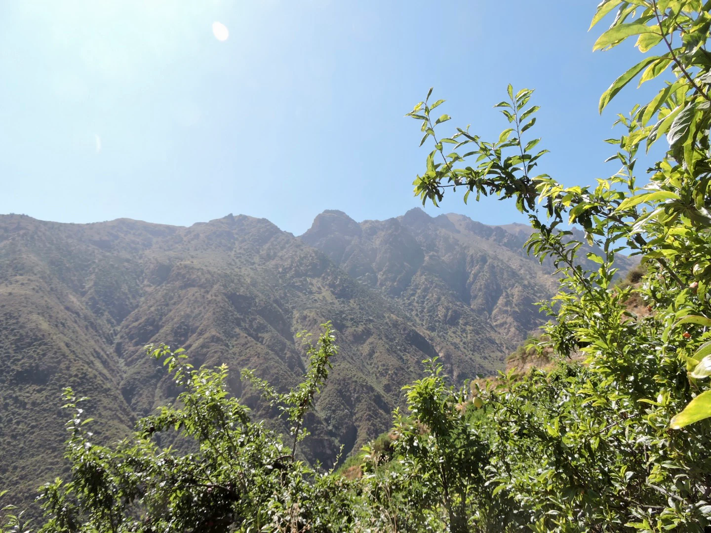
A mountainous landscape with dry, steep slopes and sparse vegetation, framed by green leafy branches in the foreground under a clear sky.
A wide view of the rugged, arid mountain terrain characteristic of the Bosque de Zárate Reserved Zone.

Bosque de Zárate Reserved Zone history and protected-area timeline

The Bosque de Zárate Reserved Zone was established through Ministerial Resolution No. 195-2010-MINAM on October 13, 2010. This designation formalized its protection under Peru's national framework for reserved zones, a category used for areas of recognized natural value that require active management while broader classification processes are considered.

Although the formal protected status is relatively recent, the ecological significance of the area had been recognized earlier through scientific work documenting its endemic bird species, notably the presence of Zaratornis stresemanni. The reserve's creation reflects a growing awareness of the value of small but biologically distinctive Andean forest patches, as well as concern about the long-term role of the forest in protecting nearby settlements from slope instability during the rainy season.

Bosque de Zárate Reserved Zone landscape and geographic character

The landscape of Bosque de Zárate is defined by steep Andean slopes descending toward the upper San Bartolomé River. The terrain is rugged and dissected by the river gorge, with narrow valleys and hillside ridges that shape both the vegetation patterns and the movement of fog and moisture through the area. Elevation rises sharply from the river corridor into forested ridges above.

The forest occupies a transitional position between the arid lowlands of the western Andes and the higher elevations of the central mountain range. Sparse vegetation and exposed rocky slopes surround denser patches of forest where fog regularly condenses. This contrast between dry, open ground and humid, tree-covered sections is one of the defining visual features of the reserve. The gorge setting also concentrates the visual drama of the landscape, with forested cliffs and the river below creating a contained but striking Andean scene.

Bosque de Zárate Reserved Zone ecosystems, habitats, and plant life

The defining ecological feature of Bosque de Zárate is its dry mist forest, a vegetation type shaped by the recurring presence of Pacific fog along the western Andean slopes. This fog supplies supplemental moisture in a region where rainfall alone is insufficient to sustain closed forest cover. The result is a fragile mosaic of tree species and shrubs that flourish in a narrow altitudinal and climatic window.

Prominent tree genera include Oreopanax, Myrcianthes, and Escallonia, supported by an understory of shrubs adapted to alternating periods of moisture and drought. The ecosystem is sensitive to disturbance, not only because of its specialized vegetation but also because of its role in stabilizing steep slopes. Disruption of forest cover in this zone can affect both biodiversity and downstream hydrology.

Bosque de Zárate Reserved Zone wildlife and species highlights

Bosque de Zárate is particularly significant for its birdlife, which is the most frequently highlighted component of the reserve's biodiversity. At least sixty-three bird species have been recorded in the area.

The reserve supports several endemic and range-restricted species, including Zaratornis stresemanni, the White-cheeked Cotinga, along with Poospiza rubecula, Leptasthenura pileada, Asthenes pudibunda, and Atlapetes nationi. These species reflect the broader importance of the western Andean dry forests as centers of endemism for passerine birds. The presence of these restricted-range species contributes meaningfully to the reserve's conservation value and to its recognition within international discussions of endemic bird areas.

Bosque de Zárate Reserved Zone conservation status and protection priorities

The Bosque de Zárate Reserved Zone represents a focused conservation effort to protect a small but ecologically distinctive dry mist forest in the western Andes. Its designation in 2010 brought the area under formal national protection through Peru's reserved zone system, managed by SERNANP. Conservation priorities associated with the reserve include the preservation of endemic bird populations, the maintenance of forest cover on erosion-prone slopes, and the protection of a fragile vegetation type that depends on a delicate fog-moisture balance.

The reserve's conservation value extends beyond its biodiversity. Its forested slopes protect downstream communities, particularly San Bartolomé, by reducing the likelihood and severity of landslides during the rainy season. This combination of ecological and protective functions gives the reserve a multi-layered importance within the regional conservation landscape, illustrating how small protected areas can yield large benefits for both biodiversity and human well-being.

Top sights and standout views in Bosque de Zárate Reserved Zone

The defining highlight of Bosque de Zárate is its dry mist forest, an unusual fog-dependent ecosystem set against the otherwise arid backdrop of the western Andes. The reserve is a recognized stronghold for endemic bird species, including the White-cheeked Cotinga and several other restricted-range passerines that give the area strong appeal for ornithologists and birdwatchers. Equally notable is the forest's practical role in protecting the town of San Bartolomé from landslides, making the reserve a meaningful example of how biodiversity protection and community safety can be linked.

Monthly climate preview

Track representative monthly precipitation and temperature patterns across the protected terrain

Bosque de Zárate Reserved Zone Climate and Long-Term Temperature Normals

Representative coordinate records show sustained monthly temperatures alongside measured precipitation data across the high elevation protected terrain. Deeper monthly climate comparisons provide complete twelve-month normals for analysis.
Annual mean10 °C
9 °C11 °C
Jan10°
Feb10°
Mar10°
Apr11°
May10°
Jun
Jul
Aug10°
Sep11°
Oct11°
Nov11°
Dec10°
Warmest month
October

10.8 °C

Coolest month
July

9.1 °C

Wettest month
February

0.3 mm/day

Driest month
June

0 mm/day

Park location guide

Geography guide, regional context, and park location map for Bosque de Zárate Reserved Zone

Bosque de Zárate Reserved Zone park geography, regions, and map view in Peru

Understand where Bosque de Zárate Reserved Zone sits in Peru through a broader geographic reading of the surrounding landscape, nearby location context, and its mapped position within the national park landscape.

How Bosque de Zárate Reserved Zone fits into Peru

Peru is a megadiverse country in western South America with a population of over 34 million. It spans three distinct geographic regions: the Pacific coastal desert in the west, the Andes mountains running north to south, and the Amazon rainforest in the east. The country has one of the longest histories of civilization in the world, tracing back to the Caral-Supe civilization of the 10th millennium BCE, and was home to the Inca Empire before Spanish colonization in the 16th century.

Wider geography shaping Bosque de Zárate Reserved Zone in Peru

Peru is located in western South America along the Pacific coast. The country encompasses three major geographic regions: the coastal desert plains along the Pacific, the Andes mountain range extending from north to southeast, and the Amazon basin rainforest in the eastern interior. It shares borders with Ecuador and Colombia to the north, Brazil to the east, Bolivia to the southeast, and Chile to the south.

Map view of Bosque de Zárate Reserved Zone

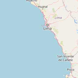
Use this park location map to pinpoint Bosque de Zárate Reserved Zone in Peru, understand its exact geographic position, and read its mapped placement within the surrounding landscape more clearly.

Pigeon | © OpenStreetMap contributors

Location context for Bosque de Zárate Reserved Zone

Huarochirí ProvinceLima Region
Recorded earthquake history

Examine the Historical Earthquake Record for Bosque de Zárate Reserved Zone

Access a structured collection of past seismic events identified within the vicinity of this Andean nature reserve. MoriAtlas provides this factual catalogue to help track historical activity patterns across the Lima Region landscape for further geographic and geological study.

Bosque de Zárate Reserved Zone Earthquake History

Catalogued events

37 events

Strongest magnitude

Magnitude 6.3

Most recent event

Feb 26, 2026

This history includes earthquakes recorded inside the park or within 50 km of its borders

Visual reference collection showcasing dry mist forest habitats, rugged river gorges, and Andean slopes

Bosque de Zárate Reserved Zone Photos, Landscape Scenery, and Protected Area Views

Visual documentation captures the rare dry mist forest ecosystems, steep mountain ridges, and river gorges that define the rugged terrain of Bosque de Zárate Reserved Zone. Photographic records reveal the stark contrast between arid western Andean slopes and dense fog-sustained vegetation patches across the protected landscape.

A mountainous landscape with dry, steep slopes and sparse vegetation, framed by green leafy branches in the foreground under a clear sky.

Park atlas

Discover related protected landscapes and regional Andean terrain surrounding the reserve.

Other Parks Near Bosque de Zárate Reserved Zone for Regional Comparison

Compare Bosque de Zárate Reserved Zone with adjacent protected areas across the western Andean slopes and nearby river gorges. Broaden your geographic analysis by exploring connected conservation zones and regional mountain terrain.
A flat-style vector illustration of a mountain valley with a central blue lake, surrounding peaks, and a winding dirt path.
Protected landscapeLima Region
44 km away#1 closest

East

Nor Yauyos-Cochas Landscape Reserve: Mapped Geography and Protected Andean Terrain

High-altitude glacial landscape and karst geology

Investigate the high-Andean environment of Nor Yauyos-Cochas Landscape Reserve, a protected area in the Lima Region spanning glacial lakes and deep valleys. Focus on the topographic diversity of the Pariacaca massif and the global significance of its subterranean karst features. This atlas provides a detailed spatial look at how these high-elevation ecosystems and traditional cultural landscapes integrate into the broader Peruvian geography.

Area
2,212.68 km²
Established
2001
IUCN
V
Relief
Mountain
A horizontal watercolor illustration depicting a serene wetland landscape with low green hills, winding water channels, and light pink clouds in the background.
Wildlife reservePeru
60 km away#2 closest

Southwest

Pantanos de Villa Wildlife Refuge: A Protected Coastal Marsh in Metropolitan Lima

Mapping the brackish lagoons and desert wetland geography

Pantanos de Villa Wildlife Refuge functions as a rare coastal wetland system located in the Chorrillos district of Lima, Peru. Its marshy terrain of brackish lagoons and reed beds represents a vital protected landscape that stands in sharp relief against the surrounding Pacific subtropical desert. This refuge provides essential habitat for migratory waterbirds and serves as a key site for understanding urban-edge conservation and hydrology.

Area
2.63 km²
Established
2006
IUCN
IV
Relief
Lowland
Nature reserveLima Region
About 76 km away#3 closest

West

Ancón Reserved Zone: Protected Coastal Desert and Bay Ecosystems in Lima Region

Coastal desert landscapes and marine habitat protection

The Ancón Reserved Zone represents a key protected area where the dry coastal plains of Peru reach the Pacific Ocean. Its mapped boundaries encompass a critical transition zone between arid desert terrain and marine environments, offering a concentrated look at specialized regional ecology within the Lima Province.

Area
21.93 km²
Established
2013
Relief
Lowland
Climate
Arid
Nature reservePeru
156 km away#4 closest

North

Cordillera Huayhuash Reserved Zone: Protected Mountain Geography and Andean Watersheds

High-altitude glacial terrain in central Peru

Cordillera Huayhuash Reserved Zone comprises a dense concentration of glacial peaks and highland basins. As a major source of water for both the Pacific coast and the Amazon, this protected area represents a unique geographic crossroads where ice fields and alpine puna support critical regional ecosystems in the heart of the Andes.

Area
675.9 km²
Established
2002
Relief
Mountain
Climate
Alpine
National parkPasco Region
192 km away#5 closest

Northeast

Yanachaga, Chemillén National Park: Protected Area in Pasco Region, Peru

Mapped terrain, Pleistocene refuge, and rich biodiversity.

Yanachaga, Chemillén National Park, a national park situated in Peru's Pasco Region, preserves over 122,000 hectares of mountainous cloud forest and rainforest ecosystems. Its landscape is characterized by dramatic canyons and steep forested slopes, creating significant altitudinal variation from 460 to 3,643 meters. Recognized as a Pleistocene refuge, the park shelters ancient forest remnants and harbors exceptional biodiversity, including hundreds of bird species and iconic mammals, offering rich context for geographic and protected-area exploration.

Area
1,220 km²
Established
1986
IUCN
II
Relief
Mountain
A horizontal watercolor painting showing rolling green hills and pinkish ground vegetation under a soft, light-yellow sky.
Protected areaPasco Region
204 km away#6 closest

Northeast

San Matías, San Carlos Protection Forest: Geographic Boundaries and Protected Landscape Context

A vital watershed corridor in the Pasco Region of central Peru.

San Matías, San Carlos Protection Forest protects fragile mountain soils and downstream infrastructure from erosion and flooding. Stretching from 300 to 2,250 metres in elevation, the reserve supports a continuous block of highland habitat that serves as a bridge between the Peruvian Yungas and Ucayali moist forest ecoregions, while acting as a cornerstone of the Oxapampa-Asháninka-Yánesha Biosphere Reserve.

Area
1,458 km²
Established
1987
IUCN
VI
Relief
Mountain
Protected areaOxapampa Province
216 km away#7 closest

Northeast

Yanesha Communal Reserve: Geography and Protected Area Context in Oxapampa Province

A vital transition zone between the Andes and the Amazon

Gain insight into the physical character of Yanesha Communal Reserve, where humid tropical forests and river channels converge to form a complex ecosystem. This protected area offers a look at how sustainable land use and conservation intersect within the Palcazu River basin. Browse the geographic boundaries and mapped landscape features that define this essential region in central Peru.

Area
347.45 km²
Established
1988
IUCN
VI
Scope
Terrestrial
National parkAncash
217 km away#8 closest

North

Huascarán National Park: Protected Landscape and Regional Geography in Ancash, Peru

Explore the mapped boundaries of this significant national park.

Huascarán National Park is a protected national park located in the Ancash region of Peru, offering valuable insights for geographic and atlas exploration. This destination provides detailed information on the park's mapped boundaries, its designation as a national park, and its integration into the regional geography. Understanding Huascarán National Park helps contextualize protected land distribution and landscape features within Peru for those interested in structured geographic discovery and atlas-style mapping.

Area
3,400 km²
Established
1975
IUCN
II
Relief
Mountain

Common questions about visiting, size, designation, and location context for Bosque de Zárate Reserved Zone

Bosque de Zárate Reserved Zone FAQs for park facts, access, geography, and protected area context

Find quick answers about Bosque de Zárate Reserved Zone, including protected-area facts, park geography, trail and visitor context, and how the park fits into its surrounding country and regional landscape.
MoriAtlas Explorer

Continue Your Protected Areas Search Across the Global Atlas

Deepen your exploration by continuing the structured search for national parks and protected areas worldwide. Utilize the comprehensive filtering capabilities to compare different conservation landscapes and refine your understanding of global park geography. Discover more about the distribution and characteristics of protected natural areas.

Global natural geography