
Mori Atlas logo
Nature reserveCabbage Tree Island (John Gould Nature Reserve)

A rugged island nature reserve off the New South Wales coast featuring specialized seabird habitats.

Cabbage Tree Island (John Gould Nature Reserve) Protected Landscape and Coastal Geography Atlas

(John Gould Nature Reserve)

Cabbage Tree Island (John Gould Nature Reserve) is a distinct continental landform rising sharply from the ocean off the Port Stephens coastline in New South Wales. This protected nature reserve encompasses a rugged central ridge, steep rocky gullies, and cabbage tree palm forests that define its ecological character. The island stands as a critical site for seabird recovery, with its physical boundaries and unique terrain serving as a primary sanctuary for protected species.

island nature reserveseabird conservationGould's petreluninhabited islandcontinental islandcoastal New South Wales
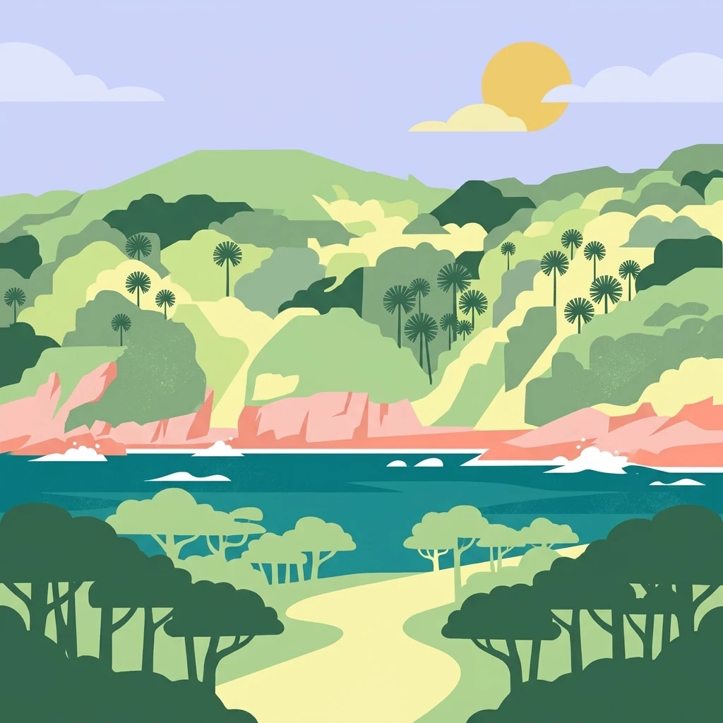
A flat-style digital illustration of Cabbage Tree Island showing a path leading through forest towards a coastal bay with hilly terrain and palms in the background under a sunny sky.

Cabbage Tree Island (John Gould Nature Reserve)

Nature reserve

Park overview

Structured park overview, official facts, and landscape profile for Cabbage Tree Island (John Gould Nature Reserve)

Cabbage Tree Island (John Gould Nature Reserve) park facts, protected area profile, and essential visitor context

Review the core facts for Cabbage Tree Island (John Gould Nature Reserve), including designation, size, terrain, visitor scale, habitats, and operating context in one park-focused overview.

About Cabbage Tree Island (John Gould Nature Reserve)

Cabbage Tree Island, gazetted as the John Gould Nature Reserve, sits just over a kilometre offshore near the entrance to Port Stephens, a large drowned river valley on the mid-north coast of New South Wales. Despite its small size, the island carries significant ecological weight, both as a piece of rugged near-coastal land and as the dominant breeding habitat for one of Australia's rarest seabirds.

The reserve is administered by the NSW National Parks and Wildlife Service as a strictly protected nature reserve under state legislation. Access is limited to scientific and conservation activities, reflecting the fragility of its breeding colonies and vegetation communities. Its offshore position protects it from many of the land-use pressures found on the adjacent mainland, allowing native vegetation and seabird colonies to persist in conditions similar to those of larger offshore sanctuaries along the New South Wales coast.

A defining feature of the island is the relationship between its physical setting and its ecological role. The steep terrain, exposed rock, and narrow gullies create a microclimate and structure that supports both the specialised plant community and the breeding biology of Gould's petrel. Without the island's particular combination of elevation, geology, and vegetation, the petrel colony could not function as it does, and this linkage between landscape form and species survival gives the reserve much of its conservation significance.

In the broader picture, Cabbage Tree Island represents a category of small, highly targeted protected area that exists primarily to safeguard a single threatened species and the habitat it depends on. Such reserves are vital to the persistence of seabirds in eastern Australia, many of which nest only on offshore islands safe from terrestrial predators. The combined management of Cabbage Tree Island and nearby Boondelbah Island forms a two-island system that spreads risk and supports long-term population recovery.

Quick facts and research context for Cabbage Tree Island (John Gould Nature Reserve)

Cabbage Tree Island is an uninhabited continental island nature reserve located off the mouth of Port Stephens on the New South Wales coast of eastern Australia. It is gazetted under the New South Wales National Parks and Wildlife Act and managed by the NSW National Parks and Wildlife Service as part of a paired reserve system with Boondelbah Island, which lies about 1.5 kilometres to the south.

The reserve is internationally recognised for the conservation management of Gould's petrel, and is classified as an IUCN Category IV protected area focused on habitat and species management. Its small size and restricted access policy make it a strictly conservation-oriented reserve rather than a visitor destination.

Protection and recognition

Examine the documented protection status and conservation management scope for Cabbage Tree Island.

Cabbage Tree Island (John Gould Nature Reserve) Protection Status and Recognition

Cabbage Tree Island (John Gould Nature Reserve) holds a mixed protection scope within its designated conservation boundary. Official records outline the established management framework and administrative status without external international listings.

Protection details

Protection scope
Mixed
Transboundary protection
No
Park context

Deeper park guide and search-rich context for Cabbage Tree Island (John Gould Nature Reserve)

Cabbage Tree Island (John Gould Nature Reserve) history, landscape, wildlife, and travel context

Explore Cabbage Tree Island (John Gould Nature Reserve) through its history, landscape character, ecosystems, wildlife, conservation priorities, cultural context, and seasonal travel timing in a structured park guide built for atlas discovery and search intent.

Why Cabbage Tree Island (John Gould Nature Reserve) stands out

Cabbage Tree Island is best known as the principal breeding stronghold of Gould's petrel, a seabird species whose global population became heavily concentrated on this single small island. The reserve's recovery story, driven by removal of introduced rabbits, control of native predators, and habitat restoration, is a well-documented example of island-based seabird conservation. The island's rugged topography, its deep gullies filled with rock scree, and its cabbage-tree palm dominated vegetation also create the specific nesting conditions that Gould's petrels depend on, making the physical landscape inseparable from the reserve's conservation identity.
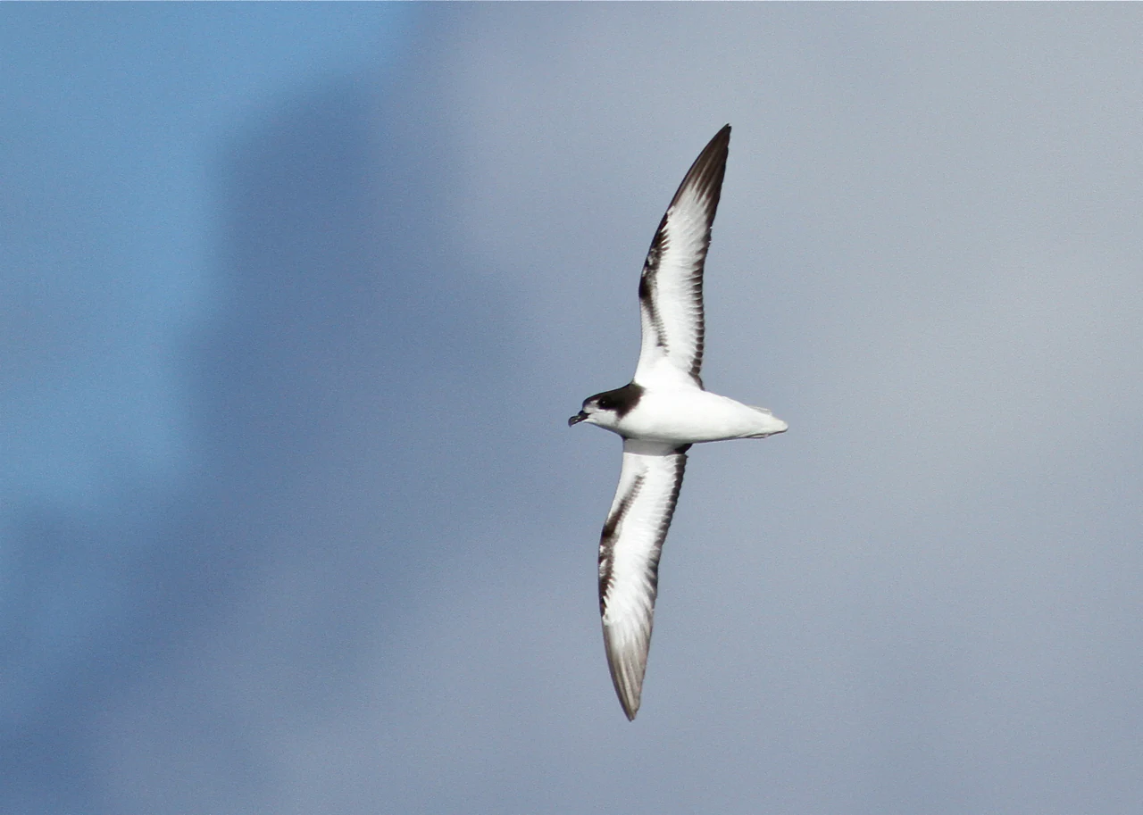
A Gould's petrel flying with wings outstretched against a cloudy sky.
A Gould's petrel in flight, the species for which the John Gould Nature Reserve is named.

Cabbage Tree Island (John Gould Nature Reserve) history and protected-area timeline

Cabbage Tree Island has a long but lightly documented human history, with early 20th-century records placing it within reach of curious visitors. A notable early anecdote is the 1911 capture of a penguin chick on the island, which was taken to Maitland in an unsuccessful attempt to raise it as a pet. This kind of incident reflects how isolated and intriguing the island once seemed to people on the nearby mainland coast.

The formal history of the reserve really begins in the modern conservation era. Both Cabbage Tree Island and Boondelbah Island were gazetted as nature reserves under the New South Wales National Parks and Wildlife Act, providing strong legal protection for their habitats and limiting human access to scientific and conservation purposes. This gazettal was the foundation for the active restoration work that followed.

The defining chapter in the island's modern history is the recovery program for Gould's petrel. By the early 1990s the breeding colony had collapsed to fewer than 250 pairs, with very low fledging success and unacceptably high adult mortality. Remedial management began in 1992, leading to the eradication of rabbits in 1997/98, the removal of bird-lime trees from nesting habitat, and predator control of pied currawongs and Australian ravens. The translocation of fledglings from Cabbage Tree Island to Boondelbah Island further diversified the breeding population. By the mid-2000s the colony had recovered dramatically, marking a rare and well-documented conservation success for an offshore island reserve.

Cabbage Tree Island (John Gould Nature Reserve) landscape and geographic character

Cabbage Tree Island is a small but visually striking piece of coast. It runs roughly one kilometre from north to south and is around 480 metres wide at its broadest point, with a sudden rise from sea level to a ridge standing about 123 metres above the ocean. The result is a steep, rugged island with dramatic cliffs, accumulated rock scree, and deep gullies on its flanks.

The western side of the island, which faces the mainland and the entrance to Port Stephens, holds the most ecologically important terrain. There, broken rocky slopes and scree fields create pockets of shelter that seabirds use for nesting, while the elevated central ridge shields the colonies from prevailing weather. The overall impression is of a compact, almost fortress-like island, with little flat ground and a strong vertical element that contrasts sharply with the surrounding ocean.

The combination of coastal exposure, steep gradients, and shallow soils shapes the vegetation, restricting it to hardy species adapted to salt spray, wind, and thin substrates. This physical intensity is essential to the island's character: it is neither a tropical palm island nor a temperate forested reserve, but a hybrid coastal landform where geology, climate, and biology intersect tightly.

Cabbage Tree Island (John Gould Nature Reserve) ecosystems, habitats, and plant life

The vegetation of Cabbage Tree Island is dominated by cabbage-tree palms, which give the island its common name and produce the dense frond cover and fallen litter that structure much of the habitat. Beyond the palms, the plant community includes deciduous figs, sandpaper figs, native plums, and bird-lime trees, each contributing to the layered canopy and understorey.

These plant species are not incidental. Their growth forms, leaf fall patterns, and root structures directly influence nesting opportunities for seabirds, and their removal or degradation has measurable effects on breeding success. The cabbage-tree palms in particular provide hollow trunks and dense mats of fallen fronds that seabirds use as alternative nest sites, supplementing the natural rock crevices of the island's gullies.

Ecologically, the island functions as a tightly integrated habitat system. The plant community, the rugged terrain, and the seabird colonies depend on one another in ways that make the decline or restoration of any single component a matter of concern for the whole reserve. The introduction of rabbits severely disrupted this system by stripping the understorey, and the subsequent recovery of vegetation has been central to restoring ecological balance.

Cabbage Tree Island (John Gould Nature Reserve) wildlife and species highlights

The wildlife story of Cabbage Tree Island is dominated by a single species: Gould's petrel. This seabird nests in colonies across the island's western gullies, choosing natural rock crevices, hollow palm trunks, mats of fallen fronds, and cavities among fig tree buttresses as nest sites. Nests can be extremely close together, often less than a metre apart, reflecting both the limited suitable habitat and the strong colonial behaviour of the species.

Gould's petrel populations on the island declined sharply before 1992, with fewer than 250 breeding pairs, low fledgling production, and high adult mortality. The principal drivers were introduced rabbits, which stripped the protective understorey vegetation and exposed petrels to predation by native birds such as pied currawongs and Australian ravens, and entanglement risk from fallen bird-lime tree fruits. Together these pressures threatened the viability of the colony.

Management actions transformed the picture. Following rabbit eradication, removal of bird-lime trees from nesting areas, and targeted control of currawongs and ravens, the population recovered strongly within little more than a decade. The establishment of a secondary colony on Boondelbah Island, supported by translocated fledglings, created a more resilient system. Today the island supports one of the largest known colonies of Gould's petrel, a recovery that has become a textbook example of island-based seabird management in Australia.

Cabbage Tree Island (John Gould Nature Reserve) conservation status and protection priorities

Cabbage Tree Island is an IUCN Category IV protected area, classified as a habitat and species management area. This designation reflects a focus on active intervention rather than passive protection, recognising that the reserve exists specifically to manage a threatened species and the habitat it requires.

The conservation framework rests on three pillars: legal protection through gazettal under the New South Wales National Parks and Wildlife Act, restricted access limited to scientific and conservation purposes, and a long-running program of targeted ecological management. These pillars work together to keep disturbance low while allowing intensive intervention where needed.

The reserve's broader conservation importance lies in its role as a paired-island refuge system. Cabbage Tree Island provides the primary breeding stronghold, while Boondelbah Island offers a secondary site that is buffered against localised catastrophes such as fire, disease outbreaks, or extreme weather. This redundancy is critical for the long-term survival of Gould's petrel and has turned the two-island system into a regional stronghold for the species in eastern Australia.

Cabbage Tree Island (John Gould Nature Reserve) cultural meaning and human context

The cultural footprint of Cabbage Tree Island is small but distinctive. Its identity is tightly intertwined with scientific and conservation institutions, particularly through its association with John Gould, the 19th-century ornithologist after whom the reserve is named. The island also entered coastal folklore in the early 20th century through accounts like the 1911 penguin chick incident, which captured the curiosity of early residents and visitors along the Port Stephens coast.

Today the reserve has minimal direct cultural presence due to restricted access, but it carries a strong identity within Australian ornithology and conservation history. It is recognised both as a place of ornithological importance and as a symbol of successful intervention-based island conservation.

Top sights and standout views in Cabbage Tree Island (John Gould Nature Reserve)

A breeding stronghold for Gould's petrel with a remarkable recovery story driven by invasive species removal and predator management. The steep 123-metre ridge, the cabbage-tree palm canopy, and the rocky western gullies together create a habitat that is both visually distinctive and ecologically specialised. The two-island partnership with Boondelbah Island gives the reserve a rare level of resilience for a site of its size, and the IUCN Category IV status underlines the intentional, management-focused approach that defines it.

Best time to visit Cabbage Tree Island (John Gould Nature Reserve)

Because public access to Cabbage Tree Island is restricted to scientific and conservation purposes, the reserve cannot be visited in the conventional sense. However, breeding activity for Gould's petrel is strongly seasonal, with peak colony activity occurring in the warmer months when nesting, chick-rearing, and fledging take place. Conservation visits and surveys typically align with these seasons, while winter months are generally quieter, with reduced seabird activity and calmer but cooler conditions offshore. Anyone hoping to experience the reserve in an educational context is usually best served by visiting nearby Port Stephens and the mainland coast, where seabirds, coastal scenery, and interpretive programs related to the reserve can often be encountered without entering the protected island itself.
Monthly climate preview

Long-term representative point measurements tracking monthly temperature ranges and precipitation patterns

Cabbage Tree Island (John Gould Nature Reserve) Climate Normals and Annual Weather Rhythm

Representative coordinates record long-term temperature variations alongside distinct precipitation cycles throughout the year at Cabbage Tree Island (John Gould Nature Reserve). Accessing the complete monthly profile provides detailed historical baseline metrics for ongoing geographic research and analysis.
Annual mean19 °C
15 °C24 °C
Jan24°
Feb24°
Mar23°
Apr21°
May18°
Jun16°
Jul15°
Aug15°
Sep17°
Oct19°
Nov21°
Dec22°
Warmest month
January

23.7 °C

Coolest month
July

14.7 °C

Wettest month
February

4.7 mm/day

Driest month
August

1.8 mm/day

Park location guide

Geography guide, regional context, and park location map for Cabbage Tree Island (John Gould Nature Reserve)

Cabbage Tree Island (John Gould Nature Reserve) park geography, regions, and map view in Australia

Understand where Cabbage Tree Island (John Gould Nature Reserve) sits in Australia through a broader geographic reading of the surrounding landscape, nearby location context, and its mapped position within the national park landscape.

How Cabbage Tree Island (John Gould Nature Reserve) fits into Australia

Australia is a constitutional monarchy and federal parliamentary democracy comprising six states and ten territories. With a population of nearly 28 million, it is one of the world's most urbanised countries, with most people concentrated on the eastern seaboard. The country has a high Human Development Index and is known for its cultural diversity, ancient Aboriginal heritage, and unique wildlife.

Wider geography shaping Cabbage Tree Island (John Gould Nature Reserve) in Australia

Australia occupies the entire Australian continent, the island of Tasmania, and numerous smaller islands. It is the world's flattest and driest inhabited continent, featuring vast deserts in the interior (the Outback), tropical rainforests along the eastern coast, and a coastline bordering the Indian and Pacific Oceans.

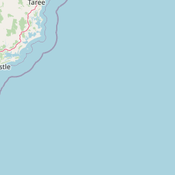
Map view of Cabbage Tree Island (John Gould Nature Reserve)

Use this park location map to pinpoint Cabbage Tree Island (John Gould Nature Reserve) in Australia, understand its exact geographic position, and read its mapped placement within the surrounding landscape more clearly.

Pigeon | © OpenStreetMap contributors

Location context for Cabbage Tree Island (John Gould Nature Reserve)

New South Wales

Visual exploration of rugged island terrain, native palm canopies, and protected coastal habitats

Cabbage Tree Island (John Gould Nature Reserve) Photos and Scenery

Photographic records capture the steep rocky ridges, deep gullies, and cabbage tree palm forests defining the topography of Cabbage Tree Island (John Gould Nature Reserve). Visual documentation reveals the isolated coastal environment and specialised seabird breeding habitats supporting regional conservation efforts.

A Gould's petrel flying with wings outstretched against a cloudy sky.

A wide shot of Cabbage Tree Island taken from the water, showing a green, forested hillside rising from a rocky coastline against a clear blue sky.

Park atlas

Compare surrounding coastal reserves, island landforms, and regional conservation habitats.

Explore Other Parks and Protected Areas Near Cabbage Tree Island (John Gould Nature Reserve)

Browsing nearby protected areas allows researchers and nature enthusiasts to evaluate similar coastal landforms and island habitats across the surrounding region. Extending the geographic scope reveals broader ecological patterns and connected wildlife reserves beyond Cabbage Tree Island (John Gould Nature Reserve).
National parkNew South Wales
About 2.9 km away#1 closest

Northeast

Myall Lakes National Park National Park: Mapped Boundaries and Protected Landscape Exploration

Discover its regional geography and natural terrain context.

Delve into the specific protected landscape and geographic features of Myall Lakes National Park. As a national park located in New South Wales, it provides critical atlas context for understanding protected areas and their distribution. Explore its mapped terrain and boundaries to gain a deeper appreciation for this significant natural area within Australia's geography.

Area
448 km²
Established
1972
IUCN
II
Relief
Lowland
A soft, watercolor painting of a green, rolling island landscape with misty hills under a pale, warm sky.
Nature reserveNew South Wales
About 3.7 km away#2 closest

South

Boondelbah Island Nature Reserve: Geography and Coastal Conservation Profile

A rugged island reserve within the New South Wales coastal landscape

Discover the physical terrain and protected-area status of Boondelbah Island, located off the coast of New South Wales. This reserve features sheer cliffs and coastal shrubland, serving as a vital, highly controlled sanctuary for threatened seabird breeding programmes. Its geographic placement and restricted status make it a foundational element in regional conservation, highlighting the importance of protected marine-adjacent landscapes.

Area
0.14 km²
IUCN
Ia
Relief
Lowland
Climate
Subtropical
National parkNew South Wales
About 5.5 km away#3 closest

Southwest

Tomaree National Park: New South Wales National Park with Defined Protected Boundaries

Explore its mapped geography and regional landscape context.

Tomaree National Park represents a significant protected landscape within New South Wales, Australia. This national park entry focuses on its distinct geographic features and mapped boundaries, offering a clear point of reference for atlas-based exploration. Understand its place in the regional geography of New South Wales and its identity as a conserved natural area. The detailed mapping and contextual data provide a solid foundation for appreciating this protected landscape.

Area
23.18 km²
Established
1984
IUCN
II
Relief
Lowland
National parkNew South Wales
About 40 km away#4 closest

Northeast

Wallingat National Park: Explore Protected Landscape and Regional Geography in New South Wales

Discover mapped park boundaries and terrain context.

Wallingat National Park in New South Wales is a protected landscape crucial for understanding Australia's natural geography. This canonical page detail provides essential information for atlas exploration, focusing on the park's protected status, mapped contours, and its place within the regional context. Discover the unique geographic features that distinguish this national park from others in the atlas.

Area
65.57 km²
Established
1999
IUCN
II
Relief
Lowland
National parkNew South Wales
About 41 km away#5 closest

North

Ghin-Doo-Ee National Park: National Park Protected Area Exploration in New South Wales

Mapped landscape and regional geography for Ghin-Doo-Ee National Park.

Ghin-Doo-Ee National Park represents a key component of Australia's protected lands, situated within the diverse geography of New South Wales. This park offers a structured point of entry for understanding its specific mapped boundaries, terrain characteristics, and its role as a national park. Users can delve into its unique landscape features and regional geographic context, contributing to a broader appreciation of conservation areas and natural atlas exploration.

Area
47.936 km²
Established
1999
IUCN
II
Relief
Upland
National parkNew South Wales
About 48 km away#6 closest

Northeast

Booti Booti National Park: New South Wales National Park Protected Landscape Atlas

Mapped boundaries and regional geography for this Australian national park.

Delve into the specifics of Booti Booti National Park, a designated national park within New South Wales, Australia. This resource facilitates a detailed understanding of its protected area status, landscape characteristics, and precise geographic placement. Explore its mapped features and regional context to enrich your atlas-based discovery of Australia's protected lands.

Area
15.67 km²
Established
1992
IUCN
II
Relief
Highland
Watercolor painting of rolling green hills, grassy foreground, and soft, hazy mountains in the background, set against a plain white background.
State or regional parkNew South Wales
About 54 km away#7 closest

Southwest

Glenrock State Conservation Area: Coastal Reserve and Geological Atlas Exploration

Protected coastal landscapes and rare remnant vegetation near Newcastle

Glenrock State Conservation Area encompasses 534 hectares of protected coastline, ranging from steep cliffs and exposed headlands to sheltered forested gullies and lagoon systems. This reserve functions as a critical ecological refuge, housing nationally significant plant communities and unique Permian-aged soil substrates. Its terrain documents both deep geological history and the cultural heritage of the Awabakal people, balanced with early industrial relics that reflect the colonial history of the lower Hunter region.

Area
5.34 km²
Established
1974
Relief
Upland
Climate
Temperate
A horizontal watercolor painting showing rolling green hills and a forest with soft pink and green tones.
Nature reserveNew South Wales
About 56 km away#8 closest

Northwest

Black Bulga State Conservation Area: Forest Geography and Protected Area Overview

A vital ecological refuge in the Hunter Region of New South Wales

Black Bulga State Conservation Area encompasses a diverse bushland mosaic of Sydney blue gum, tallowwood, and subtropical rainforest patches. This reserve highlights the abrupt shifts in terrain and vegetation typical of the Barrington Tops foothills, providing a stable habitat for koalas and various marsupials within its protected boundaries.

Area
15.54 km²
Established
2003
IUCN
Ia
Relief
Upland

Common questions about visiting, size, designation, and location context for Cabbage Tree Island (John Gould Nature Reserve)

Cabbage Tree Island (John Gould Nature Reserve) FAQs for park facts, access, geography, and protected area context

Find quick answers about Cabbage Tree Island (John Gould Nature Reserve), including protected-area facts, park geography, trail and visitor context, and how the park fits into its surrounding country and regional landscape.
MoriAtlas Explorer

Continue Your Protected Areas Search Across the Global Atlas

Deepen your exploration by continuing the structured search for national parks and protected areas worldwide. Utilize the comprehensive filtering capabilities to compare different conservation landscapes and refine your understanding of global park geography. Discover more about the distribution and characteristics of protected natural areas.

Global natural geography