Mori Atlas logo
National parkCabo Pulmo National Park

Discover the mapped boundaries and geographic context of this protected marine and terrestrial area.

Cabo Pulmo National Park: National Park Protected Landscape in Baja California Sur

(Parque Nacional Cabo Pulmo)

Cabo Pulmo National Park is a significant protected area located in the state of Baja California Sur, Mexico. This national park offers a distinct natural landscape for atlas exploration, showcasing its mapped boundaries and regional geographic importance. Understand its protected status and discover its place within the wider atlas of Mexico's natural heritage.

Marine Protected AreaCoral ReefUNESCO World Heritage SiteRamsar SiteGulf of CaliforniaBaja California Peninsula

Cabo Pulmo National Park

National park

Park overview

Structured park overview, official facts, and landscape profile for Cabo Pulmo National Park

Cabo Pulmo National Park park facts, protected area profile, and essential visitor context

Review the core facts for Cabo Pulmo National Park, including designation, size, terrain, visitor scale, habitats, and operating context in one park-focused overview.

About Cabo Pulmo National Park

Cabo Pulmo National Park protects one of the most ecologically significant marine areas in Mexico and North America. Located along the eastern shoreline of the Baja California Peninsula in the Gulf of California, the park derives its name from the landmark Cabo Pulmo, a coastal point that marks the heart of this protected marine ecosystem. The park's boundaries encompass both coastal waters and a modest terrestrial extension, creating a preserve that shields a coral reef system of extraordinary age and scientific importance. The reef has developed over approximately 20,000 to 25,000 years, building upon rock outcroppings that run parallel to the coast in progressively deeper waters offshore. This longevity has allowed the reef to develop complex ecological relationships and a diverse community of marine organisms that depend on its structural complexity for survival. The Gulf of California itself is recognized as one of the world's most biodiverse marine seas, and Cabo Pulmo represents one of its most important protected habitats. Beyond its ecological significance, the park holds cultural importance for the local community, which has transitioned from fishing-dependent livelihoods to tourism and conservation-based economic activities following the establishment of marine protections.

Quick facts and research context for Cabo Pulmo National Park

Cabo Pulmo National Park is located on the eastern coast of the Baja California Peninsula in the state of Baja California Sur, Mexico, situated along the Gulf of California near the Tropic of Cancer. The park covers 71.11 square kilometers with a marine focus protecting a unique coral reef ecosystem. Established on June 5, 1995, it holds IUCN Category II protected area status. The reef system hosts 11 coral species representing most of the hermatypic corals found in the Gulf of California, and supports 226 documented reef fish species among over 500 total marine and terrestrial species. The area has historical significance dating to the mid-19th century when its marine richness was first documented, with commercial pearl extraction occurring from 1912 onward.

Protection and recognition

Exploring the official marine protection scope and global conservation designations of the park.

Cabo Pulmo National Park Protection Status and International Recognition

Official marine protection records for Cabo Pulmo National Park document its establishment in 1995 to safeguard its fragile marine environment. Global conservation frameworks recognize the park through its inclusion in the UNESCO World Heritage site for the Gulf of California and its status as a Ramsar wetland.

International recognition

Protection details

Protection scope
Marine
Designated year
1995
Transboundary protection
No
Park context

Deeper park guide and search-rich context for Cabo Pulmo National Park

Cabo Pulmo National Park history, landscape, wildlife, and travel context

Explore Cabo Pulmo National Park through its history, landscape character, ecosystems, wildlife, conservation priorities, cultural context, and seasonal travel timing in a structured park guide built for atlas discovery and search intent.

Why Cabo Pulmo National Park stands out

Cabo Pulmo is renowned for its ancient and ecologically significant coral reef, the oldest of only three living coral reefs on the west coast of North America. The reef system stands as the northernmost coral reef in the eastern Pacific Ocean and represents the sole hard coral reef along the entire Baja California Peninsula. The park has become internationally recognized for its remarkable ecological recovery following protective measures, with fish populations increasing by 462% between 1995 and 2010 after fishing restrictions were implemented. It serves as a critical habitat for five endangered species of marine turtles and supports exceptional marine biodiversity including 226 reef fish species and 11 coral species.

Cabo Pulmo National Park history and protected-area timeline

Cabo Pulmo National Park was established on June 5, 1995, when Mexican President Ernesto Zedillo declared the area a federally protected National Marine Park following years of declining fish populations due to overfishing. Prior to protection, the waters around Cabo Pulmo had been heavily exploited commercially, with historical records dating to the mid-19th century documenting the area's exceptional marine richness. Commercial fishing intensified in the mid-20th century, targeting species such as lobster, oyster, and commercially valuable fish, while pearl extraction operations began in 1912 and attracted divers from around the world. The formal designation came after local community organizations mobilized to advocate for protection of the reef ecosystem. In 1997, Jose Luis Murrieta became the first volunteer Park Director, and the Patronato Cabo del Este organization was founded to support the park's administration. The community group Amigos para la Conservación de Cabo Pulmo was established in 2004 to promote conservation, and Carlos Narro became the first official Director appointed by the National Commission of Protected Natural Areas the same year. In 2005, Cabo Pulmo was inscribed on the UNESCO World Heritage List as part of the larger serial property recognizing the Gulf of California's exceptional biodiversity. The park's management plan was finalized in 2009. Since 2019, the site has been included on the World Heritage in Danger list due to broader threats facing the Gulf of California, particularly the critical status of the vaquita porpoise.

Cabo Pulmo National Park landscape and geographic character

The physical landscape of Cabo Pulmo National Park is defined by its coastal setting along the Gulf of California, characterized by two primary ensenadas (bays) known as Cabo Pulmo and Los Frailes. The terrestrial portion of the park encompasses approximately 1.30 square kilometers, composed of coastal terrain with alluvial deposits, sand, and gravel typical of the region's semidesert environment. The marine landscape centers on the coral reef system, where hard coral colonies have developed atop rock outcroppings running parallel to the coastline in progressively deeper waters as one moves offshore. The reef occurs in a subtropical marine environment influenced by the Gulf of California's unique oceanographic conditions, which combine warm waters from the south with cooler Pacific currents to create a highly productive marine ecosystem. The surrounding landscape is marked by the dramatic transition from the Sonoran Desert's dry terrain to the productive waters of the gulf, creating a striking contrast between the arid land and the biologically rich marine environment.

Cabo Pulmo National Park ecosystems, habitats, and plant life

The ecological character of Cabo Pulmo National Park is defined by its coral reef ecosystem, which represents a unique marine environment in the eastern Pacific. The reef supports 11 coral species, representing most of the hermatypic (reef-building) coral species found in the Gulf of California. The marine environment hosts 226 documented reef fish species from the 875 species cataloged in the gulf, making it one of the most species-rich reef communities in the region. The terrestrial environment, while smaller in extent, supports desert-adapted vegetation including xerophile plants, cacti, and matorral shrub communities. Common terrestrial plant species include the lomboy blanco, matacora, ocotillo, mezquite, and various cacti such as pitayitas and choyas. Marine algae, including red coral algae and calcarious algae, contribute to the reef's structural complexity. The overall biodiversity includes over 500 plant and animal species, with 21 species classified under some level of protection risk according to Mexican environmental standards.

Cabo Pulmo National Park wildlife and species highlights

Cabo Pulmo's wildlife encompasses both marine and terrestrial fauna of significant conservation importance. The marine environment supports an exceptional diversity of fish species including commercially valuable species such as marlin, sailfish, dorado, and roosterfish, as well as reef-dwelling species like grouper, snapper, and parrotfish. The reef community also includes mollusks such as various cone species, scorpion snail, Chinese snail, and the commercially important mother of pearl oyster. Of particular conservation significance are five species of endangered marine turtles that inhabit the waters: loggerhead sea turtle, green sea turtle, leatherback sea turtle, hawksbill sea turtle, and olive ridley sea turtle, all classified as endangered or critically endangered. Terrestrial wildlife includes reptile species such as the sand cachora, gecko, rattlesnake, spiny-tailed iguana, and desert boa, as well as bird species including red-tailed hawk and peregrine falcon. Mammals present include the black-tailed jackrabbit and mule deer, both considered species of concern in the region.

Cabo Pulmo National Park conservation status and protection priorities

The conservation story of Cabo Pulmo National Park represents a notable success in marine protected area management. Prior to the park's establishment in 1995, the area experienced severe overfishing that depleted fish populations and threatened the reef ecosystem. Following designation, authorities implemented a comprehensive non-fishing strategy within park boundaries, which proved remarkably effective. By 2010, the total fish abundance within the park had increased by 462%, demonstrating the ecosystem's capacity for recovery when given protection. This recovery has been attributed to both the reduction of fishing and high-impact activities inside the protected area and the overall improvement in reef health. The conservation model has attracted broad international attention as an example of successful marine protected area governance. However, the park faces ongoing challenges from proposed tourism development projects in the region and broader environmental threats affecting the Gulf of California's marine species, particularly the critically endangered vaquita porpoise. The park's inclusion on the UNESCO World Heritage in Danger list since 2019 reflects these ongoing conservation challenges.

Cabo Pulmo National Park cultural meaning and human context

The human context of Cabo Pulmo centers on a small coastal community that has maintained a connection to this marine environment for generations. Historical records from the mid-19th century document the area's extraordinary marine resources, which supported commercial fishing and pearl extraction operations beginning in the early 20th century. The local community played a pivotal role in the park's establishment, organizing to advocate for protection of the reef system that sustained their livelihoods. Following the transition to protected status, the community has developed sustainable tourism operations including dive shops and visitor services, representing a shift from extractive to conservation-oriented economic activities. The community organization Cabo Pulmo Vivo works to maintain the area as a sustainable, livable community that values natural resource conservation. While the area remains lightly populated due to its remote location relative to other settlements on the peninsula, the small community maintains cultural ties to the land and sea that have defined the region for centuries.

Top sights and standout views in Cabo Pulmo National Park

Cabo Pulmo National Park stands as Mexico's premier coral reef protection area and one of the most significant marine protected areas on North America's Pacific coast. The park's ancient reef system, estimated at 20,000 to 25,000 years old, represents a living laboratory of ecological evolution and an ecological anchor for the Gulf of California's marine biodiversity. The remarkable recovery of fish populations following protection, with a 462% increase in abundance, demonstrates the effectiveness of marine conservation when properly enforced. The presence of five endangered marine turtle species highlights the park's critical role in protecting vulnerable marine species. Its triple recognition as a national park, UNESCO World Heritage Site, and Ramsar Wetland underscores its international significance. The park offers exceptional diving and snorkeling opportunities atop one of the continent's rarest coral reef ecosystems, while the surrounding desert landscape creates a striking visual contrast that defines the Baja California Peninsula's character.

Best time to visit Cabo Pulmo National Park

The optimal time to visit Cabo Pulmo National Park depends on intended activities and tolerance for different conditions. The region experiences a semidesert climate with most rainfall occurring during summer and autumn months, while winter months bring cooler air and sea temperatures. For diving and snorkeling on the reef, the warmer months from late spring through early fall typically offer more comfortable water temperatures and better underwater visibility. The winter months may bring cooler conditions but can still offer rewarding diving experiences, particularly for those interested in observing different marine species that may be more active during cooler periods. The park can be visited year-round, though visitors should be aware that the area remains remote with limited infrastructure, so planning ahead is advisable regardless of when they choose to visit.
Monthly climate preview

Long term average temperature ranges and precipitation trends in Baja California Sur

Cabo Pulmo National Park Monthly Weather Normals and Annual Climate

Long term average data from a representative coordinate in Baja California Sur shows a dry cycle with mean monthly temperatures spanning from roughly 20 to over 29 degrees Celsius. Expanding the full monthly climate profile reveals detailed trends in minimum and maximum temperatures alongside shifting daily precipitation averages.
Annual mean25 °C
20 °C29 °C
Jan20°
Feb21°
Mar22°
Apr23°
May26°
Jun28°
Jul29°
Aug29°
Sep29°
Oct28°
Nov25°
Dec22°
Warmest month
August

29.5 °C

Coolest month
January

20.4 °C

Wettest month
September

3.6 mm/day

Driest month
April

0 mm/day

Park location guide

Geography guide, regional context, and park location map for Cabo Pulmo National Park

Cabo Pulmo National Park park geography, regions, and map view in Mexico

Understand where Cabo Pulmo National Park sits in Mexico through a broader geographic reading of the surrounding landscape, nearby location context, and its mapped position within the national park landscape.

How Cabo Pulmo National Park fits into Mexico

Mexico, officially the United Mexican States, is a country in North America spanning the Sierra Madre mountain ranges, coastal plains, and tropical regions. It borders the United States to the north, Guatemala and Belize to the southeast, and has coastlines along the Pacific Ocean, Gulf of Mexico, and Caribbean Sea. With a population exceeding 130 million, Mexico is home to one of the world's most significant concentrations of Indigenous languages alongside Spanish.

Wider geography shaping Cabo Pulmo National Park in Mexico

Mexico occupies a land area of 1,972,550 km2, making it the thirteenth-largest country in the world. The terrain is highly diverse, featuring the Sierra Madre Occidental and Sierra Madre Oriental mountain ranges, the Mexican Plateau, coastal lowlands along the Pacific and Gulf/Caribbean margins, and the Yucatan Peninsula. The country spans multiple climate zones from desert in the north to tropical rainforest in the south.

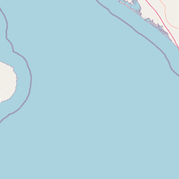
Map view of Cabo Pulmo National Park

Use this park location map to pinpoint Cabo Pulmo National Park in Mexico, understand its exact geographic position, and read its mapped placement within the surrounding landscape more clearly.

Pigeon | © OpenStreetMap contributors

Location context for Cabo Pulmo National Park

Baja California Sur
Park atlas

Compare surrounding protected areas, mapping the regional geography of marine and desert landscapes.

Discover Nearby National Parks and Protected Areas Around Cabo Pulmo National Park

Discover other national parks and marine protected areas found throughout the Baja California Peninsula and the Gulf of California, extending your exploration beyond Cabo Pulmo National Park. This regional view allows for meaningful comparison of diverse conservation landscapes, revealing how marine protected areas connect with terrestrial desert environments.
Biosphere reserveBaja California Sur
About 28 km away#1 closest

West

Sierra La Laguna Biosphere Reserve: Mapping the Highest Range in Baja California Sur

Highland geography and protected ecological terrain

Sierra La Laguna represents a singular protected landscape in Baja California Sur, characterized by high-elevation pine-oak forests and granite massifs. Its rugged topography and distinct microclimates support a dense concentration of endemic species while serving as the principal aquifer recharge zone for the southern peninsula region.

Area
1,124.37 km²
Established
1994
Relief
Mountain
Climate
Subtropical
Protected areaBaja California Sur
About 125 km away#2 closest

Northwest

El Mogote Protected Area: Coastal Geography and Wetland Mapping in Baja California Sur

Sand barriers, mangrove fringes, and arid dune systems.

El Mogote is a defining landform of the Bay of La Paz, showcasing the intersection of extreme arid environments and sheltered estuarine habitats. This protected area provides a distinct study of coastal morphology, where wind-driven dunes meet the quiet, vital channels of a Ramsar-recognized wetland system that sustains regional marine health.

Established
2008
Relief
Lowland
Climate
Arid
Access
Moderate access
Wildlife reserveBaja California Sur
About 134 km away#3 closest

Northwest

Área de protección de flora y fauna Balandra: Wildlife Reserve and Gulf Coast Geography

Protected mangrove lagoon landscapes in Baja California Sur

Discover the ecological significance of Área de protección de flora y fauna Balandra, a protected coastal area near La Paz. This site features a unique convergence of mangrove forests, shallow sandy bays, and arid desert coastal scrub that defines its status as a significant wildlife reserve in northwestern Mexico.

Area
25.125 km²
Established
2012
Relief
Lowland
Climate
Arid
Regional parkSinaloa
About 260 km away#4 closest

East

Ceuta Regional Park: Coastal Geography and Protected Nesting Habitats in Sinaloa

Coastal protection and agricultural valley landscape analysis.

Ceuta Regional Park stands as a key protected area on the Sinaloa coast of Mexico, noted for its long-standing sea turtle conservation initiatives and importance to migratory shorebirds. The park geography spans low-lying coastal plains and beach environments, framed by the agricultural heart of the Elota municipality. This entry provides a structural overview of the terrain, boundaries, and ecological context defining this coastal reserve.

Area
15 km²
Established
2002
Relief
Lowland
Access
Access unknown
Wildlife reserveSinaloa
About 283 km away#5 closest

East

Meseta de Cacaxtla Flora and Fauna Protection Area: Sinaloa Protected Landscape Overview

Mapping dry forests and Pacific coastal ecosystems

Meseta de Cacaxtla Flora and Fauna Protection Area is a significant wildlife reserve in Sinaloa, characterized by its transition from an elevated inland plateau to a complex coastal fringe of mangroves and lagoons. Spanning 508 square kilometers, this protected area preserves an essential blend of arid tropical ecosystems and marine habitats along the Mexican Pacific coast, providing a clear geographic view of regional conservation efforts.

Area
508.62 km²
Established
2000
IUCN
VI
Relief
Lowland
National parkBaja California Sur
About 319 km away#6 closest

Northwest

Bahía de Loreto National Park: National Park Protected Landscape and Geographic Identity

Explore its mapped boundaries and regional context.

Bahía de Loreto National Park offers a distinct focus on its protected natural landscape and geographic features within Baja California Sur. This destination provides detailed mapping and regional context, enabling a focused exploration of its boundaries and natural environment. It is ideal for users seeking to understand the specific protected area identity and its geographical placement as part of a broader atlas of conservation landscapes.

Area
2,065.81 km²
Established
1996
IUCN
II
Relief
Mixed relief
Protected areaChihuahua
About 369 km away#7 closest

Northeast

Cerro Mohinora: Protected Volcanic Summit and Alpine Geography in Chihuahua

An analysis of volcanic terrain and high-elevation protected ecosystems.

Cerro Mohinora dominates the skyline as a prominent volcanic landmark within the Sierra Madre Occidental. This record details the protected area's geographic reach, examining its complex igneous history and the dramatic vertical transition from pine-covered slopes to its snowy summit, offering a clear map-oriented view of this significant Chihuahua natural landmark.

Established
2012
Relief
Mountain
Water
Minor water
Season
Seasonal
Biosphere reserveNayarit
About 374 km away#8 closest

Southeast

Islas Marías Biosphere Reserve: Geographic Overview and Protected Island Mapping

Volcanic topography and marine ecosystems in the Pacific.

The Islas Marías archipelago represents a significant protected area within the Mexican Pacific. Defined by its four major islands and diverse volcanic terrain, the reserve supports unique endemic species and expansive marine ecosystems. This overview tracks the geographic boundaries, island profiles, and the ecological importance of this remote Pacific territory offshore from the state of Nayarit.

Area
244.97 km²
Established
2010
Relief
Upland
Climate
Subtropical

Common questions about visiting, size, designation, and location context for Cabo Pulmo National Park

Cabo Pulmo National Park FAQs for park facts, access, geography, and protected area context

Find quick answers about Cabo Pulmo National Park, including protected-area facts, park geography, trail and visitor context, and how the park fits into its surrounding country and regional landscape.
MoriAtlas Explorer

Continue Your Protected Areas Search Across the Global Atlas

Deepen your exploration by continuing the structured search for national parks and protected areas worldwide. Utilize the comprehensive filtering capabilities to compare different conservation landscapes and refine your understanding of global park geography. Discover more about the distribution and characteristics of protected natural areas.

Global natural geography