Mori Atlas logo
National parkCape Breton Highlands National Park

Discover the mapped terrain and natural landscape context of this key national park.

Cape Breton Highlands National Park: Protected Landscape & Nova Scotia Geography

(Parc national des Hautes-Terres-du-Cap-Breton)

Cape Breton Highlands National Park represents a significant protected area within Nova Scotia, offering rich opportunities for geographic discovery. This canonical page provides an atlas-centric view, detailing the park's mapped boundaries and its distinct landscape character. Understand its place within the regional geography and explore the natural terrain that defines this important national park for structured content and map-based research.

National ParksBoreal ForestsCoastal SceneryHiking TrailsWildlife ViewingIsland Parks

Cape Breton Highlands National Park

National park

Park overview

Structured park overview, official facts, and landscape profile for Cape Breton Highlands National Park

Cape Breton Highlands National Park park facts, protected area profile, and essential visitor context
Review the core facts for Cape Breton Highlands National Park, including designation, size, terrain, visitor scale, habitats, and operating context in one park-focused overview.

About Cape Breton Highlands National Park

Cape Breton Highlands National Park represents a remarkable convergence of geological, ecological, and cultural significance within Canada's national park system. The park occupies the northern third of Cape Breton Island, a landmass that is geologically distinct from mainland Nova Scotia and bears closer affinity to the Appalachian Mountains of New Brunswick and beyond. The protected area encompasses the Cape Breton Highlands, a former erosion surface that has been dissected by rivers into a complex terrain of plateaus, steep valleys, and coastal cliffs. This landscape was shaped by multiple episodes of continental collision and rifting over hundreds of millions of years, leaving a complex assemblage of ancient terranes that record the formation and breakup of supercontinents like Pangaea and Gondwana. The park's establishment in 1936 marked a turning point in Canadian conservation history, as it became the inaugural national park in the Atlantic provinces and demonstrated a commitment to preserving the region's natural heritage. Today, the park serves as a living laboratory for ecological research and a sanctuary for species adapted to boreal and subalpine conditions at the southern edge of their range. The interplay between the Atlantic Ocean and the highland plateau creates microclimates and ecological communities that support biodiversity found nowhere else in Nova Scotia, making the park a critical node in the regional conservation network.

Quick facts and research context for Cape Breton Highlands National Park

Cape Breton Highlands National Park occupies the northern portion of Cape Breton Island in Nova Scotia, protecting a unique landscape where boreal and Acadian forest ecosystems meet Atlantic coastal environments. The park was established in 1936 as the first national park in the Atlantic provinces of Canada and now comprises 949 square kilometers of protected terrain. The landscape is dominated by the Cape Breton Highlands, a geological plateau with the province's highest elevation at White Hill. The Cabot Trail, one of Canada's most celebrated scenic drives, traverses approximately one-third of the park's length, providing access to both ocean and mountain landscapes. The park features 26 marked hiking trails, five salt-water ocean beaches, two freshwater lakes, and the renowned Highlands Links golf course.

Park context

Deeper park guide and search-rich context for Cape Breton Highlands National Park

Cape Breton Highlands National Park history, landscape, wildlife, and travel context
Explore Cape Breton Highlands National Park through its history, landscape character, ecosystems, wildlife, conservation priorities, cultural context, and seasonal travel timing in a structured park guide built for atlas discovery and search intent.

Why Cape Breton Highlands National Park stands out

Cape Breton Highlands National Park is best known for its dramatic contrast between subalpine highlands and ocean coastline, a landscape found nowhere else in the Maritimes. The park is famous for the Skyline Trail, which offers hikers sweeping views of the Gulf of Saint Lawrence from elevated cliffs, and for the Cabot Trail's spectacular ocean-and-mountain vistas. The park protects one of the most significant boreal forest remnants in eastern North America and supports a genetically distinct moose population descended from animals translocated from Alberta in the 1940s. Marine wildlife including North Atlantic right whales, humpback whales, and fin whales frequent the coastal waters, while the highlands provide critical habitat for rare bird species including Bicknell's thrush.

Cape Breton Highlands National Park history and protected-area timeline

Cape Breton Highlands National Park was established in 1936, becoming the first national park in the Atlantic provinces of Canada and the 12th national park in the Canadian national parks system. The park's creation reflected a growing recognition in the early twentieth century of the need to preserve Canada's distinctive landscapes for future generations. The selection of this particular landscape for protection acknowledged both its dramatic scenery and its ecological significance. In the late 1940s, Parks Canada undertook a significant wildlife management initiative that would have lasting implications for Cape Breton Island's ecology. Between 1947 and 1948, eighteen western moose were transferred from Elk Island National Park in Alberta to the park, as the original eastern moose population on the island had dramatically declined. These animals, nine bulls and nine cows, established a new population that today represents a genetically distinct herd, unique from moose populations in mainland Nova Scotia and New Brunswick. The park has continued to evolve through subsequent decades, with infrastructure development focused on providing visitor access while maintaining ecological integrity. In 2014, Parks Canada initiated a multi-year boreal forest restoration project in partnership with the Unama'ki Institute of Natural Resources and other collaborators, reflecting the park's ongoing commitment to ecosystem stewardship.

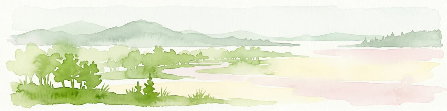
Cape Breton Highlands National Park landscape and geographic character

The landscape of Cape Breton Highlands National Park is defined by the collision of two powerful forces: the ancient Appalachian highland plateau and the relentless Atlantic Ocean. The Cape Breton Highlands form a roughly circular plateau ranging from 300 to 535 meters in elevation, which has been deeply dissected by rivers flowing outward to the sea, creating steep-walled canyons and valley systems that divide the upland into distinct massifs. The highest point in Nova Scotia, White Hill at 533.5 meters, sits within this highland plateau. The park's coastline is characterized by dramatic cliffs, rocky headlands, and small pocket beaches, where the mountains appear to rise directly from the sea. Notable rivers including the Chéticamp River and the North Aspy River have carved deep valleys through the highlands, creating cascading waterfalls and whitewater rapids as they descend toward the ocean. The interior landscape features several freshwater lakes, including Freshwater Lake and Warren Lake, which are flanked by glacial deposits and barrier beaches. The geology underlying this landscape is extraordinarily complex, with rocks representing multiple ancient terranes that originated as parts of different continents before being assembled through tectonic collisions over hundreds of millions of years. The park's terrain shifts dramatically over short distances, moving from exposed coastal barrens to dense forest-covered valleys to open subalpine heath on the high plateau.

Cape Breton Highlands National Park ecosystems, habitats, and plant life

The ecological character of Cape Breton Highlands National Park reflects its position at the intersection of boreal and temperate forest biomes, creating a mosaic of habitats that supports remarkable biodiversity. The park contains two primary forest types: the Acadian forest, characterized by species like sugar maple, yellow birch, and white spruce, found in the more sheltered valleys and lower elevations; and the boreal forest, dominated by black spruce and balsam fir, which prevails at higher elevations and on the exposed plateau. This ecological transition is visible across the park as one ascends from the coastal fringe to the highland interior, with forest composition shifting in response to elevation, exposure, and soil conditions. The highland plateau itself supports a tundra-esque character, with stunted vegetation, peat bogs, and heath barrens that resemble subarctic landscapes far to the north. This combination of forest types and alpine communities makes the park a critical refuge for species at the southern limit of their boreal range. The park's rivers and lakes support freshwater ecosystems, while the coastal waters of the Gulf of Saint Lawrence and Atlantic Ocean provide marine habitat for cetaceans and seals. Wetlands, including bogs and fens, are scattered throughout the park, particularly in the higher elevations where drainage is poor.

Cape Breton Highlands National Park wildlife and species highlights

Cape Breton Highlands National Park supports a diverse community of wildlife, from large mammals to marine cetaceans, representing both boreal and temperate species assemblages. The park is perhaps most famous for its moose population, which descends from eighteen western moose introduced from Alberta in 1947-1948 after the native eastern moose on Cape Breton Island had been nearly extirpated. Today, all moose on Cape Breton Island are descendants of these introduced animals, forming a genetically distinct population. Other mammals include white-tailed deer, which are common throughout the park, American black bear, coyote, beaver, river otter, and smaller species like American marten, Canada lynx, bobcat, and various rodents. The park's bird fauna is particularly noteworthy, with over 200 species recorded. The park is designated as an Important Bird Area, supporting significant populations of raptors including three species of hawk and two species of owl, as well as northern gannets, bald eagles, and Bicknell's thrush, a species of conservation concern. The coastal waters support remarkable marine mammal diversity, including North Atlantic right whales, humpback whales, fin whales, minke whales, sei whales, pilot whales, Atlantic white-sided dolphins, harbor seals, harp seals, and grey seals. Reptiles and amphibians are represented by species including garter snakes, wood turtle, and leatherback sea turtle.

Cape Breton Highlands National Park conservation status and protection priorities

Cape Breton Highlands National Park plays a critical role in conserving Canada's natural heritage, particularly as the first protected area in the Atlantic provinces and a core component of the national parks system. The park protects significant examples of both boreal and Acadian forest ecosystems at their southern range limits, representing habitats that have been heavily altered across much of eastern North America. Its designation as an Important Bird Area acknowledges the park's significance for migratory and resident bird species, particularly those associated with boreal forest and highland habitats. The boreal forest restoration project initiated in 2014, conducted in partnership with the Unama'ki Institute of Natural Resources and other organizations, reflects ongoing efforts to maintain and improve ecological integrity within the park. The park also serves as a crucial watershed protection area, with its rivers and headwater streams feeding coastal ecosystems. The genetically distinct moose population represents a unique conservation asset, as these animals represent a western genetic lineage maintained in isolation from other eastern moose populations.

Cape Breton Highlands National Park cultural meaning and human context

Cape Breton Highlands National Park is situated within a region of deep Mi'kmaq heritage, with the park's lands having been traditionally used by Indigenous peoples for thousands of years before European settlement. The park contains several sites of cultural significance, and the nearby community of Chéticamp, located at the western entrance, represents a vibrant Acadian cultural centre that has maintained its French-language heritage since the eighteenth century. The park name itself, drawn from the broader Cape Breton Highlands region, reflects the island's complex colonial history including French, British, and Scottish influences. The landscape also carries evidence of more recent human history, including the development of the Cabot Trail in the early twentieth century, which transformed remote highland communities by connecting them to regional transportation networks. Today, the park operates in partnership with local communities and Indigenous organizations on research and stewardship initiatives.

Top sights and standout views in Cape Breton Highlands National Park

Cape Breton Highlands National Park offers visitors an exceptional combination of scenic drives, coastal landscapes, and outdoor recreation set within a landscape of profound geological complexity. The Skyline Trail stands as the park's most celebrated hike, offering sweeping views of the Gulf of Saint Lawrence from elevated cliffs and the opportunity to observe wildlife in the highland environment. The Cabot Trail, which passes through the park's interior, is consistently rated among Canada's most scenic drives, with sections featuring ocean vistas from cliff-top roads and passage through dense forest. The park's five ocean beaches and two freshwater lakes provide opportunities for swimming and coastal exploration, while the 26 marked hiking trails range from easy walks to challenging backcountry routes. Highlands Links, an 18-hole golf course designed by Stanley Thompson at the Keltic Lodge resort, has been recognized among the top courses in North America. The park's marine environment supports whale watching opportunities, with multiple species of large cetaceans frequently observed in the offshore waters.

Best time to visit Cape Breton Highlands National Park

Cape Breton Highlands National Park offers distinct experiences across the seasons, each revealing different aspects of the park's character. Late summer and early fall represent perhaps the most popular visiting period, when warm weather allows full access to trails and beaches while reducing concerns about coastal fog. Autumn brings the park's famous fall foliage displays, when the mixed forest transforms into vivid displays of red, orange, and gold, drawing visitors specifically to experience the seasonal transformation. Spring offers the opportunity to see waterfalls at their peak flow from snowmelt and observe returning migratory birds, though some facilities and trails may have limited access during this shoulder season. Winter transforms the park into a quiet, snow-covered landscape popular with cross-country skiers and snowshoers, though many facilities are closed and visitor services are minimal. The shoulder seasons of May and October often provide a good balance of accessible facilities and smaller crowds, though weather can be variable.

Park location guide

Geography guide, regional context, and park location map for Cape Breton Highlands National Park

Cape Breton Highlands National Park park geography, regions, and map view in Canada
Understand where Cape Breton Highlands National Park sits in Canada through a broader geographic reading of the surrounding landscape, nearby location context, and its mapped position within the national park landscape.

How Cape Breton Highlands National Park fits into Canada

Canada is a federal parliamentary constitutional monarchy spanning North America from the Atlantic to the Pacific and Arctic Oceans. With a population of over 41 million, it is officially bilingual in English and French at the federal level. The country gained independence from the United Kingdom through a gradual process culminating in 1982.

Wider geography shaping Cape Breton Highlands National Park in Canada

Canada occupies the northern portion of North America, sharing its longest international border with the United States. The country extends from the Atlantic Ocean to the Pacific Ocean and northward into the Arctic Ocean, giving it the longest coastline of any nation.

Map view of Cape Breton Highlands National Park

Use this park location map to pinpoint Cape Breton Highlands National Park in Canada, understand its exact geographic position, and read its mapped placement within the surrounding landscape more clearly.

Pigeon | © OpenStreetMap contributors

Location context for Cape Breton Highlands National Park

Nova Scotia
Park atlas

Map the regional geography of other protected areas, exploring connected landscapes across Atlantic Canada.

Discover National Parks and Protected Areas Near Cape Breton Highlands National Park
Discover additional national parks and protected areas located in the vicinity of Cape Breton Highlands National Park, featuring diverse coastal scenery, boreal forests, and rugged mountain landscapes. Compare their unique geographic features, conservation efforts, and regional environmental importance through an atlas-style exploration of interconnected natural spaces.
National parkPrince Edward Island

Prince Edward Island National Park: A Mapped Protected Landscape within Canada's Maritime Region

Discover its geographic context and natural terrain.

Prince Edward Island National Park offers a distinct protected area for exploration within the Canadian Maritimes. As a national park, it represents a commitment to preserving specific natural landscapes and their geographic characteristics. This resource provides insight into its mapped boundaries, regional setting on Prince Edward Island, and its contribution to the broader atlas of protected lands.

Area
27 km²
Established
1937
IUCN
II
Relief
Lowland
National parkNew Brunswick

Kouchibouguac National Park: New Brunswick Protected Landscape Atlas

Mapped protected area boundaries and regional geography.

Kouchibouguac National Park is a designated national park offering a rich canvas for geographic discovery. This entry focuses on understanding its protected landscape, detailing its specific mapped boundaries within New Brunswick. It serves as a vital component for atlas exploration, providing the context needed to grasp the park's natural terrain and its significance within the regional geography.

Area
238 km²
Established
1969
IUCN
II
Visitors
243.5K annual
National parkNew Brunswick

Fundy National Park: New Brunswick National Park Atlas and Geographic Exploration

Mapped protected landscape and regional park context.

Fundy National Park represents a vital protected area, offering rich geographic discovery within New Brunswick, Canada. This national park detail provides context for its mapped boundaries and landscape, supporting atlas-based exploration of its regional significance. Understand Fundy National Park's protected status and its contribution to the mapped natural terrain of eastern Canada.

Area
207 km²
Established
1948
IUCN
II
Visitors
303.6K annual
National parkQuebec

Forillon National Park: Quebec National Park Protected Landscape and Geography

Explore mapped park boundaries and regional terrain.

Forillon National Park represents a crucial component of Quebec's protected lands, offering a rich subject for geographic discovery and atlas exploration. This national park's specific landscape characteristics and mapped boundaries provide essential context for understanding its role within the wider regional geography of Canada. Dive into the mapped terrain and protected area details that make Forillon National Park a unique element in any natural landscape atlas.

Area
244 km²
Established
1970
IUCN
II
Visitors
164.1K annual
National parkCanada

Gros Morne National Park: A Canadian National Park for Geographic Exploration

Discover its mapped protected boundaries and regional landscape context.

Explore Gros Morne National Park, a designated National Park within Canada, offering deep insights into its protected landscape and geographic significance. This page details its mapped boundaries and natural terrain, providing essential context for understanding its role within Canada's broader atlas of protected areas. Engage with the specific geography of this park to deepen your knowledge of natural landscapes and conservation.

Area
1,805 km²
Established
2005
IUCN
II
Relief
Mountain
National parkMinganie Regional County Municipality

Mingan Archipelago National Park Reserve: Mapped Protected Landscape

Discover its national park geography in Minganie

Mingan Archipelago National Park Reserve is a designated national park offering a distinct protected landscape within the Minganie Regional County Municipality. This entry provides core geographic context and mapped details crucial for atlas exploration. Understand the park's boundaries and its regional landscape setting for comprehensive discovery of Canada's protected natural areas.

Area
151 km²
Established
1984
IUCN
II
Visitors
44K annual
Watercolor painting showing a river landscape with green trees, rolling hills, and mountains in the background
National parkNova Scotia

Kejimkujik National Park: Detailed Protected Landscape and Regional Geography

Explore mapped boundaries and geographic context in Nova Scotia.

Kejimkujik National Park offers a dedicated entry for understanding protected natural areas. As a national park in Nova Scotia, its geographic features and protected boundaries are detailed here to support atlas-based exploration. Discover the park's unique landscape context and its positioning within regional geography, providing a factual basis for comprehending its role as a conservation area.

Area
404 km²
Established
1967
IUCN
II
Visitors
75.3K annual
National parkNewfoundland and Labrador

Terra Nova National Park: National Park Protected Landscape and Regional Geography

Explore mapped boundaries and landscape context.

Terra Nova National Park represents a significant protected area with a distinct geographic footprint within Newfoundland and Labrador. This page provides a detailed atlas-style view of its mapped landscape and protected land status, highlighting its role in the regional geography and Canada's network of natural reserves.

Area
399 km²
Established
1957
IUCN
II
Visitors
45.2K annual

Common questions about visiting, size, designation, and location context for Cape Breton Highlands National Park

Cape Breton Highlands National Park FAQs for park facts, access, geography, and protected area context
Find quick answers about Cape Breton Highlands National Park, including protected-area facts, park geography, trail and visitor context, and how the park fits into its surrounding country and regional landscape.
MoriAtlas Explorer

Continue Your Protected Areas Search Across the Global Atlas

Deepen your exploration by continuing the structured search for national parks and protected areas worldwide. Utilize the comprehensive filtering capabilities to compare different conservation landscapes and refine your understanding of global park geography. Discover more about the distribution and characteristics of protected natural areas.

Global natural geography