
Mori Atlas logo
Natural monumentCerro de la Silla

Explore the geographic terrain, summit ridges, and ecological transition zones of this iconic Mexican landmark

Cerro de la Silla: Defining the Protected Mountain Landscape and Natural Monument of Nuevo León

(Monumento Natural Cerro de la Silla)

Cerro de la Silla rises as a dominant limestone massif from the foothills of the Sierra Madre Oriental, serving as the landmark silhouette of the Monterrey metropolitan area. Designated as Mexico's first natural monument, the protected area encompasses a dramatic elevation gradient that ranges from semi-arid thornscrub at its base to dense oak-pine woodlands at higher altitudes. This atlas entry provides a detailed look at the mountain's mapped boundaries, its structural role in the local watershed, and its position within the broader geological context of northeastern Mexico.

protected areanatural monumentmountainSierra Madre Orientalsemi-arid landscapesthornscrub
A flat-design, vector-style illustration of a dramatic mountain range with a distinct saddle-like peak, set behind a tranquil park scene with trees, a small bridge, and a river flowing through the foreground.

Cerro de la Silla

Natural monument

Park overview

Structured park overview, official facts, and landscape profile for Cerro de la Silla

Cerro de la Silla park facts, protected area profile, and essential visitor context

Review the core facts for Cerro de la Silla, including designation, size, terrain, visitor scale, habitats, and operating context in one park-focused overview.

About Cerro de la Silla

Cerro de la Silla is a mountain of strong geographical and cultural significance in northeastern Mexico. Part of the foothills of the Sierra Madre Oriental, it rises sharply from the surrounding plains of Nuevo León, with slopes that climb from a few hundred meters in the lowland canyons up to elevations above 1,800 meters at the highest peaks. The mountain's most prominent summits include Pico Antena, Pico Norte, and Pico Sur, each defining a different face of the hill and shaping the experience of its hiking routes.

Identified by its characteristic saddle profile, the mountain is widely regarded as the defining natural symbol of Monterrey. Its outlines frame city views from downtown, from the Paseo Santa Lucía, and from surrounding neighborhoods, while the protected area itself offers a network of trails that connect the foothills of Guadalupe with the high summits. Despite its proximity to dense urban development, Cerro de la Silla retains ecosystems that support significant biodiversity, including mammals, birds, reptiles, and a rich mosaic of plant communities that shift with elevation.

Quick facts and research context for Cerro de la Silla

Cerro de la Silla is a mountain in Nuevo León, Mexico, part of the Sierra Madre Oriental range. It lies across the municipalities of Guadalupe, Monterrey, and Juárez, adjacent to the city of Monterrey. Declared a Natural Monument on 26 April 1991, it was the first protected area in Mexico to receive that designation under federal environmental law. The mountain's highest summit reaches roughly 1,820 meters and the protected area covers approximately 60 square kilometers. Its ecosystem blends semi-arid thornscrub with oak and pine communities and contains over a thousand recorded plant and animal species.

Protection and recognition

Documented designation records and official management scope for Cerro de la Silla

Cerro de la Silla Protection Status and Terrestrial Conservation History

Terrestrial protection records establish the official 1991 designation history for Cerro de la Silla within conservation databases. Structured administrative facts track management scope and international recognition sources for this protected natural area.

Protection details

Protection scope
Terrestrial
Designated year
1991
Transboundary protection
No
Park context

Deeper park guide and search-rich context for Cerro de la Silla

Cerro de la Silla history, landscape, wildlife, and travel context

Explore Cerro de la Silla through its history, landscape character, ecosystems, wildlife, conservation priorities, cultural context, and seasonal travel timing in a structured park guide built for atlas discovery and search intent.

Why Cerro de la Silla stands out

Cerro de la Silla is best known for its unmistakable saddle-shaped silhouette, which inspired its name and has made it the defining visual landmark of Monterrey. The mountain is also recognized as the inaugural Natural Monument of Mexico, a designation that placed it at the forefront of the country's modern system of protected natural areas. Visitors and residents know it for the contrast between arid scrub vegetation on its lower slopes and oak-pine forest at higher altitudes, all set directly against one of Mexico's largest metropolitan areas.

A wide view of the Cerro de la Silla mountain rising above the city of Monterrey with a bright double rainbow spanning the sky.
A double rainbow arches over the distinctive peak of Cerro de la Silla at dawn.

Cerro de la Silla history and protected-area timeline

Cerro de la Silla carries a layered history that blends indigenous, colonial, and modern chapters. The earliest traces of human presence in the surrounding landscape come from cave paintings left by nomadic Chichimeca groups, sometimes referred to as rayados, who moved through the mountains long before the arrival of Europeans. Although no ceremonial sites have been documented on the mountain itself, the area preserves evidence of these earlier inhabitants in nearby rock shelters.

The mountain's name is traditionally attributed to the Portuguese-born explorer Alberto del Canto, who founded Saltillo and was connected to the founding family of Monterrey. Observing that the profile of the mountain resembled an equestrian saddle, del Canto applied the name Cerro de la Silla, which has endured as the mountain's defining reference. Local tradition also recalls the bandit Agapito Treviño, known as Caballo Blanco, who according to oral accounts once hid treasure in one of the mountain's caves.

In the late 1950s and early 1960s, Monterrey developed a cable car project aimed at carrying visitors up the slopes. The inaugural run on 2 June 1961 ended in tragedy when one of the gondolas fell, claiming the lives of the engineer Jesús Fernández, who had led the project, and several colleagues. Although the system was abandoned, the surviving upper platform was preserved as a lookout point along the modern ascent trail.

In 1991, under the Ley General de Equilibrio Ecológico y Protección al Ambiente, the mountain became Mexico's first legally designated Natural Monument, marking a milestone in the country's environmental protection framework. A subsequent 2014 management program, developed jointly by federal, state, and municipal authorities with NGOs and universities, established coordinated long-term stewardship for the site.

Cerro de la Silla landscape and geographic character

Cerro de la Silla defines itself through a dramatic elevation gradient that compresses a wide range of landforms into a relatively confined area. Its lowest elevations, near the Boca canyon, sit around 450 meters, while the highest summits rise above 1,800 meters. The result is a steep, varied mountain face with slopes ranging from the gentle edges of the urban fringe to inclines above 120 percent.

At the surface, the geology reflects the mountain's place within the folded sedimentary belt of the Sierra Madre Oriental. Cretaceous limestones and shales shape much of the ridge, producing the rocky outcrops and slabs visible along the trails. Local soils are generally shallow, with profiles dominated by lithosols, regosols, rendzinas, and fluvisols, contributing to the rugged character of the terrain.

The mountain is framed by surrounding landscapes that include the Cuenca de la Boca reservoir, the Santa Catarina river basin, and the cliffs and canyons that descend toward Monterrey. From many vantage points in the city, the familiar twin-peaked silhouette is anchored by secondary features such as El Chipote, Las Rodillas, and El Estribo on the eastern flank, giving the massif a recognizable identity from nearly every direction.
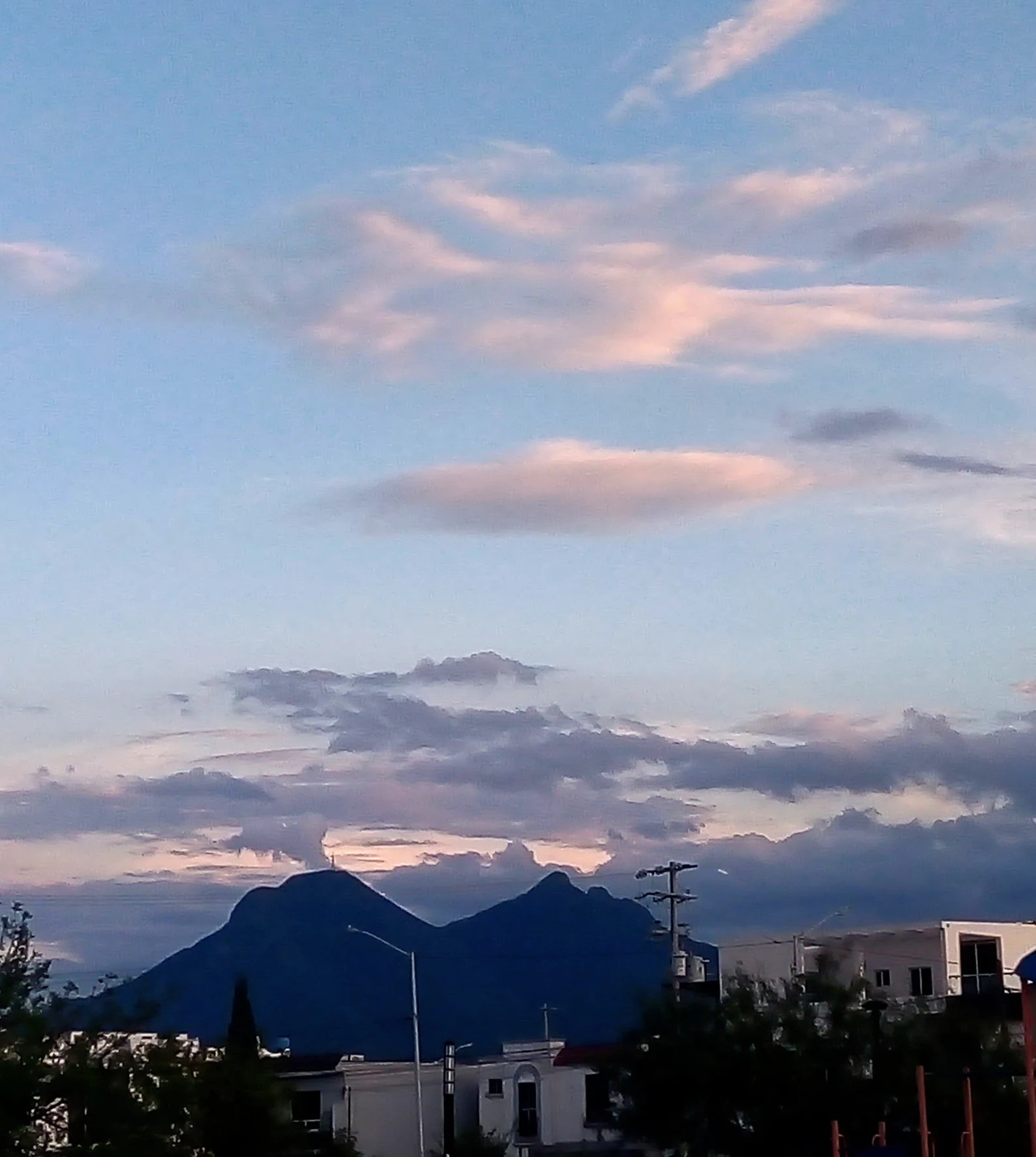
A view of the distinctive saddle-shaped peaks of Cerro de la Silla mountain against a twilight sky with scattered lenticular and cumulus clouds, framed by suburban buildings and trees in the foreground.
Cerro de la Silla at sunset with a lenticular cloud formation.

Cerro de la Silla ecosystems, habitats, and plant life

The protected area of Cerro de la Silla combines characteristic ecosystems of the semi-arid northeast with the cooler forest communities typical of the Sierra Madre foothills. On the lower elevations, thornscrub communities dominate, with species such as chaparro prieto, anacahuita, huizache, and various nopales adapted to dry conditions and rocky soils. As elevation increases, the vegetation grades into oak woodland and, on the highest slopes, into mixed stands of oak and pine.

River corridors and ravines add a riparian thread to the landscape. Gallery vegetation follows intermittent streams and ravines, supporting different moisture conditions and plant compositions than the surrounding slopes. The result is a layered mosaic in which arid, submontane, and montane elements meet within a single mountain.

Overall, the natural monument includes more than 1,025 recorded plant and animal species. Among the vegetation types documented within the area are Matorral Submontano, Bosque de Encinos, Bosque de Galería, and Chaparral de encinos, reflecting the transition between the biogeographic Nearctic and Neotropical zones that converges in this part of the Sierra Madre Oriental.
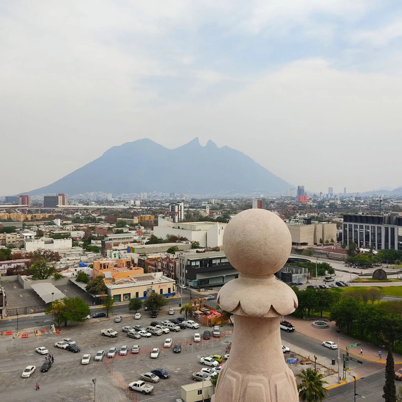
A wide angle shot of the distinctive saddle shaped mountain Cerro de la Silla in the distance, framed by a concrete architectural baluster in the foreground and the sprawling urban environment of Monterrey below.
Cerro de la Silla mountain rising above the Monterrey cityscape as seen from an urban observation point.

Cerro de la Silla wildlife and species highlights

The mountain supports a varied community of mammals and birds consistent with northern Mexican ecosystems. Documented fauna includes black bear, bobcat, jaguarundi, white-tailed deer, puma, nine-banded armadillo, various woodpecker species, the northern cardinal, eastern cottontail, gray fox, cacomistle, spotted skunk, Virginia opossum, and coyote. Coatis and other mid-sized mammals are also frequently observed on the slopes.

The biological inventory notes that the area falls mainly within the Nearctic biogeographic region but receives influence from the Neotropical region due to its position along the Sierra Madre. This blend of faunal influences shapes the mountain's distinctive wildlife character, supporting species typical of both northern arid Mexico and more tropical montane environments. Among the recorded species, a subset falls within at-risk categories under Mexico's NOM-059 standard.
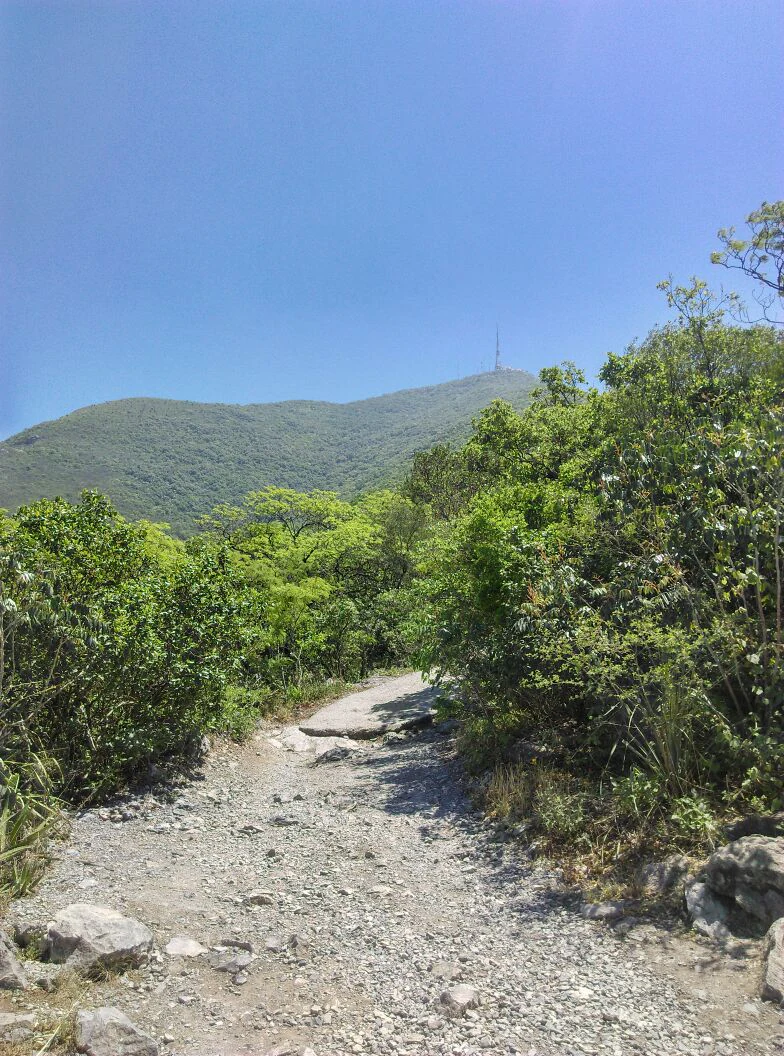
A dirt and gravel hiking trail winds through dense green vegetation toward a mountain peak topped with a communications tower under a clear blue sky.
A rocky hiking trail leading upward on the slopes of Cerro de la Silla.

Cerro de la Silla conservation status and protection priorities

Cerro de la Silla's conservation significance lies in its role as a preserved natural area embedded in a major metropolitan region and at the intersection of arid and montane biomes. Its designation as Mexico's first Natural Monument in 1991 established an early precedent for protecting discrete landscape features of cultural, ecological, and scientific value under federal environmental law. That designation has provided the framework for maintaining ecosystem integrity, biological diversity, and natural resources amid continuous urban pressure from the surrounding municipalities of Guadalupe, Monterrey, and Juárez.

Management of the area is overseen by federal authorities through SEMARNAT and the Comisión Nacional de Áreas Naturales Protegidas, which authorize recreational, tourism, and filming activities on the mountain. In 2014, SEMARNAT published a formal work program for the Natural Monument, developed collaboratively with state, municipal, academic, and civil society actors to consolidate conservation priorities.

A persistent conservation challenge is the encroachment of irregular settlements along the mountain's lower slopes, along with pollution from domestic waste. These pressures contrast sharply with the protected designation, making the management program and ongoing monitoring central to preserving the mountain's ecological functions and visual identity.

Cerro de la Silla cultural meaning and human context

Cerro de la Silla is far more than a physical landmark; it functions as a defining cultural symbol for Monterrey and the wider region of Nuevo León. Known colloquially as La Silla, the mountain is woven into local identity and aesthetics, framing postcards, skyline drawings, and the daily visual experience of the city. For residents, known as regiomontanos, the silhouette of the saddle peaks is a reminder of place, belonging, and regional pride.

Local narratives connect the mountain to figures such as Alberto del Canto, who is credited with naming it during the colonial era, and to legends about bandits who supposedly hid treasure in its caves. These stories, along with the churches, shrines, and viewpoints scattered along the hiking trails, blend the natural setting with strands of regional memory and everyday culture.

The mountain also sits at the heart of recreational life in the metropolitan area. Hiking its trails has become a common weekend activity, connecting urban residents with a protected natural environment just minutes from the city, while the surrounding reservoirs, parks, and ecological corridors reinforce the mountain's role as a shared natural and cultural resource.
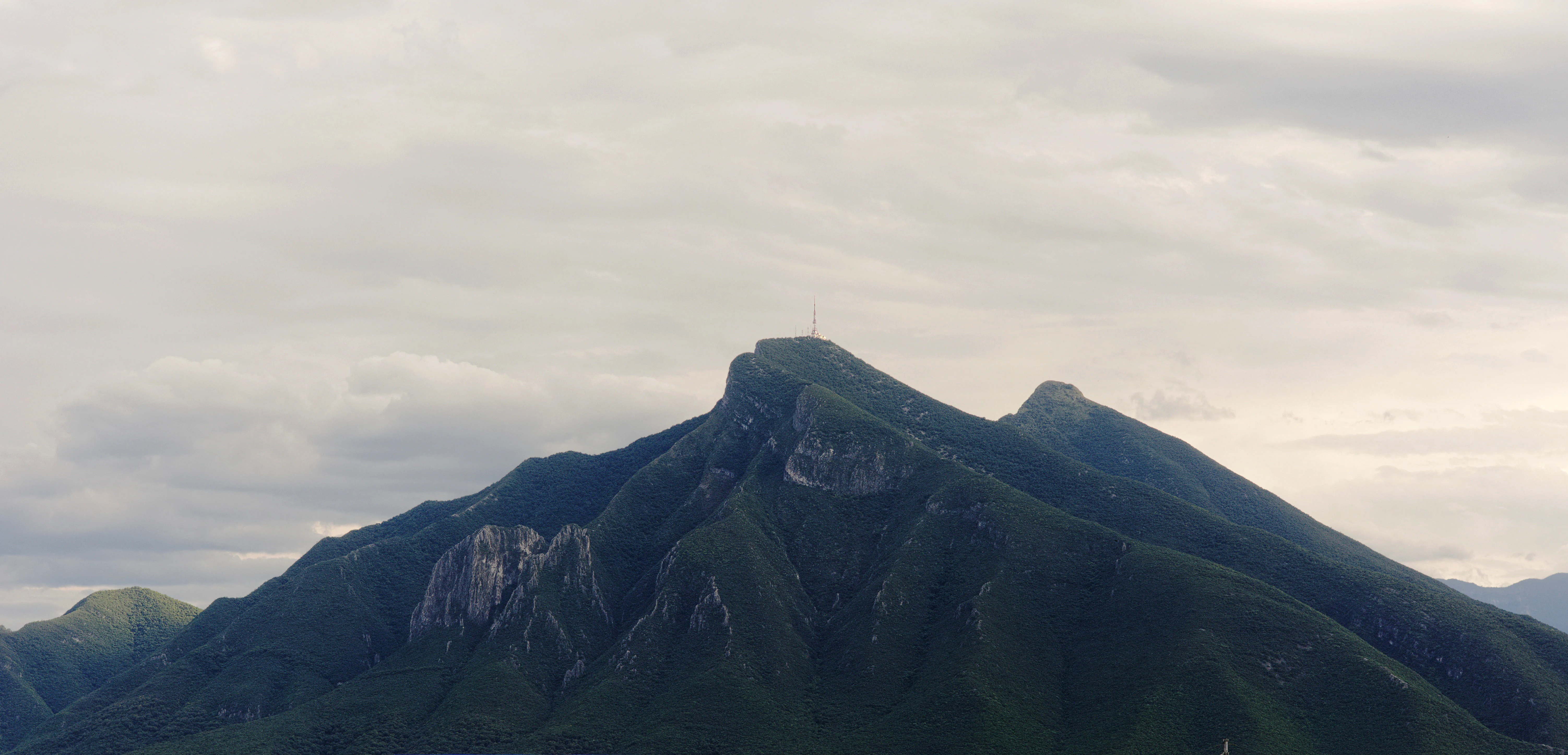
A wide view of the prominent, rugged peak of Cerro de la Silla mountain under a cloudy sky.
The distinctive profile of Cerro de la Silla in Nuevo León, Mexico.

Top sights and standout views in Cerro de la Silla

Cerro de la Silla's strongest points of distinction begin with its saddle-shaped silhouette, a profile so recognizable that it dictates the visual identity of Monterrey itself. It stands as the inaugural Mexican Natural Monument, setting the country's first modern legal precedent for protecting a single natural element for its aesthetic, historical, and scientific value. Within its boundaries lie four main summits, including Pico Antena, Pico Norte, Pico Sur, and Loma de La Virgen, each accessible by distinct routes that traverse thornscrub, oak forest, and rocky outcrops.

Equally notable is the mountain's position at the meeting point between the Nearctic and Neotropical biogeographic regions, creating a habitat mosaic of high ecological interest within the urban matrix. Hikers encounter historic traces such as the abandoned cable car platform, religious imagery along the trails, and panoramic views that encompass the city, the Cuenca de la Boca, and distant ranges of the Sierra Madre Oriental.
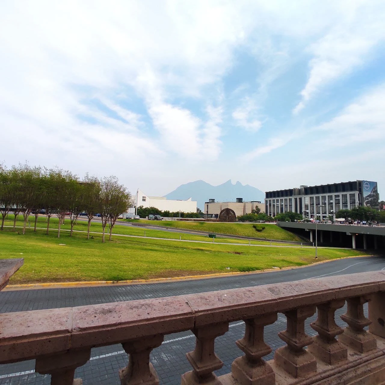
A view across a grassy park and road towards the prominent ridgeline of Cerro de la Silla in the distance, framed by a stone balustrade in the foreground.
View of Cerro de la Silla mountain from the vicinity of the Government Palace in Monterrey.

Best time to visit Cerro de la Silla

Cerro de la Silla's subtropical high-pressure climate and varied elevation produce distinct seasonal moods. Spring months typically bring mild temperatures, blooming vegetation in the lower scrub zones, and relatively stable weather for hiking. Summer is the wettest period and may bring intense rainfall, lush greener conditions on the slopes, and increased cloud cover, including the lenticular clouds occasionally captured above the summits.

Autumn and winter offer cooler temperatures, with crisp mornings and clearer atmospheric visibility that emphasizes the mountain's silhouette against the sky. These months are popular with hikers seeking sharper views of Monterrey and the surrounding ranges. Because temperatures at high elevations can drop significantly and conditions vary across a wide altitude range, any visit benefits from planning around the cooler early hours and the possibility of rapid weather change on the peaks.
Monthly climate preview

Measured monthly temperature ranges and precipitation rhythm across the park coordinate

Cerro de la Silla Climate Normals and Long Term Temperature Records

Cerro de la Silla exhibits a measured annual temperature span from mean monthly lows of 13.79 degrees Celsius to highs reaching 39.93 degrees Celsius alongside distinct precipitation variations. Reviewing the complete twelve month profile provides detailed context on long term meteorological patterns for this protected elevation.
Annual mean22 °C
14 °C27 °C
Jan14°
Feb16°
Mar20°
Apr24°
May26°
Jun27°
Jul27°
Aug27°
Sep24°
Oct21°
Nov17°
Dec14°
Warmest month
June

27.4 °C

Coolest month
January

13.8 °C

Wettest month
September

5.5 mm/day

Driest month
December

0.6 mm/day

Park location guide

Geography guide, regional context, and park location map for Cerro de la Silla

Cerro de la Silla park geography, regions, and map view in Mexico

Understand where Cerro de la Silla sits in Mexico through a broader geographic reading of the surrounding landscape, nearby location context, and its mapped position within the national park landscape.

How Cerro de la Silla fits into Mexico

Mexico, officially the United Mexican States, is a country in North America spanning the Sierra Madre mountain ranges, coastal plains, and tropical regions. It borders the United States to the north, Guatemala and Belize to the southeast, and has coastlines along the Pacific Ocean, Gulf of Mexico, and Caribbean Sea. With a population exceeding 130 million, Mexico is home to one of the world's most significant concentrations of Indigenous languages alongside Spanish.

Wider geography shaping Cerro de la Silla in Mexico

Mexico occupies a land area of 1,972,550 km2, making it the thirteenth-largest country in the world. The terrain is highly diverse, featuring the Sierra Madre Occidental and Sierra Madre Oriental mountain ranges, the Mexican Plateau, coastal lowlands along the Pacific and Gulf/Caribbean margins, and the Yucatan Peninsula. The country spans multiple climate zones from desert in the north to tropical rainforest in the south.

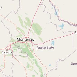
Map view of Cerro de la Silla

Use this park location map to pinpoint Cerro de la Silla in Mexico, understand its exact geographic position, and read its mapped placement within the surrounding landscape more clearly.

Pigeon | © OpenStreetMap contributors

Location context for Cerro de la Silla

Nuevo León

Explore protected area scenery, mountain terrain, and habitat elevation gradients

Cerro de la Silla Photos and Landscapes, Visual Guide to the Natural Monument

Visual documentation captures the rugged limestone ridges, thornscrub foothills, and oak woodlands defining the protected mountain environment. Examining these detailed photographic records helps reveal the dramatic elevation gradients and ecological transition zones shaping the protected natural monument.

A wide view of the Cerro de la Silla mountain rising above the city of Monterrey with a bright double rainbow spanning the sky.

A wide angle view of the distinctive Cerro de la Silla mountain peaks in the background, overlooking a canal with a concrete pathway, trees, and brick structures in the foreground.

A view of the distinctive saddle-shaped peaks of Cerro de la Silla mountain against a twilight sky with scattered lenticular and cumulus clouds, framed by suburban buildings and trees in the foreground.

A wide angle shot of the distinctive saddle shaped mountain Cerro de la Silla in the distance, framed by a concrete architectural baluster in the foreground and the sprawling urban environment of Monterrey below.

A dirt and gravel hiking trail winds through dense green vegetation toward a mountain peak topped with a communications tower under a clear blue sky.

A high angle shot looking down a rocky, overgrown trail through green vegetation, revealing a hazy cityscape with a prominent stadium below.

A wide view of the prominent, rugged peak of Cerro de la Silla mountain under a cloudy sky.

A view across a grassy park and road towards the prominent ridgeline of Cerro de la Silla in the distance, framed by a stone balustrade in the foreground.

A distant, saddle-shaped mountain peak against a light, overcast sky, viewed over a foreground of dense green trees and a leafless tree on the left.

A wide angle view of the green, shrub-covered slopes and rocky summits of Cerro de la Silla in Mexico against a bright, clear blue sky.

A coati, a small mammal with a long tail, walking on a rocky path with green bushes and a blurred city landscape in the background.

A wide shot of Cerro de la Silla mountain under a soft sky, with urban development visible in the foreground.

A wide, hazy landscape shot looking out over a series of mountain ridges under a bright, sunny sky with lens flare.

A high angle view looking down over a large city spread out beneath a layer of clouds, with a distant mountain peak visible above the cloud line.

A wide angle view from the mountain slopes looking down at the sprawling city of Monterrey, Mexico, partially obscured by hazy air under a light sky.

A wide angle shot of a green mountain slope under a clear sky with a communications tower at the peak.

Park atlas

Compare adjacent mountain terrain and regional conservation landscapes

Parks Near Cerro de la Silla and Protected Areas in the Surrounding Region

Browsing other protected areas near Cerro de la Silla reveals connected mountain ranges and regional conservation zones across Nuevo León. Comparing these neighboring habitats provides a broader geographic perspective on the natural escarpments of northeastern Mexico.
National parkMexico
About 22 km away#1 closest

South

Cumbres de Monterrey National Park: National Park Protected Landscape Discovery

Explore Mexico's Mapped Terrain and Regional Geography

Understand Cumbres de Monterrey National Park as a distinct protected landscape within Mexico. This page provides detailed atlas-oriented information focused on its geographic boundaries, mapped terrain, and its role in regional conservation. It serves as a valuable entry point for exploring the park's natural context and understanding its place in the national geography.

Area
1,773.96 km²
Established
1939
IUCN
II
Relief
Mountain
Protected areaCoahuila
About 36 km away#2 closest

Southwest

Cuenca Alimentadora del Distrito Nacional de Riego 026 Bajo Rio San Juan Protected Landscape

Mountain watershed and forest habitat in Coahuila

An expansive protected area encompassing the upper catchments of the San Juan River. The terrain features a significant altitudinal gradient, ranging from semi-arid matorral shrublands to rare high-altitude conifer groves including Mexican Douglas-fir, defining the regional water supply landscape.

Area
1,971.57 km²
Established
1949
IUCN
VI
Relief
Mountain
Watercolor painting of a mountain range featuring gentle slopes and low-lying shrubs against a white background.
Protected areaCoahuila
About 76 km away#3 closest

Southwest

Serranía de Zapalinamé: Protected Mountain Geography and Watershed in Coahuila

Ecological transition zone within the Sierra Madre Oriental

The Serranía de Zapalinamé forms a dramatic mountain corridor rising over Saltillo, Coahuila. This state natural reserve protects a vital watershed and biodiversity hotspot where Chihuahuan Desert scrub meets pine and oak montane forests. Its steep canyons and high ridges offer a significant case study in regional landscape conservation and natural water security.

Area
253.74 km²
Established
1996
Relief
Mountain
Climate
Arid
Protected areaNuevo León
About 82 km away#4 closest

Northeast

Sierra de Picachos Protected Area: Geographic Boundaries and Regional Landscapes

Mountain geography in northern Nuevo León

Sierra de Picachos represents a vital conservation zone spanning north of Monterrey. The landscape is defined by its dramatic elevation changes, moving from desert-like plains to cool coniferous slopes. This atlas entry focuses on the physical boundaries, ecological zones, and the rugged, peak-studded terrain that distinguish the range from the surrounding Sierra Madre Oriental.

Area
1,405 km²
Established
2000
Relief
Mountain
Climate
Subtropical
Watercolor painting of a desert landscape with white gypsum dunes, a central turquoise blue pool, and yucca plants.
Wildlife reserveCoahuila
About 232 km away#5 closest

Northwest

Área de Protección de Flora y Fauna Cuatrociénegas: Protected Landscape and Atlas Map

Desert wetlands and gypsum dune geography in Coahuila, Mexico

This wildlife reserve in Coahuila represents a globally significant desert wetland complex. Featuring hundreds of spring-fed pozas and the second-largest gypsum dune field in the Americas, the reserve offers a unique look at isolated ecosystems and specialized biodiversity within the Chihuahuan Desert.

Area
843.47 km²
Established
1994
Relief
Lowland
Climate
Arid
Protected areaCoahuila
About 264 km away#6 closest

North

Cuenca Alimentadora del Distrito Nacional de Riego 004 Don Martín Protected Area Geography

A vast watershed and mountain corridor in central Coahuila

This expansive protected area in northern Mexico functions as the primary catchment for the Don Martín irrigation district. The terrain ranges from dry shrubland and grasslands in the Coahuila interior to the rugged, forested heights of the Sierra Madre Oriental. It remains a key case study in river conservation and the complex interplay between arid ecosystems and mountainous watershed systems.

Area
15,193.8 km²
Established
1949
IUCN
VI
Relief
Mountain
Wildlife reserveTamaulipas
About 268 km away#7 closest

East

Laguna Madre Wildlife Reserve: Geography and Protected Coastal Landscapes of Tamaulipas

Mapping the hypersaline lagoons and barrier island chains of Mexico

Laguna Madre represents a singular coastal ecosystem characterized by its extreme salinity, expansive seagrass meadows, and sheltered barrier island configuration. As a vital protected wetland, the area serves as a primary migratory flyway and habitat for diverse shorebirds and sea turtles, revealing a distinct arid coastal landscape along the Tamaulipas shore.

Area
5,728.08 km²
Established
2005
IUCN
VI
Relief
Lowland
A soft, watercolor-style illustration of a landscape with rolling dunes, sparse grasses, and a lone yucca plant.
Protected landscapeTexas
About 323 km away#8 closest

Northeast

Padre Island National Seashore: Protected Barrier Island Geography and Mapping

Coastal landscapes and hypersaline lagoon ecosystems in South Texas

Padre Island National Seashore serves as a critical protected landscape on the Texas Gulf Coast, characterized by seventy miles of undeveloped shoreline and the hypersaline Laguna Madre. This atlas entry provides geographic context on the barrier island terrain, including active dune fields, tidal flats, and the diverse habitats that support significant migratory bird populations and sea turtle recovery efforts.

Area
527.85 km²
Established
1962
IUCN
V
Visitors
573.3K annual

Common questions about visiting, size, designation, and location context for Cerro de la Silla

Cerro de la Silla FAQs for park facts, access, geography, and protected area context

Find quick answers about Cerro de la Silla, including protected-area facts, park geography, trail and visitor context, and how the park fits into its surrounding country and regional landscape.
MoriAtlas Explorer

Continue Your Protected Areas Search Across the Global Atlas

Deepen your exploration by continuing the structured search for national parks and protected areas worldwide. Utilize the comprehensive filtering capabilities to compare different conservation landscapes and refine your understanding of global park geography. Discover more about the distribution and characteristics of protected natural areas.

Global natural geography