

Mori Atlas logo
Protected areaCerro Mohinora

Mapping the alpine terrain and distinct geological heritage of this high-elevation Chihuahua summit.

Cerro Mohinora: A Deep Dive into the Protected Volcanic Landscapes of Northern Mexico

Cerro Mohinora rises as a massive 3,300-meter volcanic peak within the Sierra Madre Occidental, anchoring one of the most ecologically significant protected areas in Chihuahua. This site provides detailed geographic insights into its Paleogene and Pleistocene volcanic roots, tracing the transition from rugged coniferous foothills to the cold, alpine environment of the summit. Through structured data and map-focused exploration, understand the spatial distribution of this protected landscape and its vital role in the high-elevation corridors of northern Mexico.

highland volcanoSierra Madre Occidentalflora and fauna protection areaChihuahuapaleogene geologypleistocene uplift

Cerro Mohinora

Protected area

Park overview

Structured park overview, official facts, and landscape profile for Cerro Mohinora

Cerro Mohinora park facts, protected area profile, and essential visitor context

Review the core facts for Cerro Mohinora, including designation, size, terrain, visitor scale, habitats, and operating context in one park-focused overview.

About Cerro Mohinora

Cerro Mohinora is a towering extinct volcano that forms part of the Sierra Madre Occidental in northern Mexico, deep within the rugged interior of the state of Chihuahua. Reaching 3,300 meters above sea level, the peak rises well above the surrounding plateau and stands as a defining landmark in the municipality of Guadalupe y Calvo. Its presence contributes to the fact that the municipality counts several of the country's highest elevations, with Cerro Mohinora among its most prominent summits.

Geologically, the mountain belongs to a long volcanic lineage. Its earliest phase dates to the Paleogene, when intense volcanism across the region produced extensive lava flows and ash deposits that built the broader Sierra Madre Occidental. The modern summit itself was uplifted to its present height during the Pleistocene through tectonic uplift, leaving the peak composed primarily of igneous rocks, including rhyolitic and andesitic formations typical of the range.

The slopes of Cerro Mohinora and the surrounding territory have been formally protected since August 1, 2012, when the area was designated a Flora and Fauna Protection Area under Mexico's national system of natural protected areas. This designation reflects the ecological value of the high-elevation ecosystems found here, even though the park is comparatively small relative to many other Mexican protected natural areas. The protected territory encompasses diverse elevations, vegetation types, and transitional habitats between the interior plateau and the higher Sierra.

At the summit elevation, the climate is distinctly continental and far colder than most visitors to northern Mexico might expect. Winters bring heavy snow and harsh subzero temperatures, while summers remain cool with regular thunderstorm activity. This combination of high elevation, igneous geology, and a strongly seasonal climate gives Cerro Mohinora an alpine character unusual for the region and supports the botanical and zoological diversity that the protection designation was designed to safeguard.

Quick facts and research context for Cerro Mohinora

Cerro Mohinora is a 3,300-meter volcanic summit in the Mexican Sierra Madre Occidental, within the municipality of Guadalupe y Calvo in Chihuahua. It is a Paleogene-to-Pleistocene extinct volcanic peak primarily composed of igneous rocks.

The surrounding area was declared an Área de Protección de Flora y Fauna on August 1, 2012, formally bringing it into Mexico's national system of natural protected areas. The protected landscape is documented to sustain more than 310 species of plants and animals, including several species listed under Mexico's NOM-059 risk categories.

Park context

Deeper park guide and search-rich context for Cerro Mohinora

Cerro Mohinora history, landscape, wildlife, and travel context

Explore Cerro Mohinora through its history, landscape character, ecosystems, wildlife, conservation priorities, cultural context, and seasonal travel timing in a structured park guide built for atlas discovery and search intent.

Why Cerro Mohinora stands out

Cerro Mohinora is best known as one of the highest protected volcanic peaks of Chihuahua and as the centerpiece of a Flora and Fauna Protection Area in a remote section of the Sierra Madre Occidental. It stands out for combining high-elevation Paleogene igneous geology, Pleistocene uplift, and a cold monsoonal climate that supports more than 310 plant and animal species, several of which are classified at risk under Mexican conservation norms.
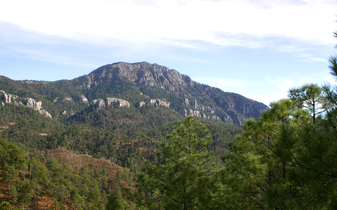
A wide landscape shot of a rocky mountain summit rising above dense pine forest, set against a bright sky.
A view of the summit and forested slopes of Cerro Mohinora in the Sierra Madre Occidental.

Cerro Mohinora history and protected-area timeline

The mountain's deep geological history begins in the Paleogene period, when intense regional volcanism laid the foundation of the Sierra Madre Occidental by depositing thick sequences of lava and ash across the area. This phase of the range's development concluded after violent pyroclastic eruptions had reshaped the surrounding terrain.

The modern summit of Cerro Mohinora took shape during the Pleistocene, when tectonic activity uplifted the mountain beyond 3,300 meters above sea level. The result is a dominant peak whose body is composed mainly of igneous rocks, weathered and shaped by successive glacial and periglacial processes over the intervening millennia.

The mountain entered the modern conservation era on August 1, 2012, when the surrounding area was officially declared an Área de Protección de Flora y Fauna Cerro Mohinora. The designation placed the volcano and its habitat mosaic into Mexico's national protected natural areas framework, aiming to safeguard its diversity of plant and animal species, including those recognized under the country's official risk classification system.

Cerro Mohinora landscape and geographic character

Cerro Mohinora is the defining peak of a section of the Sierra Madre Occidental, a long, rugged mountain chain that runs through northwestern and northern Mexico. The volcano's 3,300-meter summit commands a prominent position in the range and towers above the surrounding plateau of Chihuahua.

The terrain of the protected area climbs from foothill valleys up through pine-forested middle slopes before reaching the open, exposed upper elevations near the summit. Its geological makeup of Paleogene and Pleistocene volcanic rocks produces a landscape dominated by sharp ridges, rocky slopes, eroded volcanic terrain, and deeply incised valleys shaped by long-term water and ice action.

Above the tree line the mountain opens into a colder, more barren alpine environment, while the lower flanks transition into coniferous forest typical of the Sierra Madre Occidental. The combination of high elevation, steep topography, and igneous geology produces a varied and visually dramatic protected landscape within an otherwise largely arid regional setting.

Cerro Mohinora ecosystems, habitats, and plant life

At its higher elevations, Cerro Mohinora preserves a cold-climate ecosystem unusual for the latitude, where coniferous montane forests dominate the slopes and a more open alpine character emerges near the summit. The protected area spans a broad elevation gradient, allowing distinct vegetation belts to develop from the foothills to the upper slopes.

The mountain's combination of high altitude, Paleogene and Pleistocene volcanic geology, and the strongly seasonal continental climate produces a habitat mosaic that supports more than 310 species of plants and animals. This ecological richness is the primary reason the surrounding territory was brought under formal protection as an Área de Protección de Flora y Fauna.

Cerro Mohinora wildlife and species highlights

The Flora and Fauna Protection Area surrounding Cerro Mohinora hosts more than 310 documented species of plants and animals. Among them, around 14 species fall within risk categories defined by Mexico's official ecological protection norm NOM-059, and six are classified as exotic to the area.

The mountain's high-elevation forests and rocky alpine habitats provide refuge for wildlife adapted to cold winters and cool summers, giving the protected area particular significance for highland species at the northern end of the Sierra Madre Occidental.

Cerro Mohinora conservation status and protection priorities

Cerro Mohinora was incorporated into Mexico's national system of natural protected areas on August 1, 2012, when it was designated an Área de Protección de Flora y Fauna. The protection acknowledges the ecological importance of the high-elevation volcanic landscape and the unusually cold climate that supports plant and animal communities distinct from those of the surrounding plateau.

A central conservation priority is the safeguarding of more than 310 documented species, including the 14 species listed under Mexico's NOM-059 risk categories. The protected status helps limit pressures on these highland ecosystems by framing the area as a long-term conservation zone within the Sierra Madre Occidental.

Top sights and standout views in Cerro Mohinora

Cerro Mohinora stands out as one of the highest officially protected summits in Chihuahua and as the centerpiece of a relatively small but ecologically distinct Flora and Fauna Protection Area. Its dramatic 3,300-meter rise, Paleogene and Pleistocene volcanic geology, and exceptionally snowy high-elevation climate give it an alpine character unusual for northern Mexico.

The protected area is also notable for its concentration of biodiversity in a compact territory, with more than 310 plant and animal species documented on the mountain, several of which are formally listed under Mexico's risk classification system.

Best time to visit Cerro Mohinora

Cerro Mohinora experiences an extreme continental highland climate. Winters are very cold, often plunging below minus twenty degrees Celsius, with regular snowfall, strong winds, and deep snow cover across the upper slopes. Summers are the milder season, with daytime highs rarely reaching the mid-twenties Celsius, cool nights near or below ten degrees, and strong thunderstorms common from June into October. The summer months therefore generally offer the most accessible conditions for reaching and exploring the higher terrain, while the heavy winter snows create a much more demanding environment best suited to experienced mountaineers.
Monthly climate preview

Long term representative point measurements for monthly weather patterns in Chihuahua

Cerro Mohinora Climate Normals, Annual Temperature and Precipitation Rhythm

Measured coordinates track monthly temperature and precipitation values across a representative elevation in Cerro Mohinora. Detailed twelve month climate profiles provide comprehensive averages for ongoing environmental analysis.
Annual mean14 °C
7 °C20 °C
Jan
Feb
Mar11°
Apr14°
May17°
Jun20°
Jul18°
Aug18°
Sep16°
Oct14°
Nov11°
Dec
Warmest month
June

19.6 °C

Coolest month
January

7.5 °C

Wettest month
July

6.9 mm/day

Driest month
April

0.2 mm/day

Park location guide

Geography guide, regional context, and park location map for Cerro Mohinora

Cerro Mohinora park geography, regions, and map view in Mexico

Understand where Cerro Mohinora sits in Mexico through a broader geographic reading of the surrounding landscape, nearby location context, and its mapped position within the national park landscape.

How Cerro Mohinora fits into Mexico

Mexico, officially the United Mexican States, is a country in North America spanning the Sierra Madre mountain ranges, coastal plains, and tropical regions. It borders the United States to the north, Guatemala and Belize to the southeast, and has coastlines along the Pacific Ocean, Gulf of Mexico, and Caribbean Sea. With a population exceeding 130 million, Mexico is home to one of the world's most significant concentrations of Indigenous languages alongside Spanish.

Wider geography shaping Cerro Mohinora in Mexico

Mexico occupies a land area of 1,972,550 km2, making it the thirteenth-largest country in the world. The terrain is highly diverse, featuring the Sierra Madre Occidental and Sierra Madre Oriental mountain ranges, the Mexican Plateau, coastal lowlands along the Pacific and Gulf/Caribbean margins, and the Yucatan Peninsula. The country spans multiple climate zones from desert in the north to tropical rainforest in the south.

Map view of Cerro Mohinora

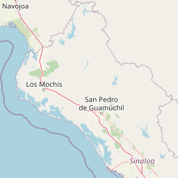
Use this park location map to pinpoint Cerro Mohinora in Mexico, understand its exact geographic position, and read its mapped placement within the surrounding landscape more clearly.

Pigeon | © OpenStreetMap contributors

Location context for Cerro Mohinora

Chihuahua

Explore detailed visual documentation of alpine terrain, coniferous forests, and protected habitats.

Cerro Mohinora Landscape and Scenery Photography: Visualizing the High Volcanic Peaks of Chihuahua

Visual documentation of Cerro Mohinora reveals the rugged topography of a 3,300-meter volcanic summit rising above the Sierra Madre Occidental. Examining field photography and landscape views helps researchers understand the alpine terrain, forest habitats, and protected environmental character of northern Mexico.

A wide landscape shot of a rocky mountain summit rising above dense pine forest, set against a bright sky.

Park atlas

Compare adjacent highland reserves and connected regional terrain across the Sierra Madre Occidental.

Explore Parks Near Cerro Mohinora and Surrounding Protected Mountain Landscapes

Browse other protected areas near Cerro Mohinora to examine shared high-elevation ecosystems and rugged volcanic topography. Comparing nearby reserves reveals broader patterns of biodiversity and regional conservation across northern Mexico.
Protected areaSonora
About 181 km away#1 closest

Northwest

Área de protección de flora y fauna Sierra de Álamos-Río Cuchujaqui: Geography and Park Boundaries

Detailed atlas view of the Sonora biodiversity enclave and canyon systems.

Spanning over 92,000 hectares in Sonora, this protected area is defined by its dramatic transition from coastal plains to the Sierra Madre range. The geography centers on the deep, moisture-trapping barrancas of the Cuchujaqui River, which sustain a rare mixture of Neotropical and temperate species. Examine the structural complexity of these forested slopes and river-carved valleys that function as a essential habitat for large predators and diverse flora alike.

Area
928.9 km²
Established
1996
Regional parkSinaloa
About 228 km away#2 closest

South

Ceuta Regional Park: Coastal Geography and Protected Nesting Habitats in Sinaloa

Coastal protection and agricultural valley landscape analysis.

Ceuta Regional Park stands as a key protected area on the Sinaloa coast of Mexico, noted for its long-standing sea turtle conservation initiatives and importance to migratory shorebirds. The park geography spans low-lying coastal plains and beach environments, framed by the agricultural heart of the Elota municipality. This entry provides a structural overview of the terrain, boundaries, and ecological context defining this coastal reserve.

Area
15 km²
Established
2002
Relief
Lowland
Access
Access unknown
Wildlife reserveSinaloa
About 264 km away#3 closest

South

Meseta de Cacaxtla Flora and Fauna Protection Area: Sinaloa Protected Landscape Overview

Mapping dry forests and Pacific coastal ecosystems

Meseta de Cacaxtla Flora and Fauna Protection Area is a significant wildlife reserve in Sinaloa, characterized by its transition from an elevated inland plateau to a complex coastal fringe of mangroves and lagoons. Spanning 508 square kilometers, this protected area preserves an essential blend of arid tropical ecosystems and marine habitats along the Mexican Pacific coast, providing a clear geographic view of regional conservation efforts.

Area
508.62 km²
Established
2000
IUCN
VI
Relief
Lowland
Wildlife reserveChihuahua
About 265 km away#4 closest

North

Papigochic Flora and Fauna Protection Area: Sierra Madre Occidental Forest Geography

An expansive mountain wildlife reserve in Chihuahua, Mexico.

Spanning over 2,200 square kilometers, this reserve preserves vital pine and oak forest ecosystems in the Sierra Tarahumara. The area is defined by its deep canyons, high-elevation forested ridgelines, and important role in safeguarding temperate montane habitats within northwestern Mexico.

Area
2,227.64 km²
Established
2003
IUCN
VI
Relief
Mountain
National parkOcampo Municipality
About 269 km away#5 closest

Northwest

Basaseachic Falls National Park: National Park Geography and Mapped Boundaries

Explore protected lands within Ocampo Municipality.

Basaseachic Falls National Park serves as a key protected area within Ocampo Municipality, Mexico. This page provides detailed geographic information and mapped boundaries, essential for understanding its landscape context and its significance as a national park. Dive into the atlas-style data to appreciate the park's protected terrain and its contribution to the regional geography, offering a factual discovery experience.

Area
58.03 km²
Established
1981
IUCN
II
Relief
Mountain
Wildlife reserveChihuahua
About 304 km away#6 closest

Northwest

Tutuaca Flora and Fauna Protection Area: Sierra Madre Occidental Mountain Conservation Reserve

Expansive pine-oak forest habitat in Chihuahua, Mexico

Covering over 4,000 square kilometers, the Tutuaca Flora and Fauna Protection Area acts as a critical link in the Sierra Madre Occidental mountain spine. This wildlife reserve preserves dense pine-oak woodlands, rugged canyons, and high-elevation watersheds that characterize the biodiversity of northwestern Mexico. The area plays a vital role in sustainable resource management and habitat connectivity between Chihuahua and neighboring regions.

Area
4,369.86 km²
Established
2001
IUCN
VI
Relief
Mountain
National parkChihuahua
About 320 km away#7 closest

North

Cumbres de Majalca National Park: National Park Discovery and Geographic Context in Chihuahua

Mapped protected landscape exploration in Chihuahua.

Delve into the protected landscape of Cumbres de Majalca National Park, a national park situated in the Chihuahua region of Mexico. This entry provides essential geographic context and details on its mapped boundaries, serving as a key point for atlas-based exploration of Mexico's protected areas. Understand its specific contribution to the regional geography and conservation landscape.

Area
47.72 km²
Established
1939
IUCN
II
Relief
Mountain
State or regional parkDurango
About 334 km away#8 closest

East

Cañon de Fernández State Park: A Protected Wetland and Canyon Landscape in Durango

Geography and riparian forest mapping in northern Mexico

Cañon de Fernández State Park is an ecologically vital protected area in Durango, defined by the Nazas River corridor. Spanning desert canyons and ancient riparian forests, this site serves as a crucial Ramsar wetland in the Chihuahuan Desert. Learn about its unique geographic boundaries and the centuries-old cypress trees that define this rare northern Mexican landscape.

Area
170.19 km²
Established
2004
Relief
Mixed relief
Climate
Arid

Common questions about visiting, size, designation, and location context for Cerro Mohinora

Cerro Mohinora FAQs for park facts, access, geography, and protected area context

Find quick answers about Cerro Mohinora, including protected-area facts, park geography, trail and visitor context, and how the park fits into its surrounding country and regional landscape.
MoriAtlas Explorer

Continue Your Protected Areas Search Across the Global Atlas

Deepen your exploration by continuing the structured search for national parks and protected areas worldwide. Utilize the comprehensive filtering capabilities to compare different conservation landscapes and refine your understanding of global park geography. Discover more about the distribution and characteristics of protected natural areas.

Global natural geography