Mori Atlas logo
National parkChitwan National Park

Navigate the mapped boundaries and natural terrain of this important national park.

Chitwan National Park: A Protected Landscape in the Geography of Nepal

Chitwan National Park stands as a significant protected area within the broader geographic context of Nepal. This page offers an atlas-oriented perspective, detailing the park's mapped boundaries and its place within the nation's diverse natural landscapes. Understanding Chitwan National Park involves exploring its role as a designated national park and appreciating its unique terrain as part of Nepal's rich geography.

national parkTerai ecosystemWorld Heritage Sitetiger habitatrhinoceros conservationsubtropical forest

Chitwan National Park

National park

Park overview

Structured park overview, official facts, and landscape profile for Chitwan National Park

Chitwan National Park park facts, protected area profile, and essential visitor context
Review the core facts for Chitwan National Park, including designation, size, terrain, visitor scale, habitats, and operating context in one park-focused overview.

About Chitwan National Park

Chitwan National Park represents Nepal's premier protected area and a cornerstone of the country's conservation history. Located in the Terai region of south-central Nepal, the park encompasses a remarkable diversity of ecosystems within its 952 square kilometer boundary. The landscape ranges from the fertile alluvial floodplains of the Narayani and Rapti river systems to the forested slopes of the Sivalik Hills, creating a mosaic of habitats that support extraordinary biodiversity. The park's significance extends beyond its borders as part of a larger transboundary conservation landscape that includes Parsa National Park in Nepal and Valmiki National Park in India, forming a coherent Tiger Conservation Unit of over 2,000 square kilometers. This interconnected protected area represents one of the most important wilderness complexes in South Asia, providing refuge for populations of tigers, rhinoceros, elephants, and countless other species. The park's designation as a UNESCO World Heritage Site in 1984 reflects its outstanding universal value as a natural habitat that exemplifies Earth's most significant ecological and evolutionary processes.

Quick facts and research context for Chitwan National Park

Chitwan National Park occupies 952.63 square kilometers in the Central Terai of Nepal, spanning parts of Nawalpur, Chitwan, Makwanpur, and Parsa Districts. The park was established in 1973 as the Royal Chitwan National Park and gained World Heritage status in 1984. It features a humid subtropical monsoon climate with most annual rainfall occurring between mid-June and late September. The park's vegetation is dominated by sal forest covering approximately 70% of the area, with extensive grasslands making up about 20%. The Narayani-Rapti river system forms a natural boundary to human settlements and supports diverse aquatic species including fish, mugger crocodiles, and critically endangered gharials.

Park context

Deeper park guide and search-rich context for Chitwan National Park

Chitwan National Park history, landscape, wildlife, and travel context
Explore Chitwan National Park through its history, landscape character, ecosystems, wildlife, conservation priorities, cultural context, and seasonal travel timing in a structured park guide built for atlas discovery and search intent.

Why Chitwan National Park stands out

Chitwan National Park is renowned as one of the finest examples of Terai ecosystem preservation in South Asia and serves as a critical stronghold for some of the region's most endangered large mammals. The park is famous for its population of Indian rhinoceros, which has recovered from fewer than 100 individuals in the late 1960s to over 600 today, representing the largest population in Nepal. It is also recognized as one of the best tiger habitats in the world, with the highest recorded tiger density in the region. The park's extensive grasslands provide crucial habitat for the critically endangered Bengal florican, while its river systems support the endangered gharial. The combination of sal forests, riverine ecosystems, and grasslands creates an exceptionally diverse habitat that supports over 700 wildlife species.

Chitwan National Park history and protected-area timeline

The history of Chitwan National Park reflects a dramatic transformation from exclusive hunting grounds to one of South Asia's most important protected areas. From the end of the 19th century until the 1950s, the dense forests and grasslands of Chitwan served as the favored hunting destination for Nepal's ruling class, where feudal big game hunters shot hundreds of tigers, rhinoceroses, elephants, leopards, and sloth bears during winter seasons. By 1950, the forest and grasslands extended over 2,600 square kilometers and supported approximately 800 rhinos. However, when poor farmers from the mid-hills began settling in the Chitwan Valley in search of arable land, the area underwent rapid transformation. Malaria eradication efforts using DDT in the 1960s enabled further human settlement, and by the end of the decade, 70% of the jungle had been cleared with only 95 rhinos remaining. The dramatic decline prompted the government to establish the Gaida Gasti, an armed rhino reconnaissance patrol, and gazette Chitwan National Park in December 1970, officially established in 1973 with an initial area of 544 square kilometers. In 1977, the park was enlarged to its present size, and a buffer zone was added in 1997. The word Royal was removed from the name in 2006 following the Nepalese Civil War.

Chitwan National Park landscape and geographic character

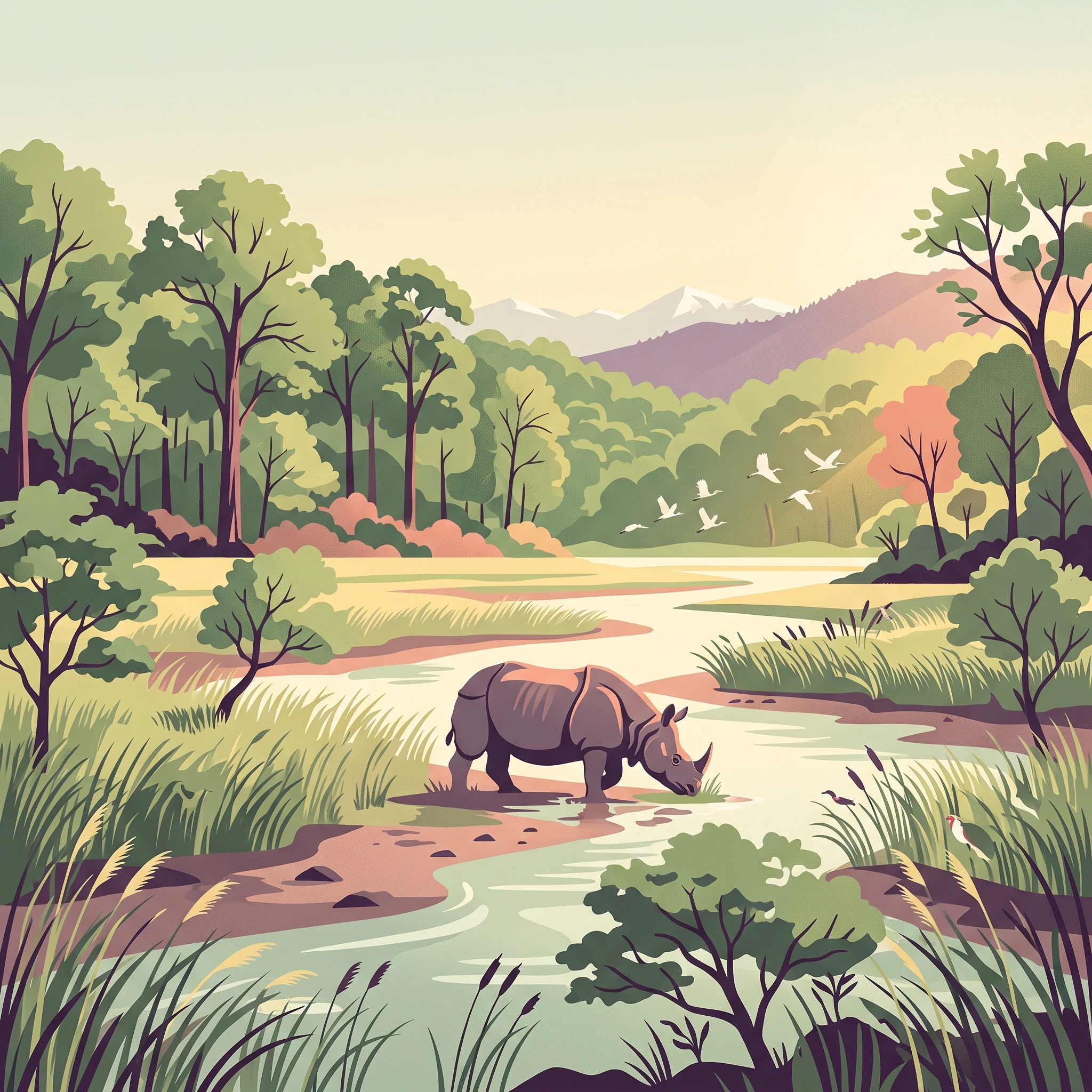
The physical landscape of Chitwan National Park encompasses a remarkable variety of terrain within its 952 square kilometer boundary. The park lies in the Terai, Nepal's lowland plain region, where elevation ranges from approximately 100 meters in the river valleys along the Narayani and Rapti rivers to 815 meters on the lower slopes of the Sivalik Hills. The Narayani-Rapti river system forms a natural boundary to human settlements in the north and west, creating a natural hydrological framework that shapes the park's interior. The terrain features a mix of flat alluvial floodplains, gently undulating hills, and the distinctive Churia Hills in the southern portion. The river system includes numerous oxbow lakes, small tributaries, and seasonal wetlands that create a dynamic aquatic landscape. The alluvial soils deposited by the rivers support the park's extensive grasslands, while the hill slopes bear the characteristic subtropical broadleaf forests that once covered much of the Himalayan foothills.

Chitwan National Park ecosystems, habitats, and plant life

The ecological character of Chitwan National Park is defined by two primary vegetation types that create a diverse habitat mosaic. Himalayan subtropical broadleaf forests, dominated by sal trees, cover approximately 70% of the park's area, with the purest stands occurring on well-drained lowland ground in the center. Along the southern face of the Churia Hills, sal forest mingles with chir pine, while northern slopes feature associations with smaller flowering trees and shrubs including beleric, rosewood, axlewood, elephant apple, and numerous climbing species. The Terai-Duar savanna and grasslands cover about 20% of the park and represent one of the most significant habitat types, featuring more than 50 grass species including some of the world's tallest grasses. Seasonal bushfires, flooding, and erosion create an ever-changing mosaic of riverine forest and grasslands along the river banks. The riverine forests along the Narayani and Rapti support distinct communities of catechu, rosewood, and kapok trees, with understory shrubs providing shelter for diverse species.

Chitwan National Park wildlife and species highlights

Chitwan National Park supports an extraordinary diversity of wildlife, with more than 700 species documented within its boundaries. The park is home to 68 mammal species, most notably the Bengal tiger, whose population has increased from approximately 25 individuals at the park's establishment to between 70 and 110 by 1980, with recent surveys indicating densities of 4 to 6 tigers per 100 square kilometers. The Indian rhinoceros represents perhaps the park's greatest conservation success, with populations recovering from near extinction in the 1960s to over 600 individuals today, representing the largest population in Nepal. The park supports significant populations of wild elephants, gaurs, and wild water buffalo, along with various deer species including chital, sambar, red muntjac, and hog deer. The avifauna is equally remarkable, with 543 bird species recorded, making Chitwan the most bird-diverse protected area in Nepal. Critically endangered species include the Bengal florican in the grasslands, while the river systems support endangered gharials and mugger crocodiles. The park also hosts diverse reptile populations including pythons, king cobras, and over 17 snake species, alongside 113 recorded fish species.

Chitwan National Park conservation status and protection priorities

Chitwan National Park holds significant conservation importance as one of South Asia's most successful protected area stories and a critical component of regional biodiversity preservation. The park's designation as a UNESCO World Heritage Site in 1984 recognizes its outstanding universal value as a natural habitat. The park forms the core of the Tiger Conservation Unit Chitwan-Parsa-Valmiki, representing a coherent transboundary protected landscape of over 2,000 square kilometers that serves as one of the most important tiger habitats in the world. Conservation efforts have focused on species recovery, with the Indian rhinoceros population recovering from fewer than 100 individuals to become the largest population in Nepal. The gharial conservation program collects eggs from wild populations and rears juveniles for release into the river system. The park also serves as a source population for translocating rhinos to other protected areas including Bardia National Park and Shuklaphanta National Park to ensure species survival in case of epidemics. The establishment of a buffer zone in 1997 extends protection beyond the core area, engaging local communities in conservation stewardship.

Chitwan National Park cultural meaning and human context

The cultural context of Chitwan National Park includes the traditional lands of the Tharu people, an indigenous group who have historically inhabited the Terai region. When the first protected areas were established, Tharu communities were forcibly relocated from their traditional lands within the park boundaries, a process that resulted in displacement and economic hardship. The Tharu people, who had lived in the area for generations and developed unique cultural practices adapted to the forest environment, were denied land ownership rights and forced to leave at gunpoint, with Nepalese soldiers destroying villages and fields. This historical displacement remains a significant aspect of the park's social history and has implications for contemporary conservation approaches that seek to balance protection with community rights and livelihoods.

Top sights and standout views in Chitwan National Park

Chitwan National Park offers visitors exceptional opportunities to experience one of South Asia's most biodiverse wilderness areas. The park's combination of sal forests, riverine ecosystems, and extensive grasslands creates varied landscapes that support remarkable wildlife viewing opportunities. Elephant safaris provide access to the interior grasslands and forests, offering chances to observe rhinos, deer, and a variety of bird species. The Narayani River supports populations of mugger crocodiles and the critically endangered gharial, while boat trips along the river provide opportunities to view these species and numerous waterfowl. The park's status as an Important Bird Area makes it particularly significant for birdwatchers, with over 540 species including the critically endangered Bengal florican and numerous migratory species. The Tharu cultural village outside the park offers insights into the traditional lifestyle of the indigenous communities of the Terai.

Best time to visit Chitwan National Park

The optimal time to visit Chitwan National Park is during the dry season from October through March, when weather conditions are most favorable for wildlife viewing. During these months, temperatures are comfortable, ranging from warm days to cool nights, and the reduced vegetation density in the grasslands makes animals easier to spot. The period from November to February offers the most pleasant climate, with clear skies and minimal rainfall. The monsoon season from mid-June to late September brings heavy rainfall, with approximately 2,500 millimeters of annual precipitation occurring during this period, which can restrict access and make wildlife viewing more challenging. However, the monsoon transforms the landscape into a lush green environment that may appeal to visitors interested in seeing the ecosystem at its most vibrant. Early mornings and late afternoons remain the best times for wildlife observation throughout the year, as animals are most active during these cooler periods.
Park location guide

Geography guide, regional context, and park location map for Chitwan National Park

Chitwan National Park park geography, regions, and map view in Nepal
Understand where Chitwan National Park sits in Nepal through a broader geographic reading of the surrounding landscape, nearby location context, and its mapped position within the national park landscape.

How Chitwan National Park fits into Nepal

Nepal is a federal parliamentary republic in South Asia, landlocked between China and India. It spans the Himalayas and includes eight of the world's ten highest mountains. Kathmandu is the capital and largest city.

Wider geography shaping Chitwan National Park in Nepal

Nepal is located in South Asia, landlocked between China to the north and India to the south, east, and west. The country occupies the Himalayan region in the north and extends into the Indo-Gangetic Plain in the south. Terrain includes the Terai lowlands, subalpine hills, and the Himalayas with peaks including Mount Everest.

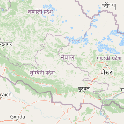
Map view of Chitwan National Park

Use this park location map to pinpoint Chitwan National Park in Nepal, understand its exact geographic position, and read its mapped placement within the surrounding landscape more clearly.

Pigeon | © OpenStreetMap contributors

Location context for Chitwan National Park

Bagmati Province
Park atlas

Map the regional context of protected areas, compare diverse ecosystems, and explore connected conservation landscapes.

Discover Other Protected Areas and National Parks Near Chitwan National Park in Nepal
After exploring Chitwan National Park, trace the rich network of national parks and protected areas that share its unique Terai ecosystem, extending conservation efforts beyond its boundaries. Compare geographic features, understand the regional spread of protected landscapes, and identify adjacent conservation units that form critical wildlife corridors in Nepal and surrounding areas.
National parkNepal

Parsa National Park: Mapped Protected Landscape Within Nepal's Geography

Explore its national park status and geographic setting.

Parsa National Park represents a significant protected area within the geographic framework of Nepal. This page provides critical atlas context, detailing the park's mapped boundaries and its role as a national park. It serves as an essential resource for understanding the specific landscape features and regional geographic positioning of Parsa National Park, contributing to a structured view of protected lands across South Asia.

Area
627.39 km²
Established
2017
IUCN
II
Relief
Lowland
National parkWest Champaran District

Valmiki National Park: A Vital National Park and Protected Landscape in Bihar

Explore unique Sivalik terrain and mapped protected area boundaries

Valmiki National Park, located in the West Champaran District of Bihar, is a significant protected area renowned for its unique geography. Situated at the interface of the Himalayas and the Gangetic plains, the park showcases a varied terrain including ridges, gorges, dense forests, and extensive wetlands. As Bihar's only national park and a designated tiger reserve, it offers rich insights into conservation landscapes and regional biodiversity for atlas exploration.

Area
898.45 km²
Established
1990
IUCN
II
Relief
Mixed relief
National parkNepal

Shivapuri Nagarjun National Park: National Park Mapping and Geographic Identity in Nepal

Explore protected boundaries and natural terrain.

Shivapuri Nagarjun National Park serves as a prime example of a protected natural area within Nepal, offering valuable geographic context for atlas exploration. This detail page provides insights into the park's mapped boundaries, its designation as a national park, and its place within the country's diverse natural landscapes. Understanding the terrain and regional distribution of protected areas like Shivapuri Nagarjun National Park is crucial for a comprehensive geographic perspective.

Area
159 km²
Established
2002
IUCN
II
Relief
Mountain
A watercolor painting depicting a river flowing through a valley with mountains in the background and green forests
National parkNepal

Langtang National Park: Nepal's Pioneer Himalayan Protected Landscape and Alpine Atlas

Mapped glaciated terrain, sacred lakes, and towering peaks define this national park.

Langtang National Park, established as Nepal's first Himalayan national park, offers a unique window into high-altitude protected landscapes. Its geography is characterized by dramatic glaciated valleys, soaring mountain peaks including Langtang Lirung, and a rich diversity of alpine ecosystems. This page provides an atlas-centric view of the park's boundaries and its significance within the broader Himalayan conservation context.

Area
1,710 km²
Established
1976
IUCN
II
Relief
Mountain
National parkKoshi Province

Sagarmatha National Park: Mapped Protected Landscape and Geographic Identity in Koshi Province

Explore the protected area's regional geographic context.

Sagarmatha National Park serves as a distinct protected national park entity. This page facilitates an in-depth understanding of its mapped boundaries and its location within Koshi Province. Users can explore the park's specific landscape characteristics and its position within the broader regional geography, providing a foundation for atlas and map-driven discovery.

Area
1,148 km²
Established
1976
IUCN
II
Visitors
19K annual
National parkNepal

Banke National Park: Nepal National Park with Distinct Protected Landscape Geography

Explore the mapped terrain and regional atlas context of Banke National Park.

Banke National Park represents a vital protected area within Nepal's diverse geography, offering a focused point for atlas and map-based discovery. As a national park, its designated status highlights its importance in conserving natural landscapes and understanding regional protected-area distribution across South Asia. This entry provides detailed geographic context, enabling users to explore the park's mapped boundaries and appreciate its role within Nepal's broader natural territory.

Area
550 km²
Established
2010
IUCN
II
Relief
Upland
National parkNepal

Shey Phoksundo National Park: Nepal's Largest Trans-Himalayan Protected Landscape with Phoksundo Lake

Explore alpine terrain and unique protected ecosystems.

Delve into the geographical distinctiveness of Shey Phoksundo National Park, Nepal's expansive protected area. This park is defined by its dramatic elevation changes and the striking Phoksundo Lake, a vivid turquoise alpine reservoir set against barren, mountainous terrain. Understanding its trans-Himalayan setting and protected landscape context reveals its importance within the broader atlas of global natural areas.

Area
3,555 km²
Established
1984
IUCN
II
Relief
Mountain
Watercolor illustration of mountain landscape with green slopes and blue peaks, showing a valley with yellow flowers in the foreground
National parkKoshi Province

Makalu Barun National Park: Protected Landscape and Regional Geography in Koshi Province

Explore the mapped boundaries of this national park.

Makalu Barun National Park is a designated national park providing critical protected landscape data for geographic discovery. Understand its position within Koshi Province and its specific mapped boundaries, offering insights into Nepal's protected areas. This entry is designed for users seeking detailed atlas information on the park's terrain and its role in regional conservation contexts.

Area
1,500 km²
Established
1992
IUCN
II
Relief
Mountain

Common questions about visiting, size, designation, and location context for Chitwan National Park

Chitwan National Park FAQs for park facts, access, geography, and protected area context
Find quick answers about Chitwan National Park, including protected-area facts, park geography, trail and visitor context, and how the park fits into its surrounding country and regional landscape.
MoriAtlas Explorer

Continue Your Protected Areas Search Across the Global Atlas

Deepen your exploration by continuing the structured search for national parks and protected areas worldwide. Utilize the comprehensive filtering capabilities to compare different conservation landscapes and refine your understanding of global park geography. Discover more about the distribution and characteristics of protected natural areas.

Global natural geography