
Mori Atlas logo
Protected areaCijevna

Mapping the rugged terrain and unique freshwater systems of this significant Balkan corridor

Cijevna Protected Area: A Deeply Cut Transboundary Canyon and Mountain River Landscape

The Cijevna protected area features a dramatic V-shaped river canyon that descends from the northwestern Albanian Alps into the lowland plains of Montenegro. This transboundary river system serves as a vital ecological refuge for endemic species and rare birds, carving a sharp corridor through the Malësia e Madhe highlands. Its mapped geography highlights a transition from steep, narrow mountain gorges to an alluvial plain, offering a look at the interplay between alpine hydrology and regional topography.

transboundary riverAlbanian AlpsProkletijecanyonV-shaped valleyMalësia e Madhe
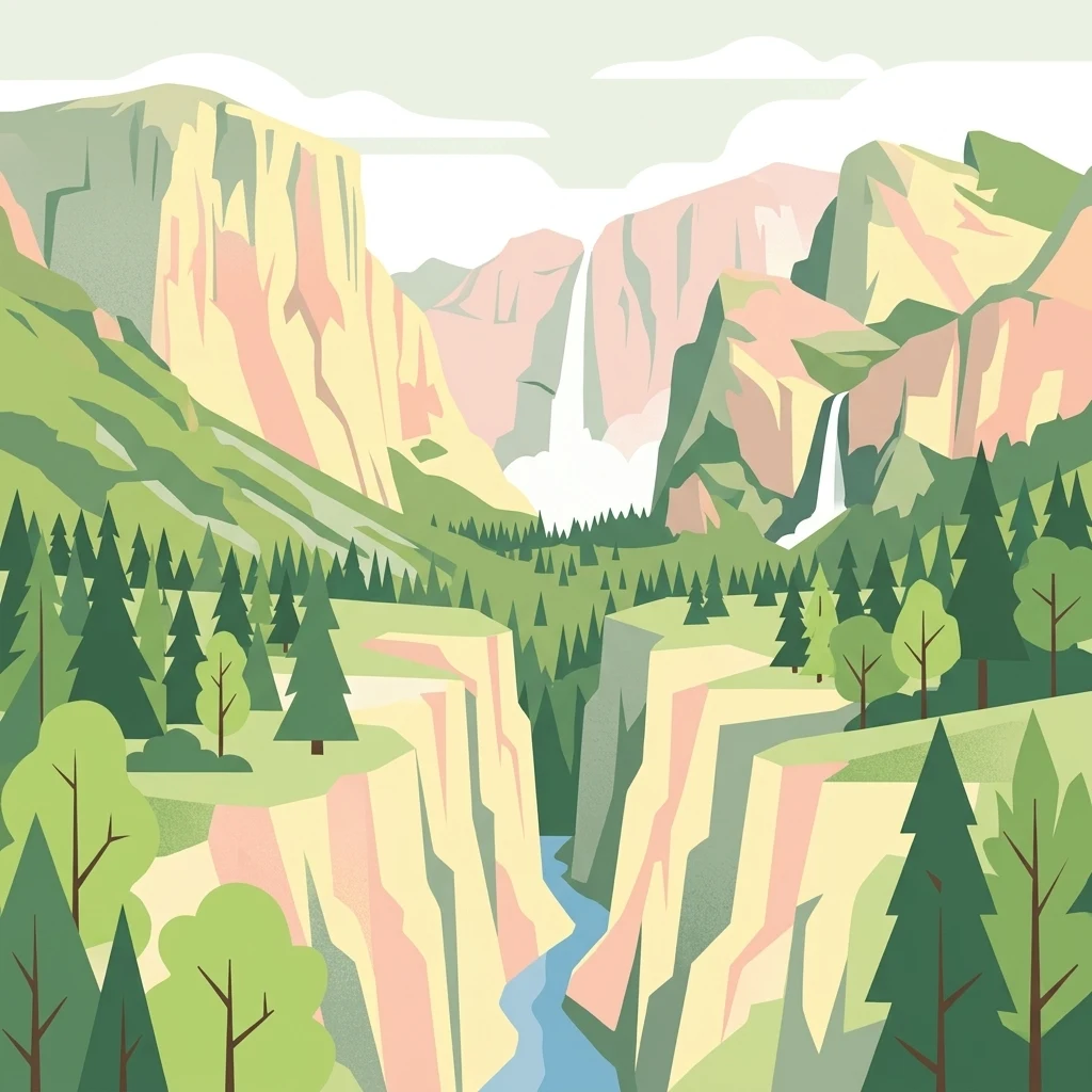
A graphic illustration of a deep river canyon featuring steep cliffs, evergreen trees, and two prominent waterfalls in the distance.

Cijevna

Protected area

Park overview

Structured park overview, official facts, and landscape profile for Cijevna

Cijevna park facts, protected area profile, and essential visitor context

Review the core facts for Cijevna, including designation, size, terrain, visitor scale, habitats, and operating context in one park-focused overview.

About Cijevna

The Cijevna, known in Albanian as Cem or Cemi and rendered in Cyrillic as Цијевна, is a transboundary river of regional significance in the western Balkans. It begins as a collection of alpine brooks in the mountains near the Qafa e Bordolecit pass, in the far north of Albania, and travels roughly 62 km before joining the Morača just south of Podgorica. The Morača continues toward the Buna and the Adriatic, making the Cijevna part of the broader Adriatic drainage via Lake Skadar.

The river's defining geographic role is to thread the northwestern edge of the Albanian Alps, sometimes called the Prokletije. From its headwaters the Cijevna cuts westward and then southwestward, digging a deeply incised V-shaped valley into the Malësia e Madhe highlands. Despite the rugged terrain, the valley floor has long supported small settlements such as Selca, Tamara, Grabon, Broja, Dobrenja, and Gropat e Selcës, with side-valley villages like Kozhnja, Vukël, and Nikç tucked into tributary ravines. The river corridor essentially forms the only continuous travel artery through this part of the Albanian mountains, shaping both settlement patterns and access for the communities that live there.

About 26.5 km from its source the river crosses into Montenegro, still confined within a steep canyon. This border-zone gorge gained renewed accessibility with a border crossing and connecting roads opened in 2021, but its principal modern significance is ecological rather than infrastructural. The canyon is widely considered an important refuge for rare plants, endemic species, and a diverse bird community, and it is formally protected under the Bern Convention. After leaving the mountains near Tuzi, the river crosses the Zeta plain south of Podgorica before delivering its water to the Morača.

Ecologically, Cijevna supports a freshwater community that includes around 22 fish species, with salmonids, eel, and the regional endemic Strömer (Leuciscus souffia montenegrinus) among the most notable. Amphibians and reptiles also inhabit the corridor. While the Albanian reaches of the river remain in relatively healthy condition, the lower sections in Montenegro face pressure from gravel and sand extraction, waste, and wastewater, alongside small hydropower developments and irrigation diversions that have long shaped, and increasingly alter, the river system.

Quick facts and research context for Cijevna

The Cijevna originates in northern Albania near Berizhdol, in the Malësia e Madhe region, at approximately 1,250 to 1,500 meters elevation. It crosses into Montenegro after roughly 26.5 km, flows past Tuzi, traverses the Zeta plain south of Podgorica, and empties into the Morača, which carries its water onward to Lake Skadar and the Adriatic.

The drainage basin covers around 368 km², of which about 238 km² lies in Albania. The river is approximately 62.2 km long and carries an average discharge near 24.86 m³/s, peaking after autumn rains in December and during spring snowmelt in April. The canyon section around the Albanian-Montenegrin border is a Bern Convention protected area and is notable for endemic flora, rare fauna, and a diverse bird community.

Protection and recognition

Examine official designation records and cross-border conservation geography.

Cijevna Protection Status and Transboundary Protected Area Recognition

Cijevna holds documented transboundary protected area characteristics within its regional geography. Official conservation records outline international recognition status, management scope, and regulatory frameworks.

Protection details

Transboundary protection
Yes
Park context

Deeper park guide and search-rich context for Cijevna

Cijevna history, landscape, wildlife, and travel context

Explore Cijevna through its history, landscape character, ecosystems, wildlife, conservation priorities, cultural context, and seasonal travel timing in a structured park guide built for atlas discovery and search intent.

Why Cijevna stands out

Cijevna is best known for the deeply cut, V-shaped gorge it carves through the northwestern Albanian Alps, and for the remote Malësia e Madhe highlands, where the river valley remains the only through-route connecting scattered mountain villages. The transboundary canyon near the Albanian-Montenegrin border stands out for its concentration of rare and endemic species, which led to its recognition under the Bern Convention. The river is also recognized for its hydrological character: a relatively short but steep, snow- and rainfall-fed mountain stream with strong seasonal pulses, a notable discharges, and a basin that bridges two countries and two distinct highland and lowland environments.
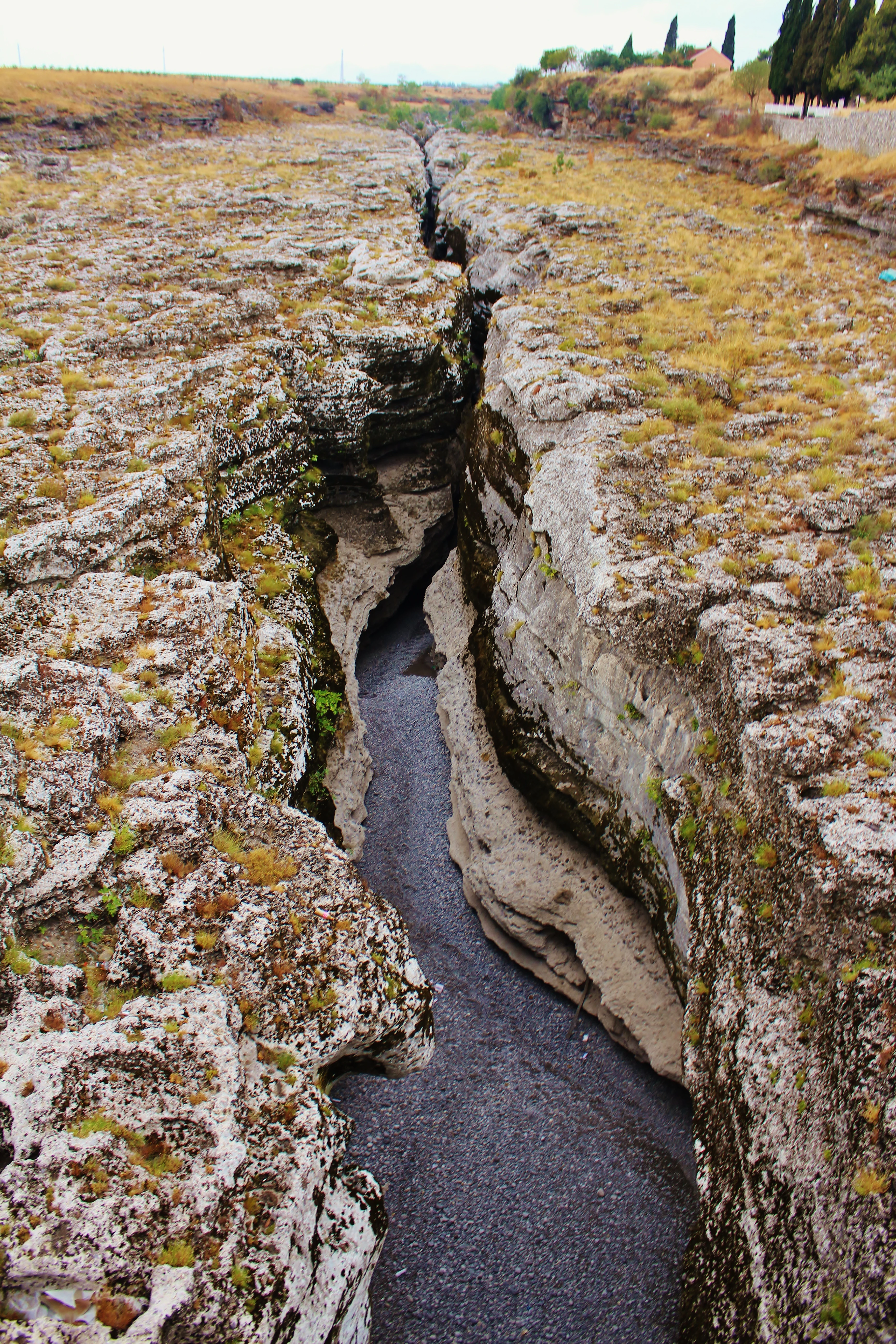
A deep, narrow limestone canyon cut by the Cijevna River, with rough, weathered rock walls and sparse vegetation on the dry terrain above.
A narrow section of the Cijevna River canyon, showing the carved limestone rock formations.

Cijevna history and protected-area timeline

The Cijevna itself is a natural feature rather than a constructed landscape, and its written history is less a chronology of infrastructure than a record of how communities, borders, and conservation frameworks have engaged with the river over time.

Human presence in the Cijevna valley is long-standing, shaped by the fact that the deeply cut gorge forms the only viable travel corridor through the northwestern Albanian Alps. Villages such as Selca, Tamara, Grabon, Broja, Dobrenja, Gropat e Selcës, Kozhnja, Vukël, and Nikç grew along the river and its tributaries, with life organized around the valley floor and the seasonal behavior of the stream.

The most meaningful modern development for the river's protected status came with its recognition as a refuge for rare and endemic species, including important bird habitat, leading to its designation under the Bern Convention. More recently, the opening of a border crossing and connecting roads in 2021 at the Albanian-Montenegrin border section of the gorge changed the practical accessibility of the valley, linking communities and reshaping how visitors and researchers experience the canyon.

Cijevna landscape and geographic character

The Cijevna's landscape is dominated by the rugged northwestern ramparts of the Albanian Alps. From its headwaters near the Qafa e Bordolecit pass, the river drops almost continuously, carving a narrow V-shaped valley into the Malësia e Madhe highlands. The terrain alternates between tight gorges with near-vertical rock walls and broader stretches where the valley floor widens enough to accommodate villages and small agricultural flats.

Long sections of the river run through canyons, including the striking gorge near Tamara in the upper catchment and the deep canyon that marks the Albanian-Montenegrin border. Above the village of Nikç, the upper Cem i Vuklit side valley forms a dramatic dry rock basin framed by steep cliffs, with permanent water appearing only lower down near Vukël, where a major resurgent spring feeds the channel. Many of the right-hand tributaries carry water year-round, contrasting with the seasonal flows further upstream.

After the border crossing, the mountains gradually descend as the river approaches the lowlands around Tuzi and enters the flat Zeta plain south of Podgorica. This transition from alpine gorge to broad alluvial plain gives the river a striking two-part landscape character: a wild, confined upper course in the high mountains, and a gentler, more populated lower course as it reaches the Morača.
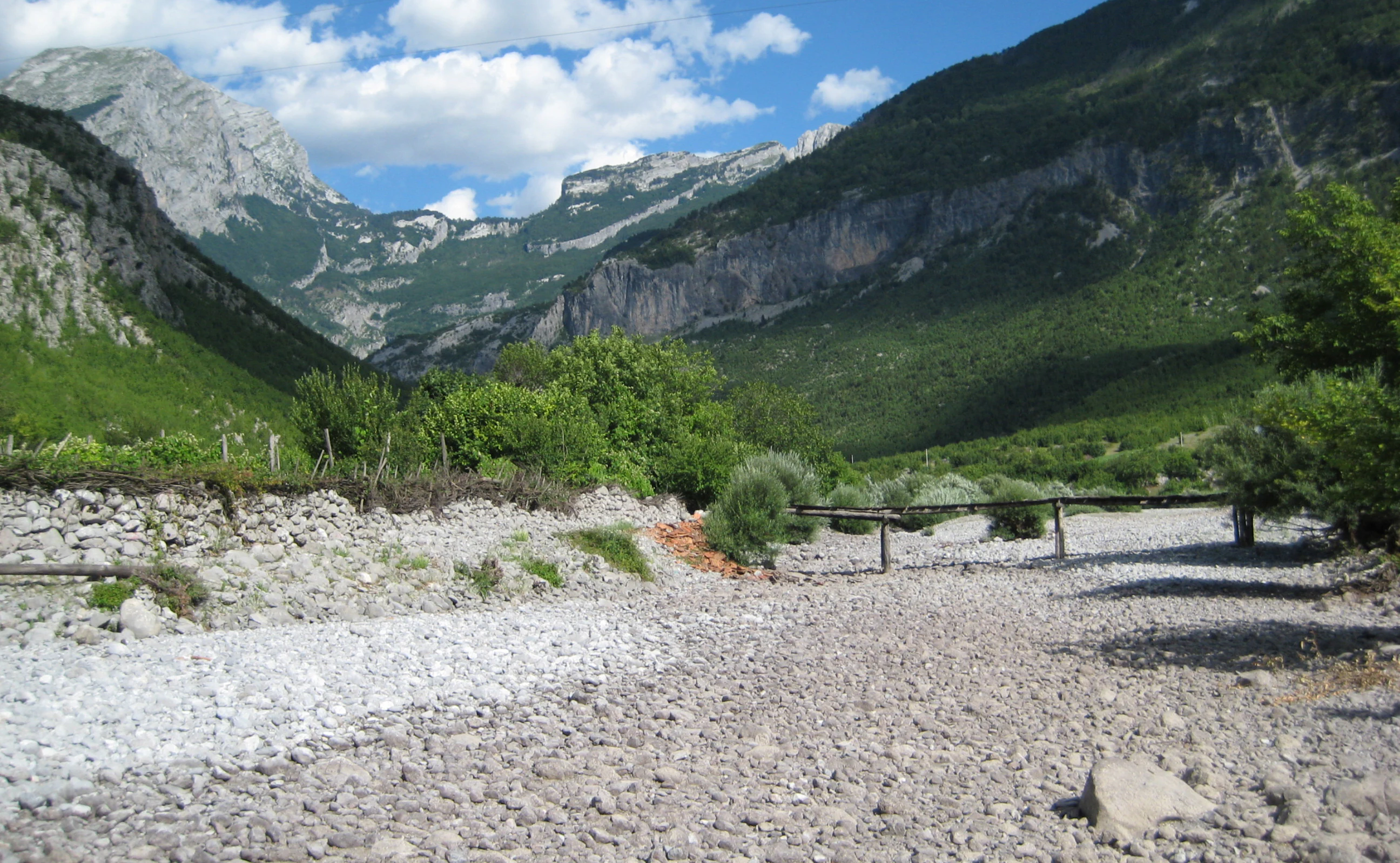
A wide, dry, rocky riverbed stretches toward a lush green mountain valley under a blue sky with scattered clouds.
The rocky, dried riverbed of the Cijevna in the Prokletije mountains.

Cijevna ecosystems, habitats, and plant life

Ecologically, the Cijevna basin spans two distinct worlds: the alpine and sub-alpine environments of the Prokletije foothills and the warm lowland stretches near Podgorica. Its canyon vegetation reflects the surrounding elevation gradient, ranging from montane forests near the headwaters to Mediterranean-influenced scrub as the river descends.

The border-zone gorge is the ecological heart of the system. Because the canyon is physically difficult to access, it has acted as a natural refuge for plant and animal species that struggle elsewhere. Endemic plant species are present, alongside rare faunal elements and important populations of birds associated with cliff and river habitats. The system is protected as a Bern Convention site, acknowledging both its habitat integrity and its role in supporting threatened species.

On the water itself, the river hosts roughly 22 fish species, a notable figure for a relatively short sub-region, including salmonids in colder upper stretches, eel, and the regionally endemic Strömer (Leuciscus souffia montenegrinus). Amphibians and reptiles also occur in and along the channel, completing a freshwater and riparian community shaped by the river's strong seasonal flow regime and largely unmodified upper catchment.

Cijevna wildlife and species highlights

The wildlife profile of the Cijevna is dominated by the canyon zone near the Albanian-Montenegrin border, which functions as an important refuge for rare plants, endemic animals, and a notable bird community. The combination of steep cliffs, relatively undisturbed riparian habitat, and limited human access makes this section disproportionately valuable for biodiversity.

In the water, the river supports a freshwater fauna of roughly 22 fish species. Salmonids occupy the colder upper reaches, while eel and the endemic Strömer (Leuciscus souffia montenegrinus) range through the system. Amphibians are present in suitable pools and side channels, and reptiles occur along the warmer, more open lower stretches. Small trout aquaculture operations also reflect the suitability of the river's water quality and temperature profile in parts of the basin.

Birdlife is among the most frequently cited values of the canyon. Site descriptions emphasize the gorge as an important area for birds, including cliff- and river-associated species, contributing to the rationale for its recognition under the Bern Convention as a refuge for rare and threatened species.

Cijevna conservation status and protection priorities

Conservation significance along the Cijevna centers on the river's transboundary canyon, where steep terrain, limited access, and intact riparian habitat combine to create a refuge ecosystem. The area is recognized under the Bern Convention as a protected site, acknowledging its importance for rare plants, endemic species, and vulnerable wildlife, particularly birds.

In the Albanian upper reaches, ecological conditions remain comparatively healthy, in part because of low settlement density and limited industrial activity. Trout aquaculture and small-scale irrigation continue in the basin, and limited hydropower development has occurred, with additional projects proposed. These uses sit alongside the river's conservation role and shape how the upper catchment is managed.

Along the lower reaches in Montenegro, the conservation picture is more mixed. Gravel and sand extraction in the riverbed, along with waste and wastewater pressures, threaten aquatic habitats, riparian vegetation, and the freshwater community. These pressures sit in tension with the river's formal protected status and underline the practical challenge of conserving a transboundary watercourse whose ecological condition varies sharply along its length.

Cijevna cultural meaning and human context

The Cijevna valley is a long-standing cultural corridor through the northwestern Albanian Alps, where the deeply cut gorge has served as the principal route connecting scattered mountain communities. Villages such as Selca, Tamara, Grabon, Broja, Dobrenja, and Gropat e Selcës line the main valley, while side-valley settlements such as Kozhnja, Vukël, and Nikç are tucked into tributary ravines. This settlement pattern reflects, and depends on, the river's role as the only continuous access line through an otherwise formidable mountain landscape.

The dual naming of the river (Cem or Cemi in Albanian, Cijevna in Serbo-Croatian, rendered as Цијевна in Cyrillic) reflects the transboundary reality of the watercourse: the same river flows through both Albanian-speaking highlands and Montenegrin lowlands, with distinct local naming for individual sections such as Cem i Selcës for the upper course and Cem i Vuklit or Cem i Nikçit for the principal tributary. Practical connectivity between the two countries strengthened in 2021 with the opening of a border crossing through the canyon, opening new possibilities for cross-border movement and regional cooperation.

Top sights and standout views in Cijevna

The Cijevna's standout features cluster around a few key points of distinction. The deeply cut V-shaped valley running through the Malësia e Madhe gives the river a dramatic visual and structural identity, with canyon sections near Tamara and at the border representing the most striking segments. The border-zone canyon stands out ecologically, combining rare plants, endemic species, and important birdlife, and is protected under the Bern Convention.

The river's seasonal flow regime is itself a distinguishing feature: a relatively short, steep mountain stream whose discharges pulse with winter rains in December and spring snowmelt in April. Its freshwater fauna, including around 22 fish species, salmonids, eel, and the regionally endemic Strömer, adds further identity. The combination of a transboundary basin of roughly 368 km², its position between the Prokletije highlands and the Zeta plain, and the recent 2021 opening of a border crossing through the canyon give the river a profile that is simultaneously remote, ecologically significant, and regionally connective.

Best time to visit Cijevna

The character of a visit to the Cijevna is strongly shaped by its seasonal rhythm. The river runs highest after the first major autumn rains in December and again in April during the spring snowmelt in the Albanian Alps, when gorges can be especially dramatic and fast-flowing but also more difficult to access safely.

Late spring and early autumn tend to offer the most balanced conditions for experiencing the valley, combining moderate water levels with settled weather and good visibility for appreciating the gorge scenery and the birdlife along the canyon. Winter brings snow to the upper basin and atmospheric conditions across the highland villages, while summer is typically the driest and most reliably accessible period in the lower reaches, though upper tributaries may carry less water and some seasonal springs can be reduced.
Monthly climate preview

Long-term representative measurements detailing annual temperature ranges and precipitation rhythm

Cijevna Climate Normals, Average Temperature and Monthly Precipitation Patterns

Representative coordinates for Cijevna record sustained temperature variations alongside measured monthly precipitation levels across the twelve-month cycle. Accessing the complete monthly climate profile reveals granular averages for evaluating long-term environmental patterns.
Annual mean10 °C
0 °C21 °C
Jan
Feb
Mar
Apr
May13°
Jun17°
Jul20°
Aug21°
Sep15°
Oct11°
Nov
Dec
Warmest month
August

21 °C

Coolest month
January

-0.5 °C

Wettest month
November

6.2 mm/day

Driest month
July

1.4 mm/day

Park location guide

Geography guide, regional context, and park location map for Cijevna

Cijevna park geography, regions, and map view in Montenegro

Understand where Cijevna sits in Montenegro through a broader geographic reading of the surrounding landscape, nearby location context, and its mapped position within the national park landscape.

How Cijevna fits into Montenegro

Montenegro is a unitary parliamentary republic in Southeast Europe on the Balkan Peninsula. With a population of approximately 623,000 and an area of 13,883 km², it borders five countries and has a coastline on the Adriatic Sea. The capital and largest city is Podgorica, while Cetinje serves as the old royal capital. The country declared independence in 2006 following the breakup of Serbia and Montenegro.

Wider geography shaping Cijevna in Montenegro

Montenegro is located on the Balkan Peninsula in Southeast Europe. It is bordered by Serbia to the northeast, Bosnia and Herzegovina to the northwest, Kosovo to the east, Albania to the southeast, and Croatia to the west. The country has a coastline along the Adriatic Sea to the southwest. The terrain is predominantly mountainous, with the Dinaric Alps running through the country.

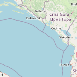
Map view of Cijevna

Use this park location map to pinpoint Cijevna in Montenegro, understand its exact geographic position, and read its mapped placement within the surrounding landscape more clearly.

Pigeon | © OpenStreetMap contributors

Explore protected area views, rugged river canyons, and highland terrain photography.

Cijevna Photos and Landscape Scenery: Visualizing the Alpine Gorge

Visual records capture the dramatic V-shaped gorges and alpine ramparts defining the Cijevna river basin across mountain borders. Examining these field photographs reveals the rugged terrain, steep rock walls, and protected habitats shaping the regional landscape.

A deep, narrow limestone canyon cut by the Cijevna River, with rough, weathered rock walls and sparse vegetation on the dry terrain above.

An aerial view from an airplane window looking down at the Cem Valley, showing a deep river canyon winding through mountainous terrain with snowy peaks in the distance.

A wide, dry, rocky riverbed stretches toward a lush green mountain valley under a blue sky with scattered clouds.

Park atlas

Compare adjacent highland river basins and connected mountain landscapes.

Other Parks Near Cijevna and Protected Areas in the Surrounding Region

Browsing other parks near Cijevna reveals shared alpine terrain and connected transboundary river systems across the highlands. Examining these adjacent protected areas provides wider geographic context for regional conservation corridors and mountain geography.
Watercolor painting of a lake landscape with green marshes in the foreground, small islands in the middle, and rolling hills in the background.
National parkMontenegro
About 23 km away#1 closest

Southeast

Lake Skadar National Park: An Atlas Overview of Montenegro's Largest Freshwater Wetland

Karst Terrain and Transboundary Protected Landscapes

Lake Skadar stands as a monumental geographic feature in Montenegro, serving as the largest lake in Southern Europe. This national park protects a diverse ecosystem ranging from submerged karst springs to expansive seasonal marshes. Its status as a transboundary system offers insights into Mediterranean hydrology and endemic freshwater biodiversity within the unique Balkan karst basin.

Area
450 km²
Established
1983
Relief
Lowland
Climate
Mediterranean
Watercolor painting showing a mountainous landscape with a lake, green hills, and pink flowers
National parkAlbania
About 26 km away#2 closest

East

Alps of Albania National Park: Explore Albania's Largest Protected Alpine Wilderness

Dramatic karst, glacial valleys, and high-altitude ecosystems await.

The Alps of Albania National Park offers an expansive view into one of the Balkans' most significant mountain protected areas. This national park encompasses a spectacular landscape characterized by towering limestone peaks, deep glacial valleys carved over millennia, and intricate karst formations like Grunas Canyon. Its pristine wilderness protects diverse high-altitude ecosystems and unique geological features, serving as a key destination for understanding regional geography and protected landscapes.

Area
828.447 km²
Established
2022
IUCN
II
Relief
Mountain
National parkMontenegro
About 31 km away#3 closest

West

Lovćen National Park: Karst Mountain Geography and Protected Landscapes in Montenegro

Dinaric Alps limestone terrain and historic mountain heritage

Spanning from 400 to 1,749 meters, Lovćen National Park protects the symbolic limestone massifs of southwestern Montenegro. The terrain is defined by complex karst formations, deep gorges, and distinct ecological zones, forming a critical observation point across the rugged Dinaric mountain interior.

IUCN
II
Scope
Terrestrial
Water
No major water
National parkMontenegro
About 32 km away#4 closest

West

Lovćen National Park: Karst Geography and Protected Mountain Landscapes in Montenegro

Dinaric massif rising above the Adriatic coastal basin.

Lovćen National Park encompasses a dense, rocky landscape of limestone and dolomite in southwestern Montenegro. Known as the namesake for the country itself, the massif creates a sharp geographic boundary between the Adriatic Sea and the inland highlands. The area offers a profound look at Dinaric karst features, including dramatic cliffs and endemic botanical habitats, preserved within a culturally rich mountain setting.

Area
62.2 km²
Established
1952
Relief
Mountain
Climate
Mediterranean
A watercolor painting showing a panoramic view of green rolling hills and a body of water under a soft, light sky.
Nature reserveShkodër District
About 39 km away#5 closest

Southeast

Lake Shkodër Nature Reserve: Mapping Protected Wetland and Riverine Geography in Albania

A critical Balkan freshwater protected area.

The Lake Shkodër Nature Reserve serves as a foundational protected landscape in northern Albania, encompassing the extensive shoreline and riverine floodplains of Lake Skadar. This geographic entity showcases a transition from fertile lowlands to mountainous ridges, offering a detailed look at how hydrologic processes and alpine proximity define Balkan wetland habitats.

Area
265.35 km²
Established
2005
IUCN
IV
Relief
Lowland
Watercolor painting of a wide wetland area with distant purple mountains, green grassy banks, and water channels.
Protected landscapeUlcinj
About 48 km away#6 closest

South

Saline Ulcinj: Coastal Wetland Geography and Protected Landscape Mapping

A large-scale saline nature park near Ulcinj in southern Montenegro.

Saline Ulcinj represents a significant coastal wetland complex nestled in the Buna delta. This protected landscape is defined by its unusual industrial history and modern transition into a vital nature reserve, characterized by expansive saline pools and shallow mudflats. Its geographic footprint offers a clear look at how coastal water management shapes the surrounding terrain and provides essential stopover habitats for Adriatic migratory birds.

Area
15 km²
Established
2019
Relief
Lowland
Water
Water-dominated
A horizontal watercolor painting of a serene river landscape with green trees on both banks and small boats floating on the water at sunset.
Protected landscapeShkodër County
About 51 km away#7 closest

Southeast

Buna River-Velipojë Protected Landscape: Albania Coastal and Wetland Geography

Mapped protected landscape in Shkodër County

The Buna River-Velipojë Protected Landscape encompasses the crucial junction of riverine systems and the Adriatic Sea. This protected area features a mosaic of marshes, lagoons, and alluvial forests that form a significant migratory corridor in northwestern Albania.

Area
230.27 km²
Established
2005
IUCN
V
Relief
Lowland
A watercolor illustration of a soft mountain range landscape with pine trees in the foreground against a white background.
Protected areaAlbania
About 51 km away#8 closest

East

Accursed Mountains: Geographic Analysis of Albania High Alpine Protected Terrain

Rugged karstic relief and glacial mountain landscapes.

Discover the Accursed Mountains, a formidable high-mountain range in northern Albania known for its sheer limestone cliffs and profound glacial sculpting. This protected area provides a critical habitat for relict flora and fauna while maintaining one of the most intense relief profiles in the Balkans. Examine the mapped canyons, alpine cirques, and jagged ridges that shape this landmark range.

Relief
Mountain
Climate
Alpine
Access
Moderate access
Scope
Terrestrial

Common questions about visiting, size, designation, and location context for Cijevna

Cijevna FAQs for park facts, access, geography, and protected area context

Find quick answers about Cijevna, including protected-area facts, park geography, trail and visitor context, and how the park fits into its surrounding country and regional landscape.
MoriAtlas Explorer

Continue Your Protected Areas Search Across the Global Atlas

Deepen your exploration by continuing the structured search for national parks and protected areas worldwide. Utilize the comprehensive filtering capabilities to compare different conservation landscapes and refine your understanding of global park geography. Discover more about the distribution and characteristics of protected natural areas.

Global natural geography