
Lakes
Park geography
Detailed spatial analysis of coastal terrain, protected boundaries, and habitat features.
Comprehensive Geographic Profile and Mapped Boundaries of Coffin Bay National Park
Examine the physical geography and structured boundary data of Coffin Bay National Park, located in South Australia. This profile covers the park’s total area of 309.76 square kilometers and its extensive coastal features, including beaches, dunes, and significant wetlands. Analyze the mapped terrain and environmental classifications that define this coastal region.
Related tags
Coastal national parksLimestone cliffsWetland habitatsBirdwatchingSouth Australian parks
Limestone cliffs and coastal dunes on the Eyre Peninsula
Coffin Bay National Park
Coffin Bay National Park is a protected coastal landscape on the Eyre Peninsula of South Australia, occupying the long peninsula that frames the sheltered waters of Coffin Bay itself. The park lies approximately 301 kilometres west of Adelaide and 46 kilometres west of Port Lincoln, making it one of the more remote coastal protected areas in the state. The landscape is defined by a striking combination of white sand beaches, limestone cliffs, coastal dune systems, and extensive wetlands that support remarkable biodiversity. The park's coastline faces outward toward islands and reef systems in the Southern Ocean, creating a dramatic interface between land and sea. This coastal peninsula environment is relatively rare in South Australia's protected area network, making Coffin Bay a significant representative of the region's maritime and dune ecosystems.
- Location
- Australia
- Park type
- National park
- Established
- 1982
- Area
- 309.8 km²
Location overview
Administrative boundaries and coastal marine status in Australia
Geographic Setting of Coffin Bay National Park in South Australia
Coffin Bay National Park is located within the state of South Australia. Protected regional status encompasses both coastal zones and marine environments under a single national jurisdiction.
- Countries
- Australia
- Regions
- South Australia
- Primary location
- South Australia
- Geographic setting
- Coastal · Marine
Boundary and coordinates
Map coordinate limits, regional span, and the 309.76 square kilometer area
Mapping the Boundaries and Geographic Extent of Coffin Bay National Park
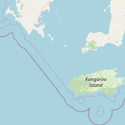
Interactive spatial outlines display the physical extent and regional shape of Coffin Bay National Park. Accompanying data lists the estimated area of 309.76 square kilometers alongside center points and span limits.
- Boundary area
- 308.6 km²
- Boundary perimeter
- 194.7 km
- Northernmost point
- 34.4285° S
- Southernmost point
- 34.7321° S
- Easternmost point
- 135.5374° E
- Westernmost point
- 135.1087° E
- Geographic centre
- 34.6003° S, 135.3301° E
- North–south span
- 33.7 km
- East–west span
- 39.3 km
Terrain and natural features
Recorded coastal capes, beaches, lakes, and viewpoints across the landscape
Coffin Bay National Park Terrain and Named Natural Features
Stored terrain classifications identify lowland regional relief alongside recorded capes, beaches, and lakes located within the boundary. Linked feature cards supply names, categories, and spatial relationships for each recorded natural landmark.
Selected named natural features
Capes
Point Whidbey
Beaches
Seven Mile Beach
Lakes
Lake Damascus
Viewpoints
Point Avoid Lookout
Capes
Point Sir Isaac
Environmental setting
Mediterranean climate zones, lowland relief, and coastal marine habitats
Coffin Bay National Park Environmental Classification and Physical Setting
Recorded classifications frame the physical setting across coastal waters, dune systems, and lowland shrublands. Connected categories link directly to related protected areas within the broader atlas database.
- Relief
- Lowland
- Climate
- Mediterranean
- Water
- Major water bodies
- Forest cover
- No forest cover
Landscape features
Cliffs · Wetland · Coast · Beach · Dunes · Islands · Reefs
Habitat types
Shrubland · Wetland · Coastal habitat · Marine habitat · Dune habitat
Park atlas
Browse adjacent protected landscapes and trace the unique peninsula geography across Eyre Peninsula
Explore More Parks Near Coffin Bay National Park, Discover South Australia's Coastal Protected Areas
Continue exploring from Coffin Bay National Park by browsing other protected areas, identifying diverse coastal landscapes, and tracing the regional geography across the Eyre Peninsula. Compare these national parks and reserves to understand the broader conservation network and how varied ecosystems are preserved throughout South Australia's maritime region.
National parkSouth Australia
22 km away#1 closest
Southeast

Lincoln National Park National Park: Mapped Protected Area and Geographic Landscape Identity
South Australia's protected landscape with detailed park boundaries.
Gain a comprehensive atlas perspective on Lincoln National Park, a designated national park in South Australia. This resource details the park's mapped boundaries, offering clear geographic context and highlighting its role as a protected landscape. Understand its place within the regional geography of South Australia, providing essential data for landscape exploration and atlas-based research.
- Area
- 216.38 km²
- Established
- 1941
- IUCN
- II
- Relief
- Upland
Wildlife reserveSouth Australia
26 km away#2 closest
East
Kathai Conservation Park: Protected Wildlife Reserve on the Eyre Peninsula
Mapping the Uley catchment basin and mallee forest terrain
Kathai Conservation Park serves as a crucial protected landscape in South Australia, anchored by the prominent Northside Hill. The reserve maintains critical habitat for coastal white mallee and rare vegetation within the wider Uley catchment basin, showcasing how small protected areas sustain regional ecological diversity.
- Area
- 0.81 km²
- Established
- 1985
- IUCN
- III
- Relief
- Upland
Nature reserveSouth Australia
28 km away#3 closest
West
Greenly Island Conservation Park: Geography and Protected Nature Reserve Map
Island protected area off the South Australian Eyre Peninsula.
This offshore nature reserve preserves an exposed, rocky island environment in the Southern Ocean. As a protected area for marine mammal haul-out sites, it provides a unique look at isolated coastal terrain and strict conservation management along the western shoreline of South Australia.
- Area
- 1.68 km²
- Established
- 1967
- IUCN
- Ia
- Relief
- Lowland
Nature reserveSouth Australia
About 54 km away#4 closest
North
Cap Island Conservation Park: Nature Reserve and Offshore Marine Habitat in South Australia
Coastal granite island and protected seabird breeding landscape.
Situated off the coast of the Eyre Peninsula, Cap Island Conservation Park is a protected nature reserve serving as a critical sanctuary for pinnipeds and nesting seabirds. Its unique geological profile, featuring a granite base and calcarenite cap, creates a rugged offshore environment shaped by marine erosion and salt-tolerant vegetation. The reserve highlights the significance of isolated island ecosystems within the broader geography of South Australia.
- Area
- 0.09 km²
- Established
- 1967
- IUCN
- Ia
- Relief
- Lowland
Wildlife reserveSouth Australia
76 km away#5 closest
North
Hincks Conservation Park: Protected Wildlife Reserve in South Australia
Mapping regional biodiversity and conservation landscapes
Hincks Conservation Park functions as a key protected area within the semi-arid coastal hinterland of the Eyre Peninsula. This reserve preserves an essential fragment of native vegetation against a surrounding backdrop of agricultural development. The site highlights the importance of managed land corridors in maintaining ecological connectivity across the central-eastern reaches of South Australia.
- Area
- 8.78 km²
- Established
- 1941
- IUCN
- VI
- Relief
- Lowland
Marine protected areaSouth Australia
About 78 km away#6 closest
Northwest
Western Eyre Marine Park: Geography and Marine Protected Area Atlas of South Australia
Explore offshore continental shelf zones and vast ocean boundaries
Western Eyre Marine Park represents a major commitment to marine conservation in the Great Australian Bight. This detailed atlas entry outlines the park's expansive management zones and its role within the broader South-West Marine Park Network. Observe the offshore terrain of the southern Australian continental shelf and the structural importance of this remote, cool-water oceanic reserve.
- Area
- 57,946 km²
- Established
- 2012
- Relief
- Lowland
- Climate
- Temperate
Wildlife reserveSouth Australia
About 113 km away#7 closest
North
Dakalanta Sanctuary: A Private Wildlife Reserve on the Northern Eyre Peninsula
Mapped regional geography and conservation habitat profiles
Dakalanta Sanctuary provides a significant example of private land conservation in South Australia. Covering 130 square kilometres of low hills and stabilized dunes, this reserve focuses on restoring native vegetation after past pastoral use. The area is vital for safeguarding semi-arid habitats like mallee woodlands, playing an active role in regional biodiversity protection and habitat connectivity.
- Area
- 130 km²
- Established
- 2002
- Relief
- Upland
- Access
- Access unknown
Wildlife reserveSouth Australia
About 126 km away#8 closest
North
Cocata Conservation Park: Eyre Peninsula Protected Wildlife Reserve and Landscape Map
Geographic overview of South Australian conservation lands.
Cocata Conservation Park encompasses a vast semi-arid expanse on the Eyre Peninsula, characterized by gently undulating plains, calcrete-capped terrain, and open salt flats. Gain insights into the physical geography and habitat distribution of this important South Australian wildlife reserve through detailed regional mapping.
- Area
- 167.62 km²
- Established
- 1993
- IUCN
- VI
- Scope
- Terrestrial
MoriAtlas Explorer
Continue Atlas Exploration of Coffin Bay National Park's Geography
Deepen your understanding of Coffin Bay National Park by delving into its specific geographic attributes and protected landscape characteristics. This entry provides a foundation for appreciating the park's mapped boundaries and its place within the regional geography of South Australia. Continue your structured exploration of Australia's national parks and protected areas to build a comprehensive view of natural landscapes.
Browse next
Global natural geography
Explore related park routes
Explore MoriAtlas Global ParksBrowse All MoriAtlas ParksGlobal Park Map DiscoveryMoriAtlas: Browse All CountriesBrowse All MoriAtlas ContinentsNational Park Environment AtlasGrand Canyon National Park AtlasYellowstone National Park AtlasYosemite National Park Atlas and GeographySerengeti National Park AtlasGalápagos National Park Protected LandscapeBanff National Park Geography and AtlasKruger National Park Atlas EntryUluṟu-Kata Tjuṯa National Park AtlasExplore Uluru-Kata Tjuta National Park GeographyPlitvice Lakes National Park AtlasFiordland National Park Protected LandscapeGreat Smoky Mountains National Park AtlasAfghanistan National Parks and Protected AreasAlbania National Parks and Protected AreasAlgeria National Parks and Protected AreasAmerican Samoa National Parks and Protected AreasAndorra National Parks and Protected AreasAngola National Parks and Protected AreasAntarctica National Parks and Protected AreasAntigua and Barbuda Park List