
Mori Atlas logo
National parkComoé National Park

Mapping the riverine forests and seasonal floodplains of this critical Ivory Coast wilderness

Comoé National Park: A Comprehensive Geographic Atlas of West Africa's Largest Protected Savanna

Comoé National Park represents the most significant protected landscape in West Africa, encompassing a vast mosaic of Sudanian savanna, gallery forests, and seasonal floodplains. Located in northeastern Ivory Coast, this park serves as a vital ecological stronghold defined by the meandering Comoé River and the Black Volta border. Detailed geographic analysis reveals a complex terrain where varied habitats intersect to support diverse mammal populations and layered riverine ecosystems.

west-african-savannasudanian-savannagallery-forestriverine-habitatseasonal-floodplainsmammals

Comoé National Park

National park

Park overview

Structured park overview, official facts, and landscape profile for Comoé National Park

Comoé National Park park facts, protected area profile, and essential visitor context

Review the core facts for Comoé National Park, including designation, size, terrain, visitor scale, habitats, and operating context in one park-focused overview.

About Comoé National Park

Comoé National Park protects an enormous tract of the West Sudanian savanna ecoregion in northeastern Côte d'Ivoire, making it the largest natural reserve in West Africa by area. The park takes its name from the Comoé River, which runs through it for roughly 230 km, shaping a varied landscape of gallery forests, floodplains, and broad grassy savannas interspersed with wooded areas. Its western edge meets the Black Volta, the river that separates Côte d'Ivoire from Burkina Faso along that stretch of the border.

The protected area is anchored around the town of Bouna, with the park occupying more than half of the surrounding Bounkani region. The savannas of Comoé host an unusually high concentration of plant and animal species for a West African park, including more than 600 recorded plant species and a mammal list dominated by elephants, hippopotamuses, and a striking variety of antelopes and primates. The river corridors and seasonal wetlands are particularly important for wildlife, and the floods of the Comoé River create natural feeding grounds that concentrate animals across the landscape.

Comoé has played an outsized role in the conservation history of Côte d'Ivoire and the wider region. Inscribed as a UNESCO World Heritage Site and designated a biosphere reserve in 1983, it has stood as a flagship for West African biodiversity for decades. Its inclusion on the List of World Heritage in Danger in 2003 reflected the cumulative impact of poaching, uncontrolled livestock grazing, and weak management during a turbulent period for the country, and its removal from that list in 2017 marked an important recovery moment. Today the park is widely viewed as one of the most important strongholds for savanna and gallery-forest biodiversity in the subregion, and as a test case for managing very large protected areas in West Africa.

Quick facts and research context for Comoé National Park

Comoé National Park lies in northeastern Côte d'Ivoire, spanning parts of the Savanes and Zanzan districts, with the nearby town of Bouna serving as the closest urban reference. The park falls within the West Sudanian savanna ecoregion and is crossed from end to end by the Comoé River, while the Black Volta forms part of its western boundary with Burkina Faso.

Created as a national park by decree in 1968 on the basis of an earlier reserve dating back to 1953, it has been a UNESCO World Heritage Site since 1983 and a biosphere reserve since the same year. It was placed on the List of World Heritage in Danger in 2003 due to poaching, overgrazing, and weak management, a status that was lifted in 2017 following improvements in conservation. It is the largest protected natural reserve in West Africa and counts among the oldest national parks in Côte d'Ivoire.

Protection and recognition

Documented terrestrial protection history and international designation records

Comoé National Park Protection Status and International Recognition Records

Terrestrial protection status and designation history outline the foundational conservation framework established for Comoé National Park since 1983. Official international recognition records highlight verified UNESCO designations associated with the protected area.

International recognition

Protection details

Protection scope
Terrestrial
Designated year
1983
Transboundary protection
No
WDPA ID
7523
Core area
11,491.5 km²
Buffer area
17.4 km²
Park context

Deeper park guide and search-rich context for Comoé National Park

Comoé National Park history, landscape, wildlife, and travel context

Explore Comoé National Park through its history, landscape character, ecosystems, wildlife, conservation priorities, cultural context, and seasonal travel timing in a structured park guide built for atlas discovery and search intent.

Why Comoé National Park stands out

Comoé National Park is best known for being the single largest protected natural reserve in West Africa and for the exceptional ecological richness packed into its Sudanian savanna landscape. It is recognized for the unusually wide range of habitats compressed within one area, from gallery forests along the Comoé River to open wooded savannas and seasonal floodplains. The park is also distinguished by holding all three species of African crocodiles, a thriving hippopotamus population along the Comoé floodplain, and important populations of elephants, antelopes, and primates. Its dual inscription as a UNESCO World Heritage Site and biosphere reserve, combined with its size, gives it an outsized role in West African conservation.
Comoé National Park history and protected-area timeline

The origins of Comoé National Park stretch back to the colonial period, when the French administration first identified the area for protection in 1926. An initial reserve, known as the Bouna Reserve, was formally established in 1953, setting the foundation for what would become one of the largest national parks in West Africa.

In 1968, by decree, the area was redesignated as the Parc national de la Comoé, taking the name of the river that runs through it. The new legal status gave the park an institutional foundation that has lasted to the present, and the Office ivoirien des parcs et des réserves has remained its principal administrator.

International recognition arrived in 1983, when the park was simultaneously inscribed on the UNESCO World Heritage List and designated a UNESCO biosphere reserve. The dual recognition highlighted both the park's exceptional biodiversity and its importance as a reference landscape for the Sudano-Sahelian transition zone.

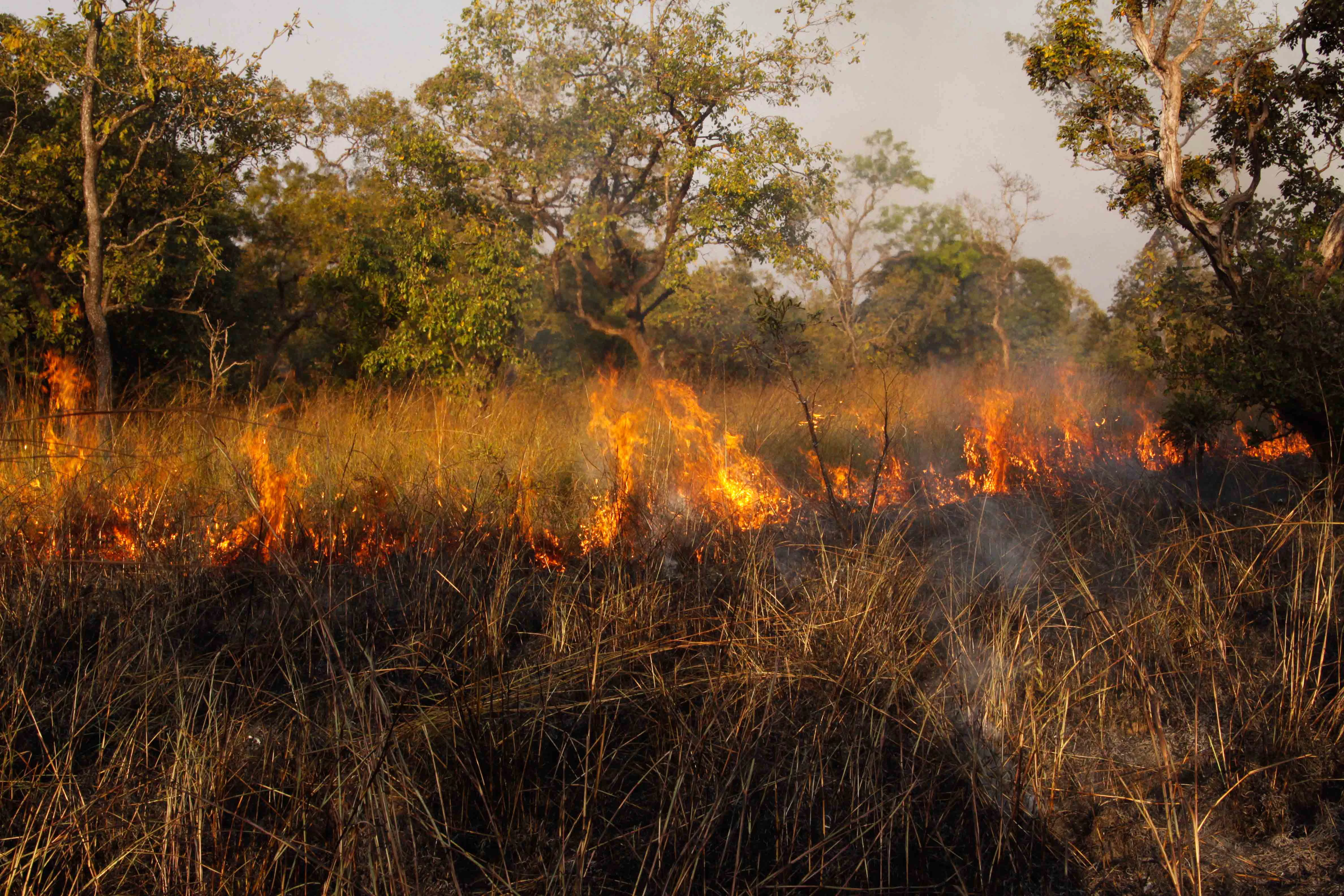
In 2003, however, the park was placed on the List of World Heritage in Danger. Poaching, uncontrolled grazing by livestock from surrounding villages, and a prolonged absence of effective site management had eroded the integrity of the protected area. More than a decade of coordinated conservation effort followed, focused on restoring protection, rebuilding wildlife populations, and re-establishing basic management infrastructure. On 4 July 2017, Comoé was formally removed from the danger list, reflecting significant improvements in the state of the fauna and its habitat.

Comoé National Park landscape and geographic character

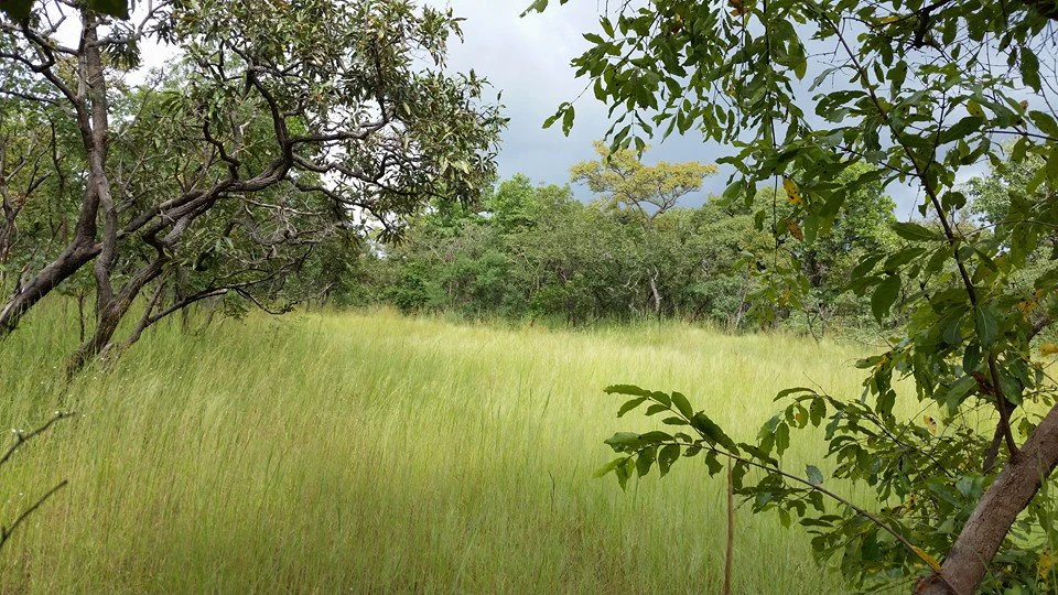
The landscape of Comoé National Park is dominated by West Sudanian savanna, a mosaic of open grasslands, tree-dotted plains, and patches of denser woodland that shifts in character with the seasons. The terrain is broadly flat to gently undulating across much of the park, with the topography shaped more by rivers and seasonal water flows than by dramatic relief.

The Comoé River is the central geographical feature of the park, carving through it for nearly 230 km. Its banks support strips of gallery forest that contrast sharply with the surrounding dry savanna, creating corridors of dense vegetation and shade that attract wildlife from the open plains. Seasonal floodplains form around the river, expanding and contracting with the annual rainfall cycle and producing temporary wetlands rich in grasses and aquatic life.

Along the western edge of the park, the Black Volta adds another major hydrological influence and defines part of the international border with Burkina Faso. The combination of rivers, floodplains, gallery forests, and open savanna creates a layered landscape in which different habitat types lie remarkably close together, an arrangement that has been central to the park's importance for biodiversity.
Comoé National Park ecosystems, habitats, and plant life

Comoé protects one of the most ecologically varied landscapes in the West Sudanian savanna ecoregion. Within its borders, gallery forests along the Comoé River stand alongside wooded savanna, open grasslands, and seasonally inundated floodplains, creating a patchwork of habitats unusually rich for a single protected area in West Africa.

The floristic diversity of the park reflects that habitat variety. Beyond the more typical Sudanian savanna flora, Comoé also harbors elements normally associated with wetter tropical forest further south, a pattern largely enabled by the moisture and soils of the river corridors. Two major rivers passing through the area, the Comoé and the Black Volta, sustain a more humid microclimate than much of the surrounding landscape, supporting denser vegetation and a wider range of plant communities.

The seasonal floodplains of the Comoé River play a special ecological role within the park. As floodwaters rise and fall, they create short-lived but highly productive zones where grasses thrive, water gathers, and animal life concentrates. These flooded areas are central to the annual rhythms of the park's wildlife and act as ecological crossroads between savanna and wetland species.
Comoé National Park wildlife and species highlights

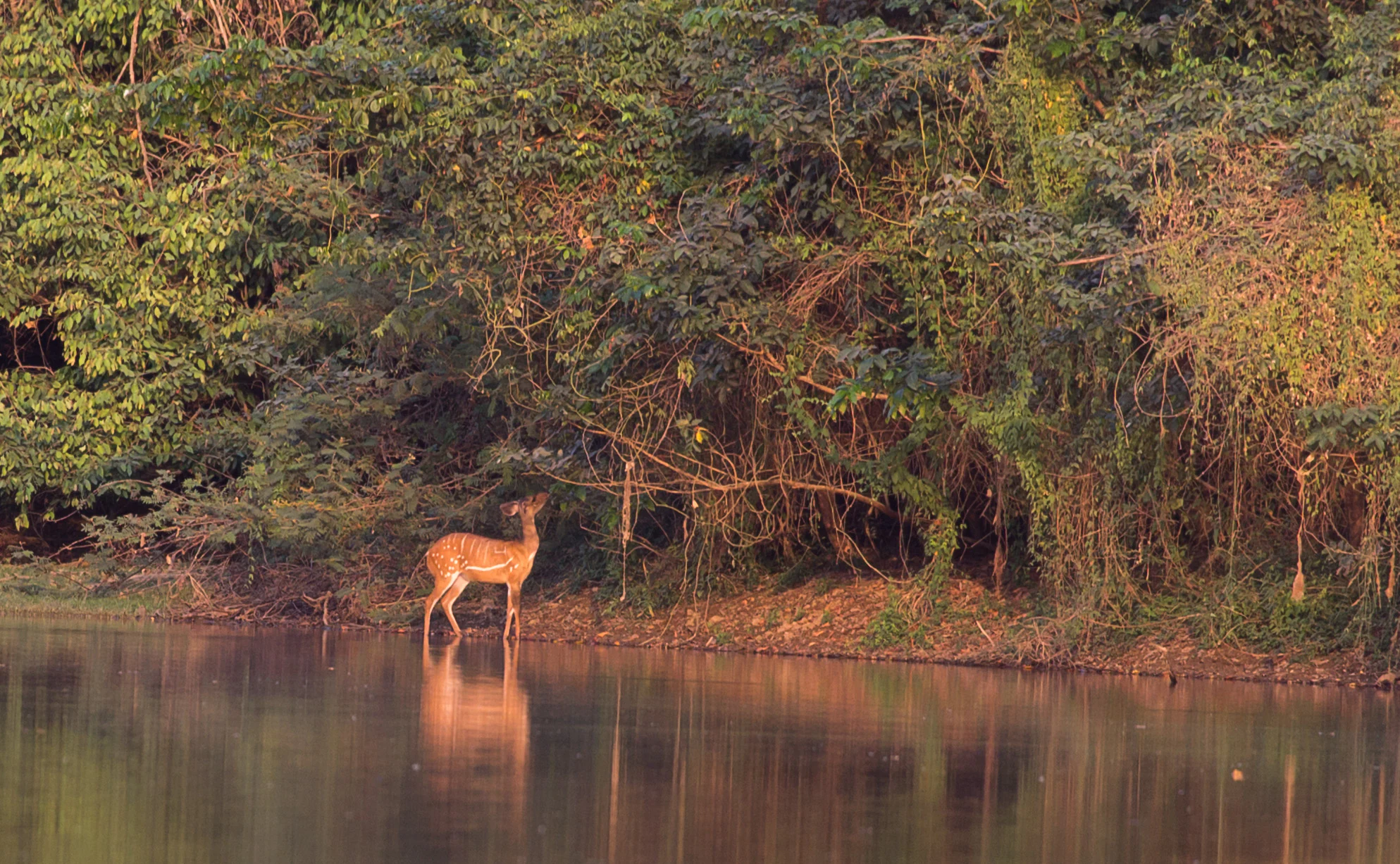
Comoé National Park supports one of the richest concentrations of large mammals in West Africa. Elephants move through the park in significant numbers and have historically been marked for tracking, while hippopotamuses congregate around the seasonal floodplains of the Comoé River, where they find prime feeding conditions during high-water periods.

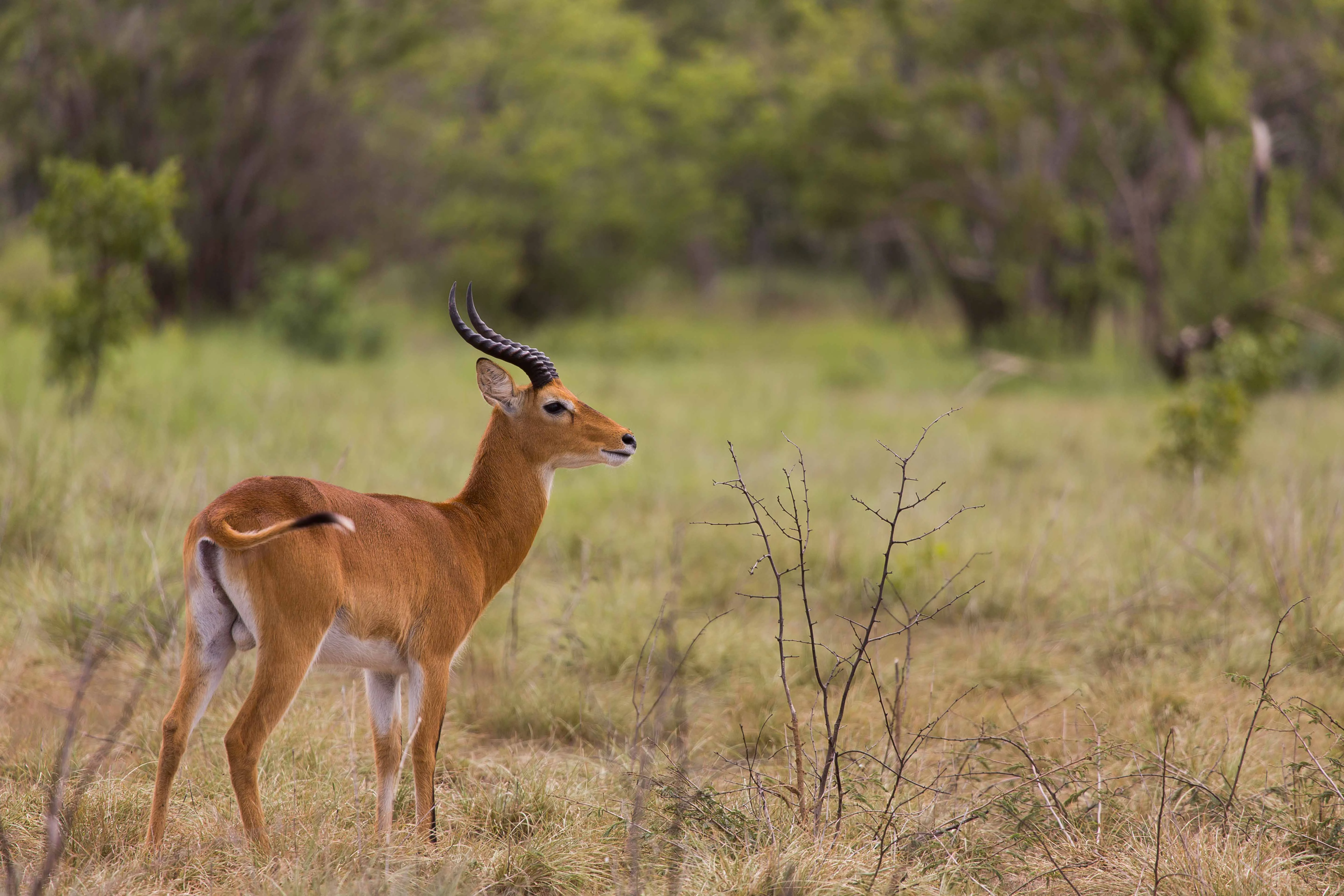
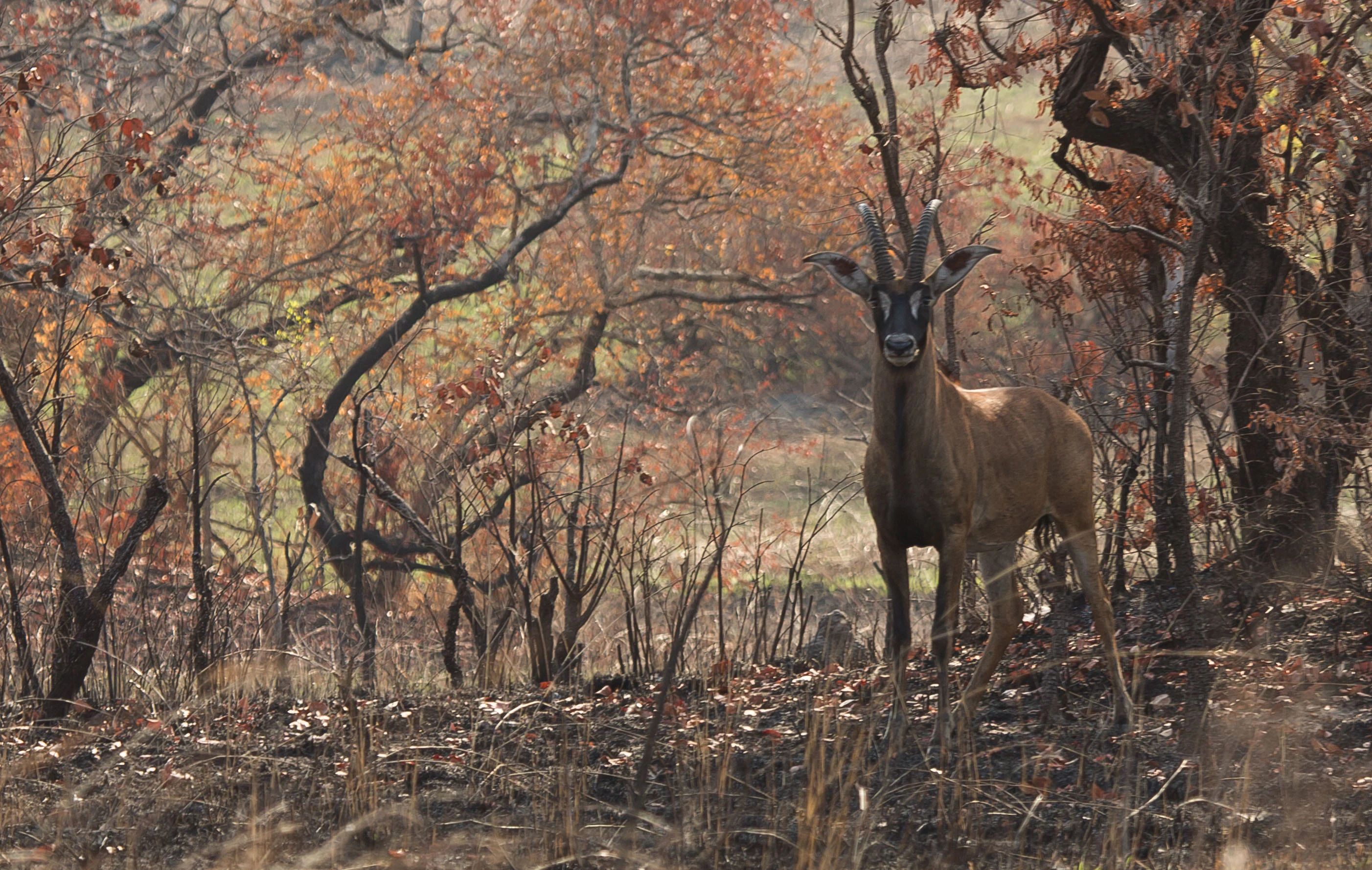
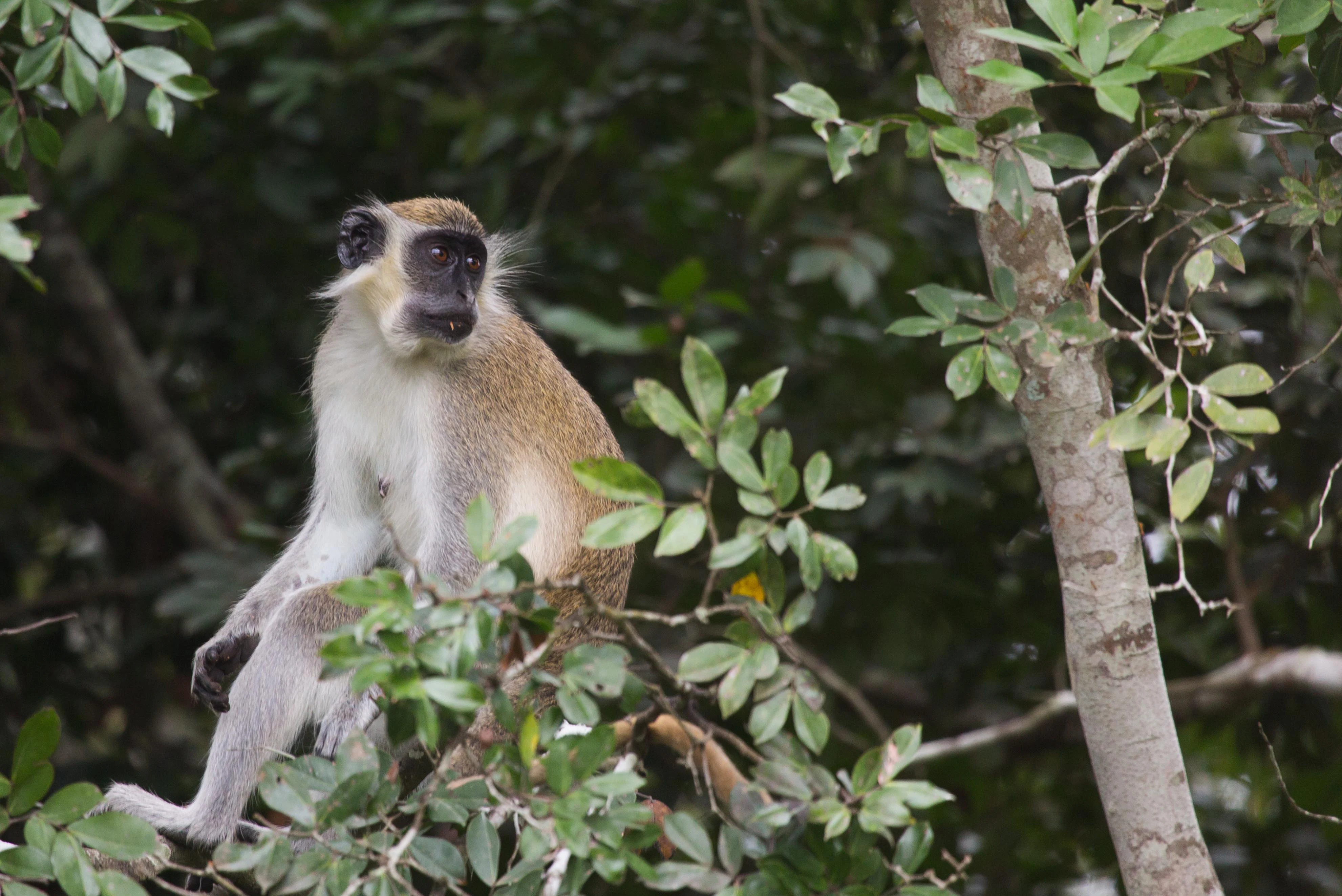
Antelopes are a defining presence across the savanna, with species such as the roan antelope, Buffon's kob, oribi, bubal hartebeest, and various Hippotragus and Kobus species recorded across the grasslands. Primates are likewise diverse, including baboons, patas monkeys, vervet monkeys, and the green monkey seen in gallery-forest settings, plus other monkey and ape species that use the wooded edges.

The park hosts all three crocodile species found in Africa: the Nile crocodile, the African dwarf crocodile, and the slender-snouted crocodile (often referred to as the false gharial). Reptiles more broadly are well represented, and the wetlands support a wide variety of fish and amphibians. Migratory birds use the seasonal wetlands of the Comoé as feeding and resting habitat, adding to the diversity of birdlife that ranges across savanna, woodland, and riverine environments. In the 1960s, lions and leopards were present in numbers sufficient for their roars to be heard regularly at night, a reminder that Comoé once supported the full suite of West Africa's signature predators, and modern conservation efforts aim to restore that balance.
Comoé National Park conservation status and protection priorities

Comoé National Park holds an exceptional place in West African conservation, both for its size and for the breadth of protection recognition it has accumulated. Its inscription as a UNESCO World Heritage Site and biosphere reserve in 1983 confirmed its value as a global reference landscape for Sudanian savanna biodiversity, and its long-standing status as the largest protected area in West Africa gives it particular weight as a refuge for species that face heavy pressure elsewhere in the region.

The park's conservation history has also been shaped by serious setbacks. In 2003, growing poaching, the intrusion of livestock that overgrazed parts of the savanna, and a near-total absence of effective management led to its placement on the List of World Heritage in Danger. That listing drew international attention to the scale of the threats and helped catalyze a long period of recovery work focused on ranger operations, anti-poaching efforts, and basic infrastructure.

In July 2017, after more than a decade of effort, the park was removed from the danger list, an outcome attributed to measurable improvements in the condition of both the wildlife and its habitat. Today, Comoé continues to function as a critical stronghold for species such as elephants, hippopotamuses, and the three African crocodiles, and as one of the principal large-scale conservation assets of Côte d'Ivoire and the broader West African savanna landscape.

Comoé National Park cultural meaning and human context

The area around Comoé National Park is home to Lobi communities, whose villages lie within and around the park's boundaries. The presence of these villages shapes the human geography of the protected area and creates a long-standing interface between traditional rural land use, including livestock keeping, and the conservation goals of the park.

This human context has been central to both the park's challenges and its recent recovery. Pressure from grazing livestock, in particular, has historically been one of the principal threats to the savanna habitats of Comoé and a key reason for its placement on the World Heritage danger list. Conversations about park management, village relations, and sustainable use remain an important part of the conservation story here, alongside the more technical work of anti-poaching and habitat restoration.
Top sights and standout views in Comoé National Park

Comoé National Park stands out as the largest protected natural reserve in West Africa and one of the most ecologically layered landscapes in the Sudano-Sahelian transition zone. Its combination of expansive savanna, gallery forest along the Comoé River, and seasonal floodplains compresses an unusual share of West African biodiversity into a single protected area.

The park's recognition as both a UNESCO World Heritage Site and a biosphere reserve, and its recovery from the World Heritage danger list in 2017, give it an outsized role in regional conservation. The presence of all three African crocodile species, significant hippopotamus populations along the Comoé floodplains, important elephant herds, and a remarkably rich antelope and primate community mean that Comoé offers a full-spectrum showcase of West Sudanian wildlife within a single, contiguous landscape.
Best time to visit Comoé National Park

Comoé's character shifts strongly with the seasons, and timing affects both the appearance of the landscape and the visibility of its wildlife. During the rainy season, the park transforms as the Comoé River and its tributaries swell, opening up floodplains that concentrate animals in tight zones around the water. This is generally the most productive period for sightings of large mammals and waterbirds, but also a time when access can be slowed by wetter ground conditions.

In the dry season, the savanna grasses dry out and the landscape opens up, often with cooler temperatures and easier movement across the park. Wildlife tends to concentrate around remaining water sources, and the gallery forests along the Comoé stand out as green corridors against the drier plains. Both seasons have their appeal, and the choice generally depends on whether a visitor prioritizes lush scenery and peak mammal activity or drier conditions and broader visibility across open landscapes.
Monthly climate preview

Long-term temperature ranges and precipitation averages measured across the year

Comoé National Park Climate Normals and Monthly Weather Patterns

Comoé National Park records measured annual temperature and precipitation rhythms across a representative coordinate from NASA data collected between 1991 and 2020. Reviewing the complete twelve-month climate profile reveals deeper monthly variations in average minimum and maximum temperatures.
Annual mean27 °C
25 °C30 °C
Jan27°
Feb29°
Mar30°
Apr29°
May28°
Jun26°
Jul25°
Aug25°
Sep25°
Oct26°
Nov27°
Dec27°
Warmest month
March

29.9 °C

Coolest month
August

25 °C

Wettest month
September

5.6 mm/day

Driest month
January

0.1 mm/day

Park location guide

Geography guide, regional context, and park location map for Comoé National Park

Comoé National Park park geography, regions, and map view in Ivory Coast

Understand where Comoé National Park sits in Ivory Coast through a broader geographic reading of the surrounding landscape, nearby location context, and its mapped position within the national park landscape.

How Comoé National Park fits into Ivory Coast

Ivory Coast, officially the Republic of Côte d'Ivoire, is a West African country with a coastline on the Gulf of Guinea. It gained independence from France in 1960 and is now a presidential republic. The country is a major producer of cocoa and coffee, with Abidjan serving as its largest city and economic hub, while Yamoussoukro is the official capital.

Wider geography shaping Comoé National Park in Ivory Coast

Ivory Coast is situated on the southern coast of West Africa along the Gulf of Guinea. It borders Guinea to the northwest, Liberia to the west, Mali to the northwest, Burkina Faso to the northeast, Ghana to the east, and the Atlantic Ocean to the south. The terrain includes coastal plains, interior highlands, and forested regions.

Map view of Comoé National Park

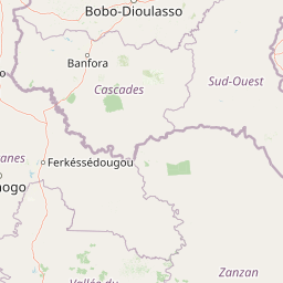
Use this park location map to pinpoint Comoé National Park in Ivory Coast, understand its exact geographic position, and read its mapped placement within the surrounding landscape more clearly.

Pigeon | © OpenStreetMap contributors
Park atlas

Compare regional park geography, savanna habitats, and adjacent protected landscapes

Other Parks Like Comoé National Park and Protected Areas in the Surrounding Region

Browse national parks and protected areas sharing the West Sudanian savanna ecoregion with Comoé National Park. Expand regional geographic comparison and trace connected conservation landscapes across the surrounding terrain.
Watercolor illustration of a landscape with green fields, trees, and a body of water
National parkIvory Coast
Park boundaries overlap#1 closest

Northwest

Comoé National Park: Geographic and Environmental Overview of the Ivory Coast Reserve

Mapping the transitions of West Africa's largest protected savanna ecosystem.

Comoé National Park serves as an ecological crossroads in north-eastern Ivory Coast, protecting 11,500 square kilometers of diverse terrain. The park hosts an extraordinary gradient of habitats, from dense gallery forests hugging the 230 kilometer stretch of the Comoé River to open, dry Sudanian savannas. Its geological foundation, featuring dramatic granite inselbergs and wide plains, supports a highly complex network of life, making it a cornerstone for understanding West African regional conservation and landscape ecology.

Area
11,500 km²
Established
1983
IUCN
II
Relief
Lowland
Wildlife reserveUpper West Region
About 66 km away#2 closest

Northeast

Wechiau Community Hippo Sanctuary: Protected River Landscapes and Savanna Wildlife Reserve

Upper West Region, Ghana: Riverine ecology and community-managed boundaries

Wechiau Community Hippo Sanctuary encompasses a protected stretch of the Black Volta, providing essential habitat for hippopotamuses in northwestern Ghana. This wildlife reserve features a diverse landscape of riverine forests, sandbanks, and savanna trails. The sanctuary demonstrates how local traditional governance maintains critical natural terrain while fostering an integrated cultural and ecological landscape.

Established
1999
Relief
Lowland
Scope
Terrestrial
Water
Major water bodies
National parkSavannah Region
90 km away#3 closest

East

Mole National Park: A Premier Protected Landscape in Ghana's Savannah Region

Explore mapped boundaries and Guinea savannah ecosystems.

Mole National Park represents a significant protected landscape within Ghana's Savannah Region, serving as the country's largest national park and a crucial conservation area for West African wildlife. The park's geography is defined by extensive Guinea savannah, characterized by grasslands with scattered woodlands and a prominent escarpment along its southern edge. Its vast expanse offers a unique opportunity to study mapped park boundaries and understand the ecosystem's role in regional conservation efforts. Discover the unique landscape context and protected area identity of this major West African wildlife refuge.

Area
4,840 km²
Established
1958
IUCN
II
Visitors
17.8K annual
National parkGhana
About 100 km away#4 closest

Southeast

Bui National Park: Protected Savanna Landscape and Black Volta River Geography in Ghana

Explore the mapped boundaries and unique ecosystems of this national park.

Bui National Park, a protected national park in Ghana, offers a rich geographic discovery of savanna ecosystems bisected by the Black Volta River. Its vast mapped area provides a unique setting for understanding riparian corridors, woodland savanna, and mountainous terrain. The park is critically important for its significant hippopotamus population and its designation as an Important Bird Area, showcasing its ecological value. Exploration of Bui National Park provides insight into Ghana's protected landscapes and their strategic position within West African geography, serving as a key entity for any natural atlas.

Area
1,820 km²
Established
1971
IUCN
II
Relief
Mixed relief
Protected areaCascades
About 131 km away#5 closest

Northwest

Lac de Tengréla Protected Area: Mapping Wetland Landscapes in the Cascades Region

Freshwater geography and regional catchment in southwestern Burkina Faso

Located near Banfora, Lac de Tengréla functions as a protected Ramsar wetland within the Comoé River system. This freshwater lake provides essential ecological value, with its elongated basin and outflow connectivity offering a distinct window into the hydrology and natural terrain of southwestern Burkina Faso.

Area
5.8 km²
Established
2009
Scope
Terrestrial
Water
Water-dominated
Wildlife reserveUpper West Region
About 171 km away#6 closest

Northeast

Gbele Resource Centre Wildlife Reserve: A Regional Atlas of Protected Savanna Landscapes

Mapped geography and protected woodland in Ghana

Gbele Resource Centre represents one of the most substantial protected savanna landscapes in northwestern Ghana, spanning over 500 square kilometres of Sudano-Sahelian woodland. The terrain is defined by the seasonal Kulpawn River and a distinct composition of African baobab and sycamore fig trees, which together anchor an important ecological corridor. This reserve provides a vital opportunity to map and understand the conservation geography and avian diversity that distinguish the Upper West Region from other parts of the country.

Area
565 km²
Relief
Lowland
Scope
Terrestrial
Water
Minor water
Protected areaBurkina Faso
About 175 km away#7 closest

North

Forêt classée de Kou: Protected Gallery Forest and Riverine Geography in Burkina Faso

A compact biodiversity refuge near Bobo-Dioulasso

Forêt classée de Kou stands as a vital example of Guinean-type forest preservation in Burkina Faso. This protected area features a complex mosaic of dense gallery woodland along the Kou and Guinguette rivers, transitioning into arborescent savanna. With its layered canopy, riverine corridors, and documented avian richness, it serves as a critical geographic marker of humid woodland in the broader Sudano-Sahelian terrain.

Area
1.15 km²
Established
1951
Climate
Tropical
Access
Easy access
Wildlife reserveBono East Region
About 192 km away#8 closest

Southeast

Boabeng-Fiema Monkey Sanctuary: Geographic Boundaries and Wildlife Reserve Context

Community-protected forest landscapes in Ghana

Boabeng-Fiema Monkey Sanctuary represents a rare community-based wildlife reserve located in central Ghana. Spanning 4.4 square kilometers between the villages of Boabeng and Fiema, the forest provides essential habitat for primate populations protected by generations of cultural tradition. This detail page offers geographic context, map exploration of the forest reserve, and insight into the unique intersection of woodland ecosystems and community-enforced conservation in the Bono East Region.

Area
4.4 km²
Established
1970
Relief
Lowland
Climate
Tropical

Common questions about visiting, size, designation, and location context for Comoé National Park

Comoé National Park FAQs for park facts, access, geography, and protected area context

Find quick answers about Comoé National Park, including protected-area facts, park geography, trail and visitor context, and how the park fits into its surrounding country and regional landscape.
MoriAtlas Explorer

Continue Your Protected Areas Search Across the Global Atlas

Deepen your exploration by continuing the structured search for national parks and protected areas worldwide. Utilize the comprehensive filtering capabilities to compare different conservation landscapes and refine your understanding of global park geography. Discover more about the distribution and characteristics of protected natural areas.

Global natural geography