Mori Atlas logo
Wildlife reserveWechiau Community Hippo Sanctuary

Mapping the Black Volta river basin, community governance, and savanna woodland habitats

Wechiau Community Hippo Sanctuary: A Protected Wildlife Reserve and River Corridor in Ghana

Wechiau Community Hippo Sanctuary protects a vital 40-kilometer stretch of the Black Volta River within Ghana's Upper West Region. This reserve serves as a critical refuge for hippopotamus populations, defined by a unique mosaic of riverine woodland, seasonally dry savanna, and distinct animal-cut terrain. The area stands as an example of community-led conservation, linking riparian habitat monitoring with the cultural landscape of northwestern Ghana.

community conservationhippopotamusriver ecosystemBlack VoltaUpper West RegionWest Africa

Wechiau Community Hippo Sanctuary

Wildlife reserve

Park overview

Structured park overview, official facts, and landscape profile for Wechiau Community Hippo Sanctuary

Wechiau Community Hippo Sanctuary park facts, protected area profile, and essential visitor context

Review the core facts for Wechiau Community Hippo Sanctuary, including designation, size, terrain, visitor scale, habitats, and operating context in one park-focused overview.

About Wechiau Community Hippo Sanctuary

Wechiau Community Hippo Sanctuary is a community-based conservation and tourism project centered on a stretch of the Black Volta River near the town of Wechiau, in the Upper West Region of northwestern Ghana. The river corridor the sanctuary protects is one of only two places in Ghana where hippopotamus populations persist, making Wechiau both a cultural landmark for the communities that depend on the river and a site of national significance for wildlife conservation.

Unlike a conventional national park, the sanctuary emerged from an agreement among traditional chiefs in 1999, who chose to organize the use of the river in a way that would safeguard hippos and the livelihoods connected to them. Over time, this vision grew into a structured project that pairs habitat monitoring with income-generating opportunities for local residents, ranging from guided river tours to cultural and craft-based experiences. Support from the Wilder Institute has helped the sanctuary build a framework that links ecological monitoring, governance, and community benefit into a single integrated model.

The sanctuary is also significant because it sits at the intersection of freshwater ecology and rural West African life. The Black Volta is a dynamic river system, and the resident hippo population influences everything from water clarity to shoreline vegetation through grazing trails and movement between land and water. By keeping hippos central to both the conservation plan and the visitor experience, Wechiau offers an unusually clear example of how a single species can anchor a regional stewardship ethic.

For visitors, the sanctuary combines close but safe encounters with hippos in their natural river habitat with opportunities to engage with community life along the Upper West Region. This dual focus, on a charismatic species and on the local culture that chose to protect it, is what gives Wechiau its distinctive identity within Ghana's network of natural attractions.

Quick facts and research context for Wechiau Community Hippo Sanctuary

Wechiau Community Hippo Sanctuary lies in the Upper West Region of Ghana, alongside the Black Volta River. It protects one of only two remaining hippopotamus populations in the country. The sanctuary was created in 1999 by traditional chiefs and is supported by the Wilder Institute. Its conservation model directly links habitat protection for hippos with livelihood outcomes for roughly twenty communities living along the river corridor. The Black Volta ecosystem on which the sanctuary depends faces ongoing pressures from habitat loss, illegal hunting, illegal mining (locally known as galamsey), agricultural encroachment, and the effects of climate change on water availability and vegetation.

Protection and recognition

Documented terrestrial protection scope, management framework, and recognized international conservation listings

Wechiau Community Hippo Sanctuary Protection Status and Designation Records

Wechiau Community Hippo Sanctuary maintains a recorded terrestrial protection scope alongside associated designation parameters and governance records. Verified conservation metrics examine official management classifications and international recognition sources to document formal administrative status.

Protection details

Protection scope
Terrestrial
Transboundary protection
No
Park context

Deeper park guide and search-rich context for Wechiau Community Hippo Sanctuary

Wechiau Community Hippo Sanctuary history, landscape, wildlife, and travel context

Explore Wechiau Community Hippo Sanctuary through its history, landscape character, ecosystems, wildlife, conservation priorities, cultural context, and seasonal travel timing in a structured park guide built for atlas discovery and search intent.

Why Wechiau Community Hippo Sanctuary stands out

Wechiau Community Hippo Sanctuary is best known as one of the last strongholds of the hippopotamus in Ghana and as a long-running example of community-led conservation in West Africa. The sanctuary is notable for tying the survival of a flagship megaherbivore directly to the governance decisions of local traditional leaders, rather than to a strictly enforced national park framework. The approach combines hippo population monitoring along the Black Volta with livelihood projects and inclusive governance support for the surrounding villages. This blend of cultural stewardship, river ecology, and ecotourism distinguishes the sanctuary from more conventional protected-area models in the region.

Wechiau Community Hippo Sanctuary history and protected-area timeline

The sanctuary was established in 1999 when local chiefs at Wechiau chose to set aside and manage a stretch of the Black Volta River in order to protect the hippo population that lived there. The decision came at a time when hippo numbers across Ghana had collapsed to just two remaining populations, making Wechiau's stretch of the Black Volta one of the country's last refuges for the species.

Following the chiefs' initial action, the project evolved into a more formalized community tourism and conservation initiative. International partners became involved over time, most notably the Wilder Institute, which has supported the sanctuary through habitat monitoring, governance support, and livelihood development programs. These partnerships have helped the sanctuary develop the capacity to monitor hippo populations, respond to threats along the river, and translate conservation outcomes into tangible benefits for the roughly twenty communities that live along the river corridor.

Over the years, the project has also become a recognizable destination for both Ghanaian and international travelers seeking an ecotourism experience that combines wildlife observation with local cultural heritage. The sanctuary's history is therefore as much about community decision-making and partnership-building as it is about the hippos themselves.

Wechiau Community Hippo Sanctuary landscape and geographic character

The sanctuary's landscape is defined by the Black Volta River, a broad, slow-moving waterway that forms part of the natural boundary between Ghana and neighboring countries in West Africa. Along the river's course, the surrounding terrain is a mix of seasonally dry savanna, riverine woodland, and exposed sandbanks, with vegetation patterns strongly influenced by seasonal rainfall and the annual rise and fall of the river.

Hippos shape much of the visible character of this river environment. Their regular paths between water and grazing areas have, across generations, cut distinct trails into the landscape, in places worn so deeply that they resemble elongated trenches. These trails, along with wallows, basking rocks, and shoreline feeding marks, are characteristic features of the Wechiau stretch of the Black Volta and give the landscape its distinctive texture.

Beyond the river itself, the broader sanctuary area blends into the cultural and agricultural landscape of the Upper West Region. Farmland, settlements, and community lands sit close to the protected river corridor, meaning the sanctuary's landscape is best understood as a working cultural-natural mosaic rather than as an isolated wilderness block.

Wechiau Community Hippo Sanctuary ecosystems, habitats, and plant life

Ecologically, the sanctuary is anchored in a Black Volta River ecosystem, where freshwater and seasonally dry savanna environments meet. The river is the defining habitat, and its seasonal fluctuations in depth, flow, and water quality shape much of the area's ecological character. Riverine vegetation along the banks provides grazing for hippos and habitat for a wide range of other wildlife, while the wider savanna supports plant species adapted to a pronounced dry season.

The combination of river and savanna ecosystems contributes to a wide diversity of wildlife in and around the sanctuary, including both species that depend directly on the river and those that range across the broader Upper West landscape. The presence of hippos plays a particularly important ecological role, since their movement between water and land influences shoreline vegetation, water nutrient cycling, and the paths other animals use along the river.

The sanctuary's ecological identity is also shaped by the pressures it faces. Habitat loss, degradation, illegal hunting, illegal mining along the river, and the expansion of farmland into protected areas all influence the ecological health of the system. Climate change adds another layer, with rising temperatures and shifting rainfall patterns affecting both vegetation growth and the availability of water in the Black Volta, which in turn shapes habitat quality for hippos and the broader ecosystem.

Wechiau Community Hippo Sanctuary wildlife and species highlights

Wechiau Community Hippo Sanctuary is defined, first and foremost, by its hippopotamus population. Hippos are considered one of the world's most ecologically powerful large mammals because their daily movements between water and land quietly shape the structure of African river ecosystems. At Wechiau, hippos are central residents of the Black Volta and the focus of the sanctuary's monitoring and protection efforts.

Biodiversity monitoring at the sanctuary has indicated that the hippo population is increasing over time, even as broader threats continue. Beyond hippos, the area supports a wide diversity of wildlife drawn from both the river and the surrounding savanna, making the sanctuary an attractive destination for visitors interested in West African fauna as well as in the animals that live directly in and around the Black Volta.

The sanctuary's wildlife significance is intensified by the fact that the hippo population it protects is one of only two remaining in Ghana. This makes every sighting, breeding event, and individual animal of real national conservation value, and it underscores why the continued protection of the Black Volta corridor matters far beyond the immediate Upper West Region.

Wechiau Community Hippo Sanctuary conservation status and protection priorities

Wechiau Community Hippo Sanctuary occupies an important place in Ghanaian conservation because it protects one of only two remaining hippopotamus populations in the country. The survival of hippos in Ghana is fundamentally tied to the health of the Black Volta here, and the sanctuary's existence is in part a response to the dramatic decline of hippo populations elsewhere in the country.

Conservation at Wechiau is built around a community-led approach. Local chiefs were the original decision-makers in 1999, and roughly twenty communities remain directly involved in how the sanctuary is governed and how benefits from it are shared. This model is reinforced through partnerships with organizations such as the Wilder Institute, which contribute habitat monitoring, governance support, and livelihood development. The integrated approach of combining species monitoring with community benefit has become one of the sanctuary's defining conservation features.

Equally important is the long list of pressures the sanctuary must counter: habitat loss, habitat degradation, illegal hunting, illegal mining activity in the Black Volta, expansion of farmland into protected areas, and climate-related shifts in temperature, rainfall, vegetation cover, and water availability. Conservation at Wechiau therefore involves not only keeping hippos safe, but also working with surrounding communities to manage competing land and water uses along one of Ghana's last remaining hippo rivers.

Wechiau Community Hippo Sanctuary cultural meaning and human context

The sanctuary is deeply rooted in the cultural and traditional governance systems of the Upper West Region. Its creation in 1999 came about through a decision by local chiefs to manage the Black Volta in a way that protected hippos while supporting the communities that depend on the river. This founding act gives the sanctuary a distinctly traditional, locally led character that sets it apart from many state-administered protected areas in Ghana.

Since then, the cultural dimensions of the sanctuary have expanded well beyond the founding decision. Community involvement in governance, the development of cultural experiences for visitors, and the weaving of traditional livelihoods into the sanctuary's economy all reflect the broader identity of northwestern Ghana. Visitors to Wechiau encounter not only a wildlife experience but an opportunity to engage with the cultural life of the riverside communities, including crafts, daily activities, and local traditions tied to the Black Volta.

Top sights and standout views in Wechiau Community Hippo Sanctuary

Wechiau Community Hippo Sanctuary stands out for combining the protection of one of Ghana's last two hippopotamus populations with a long-standing community governance model. Its roughly 40-kilometer stretch of the Black Volta is shaped both by natural river dynamics and by decades of hippo movement between land and water, producing a landscape rich in ecological and cultural significance.

The sanctuary's strongest qualities include its origin in a 1999 decision by local chiefs, its multi-decade partnership with the Wilder Institute, and its ongoing work to link hippo conservation with tangible livelihoods for more than twenty communities. The combined experience of watching hippos in a West African river and engaging with the region's cultural heritage makes the sanctuary a distinctive destination for travelers interested in responsible ecotourism.

Best time to visit Wechiau Community Hippo Sanctuary

Visiting Wechiau is shaped strongly by the seasonal character of the Upper West Region and the Black Volta. The dry season, when river levels are lower and wildlife tends to concentrate around remaining water, is often the most reliable time for hippo viewing, while the wet season reshapes the river, vegetation, and accessibility of the surrounding landscape. Conditions along the Black Volta shift noticeably through the year, and the atmosphere of a visit can vary significantly between seasons, with cooler weather, clearer skies, and more open savanna landscapes during the dry months and a lusher, greener setting during the rains.

Travelers generally benefit from considering both ecological conditions, such as water levels and hippo activity, and cultural calendars in the surrounding communities when planning a visit, since local festivals, harvests, and community events can meaningfully shape the experience of time spent at the sanctuary.
Monthly climate preview

Long-term temperature ranges and precipitation patterns across the protected landscape

Wechiau Community Hippo Sanctuary Climate Normals and Monthly Weather Data

Representative coordinates record measured monthly temperature swings from 25.58 °C to 30.43 °C alongside shifting precipitation rates from 0.07 mm to 5.28 mm per day. Examining the complete twelve-month climatology profile reveals precise seasonal variations in thermal rhythms and moisture distribution.
Annual mean27 °C
26 °C30 °C
Jan26°
Feb29°
Mar30°
Apr30°
May29°
Jun27°
Jul26°
Aug26°
Sep26°
Oct27°
Nov27°
Dec26°
Warmest month
March

30.4 °C

Coolest month
August

25.6 °C

Wettest month
September

5.3 mm/day

Driest month
December

0.1 mm/day

Park location guide

Geography guide, regional context, and park location map for Wechiau Community Hippo Sanctuary

Wechiau Community Hippo Sanctuary park geography, regions, and map view in Ghana

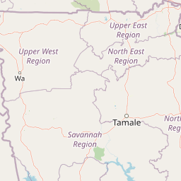
Understand where Wechiau Community Hippo Sanctuary sits in Ghana through a broader geographic reading of the surrounding landscape, nearby location context, and its mapped position within the national park landscape.

How Wechiau Community Hippo Sanctuary fits into Ghana

Ghana, officially the Republic of Ghana, is a West African nation spanning approximately 240,000 km² along the Gulf of Guinea. It achieved independence from Britain in 1957, becoming the first Sub-Saharan colony to do so, and transitioned to a republic in 1960. The country has a population of over 35 million, with Accra as its capital and largest city. Ghana features diverse ecosystems from coastal savannas to tropical rainforests and is linguistically and ethnically rich, with English as the official language.

Wider geography shaping Wechiau Community Hippo Sanctuary in Ghana

Ghana is located in West Africa along the Gulf of Guinea and Atlantic Ocean to its south. It borders Côte d'Ivoire to the west, Burkina Faso to the north, and Togo to the east. The country spans diverse ecologies including coastal savannas and tropical rainforests.

Map view of Wechiau Community Hippo Sanctuary

Use this park location map to pinpoint Wechiau Community Hippo Sanctuary in Ghana, understand its exact geographic position, and read its mapped placement within the surrounding landscape more clearly.

Pigeon | © OpenStreetMap contributors

Location context for Wechiau Community Hippo Sanctuary

Upper West Region
Park atlas

Compare adjacent river ecosystems and regional conservation landscapes in West Africa

Explore Parks Near Wechiau Community Hippo Sanctuary and Surrounding Protected Areas

Visitors exploring Wechiau Community Hippo Sanctuary can continue browsing nearby national parks and protected areas across the surrounding region. Comparing adjacent wildlife corridors and riverine habitats provides deeper context for regional conservation models.
Watercolor illustration of a landscape with green fields, trees, and a body of water
National parkIvory Coast
About 66 km away#1 closest

Southwest

Comoé National Park: Geographic and Environmental Overview of the Ivory Coast Reserve

Mapping the transitions of West Africa's largest protected savanna ecosystem.

Comoé National Park serves as an ecological crossroads in north-eastern Ivory Coast, protecting 11,500 square kilometers of diverse terrain. The park hosts an extraordinary gradient of habitats, from dense gallery forests hugging the 230 kilometer stretch of the Comoé River to open, dry Sudanian savannas. Its geological foundation, featuring dramatic granite inselbergs and wide plains, supports a highly complex network of life, making it a cornerstone for understanding West African regional conservation and landscape ecology.

Area
11,500 km²
Established
1983
IUCN
II
Relief
Lowland
A soft watercolor illustration showing a calm pond in the foreground, with gentle grassy hills and sparse trees in the background.
National parkIvory Coast
About 66 km away#2 closest

Southwest

Comoé National Park: Geographic Overview and Protected Landscape Analysis

Mapping the savanna and river corridors of Ivory Coast

Comoé National Park spans the northeastern reaches of Ivory Coast, providing a crucial protected space for West Sudanian savanna and gallery forests. This large-scale reserve is characterized by the hydrological influence of the Comoé River, which carves through the undulating plains to create seasonal floodplains and dense riverine corridors that serve as essential habitat for regional wildlife populations.

Area
11,491.5 km²
Established
1968
IUCN
II
Relief
Upland
National parkSavannah Region
About 67 km away#3 closest

East

Mole National Park: A Premier Protected Landscape in Ghana's Savannah Region

Explore mapped boundaries and Guinea savannah ecosystems.

Mole National Park represents a significant protected landscape within Ghana's Savannah Region, serving as the country's largest national park and a crucial conservation area for West African wildlife. The park's geography is defined by extensive Guinea savannah, characterized by grasslands with scattered woodlands and a prominent escarpment along its southern edge. Its vast expanse offers a unique opportunity to study mapped park boundaries and understand the ecosystem's role in regional conservation efforts. Discover the unique landscape context and protected area identity of this major West African wildlife refuge.

Area
4,840 km²
Established
1958
IUCN
II
Visitors
17.8K annual
Wildlife reserveUpper West Region
About 107 km away#4 closest

Northeast

Gbele Resource Centre Wildlife Reserve: A Regional Atlas of Protected Savanna Landscapes

Mapped geography and protected woodland in Ghana

Gbele Resource Centre represents one of the most substantial protected savanna landscapes in northwestern Ghana, spanning over 500 square kilometres of Sudano-Sahelian woodland. The terrain is defined by the seasonal Kulpawn River and a distinct composition of African baobab and sycamore fig trees, which together anchor an important ecological corridor. This reserve provides a vital opportunity to map and understand the conservation geography and avian diversity that distinguish the Upper West Region from other parts of the country.

Area
565 km²
Relief
Lowland
Scope
Terrestrial
Water
Minor water
National parkGhana
About 165 km away#5 closest

South

Bui National Park: Protected Savanna Landscape and Black Volta River Geography in Ghana

Explore the mapped boundaries and unique ecosystems of this national park.

Bui National Park, a protected national park in Ghana, offers a rich geographic discovery of savanna ecosystems bisected by the Black Volta River. Its vast mapped area provides a unique setting for understanding riparian corridors, woodland savanna, and mountainous terrain. The park is critically important for its significant hippopotamus population and its designation as an Important Bird Area, showcasing its ecological value. Exploration of Bui National Park provides insight into Ghana's protected landscapes and their strategic position within West African geography, serving as a key entity for any natural atlas.

Area
1,820 km²
Established
1971
IUCN
II
Relief
Mixed relief
National parkBurkina Faso
About 215 km away#6 closest

North

Deux Balés National Park: Burkina Faso's Elephant Sanctuary and Savanna Protected Landscape

Explore mapped terrain and key geographic features of this protected area.

Deux Balés National Park serves as a vital protected area within Burkina Faso, acclaimed for harboring the largest elephant population in West Africa. This national park's protected landscape is defined by undulating granitic plains, lateritic plateaux, and distinct gallery forests lining the Black Volta River. The presence of ancient African baobab trees adds a unique visual character to the savanna ecosystem. Investigating this park reveals its significance for regional conservation, its mapped geographic boundaries, and its role within the broader context of protected lands in West Africa.

Area
810 km²
Established
1937
IUCN
II
Relief
Lowland
Watercolor depiction of a river flowing through a landscape with green trees and distant mountains under a light sky
National parkBurkina Faso
About 242 km away#7 closest

Northeast

Kaboré Tambi National Park: Burkina Faso's Largest National Park and Protected Landscape

Explore the mapped savanna and birdwatching geography of this vital West African area.

Kaboré Tambi National Park represents a critical protected area in Burkina Faso, spanning a considerable expanse of Sudan-Guinea savanna. The park's geography is defined by the Nazinon River and a mosaic of woodland and grassland ecosystems, making it a significant site for understanding regional protected lands and landscape ecology. It offers a valuable point of reference for atlas-based exploration of West African natural areas.

Area
1,555 km²
Established
1976
IUCN
II
Relief
Lowland
Protected areaBurkina Faso
About 243 km away#8 closest

Northwest

Forêt classée de Kou: Protected Gallery Forest and Riverine Geography in Burkina Faso

A compact biodiversity refuge near Bobo-Dioulasso

Forêt classée de Kou stands as a vital example of Guinean-type forest preservation in Burkina Faso. This protected area features a complex mosaic of dense gallery woodland along the Kou and Guinguette rivers, transitioning into arborescent savanna. With its layered canopy, riverine corridors, and documented avian richness, it serves as a critical geographic marker of humid woodland in the broader Sudano-Sahelian terrain.

Area
1.15 km²
Established
1951
Climate
Tropical
Access
Easy access

Common questions about visiting, size, designation, and location context for Wechiau Community Hippo Sanctuary

Wechiau Community Hippo Sanctuary FAQs for park facts, access, geography, and protected area context

Find quick answers about Wechiau Community Hippo Sanctuary, including protected-area facts, park geography, trail and visitor context, and how the park fits into its surrounding country and regional landscape.
MoriAtlas Explorer

Continue Your Protected Areas Search Across the Global Atlas

Deepen your exploration by continuing the structured search for national parks and protected areas worldwide. Utilize the comprehensive filtering capabilities to compare different conservation landscapes and refine your understanding of global park geography. Discover more about the distribution and characteristics of protected natural areas.

Global natural geography