

Mori Atlas logo
State or regional parkCorrobinnie Hill Conservation Park

Understanding the geological boundaries and protected terrain of an Eyre Peninsula natural monument

Corrobinnie Hill Conservation Park: A Detailed Atlas of South Australia Granite Landscapes

Corrobinnie Hill Conservation Park is a protected area situated on the Eyre Peninsula of South Australia, serving as a distinct geological monument within the regional conservation estate. This park is defined by the weathered granite formations of Corrobinnie Hill, which present a striking sculptural contrast to the surrounding low-relief pastoral countryside. The site offers a focused look at inland rock formations and their integration into the wider protected-land network across the state.

granite outcropgeological featurenatural monumentIUCN Category IIIEyre Peninsulasemi-arid landscape

Corrobinnie Hill Conservation Park

State or regional park

Park overview

Structured park overview, official facts, and landscape profile for Corrobinnie Hill Conservation Park

Corrobinnie Hill Conservation Park park facts, protected area profile, and essential visitor context

Review the core facts for Corrobinnie Hill Conservation Park, including designation, size, terrain, visitor scale, habitats, and operating context in one park-focused overview.

About Corrobinnie Hill Conservation Park

Corrobinnie Hill Conservation Park is a compact, feature-focused reserve in South Australia that sits within the broader network of protected lands on the Eyre Peninsula. Although small in total area, the park plays a clearly defined role within the regional conservation landscape: it was established specifically to protect a single natural monument, Corrobinnie Hill, and the unusually weathered granite formations that give the hill its distinctive appearance.

The park lies in the locality of Pinkawillinie, well inland on the upper Eyre Peninsula and a significant distance west of Kyancutta. The surrounding region is sparsely populated and dominated by broad rural land uses, with large blocks of crown land and pastoral country. Against this setting, the granite rise of Corrobinnie Hill stands as a prominent visual landmark, its rounded and irregular boulder forms reflecting prolonged exposure to weathering processes typical of ancient inselberg-style outcrops of arid and semi-arid southern Australia.

Administratively, the park is managed by the Department for Environment and Water and operates in association with the much larger Pinkawillinie Conservation Park, with which it shares its protective framework and visitor access arrangements. This association effectively positions Corrobinnie Hill Conservation Park as a specialist geological reserve within a wider ecological conservation estate, reinforcing its status as an IUCN Category III protected area whose significance lies less in scale and more in the cultural, visual, and scientific value of the granite feature it safeguards.

Quick facts and research context for Corrobinnie Hill Conservation Park

Corrobinnie Hill Conservation Park is situated on the Eyre Peninsula in South Australia, within the locality of Pinkawillinie and roughly 24 kilometres west of Kyancutta. The reserve is compact in scale, covering only a couple of square kilometres, and is dedicated to protecting a single prominent natural feature.

The park was proclaimed on 25 August 1983 under the National Parks and Wildlife Act 1972 and is managed by the South Australian Department for Environment and Water. It is classified as an IUCN Category III protected area, a designation reserved for natural monuments and geological features of outstanding interest.

Protection and recognition

Examine the terrestrial protection scope and documented conservation status for this natural area.

Corrobinnie Hill Conservation Park Protection Status and Mapped Designation

Corrobinnie Hill Conservation Park holds a registered terrestrial protection scope within the official geographic database. Detailed conservation status records outline the administrative framework governing this protected landscape.

Protection details

Protection scope
Terrestrial
Park context

Deeper park guide and search-rich context for Corrobinnie Hill Conservation Park

Corrobinnie Hill Conservation Park history, landscape, wildlife, and travel context

Explore Corrobinnie Hill Conservation Park through its history, landscape character, ecosystems, wildlife, conservation priorities, cultural context, and seasonal travel timing in a structured park guide built for atlas discovery and search intent.

Why Corrobinnie Hill Conservation Park stands out

Corrobinnie Hill Conservation Park is best known for Corrobinnie Hill itself, a granite outcrop distinguished by unusually shaped and weathered rock formations. These granite boulders give the hill a sculptural, otherworldly character against the otherwise gentle Eyre Peninsula landscape. The combination of intact granite weathering patterns, remote inland location, and easy integration into a wider conservation estate has made the hill a recognised point of geological and scenic interest within the broader Pinkawillinie area, drawing visitors who are exploring the surrounding conservation parkland.

Corrobinnie Hill Conservation Park history and protected-area timeline

Corrobinnie Hill Conservation Park was proclaimed on 25 August 1983 under South Australia's National Parks and Wildlife Act 1972. Its name was taken directly from Corrobinnie Hill, the landform at the centre of the reserve, reflecting the park's character as a feature-focused rather than ecosystem-focused protected area.

In 1993, land surrounding the conservation park, described in cadastral terms as allotment 1 of Deposited Plan No. 33659 in the Hundred of Hill, was dedicated under the Crown Lands Act 1929 as part of the Pinkawillinie Conservation Reserve. This buffer of crown land expanded the effective context of the reserve and tied Corrobinnie Hill more firmly into the regional conservation estate.

On 21 November 2002, this surrounding land was added by proclamation to the Pinkawillinie Conservation Park, consolidating the management framework of the area and placing Corrobinnie Hill Conservation Park within a broader protected landscape. From 2010 onward, the conservation park has been operated in association with Pinkawillinie Conservation Park, an arrangement that continues to shape how visitors access and experience the site today.

Corrobinnie Hill Conservation Park landscape and geographic character

The landscape of Corrobinnie Hill Conservation Park is dominated by its single defining feature: Corrobinnie Hill itself, a granite rise composed of unusually shaped and weathered rock formations. The hill's granite boulders have been sculpted by prolonged weathering into distinctive, irregular shapes that contrast sharply with the surrounding low-relief countryside of the Eyre Peninsula.

Beyond the hill itself, the park's small footprint means the broader landscape is shaped as much by its setting as by its own landforms. The surrounding territory consists of open rural and crown land country typical of the upper Eyre Peninsula, with gently undulating terrain, sparse vegetation cover, and long sightlines across mostly cleared pastoral land.

The integration of the conservation park into the wider Pinkawillinie protected estate reinforces a landscape impression that mixes remote inland pastoral country with harder rocky outcrops, giving the area a layered character shaped by both ancient geology and contemporary land use.

Corrobinnie Hill Conservation Park conservation status and protection priorities

Corrobinnie Hill Conservation Park's principal conservation value lies in the protection of Corrobinnie Hill and its unusually shaped, weathered granite formations. The park is formally classified as an IUCN Category III protected area, a category specifically reserved for natural monuments and features of geological or geomorphological significance. This designation signals that the park's worth is measured less by ecosystem area and more by the integrity and preservation of a single outstanding natural feature.

Protection under South Australia's National Parks and Wildlife Act 1972, together with its association with the larger Pinkawillinie Conservation Park, has helped safeguard the hill from activities that could degrade its rock formations or surrounding natural values. The inclusion of surrounding crown land within Pinkawillinie Conservation Park in 2002 further strengthened the buffer around the feature, ensuring that the geological and visual integrity of Corrobinnie Hill is maintained within a broader context of managed conservation land.

Top sights and standout views in Corrobinnie Hill Conservation Park

The standout highlight of Corrobinnie Hill Conservation Park is Corrobinnie Hill itself, with its unusually shaped, weathered granite rocks that give the feature a distinctive sculptural quality. The reserve is consistently described as one of the most popular attractions within the wider Pinkawillinie Conservation Park, reflecting both the visual appeal of the outcrop and the value visitors place on seeing this small but striking geological feature up close.

Equally notable is the park's close administrative and operational relationship with Pinkawillinie Conservation Park, which means that visitation to Corrobinnie Hill is part of a broader experience of remote Eyre Peninsula conservation country. The combination of an IUCN Category III designation, remote inland location, and a feature-focused remit makes the park a small but distinctive element of South Australia's protected-area network.

Best time to visit Corrobinnie Hill Conservation Park

Corrobinnie Hill Conservation Park sits in a remote inland part of the Eyre Peninsula, and conditions for visiting tend to be most appealing during the cooler, drier months of late autumn, winter, and spring, when daytime temperatures are more moderate and the weathered granite formations can be comfortably explored on foot. Summer in this part of South Australia can be hot and dry, which can make a visit to an exposed rocky hilltop more physically demanding.

Because the park can only be reached by four-wheel-drive vehicle via the Number 17 Stock Route, access considerations also matter: drier ground conditions typically make the route more manageable. Visitors interested in photographing the unusually shaped granite boulders generally find softer, low-angle light during the cooler parts of the day to be more flattering for capturing the textures and forms of the weathered rock.
Monthly climate preview

Annual temperature ranges and precipitation rhythm from NASA coordinate data

Corrobinnie Hill Conservation Park Climate Normals and Temperature Patterns

Representative coordinates record long-term monthly temperature swings and precipitation averages across the protected terrain. Detailed monthly normals provide deeper insight into annual meteorological cycles for Corrobinnie Hill Conservation Park.
Annual mean18 °C
11 °C25 °C
Jan25°
Feb25°
Mar22°
Apr18°
May14°
Jun11°
Jul11°
Aug12°
Sep14°
Oct18°
Nov21°
Dec23°
Warmest month
January

25.1 °C

Coolest month
July

10.7 °C

Wettest month
June

1.2 mm/day

Driest month
January

0.5 mm/day

Park location guide

Geography guide, regional context, and park location map for Corrobinnie Hill Conservation Park

Corrobinnie Hill Conservation Park park geography, regions, and map view in Australia

Understand where Corrobinnie Hill Conservation Park sits in Australia through a broader geographic reading of the surrounding landscape, nearby location context, and its mapped position within the national park landscape.

How Corrobinnie Hill Conservation Park fits into Australia

Australia is a constitutional monarchy and federal parliamentary democracy comprising six states and ten territories. With a population of nearly 28 million, it is one of the world's most urbanised countries, with most people concentrated on the eastern seaboard. The country has a high Human Development Index and is known for its cultural diversity, ancient Aboriginal heritage, and unique wildlife.

Wider geography shaping Corrobinnie Hill Conservation Park in Australia

Australia occupies the entire Australian continent, the island of Tasmania, and numerous smaller islands. It is the world's flattest and driest inhabited continent, featuring vast deserts in the interior (the Outback), tropical rainforests along the eastern coast, and a coastline bordering the Indian and Pacific Oceans.

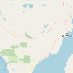
Map view of Corrobinnie Hill Conservation Park

Use this park location map to pinpoint Corrobinnie Hill Conservation Park in Australia, understand its exact geographic position, and read its mapped placement within the surrounding landscape more clearly.

Pigeon | © OpenStreetMap contributors

Location context for Corrobinnie Hill Conservation Park

South Australia
Park atlas

Compare regional protected landscapes, granite outcrops, and remote South Australia reserves

Explore Parks Near Corrobinnie Hill Conservation Park and Surrounding Protected Areas

Continue geographic discovery by browsing other protected areas situated across the upper Eyre Peninsula region. Comparing adjacent terrain helps place distinctive granite landforms and remote conservation reserves into a wider regional context.
National parkSouth Australia
About 21 km away#1 closest

Northwest

Gawler Ranges National Park: South Australia's Mapped Protected National Landscape

Explore the geography and protected area context of this national park.

Gawler Ranges National Park stands as a significant protected area within the geographic expanse of South Australia. Designated as a national park, it offers valuable insights into Australia's conservation landscapes and regional geography. Users can explore its mapped boundaries and understand its unique role within the national park system, making it a key point for structured geographic study and atlas-based discovery of protected lands.

Area
1,628.75 km²
Established
2002
IUCN
VI
Relief
Mountain
A pale, abstract watercolor painting showing rolling green hills, trees, and a light sky against a white background.
Nature reserveSouth Australia
About 50 km away#2 closest

Southeast

Caralue Bluff Conservation Park: A Protected Nature Reserve on the Eyre Peninsula

Mapping regional landscape integrity in South Australia

Caralue Bluff Conservation Park encompasses a 21.5 square kilometre tract of land in South Australia, acting as a crucial element of the Eyre Peninsula landscape. Named for the nearby Caralue Bluff landform, this nature reserve safeguards essential bushland habitats within a highly developed rural setting. Analyze the park boundaries and terrain characteristics to better appreciate its function as a conserved natural refuge.

Area
21.57 km²
Established
1993
IUCN
VI
Scope
Terrestrial
Wildlife reserveSouth Australia
About 57 km away#3 closest

Southwest

Cocata Conservation Park: Eyre Peninsula Protected Wildlife Reserve and Landscape Map

Geographic overview of South Australian conservation lands.

Cocata Conservation Park encompasses a vast semi-arid expanse on the Eyre Peninsula, characterized by gently undulating plains, calcrete-capped terrain, and open salt flats. Gain insights into the physical geography and habitat distribution of this important South Australian wildlife reserve through detailed regional mapping.

Area
167.62 km²
Established
1993
IUCN
VI
Scope
Terrestrial
Wildlife reserveSouth Australia
About 61 km away#4 closest

Southwest

Dakalanta Sanctuary: A Private Wildlife Reserve on the Northern Eyre Peninsula

Mapped regional geography and conservation habitat profiles

Dakalanta Sanctuary provides a significant example of private land conservation in South Australia. Covering 130 square kilometres of low hills and stabilized dunes, this reserve focuses on restoring native vegetation after past pastoral use. The area is vital for safeguarding semi-arid habitats like mallee woodlands, playing an active role in regional biodiversity protection and habitat connectivity.

Area
130 km²
Established
2002
Relief
Upland
Access
Access unknown
Wildlife reserveSouth Australia
About 64 km away#5 closest

Southeast

Darke Range Conservation Park: A Protected Woodland Sanctuary in South Australia

Geographic landscape and regional habitat exploration

Located near Darke Peak, this wildlife reserve safeguards threatened native peppermint gum woodland. The park functions as an ecologically significant pocket of intact vegetation, providing a window into the natural ridge terrain of the Eyre Peninsula that remains distinct from the surrounding rural land.

Area
6.93 km²
Established
1985
IUCN
VI
Relief
Mountain
Wildlife reserveSouth Australia
About 68 km away#6 closest

Northwest

Gawler Ranges Conservation Park: Mallee Landscapes and Regional Protected Areas

Semi-arid habitat and rocky terrain of South Australia

Gawler Ranges Conservation Park protects a core area of tree mallee woodland and rocky rises near the southern fringe of the Gawler Ranges. This wildlife reserve serves as an essential anchor for regional biodiversity on the Eyre Peninsula, offering a look at the arid-adapted vegetation and weathered geological structures that define this remote section of South Australia.

Area
154.8 km²
Established
1993
IUCN
VI
Relief
Upland
Nature reserveSouth Australia
About 68 km away#7 closest

Southeast

Carappee Hill Conservation Park: Atlas and Geographic Protected Area Profile

Nature reserve geography and Eyre Peninsula landscape context

Carappee Hill Conservation Park covers 8.5 square kilometres of rocky, elevated terrain in the locality of Darke Peak. As a designated conservation area and IUCN Category III site, it serves as a critical refuge for native vegetation, providing a clear map of protected landform heritage in central South Australia.

Area
8.5 km²
Established
1973
IUCN
III
Relief
Upland
National parkSouth Australia
About 71 km away#8 closest

North

Lake Gairdner National Park: National Park with Unique South Australian Geography and Mapped Boundaries

South Australian protected area with distinct landscape characteristics.

Lake Gairdner National Park serves as a key protected area within the geographic expanse of South Australia. This national park offers a unique focus for atlas exploration, highlighting its specific landscape features and mapped boundaries. Users can delve into the park's protected status and its contribution to the regional geography, providing valuable context for understanding Australia's diverse natural protected lands and their cartographic representation.

Area
5,531.77 km²
Established
1991
IUCN
VI
Relief
Lowland

Common questions about visiting, size, designation, and location context for Corrobinnie Hill Conservation Park

Corrobinnie Hill Conservation Park FAQs for park facts, access, geography, and protected area context

Find quick answers about Corrobinnie Hill Conservation Park, including protected-area facts, park geography, trail and visitor context, and how the park fits into its surrounding country and regional landscape.
MoriAtlas Explorer

Continue Your Protected Areas Search Across the Global Atlas

Deepen your exploration by continuing the structured search for national parks and protected areas worldwide. Utilize the comprehensive filtering capabilities to compare different conservation landscapes and refine your understanding of global park geography. Discover more about the distribution and characteristics of protected natural areas.

Global natural geography