
Mori Atlas logo
Nature reserveCöthener Fließtal

Glacial moraine terrain and stream valley geography in the northeastern landscape of Brandenburg

Cöthener Fließtal Nature Reserve and Protected Landscape in Brandenburg Germany

(FFH-Gebiet Cöthener Fließtal)

Cöthener Fließtal represents a significant protected area in Brandenburg, where the Barnim plateau transitions into the Oder valley. This nature reserve features an intricate mosaic of spring-fed alder and ash woodlands, oak-hornbeam forests, and deep incisions carved by Weichselian glacial activity. The valley serves as a critical habitat for protected bat populations and saproxylic insects, set against a backdrop of nineteenth-century romantic landscape design.

natura-2000habitat-species-management-areaiucn-category-ivbrandenburgglacial-end-morainedeciduous-forest
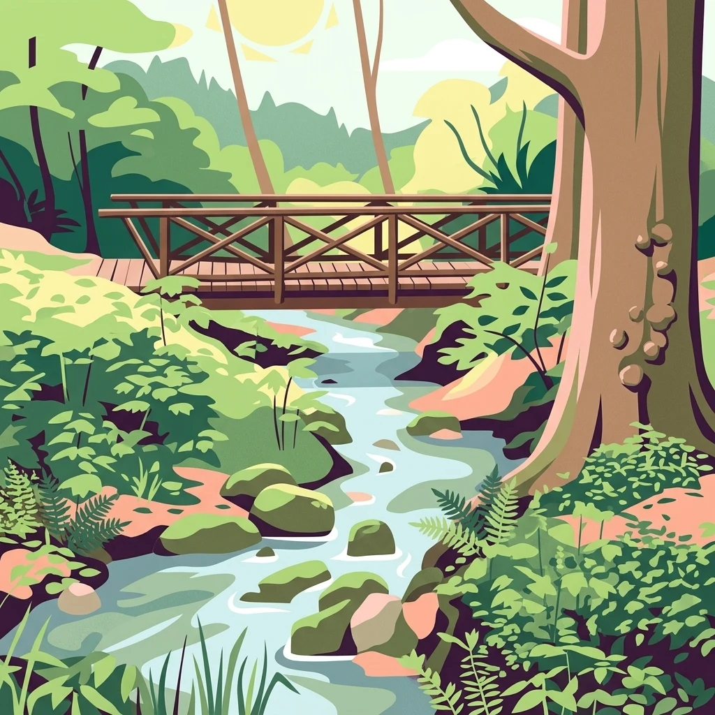
An illustrative art style drawing of a small wooden bridge crossing a winding stream in a lush, green forest setting with rocks in the water and dense vegetation.

Cöthener Fließtal

Nature reserve

Park overview

Structured park overview, official facts, and landscape profile for Cöthener Fließtal

Cöthener Fließtal park facts, protected area profile, and essential visitor context

Review the core facts for Cöthener Fließtal, including designation, size, terrain, visitor scale, habitats, and operating context in one park-focused overview.

About Cöthener Fließtal

Cöthener Fließtal sits at the transition between two very different landscapes in northeastern Brandenburg. To the north and west rise the wooded hills of the Barnim, a glacial plateau that overlooks Berlin's eastern outskirts. To the south and east opens the broad, flat Oderbruch, the historic floodplain of the Oder river. The protected area follows the Cöthener Fließ, a small stream whose headwaters emerge from spring mires on the slopes of the Barnim and then run downhill past the village of Falkenberg before joining the old Oder beyond the valley's edge. This short journey, from forested source to open floodplain, gives the site a remarkable concentration of habitats within a very compact footprint of about 75 hectares.

Geologically, the valley is a product of the Weichselian glaciation. The upper reaches in particular show prominent end-moraine ridges formed by ice-push, producing a strongly undulating relief that contrasts sharply with the flat Oderbruch below. Elevations within the site range from roughly 24 meters in the lower sections to about 82 meters on the higher moraine slopes. This topographic variety has produced a mosaic of soil conditions and moisture regimes, which in turn supports a strikingly diverse woodland community.

Ecologically, the site is most significant for its forests and its spring-fed wetland zones. In the wetter, sloping spring areas, alder and ash woodland dominates, transitioning downstream into oak and hornbeam forest on more mesic sites, with beech and sycamore on suitable soils. Pine, larch, and black locust occur as non-native or site-untypical species. Above all, the area is valued as a habitat for rare and protected fauna, including bat species such as the greater mouse-eared bat and the western barbastelle, and the hermit beetle, a saproxylic specialist of old broadleaf trees.

The cultural layer of the site is equally distinctive. In the early nineteenth century, the landowner Carl Friedrich von Jena commissioned a romantic landscape park around his newly built Cöthener Schloss. The park's surviving elements, a restored waterwheel, an artificial waterfall, and the hunting lodge known as Carlsburg, still give the lower Fließtal its scenic character and serve as anchors for walking routes and day visitors. Today, the area balances multiple uses: Natura 2000 conservation, forest management on land sold to private owners in 2016, and recreation as a green escape near Berlin.

Quick facts and research context for Cöthener Fließtal

Cöthener Fließtal is a roughly 75 hectare Natura 2000 site in the Märkisch-Oderland district of Brandenburg, Germany, just northeast of Berlin. It lies along the Cöthener Fließ, also known as the Falkenberger Fließ, between the Barnim uplands and the old Oder valley. The site was formally designated as a Flora-Fauna-Habitat area in 2003, with a management plan adopted in 2014 and final confirmation of its protected status in December 2017. It is classified as IUCN Category IV, a Habitat/Species Management Area, and is noted for its glacial end-moraine relief, spring-fed woodland mires, and species-rich bat and insect fauna.

Protection and recognition

Documented terrestrial designation history, management scope, and Natura 2000 records

Cöthener Fließtal Protection Status and International Recognition Data

Cöthener Fließtal maintains established terrestrial protection status backed by official designation history recorded since 2003. Verified international recognition sources include Natura 2000 framework listings detailing the administrative boundary.

International recognition

Protection details

Protection scope
Terrestrial
Designated year
2003
Transboundary protection
No
WDPA ID
555518725
Park context

Deeper park guide and search-rich context for Cöthener Fließtal

Cöthener Fließtal history, landscape, wildlife, and travel context

Explore Cöthener Fließtal through its history, landscape character, ecosystems, wildlife, conservation priorities, cultural context, and seasonal travel timing in a structured park guide built for atlas discovery and search intent.

Why Cöthener Fließtal stands out

The valley is best known for its combination of glacial landforms, spring-fed alder and ash woodlands, and rare protected species, especially bats such as the greater mouse-eared bat and the western barbastelle, and the hermit beetle. It is also distinguished by the surviving elements of an early nineteenth-century romantic landscape park that blend directly into the natural woodland setting along the Cöthener Fließ.
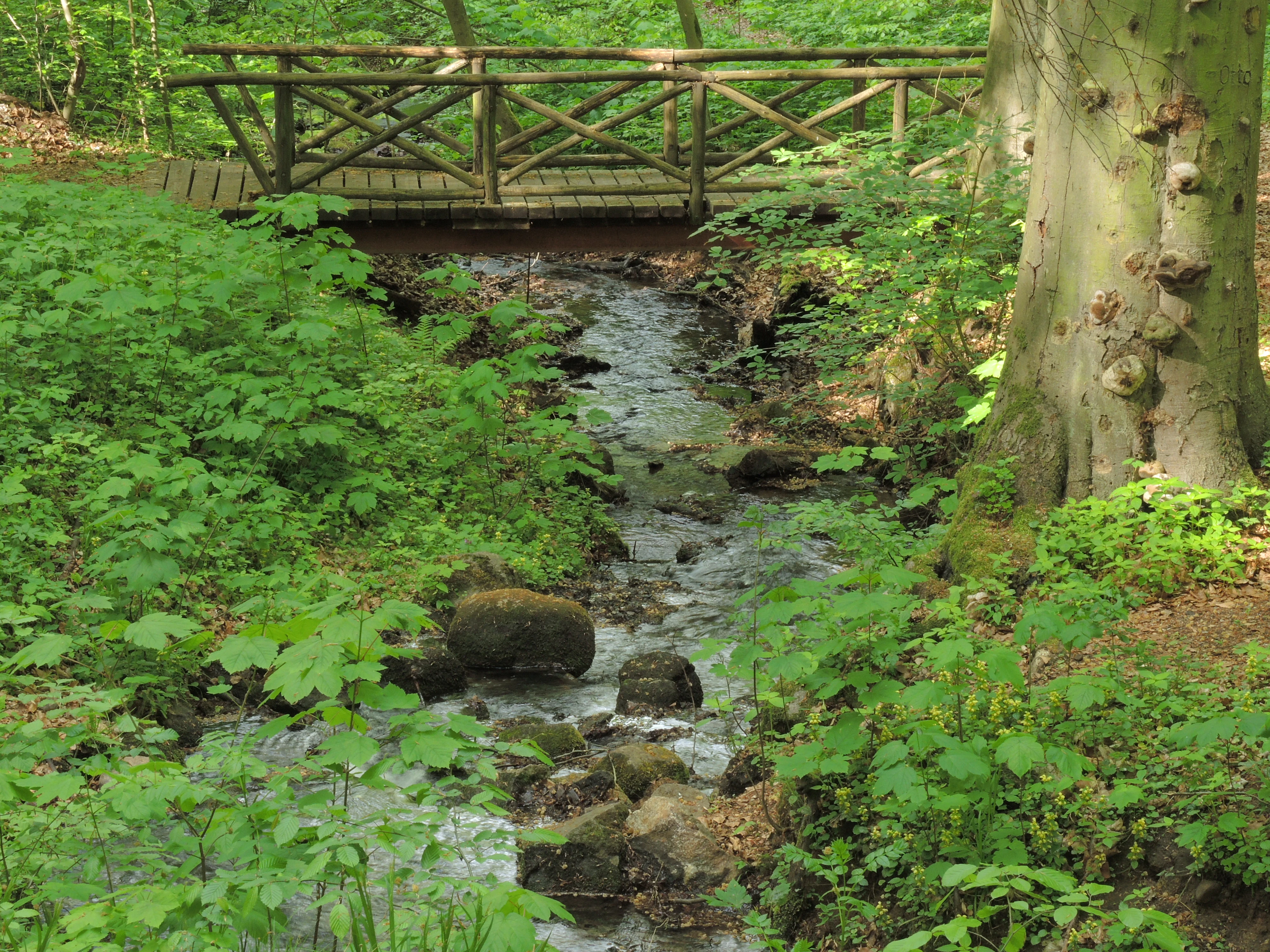
A small wooden footbridge spans a narrow, shallow stream flowing through a dense green forest, with a large tree trunk on the right.
A wooden footbridge crosses a small stream in the Cöthener Fließtal, highlighting the valley's lush forest environment.

Cöthener Fließtal history and protected-area timeline

The romantic framing of the valley dates to the early nineteenth century, when Carl Friedrich von Jena had a landscape park laid out around the contemporaneous Cöthener Schloss. This park set the template for the present-day mix of woodland and designed scenery, with features such as a waterwheel, an artificial waterfall, and the hunting lodge Carlsburg remaining as recognizable historic elements in the valley.

The modern protection history of the site is more layered. In 1996, the district of Märkisch-Oderland was granted the authority to designate a nature protection area along the Cöthener Fließ, and the area was for some time documented as a nature protection area in process. That formal designation was eventually abandoned. In 2003, the site was incorporated into the European Natura 2000 network as a Flora-Fauna-Habitat area under the EU Habitats Directive, with the identifier DE3249301. A corresponding management plan was adopted in 2014, outlining concrete conservation measures and proposing eventual designation as a formal nature protection area.

In December 2017, the Brandenburg State Office for Environment confirmed the site's status as a site of Community Importance for the Cöthener Fließ by ordinance, although without binding specific conservation measures. In February 2021, the district's authority to designate a nature protection area in the valley was withdrawn again. As a result, despite a long-acknowledged need for protection, the area still lacks a full set of legally enforceable conservation measures today. Parallel to this conservation history, the site has experienced economic change: in 2016, portions of the woodland were sold by the BVVG to private owners, introducing commercial forestry that sits in tension with the site's Natura 2000 obligations.

Cöthener Fließtal landscape and geographic character

The valley's landscape is defined by the sharp contrast between the Barnim uplands and the Oderbruch lowlands. In its upper reaches, the Cöthener Fließtal is deeply incised into strongly reliefed end-moraine ridges left by the Weichselian ice sheet, producing slopes, hollows, and small plateaus within just a few hundred meters. Elevation within the protected area ranges from roughly 24 meters in the lower sections near the Oderbruch edge to about 82 meters on the higher moraine crests. The result is a small but visually striking transition zone between forested hills and the flat historic floodplain of the Oder.

The cultural landscape overlays this natural relief. The early nineteenth-century landscape park, set along the stream and around the historical Cöthener Schloss, introduces designed and semi-natural elements: a restored waterwheel, an artificial waterfall, and vistas toward the hunting lodge Carlsburg. Walking paths and view points tie these features to the surrounding woodlands, so that visitors experience a hybrid scenery of glacial moraine, swampy stream corridors, and romantic parkland.

Cöthener Fließtal ecosystems, habitats, and plant life

Ecologically, the Cöthener Fließtal is best understood as a compact mosaic of woodland habitats stitched along a spring-fed stream. The most distinctive ecological element is the so-called Hangmoor habitat in the upper catchment, where hillside spring mires support alder and ash forests. Moving downstream and onto drier, better-drained slopes, the woodland shifts to oak and hornbeam communities, with beech and sycamore present on suitable sites. Pine, larch, and black locust occur where they are not part of the natural local forest community, and their presence is considered non-typical for the site.

This habitat diversity is closely tied to the local topography. The strong glacial relief produces rapid changes in slope, exposure, and soil moisture, allowing wet, mesic, and drier forest types to occur in close proximity. The stream corridor itself, with its alder fringes and continuous canopy, functions as a connective ecological spine linking the higher Barnim woodlands to the Oderbruch floodplain beyond Falkenberg. Because the protected area is small, this internal connectivity is unusually high relative to its size.

Cöthener Fließtal wildlife and species highlights

Although compact, the valley supports a disproportionately rich fauna. The combination of old broadleaf trees, mature woodland structure, and sheltered stream corridors makes it especially valuable for bat species. Two protected bat species are highlighted in the site's profile: the greater mouse-eared bat, Myotis myotis, which depends on large old trees and warm attic-like roosts, and the western barbastelle, Barbastella barbastellus, a forest specialist that hunts along woodland edges and rides. The valley is also notable for saproxylic insects, most prominently the hermit beetle, Osmoderma eremita, a strictly protected species that develops in cavities of very old broadleaf trees.

In addition to these headline species, the mosaic of habitats supports a range of woodland birds and stream-associated insects typical of mature mixed deciduous forests in the Brandenburg lowlands. The juxtaposition of spring-fed alder woods, oak-hornbeam forest, and the edge of the open Oderbruch gives the site the kind of habitat diversity that allows different species groups to coexist within a small area.

Cöthener Fließtal conservation status and protection priorities

The principal conservation significance of Cöthener Fließtal lies in its inclusion in the European Natura 2000 network as a Flora-Fauna-Habitat area under the EU Habitats Directive. Designated in 2003 and confirmed as a site of Community Importance in December 2017, it is classified under IUCN Category IV as a Habitat/Species Management Area, meaning it is primarily managed for the conservation of particular species and habitat types rather than for broad ecosystem protection. Its value at the European level rests on the combination of Hangmoor spring habitats, diverse broadleaf woodland, and the presence of strictly protected species such as the greater mouse-eared bat, the western barbastelle, and the hermit beetle.

A management plan adopted in 2014 lays out specific conservation measures and contemplates eventual formal designation as a nature protection area. Yet the legal trajectory has been uneven: an earlier effort in 1996 to designate the area under district authority was abandoned, and in 2021 the district again lost the authority to designate a nature protection area here. As a result, despite recognized conservation value, the site today lacks a fully enforceable national-level protection regime, and its Natura 2000 status remains the principal legal safeguard.

A further conservation pressure comes from land use. The 2016 sale of portions of the forest by the BVVG to private owners introduced commercial timber harvesting, including documented harvesting activity in 2019. Balancing this private forestry with the requirement to maintain and restore the site's Natura 2000 habitat features is an ongoing management challenge for the Brandenburg State Office for Environment and the district of Märkisch-Oderland.

Cöthener Fließtal cultural meaning and human context

The cultural context of the Cöthener Fließtal is inseparable from its romantic park heritage. The landscape park laid out for Carl Friedrich von Jena in the early nineteenth century around the Cöthener Schloss introduced designed scenery into what had been a purely agricultural and forested valley. The hunting lodge Carlsburg, the artificial waterfall, and the restored waterwheel are the most visible remnants of this period. They shape how the valley is used today, as a place where walkable designed scenery blends into a Natura 2000 woodland. The site's location near the historical border between Brandenburg estates and the Oderbruch floodplain also gives it a layered regional identity that combines aristocratic estate culture, glacial natural landscape, and modern European nature conservation.

Top sights and standout views in Cöthener Fließtal

Standout qualities of the Cöthener Fließtal include its Hangmoor spring-fed alder and ash woodlands, its richly structured oak-hornbeam and beech forests, and its population of protected bats and saproxylic insects such as the hermit beetle. Equally notable are the surviving nineteenth-century park elements, especially the restored waterwheel, the artificial waterfall, and the hunting lodge Carlsburg, which continue to define the valley's scenic character. Its compact 75-hectare footprint, situated between the Barnim hills and the Oderbruch, makes it an unusually dense concentration of habitats and cultural landscape features for its size.

Best time to visit Cöthener Fließtal

The valley's woodland scenery and stream corridor are most attractive from late spring through early autumn, when deciduous canopy is fully leafed, the stream flow is dependable, and the walkable park paths around the waterwheel, waterfall, and Carlsburg are easy to follow. Late spring is particularly rewarding for woodland birds and for the lush green character of the alder and ash spring forests, while early autumn brings color change in the broadleaf stands. Winter visits are quieter but the open park structures and the moraine topography remain visible, though wet and icy paths make the spring-fed sections more demanding.


Monthly climate preview

Long-term temperature ranges and monthly precipitation patterns across Brandenburg

Cöthener Fließtal Climate Normals and Measured Weather by Month

Historical data records monthly temperature swings from sub-zero winter minimums to peak summer maximums alongside consistent daily precipitation across the representative coordinate. Examining the full twelve-month profile provides complete historical averages for detailed climate analysis within Brandenburg.
Annual mean9 °C
-1 °C20 °C
Jan-1°
Feb
Mar
Apr
May13°
Jun17°
Jul20°
Aug19°
Sep15°
Oct
Nov
Dec
Warmest month
July

19.5 °C

Coolest month
January

-1 °C

Wettest month
July

2.5 mm/day

Driest month
April

1.1 mm/day

Park location guide

Geography guide, regional context, and park location map for Cöthener Fließtal

Cöthener Fließtal park geography, regions, and map view in Germany

Understand where Cöthener Fließtal sits in Germany through a broader geographic reading of the surrounding landscape, nearby location context, and its mapped position within the national park landscape.

How Cöthener Fließtal fits into Germany

Germany is a federal republic in Western and Central Europe with a population of over 83 million across sixteen constituent states. It is Europe's largest economy by nominal GDP and a major global exporter and importer. The capital is Berlin, and the country borders Denmark, Poland, Czech Republic, Austria, Switzerland, France, Luxembourg, Belgium, and the Netherlands.

Wider geography shaping Cöthener Fließtal in Germany

Germany is located in Western and Central Europe, spanning 357,022 km². It borders Denmark to the north, Poland and the Czech Republic to the east, Austria and Switzerland to the south, and France, Luxembourg, Belgium, and the Netherlands to the west. The country has coastlines on the Baltic Sea and North Sea to the north, with the Alps located in the southern region.

Map view of Cöthener Fließtal

Use this park location map to pinpoint Cöthener Fließtal in Germany, understand its exact geographic position, and read its mapped placement within the surrounding landscape more clearly.

Pigeon | © OpenStreetMap contributors

Location context for Cöthener Fließtal

Brandenburg

Explore photographic records of glacial moraines, swamp forests, and historic parkland elements.

Cöthener Fließtal Landscapes and Scenery: Visualizing Protected Habitats

Visual documentation reveals the distinct topography and woodland habitats of Cöthener Fließtal across glacial moraine ridges and stream corridors. Photographic records capture the shifting scenery of spring-fed mires, mature deciduous stands, and romantic landscape architecture.

A small wooden footbridge spans a narrow, shallow stream flowing through a dense green forest, with a large tree trunk on the right.

An overshot water wheel in a wooded area, with wooden railings surrounding the structure and forest foliage in the background.

Park atlas

Compare adjacent glacial valleys, woodland habitats, and regional reserves

Explore Parks Near Cöthener Fließtal and Surrounding Protected Landscapes

Browsing other parks near Cöthener Fließtal reveals connected ecological corridors and diverse glacial landforms across the surrounding region. Extending the geographic comparison allows visitors to evaluate similar protected habitats, stream valleys, and woodland reserves.
Nature reserveBrandenburg
5.8 km away#1 closest

Northeast

Tongruben Neuenhagen Nature Reserve: Protected Wetland Geography in Brandenburg, Germany

Examining post-industrial clay-pit habitats and protected wetland boundaries

Tongruben Neuenhagen is a designated nature reserve located in Brandenburg, Germany, established to protect biological communities that have developed within former clay extraction pits. The area features a complex mosaic of open water, wetland margins, and transitional scrub habitats. This reserve provides a notable example of how historical industrial land use can be repurposed into valuable habitat for protected species, serving as a key element of the local conservation network in the Märkisch-Oderland region.

Area
1.196 km²
Established
1990
IUCN
IV
Relief
Lowland
Protected landscapeWest Pomeranian Voivodeship
12 km away#2 closest

Northeast

Cedynia Landscape Park: Mapped Protected Landscapes and Regional Geography in Poland

Protected mosaic of sandy forests and river valleys

Spanning 308 square kilometers, Cedynia Landscape Park protects a complex transition zone in Poland. The area features the expansive Puszcza Piaskowa pine forests, the hilly moraine relief of the Cedynia Carpathians, and the biodiverse wetlands of the lower Oder River. This protected landscape represents an essential study in lowland ecological gradients and postglacial terrain development within the West Pomeranian Voivodeship.

Area
308.5 km²
Established
1993
Relief
Upland
Climate
Temperate
Watercolor painting depicting a river flowing through a valley with green vegetation and distant mountains
National parkBrandenburg
17 km away#3 closest

Northeast

Lower Oder Valley National Park: Unique Polder Landscape and Bird Sanctuary

Discover protected area maps and regional geography in Brandenburg

Delve into the Lower Oder Valley National Park, a national park recognized for its extraordinary polder landscape and extensive wetland ecosystems. This page provides detailed geographic context, highlighting the park's unique engineered floodplain, its role as a sanctuary for numerous bird species, and its position within the regional geography of Brandenburg. Understand the mapped boundaries and ecological importance of this exceptional protected area.

Area
103.23 km²
Established
1995
IUCN
II
Visitors
150K annual
Nature reserveBrandenburg
25 km away#4 closest

Southeast

Stobbertal Nature Reserve: Geography, Mapped Boundaries, and Protected Landscape Context

A detailed geographic study of the Stöbber river valley in Brandenburg, Germany

Stobbertal represents a compact yet ecologically dense protected area in Brandenburg. This study provides access to information regarding its diverse forest and wetland habitats, ranging from ancient oak-hornbeam woodlands to rare floodplain remnants. Gain insight into the regional importance of the river corridor, its hydrologic features, and the protected species that inhabit this distinct northeastern German landscape.

Area
8.84 km²
Established
1990
IUCN
IV
A soft watercolor painting of a pastoral landscape featuring green rolling hills, distant trees, and a foreground with grassy vegetation and pinkish marsh-like reflections.
Protected landscapeBrandenburg
About 26 km away#5 closest

South

Naturpark Märkische Schweiz: A Protected Landscape Discovery in Brandenburg

Glacial terrain, kettle lakes, and river basin geography.

Situated near Berlin, this protected landscape features a textbook glacial relief shaped by retreating ice sheets. The area encompasses the Schermützelsee, deep kettle ponds known as Sölle, and the narrow valleys of the Stobber river. Learn about the park's layered conservation framework, which combines European habitat protection with rich fieldstone architecture and cultural history.

Area
205 km²
Established
1990
Relief
Upland
Climate
Temperate
A watercolor painting of a serene fen or wetland with reeds in the foreground, calm water, and rolling hills in the background under a soft pastel sky.
Nature reserveBarnim District
About 26 km away#6 closest

Southwest

Ladeburger Schaeferpfuhle: Nature Reserve and Protected Landscape in Barnim District

Mapped lowland fen ecosystems and habitat geography

Located in the Barnim District of Germany, Ladeburger Schaeferpfuhle is a designated nature reserve defined by its post-glacial lowland fen terrain. This area preserves a mosaic of wet meadows, shrub thickets, and pools that support specialized plant and wildlife populations. The site serves as a vital example of regional hydrology, maintaining open landscapes through traditional grazing practices that protect this fragile habitat.

Area
0.267 km²
Established
2000
Relief
Lowland
Climate
Temperate
Watercolor painting of a tranquil, flat wetland landscape with pale green, pink, and yellow hues representing water, vegetation, and a soft sky.
Nature reserveBrandenburg
About 26 km away#7 closest

Southeast

Europäisches Vogelschutzgebiet Altfriedländer Teich- und Seengebiet: Protected Area Geography

Nature reserve wetland network in eastern Brandenburg

Discover the geographic structure of this extensive pond and lake complex in Märkisch-Oderland. This protected area features shallow open water, sprawling reedbeds, and remnants of lowland peat that support dense populations of migratory waterfowl and rare breeding waterbirds within a working cultural landscape.

Area
7 km²
Relief
Lowland
Climate
Temperate
Scope
Terrestrial
Protected landscapeWest Pomeranian Voivodeship
27 km away#8 closest

Northeast

Wzgórza Krzymowskie Protected Landscape: Moraine Geography and Map Context

Glacial ridges and forest landscapes in West Pomeranian Voivodeship

Wzgórza Krzymowskie serves as a primary example of compressed postglacial relief in northwestern Poland. The protected area features a unique combination of sandy inland dunes, internal moraine hills, and a steep western escarpment that carves deep ravines towards the Oder. This geographic analysis highlights the structural connection between the Puszcza Piaskowa forest, spring-fed stream networks, and elevated viewpoints across the regional landscape.

Relief
Upland
Access
Easy access
Scope
Terrestrial
Water
Major water bodies

Common questions about visiting, size, designation, and location context for Cöthener Fließtal

Cöthener Fließtal FAQs for park facts, access, geography, and protected area context

Find quick answers about Cöthener Fließtal, including protected-area facts, park geography, trail and visitor context, and how the park fits into its surrounding country and regional landscape.
MoriAtlas Explorer

Continue Your Protected Areas Search Across the Global Atlas

Deepen your exploration by continuing the structured search for national parks and protected areas worldwide. Utilize the comprehensive filtering capabilities to compare different conservation landscapes and refine your understanding of global park geography. Discover more about the distribution and characteristics of protected natural areas.

Global natural geography