
Mori Atlas logo
National parkCuronian Spit National Park

Discover the dramatic dunes, unique forests, and migratory bird pathways of this coastal protected landscape.

Curonian Spit National Park: A UNESCO World Heritage Sand Spit National Park

(National Park "Kurshskaya Kosa")

Curonian Spit National Park, situated within Russia's Kaliningrad Oblast, protects a significant portion of one of the world's longest sand spits. This national park showcases a dynamic geography shaped by the Baltic Sea and Curonian Lagoon, renowned for its towering sand dunes, including the iconic Epha Dune, and the enigmatic Dancing Forest. As a UNESCO World Heritage Site, it offers unparalleled opportunities for atlas-based exploration of unique coastal ecosystems and migratory bird routes.

UNESCO World Heritage SiteCoastal DunesMigratory BirdsBaltic SeaSand SpitWetlands
Stylized illustration of wooden boardwalk on sandy dunes with trees, Curonian Lagoon, and Baltic Sea

Curonian Spit National Park

National park

Park overview

Structured park overview, official facts, and landscape profile for Curonian Spit National Park

Curonian Spit National Park park facts, protected area profile, and essential visitor context

Review the core facts for Curonian Spit National Park, including designation, size, terrain, visitor scale, habitats, and operating context in one park-focused overview.

About Curonian Spit National Park

Curonian Spit National Park represents a unique coastal protection zone in the Baltic region, preserving a landscape that has evolved over millennia through the interplay of wind, waves, and glacial deposits. The park encompasses the Russian-owned southern portion of the Curonian Spit, a slender finger of land that extends from the Sambian Peninsula in the south northward toward Lithuania. This depositional sandbar, formed as receding glaciers left behind the materials that would become the Baltic Sea, has been shaped by marine and aeolian processes into one of Europe's most distinctive coastal landforms. The park's significance extends beyond its natural features to encompass the cultural landscape that has developed over centuries, with the spit serving as a corridor for human settlement and trade. The proximity of multiple distinct ecological communities—beach, dune ridge, various wetland types, meadows, and forests—within a relatively confined area creates exceptional biodiversity, making the park a living laboratory of coastal ecosystem dynamics.

Quick facts and research context for Curonian Spit National Park

Located in Kaliningrad Oblast, Russia, Curonian Spit National Park encompasses 41 kilometers of the southern portion of the 98-kilometer Curonian Spit. The park was established in 1987 and is managed by Russia's Ministry of Natural Resources and Environment. The spit functions as a natural barrier between the saltwater Baltic Sea and the freshwater Curonian Lagoon, with lagoon waters averaging 3.7 meters in depth and sitting approximately 12 centimeters above Baltic Sea level. The park's width varies from 0.4 to 4 kilometers, following the narrow sandy landform that is the second longest spit in the world after the Arabat Spit in the Sea of Azov.

Protection and recognition

Mapping the transboundary management scope and designated boundaries of the coastal spit

Curonian Spit National Park Protection Status and Transboundary Framework

Explorers can examine the documented protection status and transboundary management framework governing Curonian Spit National Park. Accessing verified designation records provides essential context on how sovereign nations collaborate to safeguard unique Baltic coastal features.

Protection details

Protection scope
Mixed
Transboundary protection
Yes
Park context

Deeper park guide and search-rich context for Curonian Spit National Park

Curonian Spit National Park history, landscape, wildlife, and travel context

Explore Curonian Spit National Park through its history, landscape character, ecosystems, wildlife, conservation priorities, cultural context, and seasonal travel timing in a structured park guide built for atlas discovery and search intent.

Why Curonian Spit National Park stands out

Curonian Spit National Park is best known for its extraordinary dune landscape, one of the most impressive in Europe. The park features the iconic Dancing Forest, a grove of oddly twisted pine trees whose curved and spiral forms remain a subject of scientific curiosity. The spit serves as a critical habitat along major migratory bird routes, with over 260 bird species recorded within its boundaries. Its status as a UNESCO World Heritage Site, shared with Lithuania, reflects the outstanding universal value of this dynamic coastal landscape where natural processes continue to shape the terrain.
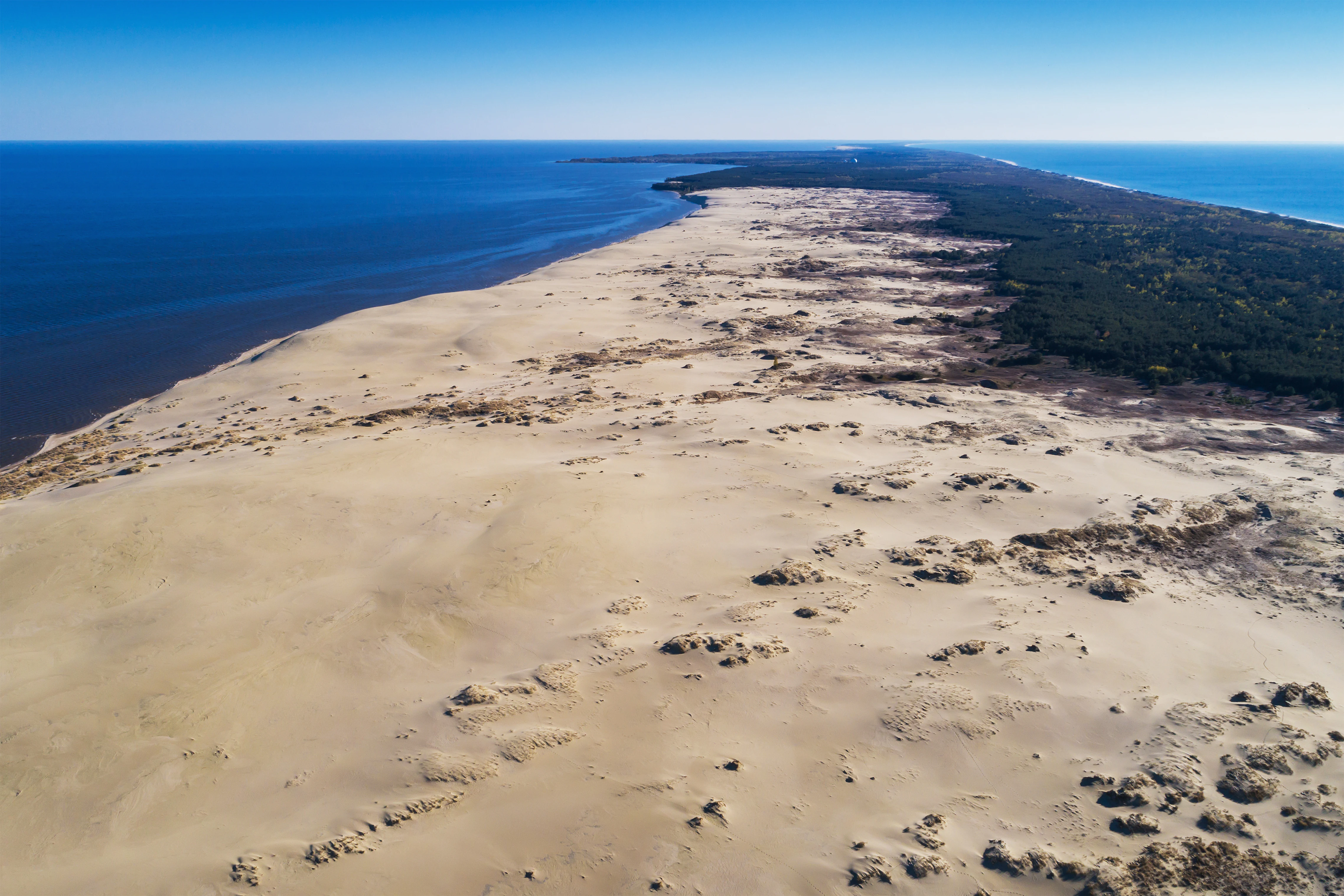
Aerial view of a sandy coastal spit extending into the sea, bordered by forested land and blue water, with visible sand dunes and sparse vegetation
Aerial view of Epha Dune within Curonian Spit National Park

Curonian Spit National Park history and protected-area timeline

The Curonian Spit began forming approximately 15,000 years BCE as the Weichselian glaciation retreated, depositing glacial moraine that would become the foundation for the spit. The subsequent action of sea currents and wind built upon this glacial substrate, creating the extensive dune systems that characterize the landscape today. The area has been inhabited for millennia, with human communities adapting to the challenging coastal environment. The modern protected area was established in 1987, recognizing the need to preserve this unique landscape and its ecological communities. The international recognition came in 2000 when the Curonian Spit was inscribed as a UNESCO World Heritage Site, a designation that encompasses both the Russian and Lithuanian portions of the spit, acknowledging that the outstanding universal value of this landscape transcends national boundaries.

Curonian Spit National Park landscape and geographic character

The Curonian Spit presents a dramatic landscape defined by its narrow, elongated form varying between 400 meters and 4 kilometers in width. The park's defining feature is its chain of sand dunes, some reaching heights of 35 meters above sea level, which have been shaped by prevailing winds into characteristic parabolic forms. The Epha Dune stands as one of the most impressive moving sand masses in Europe, continuing the centuries-old process of dune migration that has periodically buried forests and settlements. Along the western coast, wide sandy beaches meet the Baltic Sea, while the eastern side borders the calmer waters of the Curonian Lagoon. Between these water bodies, the spit supports a mosaic of habitats including wet meadows, marshland, and forest stands that have developed in the sheltered dune hollows. The landscape possesses a stark beauty, where the rhythmic lines of dunes meet the open horizons of the Baltic, creating a sense of expansive solitude.
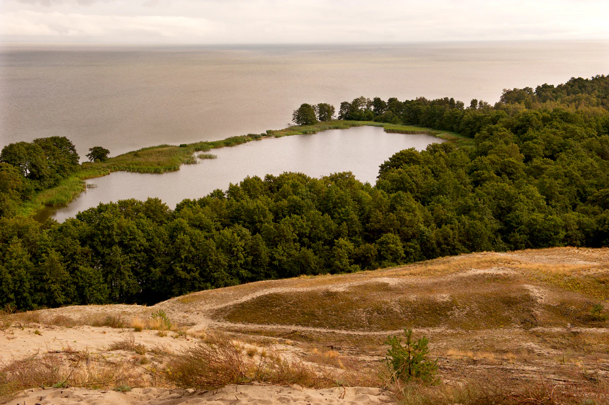
Lake surrounded by dense forest and sandy terrain with the Baltic Sea visible in the distance
A lake surrounded by forest and sand dunes with the Baltic Sea in the background

Curonian Spit National Park ecosystems, habitats, and plant life

The Curonian Spit supports remarkable ecological diversity resulting from the close proximity of multiple distinct habitat types within a narrow geographic space. The park's plant life includes 889 documented species, hybrids, varieties, and forms of wild vascular plants distributed across 398 genera and 111 families, reflecting the variety of conditions from exposed beach to sheltered forest. The transitional nature of the spit—where freshwater meets saltwater, terrestrial meets marine, and open dune meets closed forest—creates edge conditions that support species assemblages found nowhere else in the Baltic region. Wetlands play a particularly significant role, providing critical habitat for breeding, staging, and wintering waterfowl. The landscape's dynamic character, with ongoing dune movement and natural succession processes, maintains a diversity of early-successional habitats that complement the more stable forest communities.
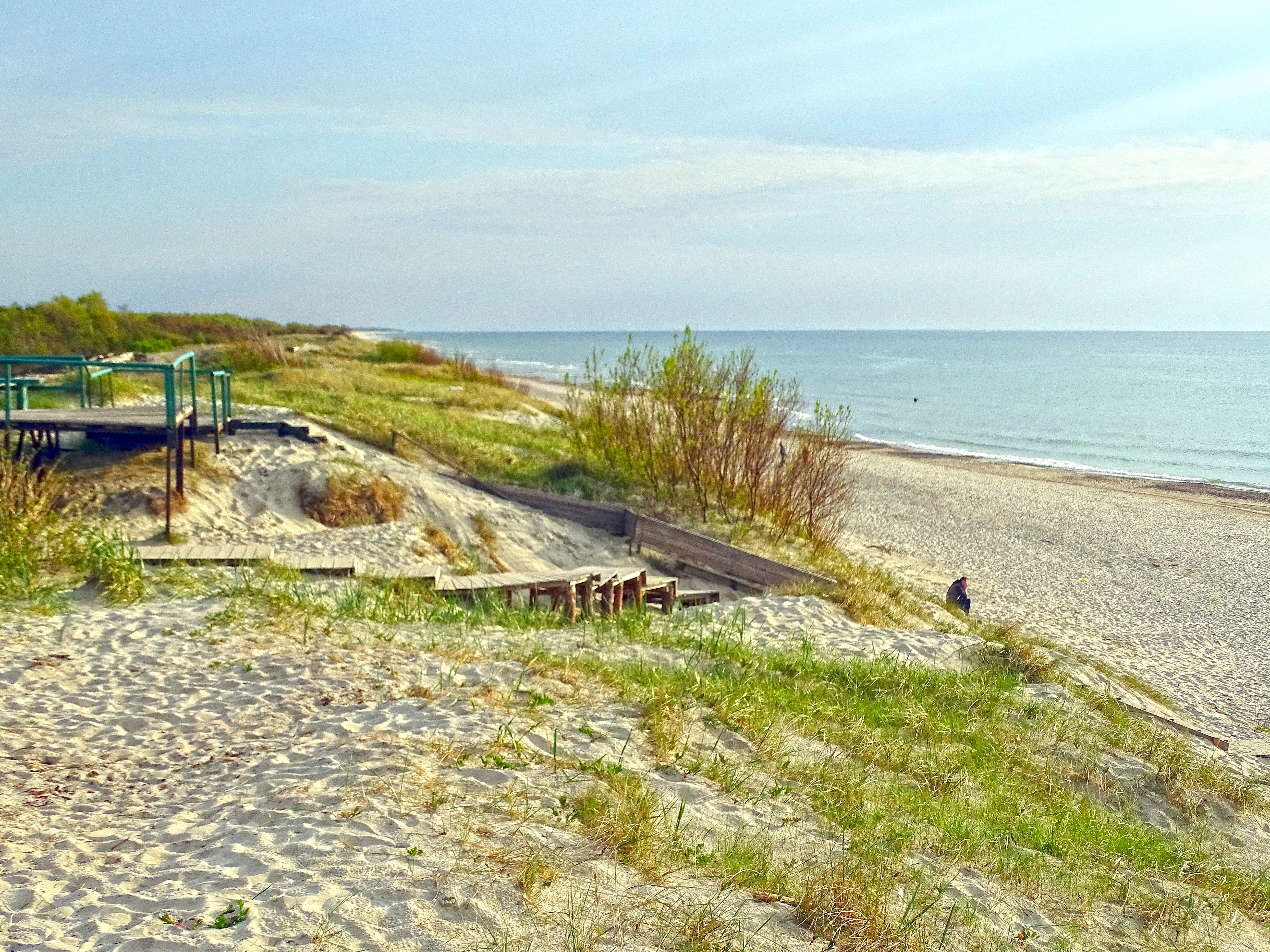
Sandy beach with grassy dunes, wooden boardwalk, and the Baltic Sea in the background
Sandy dunes and wooden boardwalk leading to the Baltic Sea at Curonian Spit National Park

Curonian Spit National Park wildlife and species highlights

The Curonian Spit's position along major migratory bird flyways makes it exceptionally significant for avian fauna. Park researchers have recorded 262 bird species within the protected area, of which approximately 100 species nest and breed on the spit, utilizing the wetlands, forests, and dune habitats for reproduction. The wetlands and lagoon shallows provide crucial staging areas for migratory waterfowl moving between northern breeding grounds and southern wintering areas. Mammalian fauna includes 46 species, with elk (moose), European roe deer, and wild boar among the larger mammals present, joined by more cryptic species including fox, marten, raccoon dog, badger, hare, red squirrel, and beaver. Overall, the park supports over 290 species of terrestrial vertebrates, representing approximately 80 percent of all vertebrate species found in the Kaliningrad region, underscoring the area's importance as a biodiversity hotspot.
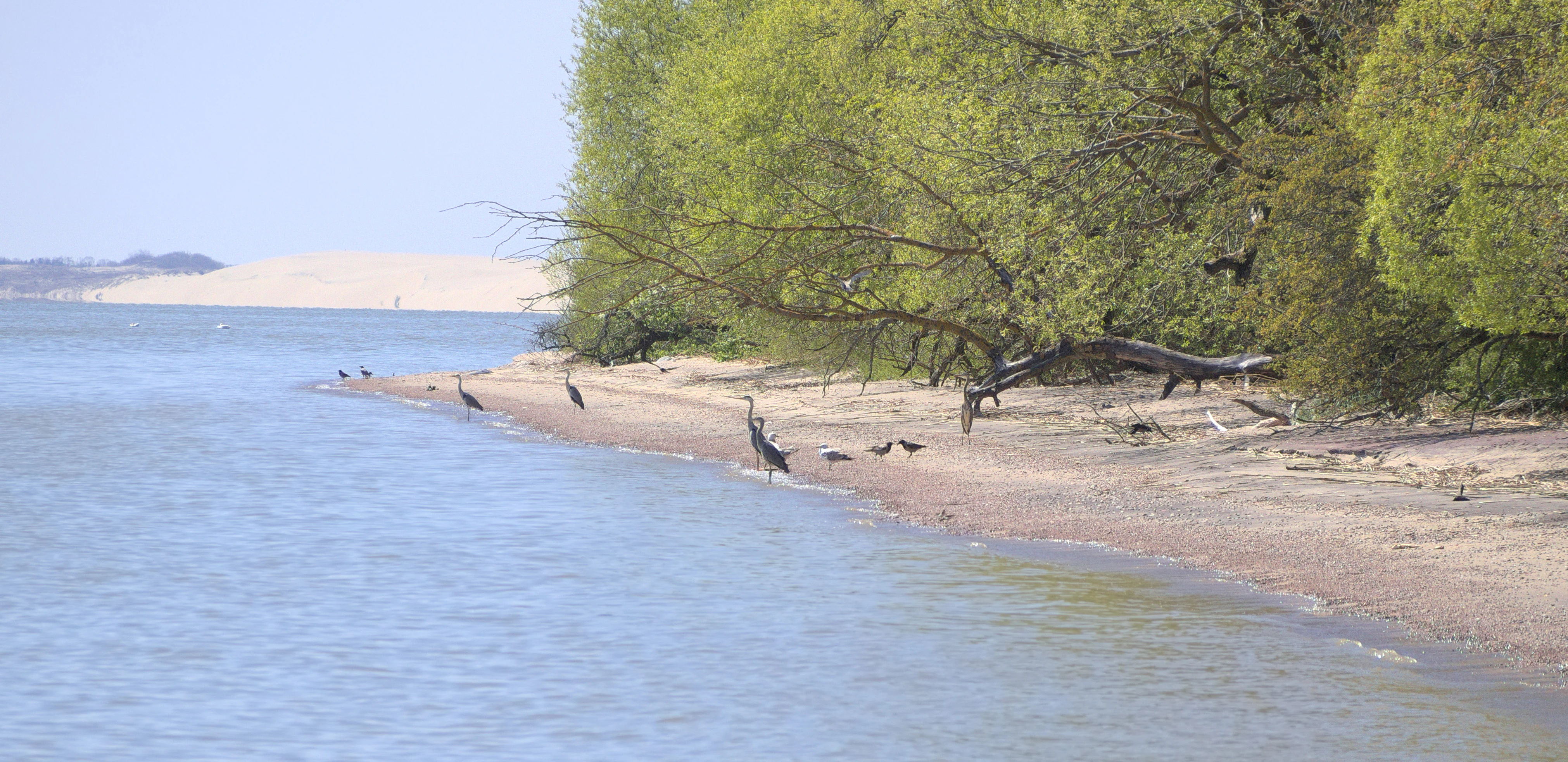
A coastal beach scene with calm water, sandy shore, trees, and several birds along the shoreline
Coastal beach scene of the Curonian Spit near the settlement of Rybachy

Curonian Spit National Park conservation status and protection priorities

Curonian Spit National Park serves as a critical conservation unit for coastal Baltic ecosystems, protecting both the dynamic geological processes that create and maintain the dune landscape and the biological communities that depend on these habitats. The UNESCO World Heritage designation reflects the international recognition that the spit represents outstanding universal value—not merely as a Russian or Lithuanian asset, but as a global heritage site where natural processes continue to operate relatively unimpeded. The park's conservation value is amplified by its position along the East Atlantic Flyway, one of the major migratory bird routes in the Western Palearctic, making it essential for the protection of waterfowl populations that traverse continents twice yearly. The diverse habitat mosaic, from open beach through dune, wetland, meadow, and forest, maintains ecological processes that support both resident species and the extraordinary number of migratory visitors.

Curonian Spit National Park cultural meaning and human context

The Curonian Spit has been a place of human habitation and activity for millennia, with the landscape shaped not only by natural forces but also by the traditions and practices of local communities. The spit served as a natural corridor for travel and trade between the Sambian Peninsula and the regions to the north, with fishing communities establishing settlements along both the Baltic and lagoon shores. The name "Kurshskaya" derives from the historical Curonians, a Baltic people who inhabited the region in medieval times. The park contains remnants of human activity dating to earlier periods, while contemporary communities continue to maintain connections to the land and its resources. The cultural dimension of the spit is intertwined with its natural features, as traditional land use practices contributed to the development of the distinctive cultural landscape that exists today.

Top sights and standout views in Curonian Spit National Park

The Curonian Spit's UNESCO World Heritage status and its position as one of the world's longest spits make it a landmark of international significance. The park's dune systems, particularly the impressive Epha Dune, represent exceptional examples of coastal aeolian processes in action. The Dancing Forest remains one of the most enigmatic features, where hundreds of pine trees exhibit curious twisted and curved forms whose origin—whether natural genetic variation, soil conditions, or historic human intervention—remains debated. The bird migration spectacle, with hundreds of thousands of waterfowl passing through twice annually, ranks among the most impressive in Europe. The juxtaposition of Baltic Sea beaches with the tranquil Curonian Lagoon creates a distinctive coastal experience where visitors can witness the meeting of two very different aquatic environments.

Best time to visit Curonian Spit National Park

The Curonian Spit can be visited throughout the year, though each season offers distinctly different experiences. Late spring through early autumn provides the most comfortable weather for exploring the beaches and hiking the dune trails, with May and June offering particularly good conditions and the opportunity to observe breeding bird activity. Autumn brings the dramatic raptor and waterfowl migration, making September and October particularly rewarding for birdwatchers. Winter transforms the landscape, with snow-covered dunes offering a stark, minimalist beauty and far fewer visitors. The changing seasons reveal different aspects of the spit's character, from the green freshness of early summer to the amber and grey tones of autumn storms to the crystalline winter silence.
Monthly climate preview

Long-term temperature averages and historical precipitation trends for the coastal spit.

Curonian Spit National Park Climate and Monthly Weather Normals

Long-term coastal data at the park representative elevation of five meters show mean monthly temperatures ranging from sub-zero averages in January to warm peaks above eighteen degrees Celsius in August. Accessing the complete twelve-month profile allows users to trace the detailed seasonal transitions and compare historic daily precipitation averages across all seasons.
Annual mean8 °C
-1 °C18 °C
Jan-1°
Feb-1°
Mar
Apr
May11°
Jun15°
Jul18°
Aug18°
Sep14°
Oct
Nov
Dec
Warmest month
August

18.3 °C

Coolest month
January

-0.7 °C

Wettest month
October

2.5 mm/day

Driest month
April

1.3 mm/day

Park location guide

Geography guide, regional context, and park location map for Curonian Spit National Park

Curonian Spit National Park park geography, regions, and map view in Russia

Understand where Curonian Spit National Park sits in Russia through a broader geographic reading of the surrounding landscape, nearby location context, and its mapped position within the national park landscape.

How Curonian Spit National Park fits into Russia

Russia is a transcontinental nation spanning eleven time zones, bordered by fourteen countries. It is the world's largest country by area, covering 17,098,246 km². Moscow is the capital and largest city, while Saint Petersburg is the second-largest and a major cultural centre.

Wider geography shaping Curonian Spit National Park in Russia

Russia spans Eastern Europe and North Asia, covering 17,098,246 km². It shares land borders with fourteen countries, more than any other nation, and spans eleven time zones. The landscape includes vast plains, mountain ranges such as the Urals and Caucasus, and extensive coastlines along the Arctic Ocean, Pacific Ocean, Baltic Sea, Black Sea, and Caspian Sea.

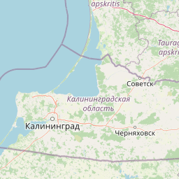
Map view of Curonian Spit National Park

Use this park location map to pinpoint Curonian Spit National Park in Russia, understand its exact geographic position, and read its mapped placement within the surrounding landscape more clearly.

Pigeon | © OpenStreetMap contributors

Location context for Curonian Spit National Park

Kaliningrad Oblast
Recorded earthquake history

Explore the Historical Earthquake Catalogue for Curonian Spit National Park

Discover the documented record of seismic events associated with the geography of Curonian Spit National Park. This MoriAtlas collection allows for the review of historical epicentres, magnitudes, and proximity data across this protected Baltic landscape.

Curonian Spit National Park Earthquake History

Catalogued events

2 events

Strongest magnitude

Magnitude 4.8

Most recent event

Sep 21, 2004

This history includes earthquakes recorded inside the park or within 50 km of its borders

Explore the unique protected landscapes of the Curonian Spit, from vast moving sand dunes to tranquil lagoon shores and critical migratory bird habitats.

Curonian Spit National Park Photos: Visualizing Coastal Dunes, Forests, and Baltic Scenery

Browse a curated collection of Curonian Spit National Park images, offering an in-depth visual understanding of its dramatic coastal terrain and diverse protected ecosystems. These photographs reveal the park's iconic sand dunes, the enigmatic Dancing Forest, and critical habitats for migratory birds, helping to contextualize its UNESCO World Heritage status.

Aerial view of a sandy coastal spit extending into the sea, bordered by forested land and blue water, with visible sand dunes and sparse vegetation

Satellite image showing the Curonian Spit as a narrow landmass between the Baltic Sea and Curonian Lagoon

Lake surrounded by dense forest and sandy terrain with the Baltic Sea visible in the distance

Sandy beach with grassy dunes, wooden boardwalk, and the Baltic Sea in the background

A coastal beach scene with calm water, sandy shore, trees, and several birds along the shoreline

A forest with tall pine trees having twisted trunks, patches of grass, and sunlight filtering through the canopy

Park atlas

Explore similar coastal protected landscapes and regional park geography across the Baltic Sea area.

Discover Other Protected Areas and National Parks Near Curonian Spit

Continue your protected area discovery from Curonian Spit National Park by exploring other nearby parks and conservation landscapes within Kaliningrad Oblast and the surrounding Baltic region. This comparative atlas view allows users to trace distinct geographic patterns and understand the broader ecological context of coastal protected areas.
Watercolor painting of a landscape with a river flowing through grassy fields, trees, and mountains in the background
National parkLithuania
Park boundaries overlap#1 closest

Northeast

Curonian Spit National Park: Atlas of Baltic Sand Dunes and Coastal Protected Areas

Exploring the narrow peninsula landscape of Lithuania

Curonian Spit National Park is a protected coastal terrain featuring massive sand dunes and coniferous forests situated along the Baltic Sea. This detailed map-based overview examines the geomorphology of the spit, the stabilization of the Nagliai reserve, and the regional geography that defines this unique ecological corridor within Lithuania.

Area
264.74 km²
Established
1991
IUCN
II
Visitors
400K annual
A panoramic watercolor illustration showing a minimalist landscape with light green dunes, tufts of grass, and small pink flowers in the foreground against a white background.
National parkKaliningrad Oblast
Mapped location lies within the park boundary#2 closest

North

Curonian Spit National Park: Mapped Geography of Russia's Baltic Coastal Peninsula

Exploring the dune systems and coastal lagoon terrain

Curonian Spit National Park serves as a critical protected landscape located in Kaliningrad Oblast. Its geography includes active aeolian dune formations, ancient forest stands, and wetlands flanking the Curonian Lagoon. The park represents a vital intersection of geological history and international bird migration research within a narrow, fragile Baltic coastal environment.

Area
66.21 km²
Established
1987
IUCN
II
Visitors
1M annual
A watercolor painting showing a wide, calm river winding through a flat, green delta landscape under a hazy sky.
Regional parkLithuania
About 2.7 km away#3 closest

Northeast

Nemunas Delta Regional Park: Mapping the Wetland Mosaic of the Lithuanian Coast

Explore the complex hydrology and floodplain geography of this Ramsar-listed regional park

Nemunas Delta Regional Park protects a unique river delta landscape shaped by seasonal floods and intricate water channels. Covering the lowlands where the Nemunas River reaches the Baltic Sea, the park is a primary site for ornithological research and wetland conservation, home to Rusnė Island and Lake Krokų Lanka. This protected area offers profound insight into coastal delta formation and the ecological importance of lowland floodplains.

Area
239.5 km²
Established
1992
Relief
Lowland
Climate
Temperate
Protected landscapeWarmian-Masurian Voivodeship
91 km away#4 closest

Southwest

Park Krajobrazowy Wysoczyzny Elbląskiej: Mapping Upland Terrain and Protected Forest Zones

Geography of a distinctive morainic plateau in northern Poland

Investigate the natural landscape of Park Krajobrazowy Wysoczyzny Elbląskiej, a protected area in the Warmian-Masurian Voivodeship. Focus on the interplay between stream valleys, morainic ridges, and rare plant communities. This mapping resource details the ecological significance of the upland terrain and its transition toward coastal lowland borders.

Area
137.32 km²
Established
1985
Relief
Upland
Climate
Temperate
Watercolor painting showing rolling hills, a lake, and green forests under a soft sky
National parkLithuania
92 km away#5 closest

Northeast

Žemaitija National Park: Mapped Glacial Terrain and Samogitian Protected Landscape

Explore protected areas and natural geography in Northwestern Lithuania.

Žemaitija National Park is a protected natural reserve in Lithuania, defined by its distinctive glacially sculpted landscape. This park preserves over 217 square kilometers of hilly terrain, featuring significant lake systems like Lake Plateliai and substantial forest cover interspersed with wetlands. Users can explore the park's unique topographic character, its mapped geographic features, and its role as a vital protected area within the Samogitian region, offering a rich context for atlas-based discovery.

Area
217.54 km²
Established
1991
IUCN
II
Relief
Highland
A soft watercolor illustration depicting a river valley with green vegetation, rolling hills, and marshy banks, rendered in light washes.
Nature reserveWarmian-Masurian Voivodeship
About 97 km away#6 closest

Southwest

Rezerwat przyrody Dolina Stradanki: Protected Forest and River Valley Geography

Nature reserve within the Warmian-Masurian Voivodeship

Rezerwat przyrody Dolina Stradanki is a critical protected area in northern Poland, known for its intricate system of side valleys and mature beech forest. This reserve integrates hydrological and biological values, functioning as a key ecological unit within the Elbląg Upland Landscape Park. Explore the map of this glacial valley, which provides a high-quality habitat for diverse avifauna and protected flora.

Area
1.211 km²
Established
2006
Relief
Upland
Scope
Terrestrial
A horizontal watercolor illustration of a lake landscape, featuring soft greens and pinks, showing marshy foreground vegetation, calm water, islands, and a distant treeline.
Nature reserveWarmian-Masurian Voivodeship
About 98 km away#7 closest

Southeast

Rezerwat przyrody Jezioro Siedmiu Wysp: Protected Wetland Geography and Map Overview

Wetland ecosystems in the Warmian-Masurian Voivodeship

Examine the geographic layout of Rezerwat przyrody Jezioro Siedmiu Wysp, encompassing Lake Oświn, the Oświnka River corridor, and extensive peat-forming marshes. This protected area offers insight into Masurian wetland dynamics, including the interplay between open water, meadow grazing by konik polski horses, and critical habitats for diverse waterfowl populations across the Polish border region.

Area
17.63 km²
Established
1956
Relief
Lowland
Climate
Temperate
Nature reserveWarmian-Masurian Voivodeship
About 102 km away#8 closest

South

Rezerwat przyrody Mokradła Żegockie: Nature Reserve Map and Protected Landscape Overview

Lowland marshland habitat in the Warmian-Masurian Voivodeship of Poland

This nature reserve preserves a shallow, boggy depression surrounded by agricultural plains. It is recognized for its bird-rich ecosystem, containing open water, reedbeds, and willow shrubs that returned after the collapse of historic drainage works. Use this atlas resource to understand the park's terrain, mapped boundaries, and environmental role within the local geography.

Area
0.336 km²
Established
1991
Relief
Lowland
Scope
Terrestrial

Common questions about visiting, size, designation, and location context for Curonian Spit National Park

Curonian Spit National Park FAQs for park facts, access, geography, and protected area context

Find quick answers about Curonian Spit National Park, including protected-area facts, park geography, trail and visitor context, and how the park fits into its surrounding country and regional landscape.
MoriAtlas Explorer

Continue Your Protected Areas Search Across the Global Atlas

Deepen your exploration by continuing the structured search for national parks and protected areas worldwide. Utilize the comprehensive filtering capabilities to compare different conservation landscapes and refine your understanding of global park geography. Discover more about the distribution and characteristics of protected natural areas.

Global natural geography