Mori Atlas logo
Wildlife reserveCuvier Island

Mapped terrain, ecological restoration sites, and volcanic island geography in the Hauraki Gulf

Cuvier Island Wildlife Reserve: A Volcanic Protected Landscape off the North Island Coast

Cuvier Island represents a significant protected wildlife sanctuary positioned at the seaward end of the Colville Channel in New Zealand. This rugged volcanic remnant serves as a critical node for ecological recovery, where the restoration of native forest and the protection of vulnerable seabird breeding colonies define its contemporary landscape. The island provides a distinct study in isolated island geography, characterized by steep coastal cliffs and historic maritime structures that contrast with its strictly managed indigenous ecosystem.

wildlife sanctuaryisland restorationImportant Bird Areavolcanic islandHauraki Gulfisland conservation

Cuvier Island

Wildlife reserve

Park overview

Structured park overview, official facts, and landscape profile for Cuvier Island

Cuvier Island park facts, protected area profile, and essential visitor context

Review the core facts for Cuvier Island, including designation, size, terrain, visitor scale, habitats, and operating context in one park-focused overview.

About Cuvier Island

Cuvier Island occupies a distinctive position among New Zealand's offshore protected natural areas. Situated at the outer edge of the Colville Channel between Great Barrier Island and the Mercury Islands, it forms part of a chain of volcanic islands that reflect the deep geological history of the Coromandel region. Despite its small size, the island carries an outsized conservation and ecological importance, functioning both as a refuge for native wildlife and as a restoration case study within New Zealand's broader island sanctuaries network.

The landscape of Cuvier Island is shaped by its volcanic origins. The terrain is the eroded remnant of a Miocene igneous intrusion associated with the ancient Coromandel Volcanic Zone, giving the island a rugged, weathered character with forested slopes and steep coastal margins. Its elevation of around 214 meters, combined with its exposed offshore location, produces a distinctive climate that supports both coastal vegetation communities and interior forest habitats that have been the focus of active ecological rehabilitation.

Ecologically, Cuvier Island is managed with the explicit goal of restoring the original natural ecosystem by removing introduced mammals. This restoration framework, combined with the island's recognition as an Important Bird Area, makes it an unusually dynamic protected area. Seabirds, native forest regeneration, and recovery of invertebrate and plant communities anchor the island's conservation narrative. The integration of restoration science, traditional Māori cultural recognition under the Treaty of Waitangi, and a tangible maritime history reflected in the surviving lighthouse and the nearby naval wreck gives Cuvier Island an unusually layered identity for such a small landmass.

Quick facts and research context for Cuvier Island

Cuvier Island covers roughly 1.95 square kilometers and rises to about 214 meters above sea level. It is classified as a wildlife sanctuary managed by the New Zealand Department of Conservation and BirdLife International has recognized it as an Important Bird Area. The island was named by French navigator Jules Dumont d'Urville in honor of the French naturalist Baron Cuvier, while its Māori name, Repanga, remains in active cultural use. It is also a site of historical significance, marked by an 1889 lighthouse and the wreck of a former naval vessel scuttled nearby after decommissioning.

Protection and recognition

Documented conservation scope and official protected area records

Cuvier Island Protection Status and International Recognition Data

Cuvier Island maintains a mixed protection scope governed by structured conservation frameworks and administrative oversight records. Review verified administrative designations and international recognition sources associated with the protected landscape.

Protection details

Protection scope
Mixed
Park context

Deeper park guide and search-rich context for Cuvier Island

Cuvier Island history, landscape, wildlife, and travel context

Explore Cuvier Island through its history, landscape character, ecosystems, wildlife, conservation priorities, cultural context, and seasonal travel timing in a structured park guide built for atlas discovery and search intent.

Why Cuvier Island stands out

Cuvier Island is best known as a compact offshore sanctuary where intensive ecological restoration is being used to recover a native island ecosystem. Its identity is closely tied to seabird conservation, particularly its breeding colony of vulnerable Pycroft's petrels, which earned the island formal recognition as an Important Bird Area. The island also stands out within the Hauraki Gulf region for its volcanic geological history and its combination of strict protection with an active program to remove introduced mammals and restore indigenous forest and fauna.

Cuvier Island history and protected-area timeline

The earliest recorded history of Cuvier Island is reflected in its Māori name, Repanga, which signals longstanding recognition of the island by tangata whenua and its continued cultural relevance. The European name Cuvier was assigned by the French navigator Jules Dumont d'Urville, who honored the French naturalist and paleontologist Georges Cuvier by naming the island after him during his explorations of the New Zealand coastline.

A major chapter in the island's more recent history opened in 1889 with the construction of the Cuvier Island Lighthouse, which marked the island as a navigational landmark in the Hauraki Gulf and provided it with a continuing human presence associated with maritime operations. In the twentieth century, the waters around Cuvier Island became a site of naval heritage when HMNZS Philomel, a decommissioned vessel stripped of useful equipment, was scuttled near the island in August 1949, leaving a wreck that remains a recognized feature of the surrounding coastal environment.

More recent history has been defined by conservation. The island's wildlife sanctuary status and ongoing island restoration project represent a deliberate shift toward ecological recovery, focused on the removal of non-native mammals and the reinstatement of the original native ecosystem. Treaty of Waitangi settlement processes have also formalized iwi connections, with the island set to be vested to several hapū and then returned to Crown management for ongoing public conservation purposes.

Cuvier Island landscape and geographic character

Cuvier Island is the surviving remnant of an igneous intrusion formed during the late Miocene period, between roughly 17 and 16 million years ago, associated with the ancient Coromandel Volcanic Zone. This deep geological origin gives the island a compact, rugged profile with steep coastal cliffs and interior ridges rising toward its highest point at about 214 meters above sea level. The volcanic bedrock continues to define the island's topography and soil chemistry, influencing the character of the native forest that cloaks much of its surface.

The surrounding marine setting further shapes the island's landscape identity. Positioned at the seaward end of the Colville Channel, Cuvier Island is exposed to open ocean influence and strong tidal movement between the Hauraki Gulf and the outer Pacific. Coastal margins, headlands, and inshore waters create a transition zone between terrestrial forest and marine habitat, while the nearby wreck of HMNZS Philomel has itself become a long-standing submerged feature within the island's broader seascape.

Cuvier Island ecosystems, habitats, and plant life

The natural character of Cuvier Island is shaped by its position as an offshore landmass that has been actively managed for ecological restoration. Native forest communities dominate the interior of the island, supported by volcanic soils and a maritime climate typical of Hauraki Gulf islands. These forests form the habitat base for the island's breeding seabirds and for the invertebrate and plant communities that benefit from the ongoing removal of introduced mammals.

As a formally designated Important Bird Area, the island's ecological identity is closely intertwined with its seabird life. The combination of restored native forest cover, predator-managed conditions, and offshore breeding habitat allows vulnerable species to nest within a relatively secure environment. The broader ecosystem of the island reflects classic New Zealand offshore island ecology, where vegetation, soil, seabirds, and marine surroundings form a tightly connected natural system.

Cuvier Island wildlife and species highlights

Wildlife on Cuvier Island is defined primarily by its seabird population, which has earned the island formal international recognition. BirdLife International has designated the island as an Important Bird Area because it supports a small breeding colony of Pycroft's petrels, a seabird species regarded as vulnerable. This colony is one of the most distinctive wildlife features of the island and a central focus of the sanctuary management goals.

Beyond the petrels, the island forms part of the broader Hauraki Gulf seabird and native fauna system. The active elimination of non-native mammals through the island restoration project is designed to expand the safe habitat available for nesting seabirds and for the recovery of other native fauna typically suppressed by introduced predators on mainland New Zealand.

Cuvier Island conservation status and protection priorities

Cuvier Island is administered by the New Zealand Department of Conservation as a wildlife sanctuary, with conservation action focused on restoring its pre-human ecological state. The island's restoration project targets the elimination of introduced mammals, a known driver of native biodiversity loss on New Zealand islands. Once predators are removed, native vegetation is expected to recover more fully and nesting seabirds gain a more secure breeding environment, reinforcing the island's conservation trajectory.

The island also carries international conservation standing as a BirdLife International Important Bird Area, validating its significance for vulnerable seabird populations. Treaty of Waitangi settlement arrangements have added a governance dimension, ensuring that iwi with ancestral connections to the island participate in its future while maintaining its protected status for public and ecological benefit.

Cuvier Island cultural meaning and human context

Cuvier Island holds cultural significance through its long-recognized Māori name, Repanga, which continues to be used alongside its European name. Several iwi, including Ngāti Maru, Ngāti Tamaterā, Ngaati Whanaunga, and Ngāti Hei, have formal connections to the island established through Treaty of Waitangi settlement processes. These arrangements recognize ancestral ties while preserving the island's protected character through Crown-managed conservation.

The island also carries maritime heritage value. The late nineteenth century lighthouse constructed in 1889 has long connected Cuvier Island to the navigational and coastal history of the Hauraki Gulf, and the scuttled wreck of HMNZS Philomel, a former naval vessel, has become a recognized feature of the island's coastal heritage. Together, these elements give the small island a layered cultural and historical presence that extends well beyond its physical footprint.

Top sights and standout views in Cuvier Island

Cuvier Island's standout qualities include its formally protected wildlife sanctuary status, its BirdLife International Important Bird Area recognition for vulnerable seabirds, and its active role in New Zealand's island restoration movement. The pairing of a rugged volcanic landscape with an ongoing ecological recovery effort gives the island a distinctive dual identity: an ancient geological landform and a modern conservation project. The presence of the historic 1889 lighthouse and the nearby wrecked naval vessel adds further depth, making Cuvier Island a compact site where natural heritage, ecological recovery, and maritime history converge within a single protected area.

Best time to visit Cuvier Island

Cuvier Island is an uninhabited sanctuary, and any visit is shaped primarily by weather and sea conditions typical of the outer Hauraki Gulf. Calm summer periods generally offer the most favorable conditions for offshore access, when settled weather supports clearer views of the island's forested cliffs, coastal margins, and surrounding waters. Wildlife observation, particularly of seabird activity around breeding colonies, is most meaningful during warmer months when breeding birds are most active around the island. Visitors should also be aware that access depends on conservation management and maritime conditions rather than traditional tourism seasons.
Monthly climate preview

Track monthly temperature variations and precipitation averages across representative coordinates.

Cuvier Island Climate Normals, Long-Term Temperature and Precipitation Rhythms

Cuvier Island exhibits a consistent annual thermal progression alongside recorded monthly precipitation measurements derived from long-term meteorological data. Reviewing the complete monthly climate profile reveals detailed temperature bounds and precipitation patterns across the protected landscape.
Annual mean16 °C
13 °C20 °C
Jan20°
Feb20°
Mar19°
Apr18°
May16°
Jun14°
Jul13°
Aug13°
Sep14°
Oct15°
Nov16°
Dec18°
Warmest month
February

20.3 °C

Coolest month
August

13.1 °C

Wettest month
July

3.7 mm/day

Driest month
January

1.8 mm/day

Park location guide

Geography guide, regional context, and park location map for Cuvier Island

Cuvier Island park geography, regions, and map view in New Zealand

Understand where Cuvier Island sits in New Zealand through a broader geographic reading of the surrounding landscape, nearby location context, and its mapped position within the national park landscape.

How Cuvier Island fits into New Zealand

New Zealand is an island nation in the southwestern Pacific Ocean comprising two main islands and numerous smaller islands. Located east of Australia across the Tasman Sea, it features varied topography with the Southern Alps running along the South Island and volcanic terrain on the North Island. The country was settled by Maori people between 1280 and 1350, followed by European exploration beginning in 1642, and became a Dominion in 1907 before gaining full independence in 1947.

Wider geography shaping Cuvier Island in New Zealand

New Zealand lies in the southwestern Pacific Ocean, east of Australia across the Tasman Sea. The country consists of two main islands, the North Island and South Island, plus over 600 smaller islands. The North Island features volcanic plateaus and hills while the South Island is dominated by the Southern Alps mountain range. The country has a long coastline and is surrounded by the Pacific Ocean.

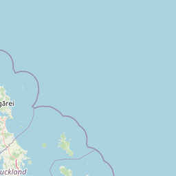
Map view of Cuvier Island

Use this park location map to pinpoint Cuvier Island in New Zealand, understand its exact geographic position, and read its mapped placement within the surrounding landscape more clearly.

Pigeon | © OpenStreetMap contributors
Park atlas

Compare surrounding marine reserves and coastal wildlife sanctuaries across the region

Explore Parks Near Cuvier Island and Connected Protected Landscapes

Visitors exploring Cuvier Island can browse nearby national parks and protected areas to compare regional island restoration projects. Extended geographic context reveals broader ecological patterns across the surrounding coastal waters and volcanic landforms.
A soft watercolor illustration of green island peaks rising from a calm pinkish water surface against a light, hazy sky.
Nature reserveNew Zealand
About 21 km away#1 closest

Southeast

Mercury Islands Nature Reserve: Volcanic Landscapes and Protected Island Geography

A coastal island group off the Coromandel Peninsula, New Zealand

The Mercury Islands form a structured volcanic chain characterized by dramatic cliffs, sheltered coves, and critical pest-free ecosystems. This protected area holds international significance for its seabird colonies and the well-preserved archaeological sites associated with early Māori history across the islands.

Established
1769
Relief
Upland
Access
Remote access
Scope
Mixed
A watercolor painting showing soft green hills rising above a light blue body of water, with a small patch of reddish-brown land visible in the foreground.
Protected areaAuckland Region
About 42 km away#2 closest

Northwest

Rakitu Island Protected Area: Volcanic Geography and Coastal Landscapes in the Hauraki Gulf

A protected offshore sanctuary near Great Barrier Island

Rakitu Island is an uninhabited 253-hectare protected area that represents a distinct volcanic landscape off the northeast coast of New Zealand. Formed from eroded rhyolite domes, the island features high coastal cliffs and a central valley that now supports native forest regrowth. This predator-free sanctuary offers an essential map perspective on small-scale island conservation and rugged maritime terrain.

Area
2.5 km²
Established
1994
Relief
Upland
Scope
Terrestrial
A wide watercolor painting showing a calm body of water surrounded by soft, pastel-colored hills in shades of green, pink, and yellow.
Nature reserveNew Zealand
About 66 km away#3 closest

Southeast

Aldermen Islands Nature Reserve: Mapped Volcanic Geography and Coastal Forest Landscapes

Protected offshore wilderness in the Coromandel region

Discover the geographic structure of the Aldermen Islands, a cluster of rocky islets serving as an undisturbed nature reserve. These eroded lava domes and forested slopes represent a specialized ecosystem, offering a unique look at New Zealand coastal geography and volcanic remnant patterns situated in the waters off the Coromandel Peninsula.

Area
1.3 km²
Relief
Upland
Access
Highly restricted
Scope
Mixed
A soft, watercolor painting of a coastal landscape featuring green rolling hills, distant pale mountains, and patches of vegetation against a white background.
Nature reserveAuckland Region
About 66 km away#4 closest

Southwest

Rotoroa Island Nature Reserve: Mapping the Geography of this Hauraki Gulf Sanctuary

A vital protected island terrain for native species and reforestation

Rotoroa Island serves as a managed conservation landscape within the Hauraki Gulf, defined by its role as a pest-free sanctuary for threatened bird populations and intensive native forest restoration. The island offers a distinct geography that combines maritime coastal terrain with a rich history of social welfare, preserved through intentional land management and active environmental rehabilitation efforts near the Auckland coast.

Area
0.82 km²
Established
2011
Relief
Lowland
Scope
Terrestrial
A horizontal, minimalist watercolor painting showing stylized rolling hills in shades of light green, pale yellow, and soft pink against a white background.
Protected areaWaikato Region
About 66 km away#5 closest

South

Coromandel Forest Park: Geography and Protected Area Overview in Waikato, NZ

Native bushland, valley systems, and conservation geography.

Coromandel Forest Park comprises an expansive system of forested hills and valleys covering the heart of the Coromandel Peninsula. This protected area features dense native ecosystems, ranging from the accessible Kauaeranga Valley to the ecologically significant southern blocks. Use this atlas perspective to understand the terrain, boundaries, and conservation value of this essential Waikato Region landscape.

Area
718.99 km²
Established
1971
Relief
Upland
Climate
Temperate
Regional parkAuckland Region
About 74 km away#6 closest

Southwest

Whakanewha Regional Park: Mapping the Protected Landscapes and Wetlands of Waiheke Island

Coastal forest and wetland geography in the Auckland Region

Whakanewha Regional Park serves as a vital protected area on Waiheke Island, known for its mature broadleaf forests and significant freshwater wetlands. The park provides a compact yet varied landscape of stream valleys and coastal ridgelines, representing a key component of the regional geography within the Hauraki Gulf, sheltered from broader environmental pressures.

Area
2.7 km²
Established
2007
Relief
Upland
Climate
Temperate
Regional parkAuckland Region
About 78 km away#7 closest

Southwest

Waitawa Regional Park: Coastal Geography and Recreation Landscapes in Auckland

Mapped terrain along the Tāmaki Strait shoreline

Waitawa Regional Park serves as a notable example of repurposed land within the Auckland Region, featuring an open coastal landscape on the Tāmaki Strait. This protected space, formerly an industrial explosives site, now offers a unique geography of grassy tracks, beach access, and historical remnants. Its layout provides a specialized atlas view of coastal development and public land use for outdoor activity.

Area
1.88 km²
Established
2013
Relief
Upland
Climate
Temperate
Regional parkWaikato Region
About 79 km away#8 closest

Southwest

Waharau Regional Park: Protected Coastal Forest and Hunua Ranges Gateway

Geographic landscape transition in the Waikato region

This protected area offers a deep look into the transition from native forest hill country to estuarine environments along the Firth of Thames. Spanning 170 hectares, it serves as a functional geographic corridor between the Hunua Ranges and the Hauraki Gulf, showcasing layered history and varied topography within the Waikato region.

Area
1.7 km²
Established
1979
Relief
Upland
Climate
Temperate

Common questions about visiting, size, designation, and location context for Cuvier Island

Cuvier Island FAQs for park facts, access, geography, and protected area context

Find quick answers about Cuvier Island, including protected-area facts, park geography, trail and visitor context, and how the park fits into its surrounding country and regional landscape.
MoriAtlas Explorer

Continue Your Protected Areas Search Across the Global Atlas

Deepen your exploration by continuing the structured search for national parks and protected areas worldwide. Utilize the comprehensive filtering capabilities to compare different conservation landscapes and refine your understanding of global park geography. Discover more about the distribution and characteristics of protected natural areas.

Global natural geography