
Mori Atlas logo
Nature reserveCuxtal Ecological Reserve

Tracing the boundaries and protected landscape features of this unique municipal conservation area.

Cuxtal Ecological Reserve: A Comprehensive Map and Geographic Portrait of a Yucatán Nature Reserve

(Zona Sujeta a Conservación Ecológica Reserva Cuxtal)

Cuxtal Ecological Reserve spans over ten thousand hectares of low deciduous forest and rural terrain within the southern portion of Mérida, Yucatán. This protected area serves as a vital groundwater recharge zone for the metropolitan region while preserving a complex mosaic of historic haciendas, cenotes, and archaeological sites. The reserve stands as a pioneering example of municipal conservation, integrating critical water security with the protection of endemic bird habitats and Maya cultural heritage across the flat karst landscape.

protected natural arealow deciduous forestYucatán Peninsulamunicipality-protected areagroundwater recharge zonebirdwatching
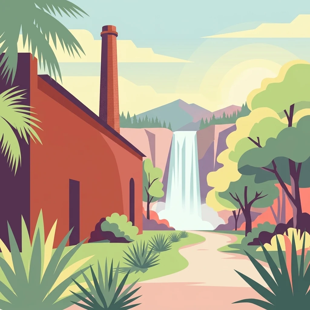
A flat-style digital illustration of an old red brick hacienda building with a tall chimney, set in a landscape with lush green trees, agave plants, a distant waterfall, and rolling hills under a soft sky.

Cuxtal Ecological Reserve

Nature reserve

Park overview

Structured park overview, official facts, and landscape profile for Cuxtal Ecological Reserve

Cuxtal Ecological Reserve park facts, protected area profile, and essential visitor context

Review the core facts for Cuxtal Ecological Reserve, including designation, size, terrain, visitor scale, habitats, and operating context in one park-focused overview.

About Cuxtal Ecological Reserve

Cuxtal Ecological Reserve occupies a strategic position in the southern portion of Mérida Municipality, bordering the city of Mérida to the north and extending south toward the commissariats of Yaxnic and Texán Cámara. With more than ten thousand hectares of territory, it functions as both an ecological refuge and a buffer zone between urban expansion and the Yucatán countryside.

The reserve's defining ecosystem is the low deciduous forest, characteristic of the hotter and drier subhumid climates of the Yucatán Peninsula. The canopy reaches up to fifteen meters in height, and a majority of tree species shed their leaves during the dry season, producing the seasonal landscape that makes this forest type recognizable across central and northern Yucatán. Within Cuxtal, this low deciduous forest occurs in secondary vegetation at varying stages of conservation and succession, mixed with areas of agricultural use, traditional milpa plots, and rural settlements.

Its role as a water source is central to the reserve's identity. Within the core zone lies the Mérida I water treatment plant and the most intact forest cover of the reserve, which serves as a principal extraction zone for groundwater supplying roughly half of the municipal water consumed in the city of Mérida. This direct link to the urban water supply frames Cuxtal as a working conservation area rather than a purely wilderness-focused park.

Equally important is the reserve's cultural and historical depth. Seven protected historic haciendas (Santa Cruz Palomeque, Xmatkuil, San Pedro Chimay, San Ignacio Tesip, Hunxectamán, San Antonio Tahdzibichén, and San Nicolás Dzoyaxché) sit within the reserve's boundaries alongside two commissariats and seven sub-commissariats that together form nine named communities. The territory also includes cenotes characteristic of the karst geology of the Yucatán Peninsula and pre-Hispanic archaeological sites, as well as a Biological Sciences campus of the Autonomous University of Yucatán, which uses the reserve as a living laboratory and teaching site.

In short, Cuxtal Ecological Reserve weaves together ecological protection, municipal water security, rural cultural heritage, and academic research into a single protected landscape on the southern edge of Mérida.

Quick facts and research context for Cuxtal Ecological Reserve

Cuxtal Ecological Reserve is a municipality-level Protected Natural Area in southern Mérida Municipality, Yucatán, Mexico. It was first decreed in 1993 by the Mérida city council, making it the first protected natural area established by a municipal government in the state.

The reserve spans around 10,757 hectares, of which a substantial core zone is dedicated to ecosystem and water source preservation. It supplies approximately half of the municipal water supply for the city of Mérida, hosts roughly 168 documented bird species (most of them migratory), and includes seven protected historic haciendas, archaeological sites, and cenotes within its boundaries.

Protection and recognition

Examine the terrestrial protection scope and documented designation records

Cuxtal Ecological Reserve Protection Status and Governance Framework

Cuxtal Ecological Reserve maintains a documented terrestrial protection scope without imported international recognition sources or transboundary status. Protected area records compile baseline designation frameworks and administrative parameters for rigorous geographic analysis.

Protection details

Protection scope
Terrestrial
Transboundary protection
No
Core area
49.29 km²
Buffer area
58.29 km²
Park context

Deeper park guide and search-rich context for Cuxtal Ecological Reserve

Cuxtal Ecological Reserve history, landscape, wildlife, and travel context

Explore Cuxtal Ecological Reserve through its history, landscape character, ecosystems, wildlife, conservation priorities, cultural context, and seasonal travel timing in a structured park guide built for atlas discovery and search intent.

Why Cuxtal Ecological Reserve stands out

Cuxtal Ecological Reserve is best known for being the first municipally decreed Protected Natural Area in Yucatán, a status it has retained since 1993. Its core forested zone is a critical groundwater recharge area that supplies around half of the drinking water for the city of Mérida, giving the reserve a direct urban water-supply function that is unusual for a protected area in the region. It is also known for its low deciduous forest habitat, which supports large numbers of migratory and Yucatán-endemic bird species, and for its layered cultural landscape that combines henequen-era haciendas, rural communities, cenotes, and pre-Hispanic archaeological sites within a single protected territory. The presence of the Biological Sciences campus of the Autonomous University of Yucatán further distinguishes Cuxtal as a site for ecological research and environmental education in the Yucatán Peninsula.
The logo for the Cuxtal Ecological Reserve shows a stylized purple bird figure with green feathers and a blue water drop shape, with the text Reserva ecológica CUXTAL underneath.
The official logo of the Cuxtal Ecological Reserve, featuring a stylized bird and water droplet motif.

Cuxtal Ecological Reserve history and protected-area timeline

The Cuxtal Ecological Reserve has its modern origin in the early 1990s, when the Mérida City Council for the 1991 to 1993 term took up the initiative to protect the southern green space of the municipality. The council approved the reserve's establishment as a Protected Natural Area, known in Spanish as an Área Natural Protegida, on June 28, 1993, and the decree was published in the Official Gazette of the Government of the State of Yucatán on July 14, 1993. This made the reserve the first Protected Natural Area to be promoted and decreed directly by a municipal government in the state of Yucatán, a distinction it retains today.

Following its original protection, the reserve entered a new institutional phase in late 2016 with the formal creation of the Alliance for Cuxtal, a coalition of government agencies, educational institutions, civil associations, and private-sector partners working toward the rescue and preservation of the reserve. In February 2017, an agreement was published authorizing the creation of a Decentralized Municipal Public Organization for the Operation and Administration of the Cuxtal Ecological Preservation Area, providing the reserve with a more stable governance body, an advisory council, and an operational directorate.

Alongside this institutional evolution, the reserve's territory has long carried older histories. The seven haciendas protected within it reflect the henequen-era rural economy of Yucatán, while archaeological sites and cenotes in the area link it back to pre-Hispanic Maya occupation and the broader cultural landscape of the Yucatán Peninsula.

Cuxtal Ecological Reserve landscape and geographic character

Cuxtal Ecological Reserve lies on the flat karst plain of the Yucatán Peninsula, where limestone bedrock supports the characteristic surface features of cenotes, sinkholes, and subtle terrain variation rather than dramatic relief. Within this setting, the dominant vegetation type is low deciduous forest, a seasonally dry forest in which trees typically reach up to fifteen meters in height and a large share of species drop their leaves through the dry months, producing an open, sunlit canopy outside of the rainy season.

The landscape is divided into distinct management zones that together describe its physical character. A protected core zone of roughly 4,928 hectares concentrates the best-preserved forest cover and the most important groundwater recharge area, including the location of the Mérida I water treatment plant. Around this core, protection, restricted-use, sustainable-use, and buffer zones extend across additional thousands of hectares, allowing agricultural, forestry, and rural settlement activities under controlled conditions.

Embedded within this ecological context are cultural landscape elements that give Cuxtal additional texture: historic hacienda complexes, rural villages such as Dzununcán and Molas, agricultural milpa plots, and the karstic water features typical of the peninsula. Together they create a protected landscape in which natural vegetation, water resources, and human settlement are tightly interwoven rather than separated by strict boundaries.
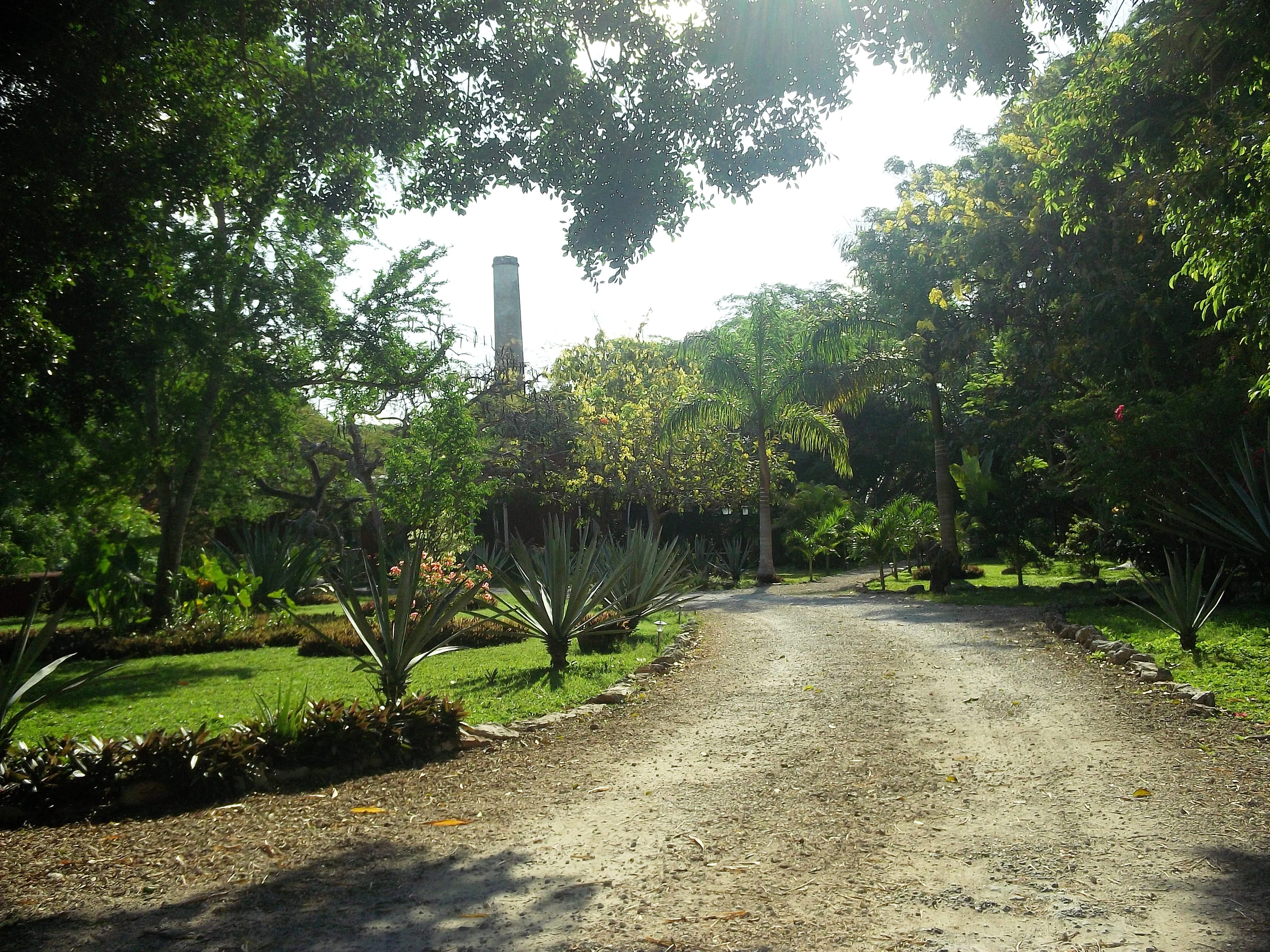
A dirt path flanked by trees and agave plants leads toward an old industrial chimney in the background under bright sunlight.
A dirt pathway leads toward the historic chimney of the Santa Cruz Palomeque Hacienda within the Cuxtal Ecological Reserve.

Cuxtal Ecological Reserve ecosystems, habitats, and plant life

Ecologically, Cuxtal is defined by its low deciduous forest, which in this reserve presents itself mainly as secondary vegetation in different stages of conservation and ecological succession. This forest type sits at the thermal and hydric threshold between hot humid forests and the drier plant communities typical of northern Yucatán, and it includes hundreds of recorded plant species across nearly one hundred families. The families with the strongest representation are Fabaceae, Euphorbiaceae, and Asteraceae, while a substantial share of the families recorded in the reserve are represented by only a single species.

Beyond plants, the reserve supports a broad biological community. Invertebrate diversity is dominated by Hymenoptera (especially braconid wasps) and spiders, while amphibians are represented by around a dozen species, mostly frogs, with the Yucatán salamander Bolitoglossa yucatana as a notable endemic. Reptile diversity is concentrated among squamates (lizards and snakes), with colubrids being the richest family and several taxa endemic to the Yucatán Peninsula. Bats, rodents, and carnivores dominate the mammal list, with Mesoamerican and Mexican endemics contributing significantly to the reserve's distinctiveness.
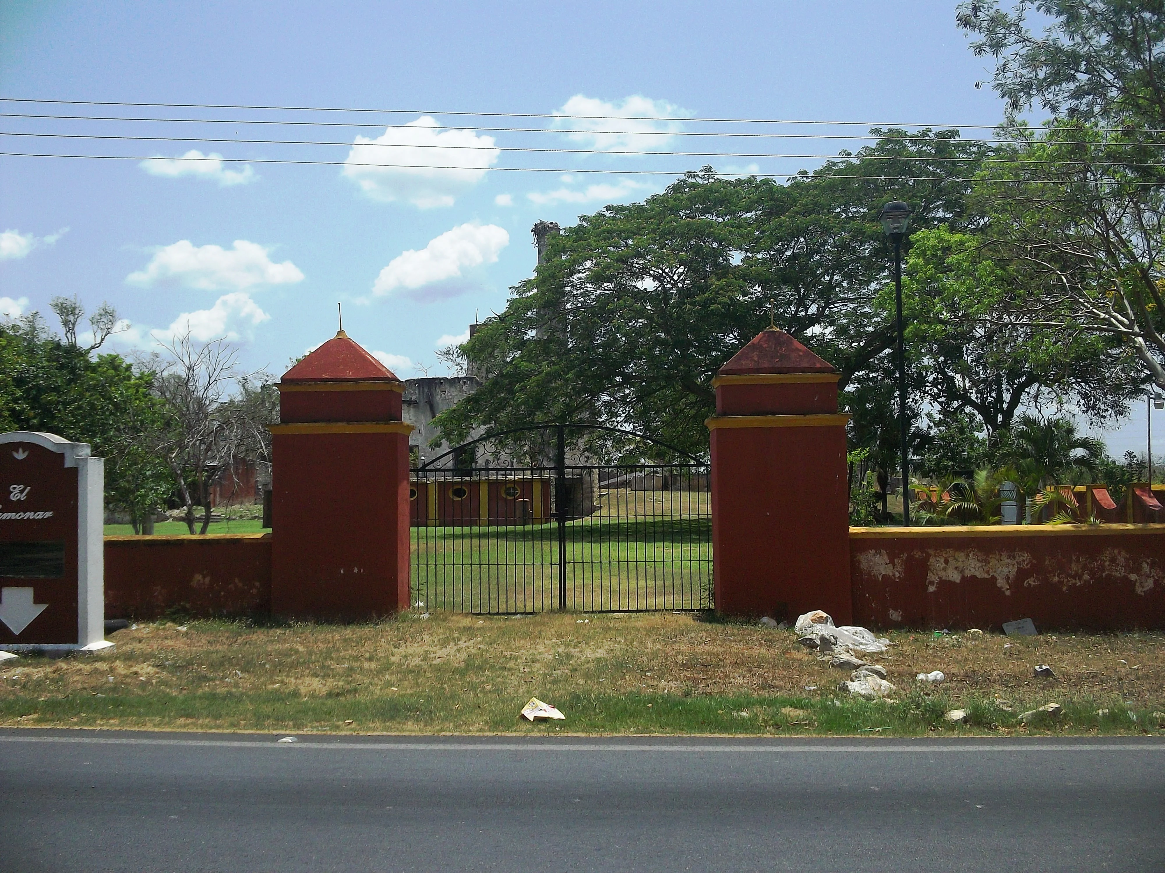
A red and yellow stucco gate and wall with a black metal fence, marking the entrance to a hacienda property with trees in the background.
The entrance gate to the Tahdzibichén Hacienda, a historical landmark within the Cuxtal Ecological Reserve.

Cuxtal Ecological Reserve wildlife and species highlights

Cuxtal Ecological Reserve supports a particularly rich bird community, with documented diversity led by the order Passeriformes and complemented by significant numbers of raptors, swifts, and pigeons. A large share of the bird species present are migratory, especially North American visitors wintering in the Yucatán, while others are year-round residents, occasional visitors, or passage migrants. Among the most notable species are the Yucatán parrot Amazona xantholora, the white-fronted parrot Amazona albifrons, the ocellated turkey Meleagris ocellata, and the Yucatan nightjar Nyctiphrynus yucatanicus, several of which are endemic to Mexico or considered priority species for conservation.

Mammal diversity is led by bats, with phyllostomid leaf-nosed bats making up a notable portion of the bat community. Other mammals include opossums, armadillos, anteaters including the endangered Tamandua mexicana subspecies, coatis, foxes, weasels, deer, rabbits, and a range of rodents, several of which are Mesoamerican or Mexican endemics. Jaguarundi, although rare, has been recorded within or near the reserve.

The reptile and amphibian fauna adds further distinctive character, with turtles, iguanas including the priority Ctenosaura similis and Ctenosaura defensor, the Yucatán box turtle Terrapene yucatana, and a long list of snakes including the locally important rattlesnake Crotalus tzabcan. Cenotes, limestone outcrops, and seasonal forests offer varied habitats that together allow this unusually wide mix of species to coexist within a single protected area just outside a major Yucatán city.
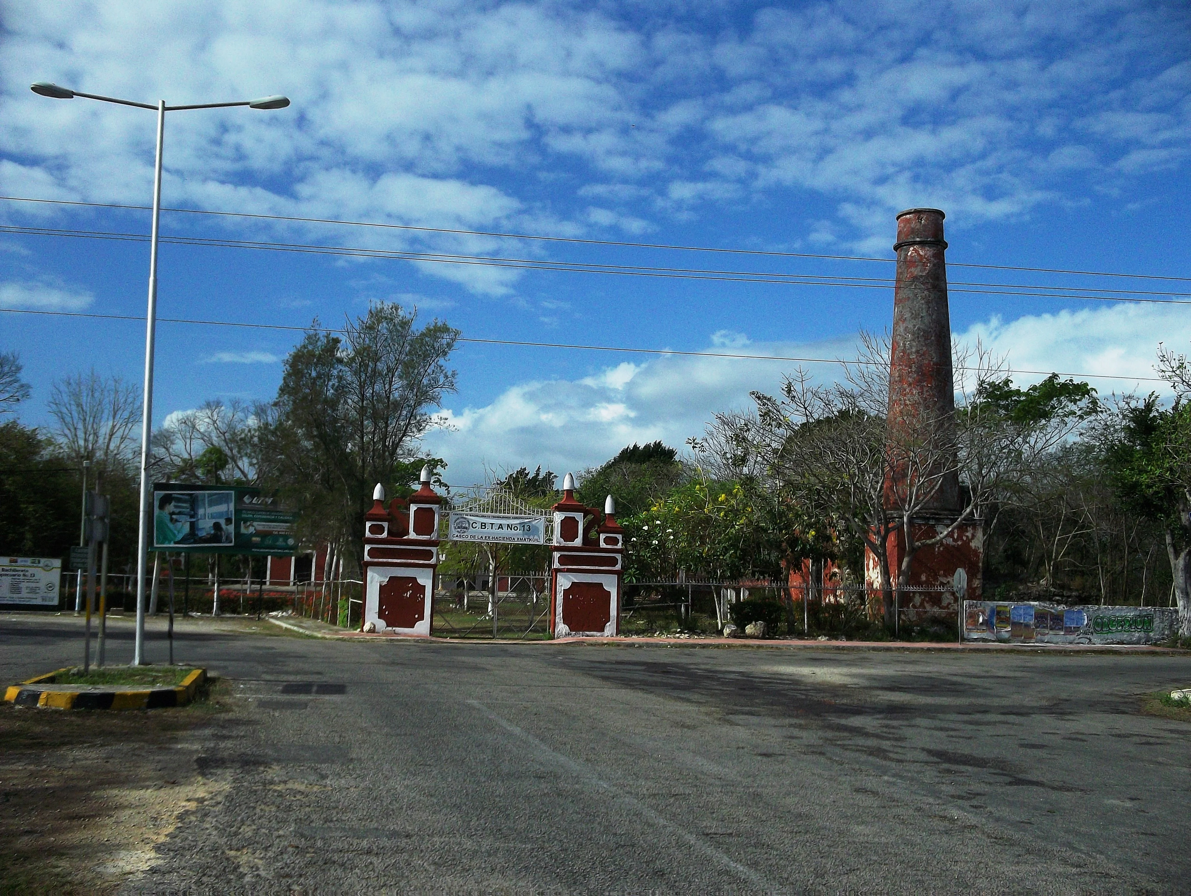
An asphalt road leads toward a gated entrance with white and red masonry columns, featuring a tall, slender brick chimney standing on the right side under a blue sky.
The entrance to the hacienda at Xmatkuil within the Cuxtal Ecological Reserve.

Cuxtal Ecological Reserve conservation status and protection priorities

Conservation at Cuxtal revolves around protecting the integrity of the low deciduous forest and the groundwater system that supports both the ecosystem and the city of Mérida. The reserve is internally zoned to concentrate the strictest protection in a core zone, where the best-preserved forest cover and the Mérida I water treatment plant are located, while surrounding buffers and sustainable-use zones aim to gradually steer agriculture, livestock, and settlements toward less damaging practices. This zoning approach allows the reserve to combine long-term ecosystem preservation with continued human presence in much of the territory.

The reserve's conservation profile is reinforced by regional and international listings. Multiple plant and animal species recorded at Cuxtal are included in Mexico's NOM-059-SEMARNAT-2010 environmental risk categories, covering special protection, threatened, and endangered statuses, while certain species are also tracked under CITES appendices for international trade regulation. The protected status of the entire area, its recognition as the first municipally decreed Protected Natural Area in Yucatán, and the existence of a dedicated management organization since 2017 give Cuxtal a stable governance foundation for ongoing conservation work.

In a regional context, the reserve plays a key role in the conservation of Yucatán-endemic species and serves as a connective green space between the expanding city of Mérida and the more rural southern landscapes of the municipality. By anchoring a protected forest close to a major urban center and tying its management directly to municipal water security, Cuxtal offers a distinctive model of urban-adjacent, water-focused conservation.

Cuxtal Ecological Reserve cultural meaning and human context

Cuxtal Ecological Reserve sits in a territory shaped by several layers of Yucatán cultural history. Pre-Hispanic Maya occupation is reflected in archaeological sites scattered across the reserve, while the karst geology of the Yucatán Peninsula has produced a network of cenotes that remain culturally significant, including the Dzonot-Ich cenote within the Hacienda San Nicolás Dzoyaxché.

The more recent layer is the henequen-era hacienda system of the nineteenth and twentieth centuries. Seven protected haciendas (Hunxectamán, San Antonio Tahdzibichén, San Ignacio Tesip, San Nicolás Dzoyaxché, San Pedro Chimay, Santa Cruz Palomeque, and Xmatkuil) form an integral part of the reserve's cultural heritage, several of them having given rise to the surrounding commissariats and sub-commissariats. The two commissariats of Molas and Dzununcán, alongside seven sub-commissariats, host the rural communities that continue to live within the reserve, with Mayan-speaking residents forming a recognized share of the local population. Today, the reserve also hosts the Biological Sciences campus of the Autonomous University of Yucatán, extending its cultural role into scientific education.
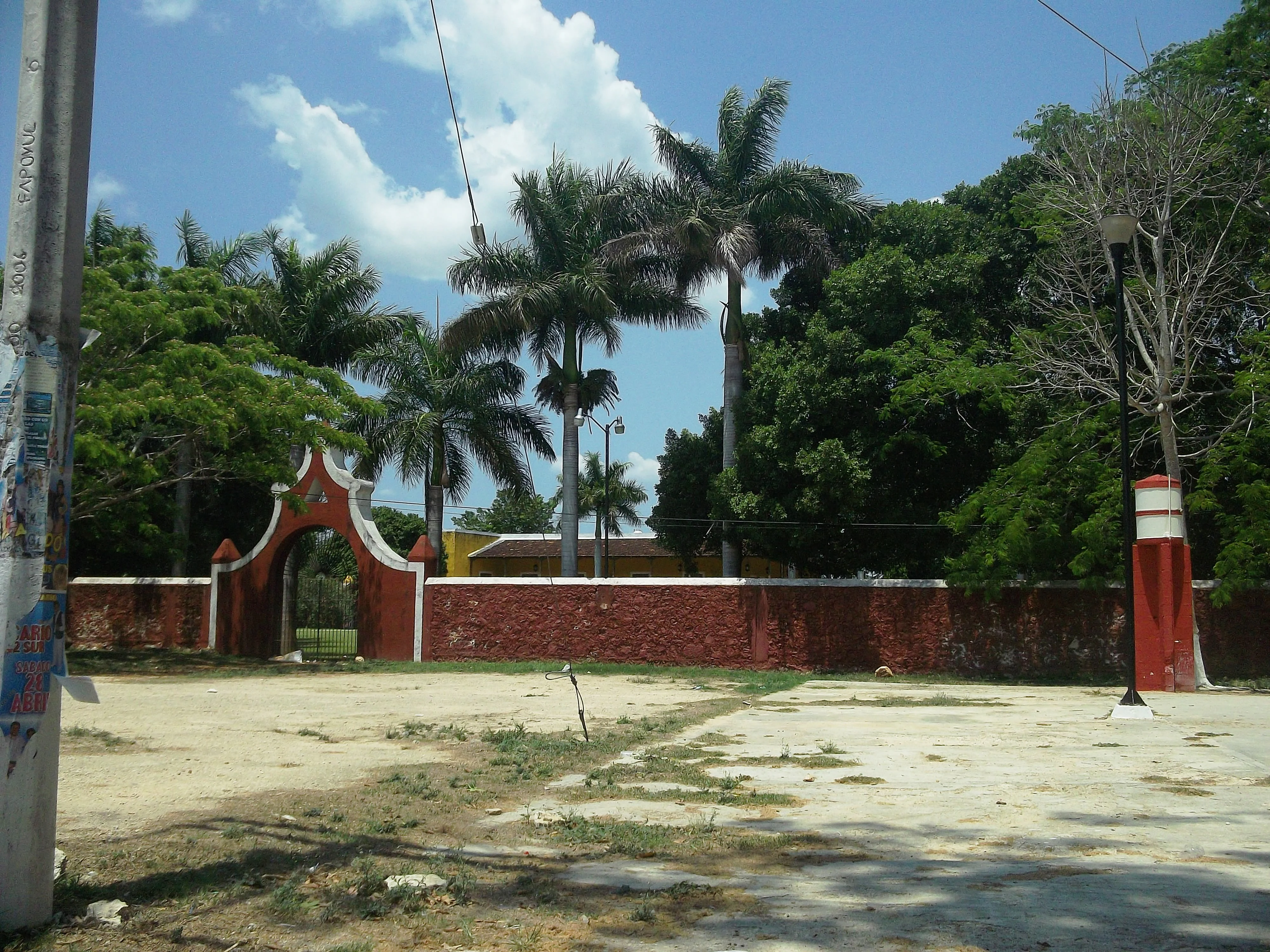
A red brick wall with an arched entrance gate set against a backdrop of palm trees and other lush greenery under a clear sky.
The arched entrance gate to Hacienda San Ignacio Tesip within the Cuxtal Ecological Reserve.

Top sights and standout views in Cuxtal Ecological Reserve

Cuxtal Ecological Reserve's standout features include its unusually direct role in urban water security, providing roughly half of Mérida's municipal water supply from a protected forest core, and its pioneering status as the first municipally decreed Protected Natural Area in Yucatán, established in 1993.

It is also distinguished by the depth of its cultural landscape, where seven protected historic haciendas, rural communities, cenotes, and pre-Hispanic archaeological sites coexist within a single zoned protected territory, and by its dual role as both a conservation area and a working academic site through the Biological Sciences campus of the Autonomous University of Yucatán.
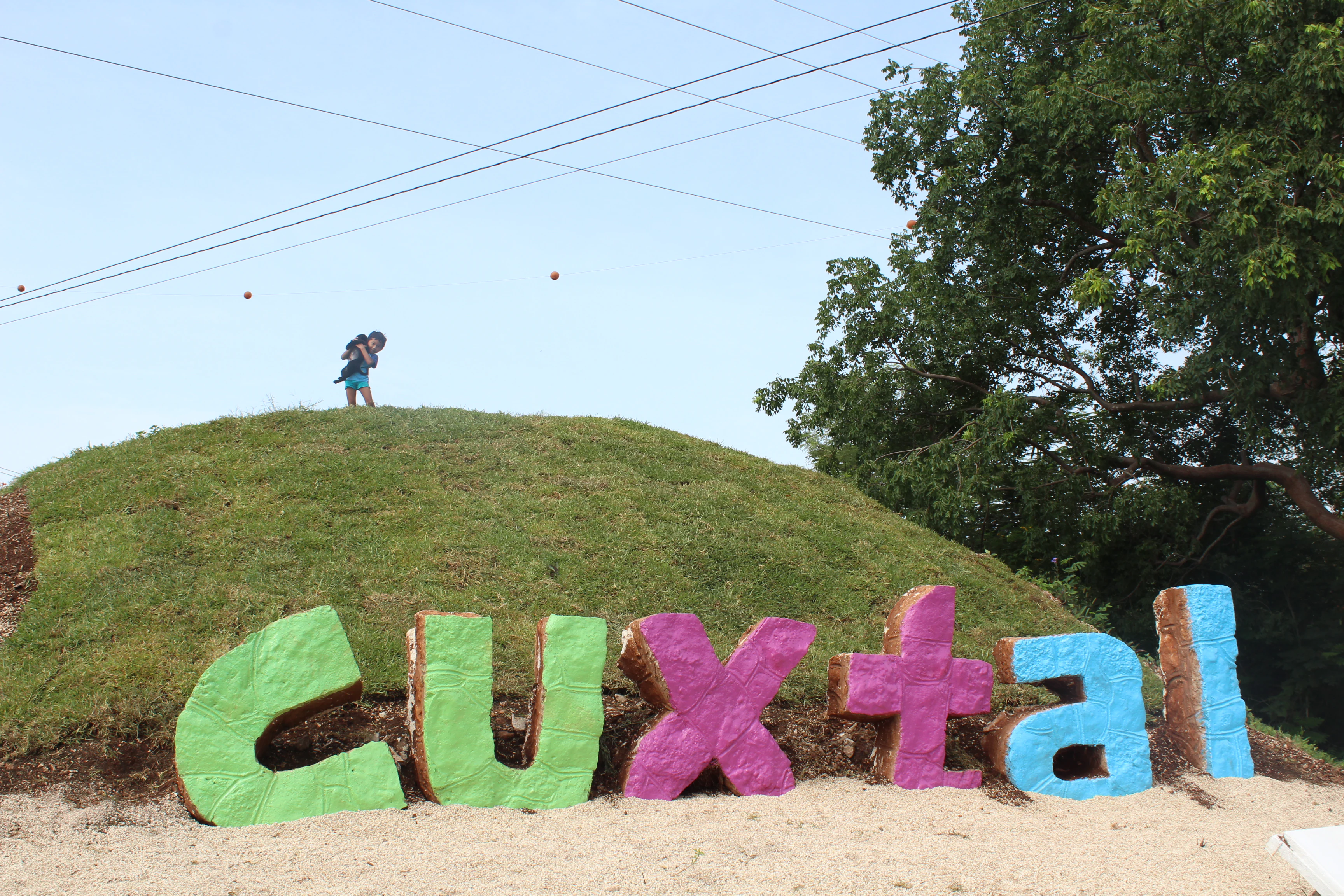
A large, multi-colored sign reading Cuxtal placed on a grassy hill, with a person standing on top of the hill.
A colorful sign spelling out Cuxtal at the entrance to the Cuxtal Ecological Reserve.

Best time to visit Cuxtal Ecological Reserve

The character of a visit to the Cuxtal Ecological Reserve is shaped strongly by the seasonal rhythm of the Yucatán low deciduous forest. During the rainy season, the forest greens up, water fills many of the area's cenotes, and bird activity is at its highest as both resident and migratory species are present. Visiting in the dry season reveals the distinctive leaf-shedding behavior of low deciduous forest vegetation, with open canopies and more exposed landscapes, while still offering pleasant conditions for outdoor walking and cultural heritage sightseeing.

Because the reserve sits immediately south of Mérida and combines ecological sites with hacienda properties, archaeological zones, and rural communities, it lends itself to visits that mix nature observation with cultural exploration rather than a single peak tourism season.
Monthly climate preview

Long-term monthly temperature and precipitation rhythm across representative coordinates

Cuxtal Ecological Reserve Climate Normals, Annual Temperature and Precipitation

Representative coordinate records show measured monthly temperature and precipitation rhythms across the protected landscape from 1991 to 2020. Examining the complete twelve-month climatology profile reveals detailed variations in average minimum and maximum temperatures throughout the year.
Annual mean26 °C
23 °C29 °C
Jan23°
Feb25°
Mar27°
Apr29°
May29°
Jun28°
Jul28°
Aug28°
Sep27°
Oct26°
Nov24°
Dec24°
Warmest month
May

29.5 °C

Coolest month
January

23.4 °C

Wettest month
September

5.9 mm/day

Driest month
March

0.7 mm/day

Park location guide

Geography guide, regional context, and park location map for Cuxtal Ecological Reserve

Cuxtal Ecological Reserve park geography, regions, and map view in Mexico

Understand where Cuxtal Ecological Reserve sits in Mexico through a broader geographic reading of the surrounding landscape, nearby location context, and its mapped position within the national park landscape.

How Cuxtal Ecological Reserve fits into Mexico

Mexico, officially the United Mexican States, is a country in North America spanning the Sierra Madre mountain ranges, coastal plains, and tropical regions. It borders the United States to the north, Guatemala and Belize to the southeast, and has coastlines along the Pacific Ocean, Gulf of Mexico, and Caribbean Sea. With a population exceeding 130 million, Mexico is home to one of the world's most significant concentrations of Indigenous languages alongside Spanish.

Wider geography shaping Cuxtal Ecological Reserve in Mexico

Mexico occupies a land area of 1,972,550 km2, making it the thirteenth-largest country in the world. The terrain is highly diverse, featuring the Sierra Madre Occidental and Sierra Madre Oriental mountain ranges, the Mexican Plateau, coastal lowlands along the Pacific and Gulf/Caribbean margins, and the Yucatan Peninsula. The country spans multiple climate zones from desert in the north to tropical rainforest in the south.

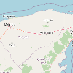
Map view of Cuxtal Ecological Reserve

Use this park location map to pinpoint Cuxtal Ecological Reserve in Mexico, understand its exact geographic position, and read its mapped placement within the surrounding landscape more clearly.

Pigeon | © OpenStreetMap contributors

Location context for Cuxtal Ecological Reserve

Yucatán

Visualizing low deciduous forests, sinkholes, and historic haciendas in Yucatán

Cuxtal Ecological Reserve Photos and Landscape Scenery

Visual records capture the low deciduous forest canopy, karstic terrain features, and historic hacienda architecture defining Cuxtal Ecological Reserve. Examining protected area photography reveals the physical terrain, vegetation structure, and cultural landscape elements shaping the Yucatán Peninsula.

The logo for the Cuxtal Ecological Reserve shows a stylized purple bird figure with green feathers and a blue water drop shape, with the text Reserva ecológica CUXTAL underneath.

Two tall yellow and red stucco pillars forming a gate, leading to an open dirt field under a bright blue sky.

A dirt path flanked by trees and agave plants leads toward an old industrial chimney in the background under bright sunlight.

A red and yellow stucco gate and wall with a black metal fence, marking the entrance to a hacienda property with trees in the background.

An asphalt road leads toward a gated entrance with white and red masonry columns, featuring a tall, slender brick chimney standing on the right side under a blue sky.

A red colonial-style building and palm trees next to a small tourist train on tracks in the Cuxtal Ecological Reserve.

A red brick wall with an arched entrance gate set against a backdrop of palm trees and other lush greenery under a clear sky.

A large, multi-colored sign reading Cuxtal placed on a grassy hill, with a person standing on top of the hill.

A paved road leading past the exterior walls and trees of the historic Hacienda San Pedro Chimay under a blue sky with white clouds.

Park atlas

Compare regional protected landscapes, forest habitats, and karstic terrain features.

Parks Near Cuxtal Ecological Reserve and Surrounding Protected Natural Areas

Explore other protected areas near Cuxtal Ecological Reserve to examine related regional ecosystems and regional conservation formats across the Yucatán Peninsula. Expanding the park comparison reveals broader ecological patterns, karst formations, and surrounding protected landscapes.
National parkMexico
About 26 km away#1 closest

North

Dzibilchantún National Park: Protected Landscape in Mexico's Atlas

Mapped boundaries and regional geography for this national park.

Delve into the protected landscape of Dzibilchantún National Park, a significant national park situated within Mexico. This entry offers a detailed look at its geographic positioning, mapped park boundaries, and its role within the national atlas of protected areas. Understand the specific landscape context and regional geography that define Dzibilchantún National Park for comprehensive exploration.

Area
5.39 km²
IUCN
II
Relief
Lowland
Climate
Tropical
National parkMexico
About 169 km away#2 closest

North

Arrecife Alacranes National Park: Protected Marine National Park Geography

Explore its mapped boundaries and regional significance.

Arrecife Alacranes National Park stands as a critical protected marine area within Mexico's national park system. This entity offers detailed geographic context for understanding protected landscapes, focusing on its mapped boundaries and the unique marine environment it encompasses. For those exploring national parks and their atlas representation, Arrecife Alacranes National Park provides a specific case study in marine conservation geography, highlighting its role within the broader Mexican landscape.

IUCN
II
Relief
Lowland
Scope
Marine
Water
Water-dominated
Watercolor illustration of a coastal mangrove ecosystem with calm water, green vegetation, and soft pink and green tones.
Biosphere reserveQuintana Roo
About 218 km away#3 closest

Southeast

Sian Ka'an Biosphere Reserve: Geographic Map and Protected Landscape Overview

Quintana Roo, Mexico coastal wetland and reef geography

Sian Ka'an Biosphere Reserve protects a diverse coastal environment in Quintana Roo, characterized by low-relief limestone terrain, flooded savannas, and the expansive Mesoamerican Barrier Reef. This entry provides a structured look at the reserve's protected land boundaries, petenes ecosystems, and integrated Maya archaeological corridors found throughout this tropical territory.

Area
5,281.47 km²
Established
1986
Relief
Lowland
Climate
Tropical
Wildlife reserveQuintana Roo
About 268 km away#4 closest

East

Área de Protección de Flora y Fauna Yum Balam: Protected Wildlife Reserve Atlas and Geography

A diverse coastal mosaic in northern Quintana Roo, Mexico.

Discover the mapped landscape of Área de Protección de Flora y Fauna Yum Balam, a critical wildlife reserve on the Yucatan Peninsula. This protected area features a unique combination of semideciduous tropical forests, inland mangrove lagoons, and freshwater wetlands, offering a comprehensive look at the ecological diversity of the northern Caribbean coast.

Area
1,540.52 km²
Established
1994
IUCN
VI
Relief
Lowland
Watercolor painting showing layered mountains, green valleys, and a river
National parkQuintana Roo
About 274 km away#5 closest

East

Arrecifes de Cozumel National Park: National Park Protected Landscape and Map Exploration

Discover the geographic boundaries and regional context.

Arrecifes de Cozumel National Park represents a significant protected national park within the Quintana Roo region. This page provides detailed atlas-style information about its protected landscape, enabling users to explore its defined boundaries and understand its place in the broader geographic context of Mexico. Discover the mapped terrain and the structured facts that illuminate this vital conservation area.

Area
120 km²
Established
1996
IUCN
II
Climate
Tropical
Protected landscapeCampeche
About 321 km away#6 closest

Southwest

Laguna de Términos Protected Landscape: Geography and Mapped Boundaries in Campeche

Coastal wetland conservation and deltaic landscape patterns

Positioned along the southwestern edge of the Yucatán Peninsula, Laguna de Términos is a central coastal lagoon protected for its high biological productivity and extensive mangrove forests. This geographic overview highlights the interaction between major river systems, tidal channels, and the Gulf of Mexico that define this essential wetland landscape.

Area
7,050.16 km²
Established
1994
Water
Water-dominated
A stylized vector illustration of tiered Mayan pyramid structures rising above a dense green jungle landscape under a soft pastel sky.
Biosphere reservePetén Department
About 337 km away#7 closest

South

Maya Biosphere Reserve: Geographic Overview and Protected Landscapes in Petén

Tropical forest ecosystems and ancient archaeological mapping

Covering roughly one-fifth of Guatemala, the Maya Biosphere Reserve represents a pioneering model of zoned conservation. The landscape features a complex mosaic of lowland rainforests, savanna patches, and seasonal wetlands formed over a weathered limestone platform. This atlas summary examines the reserve's ecological boundaries, its vital role in protecting Mesoamerican biodiversity, and the concentration of pre-Columbian cities located across the Petén Department.

Area
21,602 km²
Established
1990
Relief
Mixed relief
Climate
Tropical
National parkAmbergris Caye
About 353 km away#8 closest

Southeast

Bacalar Chico National Park and Marine Reserve: Belize National Park & Marine Reserve Atlas

Explore Ambergris Caye's unique barrier island and reef geography.

Discover the extensive protected territory of Bacalar Chico National Park and Marine Reserve, a critical national park and marine reserve situated on Ambergris Caye, Belize. This protected area showcases a rich diversity of landscapes, from rare littoral forests and inland wetlands to vital coral reefs and sea grass beds integral to the Mesoamerican Barrier Reef System. Its unique geographic position and ecological significance make it a key destination for understanding Belize's conservation landscapes and mapped marine environments.

Area
62.8 km²
Established
1996
IUCN
IV
Relief
Lowland

Common questions about visiting, size, designation, and location context for Cuxtal Ecological Reserve

Cuxtal Ecological Reserve FAQs for park facts, access, geography, and protected area context

Find quick answers about Cuxtal Ecological Reserve, including protected-area facts, park geography, trail and visitor context, and how the park fits into its surrounding country and regional landscape.
MoriAtlas Explorer

Continue Your Protected Areas Search Across the Global Atlas

Deepen your exploration by continuing the structured search for national parks and protected areas worldwide. Utilize the comprehensive filtering capabilities to compare different conservation landscapes and refine your understanding of global park geography. Discover more about the distribution and characteristics of protected natural areas.

Global natural geography