
Mori Atlas logo
Biosphere reserveSian Ka'an

Mapping the vast mosaic of tropical wetlands, mangroves, and Caribbean coral reef ecosystems

Sian Ka'an Biosphere Reserve: An Extensive Protected Coastal Landscape in Quintana Roo, Mexico

(Reserva de la Biosfera Sian Kaan)

Sian Ka'an Biosphere Reserve represents a significant protected area along the eastern coast of the Yucatan Peninsula. The geography encompasses a complex transition between saltwater lagoons, freshwater marshlands, and dense tropical forests. Users can examine the park boundaries, which include the Mesoamerican Barrier Reef and critical Maya archaeological zones, through a detailed atlas perspective that reveals the interplay of limestone bedrock, cenote systems, and coastal plains.

biosphere reserveCaribbean coastmangroveswetlandscoral reefsMesoamerican Barrier Reef
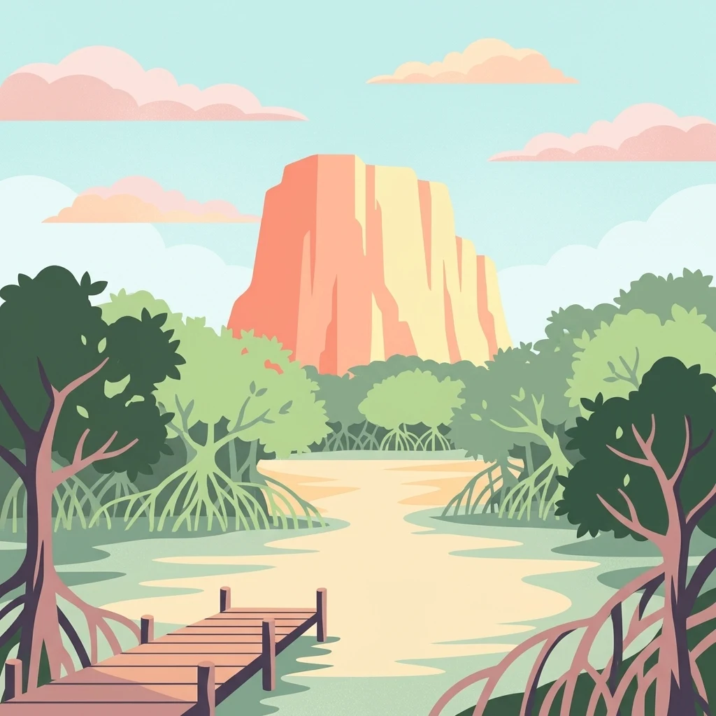
A digital illustration of a wooden pier leading into a calm, shallow waterway surrounded by mangrove trees, with a large, flat-topped orange-tinted rock formation under a pale blue sky with pink clouds.

Sian Ka'an

Biosphere reserve

Park overview

Structured park overview, official facts, and landscape profile for Sian Kaan Biosphere Reserve

Sian Kaan Biosphere Reserve park facts, protected area profile, and essential visitor context

Review the core facts for Sian Kaan Biosphere Reserve, including designation, size, terrain, visitor scale, habitats, and operating context in one park-focused overview.

About Sian Kaan Biosphere Reserve

Sian Kaan stretches along the eastern coast of the Yucatan Peninsula, occupying a long band of low-lying land between the Caribbean Sea and the inland forests of Quintana Roo. The reserve was established in 1986, recognized as a UNESCO World Heritage Site in 1987, and later designated a Ramsar wetland site in 2003, putting it among Mexico's most significant tropical protected areas.

Geologically, the region belongs to the Yucatan Platform, a vast slab of limestone bedrock that produces the peninsula's famously flat relief. Because the porous rock prevents the formation of surface rivers, water moves underground and emerges in springs, sinkholes known as cenotes, and low-lying wetlands. The result is a landscape where freshwater and saltwater environments meet, creating overlapping zones of mangrove, marsh, savanna, and forest.

The reserve's ecosystems are sharply varied. Along the coast lie long white sand beaches, rocky headlands, and the Boca Paila peninsula, a narrow strip of land that separates the protected lagoon system from the open Caribbean. Inland, broad mangrove forests give way to flooded savannas interspersed with the petenes, oval or circular islands of tall trees anchored on hidden freshwater springs. Further inland still, tropical semi-evergreen forests cover much of the western portion of the reserve.

Just offshore, the Mesoamerican Barrier Reef forms the marine backbone of the reserve. Often described as the second longest coral reef system in the world, this stretch of reef supports hard corals such as Acropora species and massive Porites corals, along with the fish and invertebrate communities that depend on them. Together, the terrestrial and marine zones form a continuous ecological gradient from inland forest to open sea.

Culturally, Sian Kaan sits in a region that was densely inhabited by the ancient Maya. Within the reserve, around two dozen archaeological sites have been identified. The largest and most studied is Muyil, also known as Chunyaxché, located southwest of Tulum. Settled during the Classic Maya period and flourishing in the Postclassic, Muyil remained inhabited until the broader Spanish conquest of the Caribbean coast around the mid-16th century. Other sites, such as the small Xlahpak temple on Chunyaxché lagoon, reflect the continuing ritual and residential presence of Maya communities in the lagoon's fertile interface of freshwater and sea.

Quick facts and research context for Sian Kaan Biosphere Reserve

Sian Kaan Biosphere Reserve lies on the Caribbean coast of Quintana Roo, Mexico, between Tulum and the Belize border area. It is the largest protected tropical area in Mexico and one of the most ecologically diverse in the country.

The reserve is part of the Yucatan Peninsula's geological province, characterized by flat limestone terrain that produces almost no surface rivers but feeds a network of cenotes and underground freshwater systems. Beyond the beaches, the landscape shifts between mangrove lagoons, freshwater marshes, coastal dunes, low tropical forests, and reef-fringed marine zones.

Protection and recognition

Designation history and formal recognition sources for Sian Ka'an

Sian Ka'an Protection Status and International Recognition Details

Sian Ka'an holds mixed protected area status alongside established international recognition sources including UNESCO and Ramsar designations from 1987. Official records track designation history and management scope without implying additional conservation outcomes.

International recognition

Protection details

Protection scope
Mixed
Designated year
1987
Transboundary protection
No
Core area
2,797.04 km²
Buffer area
2,484.44 km²
Park context

Deeper park guide and search-rich context for Sian Kaan Biosphere Reserve

Sian Kaan Biosphere Reserve history, landscape, wildlife, and travel context

Explore Sian Kaan Biosphere Reserve through its history, landscape character, ecosystems, wildlife, conservation priorities, cultural context, and seasonal travel timing in a structured park guide built for atlas discovery and search intent.

Why Sian Kaan Biosphere Reserve stands out

Sian Kaan is best known for its extraordinary combination of tropical wetlands, mangrove forests, and the offshore section of the Mesoamerican Barrier Reef, the second largest coral reef system in the world after Australia's Great Barrier Reef. It also protects the petenes, rare circular tree islands that rise out of the marshland where freshwater springs emerge through saline swamps. Equally defining is its cultural heritage. The reserve contains dozens of archaeological sites of the ancient Maya, including the major site of Muyil (Chunyaxché) and the smaller Xlahpak temple overlooking Chunyaxché lagoon, giving the natural landscape a deep human-history dimension that stretches from the Classic Maya period through the Postclassic and into the early colonial era.
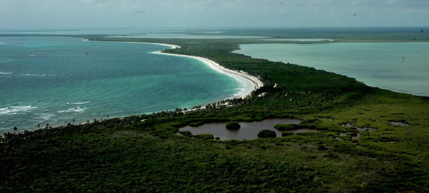
Aerial perspective of a narrow peninsula separating the Caribbean Sea from a coastal lagoon, featuring dense green vegetation and a white sand beach.
Aerial view of the Sian Ka'an Biosphere Reserve coastline in Quintana Roo, Mexico.

Sian Kaan Biosphere Reserve history and protected-area timeline

Sian Kaan was established as a national biosphere reserve by presidential decree on 20 January 1986, becoming the first large tropical protected area in Mexico. The reserve was quickly recognized internationally: UNESCO inscribed it on the World Heritage List in 1987 and included it in the Man and the Biosphere (MaB) programme, and later, in 2003, it was designated as a Ramsar site for its wetland importance.

The reserve's origin was rooted in scientific work. In early 1981, the Centro de Investigaciones de Quintana Roo (CIQRO) launched studies aimed at identifying a candidate biosphere reserve that could bring together the institution's various research, conservation, and regional development goals. The team settled on the area encompassing Ascension Bay, Espiritu Santo Bay, the offshore reef barrier, and surrounding forests in what are now the municipalities of Tulum, Felipe Carrillo Puerto, and Bacalar. Their surveys demonstrated that the area contained largely intact examples of nearly all Yucatan Peninsula biomes, with a sparse human population made up mainly of Maya fishing and farming communities.

CIQRO produced the scientific, socioeconomic, and biodiversity baseline data that justified the reserve's creation, and the project director, Dr. Alfredo Careaga, led the political and administrative negotiations with the Presidency of Mexico, the Quintana Roo state government, UNESCO, and various federal agencies between 1978 and 1986. When the reserve was formally created, its management plan was published in 1993, organizing conservation, sustainable development, public use, archaeological heritage, environmental education, and research into a coordinated framework that still shapes management today.

The reserve's more recent history also reflects environmental pressure. Tourism growth across Quintana Roo, deforestation driven by the extraction of timber species, the spread of introduced plants such as casuarina, and increased maritime traffic have all threatened its ecosystems, pushing conservation organizations and the federal protected areas agency to expand monitoring, restoration, and community-based management programs within the reserve.

Sian Kaan Biosphere Reserve landscape and geographic character

Sian Kaan's landscape is shaped by the flat limestone geology of the Yucatan Peninsula. Surface rivers are virtually absent because rainwater disappears quickly into the porous bedrock, and the terrain instead expresses itself through a mosaic of low, water-filled depressions, swamps, and a dense network of cenotes, the natural sinkholes that punctuate much of the region. This low-relief geography produces an unusually wide coastal plain where freshwater, saltwater, and terrestrial habitats meet.

Along the Caribbean shoreline, the reserve features long stretches of white sand beach, small sheltered bays, and the Boca Paila peninsula, a long, narrow sandy ridge that runs parallel to the coast and separates the protected lagoon system from the open sea. Halfway along the peninsula, a tidal channel about 20 meters wide cuts across, dividing Boca Paila into two sections, with the small fishing community of Punta Allen sitting at its southern end.

Inland from the coast, the terrain rises only slightly into broad belts of mangrove forest, freshwater marsh, and flooded savanna. Within these wetlands, the petenes form the most visually distinctive feature: oval or circular islands of tall forest, sometimes growing to nearly two kilometers across, that rise abruptly from the surrounding marsh. They owe their existence to hidden freshwater springs that emerge beneath saline swamp, allowing large trees to flourish where they otherwise could not survive.

Further inland, the wet lowlands give way to semi-evergreen tropical forest, transitioning into the broader wooded landscapes of central Quintana Roo. Throughout the reserve, the geography is defined less by dramatic relief than by subtle transitions between water and land, with vegetation shifting distance by distance as salinity, drainage, and soil depth change.
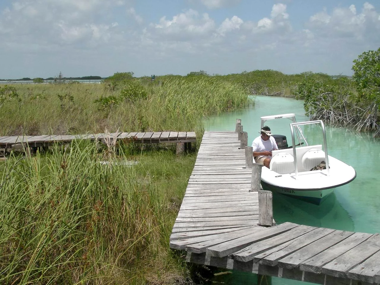
A small white motorboat is docked at a weathered wooden boardwalk that extends through a grassy marshland with clear light turquoise water.
A motorboat docked at a wooden pier in the wetlands of Sian Ka'an.

Sian Kaan Biosphere Reserve ecosystems, habitats, and plant life

Sian Kaan protects an unusually compressed sequence of tropical ecosystems arranged along the eastern edge of the Yucatan Peninsula. Close to the coast, four species of mangrove, including red, black, white, and gray mangroves, line the lagoons, bays, and tidal channels, forming the foundation of the reserve's coastal productivity. Behind them, freshwater springs emerging through the limestone create the conditions for the rare petenes, which act as biodiversity hotspots within an otherwise uniform marsh.

Further inland, low-lying tropical semi-evergreen forests cover much of the western reserve, with seasonal inundated grasslands and savannas creating a transitional zone between the wet coastal systems and the drier interior forests of the peninsula. This combination of habitats produces one of the highest concentrations of endemic and migratory species in Mesoamerica.

According to Mexico's National Biodiversity Information System, the biosphere reserve as a whole supports more than 2,500 species of plants and animals, of which a substantial number fall within Mexican risk categories. The reef portion of the reserve hosts an additional distinct marine community, including hard and soft corals such as Acropora and Porites, along with the reef fish and invertebrates that depend on them. Together, these systems make Sian Kaan one of the leading examples of integrated tropical and marine conservation in Mexico.
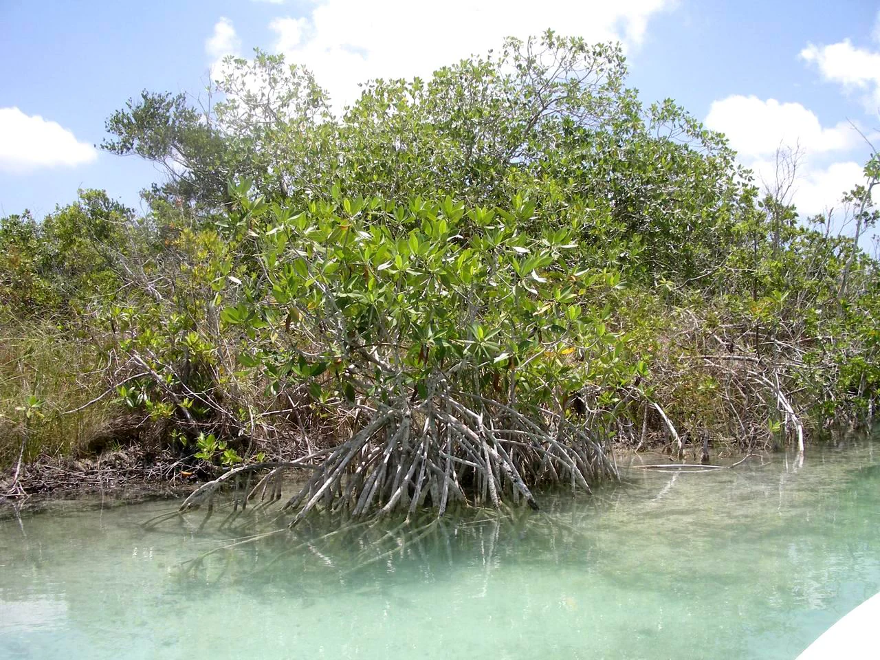
A cluster of mangrove trees with visible prop roots extending into shallow, clear turquoise water, surrounded by dense coastal vegetation under a partly cloudy sky.
Mangrove forest in the Sian Ka'an biosphere reserve.

Sian Kaan Biosphere Reserve wildlife and species highlights

Wildlife is central to Sian Kaan's identity. The reserve's mammal community includes several species that depend on continuous forest cover, including the jaguar, the Baird's tapir, the white-lipped peccary, the collared peccary, and the Yucatan black howler monkey. Spider monkeys and howler monkeys also play an important ecological role, dispersing seeds that help regenerate the forest.

The birdlife is equally significant. The reserve supports a mix of resident and migratory species, including the Yucatan woodpecker, the ocellated turkey, the crested guan, the great curassow, the jabiru stork, the American flamingo, and the roseate spoonbill. Wading birds such as the great egret, the little blue heron, and the great blue heron hunt the mangrove shallows and lagoons, helping to maintain balance in the fish and invertebrate populations of these systems.

Coastal and marine wildlife includes the American crocodile and Morelet's crocodile, sea turtles, manatees, and a rich reef community supported by the Mesoamerican Barrier Reef. The reef's hard and soft corals shelter large populations of reef fish and invertebrates, while the mangrove systems nursery many of the same species, creating a continuous ecological corridor from the inland forest all the way out to the open Caribbean.
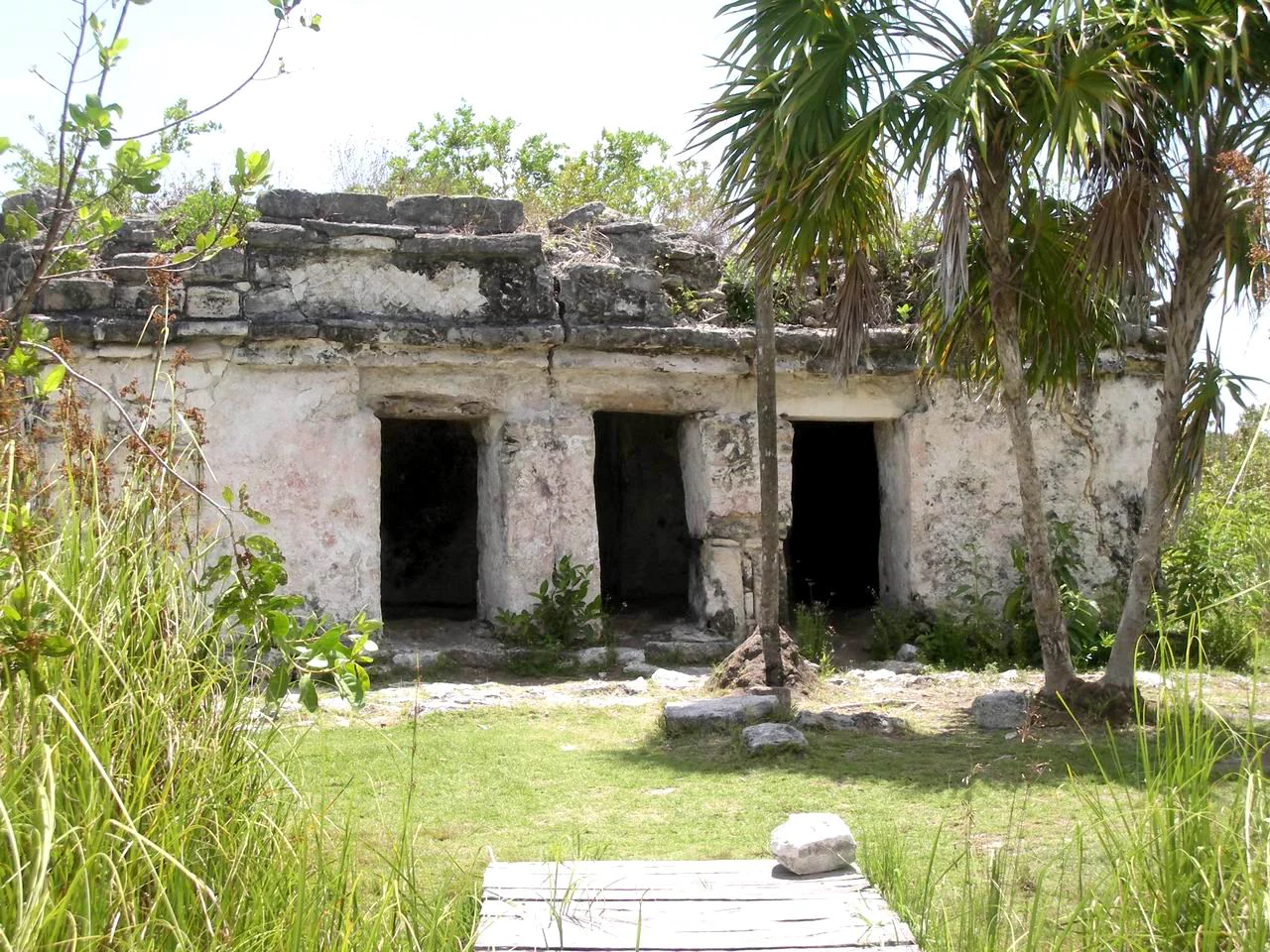
A weathered, ancient stone temple with three doorways stands partially hidden by lush green vegetation and palm trees in Sian Ka'an.
The Xlahpak archaeological site located within the Sian Ka'an Biosphere Reserve.

Sian Kaan Biosphere Reserve conservation status and protection priorities

Sian Kaan's conservation significance is recognized at both the national and international levels. Inscribed as a UNESCO World Heritage Site in 1987 and designated a Ramsar wetland site in 2003, it stands as a flagship example of integrated terrestrial and marine protection in Mexico. Its World Heritage status is based on the criteria that recognize both its ecological importance and its role in protecting representative examples of Yucatan Peninsula ecosystems.

The reserve functions as a refuge for several species that have declined elsewhere in the Yucatan, including the jaguar, Baird's tapir, ocellated turkey, and both native crocodile species, and it maintains key populations of the Yucatan black howler monkey and Geoffroy's spider monkey, both vital to forest regeneration through their seed-dispersal role.

At the same time, conservationists have flagged the growing pressures on the reserve. Rising tourism across the Quintana Roo coast, deforestation linked to timber extraction, the introduction of invasive species such as casuarina, boat traffic that damages the reef, and the broader impacts of climate change, including ocean warming, acidification, and coral bleaching, all threaten the long-term health of the system. Management of the reserve, coordinated through Mexico's National Commission of Natural Protected Areas in cooperation with NGOs, research institutions, and local producers, focuses on scientific monitoring, ecological restoration, controlled public use, and community engagement to address these pressures.

Sian Kaan Biosphere Reserve cultural meaning and human context

Sian Kaan sits in a region with a continuous human presence stretching back to the ancient Maya. Within and around the reserve, around two dozen archaeological sites reflect the depth of this history, with the largest and most prominent being Muyil, also known as Chunyaxché, located about 20 km southwest of Tulum along the highway between Cancun and Chetumal. Muyil was inhabited during the Classic Maya period and reached its height during the Postclassic, with many of its standing buildings dating from that later era. Like nearby Tulum, the ceremonial precinct at Muyil appears to have been enclosed by walls. The city remained inhabited until the Spanish extended their conquest of the Caribbean coast around 1550.

A smaller but distinctive site is the Xlahpak temple, a modest structure overlooking Chunyaxché lagoon near the point where freshwater flows into the lagoon system. Other archaeological remains have been identified along the Boca Paila peninsula, where the long, narrow strip of land splits the protected lagoon from the open sea.

Beyond prehistory, the reserve's contemporary cultural fabric remains strongly Maya. Local communities of Maya fishermen and farmers have lived in and around the reserve for generations, and modern conservation efforts have emphasized their involvement, drawing on traditional ecological knowledge alongside scientific research. The reserve's community-based forestry, fishing, and tourism initiatives reflect this blended cultural and ecological identity.

Top sights and standout views in Sian Kaan Biosphere Reserve

Maya archaeological sites around Muyil and Chunyaxché lagoon, including the walls-enclosed ruins of Muyil and the lakeside Xlahpak temple.

The petenes, rare freshwater tree islands surrounded by saline marsh, found almost nowhere else outside Florida, Cuba, and the Yucatan Peninsula.

A pristine line of Mesoamerican Barrier Reef offshore, recognized as the second largest coral reef system in the world.

Extensive mangrove belts of all four regional mangrove species, supporting crocodiles, sea turtles, and a wide range of nesting and migratory birds.

One of Mexico's largest tropical protected areas, where the Yucatan's classic low-lying geography of cenotes, flooded savanna, semi-evergreen forest, and Caribbean coast all meet within a single reserve.

Best time to visit Sian Kaan Biosphere Reserve

The climate of Sian Kaan is warm subhumid, and the character of the landscape shifts with the seasons. The dry months, broadly from late autumn through spring, tend to offer calmer seas, clearer skies, and easier access to inland trails and lagoons. Wildlife viewing remains rewarding throughout this period, with both resident and migratory birds active across the mangroves and coastal flats.

The rainy season, concentrated in the summer months, transforms much of the reserve. Heavy rainfall combines with the flat, poorly drained limestone terrain to flood large areas of the savanna and low-lying forest, expanding wetlands and concentrating wildlife around the patches of higher ground. This is also the time when hurricanes and tropical storms moving across the Caribbean can affect the area, bringing dramatic but occasionally disruptive weather. Despite the rain, the summer season brings the lushest landscapes and the most dynamic wetland scenery.
Monthly climate preview

Long-term monthly temperature and precipitation patterns recorded at Sian Ka'an

Sian Ka'an Climate Normals, Annual Temperature and Precipitation Rhythms

Long-term NASA Power climatology data reveals measured monthly temperature and precipitation rhythms across Sian Ka'an from 1991 to 2020. Reviewing the complete twelve-month normals profile provides deeper analytical insight into average temperature swings and seasonal precipitation totals.
Annual mean27 °C
25 °C29 °C
Jan25°
Feb25°
Mar26°
Apr27°
May28°
Jun28°
Jul28°
Aug29°
Sep28°
Oct28°
Nov26°
Dec25°
Warmest month
August

28.5 °C

Coolest month
January

24.8 °C

Wettest month
October

6.1 mm/day

Driest month
March

1.2 mm/day

Park location guide

Geography guide, regional context, and park location map for Sian Kaan Biosphere Reserve

Sian Kaan Biosphere Reserve park geography, regions, and map view in Mexico

Understand where Sian Kaan Biosphere Reserve sits in Mexico through a broader geographic reading of the surrounding landscape, nearby location context, and its mapped position within the national park landscape.

How Sian Kaan Biosphere Reserve fits into Mexico

Mexico, officially the United Mexican States, is a country in North America spanning the Sierra Madre mountain ranges, coastal plains, and tropical regions. It borders the United States to the north, Guatemala and Belize to the southeast, and has coastlines along the Pacific Ocean, Gulf of Mexico, and Caribbean Sea. With a population exceeding 130 million, Mexico is home to one of the world's most significant concentrations of Indigenous languages alongside Spanish.

Wider geography shaping Sian Kaan Biosphere Reserve in Mexico

Mexico occupies a land area of 1,972,550 km2, making it the thirteenth-largest country in the world. The terrain is highly diverse, featuring the Sierra Madre Occidental and Sierra Madre Oriental mountain ranges, the Mexican Plateau, coastal lowlands along the Pacific and Gulf/Caribbean margins, and the Yucatan Peninsula. The country spans multiple climate zones from desert in the north to tropical rainforest in the south.

Map view of Sian Kaan Biosphere Reserve

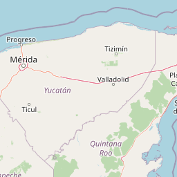
Use this park location map to pinpoint Sian Kaan Biosphere Reserve in Mexico, understand its exact geographic position, and read its mapped placement within the surrounding landscape more clearly.

Pigeon | © OpenStreetMap contributors

Location context for Sian Kaan Biosphere Reserve

Quintana Roo
Recorded earthquake history

Examine the Historical Catalogue of Earthquakes Near Sian Ka'an

Review documented seismic activity associated with the Sian Ka'an landscape through this MoriAtlas collection. Examine specific event data, including magnitudes and epicenter distances, to understand the historical seismic profile of this region on the Caribbean coast.

Sian Ka'an Earthquake History

Catalogued events

2 events

Strongest magnitude

Magnitude 4.1

Most recent event

Jun 21, 2026

This history includes earthquakes recorded inside the park or within 50 km of its borders

Explore photographic records of Caribbean coastlines, tropical wetlands, and rare forest islands.

Sian Ka'an Photos and Landscape Scenery: Visualizing the Protected Reserve

Visual documentation provides essential reference material for studying the complex wetland habitats, mangrove forests, and low limestone terrain of the reserve. Examining authentic landscape photography reveals the unique ecological character of coastal ecosystems across the Yucatan Peninsula.

Aerial perspective of a narrow peninsula separating the Caribbean Sea from a coastal lagoon, featuring dense green vegetation and a white sand beach.

A wooden pier extends into the green waters of Muyil Lagoon, with a small boat moored near the shore under a cloudy sky.

A small white motorboat is docked at a weathered wooden boardwalk that extends through a grassy marshland with clear light turquoise water.

A cluster of mangrove trees with visible prop roots extending into shallow, clear turquoise water, surrounded by dense coastal vegetation under a partly cloudy sky.

A weathered, ancient stone temple with three doorways stands partially hidden by lush green vegetation and palm trees in Sian Ka'an.

A large group of seabirds gathered on a white sand beach with turquoise ocean waves in the background.

Park atlas

Compare adjacent wetland reserves and coastal protected landscapes across the region

Parks Near Sian Ka'an: Discover Protected Areas and Regional Landscapes

Browse other parks near Sian Ka'an to examine matching coastal ecosystems, wetland reserves, and tropical habitats. Expanding the regional comparison reveals broader conservation patterns across the surrounding peninsula geography.
Watercolor painting showing layered mountains, green valleys, and a river
National parkQuintana Roo
45 km away#1 closest

Northeast

Arrecifes de Cozumel National Park: National Park Protected Landscape and Map Exploration

Discover the geographic boundaries and regional context.

Arrecifes de Cozumel National Park represents a significant protected national park within the Quintana Roo region. This page provides detailed atlas-style information about its protected landscape, enabling users to explore its defined boundaries and understand its place in the broader geographic context of Mexico. Discover the mapped terrain and the structured facts that illuminate this vital conservation area.

Area
120 km²
Established
1996
IUCN
II
Climate
Tropical
National parkAmbergris Caye
About 105 km away#2 closest

South

Bacalar Chico National Park and Marine Reserve: Belize National Park & Marine Reserve Atlas

Explore Ambergris Caye's unique barrier island and reef geography.

Discover the extensive protected territory of Bacalar Chico National Park and Marine Reserve, a critical national park and marine reserve situated on Ambergris Caye, Belize. This protected area showcases a rich diversity of landscapes, from rare littoral forests and inland wetlands to vital coral reefs and sea grass beds integral to the Mesoamerican Barrier Reef System. Its unique geographic position and ecological significance make it a key destination for understanding Belize's conservation landscapes and mapped marine environments.

Area
62.8 km²
Established
1996
IUCN
IV
Relief
Lowland
Wildlife reserveQuintana Roo
About 146 km away#3 closest

North

Área de Protección de Flora y Fauna Yum Balam: Protected Wildlife Reserve Atlas and Geography

A diverse coastal mosaic in northern Quintana Roo, Mexico.

Discover the mapped landscape of Área de Protección de Flora y Fauna Yum Balam, a critical wildlife reserve on the Yucatan Peninsula. This protected area features a unique combination of semideciduous tropical forests, inland mangrove lagoons, and freshwater wetlands, offering a comprehensive look at the ecological diversity of the northern Caribbean coast.

Area
1,540.52 km²
Established
1994
IUCN
VI
Relief
Lowland
A stylized vector illustration of tiered Mayan pyramid structures rising above a dense green jungle landscape under a soft pastel sky.
Biosphere reservePetén Department
187 km away#4 closest

Southwest

Maya Biosphere Reserve: Geographic Overview and Protected Landscapes in Petén

Tropical forest ecosystems and ancient archaeological mapping

Covering roughly one-fifth of Guatemala, the Maya Biosphere Reserve represents a pioneering model of zoned conservation. The landscape features a complex mosaic of lowland rainforests, savanna patches, and seasonal wetlands formed over a weathered limestone platform. This atlas summary examines the reserve's ecological boundaries, its vital role in protecting Mesoamerican biodiversity, and the concentration of pre-Columbian cities located across the Petén Department.

Area
21,602 km²
Established
1990
Relief
Mixed relief
Climate
Tropical
A watercolor painting showing soft, rolling hills in the distance with a marshy wetland and patches of greenery in the foreground.
Nature reserveYucatán
About 218 km away#5 closest

Northwest

Cuxtal Ecological Reserve: Mapping the Protected Landscape and Geography of Yucatán

Nature reserve featuring critical groundwater recharge and historic cultural sites.

Cuxtal Ecological Reserve represents a significant protected area in Yucatán, Mexico, known for its strategic role in supplying water to Mérida. The landscape encompasses a vast expanse of seasonally dry low deciduous forest, interspersed with limestone karst formations, historic hacienda complexes, and archaeological remnants. This unique reserve provides essential habitats for migratory birds and local fauna while demonstrating the integration of environmental research, cultural heritage, and sustainable land management in a rapidly developing region.

Area
107.57 km²
Established
1993
Relief
Lowland
Climate
Tropical
National parkCayo District
218 km away#6 closest

Southwest

Guanacaste National Park National Park: Explore its Protected Landscape and Geographic Setting

Mapped natural terrain and regional context within Cayo District.

Delve into the specifics of Guanacaste National Park, a protected national park located in the Cayo District of Belize. This detail page is designed for atlas exploration, offering insights into the park's geographic boundaries and its significance as a defined natural landscape. Understand how this protected area fits into the regional geography and contributes to the mapped natural heritage of Belize.

Area
0.2 km²
Established
1973
IUCN
II
Climate
Tropical
National parkCayo District
About 226 km away#7 closest

Southwest

St. Herman's Blue Hole National Park: National Park Protected Landscape and Geographic Setting

Mapped Boundaries and Regional Landscape Context in Cayo District

St. Herman's Blue Hole National Park is an integral protected landscape within Belize, situated in the Cayo District. This national park offers specific geographic features and mapped boundaries essential for understanding its place within regional conservation. MoriAtlas provides detailed context for exploring the park's protected terrain and its contribution to the broader geographic atlas, focusing on landscape identity and mapped outlines for analytical discovery.

Area
2 km²
Established
1986
Climate
Tropical
Access
Easy access
National parkMexico
About 228 km away#8 closest

Northwest

Dzibilchantún National Park: Protected Landscape in Mexico's Atlas

Mapped boundaries and regional geography for this national park.

Delve into the protected landscape of Dzibilchantún National Park, a significant national park situated within Mexico. This entry offers a detailed look at its geographic positioning, mapped park boundaries, and its role within the national atlas of protected areas. Understand the specific landscape context and regional geography that define Dzibilchantún National Park for comprehensive exploration.

Area
5.39 km²
IUCN
II
Relief
Lowland
Climate
Tropical

Common questions about visiting, size, designation, and location context for Sian Kaan Biosphere Reserve

Sian Kaan Biosphere Reserve FAQs for park facts, access, geography, and protected area context

Find quick answers about Sian Kaan Biosphere Reserve, including protected-area facts, park geography, trail and visitor context, and how the park fits into its surrounding country and regional landscape.
MoriAtlas Explorer

Continue Your Protected Areas Search Across the Global Atlas

Deepen your exploration by continuing the structured search for national parks and protected areas worldwide. Utilize the comprehensive filtering capabilities to compare different conservation landscapes and refine your understanding of global park geography. Discover more about the distribution and characteristics of protected natural areas.

Global natural geography