Peaks
Callcup Hill
239 m

Examining the terrain, regional area, and diverse natural landscape features of this coastal park
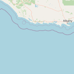
Discover the geographic composition of D'Entrecasteaux National Park, a 1187.79 square kilometer protected area in Western Australia. This structured profile maps the park boundaries, identifies key terrain features such as rivers, lakes, and dunes, and provides a clear overview of the physical landscape characteristics and environmental footprint.
Related tags
Western Australia's dramatic south coast sanctuary of ancient basalt cliffs, sweeping dunes, and internationally significant seabird colonies
D'Entrecasteaux National Park occupies a sweeping stretch of Western Australia's southern coastline approximately 315 kilometres south of Perth. The park extends for 130 kilometres along the coast from Black Point in the west to Long Point in the east, with the landscape ranging from dramatic basalt sea cliffs to inland forests, wetlands, and mobile sand dunes. Established in 1980, the park was named in honour of French Admiral Antoine Bruni d'Entrecasteaux, who became the first European to sight this coastline and identify Point D'Entrecasteaux in 1792. The park protects remarkable geographic diversity within its 1,187 square kilometre boundary, including coastal cliffs, heaths, karri forest pockets, major river systems, and significant wetland complexes that represent some of the South West's most intact natural environments.
Coastal protected area within Western Australia, Australia
Tracing the 1187.79 square kilometer regional footprint and limits
Mixed relief classifications and recorded natural landmarks
Peaks
239 m
Rivers
Viewpoints
Islands
Rivers
Peaks
182 m
Interpreting recorded landscape features, habitat types, and water presence.
Dunes · Cliffs · Beach · Rivers · Islands · Coast · Woodland · Wetland · Lakes
Coastal habitat · Riverine habitat · Wetland
Trace the regional spread of protected areas, comparing diverse coastal and wetland landscapes in Southwest Australia
Northeast

Western Australia's protected area and regional geography.
Boorara-Gardner National Park is a vital national park in Western Australia, recognized for its stands of old-growth forest and its stunning spring wildflower displays. Delve into the park's specific geographic features, mapped terrain, and its identity as a key protected area within the South West region. Understand its place in the contiguous network of conservation lands through detailed atlas-style exploration.
Northwest
Explore the protected forest and regional geography.
Greater Hawke National Park offers a significant atlas exploration opportunity for understanding Australia's protected forest ecosystems. This national park preserves critical old growth stands of karri and jarrah trees, showcasing the unique landscape of the Warren bioregion. Its Class A reserve status and adjacency to D'Entrecasteaux National Park highlight its importance as a conservation corridor within the South West of Western Australia. Users can examine the park's geographic setting and its protected-area identity.
East
Granite peaks and unique regional geography within a protected wilderness area.
Mount Frankland National Park in Western Australia is a protected area renowned for its exceptional old-growth karri and red tingle forests, some of the world's tallest tree species. The park's landscape is shaped by low granite hills and dramatic peaks, including the 411-meter Mount Frankland, offering expansive views across the wilderness. As a key component of the Walpole Wilderness Area, this national park provides a rich geographical context for understanding conservation and mapped natural landscapes in Southwest Australia.
Northeast
Discover the mapped boundaries and regional park context.
Shannon National Park represents a key protected area within the vast geographic expanse of Western Australia. This entry focuses on understanding its identity as a national park, highlighting its specific landscape character and its contribution to the regional atlas. Through detailed mapping and geographic context, users can explore the protected boundaries and natural setting of Shannon National Park.
Southeast
Mapped boundaries and natural terrain context in Western Australia.
Walpole-Nornalup National Park offers a focused lens for understanding protected landscapes. As a designated national park in Western Australia, it provides valuable insights into regional geography and mapped natural terrain. This detailed view allows for a clear appreciation of the park's specific protected area characteristics and its place within the larger geographic atlas of the state.
East
Explore its mapped boundaries and regional geographic context.
Mount Frankland South National Park is a critical protected area defined by its unique natural landscape and mapped boundaries within Western Australia. This entry provides detailed insights into its geographic setting and the protected land it encompasses, offering a focused view for atlas exploration. Understand the park's significance as a protected natural reserve and its contribution to the regional geography of Western Australia, with a clear emphasis on mapped terrain and conservation landscapes.
Northwest
Discover Protected Areas and Regional Geography
Explore Greater Beedelup National Park, a key protected landscape within Western Australia. This national park offers a focus for understanding mapped natural features and the regional distribution of conservation areas. It serves as a vital point for atlas-based discovery, providing structured insights into the park's geographic setting and its identity as a protected natural area.
Northwest
Mapped boundaries of a vital national park in the South West region.
Hilliger National Park stands as a testament to forest conservation in Western Australia's South West. This 16,962-hectare national park, established in 2004, protects representative old-growth jarrah forest ecosystems and honors a significant firefighting legacy. Explore its terrain and its geographic placement within a broader network of protected lands, offering a concrete example of conservation strategy in the region. The park's mapped area contributes valuable data to the understanding of regional natural landscapes.
Deepen your understanding of D'Entrecasteaux National Park by examining its specific geography and protected area characteristics. Use this national park as a focal point to investigate its mapped boundaries and its place within the natural terrain of Western Australia, enhancing your atlas-based exploration.