


Mori Atlas logo
Nature reserveDibeen Forest Reserve

Mapping the protected boundaries and regional geography of a rare Middle Eastern forest ecosystem.

Dibeen Forest Reserve Nature Reserve: Jordan's Ancient Pine-Oak Forest Landscape

Dibeen Forest Reserve in Jordan's northwestern highlands represents one of the last significant pine-oak forest ecosystems in the Middle East. This nature reserve, spanning rolling hills and steep limestone slopes, showcases a unique altitudinal zonation of Aleppo pine and oak woodlands. Understanding Dibeen Forest Reserve offers insight into Jordan's protected landscapes, its regional geography, and the crucial role of mapped natural areas in conservation.

pine-oak forestnature reserveendangered speciesAleppo pineJordan highlandsmediterranean forest
Illustration showing a waterfall cascading down a cliff, surrounded by pine trees, a river, and distant mountains with clouds

Dibeen Forest Reserve

Nature reserve

Park overview

Structured park overview, official facts, and landscape profile for Dibeen Forest Reserve

Dibeen Forest Reserve park facts, protected area profile, and essential visitor context

Review the core facts for Dibeen Forest Reserve, including designation, size, terrain, visitor scale, habitats, and operating context in one park-focused overview.

About Dibeen Forest Reserve

Dibeen Forest Reserve protects a fragile and ecologically significant forest ecosystem in Jordan's northern highlands. The reserve's location just south of Jerash places it within a landscape of outstanding archaeological and cultural significance, adding layers of historical context to its natural value. The forest represents a transition zone between Mediterranean and steppe climates, supporting a unique combination of species adapted to these varying conditions. The reserve's establishment in 2004 marked an important expansion of Jordan's protected area network, addressing the declining forest cover that had characterized much of the country's northern highlands in preceding decades. The Royal Society for the Conservation of Nature has prioritized the reserve as a model for community-based conservation, working with local municipalities to develop sustainable land-use practices that balance ecological protection with the needs of surrounding communities.

Quick facts and research context for Dibeen Forest Reserve

Dibeen Forest Reserve lies in the Jerash Governorate of northern Jordan, approximately 10 kilometres south of the city of Jerash. The reserve covers 8.5 square kilometres of mountainous terrain ranging from 500 to 1000 metres in elevation. Annual precipitation averages 710 millimetres, supporting one of the drier forest ecosystems in the region. The reserve is managed by the Royal Society for the Conservation of Nature, established in 2004 following a UNDP-supported conservation initiative. The forest contains the largest remaining stand of Aleppo pines in Jordan and supports at least 17 identified endangered species.

Protection and recognition

Documenting conservation boundaries and terrestrial management frameworks

Dibeen Forest Reserve Protected Area Designation and Terrestrial Status

Exploring the terrestrial protection boundaries of Dibeen Forest Reserve offers critical insight into regional conservation frameworks and management parameters. Verifying documented designation details and international protection status helps researchers compare ecological safeguards across regional landscapes.

Protection details

Protection scope
Terrestrial
Transboundary protection
No
Park context

Deeper park guide and search-rich context for Dibeen Forest Reserve

Dibeen Forest Reserve history, landscape, wildlife, and travel context

Explore Dibeen Forest Reserve through its history, landscape character, ecosystems, wildlife, conservation priorities, cultural context, and seasonal travel timing in a structured park guide built for atlas discovery and search intent.

Why Dibeen Forest Reserve stands out

Dibeen Forest Reserve is best known for containing the largest and oldest naturally grown Aleppo pine habitat in Jordan, representing one of the last remaining pine-oak forest ecosystems in the Middle East. The reserve is distinguished by its altitudinal zonation of vegetation, with Aleppo pines dominating lower slopes, a mixed pine-oak woodland in the middle elevations, and deciduous oak species including Quercus infectoria at higher altitudes. The reserve also serves as a critical refuge for 17 endangered species, most notably the Persian red squirrel, along with grey wolves, striped hyenas, and several bat species.
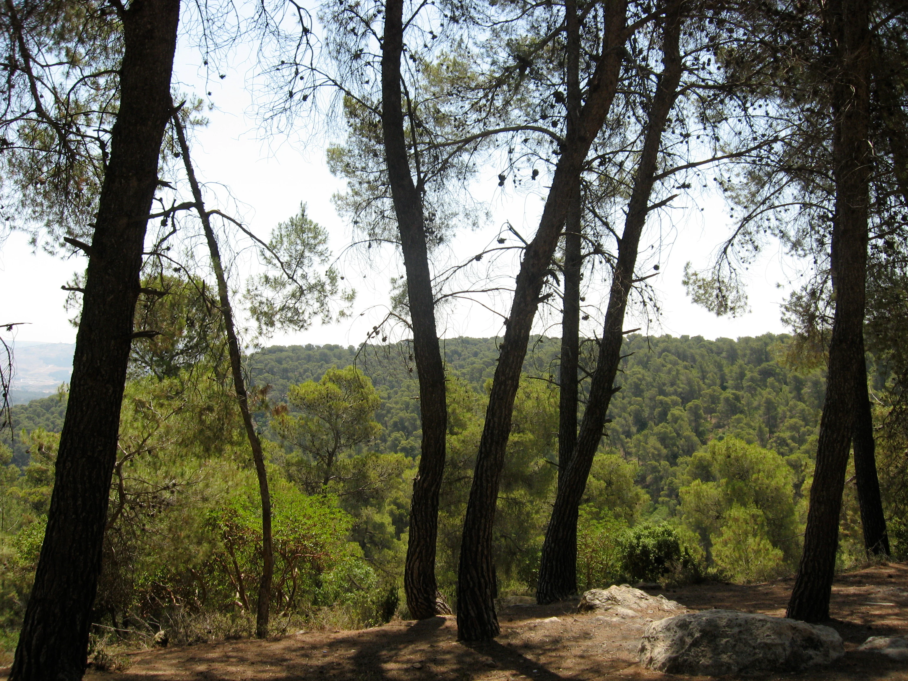
Tall pine and oak trees with a view of distant forested hills
Dibeen Forest Reserve, Jordan: pine and oak woodlands

Dibeen Forest Reserve history and protected-area timeline

Dibeen Forest Reserve was formally established in 2004 after being identified as a conservation priority in Jordan's 1998 protected areas review. The establishment followed a UNDP-led project from 2004 to 2007 that worked with the Jerash, Al Meirad, and Burma municipalities to support the nature reserve's development and promote sustainable resource use among local communities. The reserve was created in response to growing threats to Jordan's northern forest ecosystems, including illegal logging, overgrazing, and habitat fragmentation from development projects. The Royal Society for the Conservation of Nature, founded in 1966 under the patronage of Queen Noor and King Hussein, has been the primary institutional force behind Jordan's network of protected areas, and Dibeen became the sixth reserve under their management, joining Shaumari, Azraq, Dana, Wadi Mujib, and Ajloun reserves.

Dibeen Forest Reserve landscape and geographic character

The reserve occupies a landscape of rolling hills and steep limestone slopes in Jordan's northwestern highlands. The terrain rises from approximately 500 metres to 1000 metres above sea level, with the underlying geology consisting of limestone and chalky limestone that has been eroded into characteristic steep slopes and ridgelines. The landscape is intersected by seasonal wadis that carry water during the winter rainy season, creating a network of moisture corridors that support more lush vegetation in these drainage channels. The combination of altitude, limestone substrate, and variable moisture conditions across slopes and wadis creates a diverse physical setting that supports the forest's distinctive zonation of plant communities.

Dibeen Forest Reserve ecosystems, habitats, and plant life

Dibeen Forest Reserve contains one of the last remaining examples of pine-oak forest in the Middle East, making it an ecological stronghold of regional significance. The forest exhibits clear altitudinal zonation, with Aleppo pines dominating the lower elevations, a mixed pine-palestine oak woodland in the middle band, and Quercus infectoria, also known as the Aleppo or Cyprus oak, occupying the highest slopes. The forest supports a diverse understory including orchids, Greek strawberry trees, pistachio trees, and olive trees. The age structure of the forest shows considerable variation, with many areas containing mature canopy trees alongside vigorous understory regeneration, indicating a relatively healthy and self-sustaining ecosystem despite the pressures it faces.

Dibeen Forest Reserve wildlife and species highlights

The reserve supports at least 17 endangered species, making it a significant biodiversity hotspot in Jordan's protected area network. The Persian red squirrel represents one of the most notable mammal species, while grey wolves and striped hyenas patrol the forest in smaller numbers. Four species of bats have been documented within the reserve, utilizing the forest's cavities and caves for roosting. The woodland bird community is diverse, with numerous species adapted to the pine-oak habitat. There is also unconfirmed but believed presence of the Southern Banded Newt, which if validated would represent a significant conservation record as possibly the last remaining population in Jordan.

Dibeen Forest Reserve conservation status and protection priorities

Dibeen Forest Reserve was established as part of Jordan's strategic expansion of protected areas, addressing the critical decline of forest cover in the northern highlands. The reserve's conservation significance stems from its role as a refuge for regionally rare pine-oak forest and its population of endangered species including the Persian red squirrel. Between 2004 and 2007, a UNDP project supported capacity-building for local communities and promoted sustainable land-use planning. However, the reserve faces persistent threats from cement project development, intentional fires, overgrazing, and illegal logging, which continue to degrade the forest ecosystem. The reserve's location within Jordan's most heavily populated region creates ongoing pressure on its boundaries and resources.

Dibeen Forest Reserve cultural meaning and human context

While Dibeen Forest Reserve is primarily valued for its ecological significance, its location immediately south of Jerash places it within a landscape of profound historical and archaeological importance. The ancient Roman city of Jerash, one of the best-preserved Roman provincial cities in the world, has attracted visitors for centuries, and the forest reserve offers a natural counterpoint to the built heritage of the region. The surrounding communities in the Jerash Governorate have historically depended on the land for pastoral activities, and the establishment of the reserve has required balancing traditional land-use practices with conservation objectives.

Top sights and standout views in Dibeen Forest Reserve

Dibeen Forest Reserve protects Jordan's largest stand of naturally grown Aleppo pines and one of the last remaining pine-oak forests in the Middle East. The reserve's altitudinal forest zonation, from pine-dominated lower slopes through mixed woodland to deciduous oak at higher elevations, demonstrates ecological complexity rare in the region. Seventeen endangered species find refuge here, including the Persian red squirrel, grey wolves, and several bat species. The reserve serves as a living laboratory for conservation in a dry forest ecosystem, demonstrating both the vulnerability and resilience of Mediterranean forest habitats under pressure from development and climate change.

Best time to visit Dibeen Forest Reserve

The reserve can be visited year-round, though the optimal period runs from early spring through late autumn when temperatures are moderate and the forest landscape is most accessible. Spring brings wildflower blooms and active wildlife as species emerge from winter dormancy, while autumn offers pleasant temperatures and the opportunity to observe migrating birds. Summer months can bring high temperatures in the valley areas, though the higher elevations of the reserve remain relatively cool. Winter rainfall supports the wadi ecosystems and maintains the moisture balance critical for the forest's survival, though some trails may be less accessible during this period.

Monthly climate preview

Long-term temperature and precipitation records for Jordan

Dibeen Forest Reserve Climate Normals and Measured Weather by Month

Historical data records mean temperatures spanning from 11.19 degrees Celsius up to 29.47 degrees Celsius alongside shifting monthly precipitation amounts. Reviewing the complete twelve-month profile provides deeper insight into measured baseline patterns across the protected landscape.
Annual mean21 °C
11 °C29 °C
Jan11°
Feb12°
Mar15°
Apr19°
May24°
Jun28°
Jul29°
Aug29°
Sep27°
Oct24°
Nov18°
Dec13°
Warmest month
August

29.5 °C

Coolest month
January

11.2 °C

Wettest month
January

2.1 mm/day

Driest month
July

0 mm/day

Park location guide

Geography guide, regional context, and park location map for Dibeen Forest Reserve

Dibeen Forest Reserve park geography, regions, and map view in Jordan

Understand where Dibeen Forest Reserve sits in Jordan through a broader geographic reading of the surrounding landscape, nearby location context, and its mapped position within the national park landscape.

How Dibeen Forest Reserve fits into Jordan

Jordan is a unitary parliamentary constitutional monarchy in the Southern Levant region of West Asia. With a population of approximately 11.5 million and an area of 89,342 km², it borders Syria, Iraq, Saudi Arabia, Israel, and Palestine. The country features diverse geography including the Jordan Rift Valley, the Jordan River, and the Dead Sea. Amman is the capital and largest city.

Wider geography shaping Dibeen Forest Reserve in Jordan

Jordan is located in the Southern Levant of West Asia, bordered by Syria to the north, Iraq to the east, Saudi Arabia to the south, and Israel and Palestine (West Bank) to the west. The Jordan River and Dead Sea lie along its western border within the Jordan Rift Valley. The country has a small coastline on the Red Sea in the southwest, accessed through the Gulf of Aqaba.

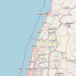
Map view of Dibeen Forest Reserve

Use this park location map to pinpoint Dibeen Forest Reserve in Jordan, understand its exact geographic position, and read its mapped placement within the surrounding landscape more clearly.

Pigeon | © OpenStreetMap contributors

Explore Jordan's Unique Pine-Oak Forest Terrain and Diverse Habitats Through Detailed Imagery

Dibeen Forest Reserve Photos, Scenery, and Protected Landscape Visuals

Visually explore Dibeen Forest Reserve's distinct landscapes, ancient pine-oak forests, and diverse habitats, gaining a clearer understanding of its unique Mediterranean ecosystem. These images reveal the reserve's rolling hills, steep limestone slopes, and seasonal wadis, offering crucial geographic context for its protected-area character in Jordan's northwestern highlands.

Tall pine and oak trees with a view of distant forested hills

Stone structure with wooden signboard displaying 'Dibeen Forest Reserve' text, surrounded by trees and a road

Park atlas

Compare nearby protected areas and trace the geographic spread of similar conservation landscapes in Jordan.

Discover Other Protected Areas Near Dibeen Forest Reserve and Jordan's Mediterranean Forests

Explore other national parks, nature reserves, and protected areas near Dibeen Forest Reserve, charting the geographic spread across Jordan's northwestern highlands and Mediterranean forests. Compare varied conservation landscapes and their unique geographic characteristics, providing essential context for the region's diverse protected natural heritage.
Nature reserveAjloun Governorate
About 16 km away#1 closest

North

Ajloun Forest Reserve: A Protected Mediterranean Woodland in Jordan's Ajloun Governorate

Explore the unique protected landscape and mapped terrain of Ajloun Forest Reserve.

Ajloun Forest Reserve is a nature reserve located in Jordan's Ajloun Governorate, distinguished by its rare Mediterranean woodland ecosystem. This protected area provides crucial habitat and showcases a landscape of rolling hills and valleys, offering a stark contrast to the country's predominantly arid regions. Its designation as a UNESCO biosphere reserve underscores its importance for conservation, including efforts in roe deer restoration and the preservation of the black iris, Jordan's national flower. Discover the geographic context and protected nature of this significant Jordanian landscape.

Area
13 km²
Established
1988
IUCN
IV
Relief
Highland
National parkIsrael
About 41 km away#2 closest

Northwest

Beit She'an National Park: A Protected Landscape in Israel's National Park Atlas

Mapped geographic context and protected area boundaries.

Beit She'an National Park offers a unique perspective on protected lands within Israel. This detail page provides users with insights into the park's specific geographic setting and its role as a mapped natural landscape. Delve into the structured data surrounding Beit She'an National Park to understand its protected status and its contribution to the broader atlas of conservation areas in the region, offering a grounded view of its terrain and spatial significance.

National parkIsrael
About 45 km away#3 closest

Northwest

Gan HaShlosha National Park: Protected Landscape and Archaeological Atlas in Israel

Explore natural springs, waterfalls, and ancient ruins within this national park.

Gan HaShlosha National Park presents a remarkable protected landscape in Israel, distinguished by its warm, natural spring-fed pools and picturesque waterfalls. This national park serves as a vital oasis within the Jordan Valley, boasting lush vegetation and a unique microclimate. Visitors can explore the park's archaeological heritage, featuring ruins that speak to its long history of human habitation. Understanding Gan HaShlosha National Park through its mapped geography and protected-area context provides valuable insight into Israel's natural and historical landscapes.

IUCN
V
Scope
Terrestrial
Nature reserveJericho Governorate
About 47 km away#4 closest

Southwest

Ain Al-Auja Nature Reserve: Mapping the Oasis Geography and Protected Ecosystems

Desert oasis and freshwater spring landscapes in Jericho Governorate

Ain Al-Auja Nature Reserve offers a distinct look at the intersection of highland escarpments and valley floor water systems. The protected landscape, defined by its perennial spring and surrounding medicinal flora, functions as a vital green corridor. View the mapped boundaries and terrain context of this significant desert oasis within the Jordan Valley network.

Area
22 km²
Access
Access unknown
Scope
Terrestrial
Water
Major water bodies
National parkIsrael
About 47 km away#5 closest

Northwest

Beit Alfa Synagogue National Park: A Protected Landscape in Israel's Geography

Explore the mapped natural terrain and park boundaries.

This page details Beit Alfa Synagogue National Park, a designated national park in Israel, offering an atlas-centric view of its protected landscape. Understand its geographic setting and the mapped context of its protected area within the region. MoriAtlas provides structured data to explore the natural terrain and park boundaries of Beit Alfa Synagogue National Park, enriching your understanding of Israel's conservation lands.

Scope
Terrestrial
Water
No major water
National parkIsrael
About 51 km away#6 closest

Southwest

Qasr el Yahud National Park: Exploring Protected Landscape and Geographic Identity in Israel

Mapped boundaries and regional natural landscape context.

Qasr el Yahud National Park is a designated protected area in Israel, serving as a crucial site for understanding regional geography and landscape context. This page facilitates detailed exploration of its protected land identity, mapped geographic boundaries, and its place within the natural terrain of the area, offering users a clear view of its atlas significance.

National parkPalestine
About 58 km away#7 closest

West

Shomron National Park: Protected Landscape and Geographic Identity

Explore the terrain and mapped boundaries of this national park.

Shomron National Park preserves the natural landscape and archaeological remnants of the historic Samarian region. This protected area offers a glimpse into the characteristic terrain of the West Bank highlands, featuring rolling hills and rocky outcrops. Understand the geographic placement and protected land context of Shomron National Park within its regional setting.

IUCN
V
Relief
Mountain
Scope
Terrestrial
National parkIsrael
About 63 km away#8 closest

Northwest

Hamat Tiberias National Park: Explore Protected Landscape and Mapped Geography in Israel

Discover natural terrain and park boundaries within Israel's protected areas.

Delve into Hamat Tiberias National Park, an important protected landscape in Israel. This page offers a detailed look at its geographic setting and the value it holds for atlas exploration. Understand the mapped extent of the park and its place within the regional geography, providing a concrete basis for understanding protected natural areas.

Common questions about visiting, size, designation, and location context for Dibeen Forest Reserve

Dibeen Forest Reserve FAQs for park facts, access, geography, and protected area context

Find quick answers about Dibeen Forest Reserve, including protected-area facts, park geography, trail and visitor context, and how the park fits into its surrounding country and regional landscape.
MoriAtlas Explorer

Continue Your Protected Areas Search Across the Global Atlas

Deepen your exploration by continuing the structured search for national parks and protected areas worldwide. Utilize the comprehensive filtering capabilities to compare different conservation landscapes and refine your understanding of global park geography. Discover more about the distribution and characteristics of protected natural areas.

Global natural geography
