Mori Atlas logo
Nearby park discovery

Map-based exploration of natural landscapes and neighboring protected regions

Geographic Distribution of Protected Areas Near Dippelsdorfer Teich in Saxony

Analyze the spatial arrangement of protected natural landscapes surrounding Dippelsdorfer Teich. This geographic overview highlights the density and distribution of nearby nature reserves, providing context for the Moritzburg pond landscape and the broader terrain of the Meißen region through structured mapping.

A flat-style digital illustration showing a waterfall in the distance flowing into a body of water, with a small building on the shore, trees, and tall reeds in the foreground.

A historic 16th-century Saxon pond lake in the heart of the Moritzburg Teichgebiet.

Dippelsdorfer Teich

The Dippelsdorfer Teich is a medium-sized pond lake in the Moritzburg pond landscape of Saxony, lying north of Dresden in the Landkreis Meißen. It is one of the historically constructed ponds that together form the broader Moritzburger Teichgebiet, a system long used for fish farming, nature conservation, and local recreation. The pond is named after the small hamlet of Dippelsdorf, which today belongs to the Moritzburg locality of Friedewald. Its landscape blends open water with woodland edges and is crossed by the Lößnitzgrundbahn, a heritage narrow-gauge railway that runs along a dam built across the pond. Recreation around the lake includes the Strandbad Friedewald-Dippelsdorf lido and the Bad Sonnenland camping area. Although modest in scale, the Dippelsdorfer Teich is characteristic of the Saxon tradition of constructing artificial pond landscapes and reflects centuries of careful water management for fisheries, flood buffering, and ecological protection within the northern Dresden countryside.

Location
Germany
Park type
Nature reserve
Established
1528
Area
0.7 km²
Dippelsdorfer Teich Nature Reserve Geography
Regional park map

See the ranked park cluster in its geographic setting

Nearby parks around Dippelsdorfer Teich

This regional map shows the same 20 nearby parks ranked below around Dippelsdorfer Teich. Select a ranked marker to highlight that park’s boundary where boundary data is available.
Reference park: Dippelsdorfer TeichRanked nearby park20 nearby parks shown
20 nearby parks

Distance-ranked regional park geography and surrounding protected landscapes

Parks and Protected Areas Geographically Near Dippelsdorfer Teich

Explore parks and protected areas ordered by geographic proximity to Dippelsdorfer Teich to examine surrounding regional conservation patterns. Structured distance metrics and environmental records provide clear comparison signals across neighboring natural areas and reserves.
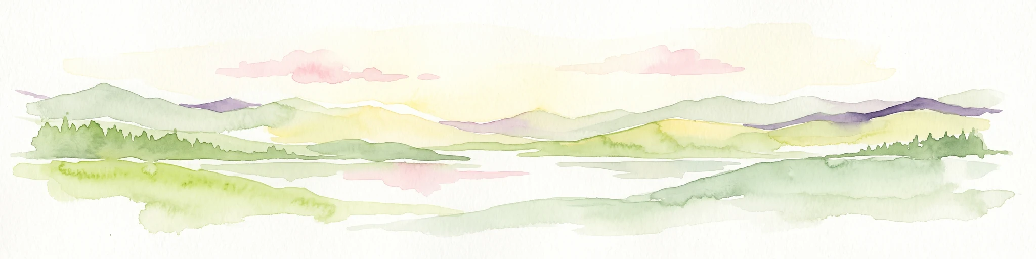
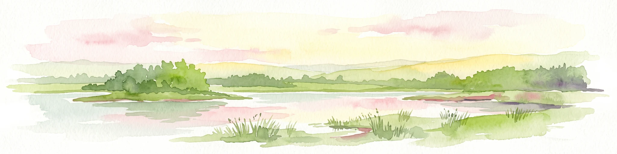
A watercolor painting showing a calm pond with a small island of green trees and distant rolling hills under a soft pink and yellow sky.
Nature reserveMeißen District
About 4.8 km away#1 closest

Northeast

Frauenteich Moritzburg: Mapping the Protected Wetland Landscapes of Meißen District

Glacial pond basins and diverse forest habitats in Saxony.

Frauenteich Moritzburg serves as a core component of Saxony's pond landscape, protecting a rich sequence of shoreline vegetation and open water. Its geography reflects the results of ancient glacial activity, creating a unique environment where sandy ridges and wet meadows coexist. This nature reserve provides essential refuge for bird populations, making it a focal point for understanding the natural, protected terrain within the broader Meißen District environment.

Area
2.02 km²
Established
1954
IUCN
IV
Relief
Lowland
Nature reserveSachsen
About 11 km away#2 closest

Northeast

Waldmoore bei Großdittmannsdorf: A Protected Wetland Landscape in Sachsen, Germany

Mapping forest mires and rare swamp woodland habitats

Waldmoore bei Großdittmannsdorf represents a carefully maintained nature reserve in eastern Germany, spanning roughly 93 hectares of forest mire and bog structures. The site supports a rare transition of swamp woodland, sedge-rich wet stands, and spring flushes within the Laußnitzer Heide. As a designated Natura 2000 area, it plays a key role in safeguarding regional wetland connectivity and providing a refuge for specialist flora and fauna in the Saxon landscape.

Area
0.935 km²
Established
2000
IUCN
IV
Nature reserveSachsen
About 15 km away#3 closest

Northwest

Winzerwiese und Gosebruch: Protected Nature Reserve and Valley Geography in Sachsen

Mapping protected wet meadows and floodplain woodlands

Winzerwiese und Gosebruch is a distinctive nature reserve in Sachsen, Germany, centered on a small valley along the Gosebach stream. This protected area creates a dense mosaic of wet meadow, marshy woodland, and dry deciduous forest, offering a significant look at the region's diverse botanical landscape and river-valley geography.

Area
0.116 km²
Established
1967
IUCN
IV
A pale, soft watercolor painting depicting a small arched bridge crossing a gentle stream within a rolling green valley.
Protected landscapeSaxony
About 15 km away#4 closest

East

Seifersdorfer Tal Protected Landscape and Cultural Heritage in Saxony

A historic garden monument and river valley ecosystem

The Seifersdorfer Tal is a protected landscape defining the Große Röder valley. Beyond its cultural status as one of Germany's earliest English-style landscape gardens, the area serves as a vital riverine corridor and nature reserve. The terrain offers a unique blend of rocky outcrops, wooded slopes, and meadows linked by historic footpaths and 18th-century allegorical monuments.

Area
2.88 km²
Established
1960
Relief
Upland
Climate
Temperate
Nature reserveFreistaat Sachsen
About 16 km away#5 closest

South

Windberg Nature Reserve: Mapping the Forested Ridge and Protected Landscape of Saxony

Geology, mining heritage, and protected oak-beech forest ecosystems

Windberg serves as the prominent local landmark for Freital, defined by its elongated forested plateau and complex tectonic geography. This nature reserve offers a study in the intersection of environmental conservation and human industrial history, featuring Saxony's deepest cave and varied habitats within the eastern Ore Mountains foothills.

Established
1967
Relief
Mountain
Climate
Temperate
Access
Easy access
Watercolor painting of a soft landscape featuring distant hills and foreground vegetation in shades of green, yellow, and soft red.
Nature reserveSachsen
About 18 km away#6 closest

Southeast

Dresdner Elbtalhänge Nature Reserve: Geography, Mapped Boundaries, and Landscape Context

An essential nature reserve along the Elbe valley in Sachsen

Dresdner Elbtalhänge captures the striking transition between the flat Elbe floodplain and the Westlausitz hill region. This detailed atlas entry covers the reserve's unique geomorphology, including its incised ravine systems, south-facing oak forests, and exposed rock formations that define its protected character within Sachsen.

Area
203.6 km²
Established
2007
IUCN
IV
A soft, light-toned watercolor painting of a low, rolling landscape with green hills, sparse vegetation, and a suggestion of wetland or pond in the foreground.
Nature reserveSachsen
About 19 km away#7 closest

Northwest

Seußlitzer und Gauernitzer Gründe: Protected Nature Reserve Map and Landscape Overview

Regional geography and habitat boundaries in the Sachsen Elbe valley.

Spanning steep slopes and narrow brook valleys on both sides of the Elbe, Seußlitzer und Gauernitzer Gründe is a defining nature reserve in Sachsen. This protected area supports a diverse mix of dry herbaceous vegetation and mature deciduous forest, serving as a critical component of the local ecological network within the broader Upper Elbe landscape.

Area
3.57 km²
Established
2013
IUCN
IV
Relief
Upland
A pale, soft watercolor illustration showing a horizontal landscape of light green trees, shrubs, and rolling grassy plains on a white background.
Nature reserveGermany
About 21 km away#8 closest

Southeast

Elbinseln Pillnitz und Gauernitz: A Study in Protected Saxon River Landscapes

Examining floodplain geography and rare river island ecosystems

Located in the Elbe valley between Dresden and Meissen, Elbinseln Pillnitz und Gauernitz preserves the final natural river islands within the state of Saxony. This protected nature reserve anchors a vital network of alluvial soils, riparian woodlands, and unarmored riverbanks, offering a unique perspective on the dynamic floodplain geography of Germany's major river corridors.

Area
0.235 km²
Established
2006
IUCN
IV
Relief
Lowland
Nature reserveSaxony
About 23 km away#9 closest

West

Trockenhänge südöstlich Lommatzsch: A Protected Dry-Slope Landscape in Saxony, Germany

Mapping rare grasslands and oak woodland habitats

Trockenhänge südöstlich Lommatzsch encompasses a unique network of non-contiguous parcels across the Ketzerbach valley. Formed on resilient Meißner monzonite bedrock, these sheltered slopes support threatened plant communities and high-value invertebrate habitats, standing as a critical protected fragment amidst the surrounding intensive agricultural landscape of Saxony.

Nature reserveSaxony
About 24 km away#10 closest

South

Weißeritztalhänge Nature Reserve: Protected Slope Forests and River Valley Geography

Regional landscape profile in Saxony, Germany

Weißeritztalhänge represents a significant nature reserve situated along the Wilde Weißeritz in Saxony. The protected area features expansive slope forests that transition from the Saxon lowlands into the Erzgebirge, providing a critical refuge for diverse woodland and river-dwelling species.

Area
4.486 km²
Established
1961
IUCN
IV
Relief
Upland
A watercolor illustration depicting rolling, soft hills and green vegetation with distant, faded mountains in the background, set against a plain white background.
Nature reserveGermany
About 25 km away#11 closest

Southeast

Spargründe bei Dohna: Nature Reserve and Protected Valley Landscapes in Germany

Examining the crystalline ravines and forest ecosystems of the Saxon landscape

Spargründe bei Dohna stands as a distinct nature reserve at the northern margin of the Elbtalschiefergebirge. The site encompasses narrow, steeply-sided valleys carved into Dohna Granodiorite, creating a rugged terrain of rocky ridges and shaded deciduous woodland. This geographic overview examines the boundaries and natural features of the reserve, highlighting its role within the wider Müglitztal protected area network.

Area
0.373 km²
Relief
Upland
Climate
Temperate
Access
Easy access
Watercolor painting showing a landscape with green hills, trees, and a river winding through the scene
National parkGermany
About 31 km away#12 closest

Southeast

Saxon Switzerland National Park: Protected Area Geography and Map Exploration

Discover its mapped boundaries and regional landscape context.

Saxon Switzerland National Park, a protected national park in Germany, offers a distinct focus for geographic and atlas-based discovery. This page details the park's specific protected landscape, its mapped boundaries, and its contribution to the regional geography. MoriAtlas allows for in-depth exploration of such natural areas, providing essential context for understanding their place within broader natural systems and mapped terrains.

Area
93.5 km²
Established
1990
IUCN
II
Visitors
1.7M annual
A soft watercolor painting depicting a pale, hazy landscape with green grassy fields, light green trees, and distant faint mountains under a pastel sky.
Protected areaSaxony
About 33 km away#13 closest

Northwest

Gohrischheide und Elbniederterrasse Zeithain: Geography and Protected Area Overview

Analyzing the inland dunes and dry heath landscape of the Elbe river terrace

Discover the unique geography of Gohrischheide und Elbniederterrasse Zeithain in Saxony, a protected area known for its expansive inland dunes and dry heath habitats. This region represents a rare combination of post-glacial sand landscapes and semi-open forest mosaics that reflect long-term ecological evolution and distinct regional environmental conditions.

Area
28.47 km²
Established
2011
Relief
Lowland
Climate
Temperate
A horizontal watercolor painting showing a soft, atmospheric wetland scene with green meadows, tall grasses, distant tree lines, and a pale pink and yellow sky.
Nature reserveBrandenburg
About 37 km away#14 closest

Northwest

Kleine Röder Nature Reserve: Mapped Wetland Geography and Protected Landscape in Brandenburg

A vital Elbe-Mulde lowland corridor near Bad Liebenwerda

The Kleine Röder Nature Reserve functions as a major ecological link in northeastern Germany, protecting a 385 hectare mosaic of fens, wet meadows, and alluvial forests. This site is defined by its water-dominated terrain and its role as a habitat corridor in the Elbe-Mulde lowland, encompassing both rare wetland flora and the historic Kosilenzien Slavic ringwall within its official boundaries.

Area
3.65 km²
Established
2011
IUCN
IV
Nature reserveSächsische Schweiz-Osterzgebirge
About 38 km away#15 closest

South

Weicholdswald Nature Reserve: Mapped Protected Landscapes of the Eastern Ore Mountains

A preserved beech forest enclave within the Sächsische Schweiz-Osterzgebirge

Weicholdswald stands as a primary nature reserve in the Sächsische Schweiz-Osterzgebirge district, known for its 160-year-old beech trees and extensive deadwood habitats. This protected area provides a rare look at near-natural forest ecosystems that have remained free from historic clear-cutting or coniferous monocultures, maintaining rich biodiversity across its streams and granitic slopes.

Area
1.037 km²
Established
1961
IUCN
IV
Nature reserveBrandenburg
About 39 km away#16 closest

North

Welkteich Nature Reserve: Brandenburg Industrial Legacy and Protected Habitat Mapping

Mapping a unique mosaic of post-mining terrain and historic pond systems

Located in the district of Oberspreewald-Lausitz, Welkteich represents a distinct example of how industrial-era mining scars and artificial ridges can evolve into protected nature reserves. The site serves as a vital ecological corridor, featuring a dense interspersion of aquatic basins, forest patches, and dry ground that provides a sanctuary for diverse species within the broader Brandenburg landscape.

Area
1.13 km²
Established
1981
IUCN
IV
Relief
Lowland
Nature reserveSachsen
About 40 km away#17 closest

South

Gimmlitztal Nature Reserve in the Ore Mountains: Mapped Protected Landscapes

Exploring the stream valley geography of Saxony, Germany.

Gimmlitztal is a significant nature reserve in the German state of Saxony that protects the unique hydrology and biodiversity of the Gimmlitz stream corridor. The terrain includes forested slopes and traditional meadow patches, reflecting a long history of human interaction with the Ore Mountain environment. This reserve functions as a continuous green ribbon for regional habitat preservation.

Area
2.578 km²
Established
2015
IUCN
IV
Watercolor painting of a panoramic mountain landscape with rolling green hills, patches of forest, and distant peaks under a soft sky.
Nature reserveSaxony
About 42 km away#18 closest

South

Geisingberg Nature Reserve: A Volcanic Basalt Peak in the Eastern Ore Mountains of Saxony

Exploration of protected mountain terrain and volcanic geology

Geisingberg serves as a rare volcanic Quellkuppe rising above the Saxon mining landscapes of Altenberg. The nature reserve protects 300 hectares of high-altitude bogs, species-rich meadows, and historic forest clearings. Gain a deeper understanding of this mountain through detailed mapped terrain, topographic features, and long-standing protected-area status within the Ore Mountains.

Area
3 km²
Established
1960
Relief
Mountain
Climate
Temperate
A pale, soft watercolor painting of a serene moorland landscape with rolling green hills and a light, misty background.
Nature reserveSaxony
About 43 km away#19 closest

Northeast

Dubringer Moor Nature Reserve: Geographic Atlas and Protected Landscape Mapping

Extensive mire and wetland complex in the Saxony region

Spanning over 1,700 hectares, Dubringer Moor serves as a prime example of a through-flow moor system with deep peat deposits. The reserve features a unique integration of old fish-pond culture, open heath-mire, and coniferous forest, all situated within a glacial landscape that anchors the wetland ecology of northern Saxony. Examine the boundaries and environmental context of this significant habitat.

Area
17.11 km²
Established
1995
IUCN
IV
Relief
Lowland
Nature reserveSaxony
About 44 km away#20 closest

Southwest

Unterer Großhartmannsdorfer Teich Protected Landscape and Historic Mining Reservoir

Essential wetland geography in the Ore Mountains of Saxony

The Unterer Großhartmannsdorfer Teich reservoir serves as a critical example of mining water engineering within Saxony. Today, the area functions as a protected nature reserve, preserving an extensive network of peatlands, reed beds, and diverse aquatic habitats that support significant waterbird populations and regional biodiversity.

Area
1.55 km²
Established
1568
Relief
Upland
Climate
Temperate
Distance methodology

Geographic measurements, not driving distances

How nearby park distances are calculated

Distances use park boundaries whenever the available geometry allows it. When one or both boundaries are missing, the mapped park locations provide a clearly labelled estimate. Every value represents straight-line geographic separation and does not use roads or routing.

Boundary distance

Calculated between the nearest points of both park boundaries.

Location-to-boundary estimate

Estimated from one mapped park location to the nearest boundary of the other park.

Mapped-location estimate

Estimated between the mapped locations of both parks.

MoriAtlas Explorer

Analyze the Geography and Protected Landscape of Dippelsdorfer Teich

Open this detailed entry to examine the environmental and cultural features of Dippelsdorfer Teich. MoriAtlas provides a clear look at this historic reservoir, its physical boundaries, and its position within the broader system of protected lands in the Meißen region.