Why El Naggaza National Park stands out
El Naggaza National Park is best known as a premier birdwatching destination in Libya, with flamingos and various gull species being the most characteristic avian inhabitants. The park's shallow wetland waters and coastal lagoon environments create ideal conditions for these and other waterbird populations. The presence of seals in the park's marine waters adds to its ecological significance, making it one of the few locations in Libya where visitors can observe marine mammals in their natural protected habitat.
El Naggaza National Park history and protected-area timeline
El Naggaza National Park was established in 1993 as part of Libya's broader initiative to develop a national system of protected areas. The creation of the park reflected growing awareness in Libya during the late 20th century of the need to conserve representative examples of the country's natural ecosystems, particularly those in the heavily populated and developed Mediterranean coastal zone. While the park's history as a formal protected area dates only to 1993, the area's ecological significance as a wetland and bird habitat would have been recognized by local communities and naturalists for much longer.
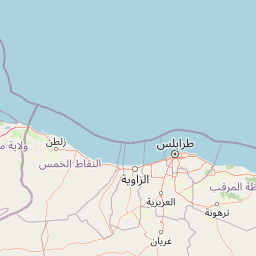
El Naggaza National Park landscape and geographic character
El Naggaza National Park occupies a coastal position along the Mediterranean Sea in northern Libya. The terrain consists of low-lying coastal plains and shallow wetland areas that transition into the marine environment. The landscape is characterized by lagoon systems and intertidal zones that create the shallow, nutrient-rich waters favored by waterbirds and marine species. The Mediterranean coastline in this region features sandy shorelines and nearshore waters that support the park's ecological communities. Given the park's relatively small area and proximity to Tripoli, the surrounding landscape consists largely of agricultural land and coastal development, making the protected area a critical green corridor within a modified landscape.
El Naggaza National Park ecosystems, habitats, and plant life
The nature of El Naggaza National Park centers on its coastal wetland ecosystem, which forms the ecological foundation for the park's biodiversity. These wetland habitats provide critical feeding, nesting, and resting areas for bird populations, particularly species associated with shallow water and mudflat environments. The Mediterranean climate influences the park's ecological character, with seasonal variations in temperature and precipitation shaping the conditions that different species encounter throughout the year. The transition from wetland to marine environments within the park creates a mosaic of habitats that supports both terrestrial and aquatic species, contributing to the overall ecological diversity of the protected area.
El Naggaza National Park wildlife and species highlights
El Naggaza National Park is notable for its bird populations, with flamingos representing one of the park's most iconic species. These large wading birds frequent the park's shallow waters, where they feed on aquatic invertebrates and algae. Various gull species also inhabit the park, taking advantage of the coastal resources and the opportunities for foraging along the shoreline and in nearshore waters. Beyond avifauna, the park supports populations of seals, which represent one of the few marine mammal species found in Libyan waters. The presence of these pinnipeds indicates the ecological health of the park's marine environment and its significance as a coastal habitat.
El Naggaza National Park conservation status and protection priorities
El Naggaza National Park serves as an important conservation unit within Libya's protected area network. The park's designation as an IUCN Category II protected area reflects its primary purpose of ecosystem conservation and national park management. Protecting this coastal wetland area helps preserve biodiversity values that would otherwise be threatened by coastal development, tourism pressure, and other human activities concentrated along Libya's Mediterranean shoreline. The park's role in supporting migratory bird populations extends its conservation significance beyond national borders, contributing to regional and international bird conservation frameworks that depend on protected staging and wintering sites.
El Naggaza National Park cultural meaning and human context
El Naggaza National Park is situated in a region with historical connections to Mediterranean maritime communities, though the sparse Wikipedia source provides limited detail on specific cultural dimensions. The park's proximity to Tripoli places it within the sphere of Libya's most densely populated and historically significant urban area. The coastal wetlands of this region have likely supported human communities through traditional fishing and resource gathering activities over generations, though precise information about contemporary local communities within or adjacent to the park is not available from the source material.
Top sights and standout views in El Naggaza National Park
The standout features of El Naggaza National Park include its role as a Mediterranean wetland sanctuary, its population of Greater Flamingos, diverse gull species, and the presence of seals in its coastal waters. The park provides one of the most accessible wildlife observation opportunities in Libya, particularly for visitors coming from Tripoli. Its status as a designated national park since 1993 makes it a mature protected area within Libya's conservation system, while its relatively compact area allows for focused exploration of its key habitats.
Best time to visit El Naggaza National Park
The best time to visit El Naggaza National Park would typically be during the cooler months of the year when outdoor activity is more comfortable in the Mediterranean climate. Birdwatching opportunities may vary seasonally, with migratory species present during different times of the year depending on their movement patterns along the Mediterranean flyway. The summer months can bring high temperatures that may limit activity levels, while spring and autumn often provide favorable conditions for observing both resident and migratory bird species.