Mori Atlas logo
Nature reserveReserva biologica El Quimi

Explore the mapped watershed boundaries and metamorphic mountain terrain of this vital Ecuadorian reserve.

Reserva biologica El Quimi: A Protected Andean Wilderness in the Cordillera del Condor Region

(Reserva Biológica El Quimi)

Reserva biologica El Quimi protects the critical headwaters of the Quimi micro-watershed within the southern Cordillera del Condor. Spanning elevations between 1,700 and 2,480 meters, this nature reserve is defined by a complex geological composition of metamorphic, sedimentary, and volcanic rock. Its rugged, folded landscape sustains diverse Andean ecosystems and maintains essential hydrological networks across the Zamora River basin in Morona Santiago.

Andean reserveCordillera del Cóndorbiological reserveheadwaters protectionwatershed dividesub-Andean forest

Reserva biologica El Quimi

Nature reserve

Park overview

Structured park overview, official facts, and landscape profile for El Quimi Biological Reserve

El Quimi Biological Reserve park facts, protected area profile, and essential visitor context

Review the core facts for El Quimi Biological Reserve, including designation, size, terrain, visitor scale, habitats, and operating context in one park-focused overview.

About El Quimi Biological Reserve

El Quimi Biological Reserve occupies a strategically important position at the southern end of Ecuador's Cordillera del Cóndor, a mountain range that forms part of the Andean crest near the country's border with Peru. Designated as a biological reserve, the area exists primarily to protect intact ecosystems, freshwater sources, and the wildlife they support rather than to accommodate large-scale public visitation.

The terrain of El Quimi is the product of long-continued orogenic (mountain-building) processes. These tectonic forces have produced a complex geological mosaic: metamorphic rocks such as quartzites, phyllites, black slates, meta-andesites, metagraywackes and granitic schists; sedimentary layers including siliceous sandstones, limestones and black shales; and volcanic contributions such as calc-alkaline lavas and pyroclastic rocks. The resulting landscape is irregular, varied, and highly dissected, which contributes to habitat diversity.

Hydrologically, the reserve sits at the uppermost section of the Quimi River micro-watershed, which drains into the larger Zamora River basin, one of the most important river systems of southeastern Ecuador. By protecting the nacimiento, or headwaters, of several streams, the reserve underpins local and regional water provision. Its northwestern limit follows the international border with Peru, while its western boundary traces the watershed divide between the Yukutais and Quimi rivers along the edge of a high plateau or meseta.

Climatically, the area is mild for a montane reserve, with average temperatures ranging from approximately 18°C to 24°C, consistent with its mid-elevation position. Vegetation likely reflects the typical gradient between sub-Andean and lower montane forests of the eastern Andes, supporting the mammal diversity documented in early inventories. Together, these characteristics make El Quimi a significant, if still relatively understudied, component of the protected-area network that surrounds the Cordillera del Cóndor.

Quick facts and research context for El Quimi Biological Reserve

El Quimi Biological Reserve lies entirely in Morona Santiago Province, in the southern portion of the Cordillera del Cóndor. The reserve encompasses the headwaters of the Quimi River, a micro-watershed within the larger Zamora River basin. It extends across elevations of roughly 1,700 to 2,480 meters and covers an area of about 9,024 hectares.

Created in 2006, El Quimi is managed within Ecuador's National System of Protected Areas (SNAP). The reserve's position along the international boundary and across a major watershed divide gives it particular importance for both transboundary conservation and the protection of freshwater sources.

Protection and recognition

Terrestrial conservation scope, establishment year, and recognized status details

Reserva biologica El Quimi Protection Status and Designated Area History

Reserva biologica El Quimi maintains a documented terrestrial protection scope established in two thousand six. Official records track formal designation timelines and international recognition parameters for conservation analysis.

Protection details

Protection scope
Terrestrial
Designated year
2006
Transboundary protection
No
Park context

Deeper park guide and search-rich context for El Quimi Biological Reserve

El Quimi Biological Reserve history, landscape, wildlife, and travel context

Explore El Quimi Biological Reserve through its history, landscape character, ecosystems, wildlife, conservation priorities, cultural context, and seasonal travel timing in a structured park guide built for atlas discovery and search intent.

Why El Quimi Biological Reserve stands out

El Quimi is best known for protecting the headwaters of the Quimi River within the southern Cordillera del Cóndor. Its defining feature is the combination of a strategically placed watershed divide along the Ecuador-Peru frontier and a rugged Andean terrain sculpted by metamorphic, sedimentary, and volcanic geology. The reserve is also notable for sustaining a diverse Andean mammal community, including the Andean bear (spectacled bear), jaguar, Andean guanta, coati, bats, and various small rodents and marsupials. Although formal biodiversity study remains limited, the preliminary species inventory has highlighted the area's ecological importance for the southern Andes.

El Quimi Biological Reserve history and protected-area timeline

El Quimi Biological Reserve was formally established on 26 December 2006, when its creation was published in Ecuador's Official Registry under Interministerial Agreement number 120, dated 30 October 2006. The reserve was created within the framework of Ecuador's National System of Protected Areas (SNAP), which coordinates the country's network of natural reserves.

The reserve's placement in the southern Cordillera del Cóndor reflects a broader pattern of conservation actions taken in the region during the early twenty-first century, aimed at protecting transboundary forests, headwater ecosystems, and the Andean slopes near the border with Peru. Apart from its foundational designation, the reserve's official record notes no subsequent modifications to its legal status.

Because the reserve's creation is relatively recent and biological survey work in the area has been limited by difficult access and limited funding, much of the reserve's human and scientific history is still being written. El Quimi's administrative permanence within the SNAP framework is the clearest documented institutional fact about its past.

El Quimi Biological Reserve landscape and geographic character

The landscape of El Quimi Biological Reserve is defined by the rough, folded terrain of the southern Cordillera del Cóndor. Long-continued tectonic uplift has folded and faulted the bedrock into a structurally complex relief, producing a patchwork of ridges, valleys, and elevated plateaus shaped by both ancient marine sediments and younger volcanic activity.

The underlying geology is unusual and varied. Metamorphic rocks such as quartzites, phyllites, black slates, meta-andesites, metagraywackes and granitic schists form much of the basement. Interbedded with these are sedimentary strata including siliceous sandstones, limestones and black shales, while past volcanic activity has left calc-alkaline lavas and pyroclastic deposits across parts of the area. This geological diversity influences soil chemistry, drainage patterns, and plant communities.

At a broader scale, the reserve straddles the watershed divide that separates waters flowing into the Yukutais and Quimi river systems. Its western boundary follows the edge of a high plateau, while its northwestern limit coincides with the international border, putting El Quimi firmly within the trans-Andean geographic context. Elevations span roughly 1,700 to 2,480 meters, placing the reserve within the sub-Andean to lower montane elevation bands and giving it a landscape character between steep forested slopes and plateau edges.

El Quimi Biological Reserve ecosystems, habitats, and plant life

El Quimi protects ecosystems at the upper end of the eastern Andean foothills, within an elevation range that supports a transition between sub-Andean forests and lower montane forest types typical of the Cordillera del Cóndor. The combination of dissected topography, varied geology, and a humid mild climate results in a mix of habitats even within the reserve's modest area.

The watershed divide position of the reserve is ecologically critical. By protecting the headwaters of the Quimi River micro-watershed and additional stream sources that drain into the Zamora River basin, El Quimi safeguards the freshwater base for downstream ecosystems, including forests and rivers that may extend well beyond the reserve's boundaries. The integrity of these upper catchments is central to maintaining water quality, base flows, and aquatic habitat downstream.

Although formal vegetation classification is limited in the available record, the reserve's elevation and eastern Andean location imply the presence of closed-canopy humid forest, likely with elements of cloud forest influence at higher elevations, alongside steeper-slope forests and possibly shrubby or herbaceous formations along the plateau edge. This ecological mosaic is consistent with the area's value for medium- and large-bodied mammals.

El Quimi Biological Reserve wildlife and species highlights

El Quimi's wildlife value lies primarily in its population of medium and large mammals typical of the southern Cordillera del Cóndor and adjacent eastern Andean forests. Preliminary biological studies suggest that at least around 50 mammal species likely occur within the reserve, though the documentation of diversity remains preliminary.

Among the most emblematic species reported for the reserve are the Andean bear (or spectacled bear, Tremarctos ornatus), the jaguar (Panthera onca), the Andean guanta (a large native rodent), the coati, and a rich community of bats. The presence of these species indicates that El Quimi supports predator-prey dynamics typical of larger and more intact Andean forest landscapes, despite the limited extent of formal study.

Small mammals are also likely well represented, including various rodent and marsupial species that often form the base of the food web for larger carnivores and raptors. The local researchers note that biodiversity work in the reserve has so far been hampered by limited funding and difficult access, leaving the full mammal, bird, and herpetofauna inventory still incomplete. Even so, the confirmed presence of jaguars and Andean bears is ecologically significant for a protected area of El Quimi's size.

El Quimi Biological Reserve conservation status and protection priorities

El Quimi Biological Reserve exists primarily to protect ecosystems, watersheds, and wildlife rather than to support intensive human use. Its placement within the National System of Protected Areas (SNAP) places it under a national conservation framework that emphasises ecological integrity and the long-term protection of representative ecosystems of the Ecuadorian Andes.

The reserve's hydrological role is one of its most important conservation contributions. By safeguarding the headwaters of the Quimi River micro-watershed and additional streams feeding the Zamora River basin, El Quimi helps maintain regional water supplies, regulate seasonal flows, and preserve downstream aquatic ecosystems. Because freshwater integrity in tropical Andean catchments has cascading effects on forests, soils, and human communities, this hydrological value extends the reserve's conservation relevance well beyond its boundaries.

El Quimi also sits adjacent to and complements other conservation areas in the Cordillera del Cóndor, such as the Ichigkat Muja National Park, which lies within the same broader landscape. Together, these protected areas form part of a cross-border conservation complex along the Ecuador-Peru frontier. The presence of wide-ranging species such as the Andean bear and the jaguar adds further weight to the reserve's role in maintaining habitat connectivity in this part of the Andes, while ongoing scientific survey work remains a key priority for strengthening conservation management.

El Quimi Biological Reserve cultural meaning and human context

El Quimi Biological Reserve is located in Morona Santiago Province, a region of southern Ecuador historically tied to Andean and Amazonian cultural landscapes, including Shuar and other indigenous communities of the eastern foothills. While the available source material does not provide detailed cultural or ethnographic information about the reserve itself, its setting places it within a long-established human geography of the Cordillera del Cóndor and Zamora River basin.

The broader Cordillera del Cóndor region has been a focal point of both indigenous presence and contemporary conservation policy, with protected areas often negotiated alongside, or in relation to, indigenous land use and traditional territories. El Quimi's existence as a strictly protected biological reserve suggests a management approach prioritising ecological integrity rather than active cultural or extractive use, but the surrounding landscape retains deep cultural meaning for the region's communities. Further detailed cultural information would require sources beyond the current Wikipedia record.

Top sights and standout views in El Quimi Biological Reserve

Protects the headwaters of the Quimi River and other tributaries feeding the Zamora basin. Sits along the watershed divide between the Yukutais and Quimi rivers on the edge of a high plateau. Borders the international frontier at its northwestern extent, contributing to transboundary conservation in the southern Cordillera del Cóndor. Comprises a geologically diverse terrain of metamorphic, sedimentary, and volcanic rocks shaped by Andean uplift. Supports emblematic Andean mammals including the Andean bear, jaguar, Andean guanta, coati, and bat communities. Operates within Ecuador's National System of Protected Areas (SNAP), reinforcing its role in national conservation strategy.

Best time to visit El Quimi Biological Reserve

El Quimi Biological Reserve is a strictly protected biological reserve, and public access for tourism is not its primary purpose, so typical seasonal tourism guidance is of limited relevance. That said, the reserve's mid-elevation Andean setting, between roughly 1,700 and 2,480 meters, implies a relatively mild year-round climate with average temperatures between 18°C and 24°C, suggesting that conditions remain workable across much of the year.

For any future ecological or research-oriented visit, the dry-season months generally offer easier overland access and more stable observation conditions in Andean forests like these, while the wetter months bring higher humidity, denser vegetation, and more challenging access on steep slopes. Given the limited road infrastructure and the reserve's protected status, any visit would typically need to be coordinated with the reserve's administering authority. Visitors should treat seasonal guidance as broadly indicative rather than definitive, in the absence of more detailed access information.

Monthly climate preview

Long-term representative measurements of monthly temperature and precipitation rhythms

Reserva biologica El Quimi Climate Normals and Annual Temperature Patterns

Representative coordinate records show measured monthly temperature variations and precipitation rates across the protected terrain. Analyzing twelve-month climatology data provides deeper insight into historical environmental patterns at this specific location.
Annual mean22 °C
20 °C23 °C
Jan22°
Feb22°
Mar21°
Apr21°
May21°
Jun20°
Jul20°
Aug22°
Sep23°
Oct23°
Nov22°
Dec22°
Warmest month
September

22.6 °C

Coolest month
June

20.3 °C

Wettest month
March

4 mm/day

Driest month
August

1.7 mm/day

Park location guide

Geography guide, regional context, and park location map for El Quimi Biological Reserve

El Quimi Biological Reserve park geography, regions, and map view in Ecuador

Understand where El Quimi Biological Reserve sits in Ecuador through a broader geographic reading of the surrounding landscape, nearby location context, and its mapped position within the national park landscape.

How El Quimi Biological Reserve fits into Ecuador

Ecuador is a presidential republic located in northwestern South America, with Quito as its capital and Guayaquil as its largest city. The country spans 283,561 km² and encompasses the Galápagos Islands, a volcanic archipelago famous for unique wildlife that helped shape Darwin's theory of evolution. Ecuador is a plurinational state with Spanish as the official language, though Kichwa and Shuar are recognized for indigenous peoples.

Wider geography shaping El Quimi Biological Reserve in Ecuador

Ecuador is located in northwestern South America along the Pacific coast. It shares borders with Colombia to the north and Peru to the east and south. The country includes the Galápagos Islands, a volcanic archipelago in the Pacific Ocean approximately 1,000 km west of the mainland. The territory encompasses diverse terrain including the Amazon rainforest in the east, the Andean highlands in the center, and coastal plains along the Pacific.

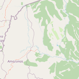
Map view of El Quimi Biological Reserve

Use this park location map to pinpoint El Quimi Biological Reserve in Ecuador, understand its exact geographic position, and read its mapped placement within the surrounding landscape more clearly.

Pigeon | © OpenStreetMap contributors

Location context for El Quimi Biological Reserve

Morona Santiago
Recorded earthquake history

Examine Recorded Seismic History Near Reserva biologica El Quimi

Consult the historical catalogue of earthquakes mapped to the surrounding geography of Reserva biologica El Quimi. This MoriAtlas dataset allows for the review of recorded seismic events, providing localized context on historical magnitude and depth for this protected Andean region.

Reserva biologica El Quimi Earthquake History

Catalogued events

19 events

Strongest magnitude

Magnitude 5.7

Most recent event

Aug 4, 2024

This history includes earthquakes recorded inside the park or within 50 km of its borders

Park atlas

Compare adjacent Andean reserves and regional conservation landscapes in southern Ecuador

Other Parks Near Reserva biologica El Quimi and Surrounding Protected Areas

Browsing other protected areas near Reserva biologica El Quimi reveals connected Andean mountain habitats and regional watershed networks. Expanding the geographic comparison highlights neighboring reserves across the Cordillera del Condor.
National parkPeru
About 26 km away#1 closest

East

Ichigkat Muja, Cordillera del Cóndor National Park: Peru's National Park Geography and Mapped Boundaries

Explore its protected landscape and regional geographic context.

This detail entry focuses on Ichigkat Muja, Cordillera del Cóndor National Park, a designated national park in Peru. It provides essential information for understanding the park's geography, its protected landscape features, and its mapped extent. Users can explore this park's unique geographic identity and its place within the broader atlas of Peru's natural protected areas, offering a factual foundation for geographic research.

Area
884.77 km²
Established
2007
Relief
Mountain
Climate
Tropical
Wildlife reserveZamora Chinchipe
32 km away#2 closest

Southwest

Refugio de vida silvestre El Zarza: Mapping Protected Lands in Zamora Chinchipe

Andean-Amazonian transition and sandstone tepuy habitats

Refugio de vida silvestre El Zarza serves as a critical conservation zone where the volcanic and metamorphic rocks of the Andes meet the sandstone formations of the Amazonian fringe. Explore the varied morphology of this wildlife refuge, which encompasses rounded ridges, steep river canyons, and pale, stratified farallones that define the eastern sector of the Cordillera del Condor.

Area
36.96 km²
Established
2006
IUCN
Ia
Relief
Mountain
National parkEcuador
59 km away#3 closest

North

Parque nacional Río Negro-Sopladora: Andean Protected Area and Highland Connectivity Atlas

Mapping forest-to-páramo transitions in the Eastern Cordillera

Parque nacional Río Negro-Sopladora encompasses a vast, undisturbed stretch of the southern Eastern Cordillera of the Andes. This protected landscape is defined by its dramatic vertical relief, which funnels water into the Río Negro and Sopladora basins while supporting a diverse array of endemic plants and high-altitude species. Gain insight into its role as a key geographic link in the Cóndor Kutukú-Palanda connectivity network through this structured park map.

Area
306.163 km²
Established
2018
IUCN
II
Relief
Mountain
Watercolor illustration showing a mountain landscape with a snow-capped peak, a lake, and green hills.
National parkEcuador
81 km away#4 closest

North

Sangay National Park: Ecuador's National Park for Mapped Landscape and Geographic Discovery

Explore Ecuador's protected area boundaries and regional terrain.

Sangay National Park serves as a crucial protected landscape within Ecuador, offering rich opportunities for atlas and geography exploration. This page details the park's specific mapped boundaries and its natural terrain, providing essential context for understanding its place within South America's broader geographic tapestry. Investigate Sangay National Park's identity as a protected national park and its value for focused landscape and regional discovery.

Area
5,177.65 km²
Established
1979
IUCN
II
National parkEcuador
89 km away#5 closest

Southwest

Podocarpus National Park: Ecuador's Diverse National Park and Protected Landscape

Discover elfin forests, paramo, and over 100 lagoons.

Podocarpus National Park, situated in southeastern Ecuador, stands as a prime example of a protected natural area at a unique biogeographic crossroads. This national park spans dramatic elevational zones, from montane rain forests to high-elevation paramo ecosystems dotted with more than 100 lagoons, offering rich mapped landscape exploration. Its significance lies in the convergence of four distinct ecological systems, contributing to exceptional biodiversity and a rich tapestry of natural terrain.

Area
1,462.8 km²
Established
1982
IUCN
II
Relief
Mountain
Watercolor painting of a mountain landscape with a lake, rolling hills, and coniferous trees in soft green and yellow tones.
National parkAzuay
99 km away#6 closest

Northwest

Parque nacional Cajas: Mapping the Glacial Lakes and Paramo of the Ecuadorian Andes

Geographic analysis of high-elevation protected lands

Parque nacional Cajas encompasses a rugged, glacial-sculpted plateau characterized by cushion vegetation, boggy wetlands, and frequent fog. This protected area offers deep insight into the highland Andean geography of Azuay, where water bodies and mountain ridges intersect to form an essential ecological and cultural corridor for the region.

Area
293.89 km²
Established
1977
IUCN
II
Visitors
53K annual
National parkEcuador
About 109 km away#7 closest

Northwest

El Cajas National Park National Park: Ecuador's Protected Landscape Geography and Map Context

Explore the mapped protected areas and regional geography of El Cajas National Park.

El Cajas National Park is a protected national park in Ecuador, serving as a focal point for atlas-driven geographic exploration. This page provides detailed insight into the park's mapped boundaries and its significance as a protected natural landscape within Ecuador's broader geography. Understand the context of El Cajas National Park for structured discovery of protected lands and natural terrains across South America.

Nature reserveZamora Chinchipe
113 km away#8 closest

South

Reserva Biológica Cerro Plateado: Andean and Amazonian Landscape and Protected Area Context

Vertical gradient and mountain forest geography in Zamora Chinchipe

Spanning elevations from 840 to 3,120 meters, Reserva Biológica Cerro Plateado represents a significant conservation effort within the Zamora Chinchipe province. The reserve preserves intact montane cloud forests and paramo, serving as a vital link between the eastern Andean slopes and the Nangaritza watershed in southeastern Ecuador.

Area
307.607 km²
Established
2010
IUCN
Ia
Relief
Mountain

Common questions about visiting, size, designation, and location context for El Quimi Biological Reserve

El Quimi Biological Reserve FAQs for park facts, access, geography, and protected area context

Find quick answers about El Quimi Biological Reserve, including protected-area facts, park geography, trail and visitor context, and how the park fits into its surrounding country and regional landscape.
MoriAtlas Explorer

Continue Your Protected Areas Search Across the Global Atlas

Deepen your exploration by continuing the structured search for national parks and protected areas worldwide. Utilize the comprehensive filtering capabilities to compare different conservation landscapes and refine your understanding of global park geography. Discover more about the distribution and characteristics of protected natural areas.

Global natural geography