
Mori Atlas logo
Wildlife reserveEllicott Rock Wilderness

Mapping the rugged Blue Ridge Mountains and the historic Chattooga River watershed across state borders.

Ellicott Rock Wilderness: Exploring the Geographic and Historic Boundaries of a Unique Tri-State Protected Area

Ellicott Rock Wilderness offers a distinct intersection of American history and Appalachian geography where the boundaries of Georgia, North Carolina, and South Carolina converge. Spanning the dense, hardwood-blanketed slopes of the southern Blue Ridge Mountains, this protected landscape is anchored by the Chattooga Wild and Scenic River. Users can explore its rugged river gorge, steep mountain terrain, and historic survey markers that preserve the 35th parallel, providing a detailed look at this rare, three-state designated wilderness area.

wilderness areatripointBlue Ridge MountainsAppalachian forestswild and scenic riverChattooga River
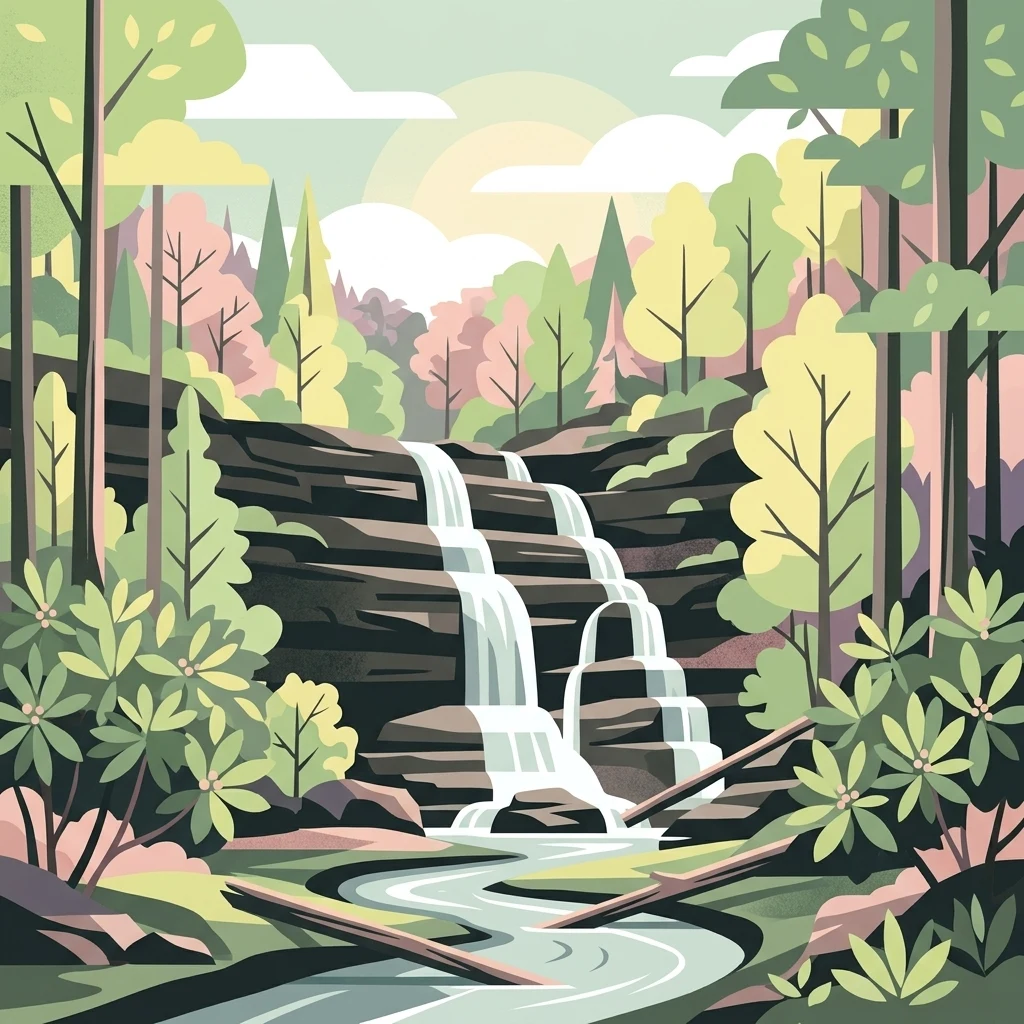
A stylized flat vector illustration of a tiered waterfall flowing into a river through a vibrant forest with layered rocky cliffs and lush vegetation.

Ellicott Rock Wilderness

Wildlife reserve

Park overview

Structured park overview, official facts, and landscape profile for Ellicott Rock Wilderness

Ellicott Rock Wilderness park facts, protected area profile, and essential visitor context

Review the core facts for Ellicott Rock Wilderness, including designation, size, terrain, visitor scale, habitats, and operating context in one park-focused overview.

About Ellicott Rock Wilderness

Ellicott Rock Wilderness occupies a singular place in the American conservation landscape. Although relatively small in size, it is the only federally designated wilderness that straddles three states, sitting at the geographic tripoint of Georgia, North Carolina, and South Carolina. Its borders are drawn around the convergence of those state lines along the Chattooga River, an area that has carried boundary significance since the early nineteenth century. Today it forms a compact but ecologically rich unit within the National Wilderness Preservation System, managed cooperatively by the U.S. Forest Service across Sumter, Nantahala, and Chattahoochee National Forests.

The wilderness lies within the southern tip of the Blue Ridge Mountains, a sub-range of the Appalachians. Its terrain is steep and rugged, shaped by deep river gorges, high rainfall of roughly 80 inches per year, and a temperate climate that supports a dense, mixed forest. Hardwood species dominate the slopes, joined by white pine and hemlock along cooler drainages. Throughout the area, springs and small tributaries feed waterfall cascades and contribute to the Chattooga Wild and Scenic River, which bisects the wilderness and rises only by a few hundred feet as it passes through.

Ecologically, the Chattooga watershed is regarded as one of the most biologically diverse in the country. The wilderness supports migratory songbirds, black bears, white-tailed deer, wild turkey, native trout in the river and its tributaries, box turtles, common garter snakes, and timber rattlesnakes. The interplay between high-gradient streams, north-facing coves, and exposed ridgelines creates a mosaic of habitats, all preserved within the strict protections of wilderness status, where access is limited to foot travel and motorized or mechanized use is prohibited.

Culturally and historically, the area is anchored by Ellicott Rock and Commissioner's Rock, two carved boundary stones placed along the riverbank in 1811 and 1813 respectively. Commissioner's Rock is listed on the National Register of Historic Places, recognizing its role in formally fixing the meeting point of these three states. Beyond the rocks themselves, the Chattooga has a deeper cultural resonance, made iconic by the novel and film Deliverance, and remains a prized destination for paddlers, anglers, and hikers seeking a wild southeastern river experience.

Quick facts and research context for Ellicott Rock Wilderness

Ellicott Rock Wilderness is a federally designated wilderness of about 8,274 acres lying at the tripoint of Georgia, North Carolina, and South Carolina in the southern Blue Ridge Mountains. It is administered by the U.S. Forest Service within the National Wilderness Preservation System under IUCN Category Ib, and is unique in being the only congressionally designated wilderness that straddles three states.

Its acreage is split between Sumter National Forest in South Carolina (the lead manager), Nantahala National Forest in North Carolina, and Chattahoochee National Forest in Georgia. The Chattooga Wild and Scenic River bisects the area, and the watershed surrounding it is recognized as one of the most biologically diverse in the country.

Protection and recognition

Documented protection records and management frameworks for Ellicott Rock Wilderness

Ellicott Rock Wilderness Protection Status and Terrestrial Conservation Scope

Ellicott Rock Wilderness maintains a documented terrestrial protection scope within the regional conservation network. Structured protected area data outlines the established governance framework and international recognition criteria without additional designations.

Protection details

Protection scope
Terrestrial
Transboundary protection
No
Park context

Deeper park guide and search-rich context for Ellicott Rock Wilderness

Ellicott Rock Wilderness history, landscape, wildlife, and travel context

Explore Ellicott Rock Wilderness through its history, landscape character, ecosystems, wildlife, conservation priorities, cultural context, and seasonal travel timing in a structured park guide built for atlas discovery and search intent.

Why Ellicott Rock Wilderness stands out

Ellicott Rock Wilderness is best known as the only congressionally designated wilderness in the United States that crosses three states at once. Its defining landmarks are Ellicott Rock and the nearby Commissioner's Rock along the Chattooga River, where the Georgia, North Carolina, and South Carolina state lines converge. The historic 1811 chisel mark by surveyor Andrew Ellicott, marking the 35th parallel, gives the area both its name and its enduring geographic and political significance. Beyond its cartographic distinction, the wilderness is also recognized for the dramatic Blue Ridge gorge carved by the Chattooga Wild and Scenic River, the dense cove and upland hardwood forests of the southern Appalachians, and the exceptional biodiversity of the surrounding watershed. Falls like Spoonauger Falls and rugged ridgelines such as Glade Mountain and Fork Mountain add to its visual and ecological identity.
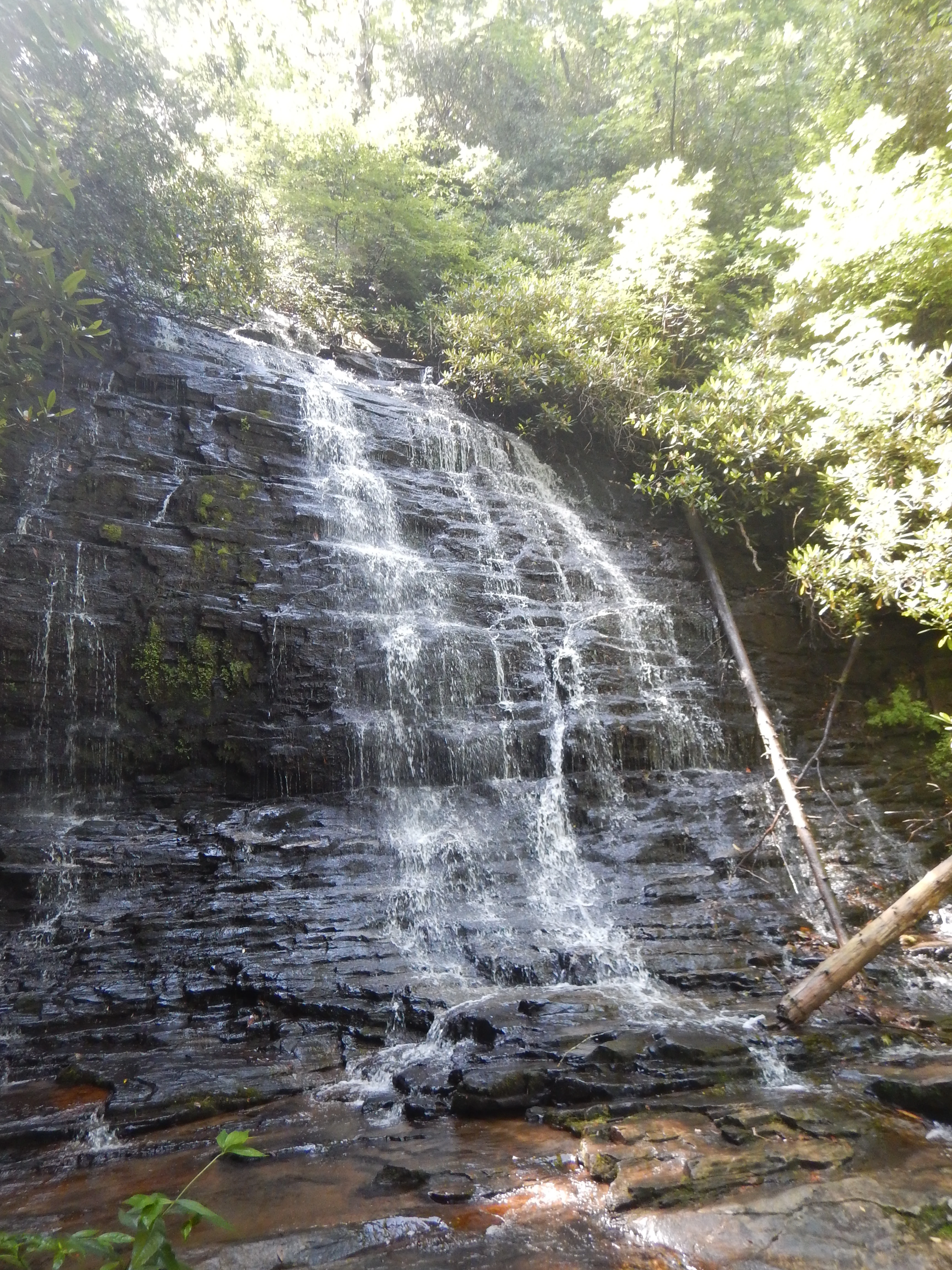
A multi-tiered waterfall cascading down a dark, layered rock face surrounded by dense green forest foliage.
Spoonauger Falls, a cascading waterfall in the lush woodlands of Ellicott Rock Wilderness.

Ellicott Rock Wilderness history and protected-area timeline

The history of Ellicott Rock Wilderness begins in 1811, when Major Andrew Ellicott, a respected surveyor and astronomer hired by the state of Georgia, was commissioned to resolve a long-running border dispute between Georgia and North Carolina. Working along the difficult and remote terrain of what is now the Chattooga River, Ellicott used astronomical observations to calculate the 35th parallel and chiseled the letters "N-G" into a rock on the river's east bank on December 26, 1811. The result placed the Georgia–North Carolina line roughly 18 miles south of what Georgia had previously claimed, a determination that left the state displeased enough that Ellicott went unpaid for more than a year and ultimately received only a small fraction of his promised salary.

Two years later, in 1813, a team of commissioners representing North Carolina and South Carolina traveled to the same general area to verify the location of the marked rock. They carved a separate stone approximately ten feet north of Ellicott's Rock, inscribing it with "Lat 35 AD 1813 NC + SC" to mark the point where the North Carolina and South Carolina state lines joined. Although popularly known as Ellicott's Rock, this second stone is more accurately called Commissioner's Rock; it was added to the National Register of Historic Places on July 24, 1973, recognizing its importance as a foundational boundary marker for three states.

As a protected area, Ellicott Rock Wilderness was first identified for conservation review in 1966 and was officially designated by Congress in 1975 through the Eastern Wilderness Act. Subsequent legislation expanded and refined its boundaries: the North Carolina Wilderness Act and the Georgia Wilderness Act, both passed in 1984, contributed additional lands, bringing the designated wilderness to its current footprint of approximately 8,274 acres. A 1979 Forest Service roadside and roadless review (RARE II) classified about 1,982 acres of adjacent Sumter National Forest land as the Ellicott Rock Extension, and a 1995 Resource Management Plan by the Andrew Pickens Ranger District recommended that area for wilderness. In 2017, the Nantahala Ranger District added another 824 acres as the Ellicott Rock West Extension during a forest plan revision. Although not all of these additions have received full congressional designation, they are generally managed as wilderness, preserving the area's strict non-motorized character.

Ellicott Rock Wilderness landscape and geographic character

Ellicott Rock Wilderness is set in the southern reaches of the Blue Ridge Mountains, the southernmost sub-range of the broader Appalachian Mountains. Its topography is steep, rugged, and tightly dissected by streams, with a dense forest cover interrupted by cliff bands, rocky coves, and narrow river gorges. Elevations range from the river level along the Chattooga up to summits such as Glade Mountain in Georgia, around 3,672 feet, and Fork Mountain in South Carolina, near 3,294 feet. The terrain is shaped by an exceptionally wet climate, with average rainfall close to 80 inches per year, which keeps the slopes saturated, fuels ongoing stream erosion, and supports the thick vegetation that defines the wilderness.

The Chattooga Wild and Scenic River is the dominant physical feature of the area. It flows through the heart of the wilderness and forms part of the South Carolina and Georgia border as it descends, dropping from approximately 2,381 feet to roughly 2,100 feet within the area. The river corridor is a deep, rocky gorge with boulder-strewn rapids, small waterfalls, and quiet pools. Additional streams and tributaries, including Bad Creek and the East Fork of the Chattooga, contribute to the area's network of cascades and seeps. Waterfalls such as Spoonauger Falls, found a short quarter-mile hike from the trailhead on Burrell's Ford Road, are characteristic features of this landscape.

The soils of the nearby additions belong to the Tusquitee-Edneyville-Porters soil group, a set typical of steep mid-elevation slopes in the southern Appalachians. This substrate, combined with the heavy rainfall and varied aspect of the terrain, creates the conditions for a richly layered forest mosaic. Mixed hardwoods, white pines, and hemlocks blanket the slopes, while exposed ridgetops and north-facing coves each produce their own microclimates. The result is a landscape that reads as continuously forested and mountainous, but with subtle transitions visible to attentive visitors, especially when fall foliage turns the hardwood slopes vivid red, orange, and gold.
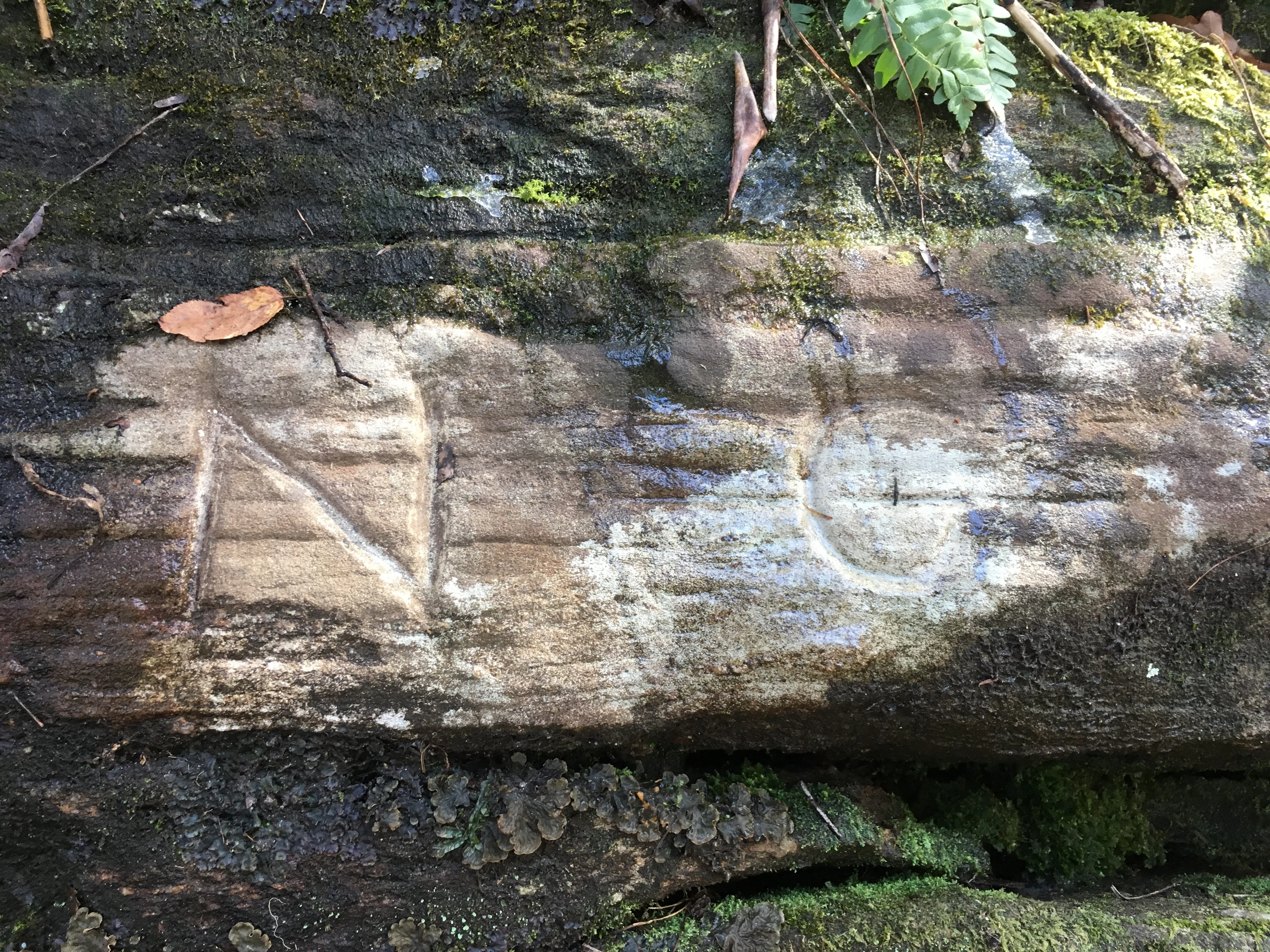
A close-up view of a historic inscription carved into a dark, moss-covered rock surface, showing the letters N and G.
The historical Ellicott Rock carving marking the boundary tripoint of Georgia, North Carolina, and South Carolina.

Ellicott Rock Wilderness ecosystems, habitats, and plant life

Ecologically, Ellicott Rock Wilderness functions as a small but unusually diverse refuge in the southern Appalachians. Its habitats form a tightly packed mosaic because three factors coincide in a very small area: high rainfall, steep topography, and the deep, sheltered corridor of the Chattooga River gorge. These conditions support hardwood forests on the slopes, cove hardwoods in the sheltered drainages, and pockets of white pine and hemlock that thrive in cooler, moister microclimates.

The forest composition reflects classic southern Appalachian diversity. Upland hardwoods dominate many of the ridgetops and drier slopes, with species such as white oak, red oak, and hickory forming the structural backbone of the canopy. Lower down, in the more sheltered and moisture-rich coves, the forest transitions to cove hardwood mixes, with taller trees and a richer understory. White pines add coniferous character to portions of the canopy, and hemlocks contribute along streamside corridors, although they face the well-documented pressures affecting the species across the region as a whole.

The area's defining ecological signature, however, lies in its watershed. The drainage surrounding the Chattooga Wild and Scenic River is recognized as one of the most biologically diverse in the country. Streams that tumble through the wilderness carry cool, well-oxygenated water that supports native trout and a wide array of aquatic invertebrates, while the surrounding forests sustain complex food webs on land. Because vehicles, mechanized equipment, and development are excluded under wilderness protections, the natural processes of this drainage, including flooding, tree fall, and succession, are allowed to operate with minimal human interference, maintaining the integrity of both aquatic and terrestrial habitats.
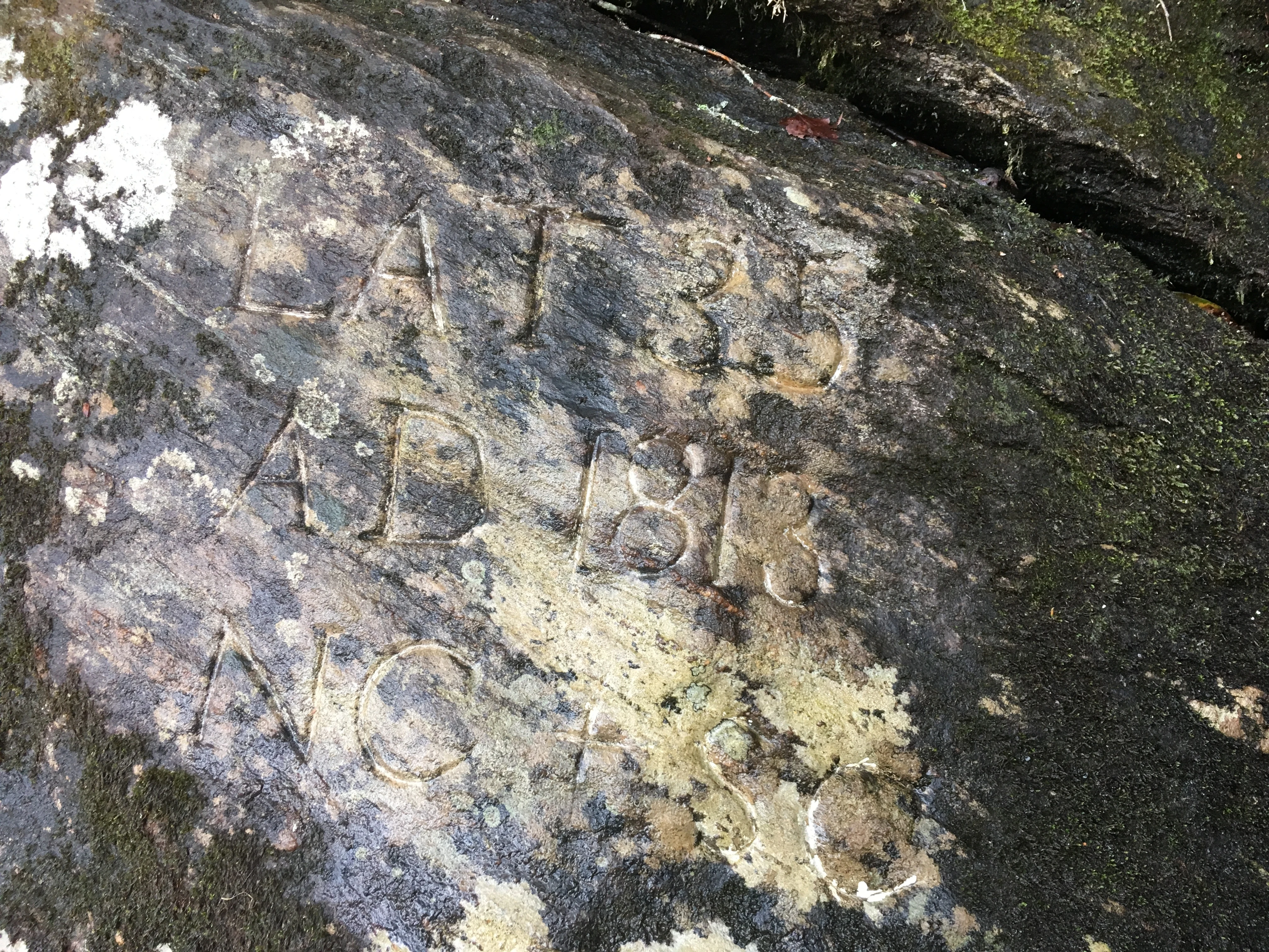
Close up view of historic letters and numbers chiseled into a dark mossy rock face.
The historic inscription on Commissioner's Rock, located near the tripoint of Georgia, North Carolina, and South Carolina within Ellicott Rock Wilderness.

Ellicott Rock Wilderness wildlife and species highlights

The wilderness supports a representative cross-section of southern Appalachian wildlife, made possible by the diversity of habitats packed into a comparatively small area. Mammals typical of the region are present, including white-tailed deer, wild turkeys, and black bears, which use the steep coves and forested slopes of the Chattooga drainage as core habitat. Smaller mammals and a rich suite of forest-floor species occur throughout, taking advantage of the thick leaf litter, fallen logs, and rocky refuges that define much of the woodland.

River and stream habitats add a strong aquatic dimension to the wildlife profile. The Chattooga and its tributaries support native trout populations, along with associated aquatic life that depends on cold, clean, well-oxygenated water. These fisheries are an important reason anglers are drawn to the wilderness, and they also reflect the overall ecological health of the watershed.

Reptiles and amphibians are also well represented. Box turtles, common garter snakes, and timber rattlesnakes are documented residents of the area, each occupying slightly different niches from upland forests to rocky outcrops and riverbanks. Above the canopy and through the understory, migratory songbirds pass through and breed in the forest, contributing to the area's strong bird life, particularly during spring and fall migration. The combination of deep forest, rock outcrops, fast rivers, and sheltered coves gives the wilderness more faunal diversity than its modest acreage would suggest.
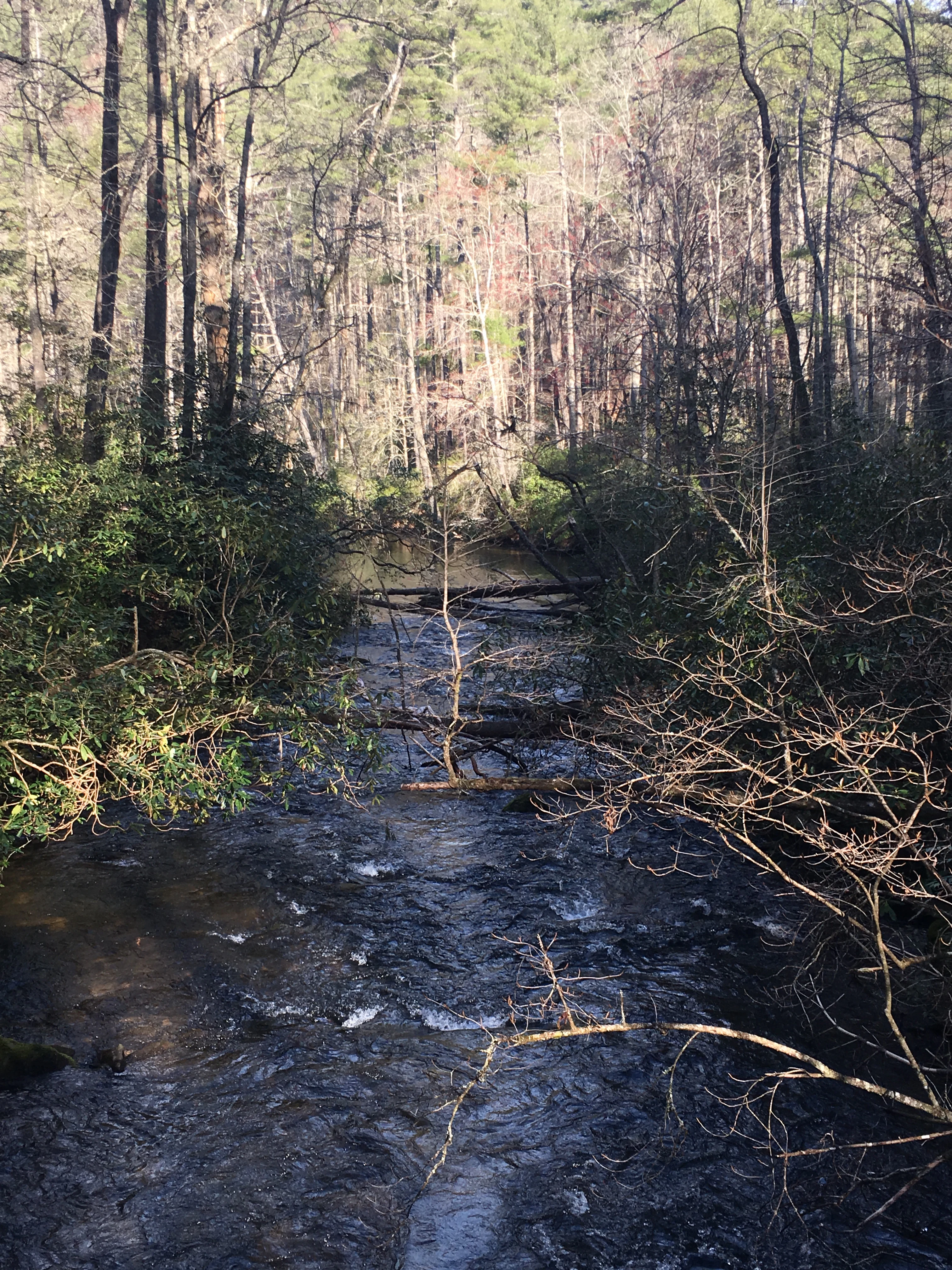
A narrow forest river flowing over rocky ground, surrounded by trees and shrubs in a wooded area.
The East Fork of the Chattooga River flowing through a dense forest in the Ellicott Rock Wilderness.

Ellicott Rock Wilderness conservation status and protection priorities

Ellicott Rock Wilderness plays a meaningful conservation role despite its small size, both as a protected refuge in the southern Appalachians and as part of a larger network of wildlands along the Chattooga River. Its wilderness designation under the Eastern Wilderness Act of 1975, and subsequent additions through the North Carolina Wilderness Act and Georgia Wilderness Act of 1984, places it within the National Wilderness Preservation System. Within that system, it carries the highest level of protection available for U.S. federal lands, with motorized and mechanized use restricted to preserve the area's natural character. The U.S. Forest Service manages it under IUCN Category Ib, recognizing it formally as a wilderness area.

The conservation significance of the wilderness extends beyond its own boundaries because it is integrated into one of the most biologically diverse watersheds in the country. By keeping the Chattooga River corridor and its surrounding forests free from roads, logging, and development, the wilderness helps maintain water quality, native trout habitat, forest interior conditions for sensitive species, and connectivity between larger protected areas in the southern Blue Ridge. Adjacent lands, including the Ellicott Rock Extension in South Carolina and the Ellicott Rock West Extension in North Carolina, are managed as if they were designated wilderness while awaiting formal status, extending the practical conservation footprint of the core area.

Indirectly, the wilderness also contributes to cultural and historical preservation. Ellicott Rock and Commissioner's Rock, lying within the area, are physical records of early American boundary surveying and political conflict. Commissioner's Rock's listing on the National Register of Historic Places places the wilderness within a dual framework of ecological and historical preservation, an unusual pairing that strengthens its identity as both a natural and a cultural landmark.

Ellicott Rock Wilderness cultural meaning and human context

The cultural context of Ellicott Rock Wilderness is shaped by its role as a meeting point of states, a contested boundary in early American history, and a beloved wilderness recreation area in the modern South. The current landscape was first made culturally significant in the early nineteenth century, when surveyor Andrew Ellicott was hired to settle the bitter dispute between Georgia and North Carolina over the location of the 35th parallel. His 1811 chisel mark on the riverbank turned a remote stretch of the Chattooga into a place of geopolitical interest.

The 1813 carving of Commissioner's Rock by state representatives formalized that interest, marking the convergence of the North Carolina and South Carolina lines alongside the Georgia boundary. Both rocks have since become reference points for understanding how the early American republic drew its internal lines, often through fieldwork and negotiation rather than precise cartography. The National Register listing of Commissioner's Rock in 1973 underscores the lasting recognition of this site as part of America's surveying and boundary history.

In more recent memory, the Chattooga River has its own cultural weight. The wilderness sits along stretches of the river that became famous worldwide through the novel and subsequent film Deliverance, embedding the area in broader popular consciousness as a symbol of a wild, demanding southeastern landscape. Today, the river corridor continues to carry a strong recreational and emotional significance for paddlers, anglers, hikers, and longtime residents of the surrounding Appalachian communities, who treat it as a special place both for its natural character and for the stories attached to it.

Top sights and standout views in Ellicott Rock Wilderness

Ellicott Rock Wilderness stands out for the unusual combination of geographic distinctiveness, historical depth, and ecological richness that it packs into a relatively small area. Its most singular feature is being the only congressionally designated wilderness that straddles three states, a status reflected in its location at the tripoint of Georgia, North Carolina, and South Carolina.

The area's natural highlights include the dramatic gorge of the Chattooga Wild and Scenic River, the dense mosaic of hardwood, white pine, and hemlock forests of the southern Blue Ridge, waterfalls such as Spoonauger Falls, and the rugged terrain of summits like Glade Mountain and Fork Mountain. Its watershed is recognized as one of the most biologically diverse in the country, supporting everything from native trout and migratory songbirds to black bears, deer, wild turkey, and a suite of reptiles including timber rattlesnakes.

Best time to visit Ellicott Rock Wilderness

Season shapes the Ellicott Rock Wilderness experience as much as effort does. Spring brings a flush of wildflowers in the cove forests, rising water levels on the Chattooga and its tributaries, and the arrival of migratory songbirds, making it a rewarding time for hiking and birdwatching, though trails and river crossings can be wetter and more demanding.

Summer offers the warmest conditions for paddling and swimming in the river, but it is also when humidity, thunderstorms, and biting insects are at their peak, and high water can complicate river crossings on foot. Fall is widely considered the most visually striking season, when the mixed hardwood canopy turns vivid shades of red, orange, and gold, the air cools, and biting insects subside, creating comfortable conditions for backpacking and overnight trips. Winter is the quietest and most austere; low water exposes the river's boulder gardens, and bare trees open up long views of the gorge, but shorter days, cold nights, and occasional ice on rock slabs near the river can make travel more difficult.

Monthly climate preview

Long-term monthly temperature and precipitation data recorded at a reference coordinate

Ellicott Rock Wilderness Climate Normals and Representative Weather by Month

Ellicott Rock Wilderness records recorded long-term temperature values ranging from negative minimums to warm maximums alongside consistent daily precipitation across the year. Reviewing the complete twelve-month record provides deeper perspective on the measured meteorological averages tied to this coordinate.
Annual mean13 °C
2 °C24 °C
Jan
Feb
Mar
Apr13°
May18°
Jun22°
Jul24°
Aug23°
Sep20°
Oct14°
Nov
Dec
Warmest month
July

23.8 °C

Coolest month
January

2.4 °C

Wettest month
February

4.4 mm/day

Driest month
October

3.2 mm/day

Park location guide

Geography guide, regional context, and park location map for Ellicott Rock Wilderness

Ellicott Rock Wilderness park geography, regions, and map view in United States of America

Understand where Ellicott Rock Wilderness sits in United States of America through a broader geographic reading of the surrounding landscape, nearby location context, and its mapped position within the national park landscape.

How Ellicott Rock Wilderness fits into United States of America

The United States of America is a federal presidential republic and one of the world's largest countries by area and population. It consists of 50 states across a vast territory spanning multiple time zones, with its capital in Washington, D.C. and largest city in New York City. The nation has a diverse economy, influential political system, and significant cultural and military presence globally.

Wider geography shaping Ellicott Rock Wilderness in United States of America

The United States occupies a vast territory in North America, bordered by Canada to the north and Mexico to the south. The 48 contiguous states stretch from the Atlantic to the Pacific Ocean, while Alaska occupies the northwestern region and Hawaii is an archipelago in the Pacific. The country encompasses diverse terrain including the Rocky Mountains, Appalachian Mountains, Great Plains, and extensive river systems.

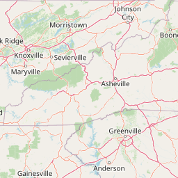
Map view of Ellicott Rock Wilderness

Use this park location map to pinpoint Ellicott Rock Wilderness in United States of America, understand its exact geographic position, and read its mapped placement within the surrounding landscape more clearly.

Pigeon | © OpenStreetMap contributors

Location context for Ellicott Rock Wilderness

North Carolina
Recorded earthquake history

Explore the Ellicott Rock Wilderness Earthquake History Catalogue

Access a structured archive of recorded seismic events associated with the geography of Ellicott Rock Wilderness. Use this dataset to review historical earthquake data, including magnitudes and proximity, within the broader context of the southern Appalachian Mountains.

Ellicott Rock Wilderness Earthquake History

Catalogued events

5 events

Strongest magnitude

Magnitude 3.7

Most recent event

Feb 13, 1986

This history includes earthquakes recorded inside the park or within 50 km of its borders

Visual exploration of southern Appalachian forests, river gorges, and protected terrain.

Ellicott Rock Wilderness Photos and Landscape Scenery

Examine detailed photographs of the rugged Blue Ridge terrain, dense hardwood canopies, and winding river gorges that define Ellicott Rock Wilderness. Visual documentation reveals the distinct topography and protected habitats of this unique three state natural area.

A multi-tiered waterfall cascading down a dark, layered rock face surrounded by dense green forest foliage.

A weathered wooden sign mounted on a post in a forest, engraved with the text 'ELLICOTT ROCK WILDERNESS, NANTAHALA & SUMTER National Forest'.

A close-up view of a historic inscription carved into a dark, moss-covered rock surface, showing the letters N and G.

Close up view of historic letters and numbers chiseled into a dark mossy rock face.

A narrow forest river flowing over rocky ground, surrounded by trees and shrubs in a wooded area.

Park atlas

Compare adjacent southern Appalachian landscapes and connected mountain forest reserves

Parks Near Ellicott Rock Wilderness and Surrounding Regional Protected Areas

Browse nearby national forests and protected areas situated across the surrounding Blue Ridge mountain terrain. Expanding the geographic scope reveals related wild river watersheds and contiguous conservation zones.
A horizontal watercolor painting depicting a soft green landscape with rolling hills, a meandering stream, and foreground grasses against a light white background.
Protected landscapeNorth Carolina
Park boundaries overlap#1 closest

Northwest

Nantahala National Forest: Geographic Overview of Protected Appalachian Mountain Landscapes

Mapping deep river gorges and temperate rainforests in North Carolina

The Nantahala National Forest represents a significant conservation achievement, encompassing diverse southern Appalachian mountain terrain. The landscape features deep river gorges, ancient old-growth forests, and extensive networks of waterfalls. This overview provides mapped context on its vast wilderness areas, including Joyce Kilmer-Slickrock, and the long-distance trail corridors that traverse this temperate rainforest region.

Area
2,150 km²
Established
1920
Relief
Mountain
Climate
Temperate
Protected landscapeSouth Carolina
Park boundaries overlap#2 closest

East

Sumter National Forest: Mapping Protected Landscapes and Terrain in South Carolina

Bridging Piedmont forests and Appalachian mountain foothills

Sumter National Forest offers a study in geographic contrast, as its three districts span the transition from South Carolina Piedmont ridges to the rugged spurs of the Blue Ridge Mountains. This protected area features the Chattooga Wild and Scenic River corridor, expansive hardwood-conifer mosaics, and complex mountain watersheds. The forest provides a window into regional land restoration, where reclaimed farmland and mountain ridges now form a continuous network of protected natural terrain.

Area
1,500.98 km²
Established
1936
Relief
Mixed relief
Climate
Temperate
Watercolor painting of a winding trail through grassy hills with mountains in the background, using a soft pastel color palette of greens, purples, and yellows.
Protected landscapeNorth Carolina
18 km away#3 closest

Northeast

Pisgah National Forest: Protected Appalachian Mountain Geography and Regional Mapping

An extensive mountain forest in western North Carolina

Pisgah National Forest represents a major protected landscape in the southern Appalachian Mountains of North Carolina. Its diverse terrain includes high peaks above 6,000 feet, dense hardwood forests, and deep river gorges. Recognized as a historic center for professional forestry, the area protects extensive watersheds and wilderness zones, offering a detailed case study in Appalachian geography, conservation science, and rugged mountain topography.

Area
2,075.06 km²
Established
1916
Relief
Mountain
Climate
Temperate
A pale, abstract watercolor painting depicting gentle, tree-covered mountain ridges against a white background.
Wildlife reserveNorth Carolina
33 km away#4 closest

North

Middle Prong Wilderness: High-Elevation Appalachian Forest and Watershed Geography

Rugged ridges and headwaters in the Pisgah National Forest

Middle Prong Wilderness encompasses nearly 7,900 acres of protected southern Appalachian terrain. This rugged landscape, ranging from deep valley floors to wind-swept high-elevation ridges, serves as a vital protected corridor adjacent to Shining Rock Wilderness, showcasing a complex mosaic of hardwood and spruce-fir forest ecosystems within the Blue Ridge Mountains.

Area
32 km²
Established
1984
IUCN
Ib
Relief
Mountain
National parkTennessee
55 km away#5 closest

Northwest

Great Smoky Mountains National Park: Exploring Its Protected Landscape and Regional Geography

Tennessee's premier national park, mapped for landscape discovery.

Delve into the protected area identity of Great Smoky Mountains National Park, a significant natural landmark within Tennessee. This page provides detailed context on its mountainous terrain, mapped ecological zones, and its foundational role in the broader geography of eastern North America. Understanding the park's specific protected landscape features and its geographic setting is essential for appreciating its unique conservation value.

Area
2,114.15 km²
Established
1934
IUCN
II
Visitors
12.2M annual
A pale, minimalist watercolor painting showing layers of soft green hills and a gentle stream against a white background.
Wildlife reserveGeorgia
67 km away#6 closest

Southwest

Raven Cliffs Wilderness: Exploring the Appalachian Ridges and Protected Forest Landscapes

High-elevation wilderness area in northern Georgia.

Spanning steep ridges and narrow valleys, Raven Cliffs Wilderness represents a significant protected area within the Chattahoochee National Forest. The landscape transitions from high, exposed ridgelines to dense hardwood forest, offering a compact yet varied study in Appalachian mountain geography.

Area
36.89 km²
Established
1986
IUCN
Ib
Relief
Mountain
A horizontal watercolor painting showing a soft, impressionistic landscape with mature trees in the foreground, rolling green hills in the midground, and faded purple mountain silhouettes in the distance against a white background.
Wildlife reserveNorth Carolina
80 km away#7 closest

Northwest

Joyce Kilmer-Slickrock Wilderness: Mapped Topography and Protected Forest Boundaries

Old-growth Appalachian wilderness in North Carolina

Analyze the dramatic valley-and-ridge geography of the Joyce Kilmer-Slickrock Wilderness. This protected area, encompassing the rare Joyce Kilmer Memorial Forest, serves as a vital reference for eastern forest conservation, featuring ancient hardwood groves and sweeping mountain vistas across the Unicoi range.

Area
70 km²
Established
1975
IUCN
Ib
Relief
Mountain
A soft watercolor illustration depicting a landscape of rolling hills and mountain silhouettes in shades of green, yellow, and faint red against a white background.
Protected landscapeGeorgia
About 105 km away#8 closest

West

Ed Jenkins National Recreation Area and Southern Appalachian Mountain Geography

Protected forested ridges and trail gateway in northern Georgia

Covering over 23,000 acres, this protected area features the iconic southern terminus of the Appalachian Trail at Springer Mountain. The unit preserves a dense tapestry of hardwood forests, rolling ridges, and spring-fed stream valleys, representing a core portion of the Blue Ridge mountain range's continuous landscape in northern Georgia.

Area
94.4 km²
Established
1991
Relief
Mountain
Climate
Temperate

Common questions about visiting, size, designation, and location context for Ellicott Rock Wilderness

Ellicott Rock Wilderness FAQs for park facts, access, geography, and protected area context

Find quick answers about Ellicott Rock Wilderness, including protected-area facts, park geography, trail and visitor context, and how the park fits into its surrounding country and regional landscape.
MoriAtlas Explorer

Continue Your Protected Areas Search Across the Global Atlas

Deepen your exploration by continuing the structured search for national parks and protected areas worldwide. Utilize the comprehensive filtering capabilities to compare different conservation landscapes and refine your understanding of global park geography. Discover more about the distribution and characteristics of protected natural areas.

Global natural geography